


Seppl Hütte Circuit


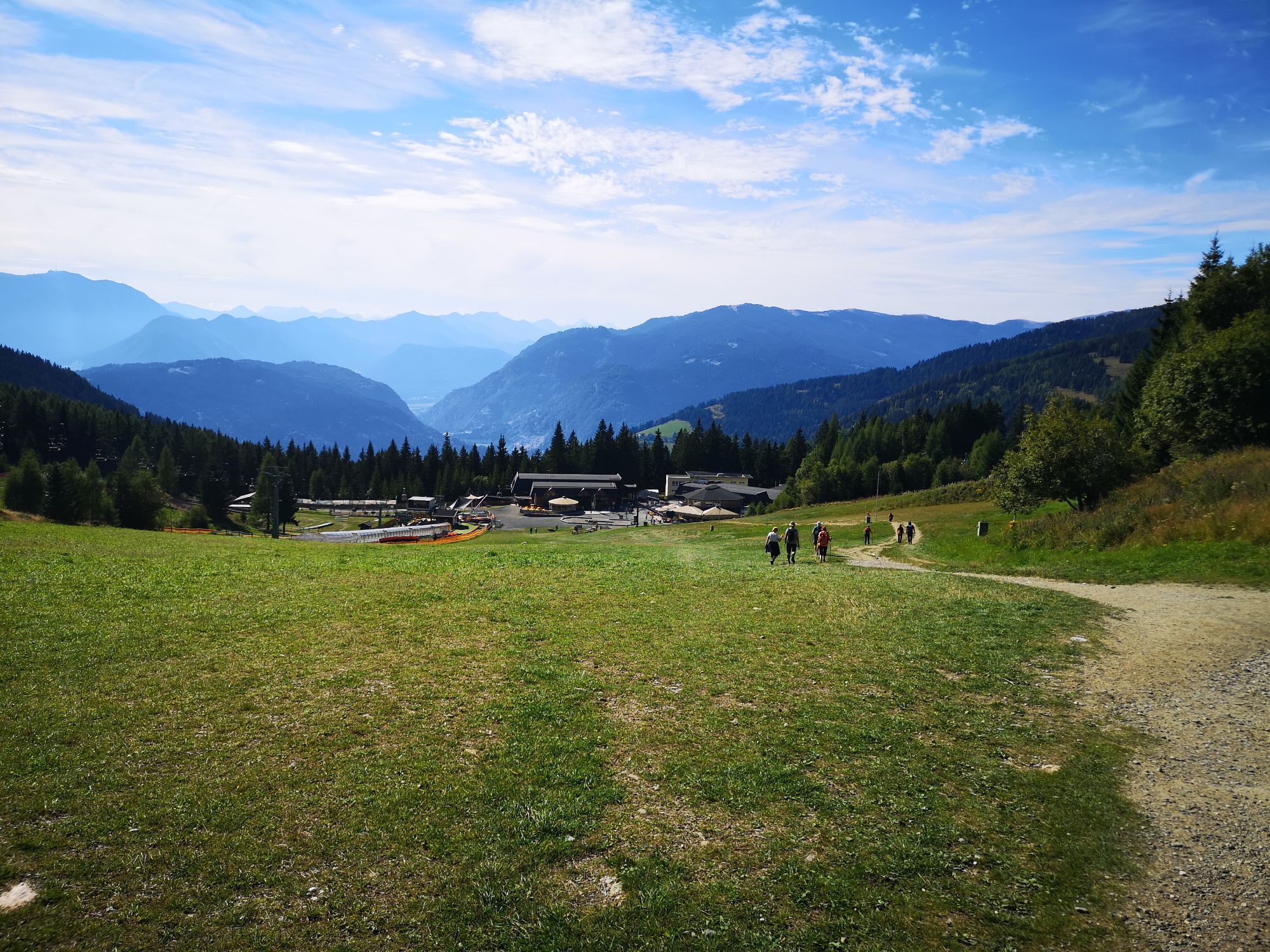
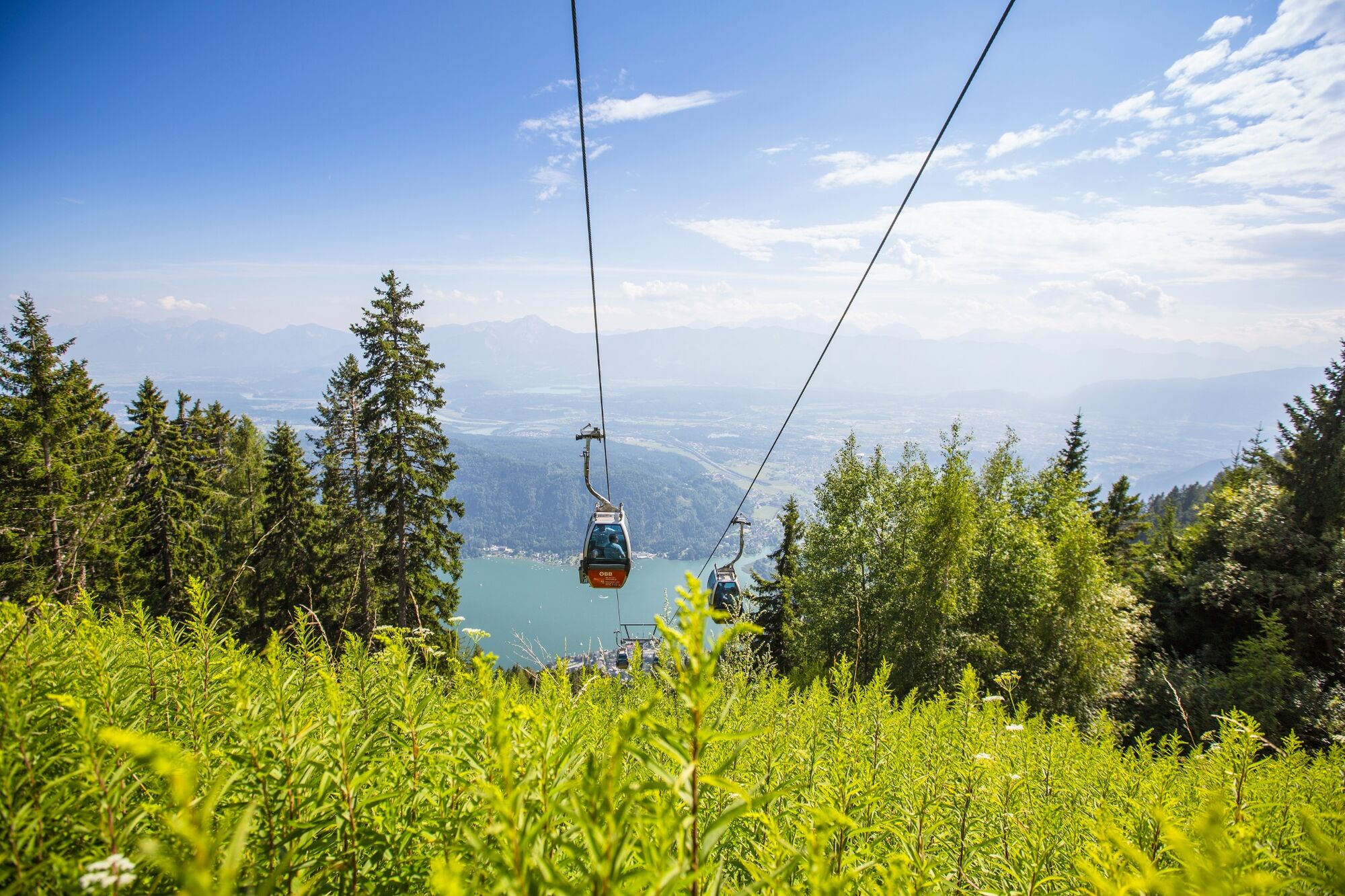
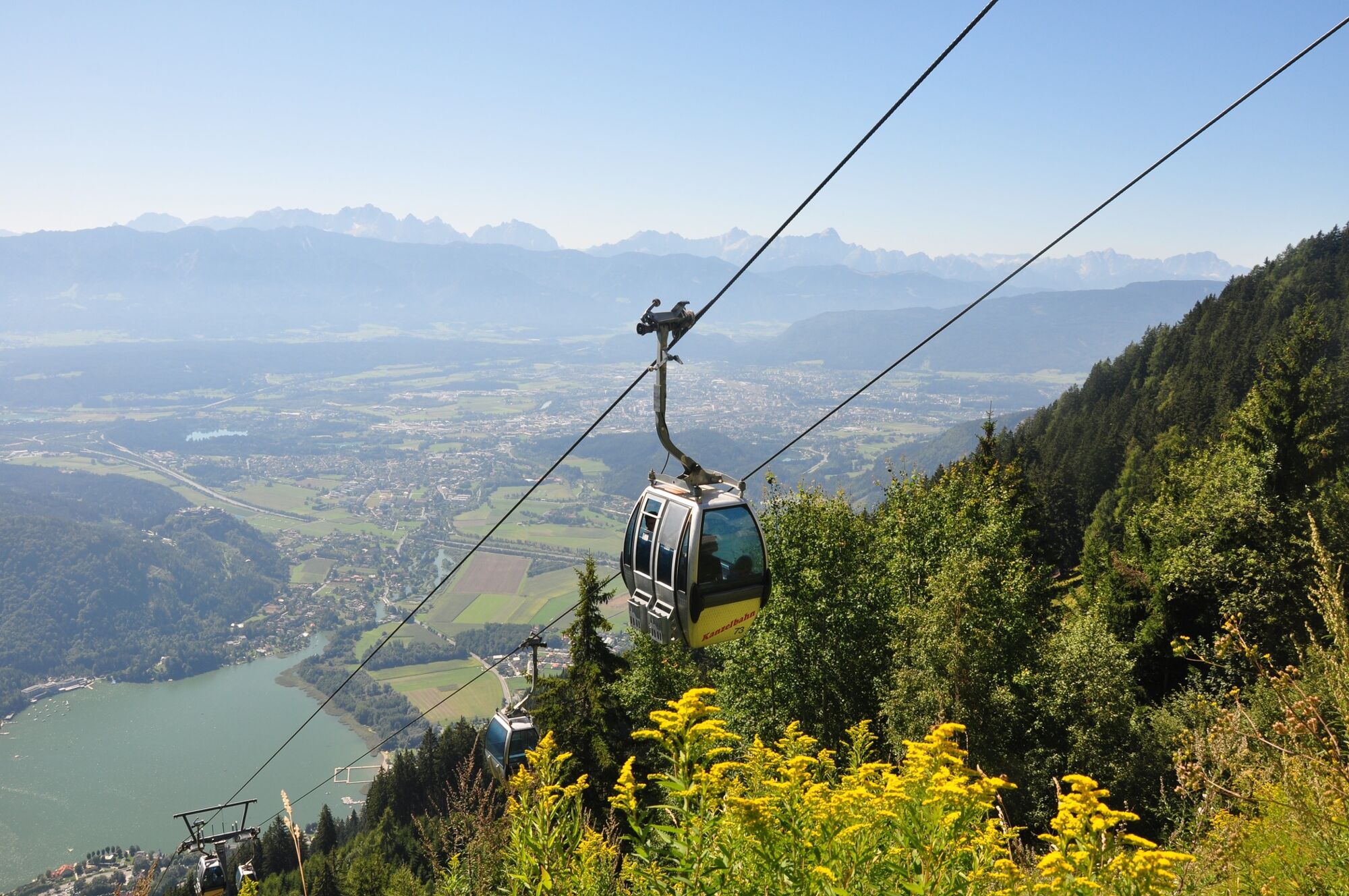
From the mountain station of the Kanzelbahn, the path leads east over an area called Waldtratte to the Seppl Hütte. This hut offers Carinthian specialties and while you relax on the large south sided terrace....
From the mountain station of the Kanzelbahn, the path leads east over an area called Waldtratte to the Seppl Hütte. This hut offers Carinthian specialties and while you relax on the large south sided terrace. After this short break, you walk further on, past the Schönfeldsiedlung. From there you hike comfortably back to the starting point.

From the mountain station of the Kanzelbahn, follow the path (path no. 52) to the upper part of the Waldtratte, where you join the path into the direction of Pöllingersiedlung/Pöllinger Hütte (path no. 176). Follow this road two hairpin bends uphill. Just before the third hairpin bend, turn right again slightly downhill into the direction of Seppl Hütte (path no. 37).
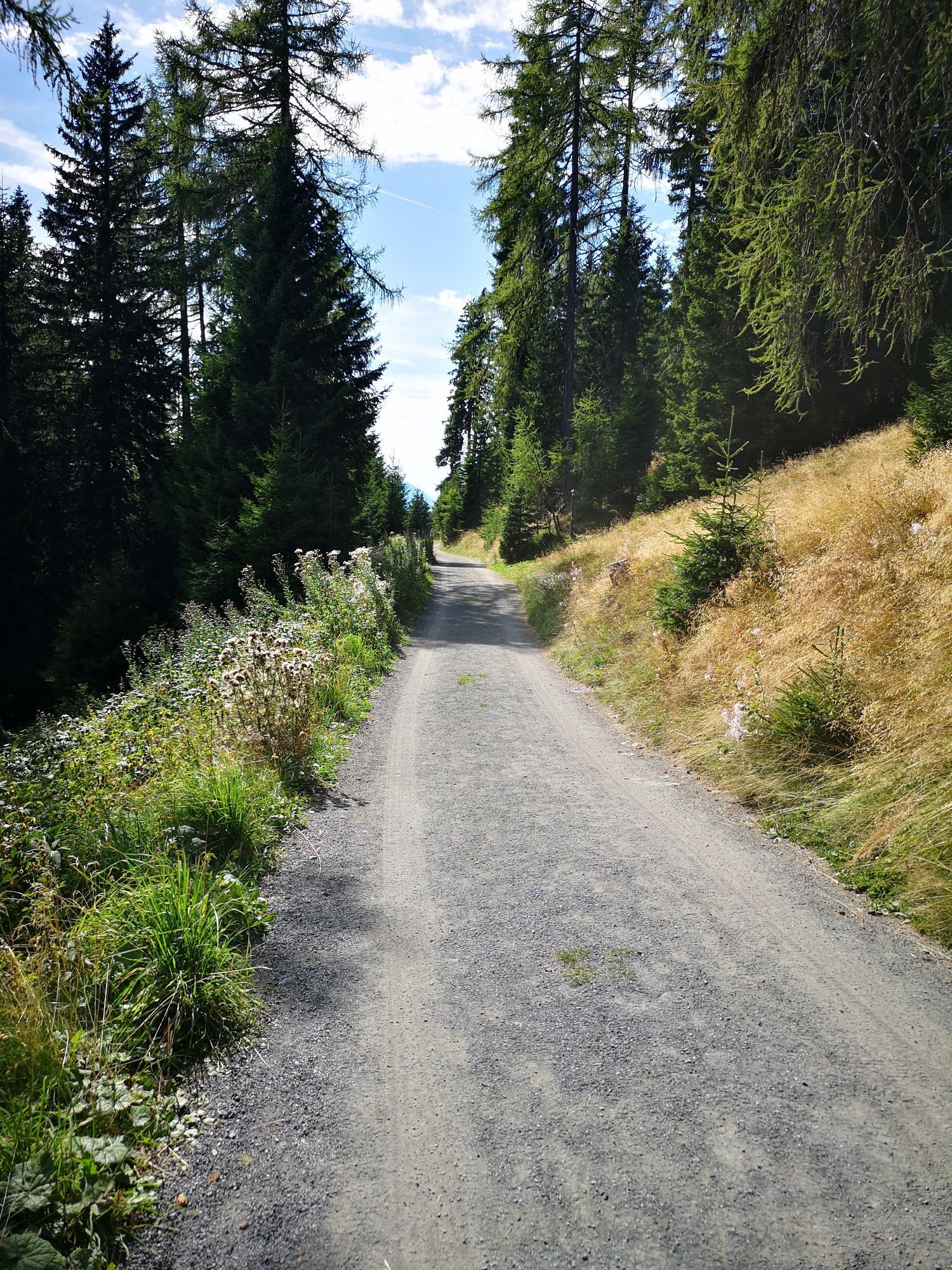
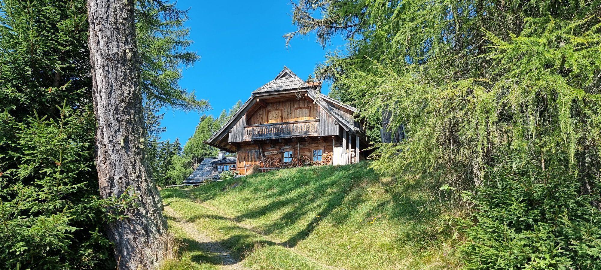
The forest road, which is easy to walk on, narrows before and after crossing the Finsterbach (beware of the risk of slipping when wet!). After crossing the Finsterbach, the narrow path leads back into a wide forest road, which leads slightly downhill to a signposted crossroads. Here you branch off onto the path into the direction of the Schönfeldsiedlung and Seppl Hütte (path no. 7) and, after a few minutes' walk, you reach another crossroads. Turn east and you will reach the Seppl Hütte after a few minutes (path no. 42).
After a well-deserved rest and refreshment, follow the path (path no. 42) back to the crossroads and follow the path to the Schönfeldsiedlung steadily uphill (path no. 7). The path joins the left edge of the ski slope and you follow the lanes in the ski slope further uphill. Shortly below the Schönfeldsiedlung, the path branches off to the left. Below the Schönfeldsiedlung, turn left again in the direction of Pöllinger Hütte (path no. 33).
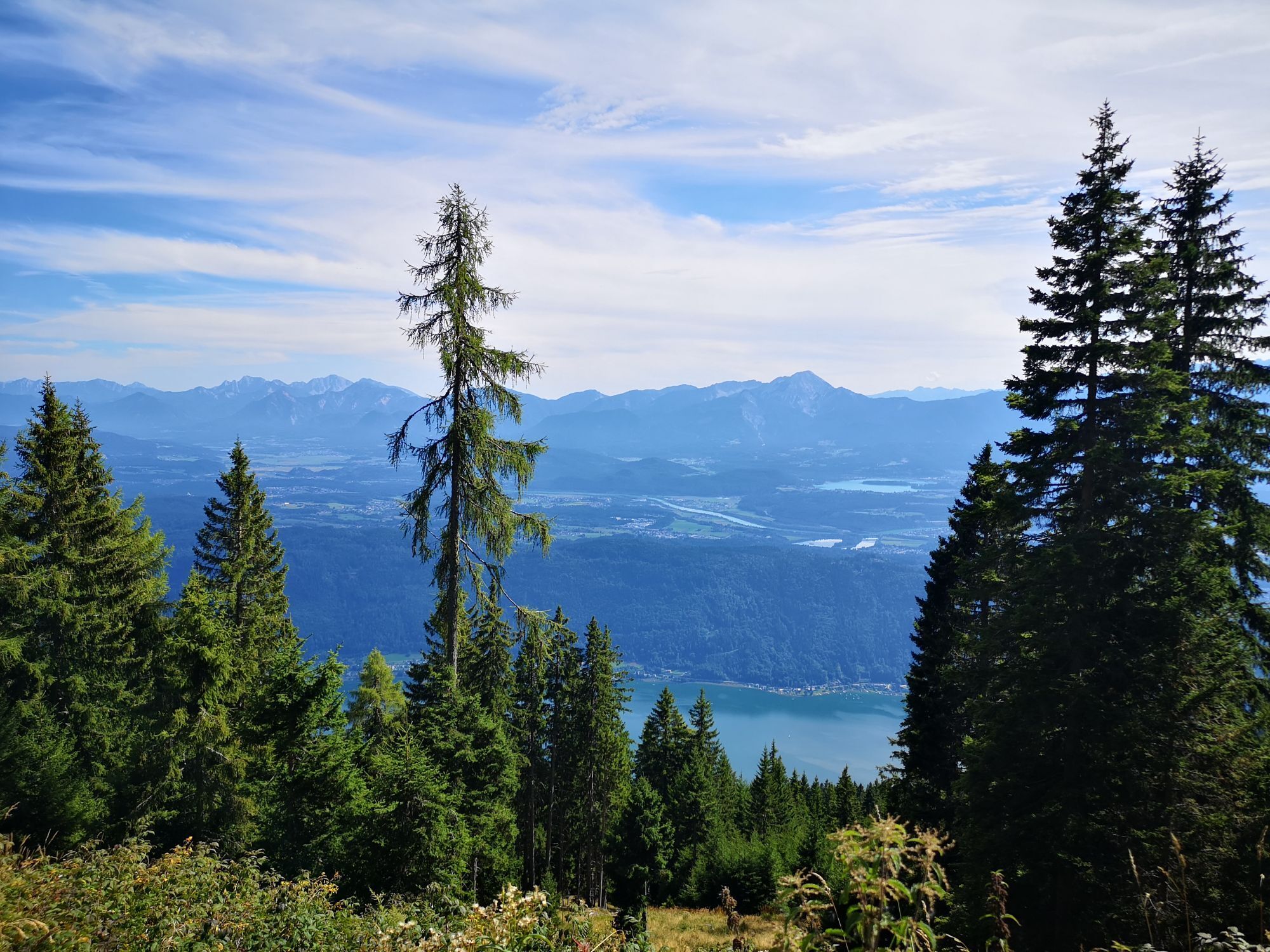
The further path leads past the source of the Finsterbachand without any significant differences in altitude to a fork in the road. Basically, both ways are possible here. If you are planning a detour to the Pöllinger Hütte, it is better to choose the upper path, which leads to the hut with slight inclines. The way back to the starting point is more direct via the lower path (path no. 33), which leads down to the Pöllingersiedlung and there joins the road (path no. 176).
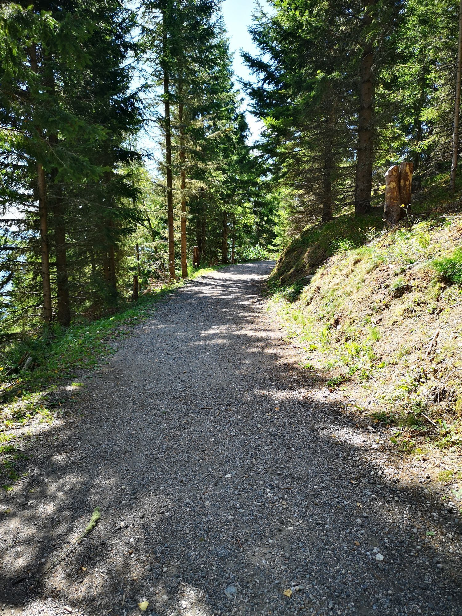
Follow this track downhill via the well-known section back to Waldtratte and from there back to the starting point of the hike at the Kanzelbahn mountain station.
Da
Hiking shoes, drinking water, functional clothes, rain jacket, hiking sticks, map, first aid kit, smartphone etc.
Check the weather conditions in the mountains before hiking!
Annenheim is best reached by car by taking the A10 highway . Exit at "Villach-Ossiacher See." From there follow the road along the lake until Annenheim.
The Gerlitzen Kanzelbahn can best be reached by taking ÖBB train S2 - exit at Annenheim.
There are plenty of parking spaces available at the valley station (Annenheim Kanzelbahn).
This hike is near the Alpa-Adria-Trail- in case you want more information about this unique long-distance hiking trail, visit www.alpe-adria-trail.com!
Spletne kamere s turneje
Gerlitzen Gipfel
Gerlitzen Gipfel
Gerlitzen Gipfel
Gerlitzen Gipfel
Ossiach/Ossiachersee
Ossiach/Ossiachersee
Ossiach/Ossiachersee
Ossiach/Ossiachersee
Ossiach/Ossiachersee
Ossiach/Ossiachersee
Annenheim/Ossiacher See
Gerlitzen Gipfel
Gerlitzen Mittelstation Kanzelhöhe
Gerlitzen Mittelstation Kanzelhöhe
Gerlitzen Mittelstation Kanzelhöhe
Gerlitzen Mittelstation Kanzelhöhe
Observatorium Kanzelhöhe
Observatorium Kanzelhöhe
Observatorium Kanzelhöhe
Observatorium Kanzelhöhe
Observatorium Kanzelhöhe
Observatorium Kanzelhöhe
Observatorium Kanzelhöhe
Observatorium Kanzelhöhe
Hotel SeeRose
Ossiacherberg
Neugarten Talstation 8er-Carving-Jet
Bodensdorf am Ossiacher See
Bodensdorf am Ossiacher See
Priljubljeni izleti v okolici
- 3,6
Forstsee Runde
svetlobaPohodništvo4,26 km - 3,9
Faakersee Rundweg
svetlobaPohodništvo9,55 km - 3,3
Around Lake Ossiach
srednjaKolesarjenje68,7 km - 3,8
Lake Ossiach cycle path - R2 and R2A
srednjaKolesarjenje28,2 km - 4,0
Slow Trail Bleistätter Moor
svetlobaPohodništvo7,22 km - 4,4
Panorama trail Schwarzsee - Palnock
srednjaPohodništvo11,9 km - 3,9
Schwarzsee circular hiking trail
srednjaPohodništvo7,79 km - 4,8
Hoher Gallin route
srednjaPohodništvo7,09 km - 4,9
4 Huts Tour
srednjaPohodništvo8,96 km - 4,4
E-Bike Route "Wörthersee - Ossiacher See"
srednjaKolesarjenje46,7 km
Pohodništvo in sledenje


Ne zamudite ponudb in navdiha za naslednje počitnice
Vaš e-poštni naslov je bil dodan na poštni seznam.