







Hike to the Edenhütte snack station
Stopnja težavnosti: T2
This challenging circular tour starts at the tourist office in Flattach. After a somewhat steeper section through the shady forest, the first section leads us steadily uphill to the Großfercher farmstead...
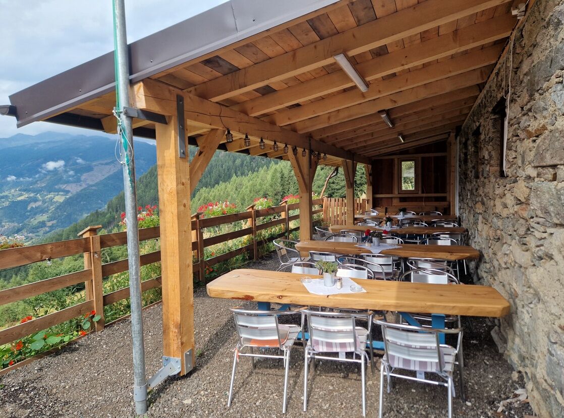
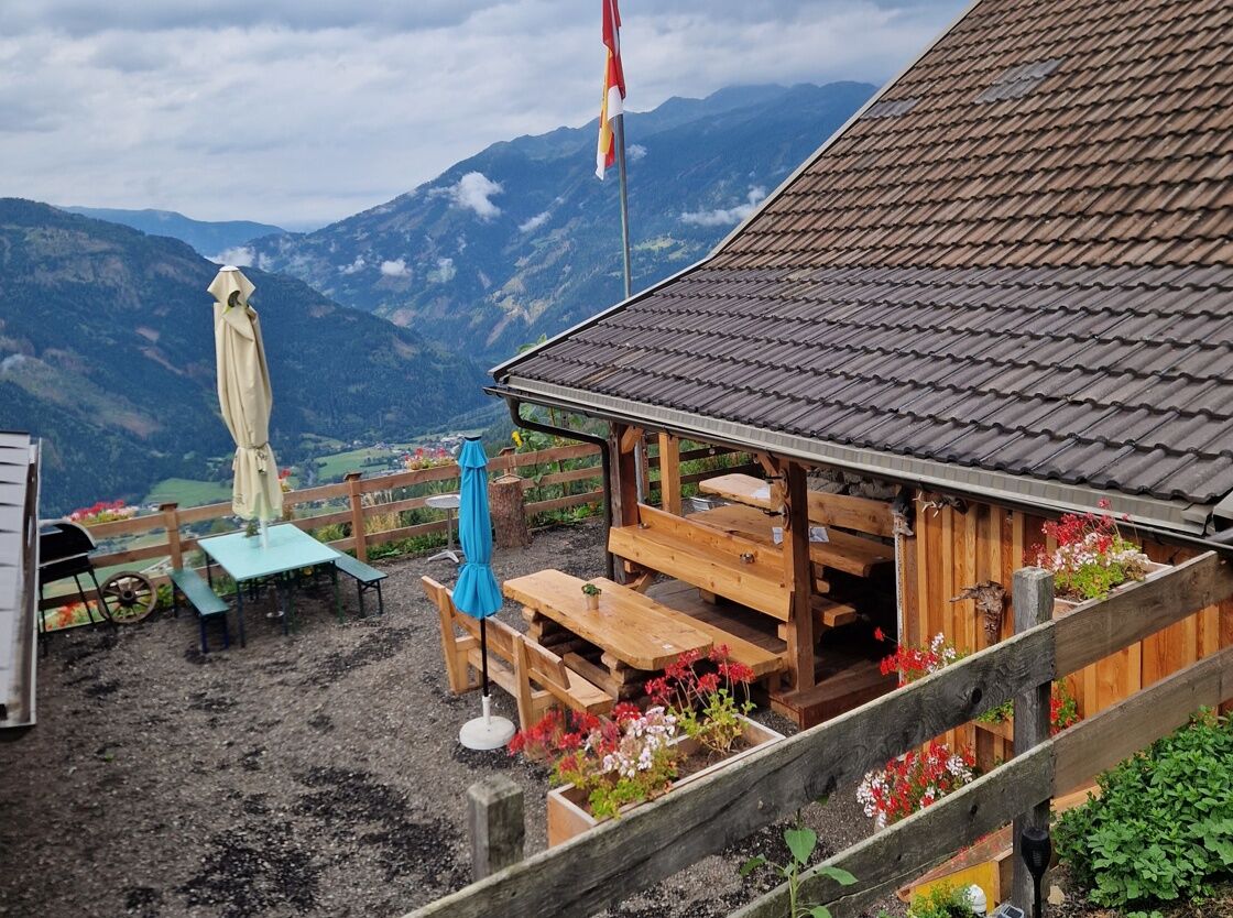
This challenging circular tour starts at the tourist office in Flattach. After a somewhat steeper section through the shady forest, the first section leads us steadily uphill to the Großfercher farmstead on the Flattachberg. The route continues along the road to Poschacher, where a fantastic panorama opens up with views of the lower Mölltal valley. This is followed by a final ascent until we reach the Edenhütte snack station. Situated at 1,320 m, the renovated snack station invites hikers to linger with a hearty snack and regional delicacies. From the terrace you have a wonderful panoramic view over Flattach and the surrounding peaks. The hut can also be reached by car (forest road, approx. 1.3 km) and is located directly on an official mountain bike route and the well-known Alpe-Adria-Trail long-distance hiking trail. The way back leads first along the ascent route and then along the road from Flattachberg down the valley back to the starting point.
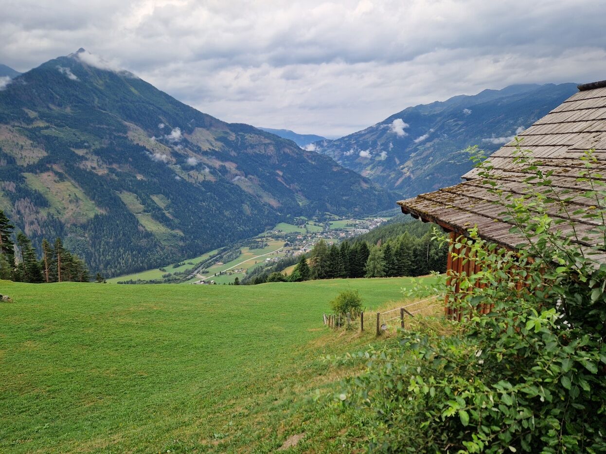

The starting point is the tourist office in Flattach. From there, the trail first leads us through the village of Flattach. At the park (after the bridge) we turn right and follow the ascending path. We cross a small wooden bridge and continue uphill to the last house on the road. We do not follow the tempting path to the left! To the left of the house, we continue uphill on an initially steep, marked forest path (no. 5). This leads us steadily uphill, past a fountain, until we reach the Großfercher farmstead. We then follow the asphalt mountain road uphill until we reach a crossroads. At an altitude of approx. 1,100 meters, we leave the asphalt road to the left and follow the signs towards "Staneralm" and "Poschacher". We follow the gravel road to Poschacher. Here we pause briefly and enjoy the fantastic panoramic view. We continue uphill and the last few meters lie ahead of us until we reach the Edenhütte snack station. The Edenhütte is a real insider tip for hiking enthusiasts. The cuisine is down-to-earth and delicious, the Kaspressknödel dumplings are particularly popular, and for the way back we first follow the familiar route downhill to the Großfercher farmstead. From there, we follow the asphalt road further down the valley over the Flattachberg and walk along the road through the district of Kurierdorf back to the starting point. We walk past the Flattach parish church and keep to the right. The parish church is now on our right and we follow the road straight ahead. At the crossroads, we turn left. We pass the Flattacher Hof and Café Greissler (refreshments available) and after a few meters we reach our starting point again.
Sturdy shoes and sure-footedness are recommended, as well as weatherproof clothing, sun protection and sufficient drinking water.
Sturdy shoes and sure-footedness are essential. Sufficient water and sun protection should be carried. Before starting the tour, it is advisable to check the weather forecast, as conditions in the mountains can change quickly. Special care should be taken in wet conditions, as forest and root passages can be slippery.
Autobahn A10 - coming from Villach/Italy
Via the Spittal/Millstättersee junction to the Lendorf exit via the B100 to the Mölltal exit, via the B106 to Flattach. The tourist office is on the right-hand side.
Federal road B106 - coming from Lienz
Take the B107 to Winklern, turn right onto the B106, take the B106 to Flattach. The tourist office is on the left-hand side.
Travel by bus to the bus stop "Raggaschlucht" - this is located directly in front of the Flattach tourist office. This is also the starting point of our tour. The bus stop is served by public buses on the Spittal-Winklern-Heiligenblut line several times a day.
Travel by train to Mallnitz-Obervellach station. From there, continue by bus to the "Raggaschlucht" bus stop in Flattach.
The timetables for bus & train (ÖBB, Postbus and Carinthian lines) can be found at the Scotty-ÖBB timetable information.
Just after the turn-off from the B106 main road / Flattach tourist office, there is a free parking lot at the tourist office.
T2
Refreshment stop:
Edenhütte snack station Cafe Greissler and Hotel&Restaurant Flattacherhof in the village of FlattachFurther information from the Hohe Tauern Tourism Region - the National Park Region at www.nationalpark-hohetauern.at or +4348242700
From the terrace you have a great panoramic view of the Kreuzeck and Goldberg mountains.
Spletne kamere s turneje
Pridobite vpogled
Vedno v živo na mestu z več kot 9.500 spletnimi kamerami. bergfex Kot uporabnik Pro si lahko zdaj ogledate ustrezne spletne kamere za številne izlete v aplikaciji izleti iz. Tako si lahko neposredno ogledate trenutne razmere.

Priljubljeni izleti v okolici
-
4.5
Groppenstein Gorge Obervellach
srednjaPohodništvo 2.99 km -
4.9
Wanderung zur Schwussner Hütte
svetlobaPohodništvo 8.07 km -
5.0
Ankogelgruppe - Säuleck 3.086m - Detmolder Weg mit zu viel Schnee
težkoVisokogorska tura 23 km -
4.0
Raggaschlucht
srednjaPohodništvo 3.44 km -
4.5
Arthur von Schmidhaus
srednjaPohodništvo 6.36 km -
4.9
Schareck über Ostgrat
težkoVisokogorska tura 13.3 km -
4.0
Ankogel
Pohodništvo 3.40 km -
4.7
Teuchlspitz
srednjaPohodništvo 10.8 km -
4.6
Vorderer Geißelkopf
srednjaVisokogorska tura 19.1 km -
4.2
The Glockner cycle route R8
srednjaKolesarjenje 89.7 km
Pohodništvo in sledenje


Ne zamudite ponudb in navdiha za naslednje počitnice
Vaš e-poštni naslov je bil dodan na poštni seznam.





