


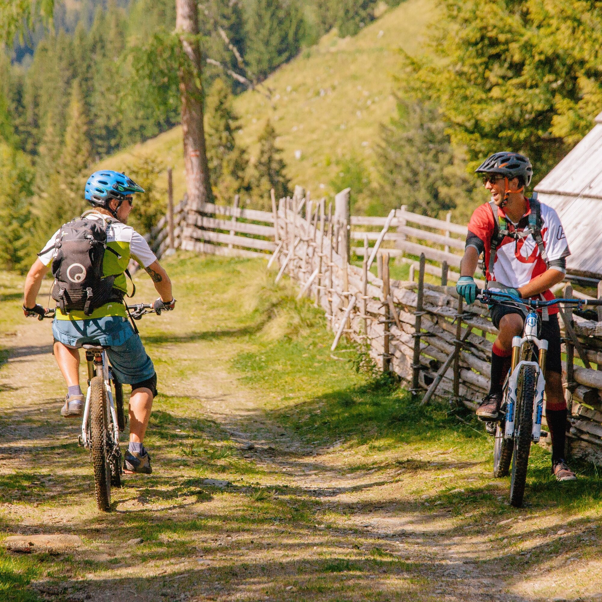
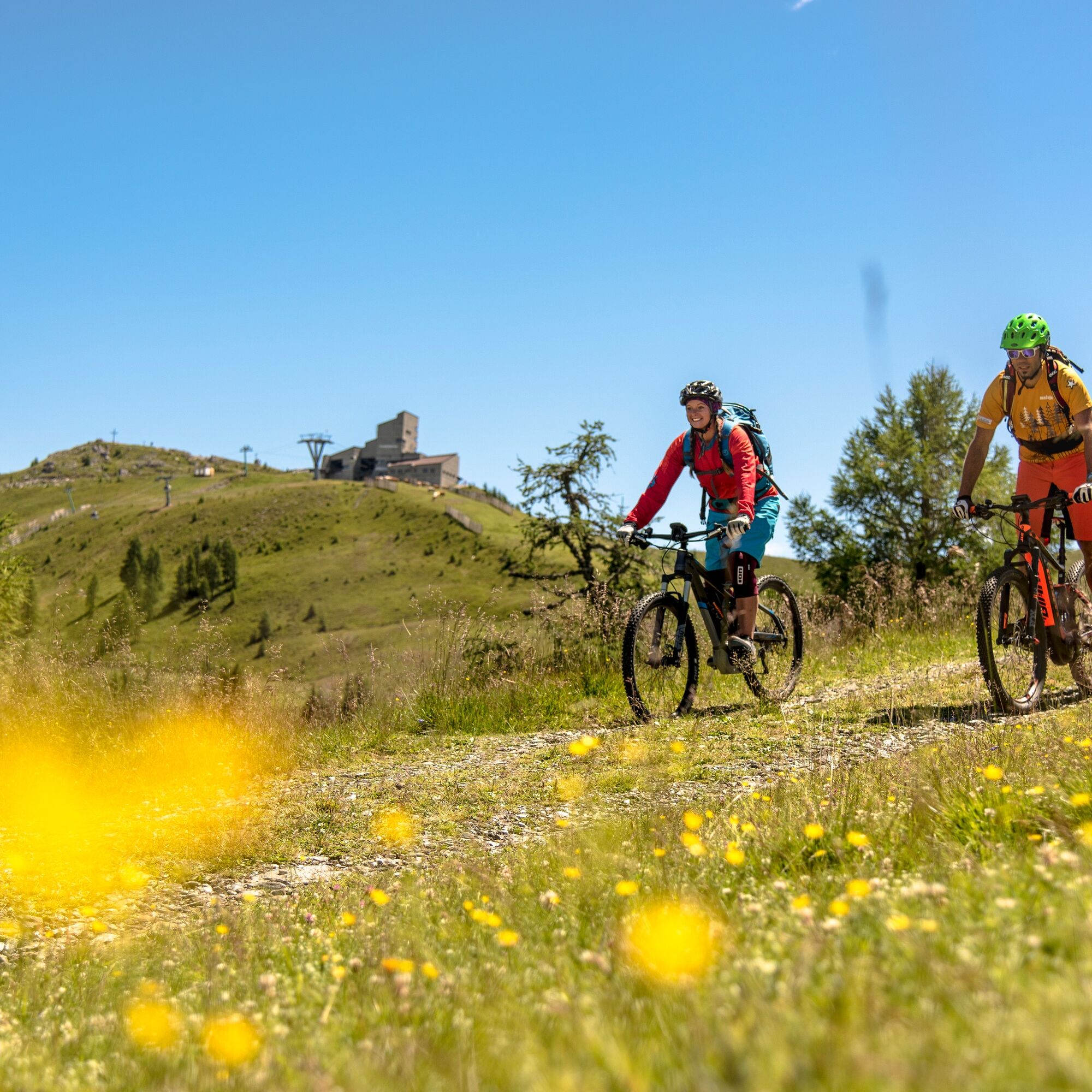
Feldpannalm Route | nock/bike Route 20
Starting Point: Feld am See, church square
Route: Feld am See – Feldpannalm – Klamberg – Obertweng – Feld am See
Route connections: Trail T20, T1; Tours Nos. 10, 11, 8, 21
e-MTB - this route is also passable...
Starting Point: Feld am See, church square
Route: Feld am See – Feldpannalm – Klamberg – Obertweng – Feld am See
Route connections: Trail T20, T1; Tours Nos. 10, 11, 8, 21
e-MTB - this route is also passable with an e-mountain bike.
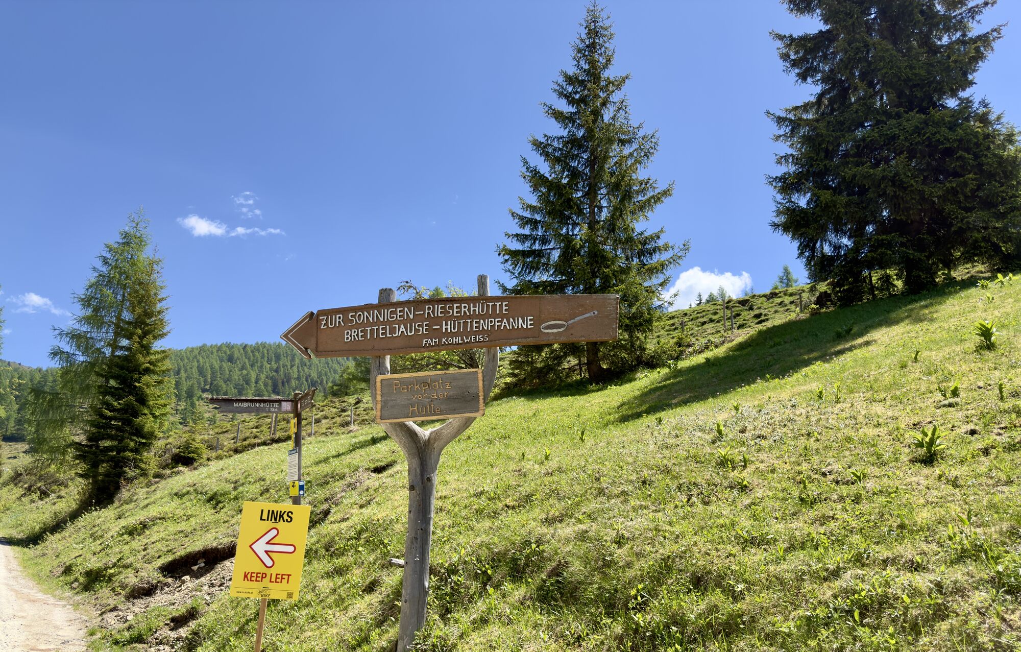
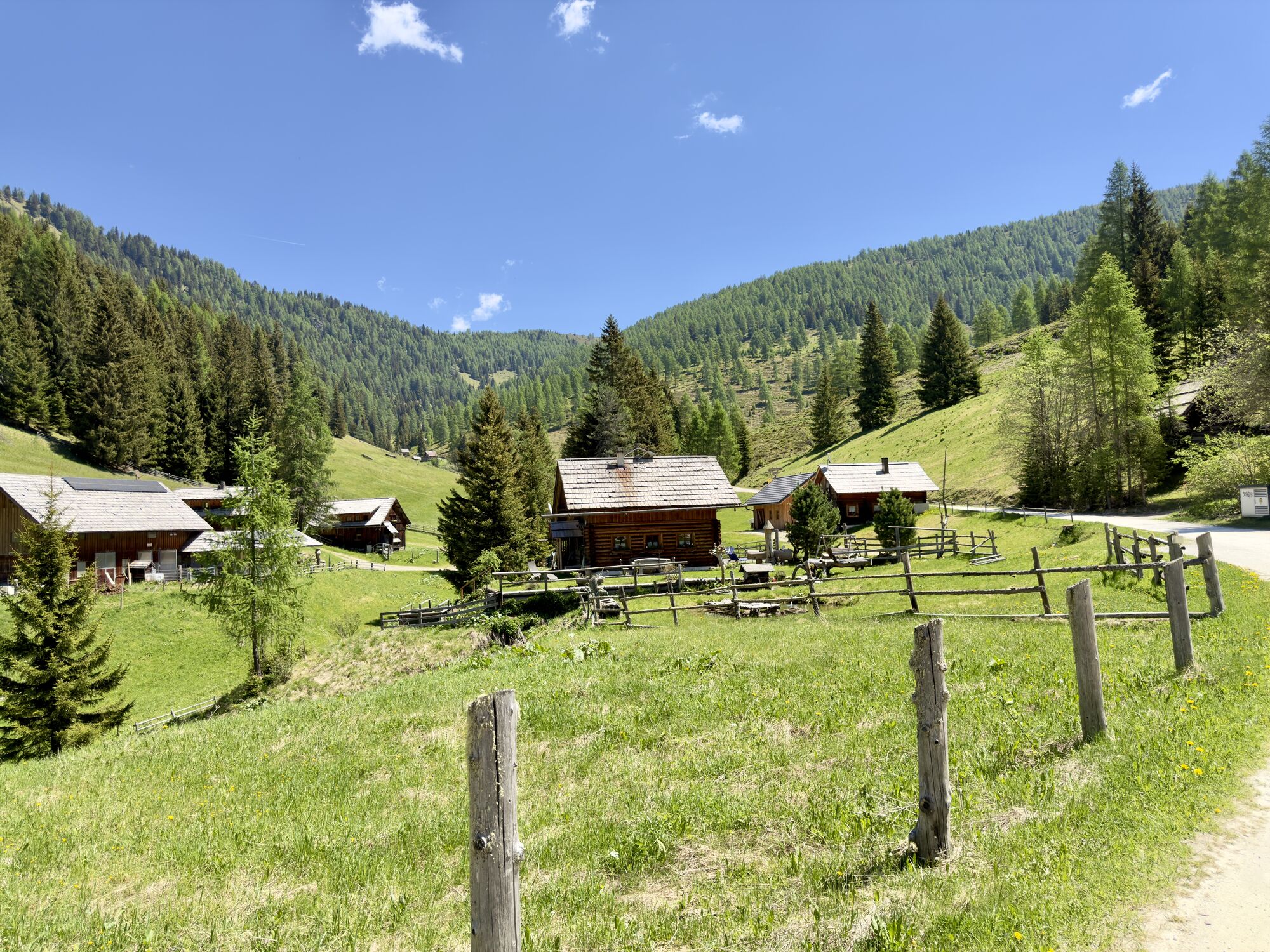
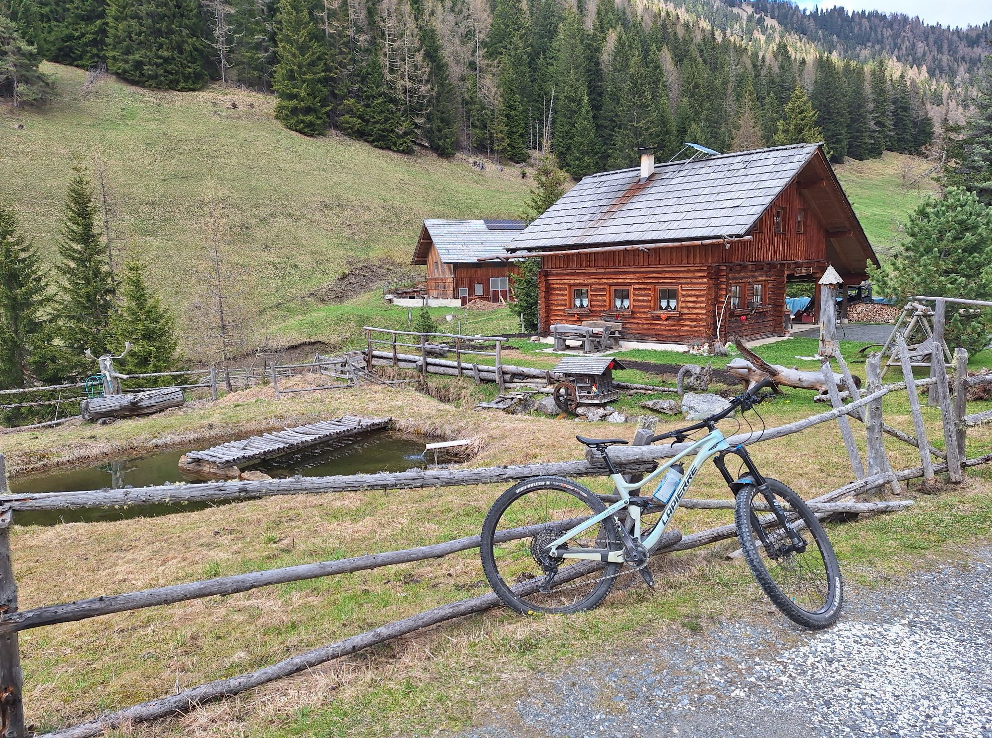
Special features: Alpine experience, stream course
The starting point is Feld am See. Initially, it goes relatively steeply uphill on asphalt roads over the Klamberg. After a short very steep section before the toll station, it then goes moderately on a gravel road towards Feldpannalm.
After a good snack in one of the huts on the alpine pasture, the route continues on the very scenic stream path (tractor road - easy trail) and via Obertweng back down to the valley.
Tip: Use the village fountain in Feld am See and the "Biker fountain" in Obertweng to refresh yourself and enjoy the wonderful view of the lake area and the Nockberge.
Basic Skills
Appropriate riding skills and basic fitness are essential for a pleasant and safe ride. When braking, it is especially important to use only one finger, distribute the braking force correctly, and adjust the basic position.
The Bike Used
Must be adapted to the trail conditions and well maintained. A freeride or downhill bike is best suited. Tip: Protective gear and bikes can be rented or purchased at rental stations.
Mountainbike Fair Play Rules for an Orderly Togetherness
1. Stay only on marked and signed nock/bike trails
2. Use of the nock/bike trails is only permitted at your own risk during the contractually fixed periods from May 1 – August 31 from 09:00 – 19:00 and September 1 – October 31 from 09:00 – 17:00
3. No riding at dusk to protect wildlife
4. Observe nock/bike maps and tour descriptions
5. Priority of hikers over mountain bikers, 'Shared Trail'
6. Forest roads are operational areas and workplaces. Expect work machines, wood or potholes on the roadway, livestock, and motor vehicle traffic
7. Pay special attention to motor vehicles and traffic regulations
8. Ride at half sight with controlled speed; when sudden and unexpected obstacles occur, dismount and push the bike past the obstacle
9. In the forest, camping, staying at night, making fires, disturbing wildlife, or entering forest cultures under 3 m tree height are legally prohibited
10. Always close pasture gates and gates and be cautious with forestry work and livestock
11. Consideration for a clean environment and noise avoidance
12. First aid assistance in accidents is mandatory, first aid kit, emergency numbers
13. Ongoing sports equipment inspection by professionals, riding with helmet and gloves, etc.
14. Riding technique tips for increased safety and fun from a professional – nock/bike Competence Center – obtain
15. Also communicate fair play rules and thus raise awareness
Parking available in the village
nock/bike Competence Center
Krainer Family
Sonnenstraße 5
A-9544 Feld am SEE
Tel.: +43 4246 3188
www.nockbike.com
Further information on the Bad Kleinkirchheim region at: www.badkleinkirchheim.at
Priljubljeni izleti v okolici
- 4.7
4 Huts route
srednjaPohodništvo 8.96 km - 4.9
Nockbergrundwanderweg
srednjaPohodništvo 6.62 km - 4.8
Enzian-Granatsteig & Almbrunn Steig
svetlobaPohodništvo 8 km - 4.7
Millstätter See cycle track
srednjaKolesarjenje 27.7 km - 4.8
Große Rosennock Runde
Pohodništvo 9.80 km - 4.8
Lammersdorfer Hütte, Granattor Runde
svetlobaPohodništvo 9.85 km - 4.6
Falkertsee - Sonntagstal - Falkert
srednjaPohodništvo 4.84 km - 4.8
St. Oswald - Circular hike - Mallnock - Klomnock
srednjaPohodništvo 10.9 km - 4.7
H-2-O Höhenweg
svetlobaTematska pot 5.40 km - 4.7
Falkert, Murmelsteig B/C mit Direktem Abstieg
srednjaVia ferrata 3.61 km
Pohodništvo in sledenje


Ne zamudite ponudb in navdiha za naslednje počitnice
Vaš e-poštni naslov je bil dodan na poštni seznam.