






The Springs of the Authie

Set out to explore the rolling landscapes of northern Somme and the unassuming headwaters of the Authie on this 42-km loop bike ride starting in Acheux-en-Amiénois. This unmarked route takes you along...
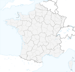
Set out to explore the rolling landscapes of northern Somme and the unassuming headwaters of the Authie on this 42-km loop bike ride starting in Acheux-en-Amiénois. This unmarked route takes you along small country roads through fields, woods, and villages typical of the Picardy plateau.
After leaving Acheux-en-Amiénois, the route heads to Raincheval and then follows the Authie River upstream to its source at Coigneux. From there, it climbs toward the plains around Mailly-Maillet, marked by the history of World War I.
Throughout the ride, you’ll discover the peaceful beginnings of this coastal river, which then winds its way to the Bay of Authie. Set amid green valleys, quiet country roads, and rural heritage, this ride offers an authentic immersion in the Picardy countryside.
The route is suitable for regular cyclists, with a few gentle inclines and slight climbs.
⚠️ Unmarked route: be sure to download the GPX track before setting out and bring plenty of water and appropriate gear.


Priljubljeni izleti v okolici
La véloroute de la mémoire
srednjaKolesarjenje 91.8 kmAround Naours
svetlobaCestno kolo 41.0 kmThe Caribou circuit
svetlobaPohodništvo 8.37 kmIn the footsteps of the First World War
svetlobaMountainbike 32 kmThe Memory Cycle Route
svetlobaCestno kolo 85.9 kmThe short train
svetlobaPohodništvo 11.7 kmAround the Priory of Authie
svetlobaPohodništvo 10.0 kmAround the Thiepval Memorial
svetlobaPohodništvo 14.1 kmArquèves - Monts de Terre - Les Terres Franches - Église Saint-Martin
srednjaPohodništvo 10.7 kmLucheux
srednjaPohodništvo 11.4 km
Pohodništvo in sledenje


Ne zamudite ponudb in navdiha za naslednje počitnice
Vaš e-poštni naslov je bil dodan na poštni seznam.





