


Tschlin – God sur las chasas (circular route)


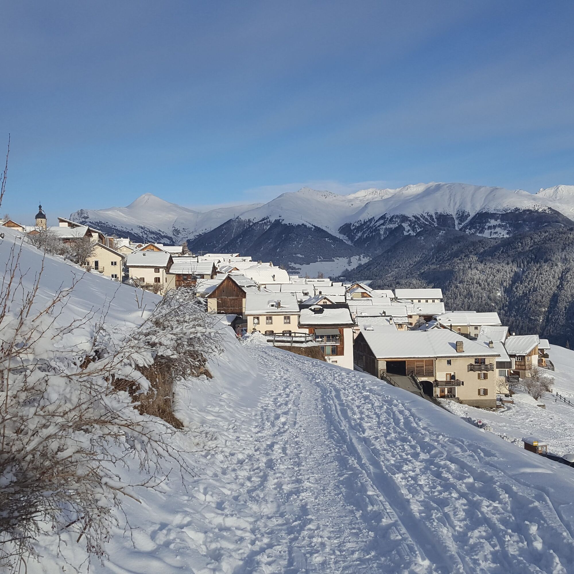
To reach the starting point of the hike, walk through the entire charming village of Tschlin along the main street, where you can admire the truly traditional Engadin houses. Tschlin has also made a name...
To reach the starting point of the hike, walk through the entire charming village of Tschlin along the main street, where you can admire the truly traditional Engadin houses. Tschlin has also made a name for itself with the "Village Phone Campaign" and recently with the "bügl public" bathing fun in the village fountain of Tschlin. In the summer of 2018, a special bathing event was offered on certain Saturdays. To continue the hike, once at the top of the village, take the path westward through the forest "God zur las Chasas". At a bend and across a terrace landscape, it leads back to the village.

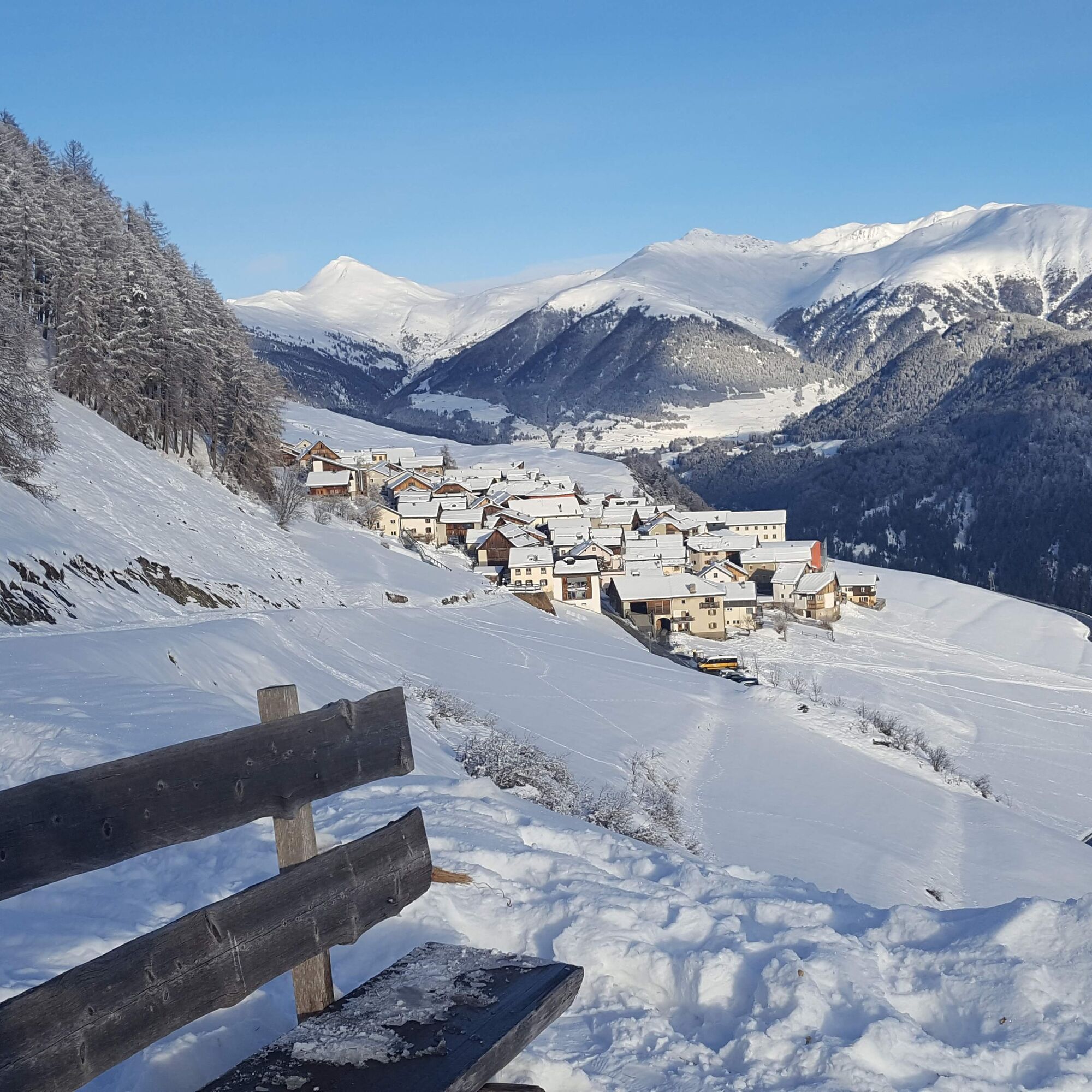


First through the village of Tschlin. Slightly ascending, you reach a viewpoint, then continue through the forest "God sur las Chasas". The path leads over the terrace landscape back to Tschlin.
Da
High and sturdy hiking boots or winter boots, warm clothing, sunscreen, sunglasses, sun protection, hiking poles.
The path is groomed after every snowfall. Please observe the condition reports in the winter sports report. The route was rated under favorable weather conditions; the current snow and weather conditions must be checked before starting.
Emergency numbers:
144 Emergency, first aid
1414 Mountain rescue REGA
112 International emergency number
From the north: via Landquart – Klosters by car shuttle through the Vereina tunnel (Selfranga - Sagliains) or via the Flüela pass to the Lower Engadin on H27 From the east: via Landeck / Austria towards St. Moritz on H27 From the south: via Reschen pass (Nauders-Martina) or Ofen pass (Val Müstair-Zernez) on H27
Scuol is located directly on the Engadin road H27 (20 minutes drive from Vereina south portal). From Scuol to Tschlin 30 minutes.
By the Rhaetian Railway (from Chur, Landquart/Prättigau or Upper Engadin) hourly to Scuol-Tarasp
By the PostBus hourly from Scuol station to Tschlin, direction Martina. Change in Strada.
Paid parking spaces available at the bus stop
Priljubljeni izleti v okolici
-
4.1
Panoramaweg Schöneben Haider Alm
svetlobaPohodništvo 5.78 km -
3.5
Nauders - Bergkastel - Plamort - Reschen - Nauders
srednjaMountainbike 20.9 km -
4.2
Reschensee
svetlobaPohodništvo 15.6 km -
5.0
NAUDERS | Grenzüberquerung
svetlobaPohodništvo 7.41 km -
4.5
Radurschelklamm
srednjaPohodništvo 7.51 km -
5.0
Samnaun Dorf – Muttler
težkoPohodništvo 14.8 km -
5.0
Plamort
svetlobaPohodništvo 8.25 km -
Suspension Bridge Trail Val Sinestra – Zuort – Griosch – Vnà
srednjaPohodništvo 11.0 km -
5.0
3 Länder Tour Uinaschlucht MTB
težkoMountainbike 74.6 km -
4.5
Tarasp Fontana – Sparsels – Lai Nair (circular route)
svetlobaPohodništvo 7.67 km
Pohodništvo in sledenje


Ne zamudite ponudb in navdiha za naslednje počitnice
Vaš e-poštni naslov je bil dodan na poštni seznam.