


Samnaun Dorf – Muttler
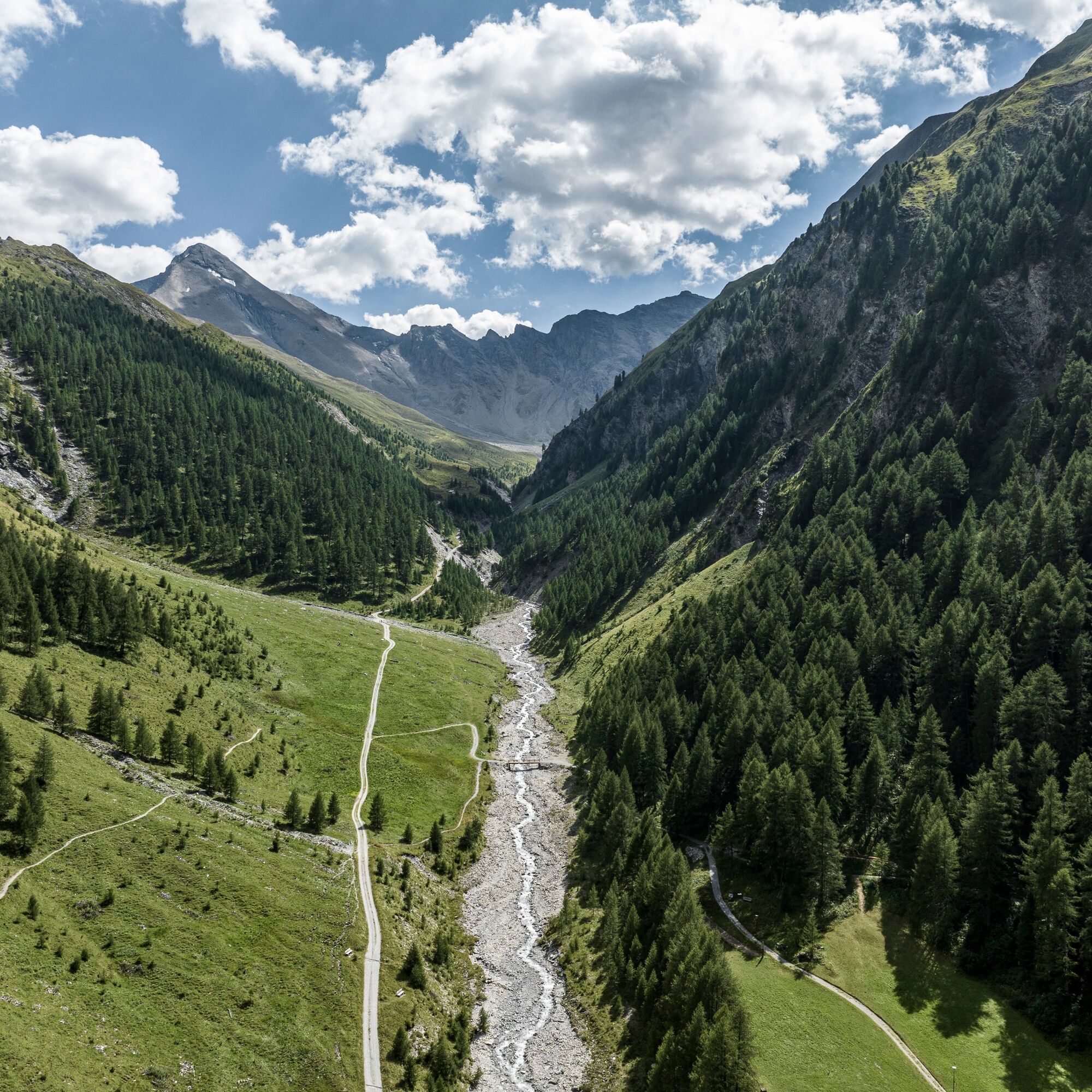
From Samnaun Dorf the hiking trail leads into the Val Maisas, past the herders' hut and over alpine meadows to the Rossboden. The day's goal, the Muttler, remains in view at all times. Via the Lange Seite,...
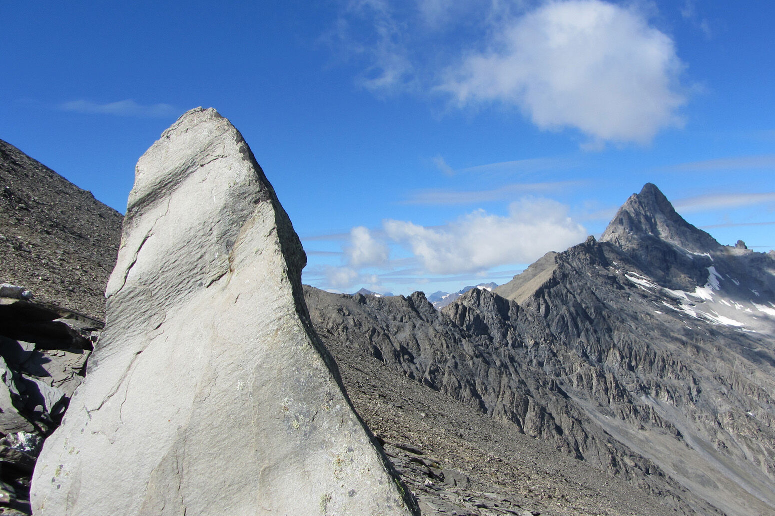
From Samnaun Dorf the hiking trail leads into the Val Maisas, past the herders' hut and over alpine meadows to the Rossboden. The day's goal, the Muttler, remains in view at all times. Via the Lange Seite, we reach the Rote Seeli (Red Lake), which used to turn red in summer. In recent years, the lake has often dried out almost completely, so the natural phenomenon could not be observed. Algae were responsible for the coloration. At the Rossbodenjoch, the view opens to the Val Sampuoir and the Mundin group. From here you reach the highest Samnaun peak, the Muttler, via the north ridge. The last steep section over fragile shale is often wet or even icy and therefore slippery. The summit panorama compensates for the effort and extends over the Silvretta, Bernina, and Verwall groups, the Zugspitze, the Ötztal Alps, and the Ortler. On clear days even Lake Constance can be seen. The same path leads back to Samnaun Dorf.


Turn into Val Maisas from Samnaun Dorf
Follow the valley
Keep left at the fork in the valley basin
To the Rote Seeli on the Rossbodenjoch
Last ascent to the Muttler
Same way back to Samnaun Dorf
Da
Good footwear, rain and sun protection, drinking bottle, first aid kit.
The route was assessed under favorable weather conditions; current weather conditions and forecasts must be carefully observed before starting the hike.
Emergency numbers:
144 Emergency, first aid
1414 Mountain rescue REGA
112 International emergency number
From the north: via Landquart – Klosters by car shuttle through the Vereina tunnel (Selfranga - Sagliains). Then on H27 towards and via Scuol and Martina to Vinadi. At the Vinadi junction to Samnaun (approx. 1 hour from Vereina south portal)
From the east: via the Inn Valley road B180 via Landeck to Pfunds, Kajetansbrücke junction and via Spiss to Samnaun.
From the south: via Reschen Pass (Nauders) on B180 to Pfunds, Kajetansbrücke junction and via Spiss to Samnaun.
By the Rhaetian Railway (from Chur, Landquart/Prättigau or from the Upper Engadin) hourly to Scuol-Tarasp station
Continue by PostAuto (from Scuol-Tarasp or Martina, Cunfin) hourly to PostAuto stop Samnaun Dorf, Riva
In Samnaun, hourly service during the day with the Samnaun bus to PostAuto stop Samnaun Dorf, Riva
Parking lot Chasa Riva at the entrance to Samnaun Dorf village
Additional parking lots at Musella or Votlas

Priljubljeni izleti v okolici
- 5,0
Menta Alm - Scheibenalm
svetlobaPohodništvo 11,4 km - 4,5
Radurschelklamm
srednjaPohodništvo 7,51 km - 4,7
Jamtal lodge
srednjaPohodništvo 19,6 km - 4,3
Sonnenkogel - Friedrichshafener lodge
srednjaPohodništvo 13,2 km - 5,0
Rundwanderung Berglisee, Mathon
težkoPohodništvo 11,1 km - 3,5
Nauders - Bergkastel - Plamort - Reschen - Nauders
srednjaMountainbike 20,9 km - 4,7
Around the Flimspitz from Alptrider Sattel
srednjaPohodništvo 8,57 km - 5,0
Plamort
svetlobaPohodništvo 8,25 km - 4,5
Etappe 2; Kappl-Heidelberger Hütte
srednjaMountainbike 23,3 km - 3,6
Bergstation Silvretta nach Patznauener Taja
svetlobaPohodništvo 11,6 km
Pohodništvo in sledenje


Ne zamudite ponudb in navdiha za naslednje počitnice
Vaš e-poštni naslov je bil dodan na poštni seznam.