







MTB Tour Tomülpass


A short stretch from the village to Plansch on an asphalted road, which from there continues as a winding natural road to the Riefawald forest. Up to the Pradätsch viewpoint it is very steep uphill, where...
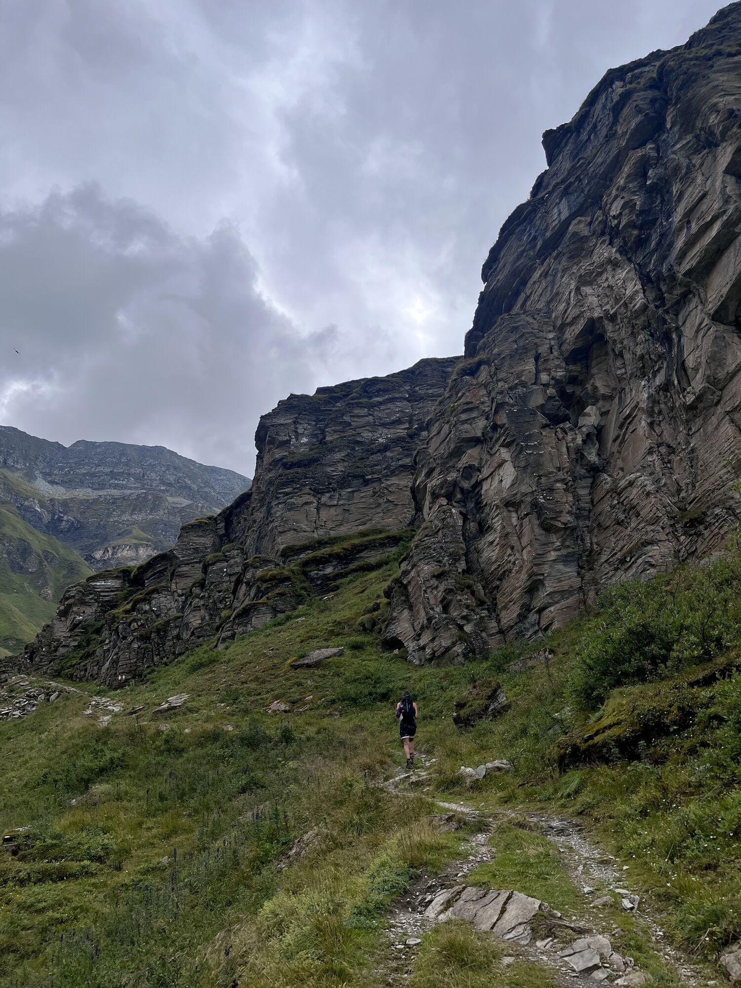
A short stretch from the village to Plansch on an asphalted road, which from there continues as a winding natural road to the Riefawald forest. Up to the Pradätsch viewpoint it is very steep uphill, where you will probably have to push your MTB for a short stretch. At Pradätsch the trail continues leisurely and always slightly uphill to Riedboda. You pass the impressive plain of the Riedboda with its murmuring rivers and waterfalls, before a last steeper climb ends directly in front of the Alp Tomül. After Alp Tomül, the now wider trail continues steadily uphill until it reaches the Tomülpass.
The downhill to Vals leaves nothing to be desired. You take the same route back to Riefawald. Technical as well as flowing sections accompanied by a great panorama. If you still have enough energy and love technical trails, you can take the trail "Abkürzung Vals". Alternatively, you can let the downhill roll out on the natural road all the way to Vals.



Da
The tour can be extended. Downhill to Turrahus, Safien üvia Ilanz back to Vals.
Pridobite vpogled
Vedno v živo na mestu z več kot 9.500 spletnimi kamerami. bergfex Kot uporabnik Pro si lahko zdaj ogledate ustrezne spletne kamere za številne izlete v aplikaciji izleti iz. Tako si lahko neposredno ogledate trenutne razmere.
Priljubljeni izleti v okolici
-
5.0
Panorama route
svetlobaPohodništvo 5.39 km -
5.0
Hiking route Suspension Bridge Val da Tersnaus
srednjaPohodništvo 3.24 km -
Piz Fess 2880m, the proud one
težkoPohodništvo 12.8 km -
3.3
3-lake hike
srednjaPohodništvo 12.8 km -
5.0
Winter hike Gadastatt - Frunt - Zerfreila (Panorama trail)
svetlobaZimsko pohodništvo 5.36 km -
4.5
Fanellhorn 3124 m
težkoVisokogorska tura 6.86 km -
5.0
Southeast Switzerland Hiking Day Vals 2017
svetlobaPohodništvo 11.8 km -
5.0
Hike Vrin - Uors over the suspension bridge Val da Silgin
srednjaPohodništvo 12.3 km -
3.5
Places of Magic - Lumbrein
srednjaPohodništvo 8.74 km -
4.0
Senda culturala Lumnezia / Kulturweg Lumnezia
svetlobaTematska pot 7.54 km

Pohodništvo in sledenje


Ne zamudite ponudb in navdiha za naslednje počitnice
Vaš e-poštni naslov je bil dodan na poštni seznam.





