


Belvédère de la Roche d'Aujoux
Stopnja težavnosti: T3
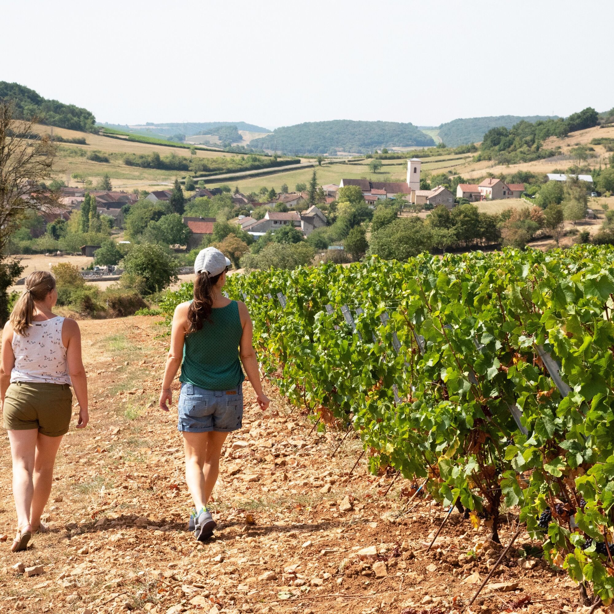
At the start, discover a magnificent vineyard on the hillside. Go up through the woods of La Pérouse and the Verneuse forest towards the Col du Navois (450 m).Take the Chemin de Moines GR76, a mythical...
At the start, discover a magnificent vineyard on the hillside. Go up through the woods of La Pérouse and the Verneuse forest towards the Col du Navois (450 m).
Take the Chemin de Moines GR76, a mythical ridge path linking Sennecey to Cluny, which will take you to the belvedere of the Roche d'Aujoux, with its magnificent view of the Grosne valley and the Chalonnaise coast in the distance. Return to the village of Mancey.
Da
In case of emergency, dial 112.
Consider carpooling
Parking close to the starting point
T3
Priljubljeni izleti v okolici
La Boucle de Bourgogne du Sud
svetlobaKolesarjenje 145,0 kmAu fil de l'eau de Louhans à Mâcon
svetlobaKajak / Kanu 73,4 kmLe chemin des Moines
srednjaPohodništvo 35,0 kmLa Voie Bleue, Moselle-Saône à vélo : de Mont-les-Seurre à Mâcon
svetlobaKolesarjenje 212,4 kmCycloRoute71 - Etape 2 de Cormatin à Tournus
srednjaKolesarjenje 31,1 kmBoucle "Vélo & Fromages"
svetlobaKolesarjenje 322,2 kmLa Route Européenne d'Artagnan
svetlobaJahanje 327,8 kmLa Boucherette
svetlobaPohodništvo 3,37 kmBoucle 10 bis : Boucle des églises romanes
srednjaKolesarjenje 35,8 kmAutour de Brancion
srednjaPohodništvo 11,1 km
Pohodništvo in sledenje


Ne zamudite ponudb in navdiha za naslednje počitnice
Vaš e-poštni naslov je bil dodan na poštni seznam.