


Circular hike Gaienhofen-Middle Höri


The start of this route is directly at the bus stop "Gaienhofen Schloss." The building, originally built as an episcopal castle, now houses a spacious school center (gymnasium, secondary school, and advanced...
The start of this route is directly at the bus stop "Gaienhofen Schloss." The building, originally built as an episcopal castle, now houses a spacious school center (gymnasium, secondary school, and advanced branch). The hike starts along the Erlenlohtobel and allows a short detour to the Mia and Hermann Hesse House before heading up to a viewpoint and the Honisheim and Balisheim farmsteads. Via the Horn water tower and through the district of Gundholzen, you reach the shore of Lake Constance. The paved path leads through the nature reserve to Hornstaad, past the beach and then follows the lakeshore back to Gaienhofen. Along the route and at the end, there are various opportunities to stop for refreshments.
Gaienhofen - barbecue area "Schöne Aussicht" - Honisheim hiking car park - Balisheim farmstead - Horn water tower - Gundholzen - Hornstaad - Gaienhofen

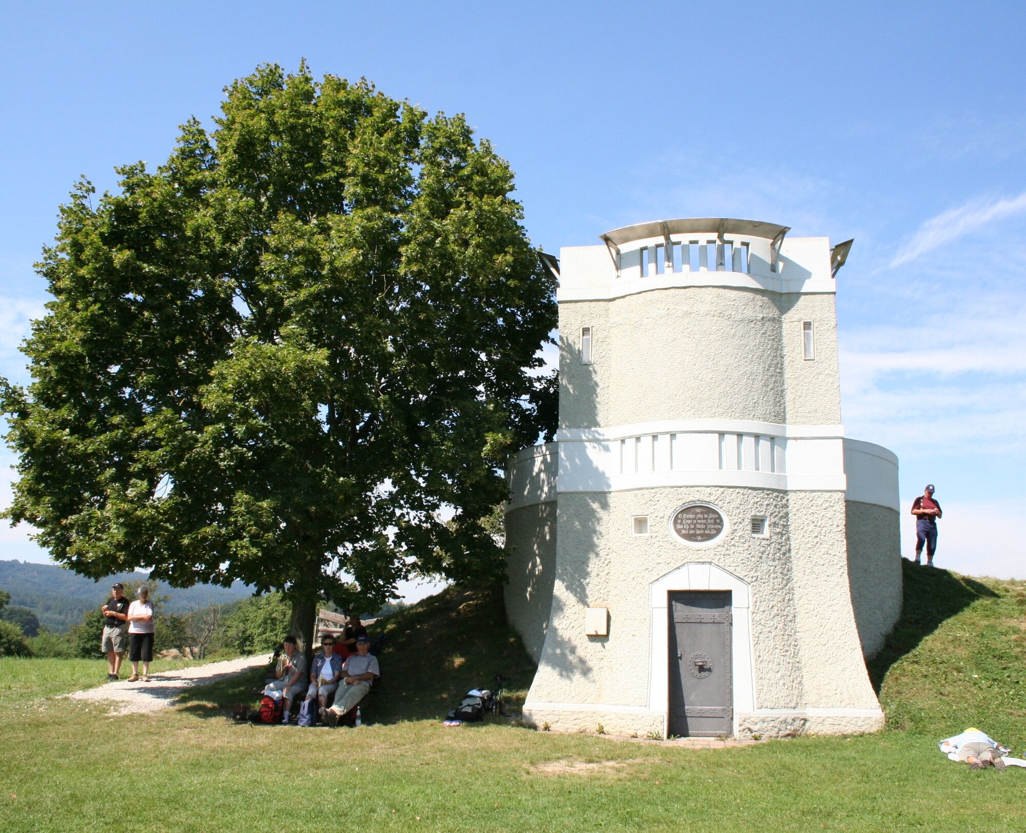
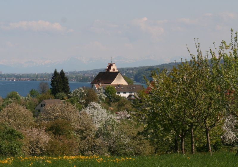
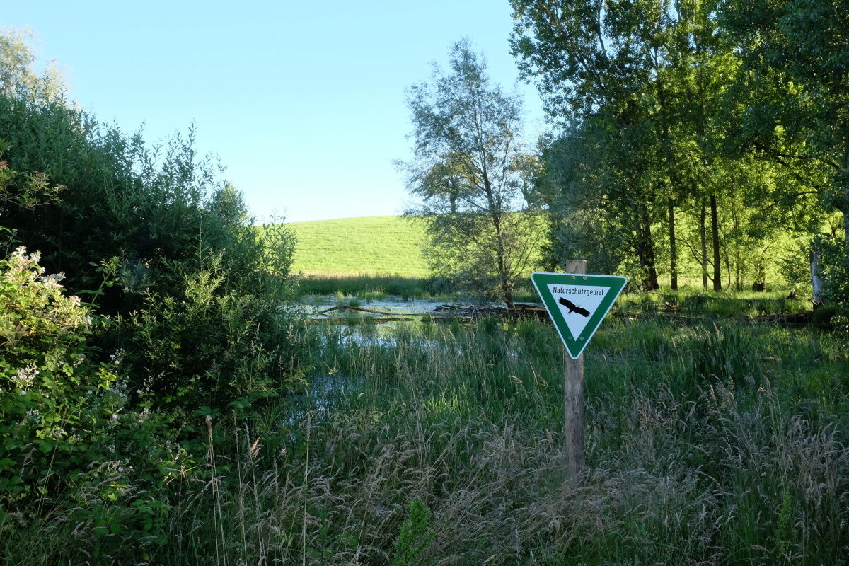
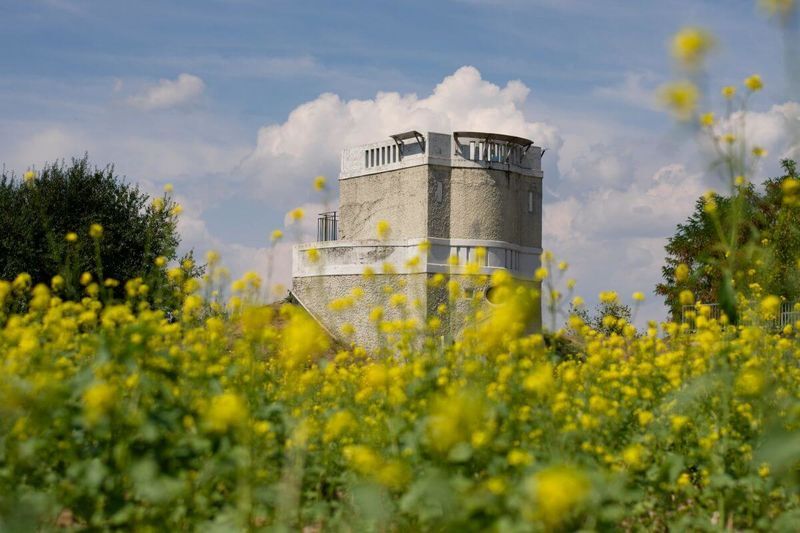

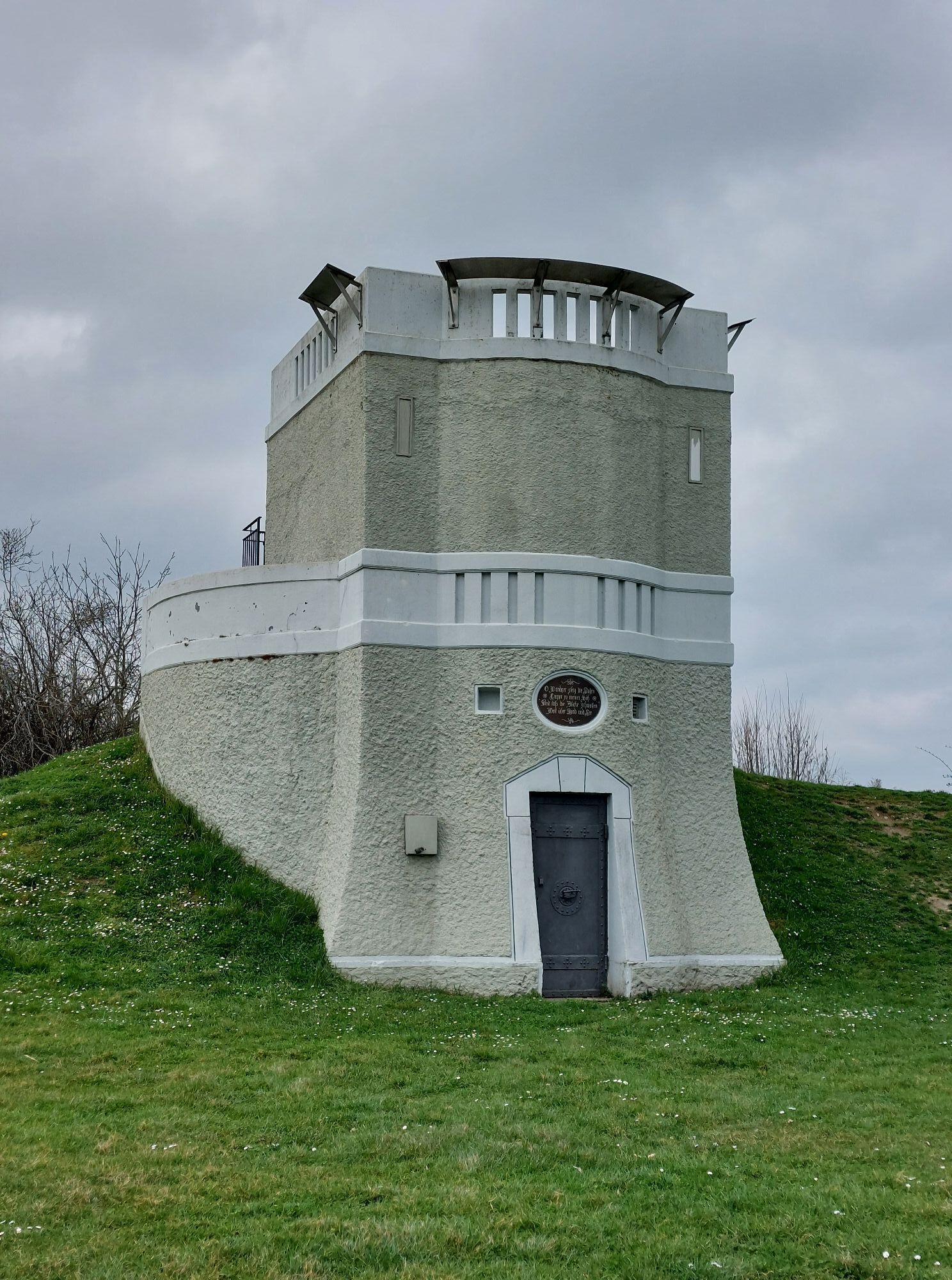
This charming circular route starts at the bus stop of the Ev. School "Schloss Gaienhofen" on the main street. We walk up the street "Im Erlenloh." After about 200m, there is the possibility to take a short detour to the Mia and Hermann Hesse House on the left. Back on the original hiking trail, which at this point is marked with a green diamond on a yellow background, it continues on a wide field/forest path, uphill between two houses and along the Erlenloh stream/Erlenlohtobel. Always uphill straight ahead, we reach a crossroads with a paved road at a bench under birches. The path to the left leads to the Mühlbachhof. Immediately after the stone cross and a panel of the art route (Helmuth Macke), turn sharply right and we hike uphill past the barbecue area "Schöne Aussicht" towards the Honisheim farmstead. Shortly before the Honisheim farmstead, we turn right, go downhill via the Honisheim hiking car park, then turn left towards Balisheim. We leave the Balisheim farmstead on the left and follow the paved road on the right. Continuing towards Horn, we then cross the road between Weiler and Gaienhofen and immediately take the small field path towards the forest edge. The path continues along the forest edge and across the fields to the Horn water tower. There, a beautiful barbecue area with seating and a great view over the western Lake Constance and, in good weather, to the Alps invites you to linger. From the water tower, we go downhill towards Horn and after about 100m take the left turn to Gundholzen. In Gundholzen, we cross the main street at the village fountain and continue downhill towards the lakeside path (Lake Constance cycle path). Once there, we go right again towards Horn. Upon arriving in Horn, we turn left onto Hornstaaderstraße and follow it to the lakeshore. Along the lakeshore, we walk on a paved path past the "Schlössli Hornstaad" and the Horn beach (Attention: about 200 m after the beach turn left into the hiking trail blocked for cyclists by a wooden barrier, marked with a blue dot and a round arrow). At the end of this path, continue straight along the lakeshore through the nature reserve towards the Gaienhofen ferry dock. There, turn right up Schlossstraße and we have arrived back at the starting point "Schloss Gaienhofen."
Of course, the hike can also be started from all other districts or from the Honisheim hiking car park.
Da
Sturdy footwear
L 192 from Radolfzell towards Stein am Rhein (CH)
Höri bus line 200 from Radolfzell or Stein am Rhein, no bicycle transport
Schlossstr. and Hauptstr. Gaienhofen
Visit to the Hesse Museum Gaienhofen: Hermann Hesse lived here. In the old schoolhouse, paintings of the Hörimaler are shown.
Priljubljeni izleti v okolici
- 3,7
Mindelsee-Runde
svetlobaPohodništvo7,83 km - 4,0
Around the island of Reichenau
svetlobaPohodništvo10,9 km - 4,0
Bodanrück-Runde
težkoPohodništvo8,36 km - 5,0
Mühlsberg-Runde
srednjaPohodništvo8,67 km - 3,7
Firstweg Langenmos
srednjaPohodništvo5,76 km Nature enjoyment on the circular hiking route with a view of Freudental Castle
svetlobaPohodništvo5,67 kmHike on the panorama route of the Höri Peninsula
srednjaPohodništvo8,11 kmHegne circular route
svetlobaPohodništvo4,26 km- 4,0
Homburg-Steig
srednjaPohodništvo5,83 km Stein am Rhein - Hohenklingen Castle - Stein am Rhein
težkoPohodništvo7,79 km
Pohodništvo in sledenje


Ne zamudite ponudb in navdiha za naslednje počitnice
Vaš e-poštni naslov je bil dodan na poštni seznam.