







Altburg - Oberreichenbach - Altburg
The varied and contrasting circular hike runs on the high plateau of the eastern Northern Black Forest. Here we encounter the settlement structure of the former Waldhufendörfer (forest village farms)....
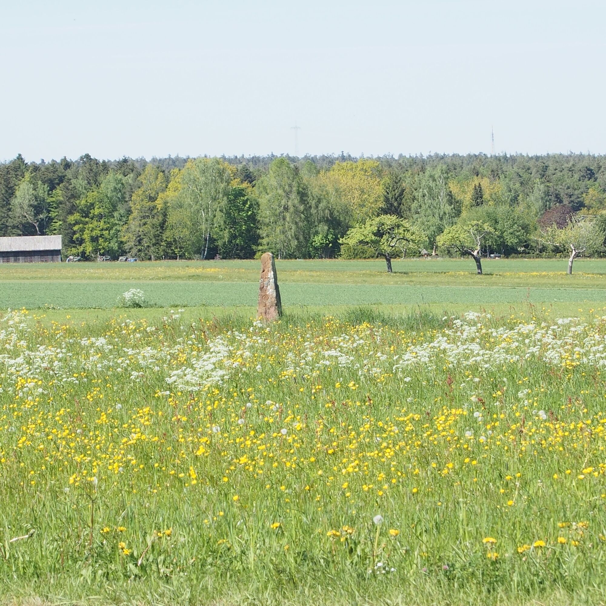
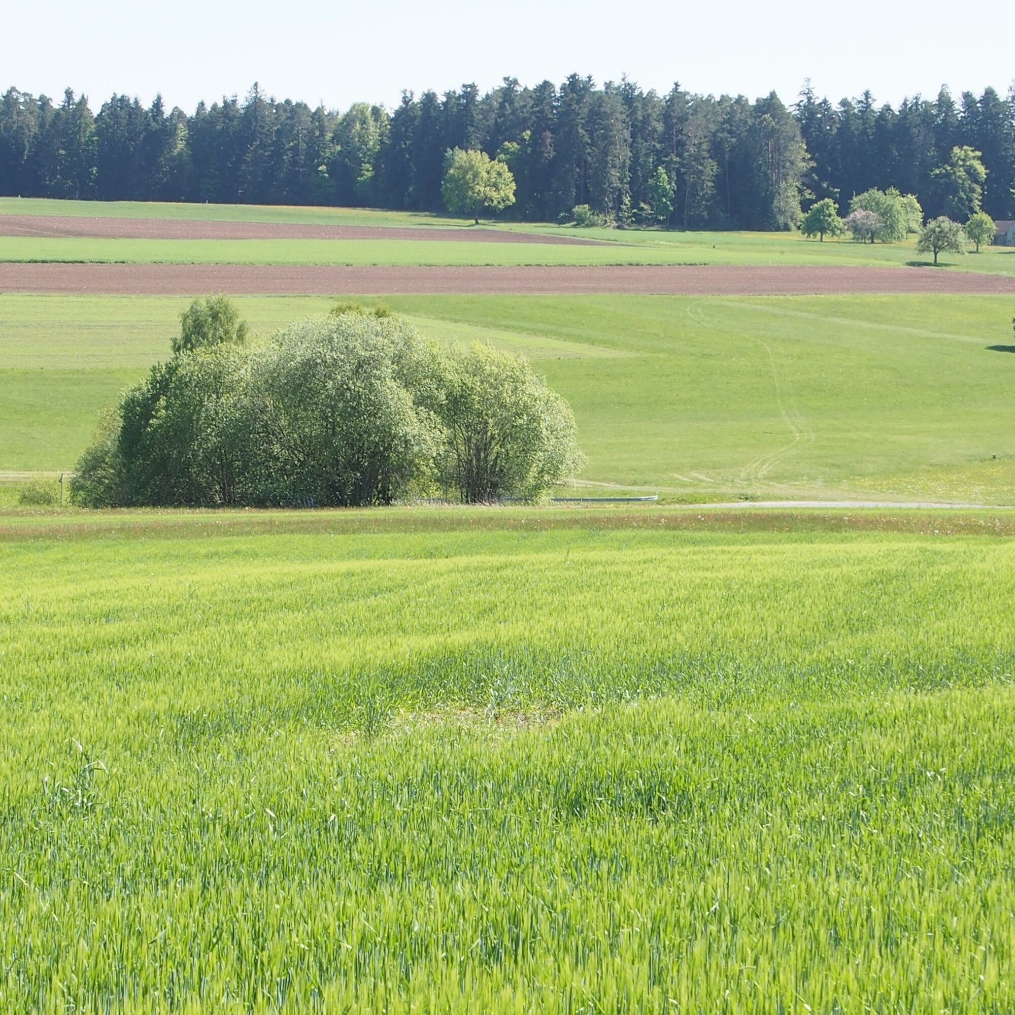
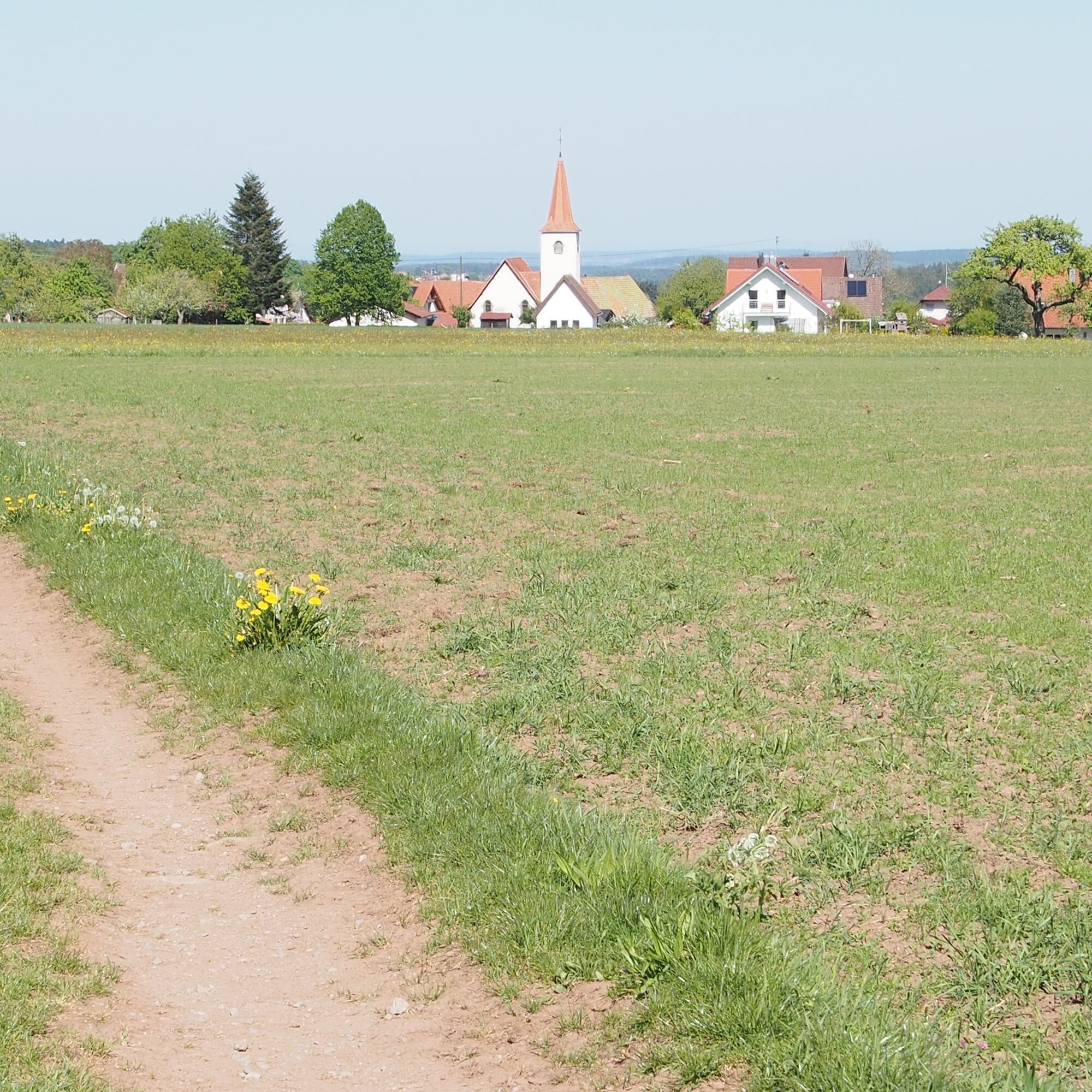
The varied and contrasting circular hike runs on the high plateau of the eastern Northern Black Forest. Here we encounter the settlement structure of the former Waldhufendörfer (forest village farms). The red tones of the Upper Buntsandstein weather into a relatively fertile soil that allows agriculture. Where settlers in the 11th and 12th centuries cleared the forests with simple tools at the cost of their lives and established their strips of land, today we enjoy brightly colored meadows, cultivated fields, and splendid wide views over the land to the Swabian Jura instead of extensive forest. Occasionally, tree-covered stone walls remind us of the former strip boundaries. After much open landscape, we repeatedly dive into the aromatic, scented coniferous forest along idyllic nature trails.
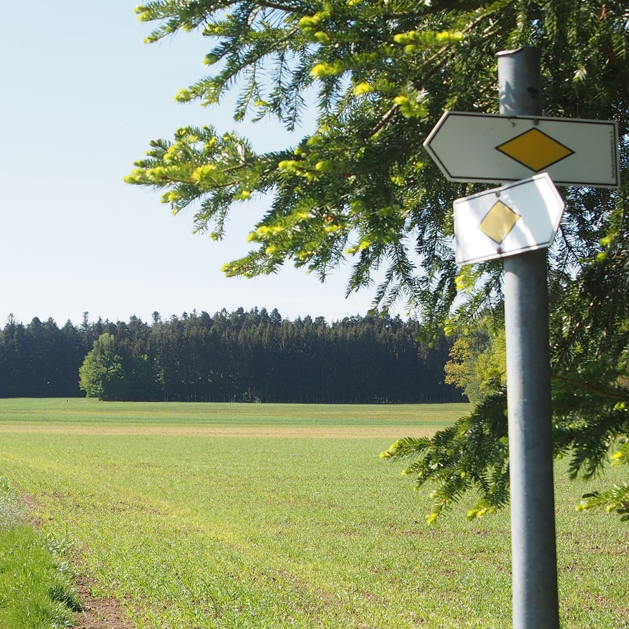

Follow the signposts of the Black Forest Association:
Altburg, Kirchweg, Schweinbachtal, Steinernes Brücke, Felsenmeer/ Simmersfelder Trail, Scheufelteich, Oberkollbach Tiroler Trail, Oberkollbach, Baierweg, Unterkollbach Katzenbuckel, Igelslocher Town Hall, Alte Badstraße, Alte Badstraße / Siehdichfür, Herrschaftsbiegel, Simmersfelder Trail/Oberreichenbach Waldsiedlung, Simmersfelder Trail/Allmend, Altburg Sports Field
The hike starts at the end of Reizengasse at the cemetery. We cross Theodor Dierlamm Street and take a look at the stately farmhouse museum. The building, clad in ochre-colored shingles at the front, was built in 1813. It is open from April to October on the first Sunday of each month from 2 to 5 p.m. The appealing information panels of the Altburger-Bohnenberger Historical Trail are impossible to miss. Those who want to learn more about historic Altburg, pastor and inventor Gottlob Christoph Bohnenberger (1732-1807), and his son Professor Johann Friedrich von Bohnenberger (1765-1831) should plan at least 1.5 hours for the 22 stations. That would be a reason for another visit to Altburg. The widely visible evangelical Martinskirche is also worth a visit, not only for its old wall paintings and very old gravestones. Those who prefer hiking continue via the Bohnenberger Trail and Klösterle to Schwarzwaldstraße. There we encounter, opposite the town hall, the first trail junction of the Black Forest Association: Altburg 599 m. Diagonally opposite we see a half-timbered house on the corner. It is the landmark of Altburg: the observatory once run by Professor Bohnenberger.
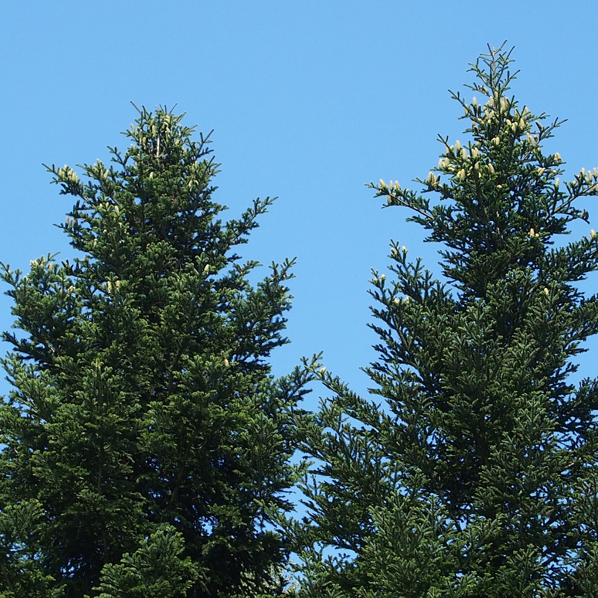
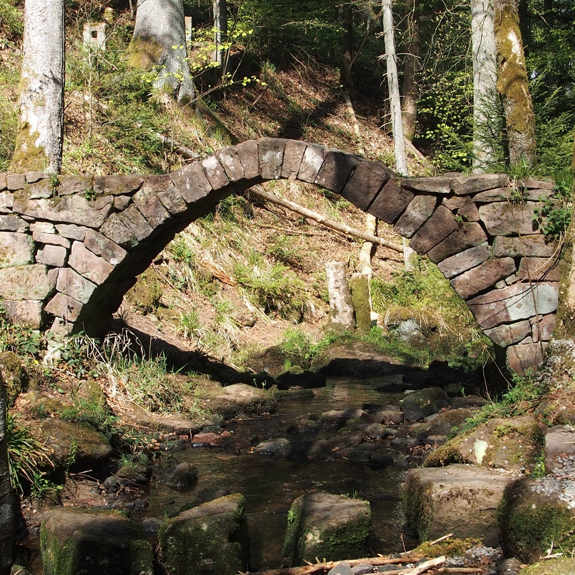
We follow Schwarzwaldstraße (K 4325) towards Schweinbachtal with the yellow lozenge as a marking sign. Just before leaving the village, we turn right into Buchgässle and walk on an asphalted path past rural properties and meadows towards the forest. Caution: the turn left along the forest edge over a mowed meadow can be easily overlooked. Upon entering the forest we encounter Kirchweg. Many small conifer saplings grow under large trees here. Are they firs or spruces? A look under the branches shows two light growth bands, which are only found on firs. To know the age of the trees, simply count the annual shoots or whorls. Fir cones grow only on the highest branches and only from an age of 60 to 80 years. Those traveling in summer with sharp eyes can repeatedly spot them on this tour. Kirchweg leads us straight downhill into the romantic Schweinbachtal. We orient ourselves towards the junction “Steinernes Brückle” and take the route to Oberkollbach. Immediately after we cross the gently flowing Schweinbach on large stepping stones next to the historic barrel-vaulted bridge. It was built in the 18th century without any mortar. At least Professor Bohnenberger mentioned it in 1798 in his "Charte von Württemberg". Because the bridge documents church history in the Northern Black Forest and is also a testimony to the history of technology, it was important enough to be renovated in 2016. The statics do not permit normal crossing, so railings were not replaced.
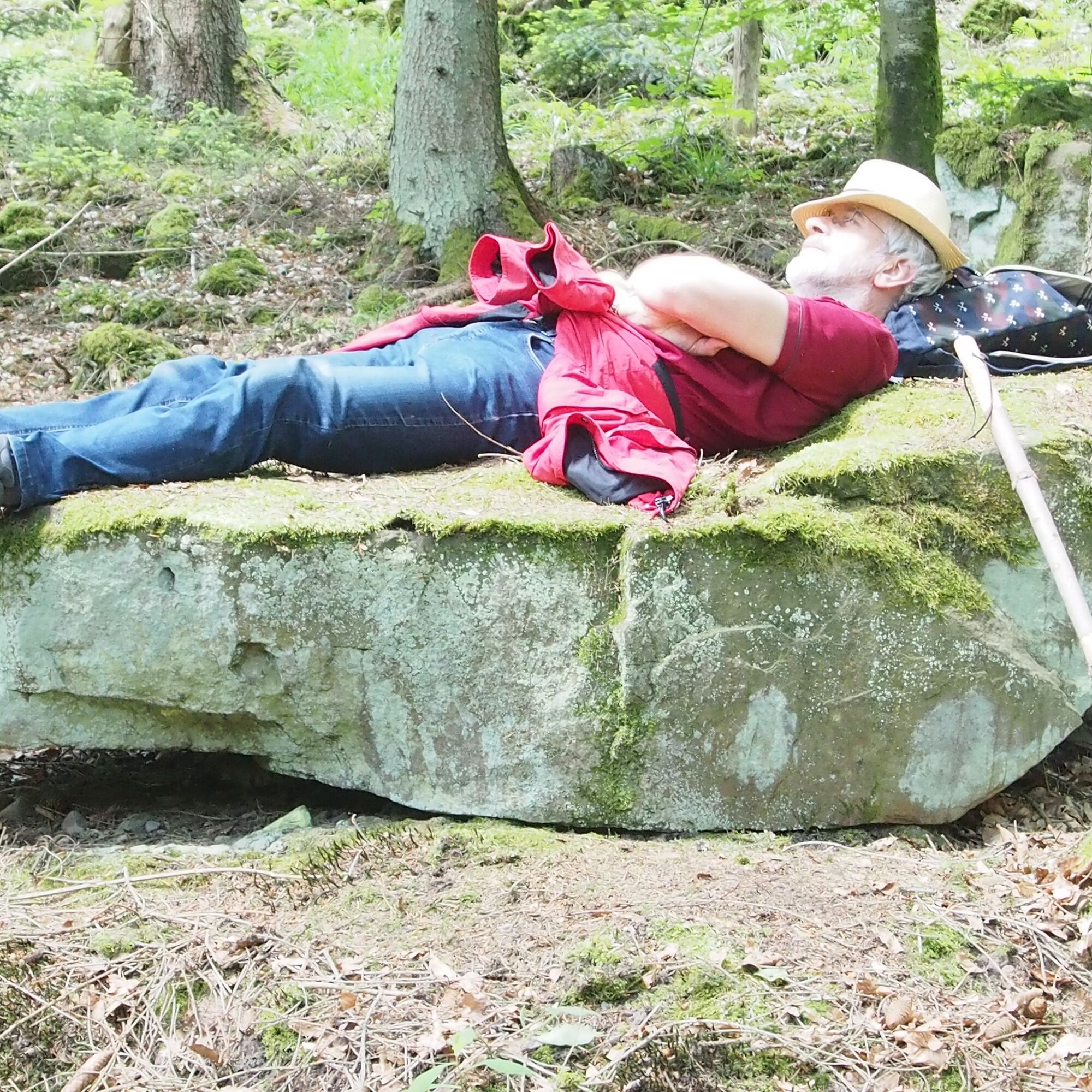
Immediately after we cross B 296 and follow the narrow nature trail uphill on the other side of the street. Who spots the large Buntsandstein shaped like a lounge chair? Be careful again at the junction “Felsenmeer,” because two paths to Oberkollbach are indicated. We follow the sign for the Simmersfelder Trail marked by a blue lozenge over Scheufelteich on an idyllic nature trail with some stone steps uphill and downhill and protruding spruce roots through mostly coniferous forest. Many young spruce saplings stand out. A simple saying helps to distinguish them from firs: “Spruce pricks, fir not!” Just reach in and feel. The long cones lying on the ground also reveal the spruce. We walk past impressively large Buntsandstein blocks. They come from the Upper Buntsandstein. The over 240 million-year-old blocks were broken off by cracking during the ice ages. Here they now lie and weather imperceptibly for us. There are old boundary stones along the way. The still recognizable shepherd's staff indicates a connection to Hirsau Abbey. Suddenly the forest opens and we see the first houses of Oberkollbach.
In Oberkollbach, we meet the Tiroler Trail, which we follow. Some inns invite you to rest on Alte Badstraße. We leave the village via Igelslocher Straße on the sidewalk and cross Kollbach at the “Brückle” bus stop. We leave Unterkollbach on the right and hike towards Igelsloch past a rural estate at Katzenbuckel on a mown meadow path with nice views of the forest, meadows, fields and back to Oberkollbach.
Many mountain villages in the Northern Black Forest such as Ober- and Unterkollbach, Igelsloch and Oberreichenbach were founded between 1050 and 1150 as Waldhufendörfer. The settlers were allocated “Waldhufe” by the Counts of Calw, i.e. strips of land that had to be cultivated with simple tools and incredibly hard work first. One “Hufe” was large enough for agricultural cultivation to feed a family and secure taxes. Usually, they were 50 to 100 m wide and up to 2000 m long properties. First, a central connecting path was built, along which the settlers' houses were built. Behind each house followed garden, meadows, fields, and forest. From the stones dug out and laid at the edge of the strips by the settlers, low stone walls formed on which bushes and trees also formed a natural boundary. Place names such as “Hausäcker” still recall the former use.
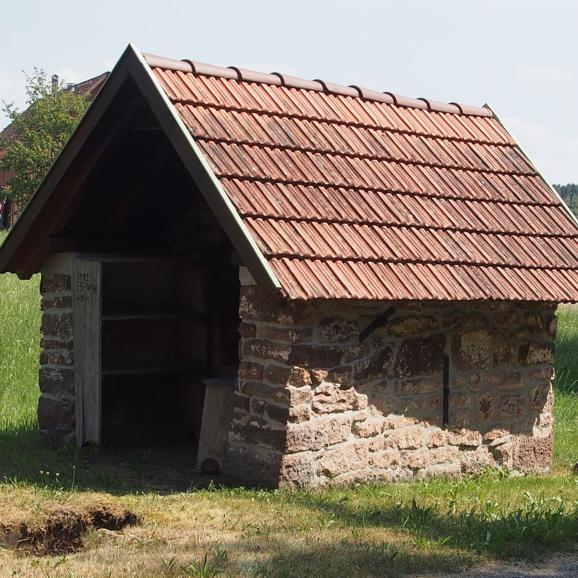
The path and the yellow lozenge lead us directly to the Igelslocher town hall. Behind the bus shelter, benches under a large chestnut tree invite you to take a break. A look at the Igel fountain is also worth a small detour. Then continue along the main street and watch the yellow lozenge again. It initially guides us right into Bachstraße, then left into Poststraße, at its end right into Fasanen Weg past Café Kienle (open every 1st and 2nd Sunday of the month from 1:30 p.m.) out of the village. The path leads straight on a field path to a hut, then turn left following the yellow lozenge, past meadows and fields, towards the forest. At the end of the path, now at 675 meters altitude, the highest point of our route, we reach the simple barbecue area “Siehdichführ.” Then continue on Alte Badstraße to Oberreichenbach. 400 m further, we come to another junction and take the path towards “Herrschaftsbiegel, Oberreichenbach.” The word Biegel as a place name means the same as “corner” or “angle” and is used for pointed properties or remote areas. It was owned by the possibly noble “Herrschaft.” Caution: do not follow signposting here and continue on the bicycle path but take the forest path at right angles to the street. The yellow lozenge shows us the way through the forest. It opens up a bit later and on the way to Oberreichenbach the long outdoor bench of the Mössackerhütte of the Black Forest Association invites you to rest.
On the right, via Ziegelweg, past a bakehouse, we meet Baierweg and run it initially parallel to B 296. Then continue on Schömberger Straße to Gasthof Hirsch and cross the street. Behind the gas station and the village shop, we climb the steep wine street and cross L 346. There we meet the Simmersfelder Trail again. We follow it initially marked with a blue lozenge, later yellow, towards Altburg. When the footpath splits, keep left towards the forest. After one kilometer, we meet the junction “Simmersfelder Trail/Allmend.” The Allmend or common land was formerly a piece of land used collectively. We follow the path towards Altburg through the forest and over meadows, cross a lightly trafficked street, and again enjoy the magnificent view over the cultural landscape up to the Swabian Jura. At the next main road, we turn right towards Weltenschwann and shortly before the village sign reach Stauchgasse. Past a nursery and interesting flora, the green asphalt alley meets Speßhardter Straße, which takes us past the sports field back to the town hall and the start of our hike.
Text and images: Black Forest guide Roswitha Hild
Da
Arrival by Car:
Autobahn A8 from Karlsruhe: Exit Pforzheim-West (approx. 30 km); continue via Federal Road 463 towards Calw. Via K4325 you reach Calw-Wimberg then Calw-Altburg. Autobahn A8 from Ulm/Stuttgart: Exit Leonberg (approx. 25 km), continue on Federal Road 295 towards Weil der Stadt to Calw. Then continue via K4325 to Calw-Altburg. Autobahn A81 from South/Lake Constance: Exit Gärtringen-Stadtmitte (approx. 20 km), continue via K 1075; near Deckenpfronn take the first exit at the roundabout and continue on B 296 towards Calw. Via K4325 you reach Calw-Altburg.Plan your arrival by car at www.map24.de
Arrival by Train:
Route Pforzheim - Calw - Horb - Tübingen (Kulturbahn). Long-distance trains (EC, IC, ICE) are best reached in Karlsruhe with connecting trains via Pforzheim (Kulturbahn). If arriving via Stuttgart, we recommend continuing with the S-Bahn S6 Stuttgart - Weil der Stadt with a transfer to bus line 670 to Calw.Plan your journey at http://reiseauskunft.bahn.de/bin/query.exe/d
Arrival by Bus:
Greater Stuttgart area bus line 670 DB Bahn Regiobus / Volz; (Calw-Weil der Stadt) connection to S6 Böblingen / Sindelfingen area: bus line 763 DB Bahn Regiobus; Calw-Böblingen (connection to S1) From Calw Central Bus Station (ZOB) you can reach Altburg with bus line 6302. It is recommended to get off at the Lamm stop; from there it is only a few minutes' walk to the starting point at Altburg cemetery.Regiobus line X63 between Calw - Altburg - Bad Wildbad - Bad Herrenalb
Plan your journey at www.efa-bw.de
Calw-Altburg, Cemetery Parking Lot
Other parking options:
Hiking parking lot at the sports field in Altburg Hiking parking lot at Schwarzwaldhalle AltburgImmerse yourself in the local history of Altburg on the Altburger-Bohnenberger Historical Trail.
Visit the Farmhouse Museum with current programs on the first Sunday of the months from April to October and enjoy the Altburg „Glombakucha“.
Pridobite vpogled Vedno v živo na mestu z več kot 9.500 spletnimi kamerami. bergfex Kot uporabnik Pro si lahko zdaj ogledate ustrezne spletne kamere za številne izlete v aplikaciji izleti iz. Tako si lahko neposredno ogledate trenutne razmere. Priljubljeni izleti v okolici
- 4.6
Hiking through the Monbach Gorge in search of the kingfisher
srednjaPohodništvo 10.5 km - 5.0
Wild romantic Monbach Valley
svetlobaPohodništvo 6.25 km - 4.9
Der Teinacher (Premiumweg & Genießerpfad)
srednjaPohodništvo 12.0 km - 4.7
Eyach round
srednjaPohodništvo 7.84 km - 4.0
Wolfsschlucht and Fox Gorge
srednjaPohodništvo 9.74 km - 4.2
Kaltenbronn Circular Route No. 1 - Wildsee Moor Loop
svetlobaPohodništvo 8.30 km - 4.7
Through the wild romantic Schweinbachtal to the Bruderhöhle cave
srednjaPohodništvo 13.8 km - 3.0
Dobel High-Altitude Route
srednjaPohodništvo 11.8 km - 5.0
Water, Woods and Meadowtrail / Zavelstein > Calw (Premium trail & Genussweg)
težkoPohodništvo 14.4 km - 5.0
From Bieselsberg into the wild Monbach valley - dream route on small paths
težkoPohodništvo 18.0 km
Pohodništvo in sledenje


Ne zamudite ponudb in navdiha za naslednje počitnice
Vaš e-poštni naslov je bil dodan na poštni seznam.





