


"Hegauer Kegelspiel" Hegau Volcano Tour
Fotografije naših uporabnikov
-
 © Sandra KoelblUstvarjeno na 06.07.2025
 -
 © Sandra KoelblUstvarjeno na 06.07.2025
 -
 © Sandra KoelblUstvarjeno na 06.07.2025
 -
 © Sandra KoelblUstvarjeno na 06.07.2025
 -
 © Sandra KoelblUstvarjeno na 06.07.2025
 -
 © Sandra KoelblUstvarjeno na 06.07.2025
 -
 © Sandra KoelblUstvarjeno na 06.07.2025
 -
 © Sandra KoelblUstvarjeno na 06.07.2025


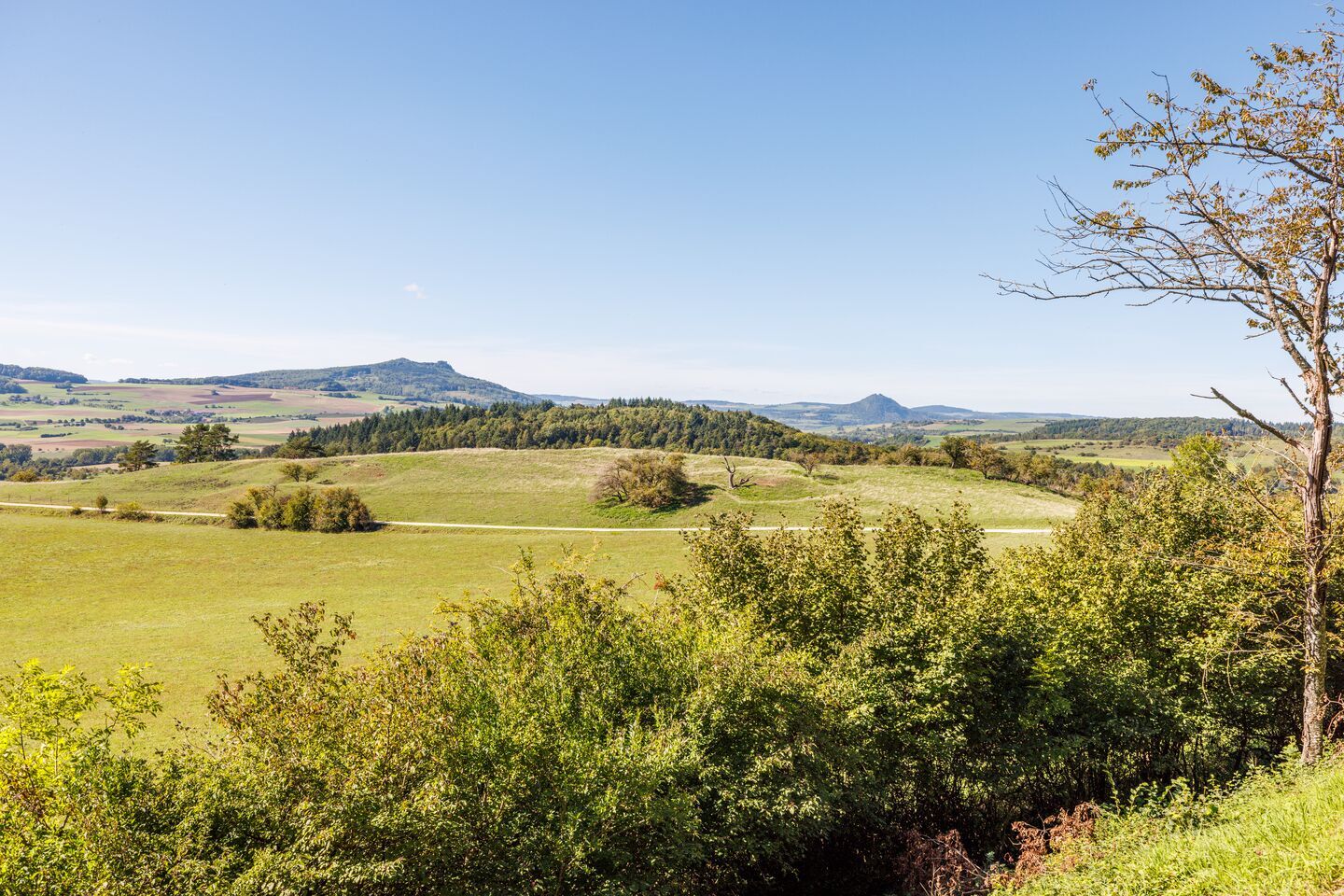
The volcanic landscape of the Hegau, just a stone's throw from Lake Constance, is now considered a hidden gem among hikers. A total of 10 premium hiking trails have been planned and created here over the...
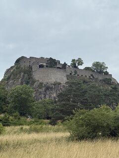
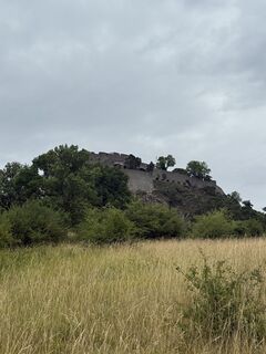
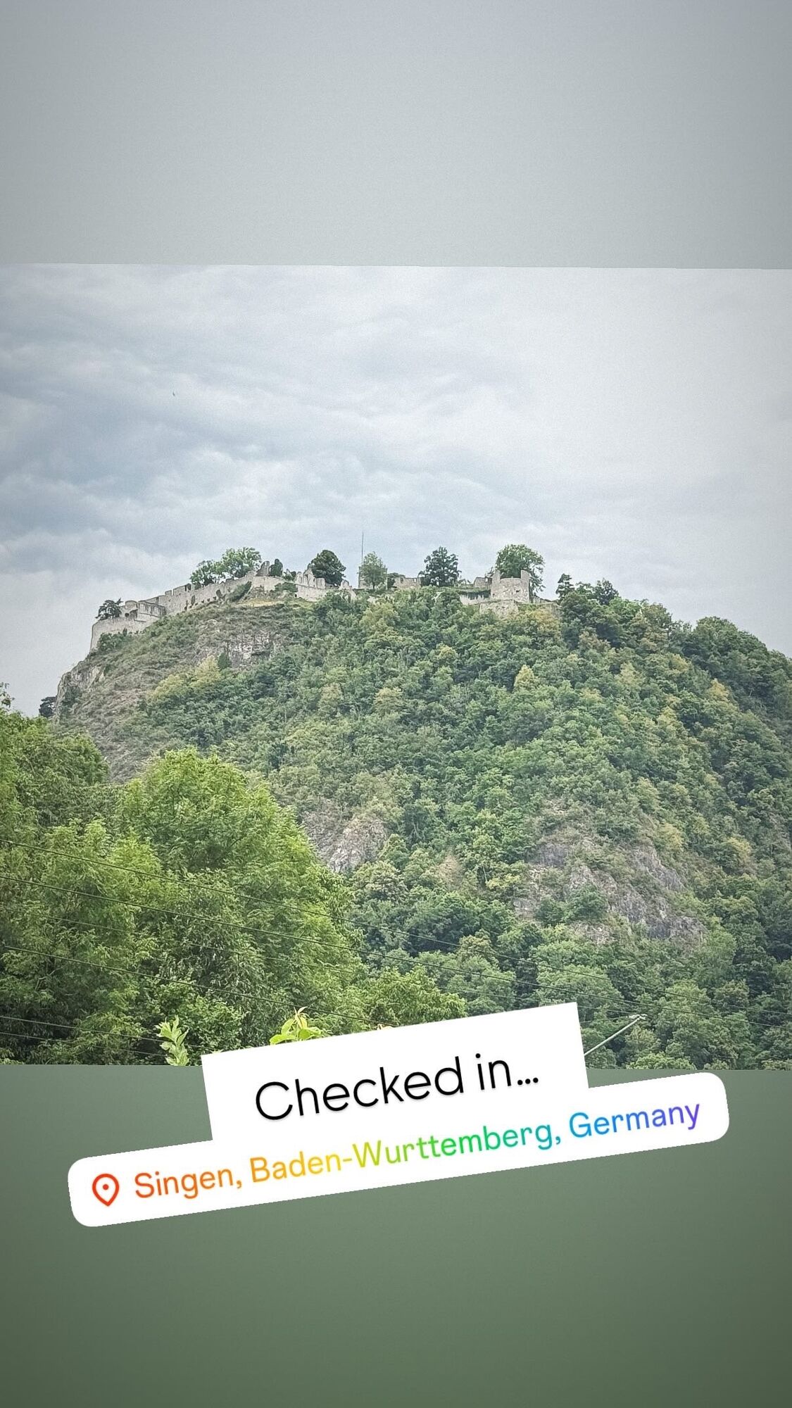
The volcanic landscape of the Hegau, just a stone's throw from Lake Constance, is now considered a hidden gem among hikers. A total of 10 premium hiking trails have been planned and created here over the past seven years. Currently, nine trails are in operation. In addition to eight circular trails, there is a nearly 30 km point-to-point hike from Engen to Singen and vice versa. On this route, the five most famous Hegau volcanoes are hiked, starting with Hohenhewen, then Hohenstoffeln, Mägdeberg, and Hohenkrähen, with the Hohentwiel and its massive fortress ruin rounding off the hike. The route is suitable both for a two-day hike, which can be interrupted in Weiterdingen or Mühlhausen-Ehingen, and for very sporty hikers who manage the hike in one day. However, caution: the nearly 30 km route combined with many elevation meters is also a challenge for athletic hikers. An additional 6 km and 340 meters of elevation gain result if all five mountain summits are climbed.


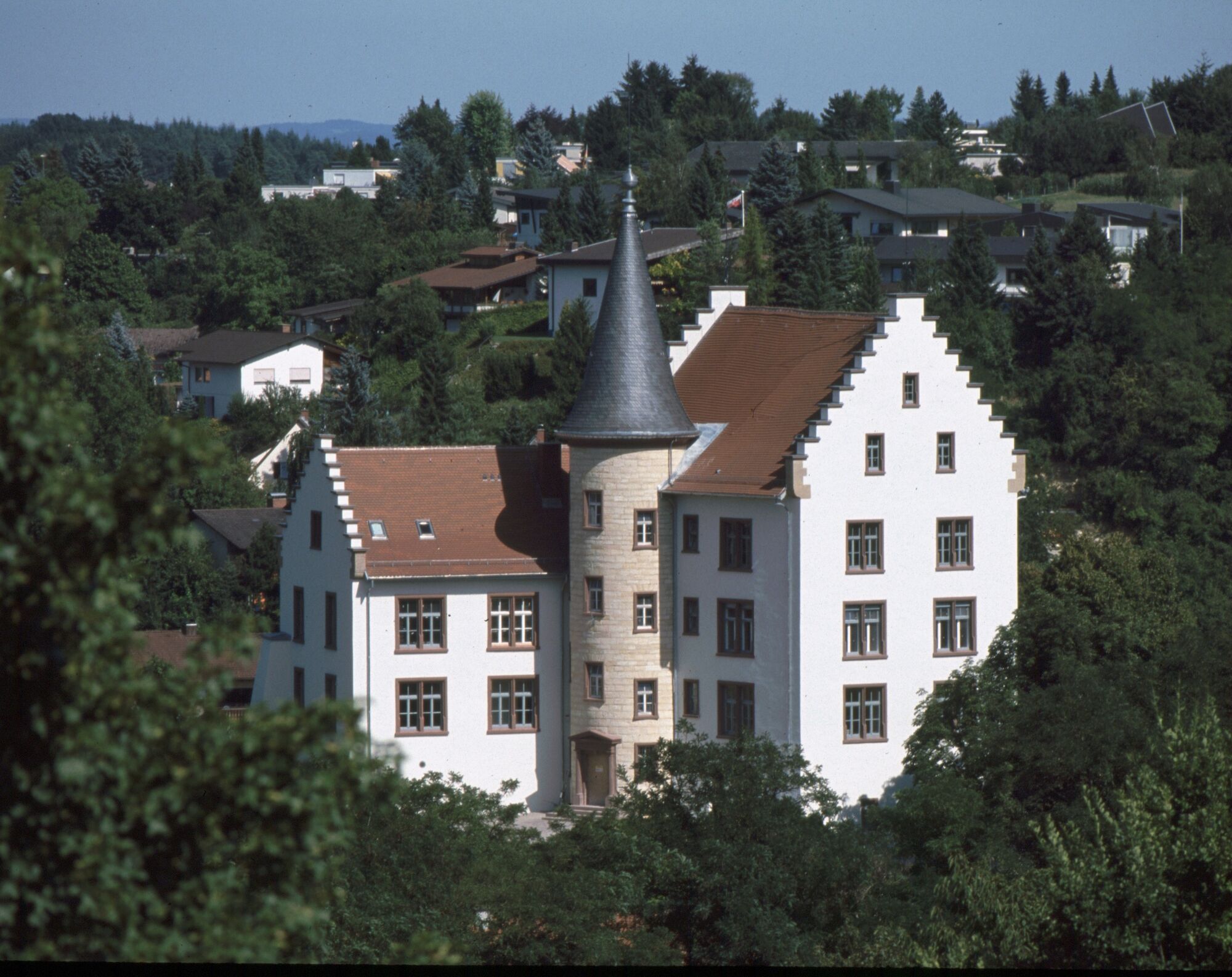
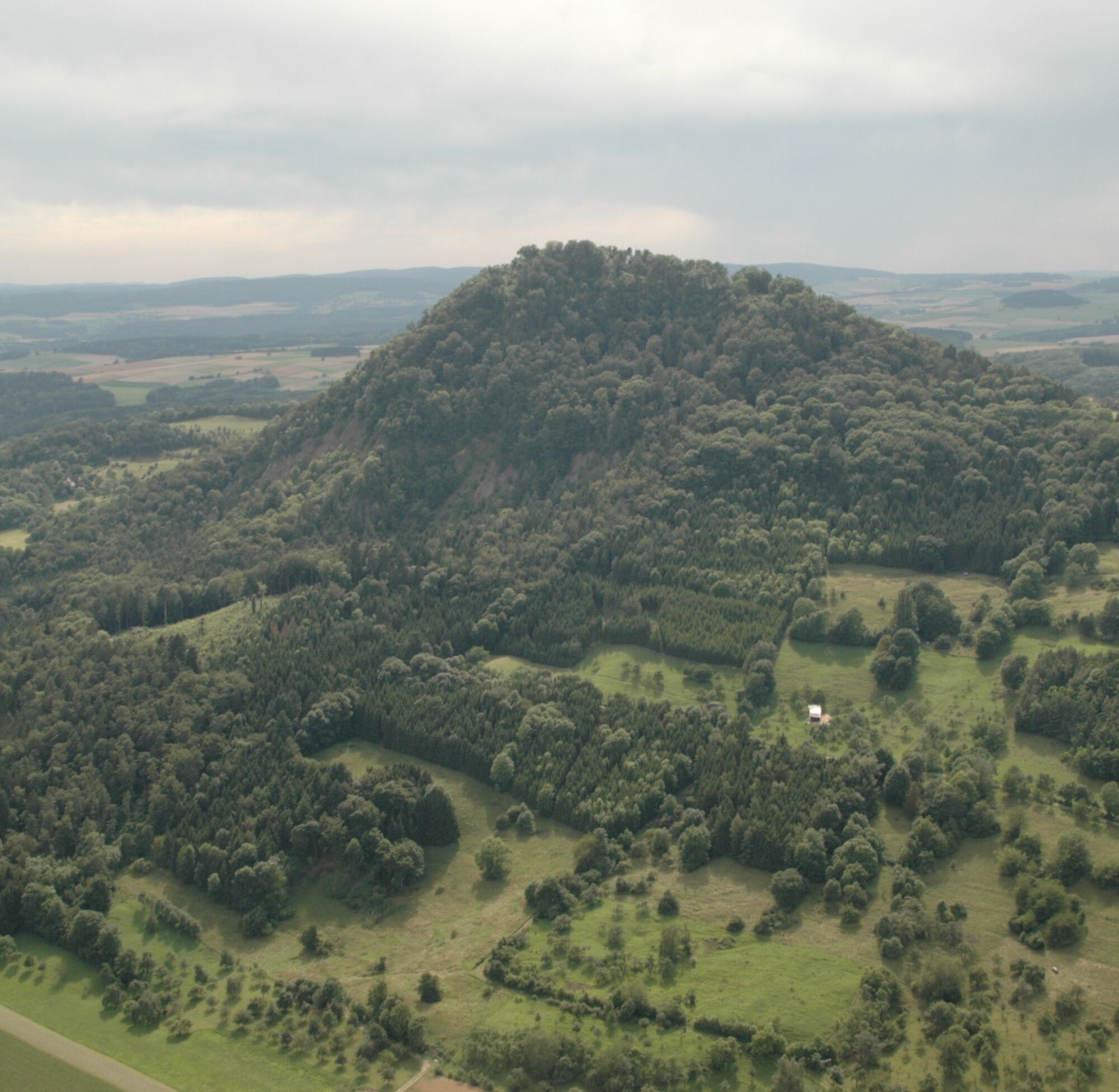

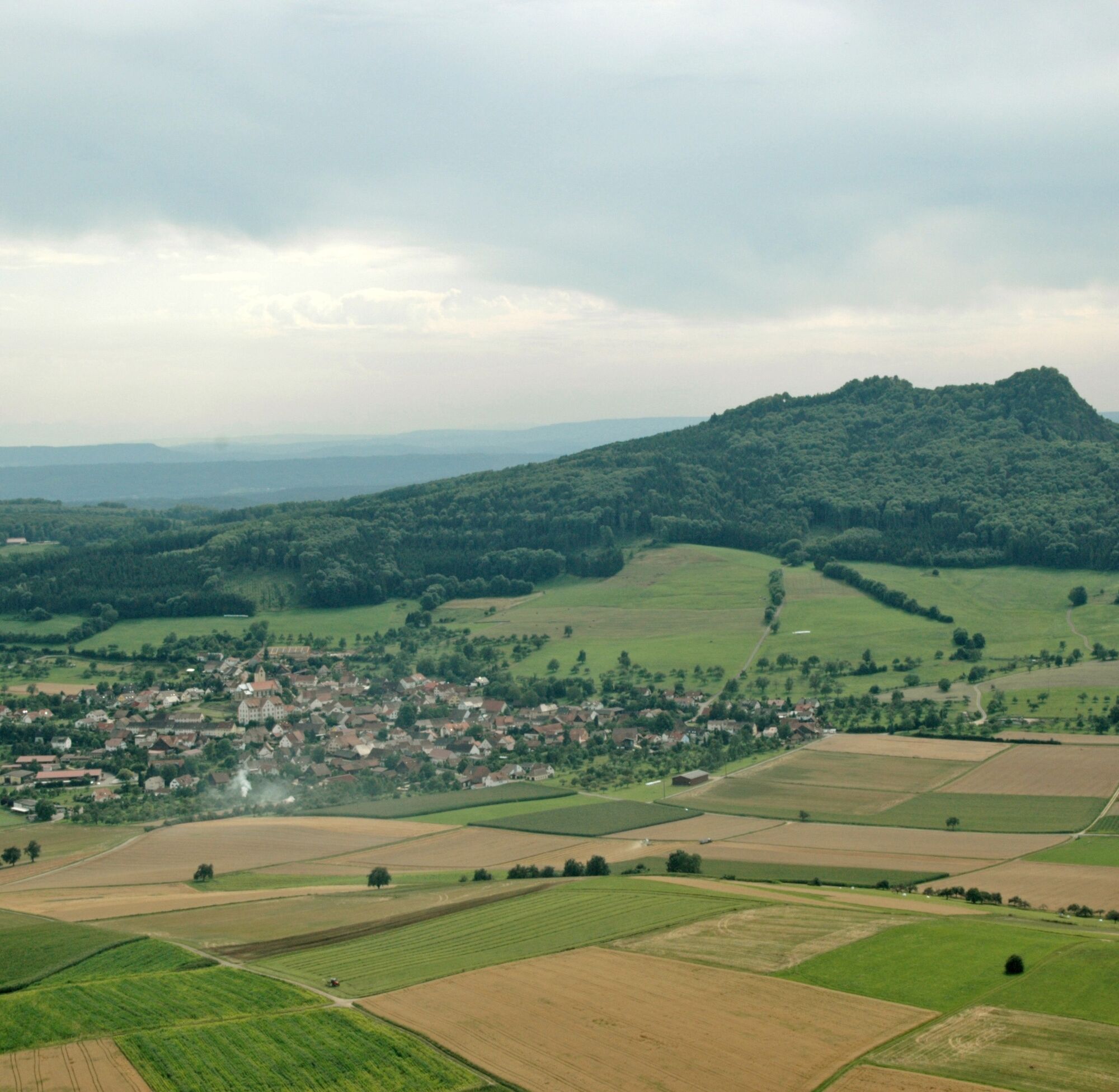
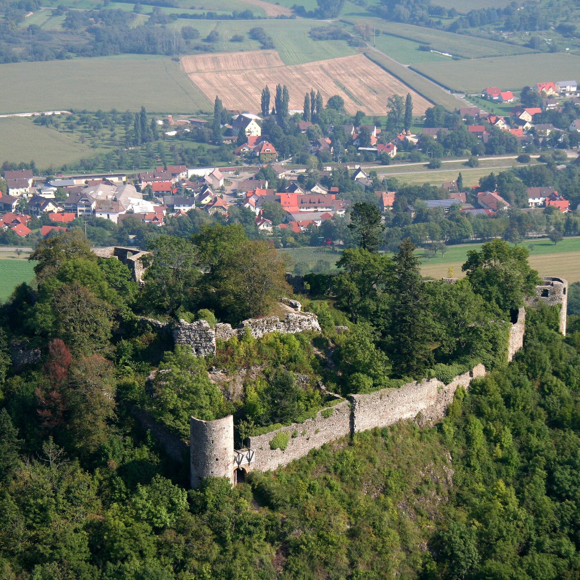
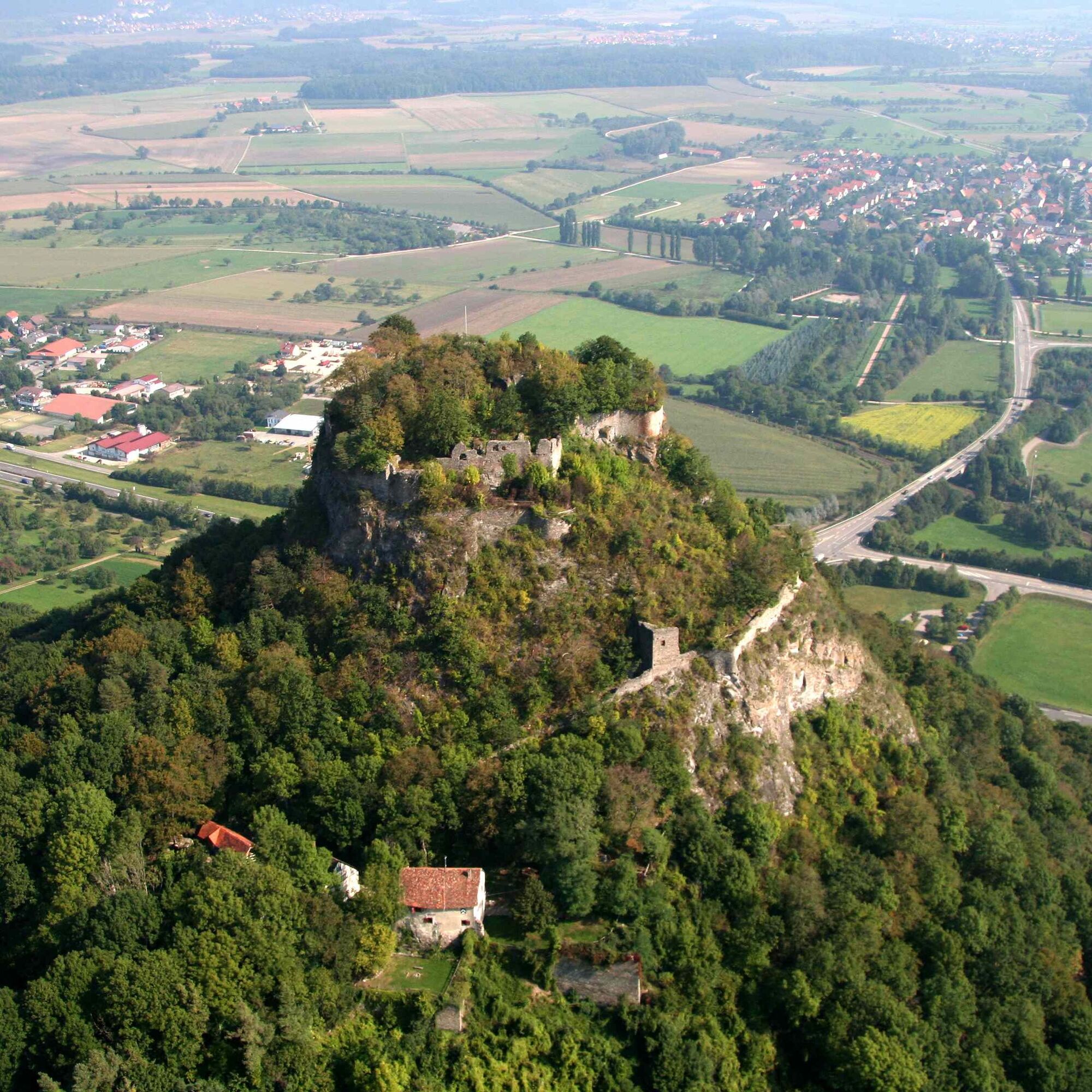
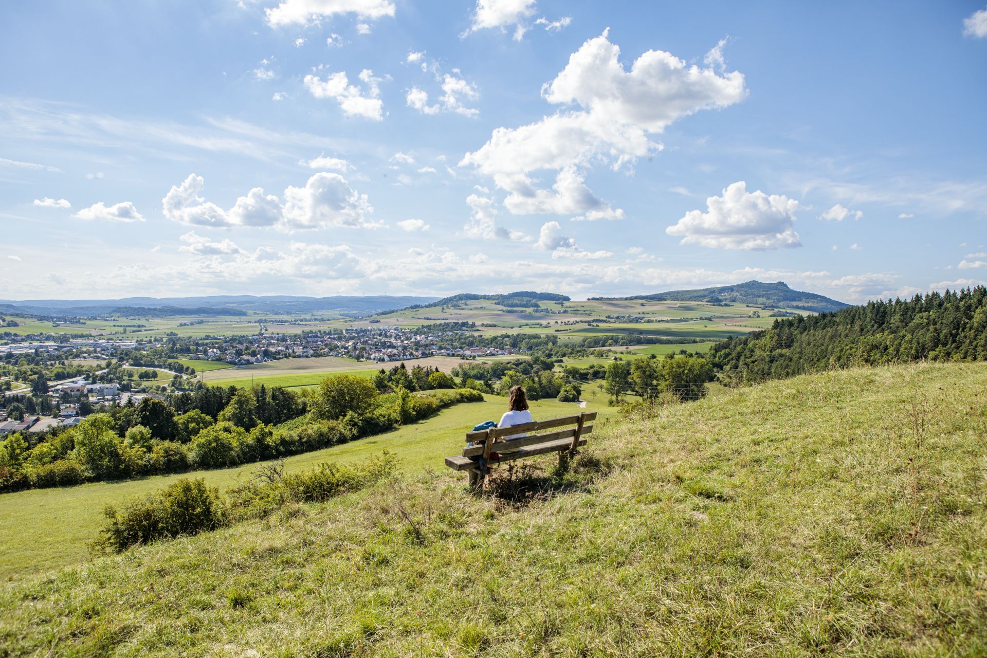
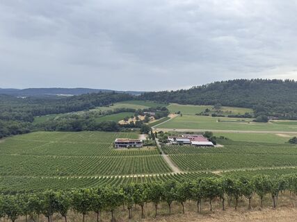
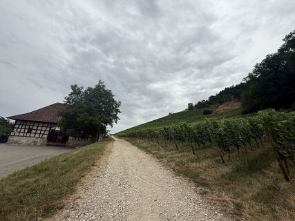
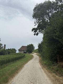
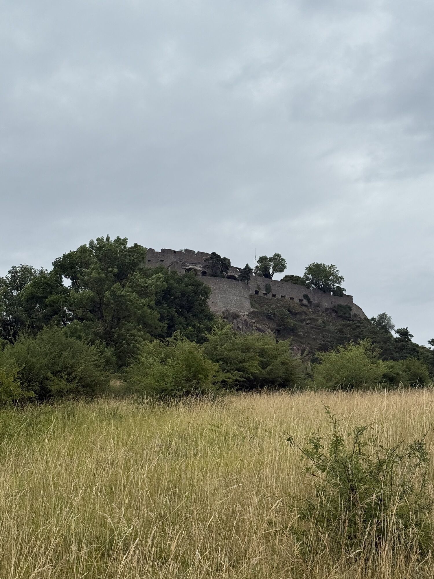
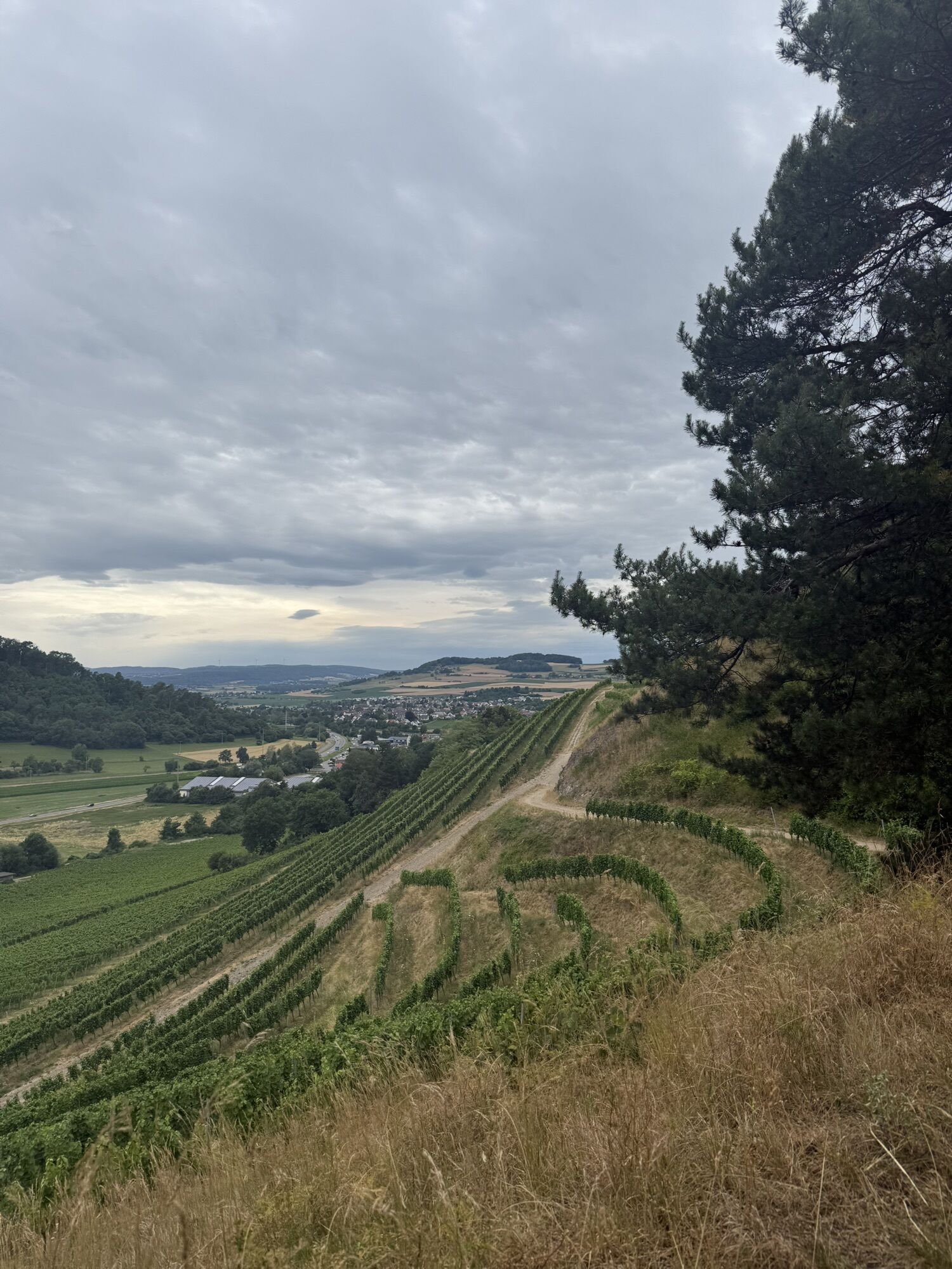
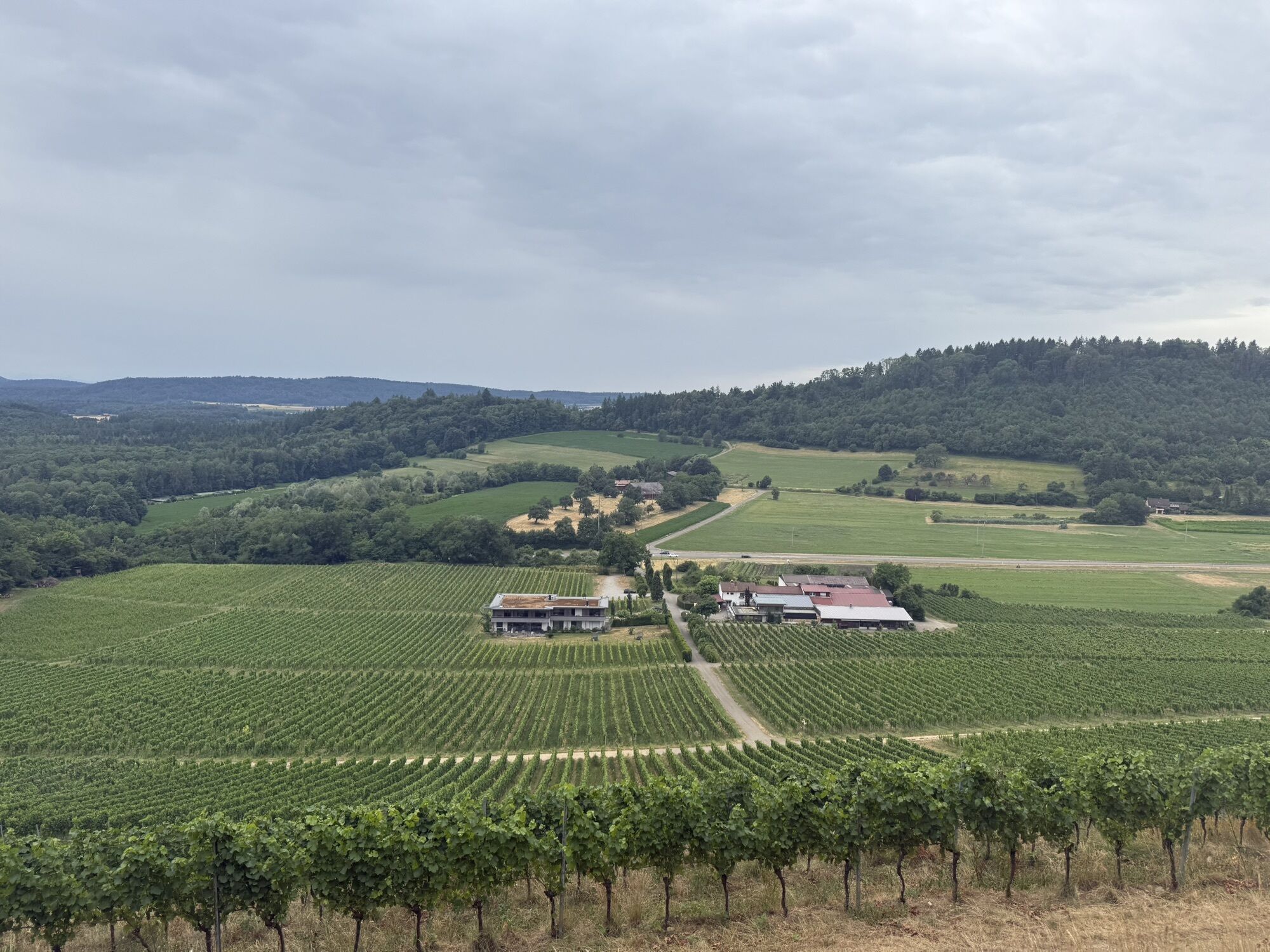
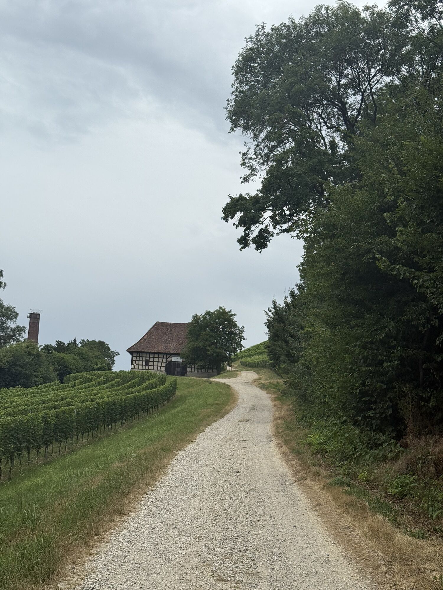
The starting point of the tour is the Almenhütte near Anselfingen. From there, the well-marked path leads through the shady forest first up to the local mountain of Engen, the Hohenhewen. The wide view over the Hegau to Lake Constance compensates for the strenuous ascent. At the summit, numerous wall remains bear witness to the castle that once stood here. Southwards, the path leads downhill towards Welschingen. After crossing the district road, you enter the Ertenhag forest. First, you walk along the forest edge, brushing past a nature reserve, and arrive at the connecting road to Weiterdingen. Here you already have the first view of the next volcanic mountain, the Hohenstoffeln. A steep meadow path leads up towards Hohenstoffeln. Halfway, you enter the forest. The path soon leaves the forest again. (From here, it is also possible to climb the second volcanic summit. Please follow the yellow signs of the Black Forest Association.) Above the crossroads, a bench with a great view invites you to take a short break before the path leads back into the forest. Always slightly downhill, the path continues out of the forest towards Weiterdingen. From there, you can already see the next volcanic cone across the wide valley, the Mägdeberg. The path leads first flat, then ascending again across open terrain to the "Hegaukreuz". Here the Hegau reveals its entire beauty in all directions. Next, it goes initially downhill towards Mägdeberg. There, a short detour to the summit with its castle ruin is also worthwhile. Attention: After crossing the connecting road from Mühlhausen-Ehingen to Duchtlingen, you must strictly follow the marked route as there is a very sensitive nature reserve with rare plants there. And another volcanic mountain is already within reach: the Hohenkrähen. The smallest Hegau volcanic cone at 643 m is definitely one of the most striking. Below the castle, the scouts of the Graue Reiter have their headquarters. They also ensure that the path up to the summit is in safe condition, as surefootedness is essential for the ascent of Hohenkrähen. There are also still clear traces of the old castle site there, again with great views in all directions. From here, the destination of the strenuous hike is already in sight, the Hohentwiel. After crossing the district road, you will quickly reach the Hotel/Restaurant Hegauhaus with its excellent cuisine. A break for coffee and cake on the terrace with a view of Lake Constance is certainly a very good decision. Across open terrain, the path leads toward the stage destination. At the little brother of Hohentwiel, the Staufen, you meet the premium hiking trail "Hohentwieler". Parallel to this, it soon goes uphill to Hohentwiel and to the largest fortress ruin in Germany. If you wish to visit the ruin, the entrance ticket must be purchased in advance or a small detour to the information center must be accepted. The final sprint has begun. In the last section, the hike passes through the highest vineyard in Baden-Württemberg of the Vollmayer winery. The vines escort the hiker down to Singen, either to the Landesgartenschau station or to the large free parking lot of the former Landesgartenschau.
The hike can be done in both directions and is signposted in both directions.
Da
Clothing adapted to the weather (sun protection/rain protection)
Good footwear
Enough drinks and food; there are no public facilities along the route to refill water bottles. The selection of gastronomic facilities along the route is limited, and many require a detour to reach.
The path up to the summit of Hohenkrähen requires a considerable degree of surefootedness.
By car via the A81 to Engen or Singen. From the east via the A98/81 to the starting points.
By train to Engen station or Singen station (Landesgartenschau). The tour can be interrupted in Weiterdingen or Mühlhausen-Ehingen. Arrival and departure are possible by public transport. Further interruption options exist via Neuhausen station or by bus in Welschingen. At Hohenkrähen, a descent down to Schlatt and Krähen is possible. From there, take the city bus to Singen.
Parking at the station in Engen or at the hiking car park Almenhütte.
Parking at the former Landesgartenschau site/fairground (signposted from all directions).
Drinking water options:
"Hegau-Haus" (Singen, K 6125, "Duchtlinger Straße"): Outside opening hours, a hand pump on the right after the entrance gate can be operated. There is a faucet dispensing fresh water from an approved spring.
Farm "Seeweiler" from Singen towards Engen, about 500 m after the signpost "Beim Binninger Ried": On the right side there is a house with a "Zieh-Bimmel" (bell on a string). It is possible here, in a non-binding and respectful manner, to obtain water from the tap.Priljubljeni izleti v okolici
-
5.0
"Hegauer Kegelspiel" Stettener Panoramaweg
srednjaPohodništvo 7.62 km -
4.5
"Hegauer Kegelspiel" Alter Postweg
srednjaPohodništvo 9.26 km -
3.3
"Hegauer Kegelspiel" Wannenberg hike
srednjaPohodništvo 9.35 km -
4.5
Nature trail Merishausen: Brown route
srednjaTematska pot 11.4 km -
4.5
SchweizMobil 593: Nordspitze Panoramaweg
srednjaPohodništvo 13.7 km -
2.8
"Hegauer Kegelspiel" Hewensteig
srednjaPohodništvo 6.23 km -
5.0
Vulkansee Höwenegg Rundweg
svetlobaPohodništvo 7.05 km -
5.0
"Hegauer Kegelspiel" Hohentwieler
srednjaPohodništvo 7.21 km -
Aacher Geißbock
srednjaPohodništvo 13.4 km -
4.0
Homburg-Steig
srednjaPohodništvo 5.83 km

Pohodništvo in sledenje


Ne zamudite ponudb in navdiha za naslednje počitnice
Vaš e-poštni naslov je bil dodan na poštni seznam.