


Uphill, downhill! - Across the Bodanrück
Stopnja težavnosti: 2
This sporty route starts at the harbor mole in Radolfzell. Via Markelfingen, it goes to the Bodanrück wildlife and leisure park and continues via Langenrain to Liggeringen, the highest Radolfzell district....
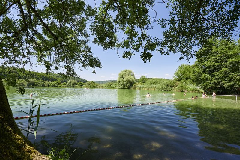
This sporty route starts at the harbor mole in Radolfzell. Via Markelfingen, it goes to the Bodanrück wildlife and leisure park and continues via Langenrain to Liggeringen, the highest Radolfzell district. Via Möggingen and Güttingen, past the Buchen lakes with a beautiful lake beach, the round trip leads back to Radolfzell.

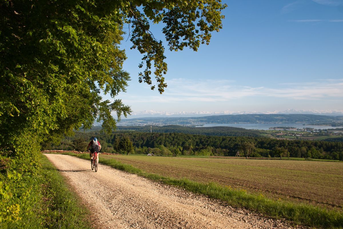
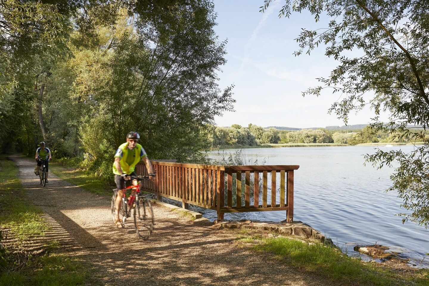
The route starts at the station in Radolfzell. You use the underpass to the lake. From there, you follow the signs for the Lake Constance cycle path - direction Konstanz, passing through the Ried to Markelfingen. Upon arrival there, turn right at the inn «Kreuz» and follow Kaltbrunner Strasse. You enter a forest area and begin to circle the Mindelsee in a wide arc. In the shade of the trees, you ride to the end of the forest, where the path slightly ascends towards the Bodanrück Wildlife and Leisure Park and continues to the Gemeinmärker farms. Here you have the opportunity to observe and feed around 300 wild animals, including ibex, goats, red deer, bears, lynxes, mouflons, donkeys, and wisents. Past the farms, keep left and cycle to Langenrain. There, ride to the town center and then keep left towards Liggeringen. Also passing through the town, your next stop is Güttingen. You reach a roundabout, through which you exit the town to the south. Along the country road, it goes back to Radolfzell.
Don't forget appropriate clothing! Sun and rain protection and above all a bicycle helmet should always be with you. It is recommended to carry enough drinks and some provisions.
From Nuremberg and Munich via the A96 motorway Memmingen, Kempten, Lindau, then continuing on federal highways B31 and B34.
From Frauenfeld via the A7 to Kreuzlingen - Konstanz, then continuing on federal highway B33. From Stein am Rhein via the country road L192. From Schaffhausen via E41/E54 to Thayngen, then continuing on B34, then on the A81 towards Stuttgart and continuing on B33 to the Radolfzell exit.
Follow the station signs in Radolfzell.
2
Information about opening hours and entrance fees of the Allensbach wildlife and leisure park can be found at http://www.wildundfreizeitpark.de/.
Priljubljeni izleti v okolici
-
4.0
Around the island of Reichenau
svetlobaPohodništvo 10.9 km -
5.0
Mindelsee-Runde
svetlobaPohodništvo 7.83 km -
Hike on the panorama route of the Höri Peninsula
srednjaPohodništvo 8.11 km -
4.0
Bodanrück-Runde
težkoPohodništvo 8.36 km -
4.0
Circular hike Gaienhofen-Middle Höri
srednjaPohodništvo 12.6 km -
4.5
Mühlsberg route
srednjaPohodništvo 8.67 km -
5.0
Überlingen, Baden-Württemberg
svetlobaPohodništvo 9.12 km -
3.7
Firstweg Langenmos
srednjaPohodništvo 5.76 km -
4.0
Rundwanderung Liggeringen - Bodman
srednjaPohodništvo 13.0 km -
5.0
Natur & Kultur - Rundtour entlang des Überlinger Sees
svetlobaKolesarjenje 32.7 km
Pohodništvo in sledenje


Ne zamudite ponudb in navdiha za naslednje počitnice
Vaš e-poštni naslov je bil dodan na poštni seznam.