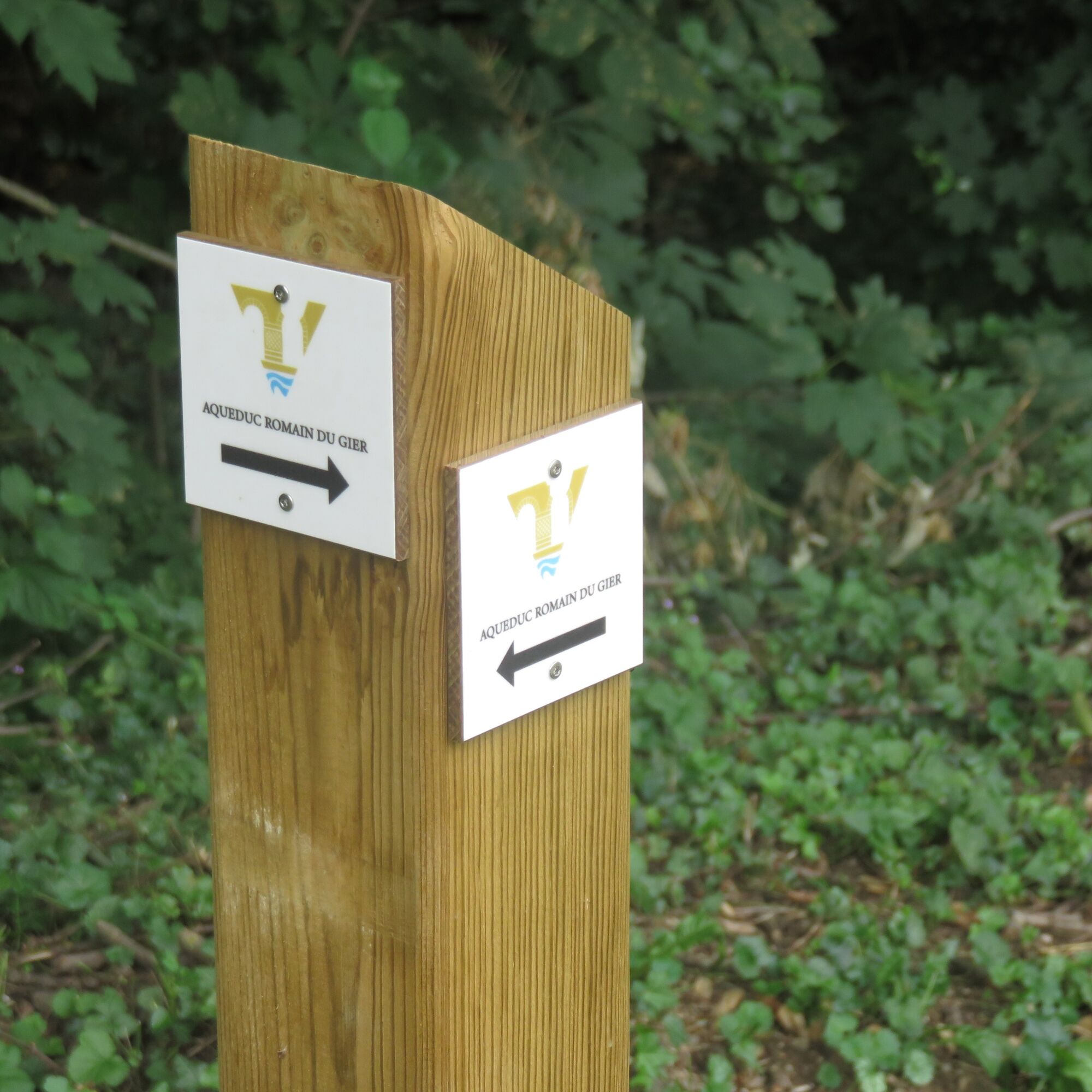
Roman Gier Aqueduct path
težko
Navigacija po spletni strani
Navigacija po spletni strani
Pridobite to turo v svoj mobilni telefon
Roman Gier Aqueduct path
težko
Pohodništvo
44.45
km
Skenirajte kodo QR in začnite navigacijo v aplikaciji bergfex.

Pohodništvo in sledenje


Roman Gier Aqueduct path
težko
Razdalja
44.45
km
Trajanje
11:29
h
Ascent
743
hm
Morska gladina
193 -
471
m
Prenos skladbe
Roman Gier Aqueduct path
težko
Pohodništvo
44.45
km
Start: Peu communal park in Chabanière. The route can be done in the direction Lyon - Saint-Maurice-sur-Dargoire.
The route starts in the village center of Saint-Maurice-sur-Dargoire. Up to Mornant, the...
Opis
Start: Peu communal park in Chabanière. The route can be done in the direction Lyon - Saint-Maurice-sur-Dargoire.
The route starts in the village center of Saint-Maurice-sur-Dargoire. Up to Mornant, the itinerary mainly follows hiking trails surrounded by orchards with views of the hills and villages of the Monts du Lyonnais.
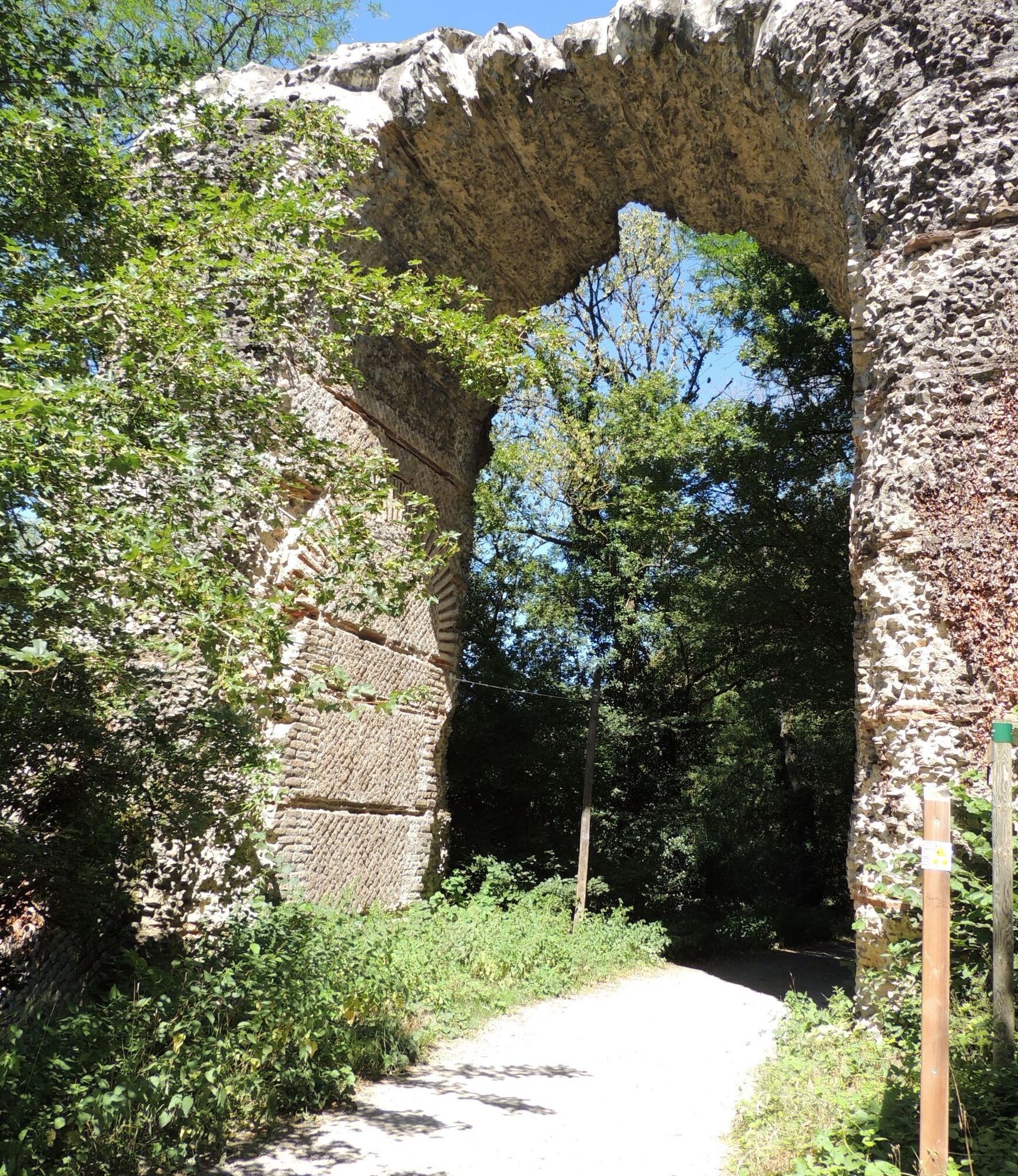
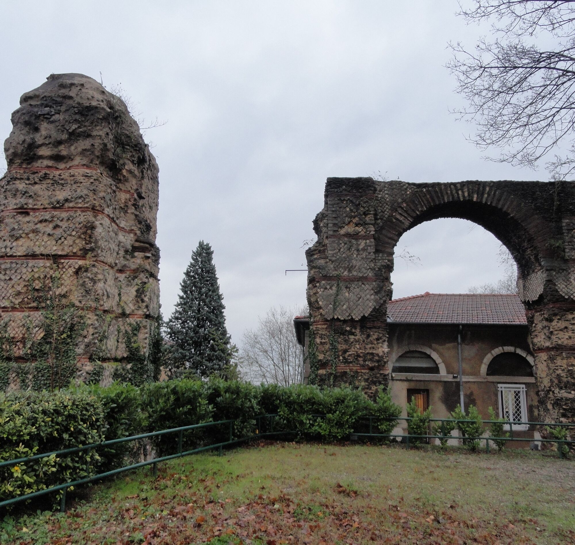
In Mornant, the discovery of the aqueduct takes place mainly in the village center with underground sections.
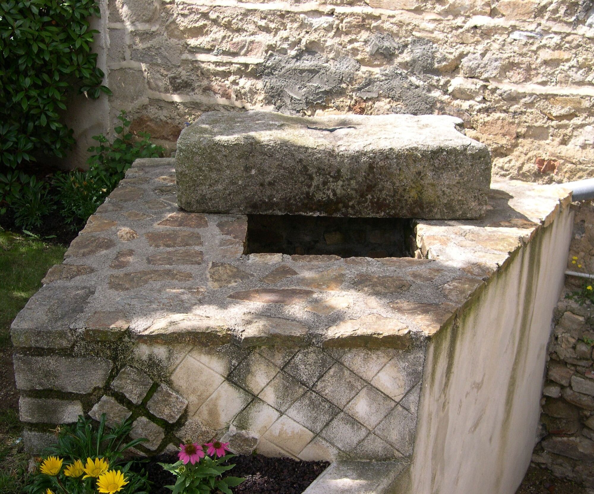
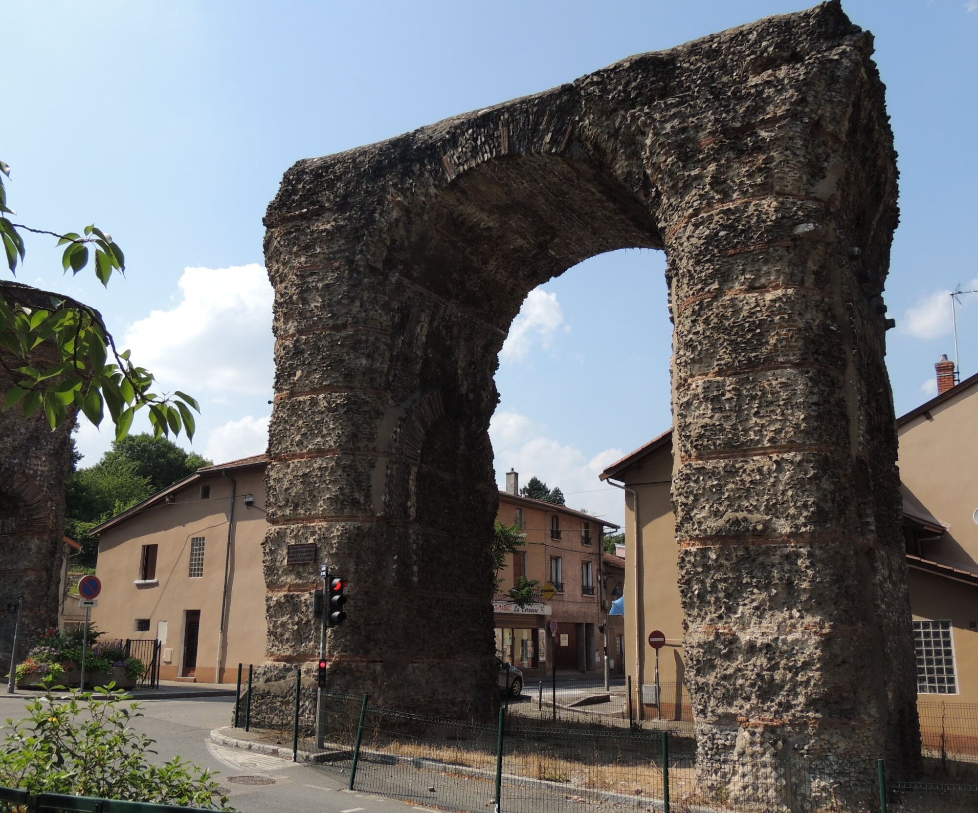
After crossing Saint-Laurent-d'Agny, Taluyers, and Orliénas, you arrive at Soucieu en Jarrest with remarkable parts of the Roman Gier aqueduct: the Gerle chase reservoir is an engineering feat with siphon technology.
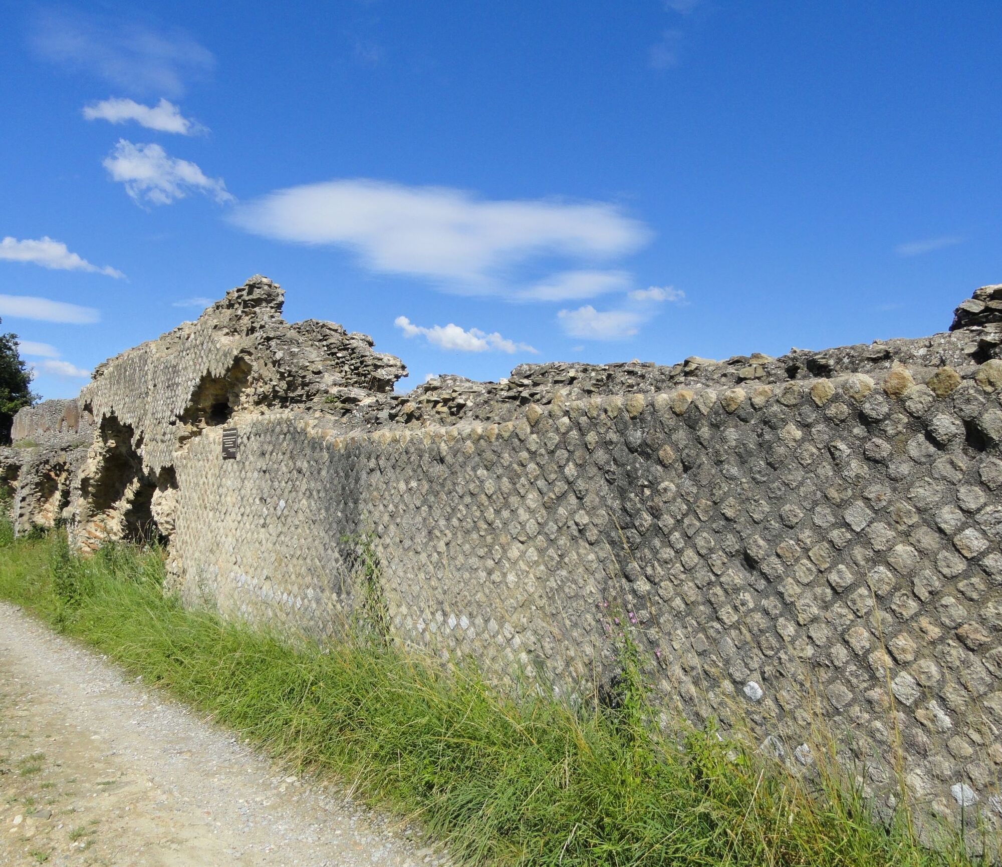
The rest of the route proceeds in the Barret valley, a Sensitive Natural Area, with other parts of the aqueduct.
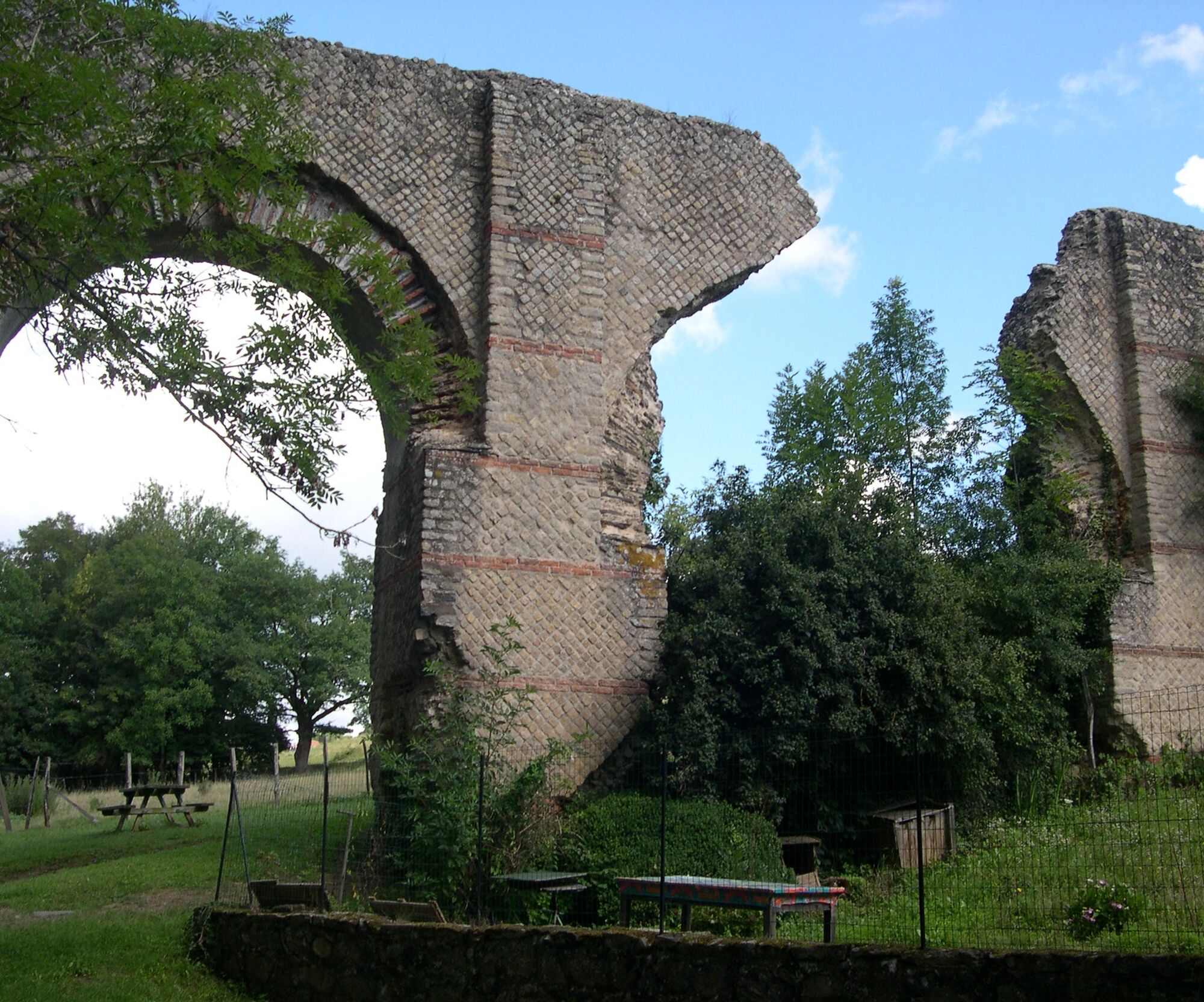
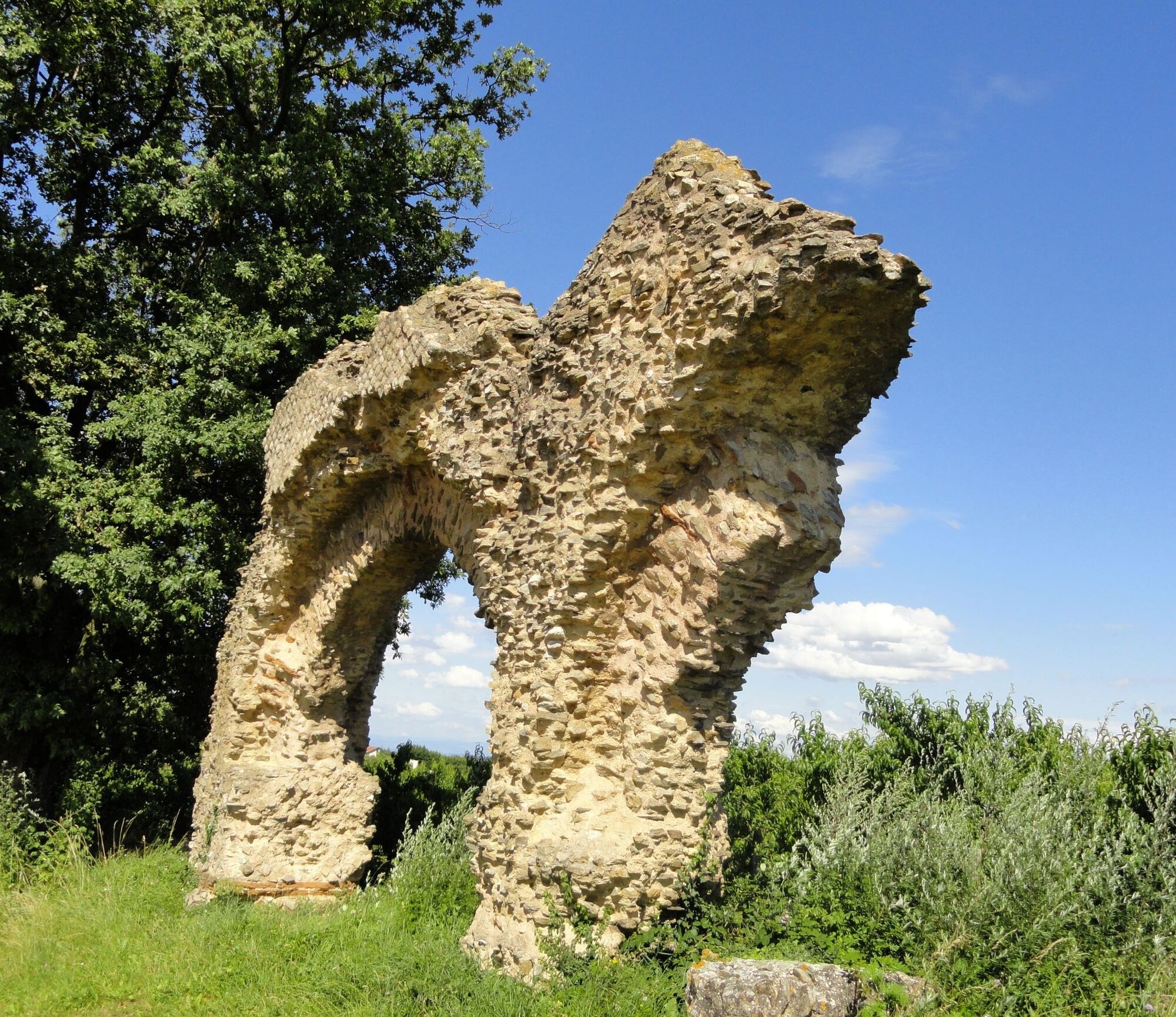
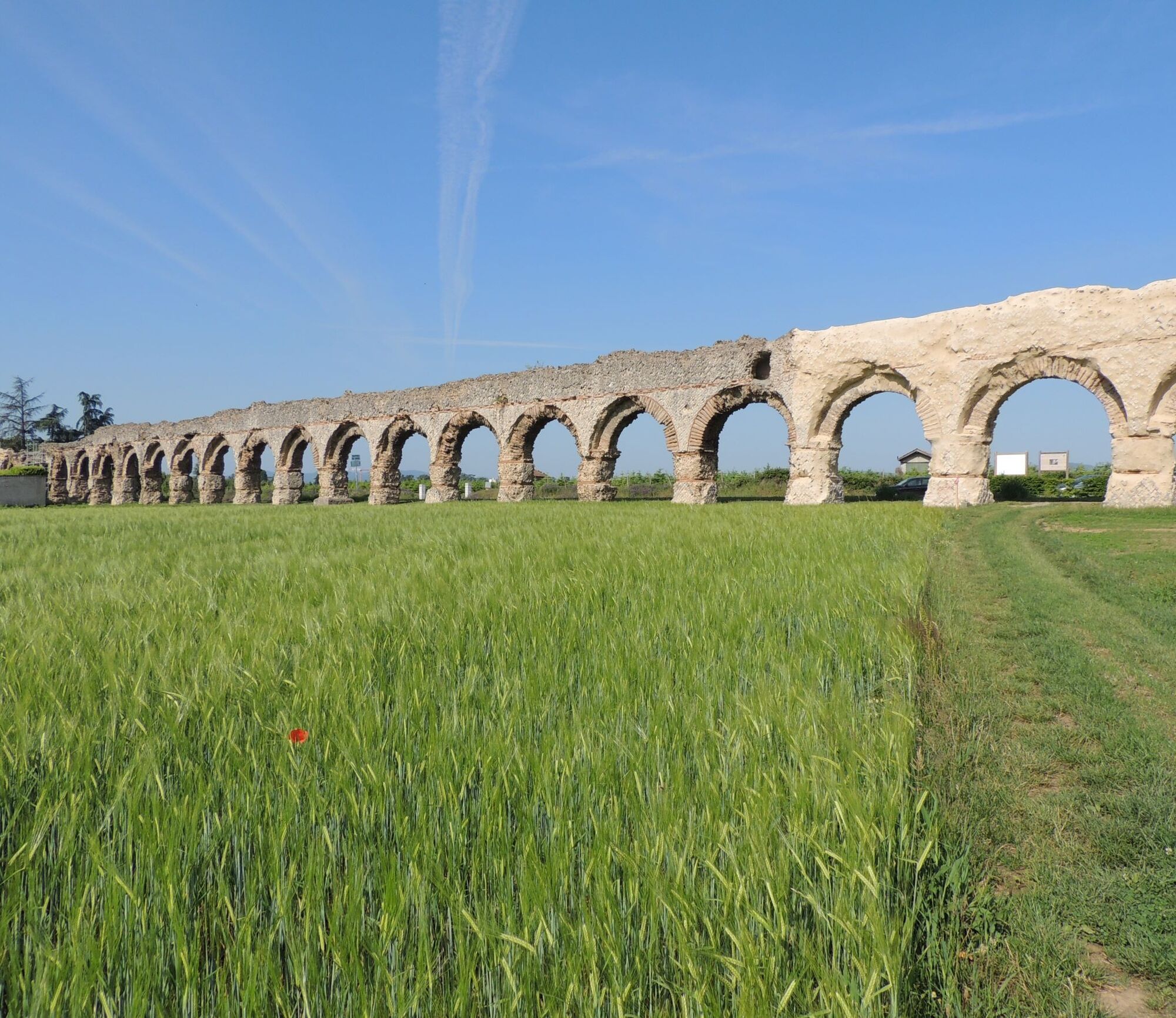
In Chaponost, you reach the plat de l'air site with the longest visible aqueduct section in France with a series of 72 arches.
The route starts in the village center of Saint-Maurice-sur-Dargoire. Up to Mornant, the itinerary mainly follows hiking trails surrounded by orchards with views of the hills and villages of the Monts du Lyonnais.
In Mornant, the discovery of the aqueduct takes place mainly in the village center with underground sections.
After crossing Saint-Laurent-d'Agny, Taluyers, and Orliénas, you arrive at Soucieu en Jarrest with remarkable parts of the Roman Gier aqueduct: the Gerle chase reservoir is an engineering feat with siphon technology.
The rest of the route proceeds in the Barret valley, a Sensitive Natural Area, with other parts of the aqueduct.
In Chaponost, you reach the plat de l'air site with the longest visible aqueduct section in France with a series of 72 arches.
Pot
Lyon
(168 m)
Mesto
0.0 km
Oullins
(189 m)
Mesto
3.8 km
Chaponost
(289 m)
Vas
10.1 km
Le Boulard
(316 m)
Poravnava
24.2 km
Mornant
(366 m)
Vas
36.1 km
La Grange à Gonin
(379 m)
Poravnava
39.4 km
Église Saint-Maurice
(472 m)
Kraj čaščenja
44.2 km
Pot
Roman Gier Aqueduct path
težko
Pohodništvo
44.45
km
Lyon
(168 m)
Mesto
0.0 km
Saint-Irénée
(290 m)
Soseska
0.0 km
5th Arrondissement
(277 m)
Soseska
0.2 km
Sainte-Foy-lès-Lyon
(271 m)
Mesto
2.8 km
Oullins
(189 m)
Mesto
3.8 km
Restaurant Fenet
(284 m)
Restavracija
4.4 km
Francheville
(245 m)
Mesto
5.7 km
Auberge des Aqueducs
(309 m)
Restavracija
7.8 km
Chaponost
(289 m)
Vas
10.1 km
Le Crouton des Gones
(318 m)
Restavracija
10.4 km
Le Bourg
(311 m)
Koridor/teren
11.4 km
Barrel
(258 m)
Koridor/teren
18.0 km
Le Châtelard
(289 m)
Koridor/teren
18.1 km
Le Boulard
(316 m)
Poravnava
24.2 km
Orliénas
(301 m)
Vas
24.6 km
Rivoire
(355 m)
Koridor/teren
26.1 km
Bas Germanie
(364 m)
Koridor/teren
29.3 km
L'Epinasse
(335 m)
Koridor/teren
30.9 km
Mornant
(366 m)
Vas
36.1 km
La Condamine
(352 m)
Poravnava
37.3 km
Trillonnière
(328 m)
Koridor/teren
37.7 km
La Grange à Gonin
(379 m)
Poravnava
39.4 km
La Grimodière
(373 m)
Poravnava
41.4 km
Thurigneux
(392 m)
Poravnava
42.1 km
La Roche
(438 m)
Soseska
43.3 km
Église Saint-Maurice
(472 m)
Kraj čaščenja
44.2 km
Saint-Maurice-sur-Dargoire
(471 m)
Vas
44.3 km
Auberge Les Gourmandines
(471 m)
Restavracija
44.4 km


Dodatne informacije in nasveti
Dodatne informacije
Be sure to bring sufficient water, hiking shoes, and clothing suitable for your outing depending on the forecasted weather. A small first aid kit is also recommended.
Še ni pregledov
Priljubljeni izleti v okolici
-
5.0
Walk to the Garon siphon bridge of the Roman Aqueduct of Gier
svetlobaPohodništvo 6.08 km -
The Signal - Monts du Lyonnais - Saint-André-la Côte
svetlobaPohodništvo 14.5 km -
The Tacot, ephemeral journey
svetlobaTematska pot 1.91 km -
Wine trails at the heart of the vineyards
svetlobaPohodništvo 4.92 km -
Walking towards the Aqueduct of Gier - Monts du Lyonnais - Chaponost
svetlobaPohodništvo 8.25 km -
Health-sport hike: the Croix Forest bridge
svetlobaPohodništvo 9.78 km -
Family hike "In the heart of the orchards"
svetlobaPohodništvo 4.04 km -
Let's walk in the woods - Monts du Lyonnais - Pollionnay
svetlobaPohodništvo 12.6 km -
MTB Route 231 - Les Landes de Montagny
težkoMountainbike 19.9 km -
Gourmet route "In the heart of the vineyards of Millery"
svetlobaPohodništvo 9.96 km
Pohodništvo in sledenje

Zaradi več kot 550.000 predlogov izletov, podrobnih zemljevidov in intuitivnega načrtovanja poti je aplikacija obvezna oprema za vse ljubitelje narave.

Ne zamudite ponudb in navdiha za naslednje počitnice
Naročite se na novice
Napaka
Zgodila se je napaka. Prosimo, poskusite znova.
Zahvaljujemo se vam za prijavo
Vaš e-poštni naslov je bil dodan na poštni seznam.
Izleti po vsej Evropi
Avstrija
Švica
Nemčija
Italija
Slovenija
Francija
Nizozemska
Belgija
Poljska
Lihtenštajn
Češka
Slovaška
Španija
Chorvátsko
Bosna in Hercegovina
Luksemburg
Andora
පෘතුගාලය
අයිස්ලන්තය
එක්සත් රාජධානිය
අයර්ලන්තය
ග්රීසිය
ඇල්බේනියාව
North Macedonia
Malta
Norway
Montenegro
Moldova
කොසෝවො
හන්ගේරියානු සමුහාණ්ඩුව
San Marino
රුමේනියාව
එස්ටෝනියා
ලැට්වියාව
බෙලාරස්
සයිප්රස්
Lithuania
Serbia
බල්ගේරියාව
Monaco
ඩෙන්මාර්කය
Sweden
ෆින්ලන්තය