Tour of the Bellecombe lakes
težko
Navigacija po spletni strani
Navigacija po spletni strani
Pridobite to turo v svoj mobilni telefon
Tour of the Bellecombe lakes
težko
Pohodništvo
10.15
km
Skenirajte kodo QR in začnite navigacijo v aplikaciji bergfex.

Pohodništvo in sledenje


Tour of the Bellecombe lakes
težko
Razdalja
10.15
km
Trajanje
04:00
h
Ascent
449
hm
Morska gladina
2,057 -
2,438
m
Prenos skladbe
Tour of the Bellecombe lakes
težko
Pohodništvo
10.15
km
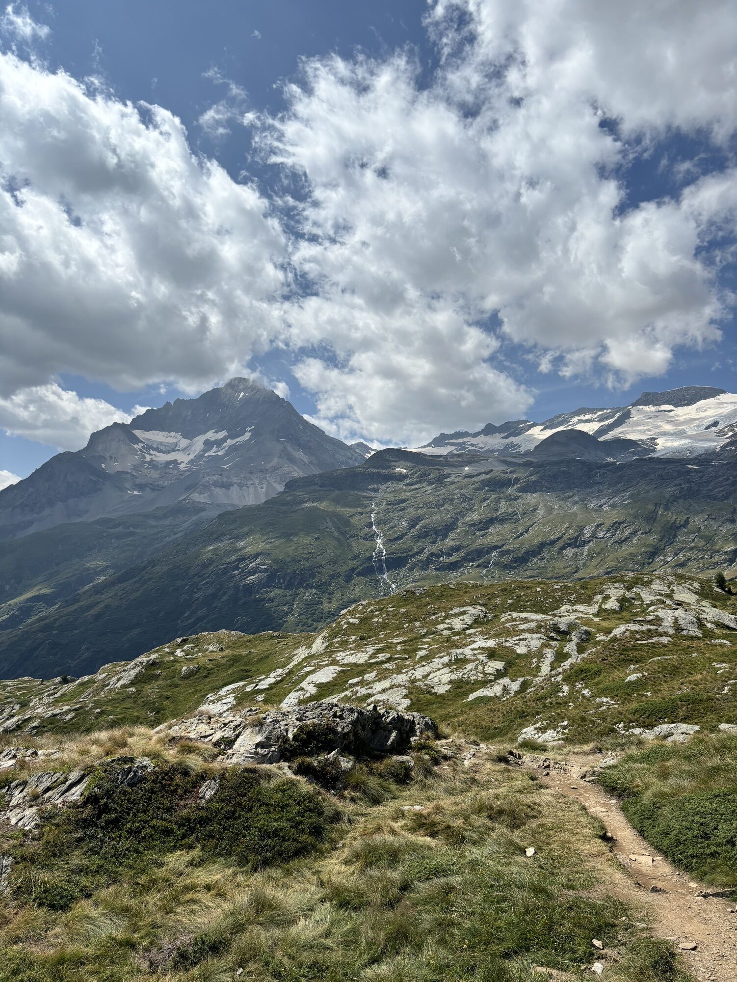
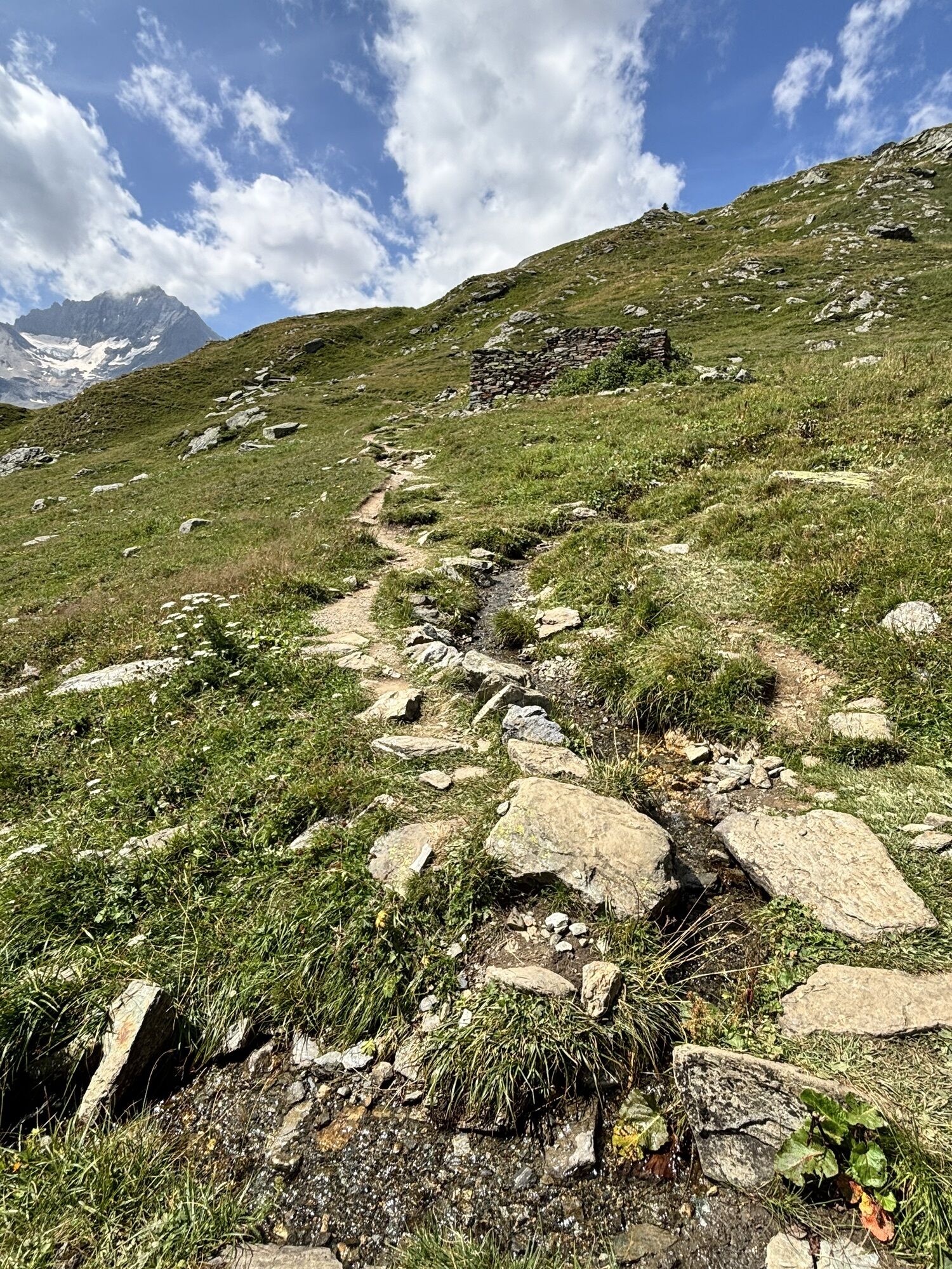
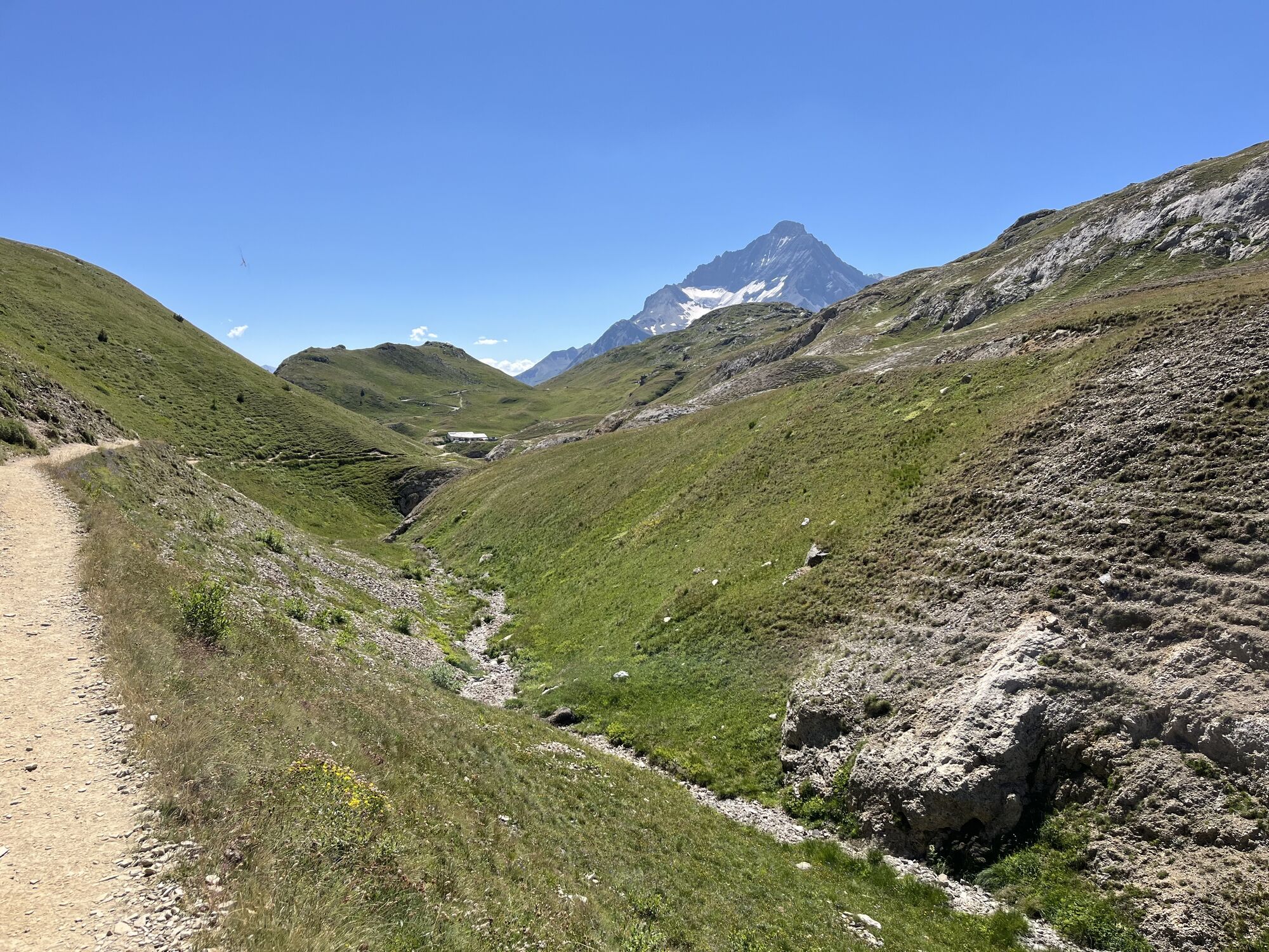
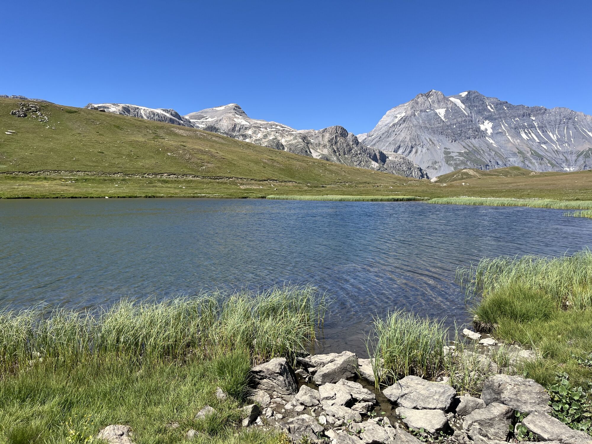
Fotografije naših uporabnikov
-

 © Marina IUstvarjeno na 20.07.2025
 -
 © Marina IUstvarjeno na 20.07.2025
 -
 © Marina IUstvarjeno na 20.07.2025
 -
 © Marina IUstvarjeno na 20.07.2025
 -

 © Sébastien BouillouxUstvarjeno na 22.08.2024
 -
 © Sébastien BouillouxUstvarjeno na 22.08.2024
 -
 © Sébastien BouillouxUstvarjeno na 22.08.2024
 -
 © Sébastien BouillouxUstvarjeno na 22.08.2024
 -
 © Sébastien BouillouxUstvarjeno na 22.08.2024
 -
 © Sébastien BouillouxUstvarjeno na 22.08.2024
 -
 © Sébastien BouillouxUstvarjeno na 22.08.2024
 -
 © Sébastien BouillouxUstvarjeno na 22.08.2024
 -
 © Sébastien BouillouxUstvarjeno na 22.08.2024
 -
 © Andreas StopperichUstvarjeno na 10.08.2024
 -
 © Andreas StopperichUstvarjeno na 10.08.2024


Pot
Refuge du Plan du Lac
(2,367 m)
Zavetišče
5.5 km
Chapelle Sainte-Marguerite
(2,205 m)
Kraj čaščenja
8.9 km
Pot
Tour of the Bellecombe lakes
težko
Pohodništvo
10.15
km
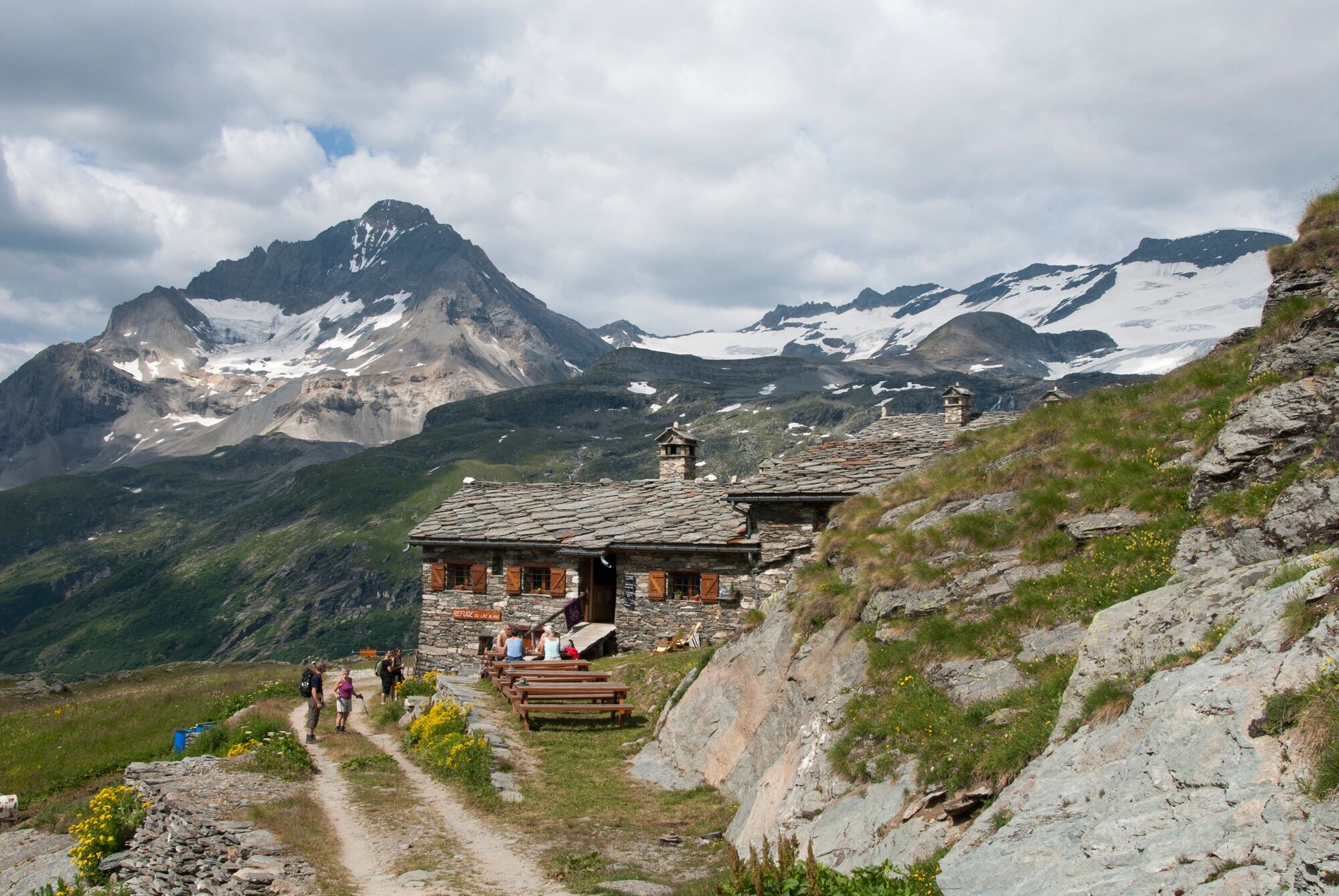
Refuge du Plan du Lac
(2,367 m)
Zavetišče
5.5 km
Chapelle Sainte-Marguerite
(2,205 m)
Kraj čaščenja
8.9 km
Avtor
Zagotavlja Haute Maurienne Vanoise Tourisme
Za ogled Tour of the Bellecombe lakes poskrbi outdooractive.com.

Informacije o poti
Pot
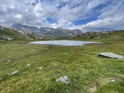
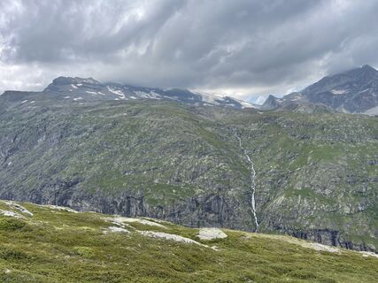
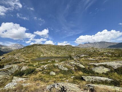
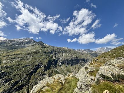
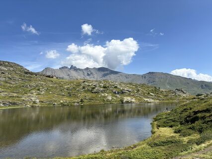
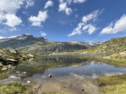
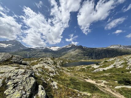
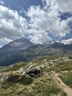
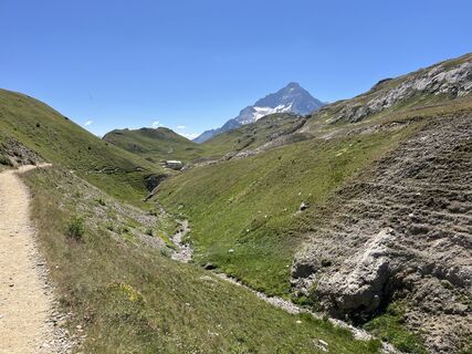
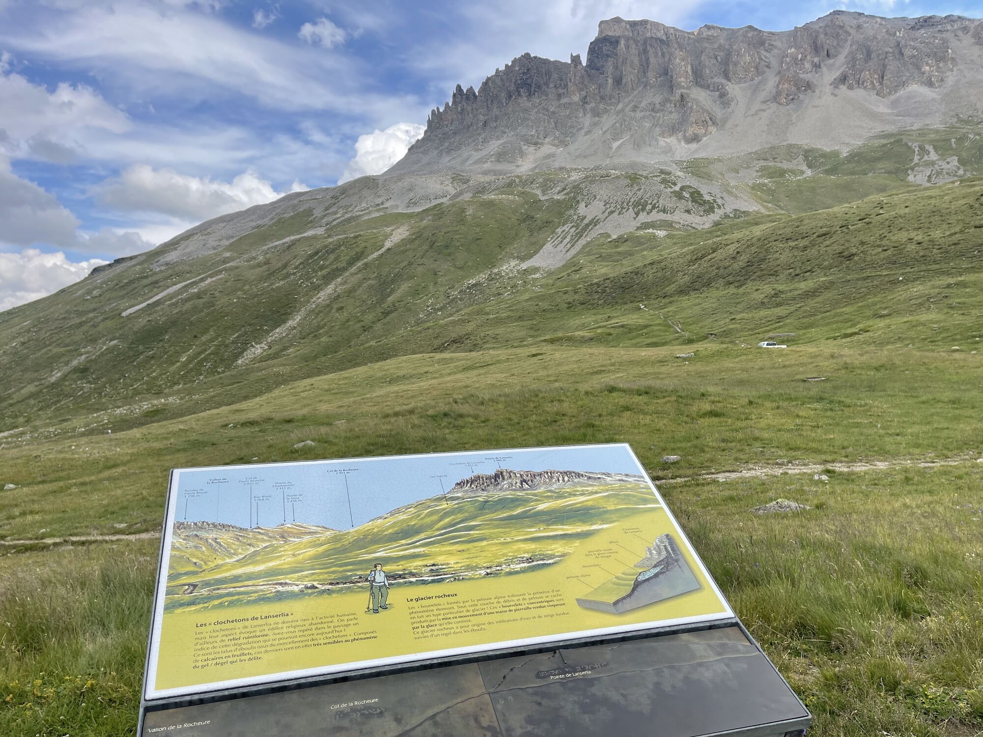
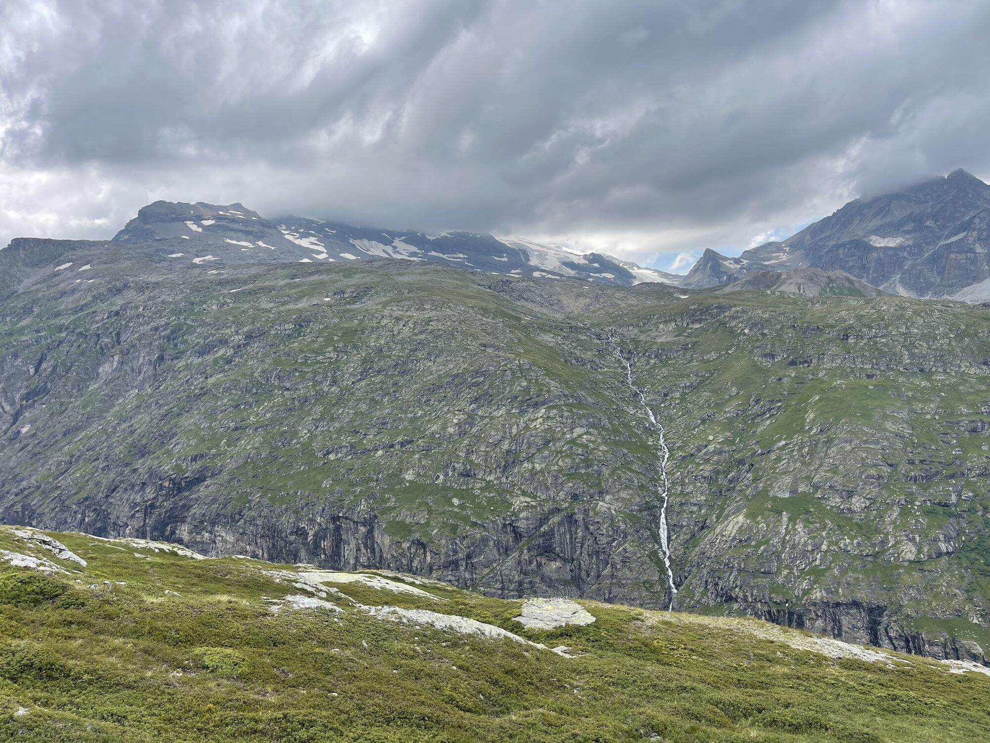
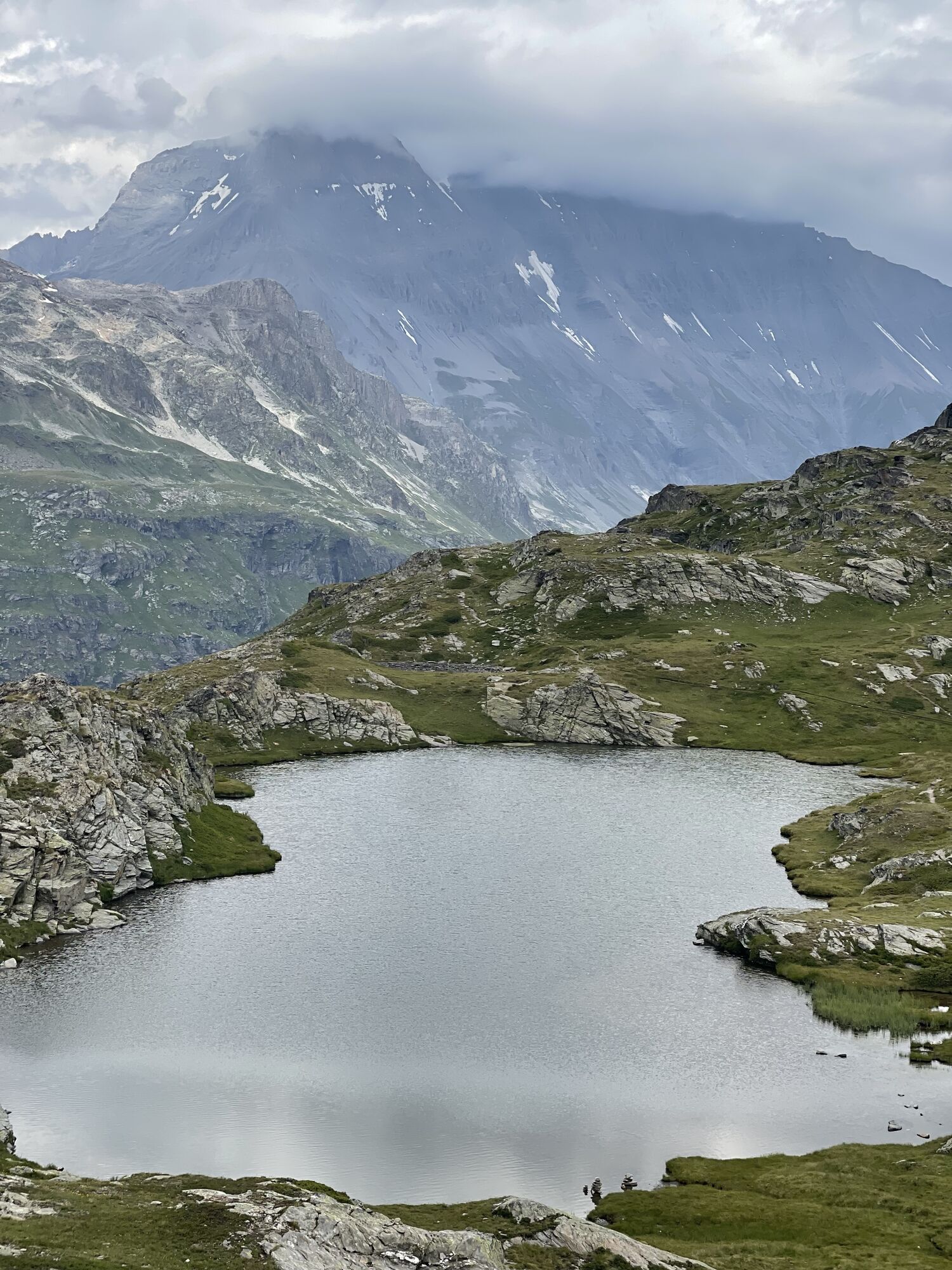
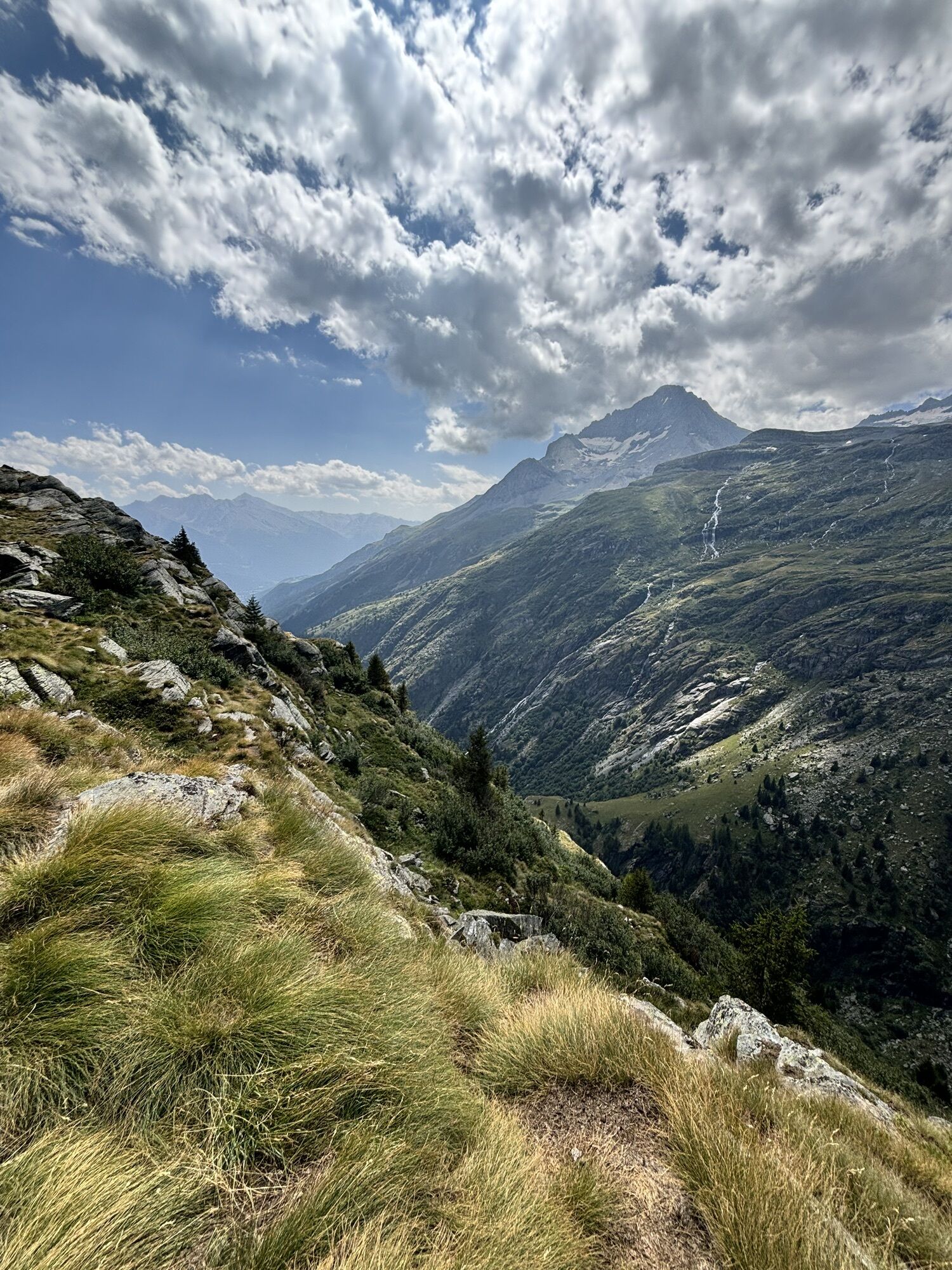
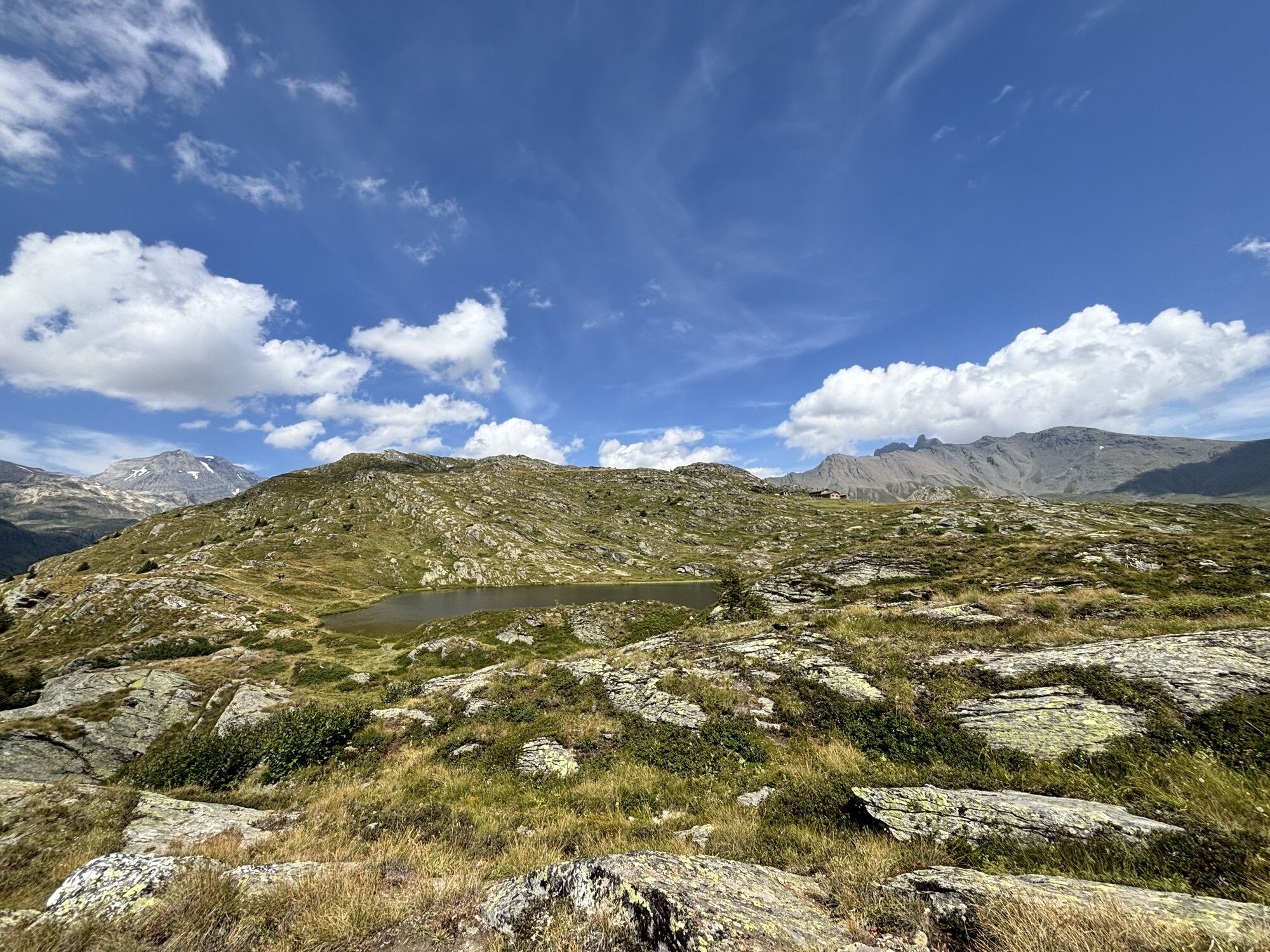
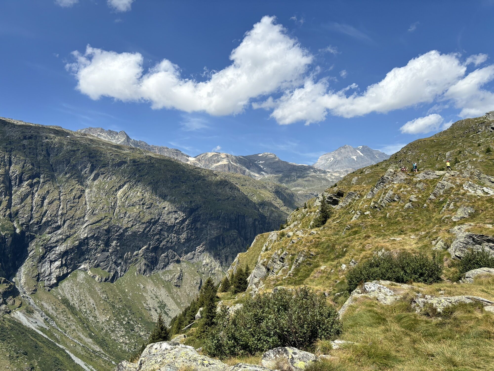
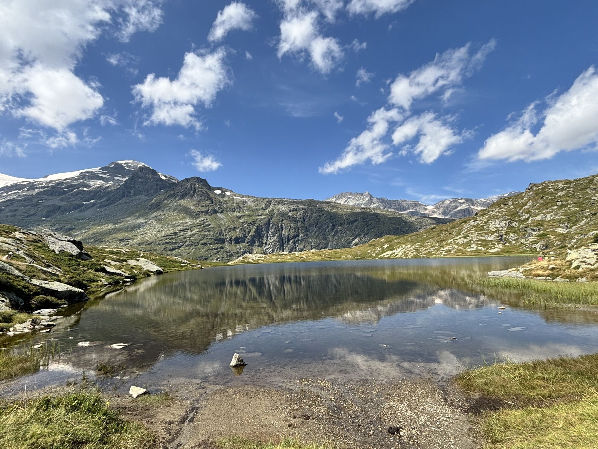
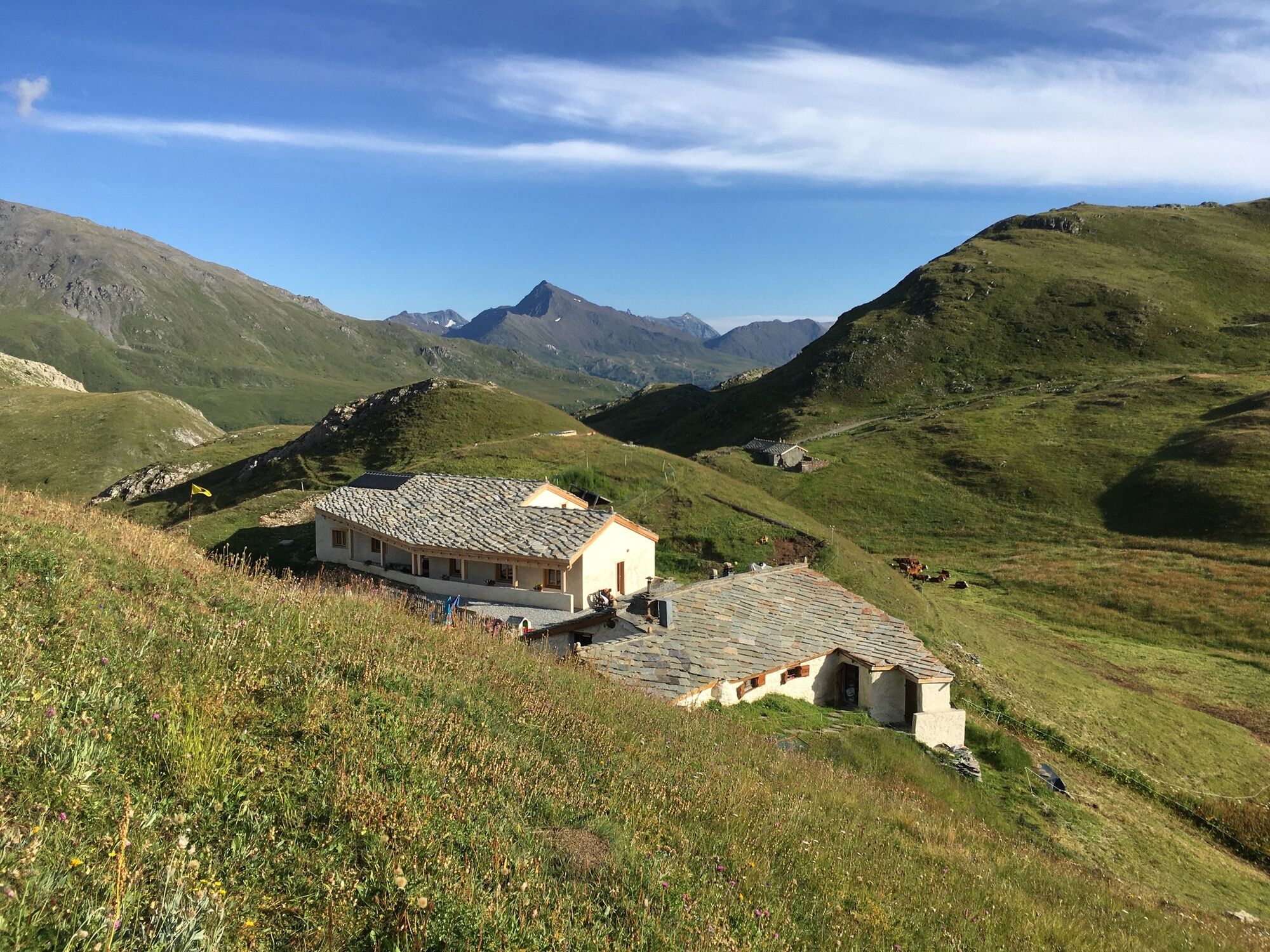
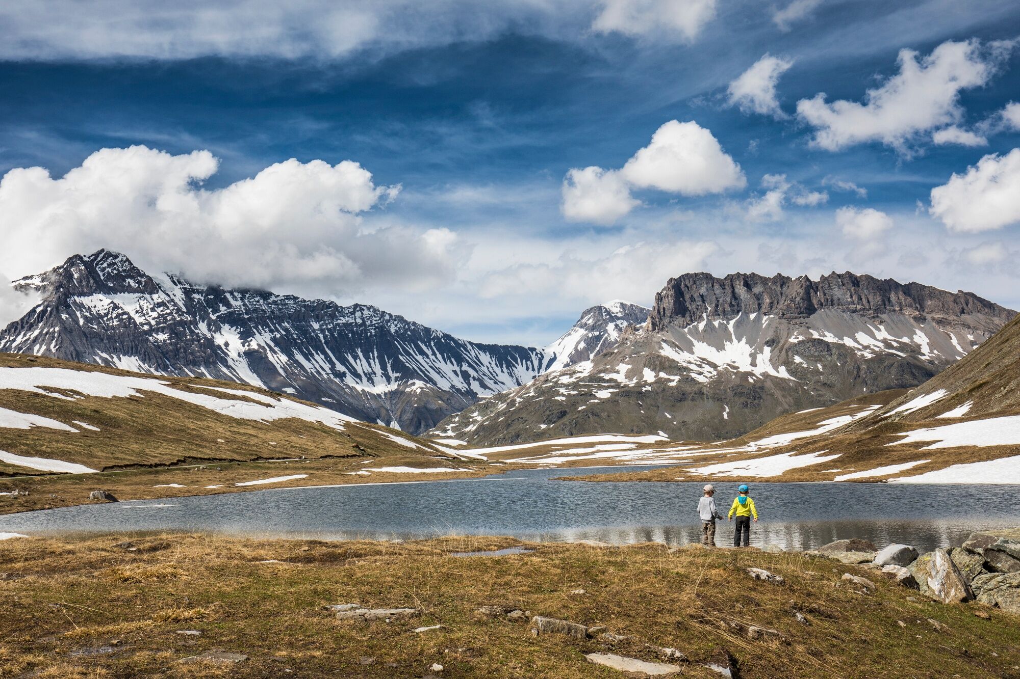
Loop starting from the Coêtet car park. Take the direction of Lac Blanc (path in the hairpin). During this hike you will see many lakes, pass by the Plan du Lac refuge and have a view of the Parrachée, the Arpont glacier.
Geološki poudarki
Da
Varnostna navodila
In case of emergency, dial 112
Informacije o prihodu
Prihod
Consider carpooling
Dodatne informacije in nasveti
Dodatne informacije
The duration of hiking trails is calculated using reference paces: 300 m/h ascent, 500 m/h descent and 4 km/h on the flat.
As hazards may occur at any time on the routes, the GPX tracks provided are not contractual. They are given for information only. Riders use them at their own risk, depending on their level of technological proficiency and their understanding of the terrain.
As hazards may occur at any time on the routes, the GPX tracks provided are not contractual. They are given for information only. Riders use them at their own risk, depending on their level of technological proficiency and their understanding of the terrain.
Še ni pregledov
Priljubljeni izleti v okolici
-
little 'Haute-Maurienne Vanoise' circuit
težkoCestno kolo 32.0 km -
Refuge du Fond d'Aussois - a wild valley in the Vanoise - 2-day hike
svetlobaPohodništvo 9.22 km -
The White Lake
svetlobaPohodništvo 4.42 km -
5.0
The Builder's Trail on foot
svetlobaTematska pot 7.23 km -
Col du Mont Cenis from Lanslebourg
težkoCestno kolo 9.84 km -
5.0
Goldtoni - Alpenbogen A068 Refuge de la Leisse-Termignon Val Cenis
srednjaPohodništvo v daljavo 28.7 km -
Col de l'Iseran from Modane
težkoCestno kolo 59.5 km -
Col du Mont Cenis from Modane
težkoCestno kolo 34.8 km -
5.0
Walking tour of the Plan du Lac refuge
svetlobaPohodništvo 4.58 km -
Petit Mont-Cenis pass
težkoCestno kolo 18.0 km

Pohodništvo in sledenje

Zaradi več kot 550.000 predlogov izletov, podrobnih zemljevidov in intuitivnega načrtovanja poti je aplikacija obvezna oprema za vse ljubitelje narave.

Ne zamudite ponudb in navdiha za naslednje počitnice
Naročite se na novice
Napaka
Zgodila se je napaka. Prosimo, poskusite znova.
Zahvaljujemo se vam za prijavo
Vaš e-poštni naslov je bil dodan na poštni seznam.
Izleti po vsej Evropi
Avstrija
Švica
Nemčija
Italija
Slovenija
Francija
Nizozemska
Belgija
Poljska
Lihtenštajn
Češka
Slovaška
Španija
Chorvátsko
Bosna in Hercegovina
Luksemburg
Andora
පෘතුගාලය
අයිස්ලන්තය
එක්සත් රාජධානිය
අයර්ලන්තය
ග්රීසිය
ඇල්බේනියාව
North Macedonia
Malta
Norway
Montenegro
Moldova
කොසෝවො
හන්ගේරියානු සමුහාණ්ඩුව
San Marino
රුමේනියාව
එස්ටෝනියා
ලැට්වියාව
බෙලාරස්
සයිප්රස්
Lithuania
Serbia
බල්ගේරියාව
Monaco
ඩෙන්මාර්කය
Sweden
ෆින්ලන්තය