Bellecombe to Refuge de la Femma walking trail
težko
Pridobite to turo v svoj mobilni telefon
Bellecombe to Refuge de la Femma walking trail
težko
Pohodništvo
21,97
km
Skenirajte kodo QR in začnite navigacijo v aplikaciji bergfex.

Pohodništvo in sledenje


Bellecombe to Refuge de la Femma walking trail
težko
Razdalja
21,97
km
Trajanje
07:15
h
Ascent
378
hm
Morska gladina
2.199 -
2.403
m
Prenos skladbe
Bellecombe to Refuge de la Femma walking trail
težko
Pohodništvo
21,97
km
What a boon in the summer, to have a bus that drops you off at your start point! The route that goes via the Plan du Lac refuge from Bellecombe is a good warm-up. After an encounter with the fearless Lady...
Opis
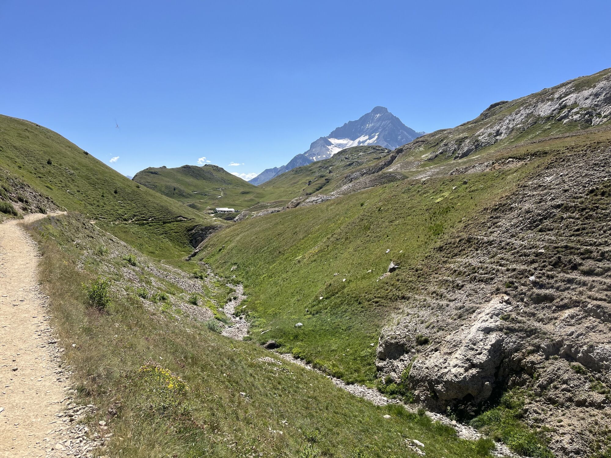
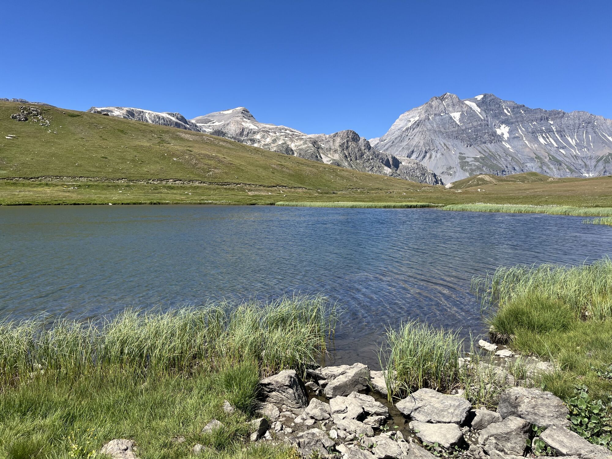
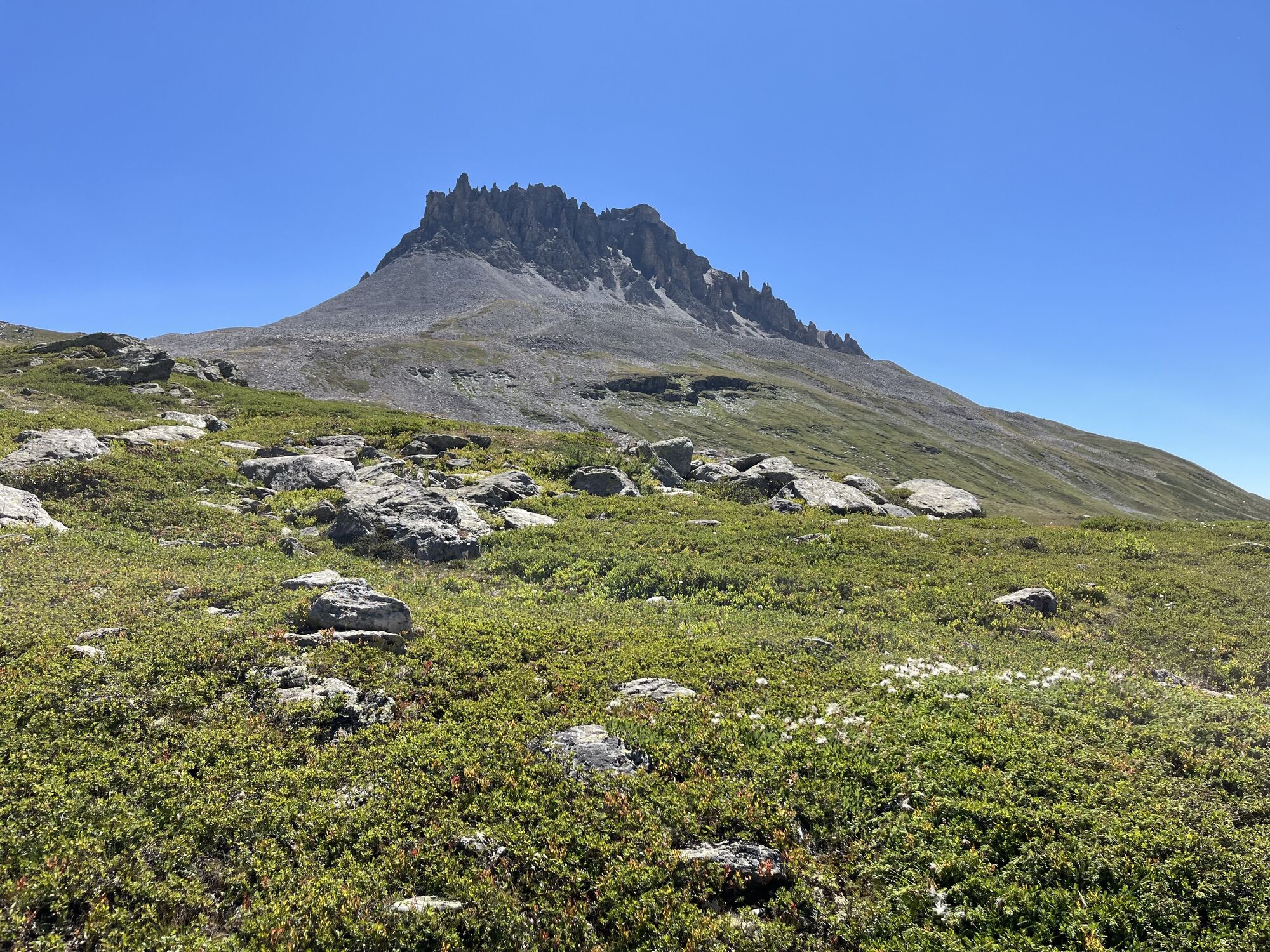
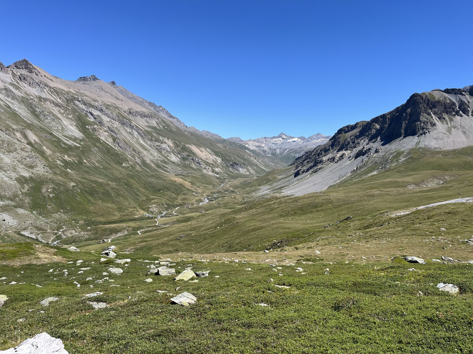
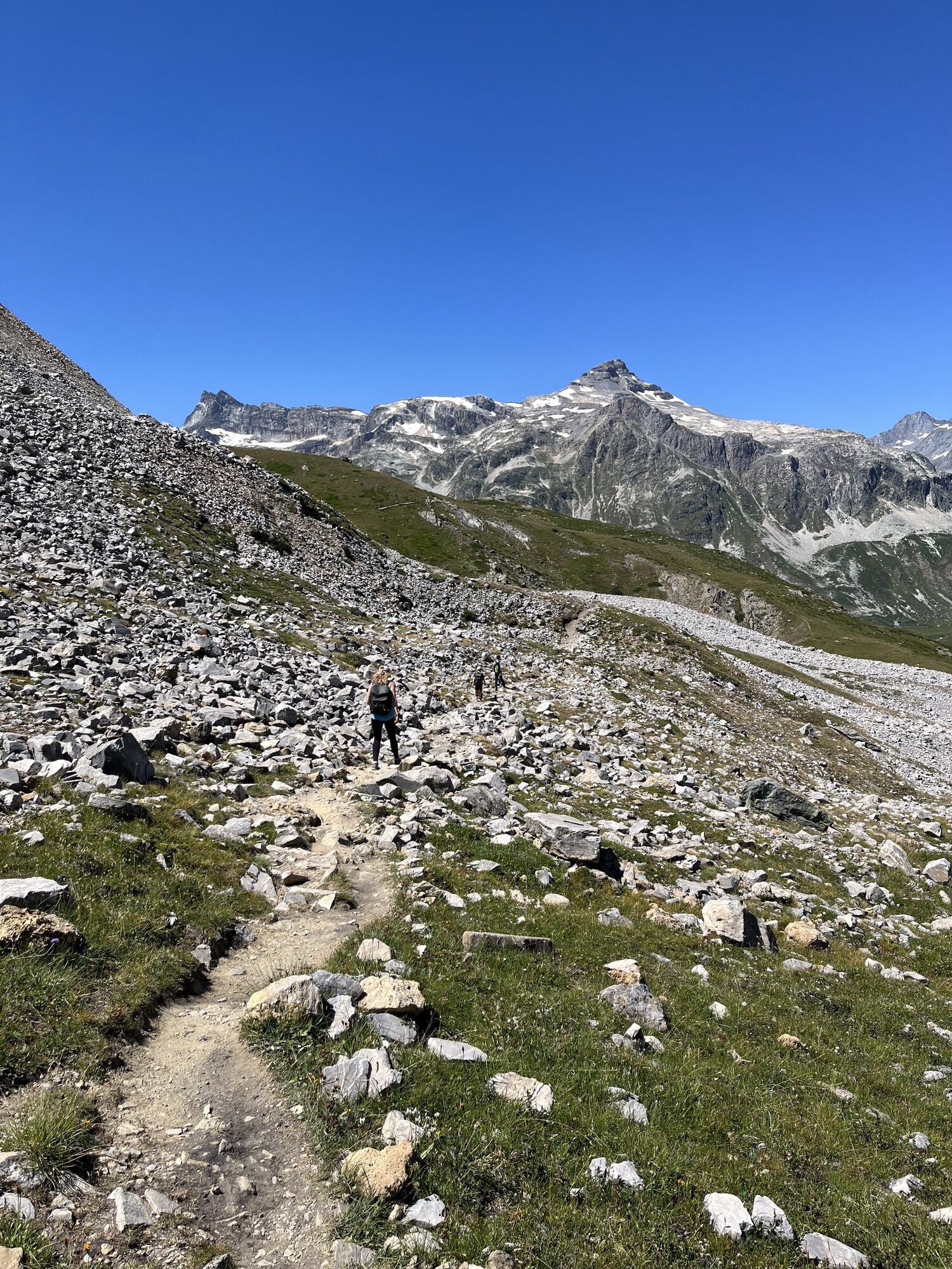
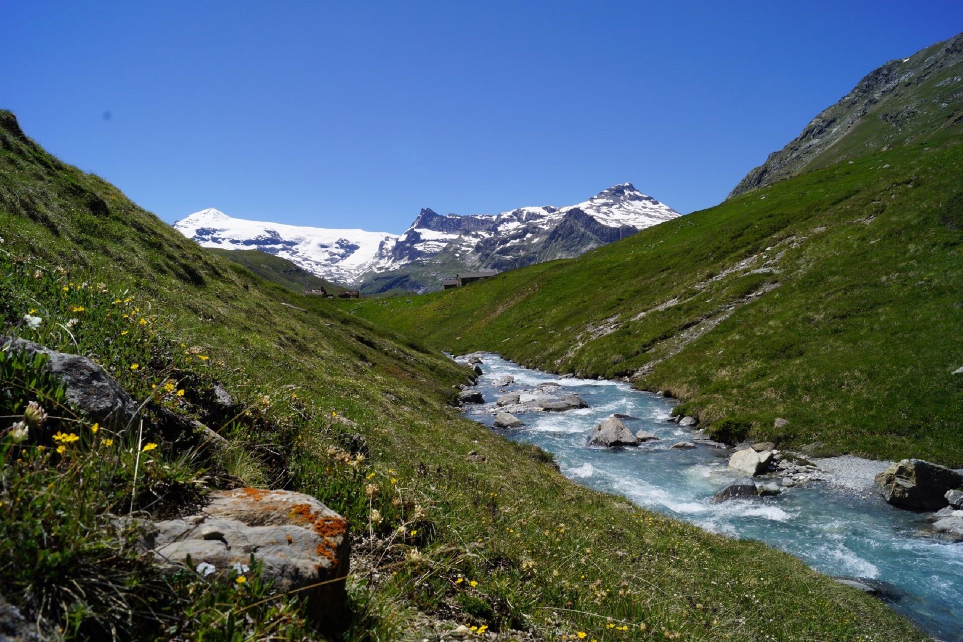
What a boon in the summer, to have a bus that drops you off at your start point! The route that goes via the Plan du Lac refuge from Bellecombe is a good warm-up. After an encounter with the fearless Lady Marmot, who keeps a vigilant eye
on you as you approach, and among these magnificent glaciers that have inspired countless seasoned mountaineers, the miles effortlessly go flying by. Pay close attention to these oversized scree slopes, they are home to chamois and ibex. And what's that little black spot in the sky? Could it be a bearded vulture, eyeing you from the heights of a thermal air current or one of its favourite nesting perches? This rare bird of prey is a local. Maybe he'll let you take a photo... By the time you get to the refuge, your thirst for adventure has been awakened. Next time, you'll definitely spend the night here... After an Epicurean break on the terrace, head back, taking your time to enjoy the trail. You'll encounter late-night walkers and sunset photographers along the way.
on you as you approach, and among these magnificent glaciers that have inspired countless seasoned mountaineers, the miles effortlessly go flying by. Pay close attention to these oversized scree slopes, they are home to chamois and ibex. And what's that little black spot in the sky? Could it be a bearded vulture, eyeing you from the heights of a thermal air current or one of its favourite nesting perches? This rare bird of prey is a local. Maybe he'll let you take a photo... By the time you get to the refuge, your thirst for adventure has been awakened. Next time, you'll definitely spend the night here... After an Epicurean break on the terrace, head back, taking your time to enjoy the trail. You'll encounter late-night walkers and sunset photographers along the way.
Pot
Plan du Lac
(2.367 m)
Koridor/teren
1,3 km
Chapelle Saint-Jacques
(2.214 m)
Kraj čaščenja
6,8 km
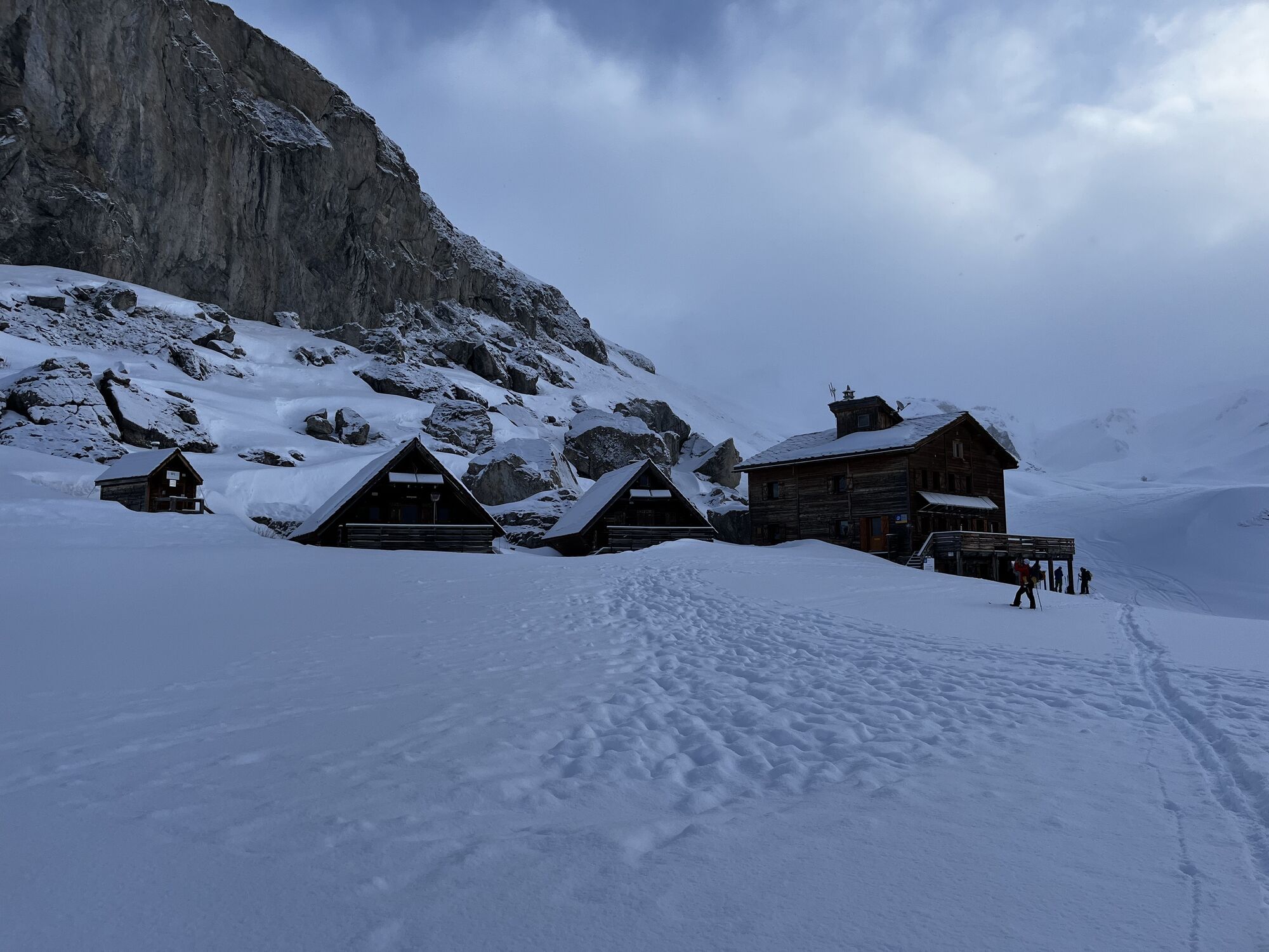
Refuge de la Femma
(2.353 m)
Zavetišče
10,9 km
Chapelle Saint-Jacques
(2.214 m)
Kraj čaščenja
15,1 km
Plan du Lac
(2.367 m)
Koridor/teren
20,6 km
Pot
Bellecombe to Refuge de la Femma walking trail
težko
Pohodništvo
21,97
km
Plan du Lac
(2.367 m)
Koridor/teren
1,3 km
Chapelle Saint-Jacques
(2.214 m)
Kraj čaščenja
6,8 km
Refuge de la Femma
(2.353 m)
Zavetišče
10,9 km
Chapelle Saint-Jacques
(2.214 m)
Kraj čaščenja
15,1 km
Plan du Lac
(2.367 m)
Koridor/teren
20,6 km
Avtor
Zagotavlja Haute Maurienne Vanoise
Za ogled Bellecombe to Refuge de la Femma walking trail poskrbi outdooractive.com.

Informacije o poti
Pot
To guide you in the field, consult the "step-by-step" directional diagram provided in pdf.
Enosmerna tura
Da
Dodatne informacije in nasveti
Dodatne informacije
The duration of hiking trails is calculated using reference paces: 300 m/h ascent, 500 m/h descent and 4 km/h on the flat.
As hazards may occur at any time on the routes, the GPX tracks provided are not contractual. They are given for information only. Riders use them at their own risk, depending on their level of technological proficiency and their understanding of the terrain.
As hazards may occur at any time on the routes, the GPX tracks provided are not contractual. They are given for information only. Riders use them at their own risk, depending on their level of technological proficiency and their understanding of the terrain.
Še ni pregledov
Priljubljeni izleti v okolici
little 'Haute-Maurienne Vanoise' circuit
težkoCestno kolo 32,0 kmThe White Lake
svetlobaPohodništvo 4,42 kmCol de l'Iseran from Modane
težkoCestno kolo 59,5 kmCol du Mont Cenis from Lanslebourg
težkoCestno kolo 9,84 kmCol du Mont Cenis from Modane
težkoCestno kolo 34,8 km- 5,0
Goldtoni - Alpenbogen A067 Le Monal-Refuge de la Leisse
srednjaPohodništvo v daljavo 27,2 km - 5,0
Goldtoni - Alpenbogen A068 Refuge de la Leisse-Termignon Val Cenis
srednjaPohodništvo v daljavo 28,7 km - 5,0
Walking tour of the Plan du Lac refuge
svetlobaPohodništvo 4,58 km - 5,0
Girarde footpath
svetlobaPohodništvo 8,10 km Petit Mont-Cenis pass
težkoCestno kolo 18,0 km

Pohodništvo in sledenje

Zaradi več kot 550.000 predlogov izletov, podrobnih zemljevidov in intuitivnega načrtovanja poti je aplikacija obvezna oprema za vse ljubitelje narave.

Ne zamudite ponudb in navdiha za naslednje počitnice
Naročite se na novice
Napaka
Zgodila se je napaka. Prosimo, poskusite znova.Zahvaljujemo se vam za prijavo
Vaš e-poštni naslov je bil dodan na poštni seznam.
Izleti po vsej Evropi
Avstrija Švica Nemčija Italija Slovenija Francija Nizozemska Belgija Poljska Lihtenštajn Češka Slovaška Španija Chorvátsko Bosna in Hercegovina Luksemburg Andora පෘතුගාලය අයිස්ලන්තය එක්සත් රාජධානිය අයර්ලන්තය ග්රීසිය ඇල්බේනියාව North Macedonia Malta Norway Montenegro Moldova කොසෝවො හන්ගේරියානු සමුහාණ්ඩුව San Marino රුමේනියාව එස්ටෝනියා ලැට්වියාව බෙලාරස් සයිප්රස් Lithuania Serbia බල්ගේරියාව Monaco ඩෙන්මාර්කය Sweden ෆින්ලන්තය