
ViaRhôna : De Loire sur Rhône à Condrieu
srednja
Pridobite to turo v svoj mobilni telefon
ViaRhôna : De Loire sur Rhône à Condrieu
srednja
Cestno kolo
35.76
km
Skenirajte kodo QR in začnite navigacijo v aplikaciji bergfex.


Pohodništvo in sledenje




ViaRhôna : De Loire sur Rhône à Condrieu
srednja
Razdalja
35.8
km
Trajanje
01:54
h
Ascent
103
hm
Morska gladina
151 -
191
m

V aplikaciji si oglej pot
Brezplačno namestite aplikacijo in spremljajte pot z GPS-navigacijo in sledenjem.
bergfex zdaj uporabljaj v aplikaciji
S kamero poskeniraj QR-kodo
Ko je aplikacija nameščena, se vsebina odpre takoj. Če aplikacije še nimaš, te bo preusmerila na stran za brezplačen prenos.
Prenos skladbe
ViaRhôna : De Loire sur Rhône à Condrieu
srednja
Cestno kolo
35.76
km
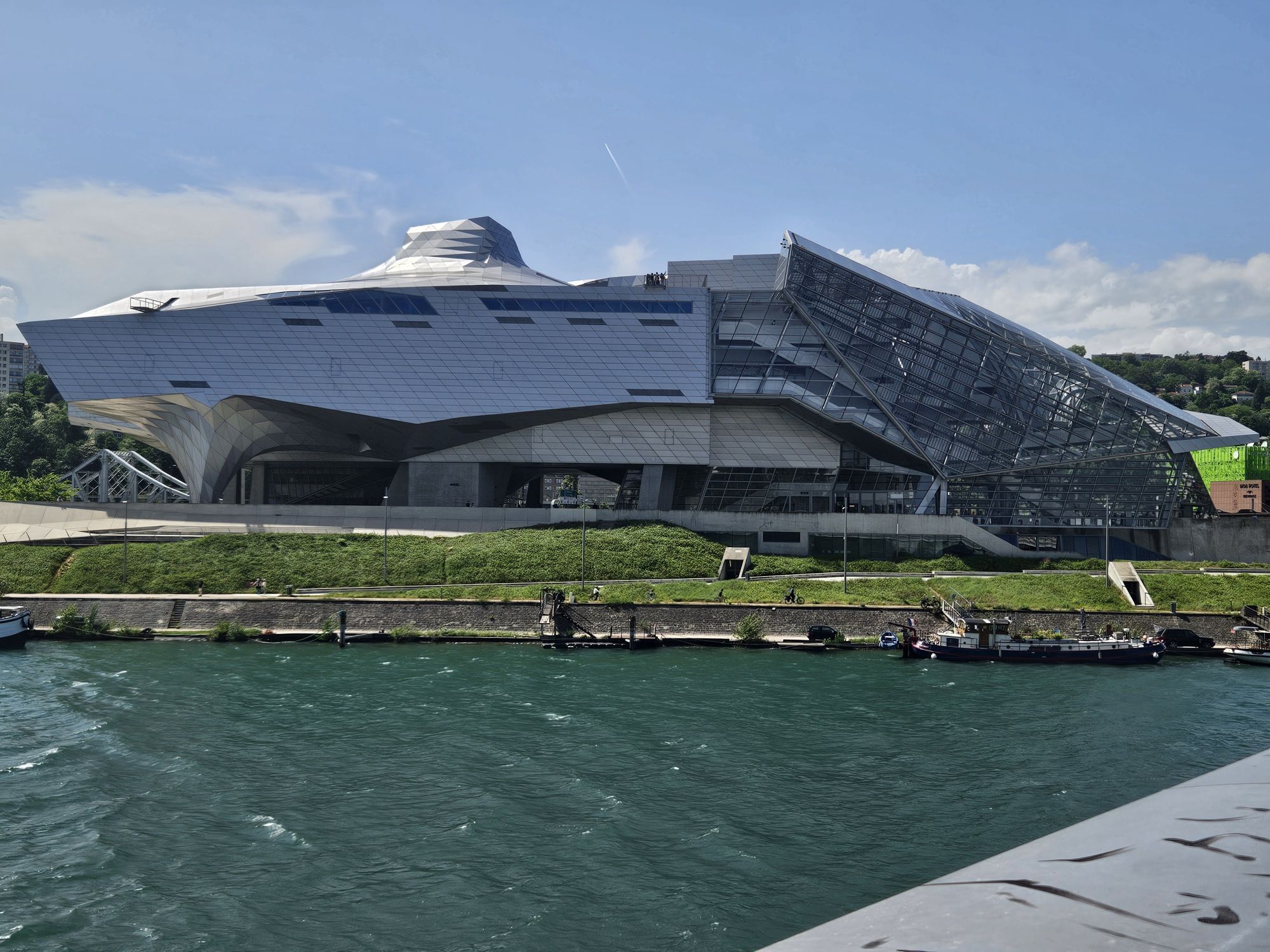
The ViaRhôna/Eurovélo 17 is an 817 km greenway cycle route which winds its way through the Rhône valley, crossing 3 regions and 12 departments.
As a link between Lake Geneva and the Mediterranean, ViaRhôna
allows...
Opis
The ViaRhôna/Eurovélo 17 is an 817 km greenway cycle route which winds its way through the Rhône valley, crossing 3 regions and 12 departments.
As a link between Lake Geneva and the Mediterranean, ViaRhôna
allows you to discover the banks of the Rhône, to get close to an exceptional river heritage and to discover the territories along the river. It invites us to (re)discover one of the founding elements of our identity and reveals to us the richness and originality of the Rhone's culture.
A peaceful experience reserved for soft modes of transport
and accessible to people with reduced mobility. An opportunity to stroll along the banks of the wild Rhone by bike, rollerblades, scooter or on foot.
Auvergne-Rhône-Alpes is home to 2/3 of the ViaRhôna itinerary.
Some sections are greenways on protected sites accessible to all:
accompanied children, adults, pedestrians, cyclists, able-bodied or
disabled people... Each stage is an opportunity to discover the diversity of the region. From the Alpine landscapes to the urban banks in the heart of Lyon, from the terraced vineyards of the Côtes du Rhône to the castles of Saint-Vallier
or Tournon, the tourist wealth is infinite!
As a link between Lake Geneva and the Mediterranean, ViaRhôna
allows you to discover the banks of the Rhône, to get close to an exceptional river heritage and to discover the territories along the river. It invites us to (re)discover one of the founding elements of our identity and reveals to us the richness and originality of the Rhone's culture.
A peaceful experience reserved for soft modes of transport
and accessible to people with reduced mobility. An opportunity to stroll along the banks of the wild Rhone by bike, rollerblades, scooter or on foot.
Auvergne-Rhône-Alpes is home to 2/3 of the ViaRhôna itinerary.
Some sections are greenways on protected sites accessible to all:
accompanied children, adults, pedestrians, cyclists, able-bodied or
disabled people... Each stage is an opportunity to discover the diversity of the region. From the Alpine landscapes to the urban banks in the heart of Lyon, from the terraced vineyards of the Côtes du Rhône to the castles of Saint-Vallier
or Tournon, the tourist wealth is infinite!
Pot
Lyon
(168 m)
Mesto
0.0 km
Vénissieux
(188 m)
Mesto
8.4 km
Église Saint-Denis
(177 m)
Kraj čaščenja
14.0 km
Givors
(157 m)
Mesto
24.1 km
Le Bourg
(155 m)
Soseska
28.2 km
Barlet
(155 m)
Poravnava
31.8 km
Église Sainte-Colombe
(154 m)
Kraj čaščenja
35.4 km
Pot
ViaRhôna : De Loire sur Rhône à Condrieu
srednja
Cestno kolo
35.76
km
Lyon
(168 m)
Mesto
0.0 km
Chevreul
(166 m)
Soseska
0.7 km
Sainte-Foy-lès-Lyon
(271 m)
Mesto
3.5 km
La Mulatière
(238 m)
Vas
4.2 km
La Saulaie
(164 m)
Soseska
5.6 km
Oullins
(189 m)
Mesto
5.6 km
La Saulaie
(165 m)
Soseska
6.1 km
Léo Sushi
(167 m)
Restavracija
6.6 km
Pierre-Bénite
(167 m)
Vas
7.3 km
Vénissieux
(188 m)
Mesto
8.4 km
Chez Ruben et Bénédicte
(161 m)
Restavracija
10.1 km
Irigny
(239 m)
Vas
11.0 km
Vernaison
(189 m)
Vas
14.0 km
Église Saint-Denis
(177 m)
Kraj čaščenja
14.0 km
La Grande Prairie
(161 m)
Koridor/teren
17.1 km
Ternay
(223 m)
Vas
20.3 km
Givors
(157 m)
Mesto
24.1 km
Quartier Du Pont
(154 m)
Koridor/teren
24.6 km
Le Freyssinet
(164 m)
Soseska
27.3 km
Ruisseau Rolland
(160 m)
Koridor/teren
27.7 km
Le Socca
(159 m)
Soseska
27.9 km
Le Bourg
(155 m)
Soseska
28.2 km
Loire-sur-Rhône
(166 m)
Vas
28.3 km
Le Capas
(155 m)
Soseska
28.6 km
La Roche Moussy
(154 m)
Soseska
29.6 km
Île Barlet
(152 m)
Koridor/teren
31.3 km
Barlet
(155 m)
Poravnava
31.8 km
Île des Sauveteurs
(151 m)
Koridor/teren
32.5 km
La Buvette de l'Île Barlet
(151 m)
Restavracija
32.8 km
La Roche
(161 m)
Soseska
33.4 km
Saint-Romain-en-Gal
(161 m)
Vas
33.9 km
Église Sainte-Colombe
(154 m)
Kraj čaščenja
35.4 km
Vienne
(165 m)
Mesto
35.4 km
Le Bourg
(156 m)
Soseska
35.5 km
Quartier Saint-Maurice
(155 m)
Soseska
35.5 km
Sainte-Colombe
(157 m)
Vas
35.7 km
Avtor
Zagotavlja Rhône Tourisme
Za ogled ViaRhôna : De Loire sur Rhône à Condrieu poskrbi outdooractive.com.



Dodatne informacije in nasveti
Dodatne informacije
APIDAE tourism data updated on 17/01/2022 by "Office de Tourisme de Vienne Condrieu Agglomération".
Spotted an error? Write to ajouvenaud@vienne-condrieu.com with the following information:
File name: ViaRhôna : De Loire sur Rhône à Condrieu | Record identifier: 144142 | URL (link) for this Outdooractive page.
Spotted an error? Write to ajouvenaud@vienne-condrieu.com with the following information:
File name: ViaRhôna : De Loire sur Rhône à Condrieu | Record identifier: 144142 | URL (link) for this Outdooractive page.
Še ni pregledov
Priljubljeni izleti v okolici
-
5.0
Walk to the Garon siphon bridge of the Roman Aqueduct of Gier
svetlobaPohodništvo 6.08 km -
Roman Gier Aqueduct path
težkoPohodništvo 44.4 km -
Wine trails at the heart of the vineyards
svetlobaPohodništvo 4.92 km -
Walking towards the Aqueduct of Gier - Monts du Lyonnais - Chaponost
svetlobaPohodništvo 8.25 km -
Family hike "In the heart of the orchards"
svetlobaPohodništvo 4.04 km -
MTB Route 231 - Les Landes de Montagny
težkoMountainbike 19.9 km -
In the heart of the Millery vineyards
svetlobaPohodništvo 9.96 km -
MTB Circuit 241 - The Garon Valley
težkoMountainbike 25.4 km -
Panorama Hike "The landscapes of Montagny"
svetlobaPohodništvo 10.3 km -
Mountain bike route 230 - The Old Town
svetlobaMountainbike 7.77 km
Pohodništvo in sledenje

Zaradi več kot 550.000 predlogov izletov, podrobnih zemljevidov in intuitivnega načrtovanja poti je aplikacija obvezna oprema za vse ljubitelje narave.

Ne zamudite ponudb in navdiha za naslednje počitnice
Naročite se na novice
Napaka
Zgodila se je napaka. Prosimo, poskusite znova.
Zahvaljujemo se vam za prijavo
Vaš e-poštni naslov je bil dodan na poštni seznam.
Izleti po vsej Evropi
Avstrija
Švica
Nemčija
Italija
Slovenija
Francija
Nizozemska
Belgija
Poljska
Lihtenštajn
Češka
Slovaška
Španija
Chorvátsko
Bosna in Hercegovina
Luksemburg
Andora
පෘතුගාලය
අයිස්ලන්තය
එක්සත් රාජධානිය
අයර්ලන්තය
ග්රීසිය
ඇල්බේනියාව
North Macedonia
Malta
Norway
Montenegro
Moldova
කොසෝවො
හන්ගේරියානු සමුහාණ්ඩුව
San Marino
රුමේනියාව
එස්ටෝනියා
ලැට්වියාව
බෙලාරස්
සයිප්රස්
Lithuania
Serbia
බල්ගේරියාව
Monaco
ඩෙන්මාර්කය
Sweden
ෆින්ලන්තය





