


High route Schalb-Jungu
With its spectacular landscapes, the hike offers a true feast for the eyes throughout. Start your route high up with two consecutive cable car rides. The breathtaking panorama overlooking the Matter Valley...
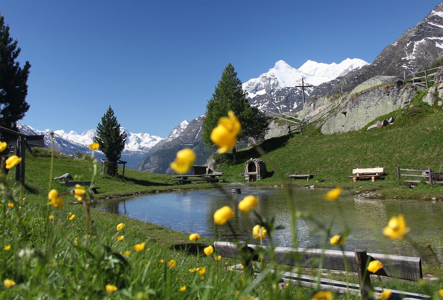
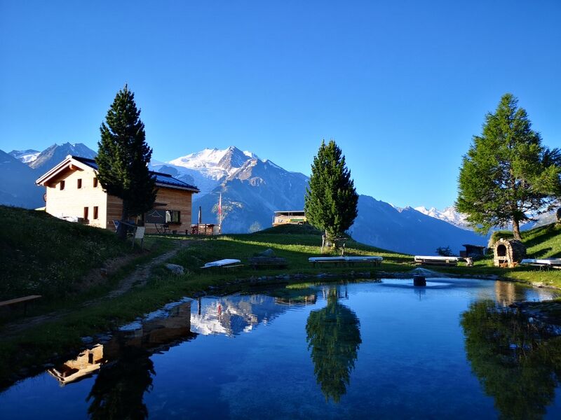
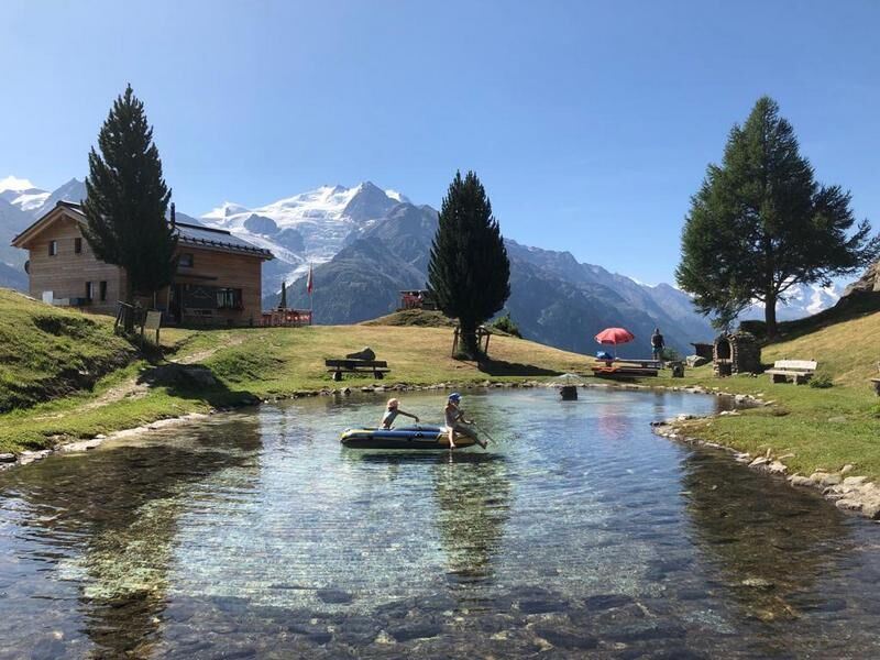
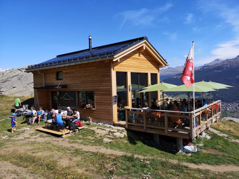
With its spectacular landscapes, the hike offers a true feast for the eyes throughout. Start your route high up with two consecutive cable car rides. The breathtaking panorama overlooking the Matter Valley will captivate you and make you forget the time completely. Upon reaching the small mountain lake on Jungenalp, you can refresh yourself on the terrace of the new restaurant, which offers a fantastic view of the valley towards Zermatt.

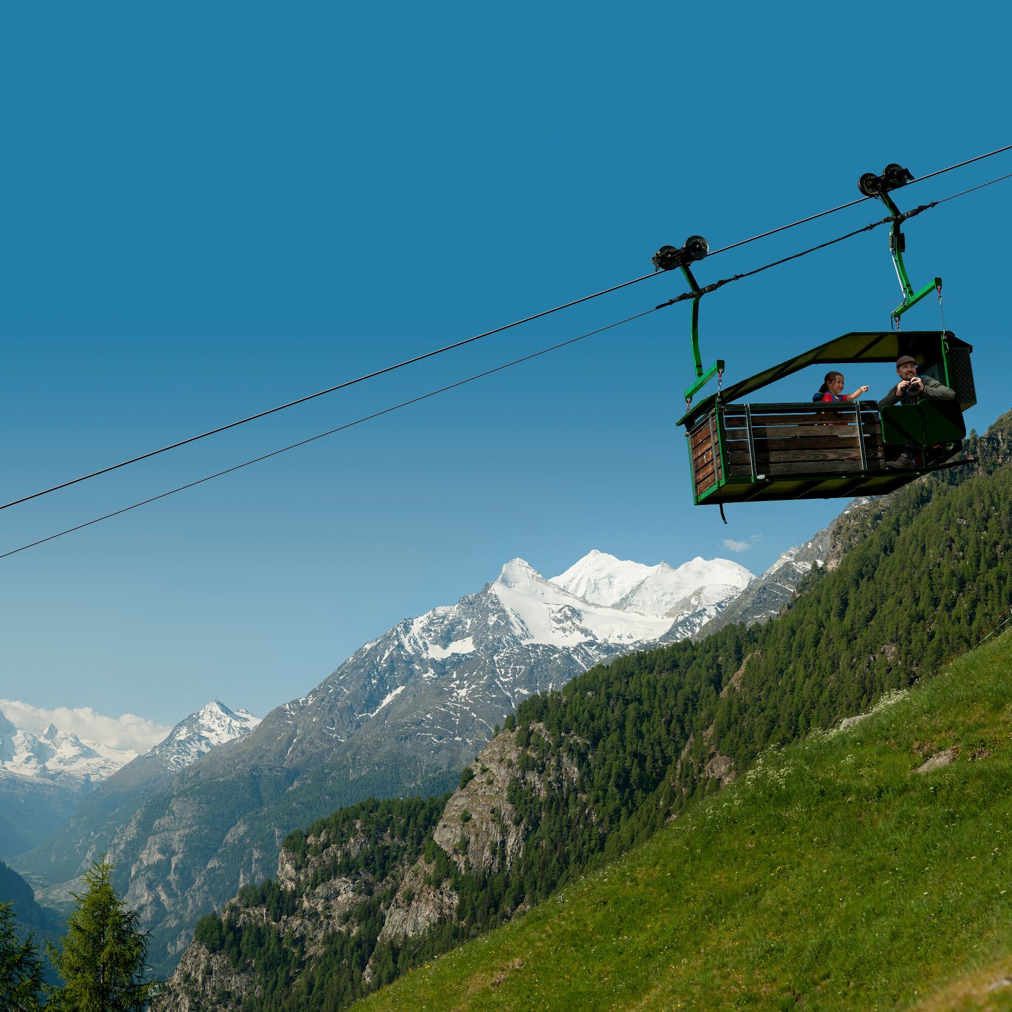
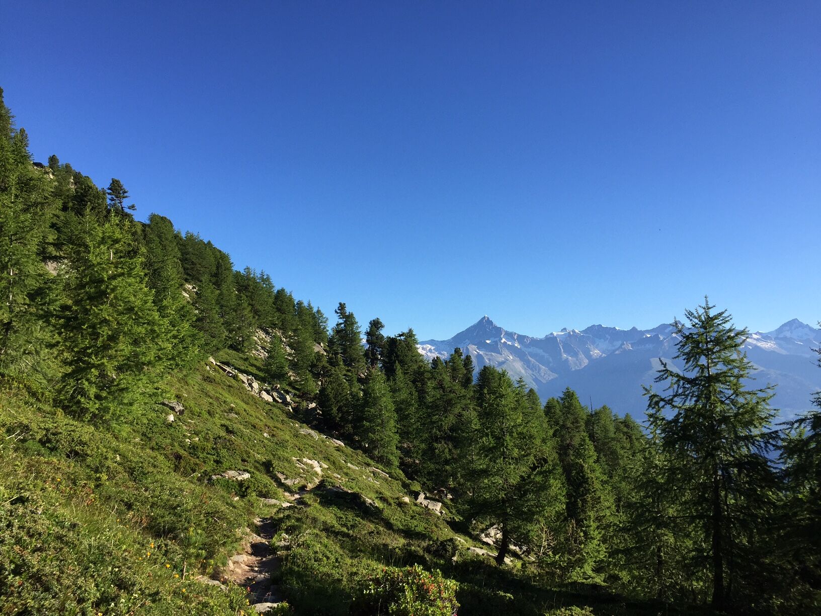
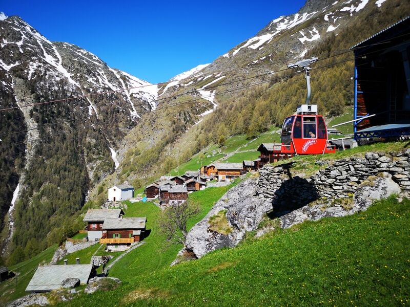
This hiking route is very well marked with signposts along the way. The hike begins with a first cable car ride from Kalpetran to Embd, where you transfer to a second, semi-open and thus unique cable car that takes you to Schalb. Once there, you cross the Embdbach and then follow the path towards Jungen until you reach the new mountain restaurant. At the end, the cable car takes you down to the endpoint of your hike in the village of St. Niklaus, where in winter the largest St. Nicholas in Switzerland stands. You return to your starting point by the Matterhorn Gotthard Bahn.
Da
We recommend:
Good footwear Weather-dependent clothing: always carry a waterproof vest Headgear Sunscreen Water bottle Picnic Camera Binoculars (optional) Hiking poles (optional) Printed map of the hiking trail (click "Print" to download)For certain hikes:
SwimsuitThe mountains, a place of joy for sharing and respecting. The mountain world is a place to meet and experience unforgettable moments together – whether by bike or on foot. To ensure all users can benefit, it is essential to share this space with respect for nature and agriculture. Respectful behavior allows everyone to pursue their leisure activities under the best conditions. Inform yourself about recommendations and rules. Assess your own skills and fitness well. Using the different routes is always at your own risk.
For all hikes:
Carry a map with you. Download the complete description of the hiking trail with a large-scale map by clicking "Print" at the top right of the page. Use only marked hiking trails and observe all signposts and instructions - for your own safety, to protect grazing animals, and out of respect for wildlife. Close gates after passing through. Behave considerately towards other trail users, plants, and animals.For mountain hikes:
Carry additional sunscreen. UV rays at high altitudes can be very strong, even on cloudy days. Plan your hike carefully: take into account the required fitness level of all participants, weather forecasts, and seasonal factors. Weather conditions in the mountains can change very quickly and without warning. Appropriate clothing and enough provisions (food and drink) are very important. In unstable weather, it is better to turn back early.For high alpine hikes:
Inform your family about your hiking route. If possible, avoid going alone. Do not venture onto glaciers without a mountain guide. Observe warning signs indicating dangers at riverbanks, along watercourses below dams and reservoirs: water levels can rise quickly and without warning.Arrival to Visp, then follow the signs to Zermatt. After the Stägjitschugge tunnel, turn right to Kalpetran. Then follow the road to the car park at the sports ground in Kalpetran. Continue with the cable car to Embd and cable car to Schalb. Since the hike ends in Jungen, it is recommended to drive by car to Kalpetran and after the hike return to Kalpetran by public transport.
Regular train connections from all over Switzerland to Visp, then change to the Matterhorn Gotthard Bahn which takes you to Kalpetran. From Kalpetran take the gondola to Embd. With the unique semi-open gondola to Schalb. At the end of the hike, the gondola takes you from Jungen to St. Niklaus. From there, the Matterhorn Gotthard Bahn regularly runs to Visp – Brig with train connections throughout Switzerland.
Train schedules and the connections of the Schalb cable car can be found at www.sbb.ch
Free parking in Kalpetran.
At the end of your hike, take a break in the new restaurant in Jungen, where you can expect hearty dishes and a magnificent view into the Matter Valley.
Spletne kamere s turneje
-
Seetal - Grächen
-
Brandalp - Skilift Seefeld
-
Moosalp - Restaurant Moosalp - Törbel
-
Hannigalp
-
Grächen - Dorf
-
Moosalp - Bergrestaurant Dorbia
-
Brandalp - Skilift Seefeld
-
Brandalp - Skilift Seefeld
-
Brandalp - Skilift Seefeld
-
Brandalp - Skilift Seefeld
-
Grächen
-
Furggen Berg
-
Brandalp - Skilift Seefeld
-
Brandalp - Skilift Seefeld
-
Brandalp - Skilift Seefeld
-
Brandalp - Skilift Seefeld
-
Törbel - Chalet Dolores
-
Yakfarm - Embd
Priljubljeni izleti v okolici
-
3.3
Europaweg Grächen - Europahütte - Zermatt
težkoPohodništvo 39.9 km -
5.0
Moosalp Panoramaweg
svetlobaPohodništvo 6.36 km -
3.8
Höhenweg Saas-Fee - Grächen
Pohodništvo 12.0 km -
5.0
Marmot mountain path Spielboden
srednjaPohodništvo 3.89 km -
5.0
Via ferrata Jägihorn
težkoVia ferrata 6.14 km -
5.0
Bella-Tola
srednjaVisokogorska tura 6.72 km -
3.5
Saas-Fee - Gemsweg - Hannig - Plattjen
Pohodništvo 6.89 km -
4.5
Saas Fee - Bärenfalle - Melchboden - Hannigalp
srednjaPohodništvo 8.38 km -
Kinderwanderweg MoosAlbi uns seine Waldtiere
svetlobaPohodništvo 3.50 km -
Panoramaweg Visperterminen
svetlobaPohodništvo 9.72 km
Pohodništvo in sledenje


Ne zamudite ponudb in navdiha za naslednje počitnice
Vaš e-poštni naslov je bil dodan na poštni seznam.