


Bisse du Ro
In the Middle Ages, this canal built on a rock face brought water to the crops. The route, now perfectly safe, was carved into the rock during the first half of the 15th century. A real source of life,...
In the Middle Ages, this canal built on a rock face brought water to the crops. The route, now perfectly safe, was carved into the rock during the first half of the 15th century. A real source of life, it was carefully maintained by villagers until 1946, when a water supply tunnel was inaugurated. To preserve this route for tourists, the Montana development company decided to take charge of its maintenance.
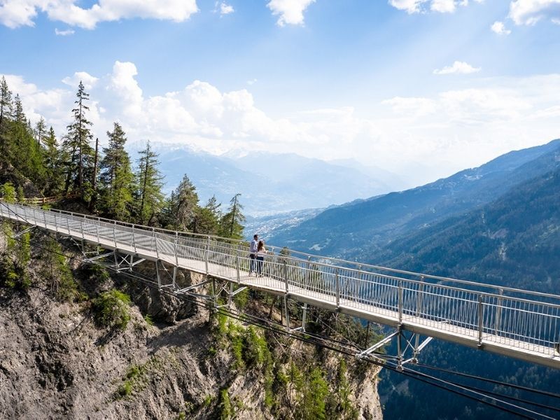
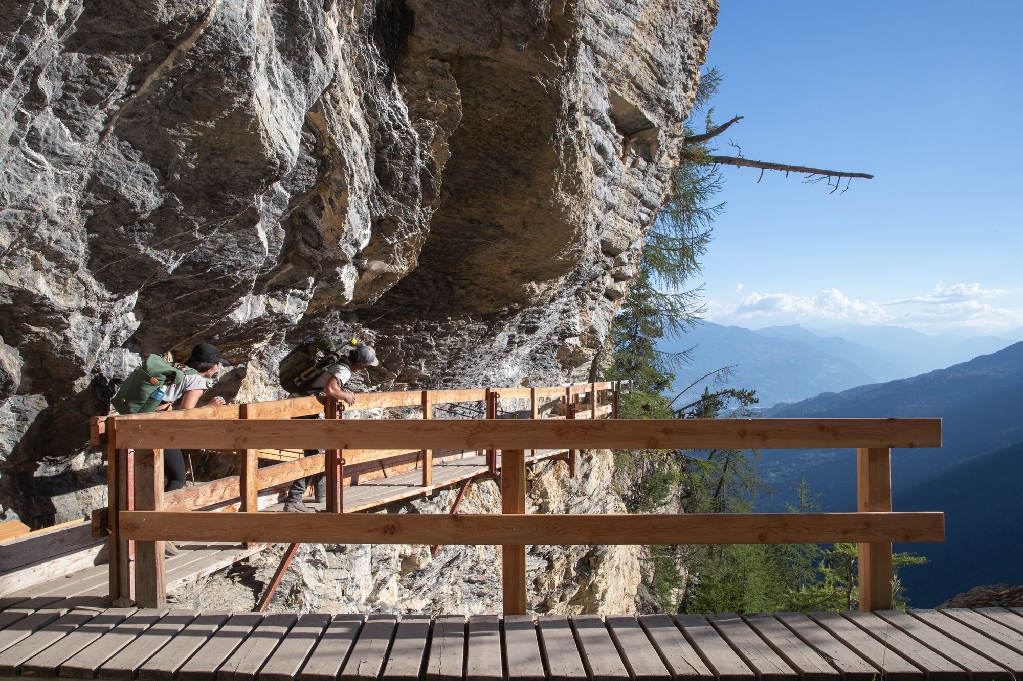
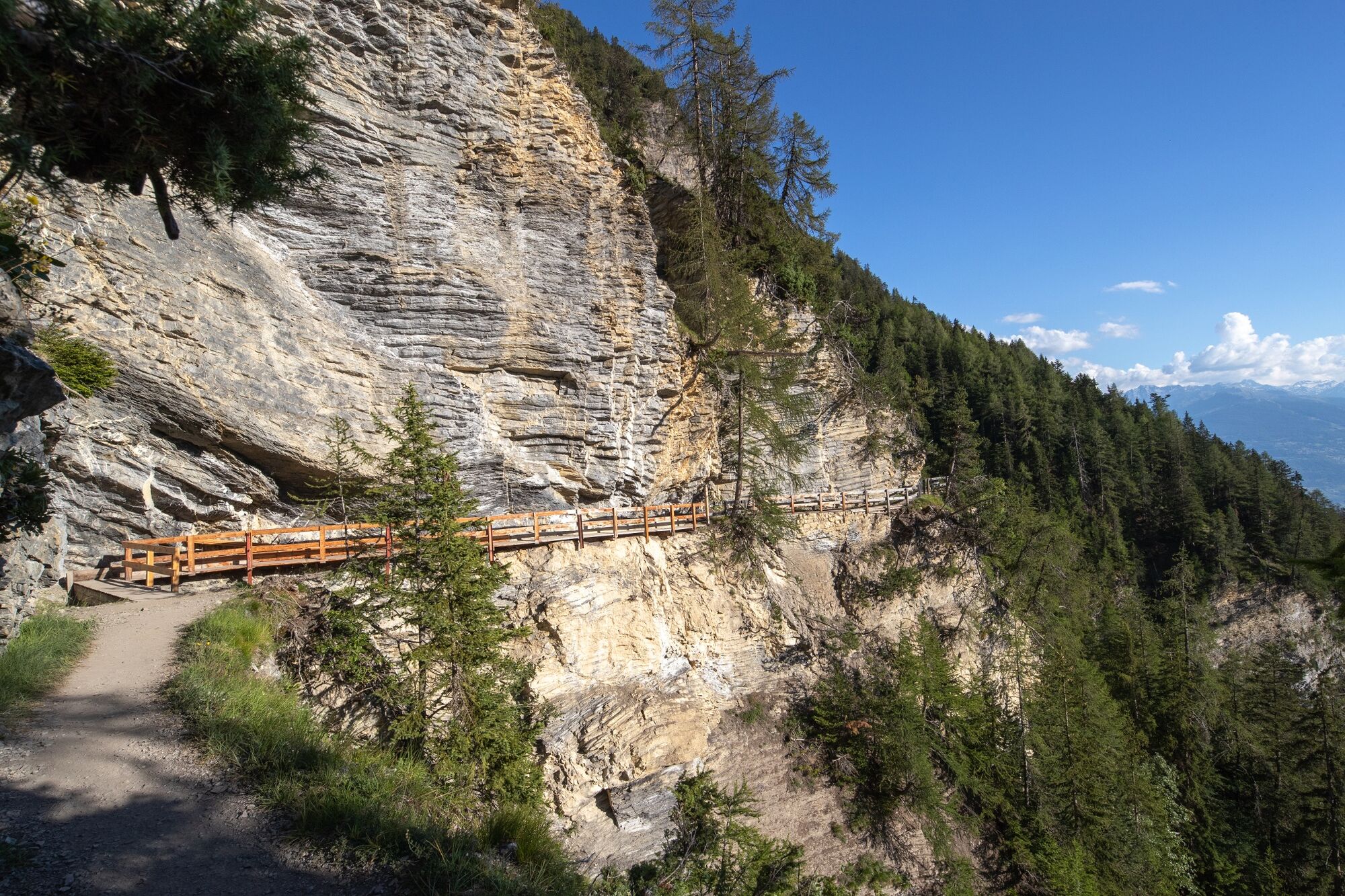
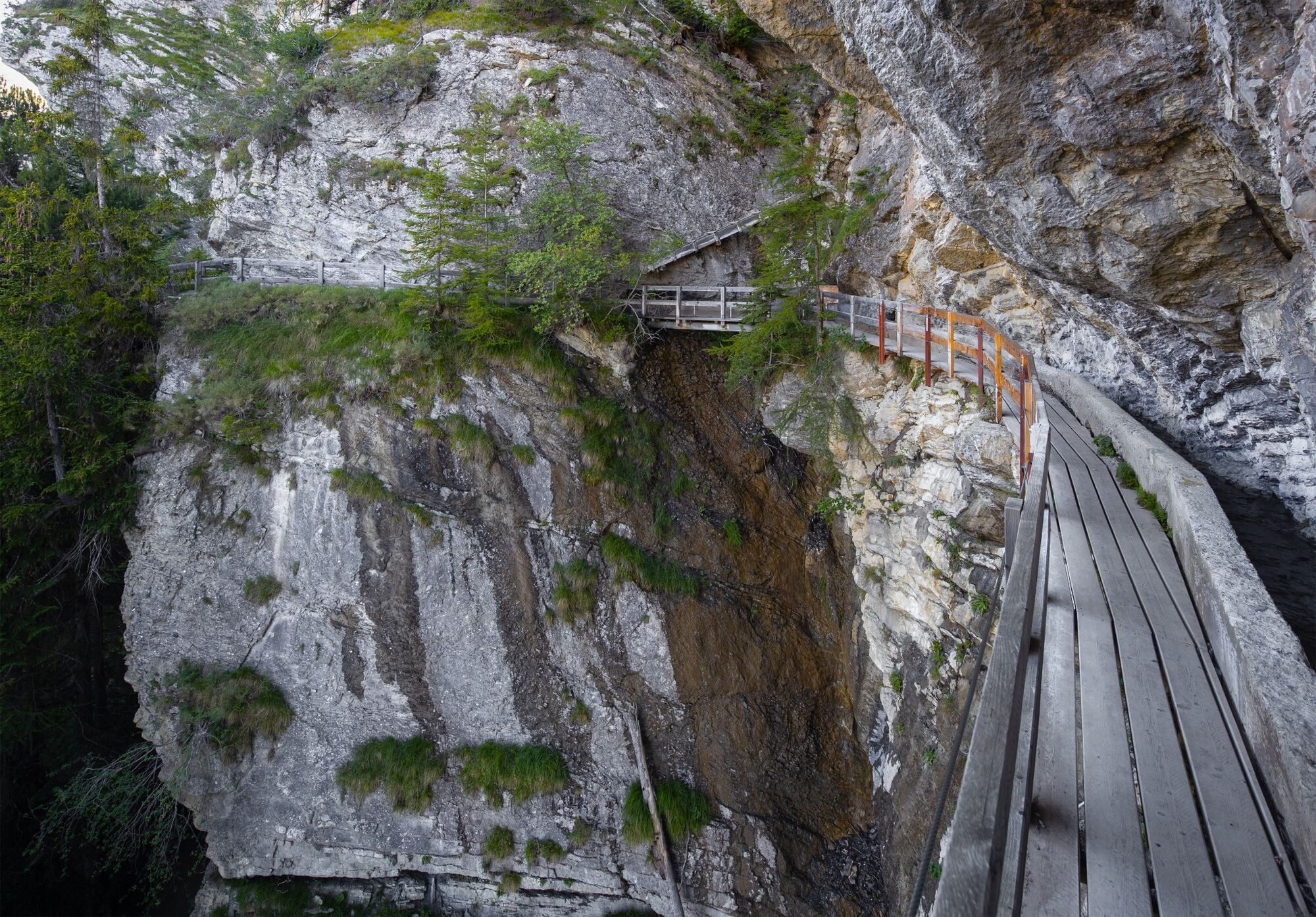
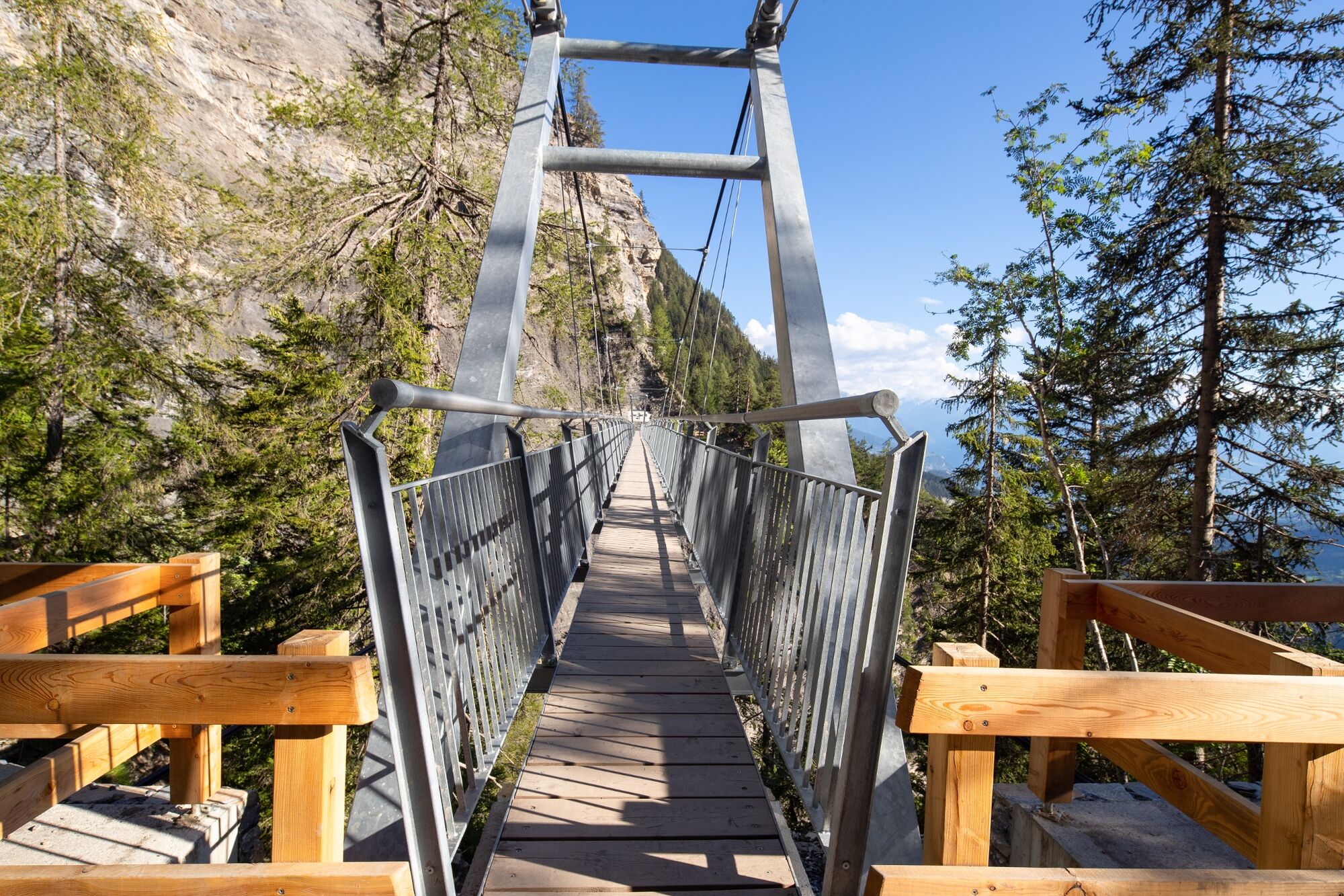
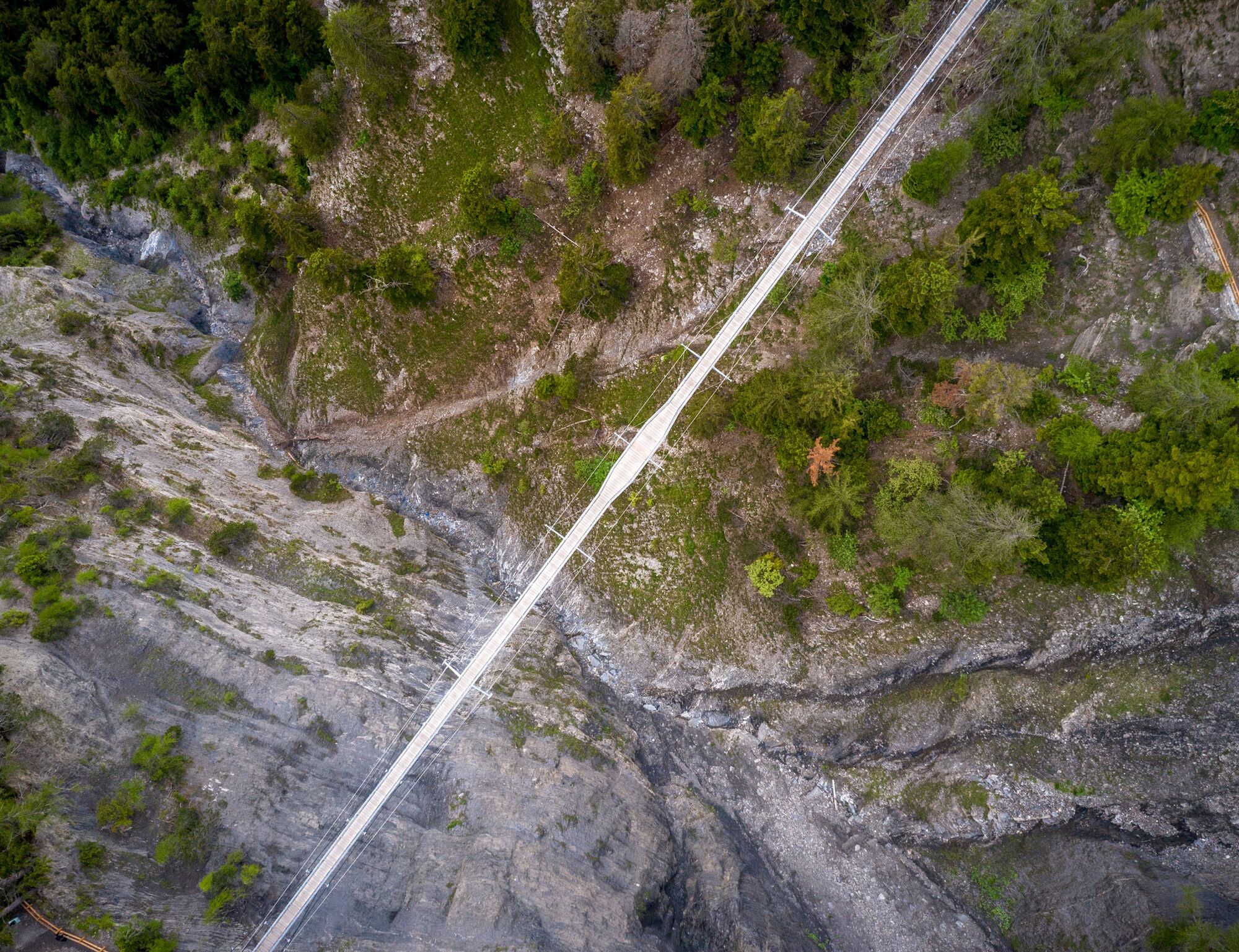
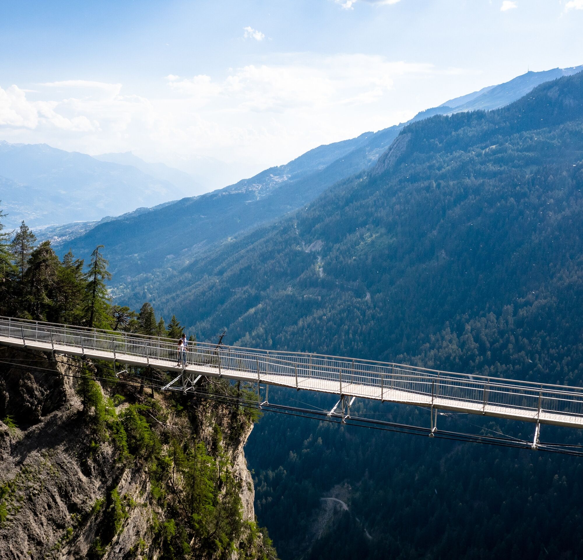
The Bisse du Ro is a construction about 5.5 km long illustrating truly the difficulties encountered by the inhabitants of our regions at the end of the Middle Ages and the ingenuity they had to demonstrate in the struggle for the water supply necessary for their survival.
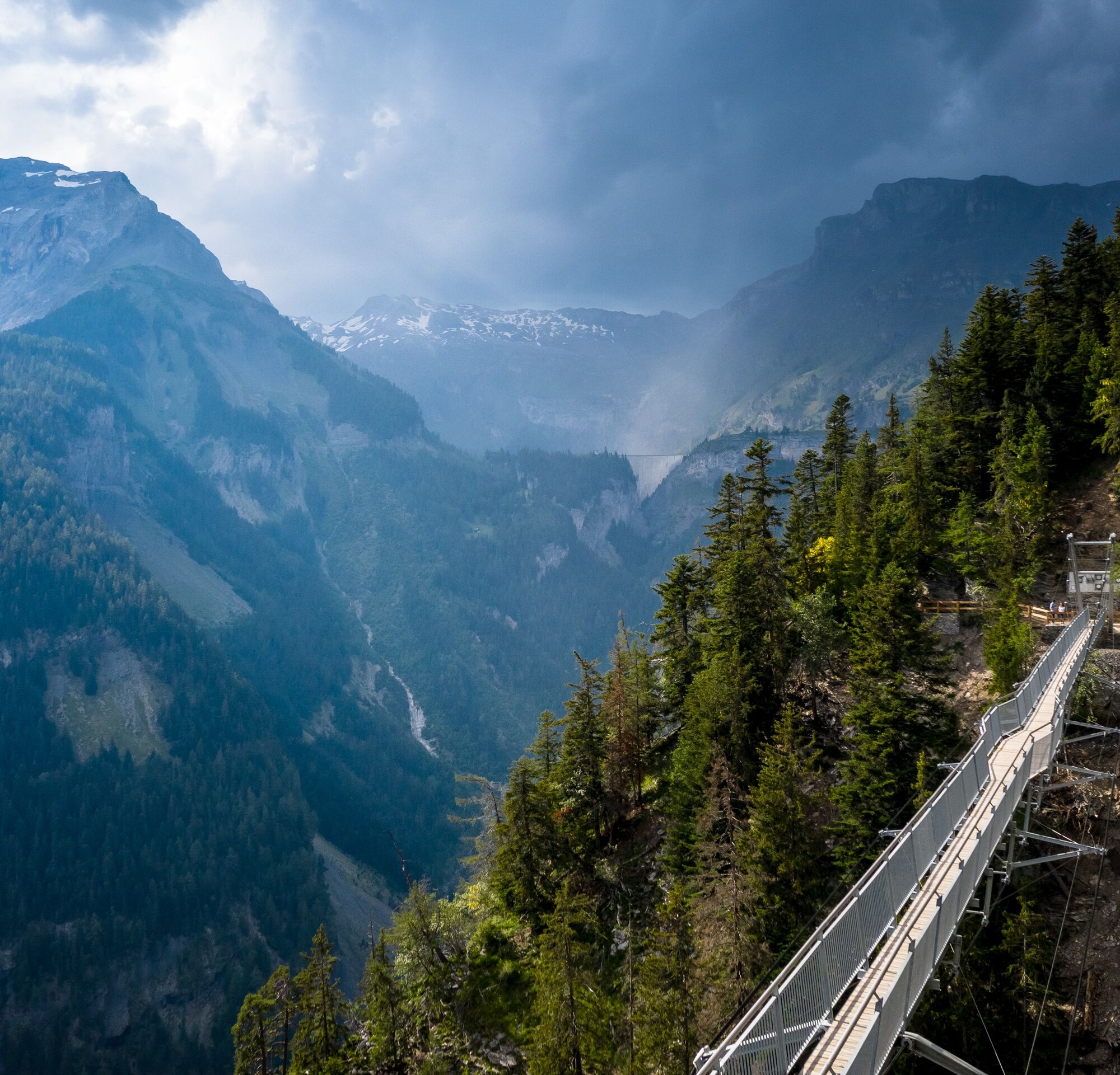
Indeed, the bisse crosses several times rocky diagonals, corridors with a smooth tendency, forest on scree, or zones of significant avalanche passages.
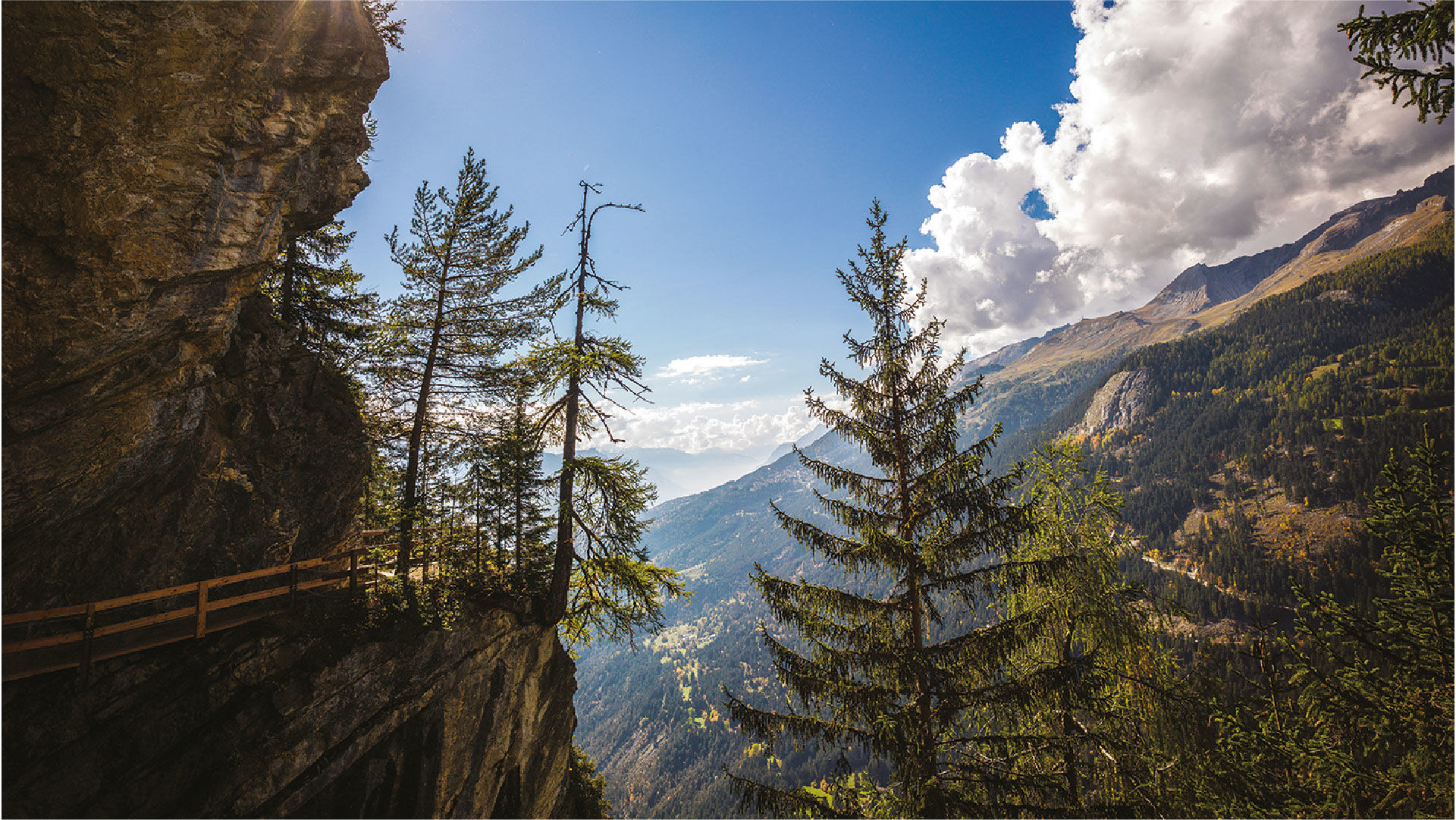
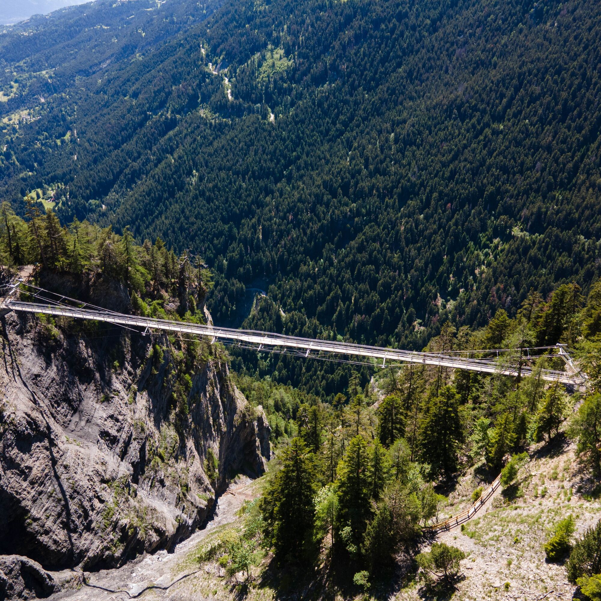
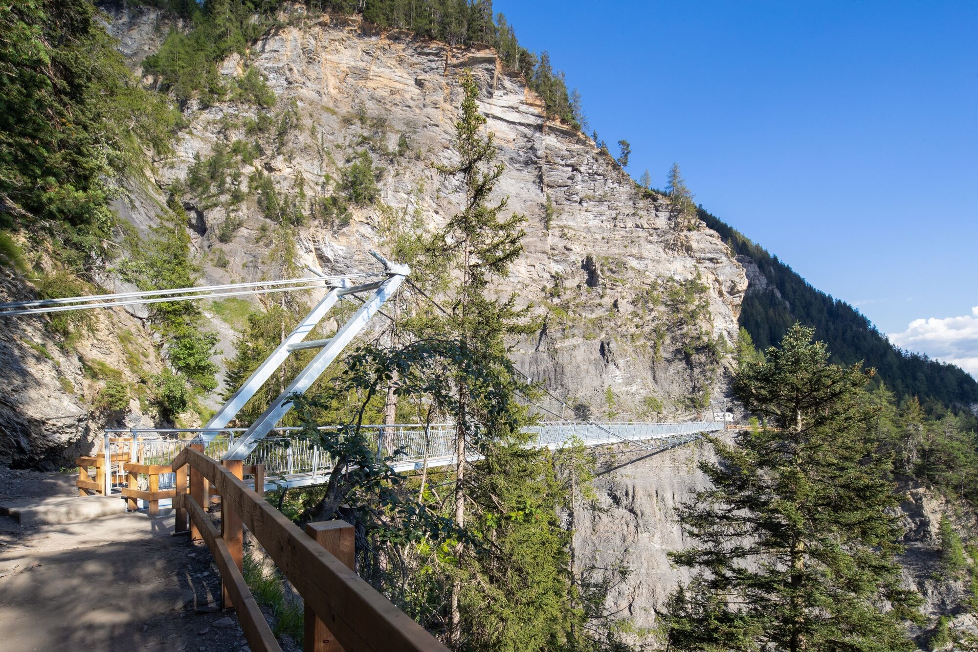
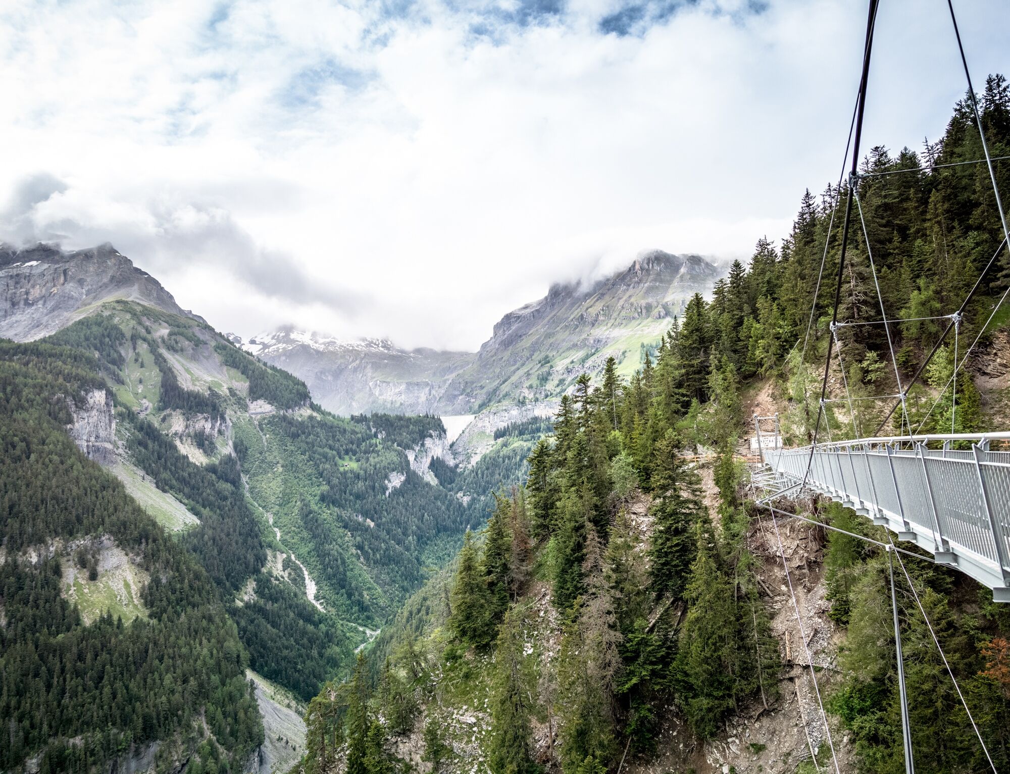
When you follow its trail you will discover all this. The bisse is now replaced by a gallery dug to overcome the well-known difficulty of maintaining its flow. Indeed, between leaks and annual damage, it was no longer possible to ensure acceptable safety of use. You therefore take it at the bottom of the dam of Lac de Plans-Mayens and engage on its course in the RiÑre valley. On its first 3 kilometers, even if sometimes impressive, there are no really dangerous spots. Then from point 1598, it is highly recommended to be cautious. You go another 500 meters and leave the RiÑre valley to enter the wild valley of Ertentse.
It is then in this wild, raw and intact mountain that we are able to grasp how much our predecessors fought their whole lives to get water for their houses, their crops as well as to pasture their animals during the hot summer seasons while in the villages the fodder was harvested that would allow passing the winter.
This Ertentse valley is a place which still, even if it is more accessible via Ayent and Tseuzier, awakens in the hearts of the local people strong feelings linked to the work of the ancestors.


Departure from Lac de Tseuzier - Er de Chermignon Pra du Taillour - Former Bisse du Ro - Plans-Mayens - Arrival at Lac Grenon, Route du Rawyl
Da
Good walking shoes.
The weather changes rapidly at altitude, plan to have suitable clothing.
Certain passages are not recommended for people prone to vertigo.
Follow the marked trails. Please respect the fauna, flora: nature.
Check the weather conditions before your departure.
Crans-Montana Tourism & Congress declines all responsibility in case of accident.
Take the Sion East highway exit and follow the direction to Ayent then when you arrive at Botyre take the direction to Tseuzier/Rawyl Dam. The journey takes about 40 minutes from the highway exit to your final destination.
From Crans-Montana, it is also possible to reach the Tseuzier Dam. First, take postal bus 353 towards Sion from the stop « Crans, Poste ». Then get off at the stop « Botyre (Ayent), centre ». Finally, take the postal bus on the other side of the road to « Anzère, Barrage de Tseuzier ». Timetable link: https://www.crans-montana.ch/horaires_bus_cm_tseuzier.
Cross the dam. The trail starts on the other side of the lake.
It is possible to park near the Tseuzier/Rawyl Dam next to the start of the hike.
For any other information: www.crans-montana.ch/rando
This particular bisse can be discovered both going and returning. You can therefore follow it partly and then retrace your steps. On the way back, you will discover things you probably did not see on the way there. If you do it in its entirety, from its source, several routes present themselves; you must then prepare your hike beforehand considering the weather, distances, and elevation changes by following the official tracks according to the information provided on the walking map.
We advise against using a dorsal baby carrier as you frequently need to bend down to avoid rock walls along the bisse.
We also ask you to keep your dogs on a leash.
Priljubljeni izleti v okolici
- 4,7
Leukerbad - Gemmipass - Lämmerenhütte
srednjaPohodništvo 9,49 km - 4,0
Grand Bisse de Lens
svetlobaPohodništvo 8,73 km - 4,0
Gemmipass - Lämmerenhütte - Rote Totz Lücke - Daubensee - Gemmipass
srednjaPohodništvo 13,7 km - 4,0
Tripon - Brac – Ancien Bisse du Torrent Neuf – St. Marguerite – Torrent Neuf – Prafirmin - St. Germain
svetlobaPohodništvo 12,9 km - 4,0
Wolfstritt
Pohodništvo 7,02 km - 5,0
Klettersteig Daubenhorn
težkoVia ferrata 5,34 km Erlebnistipp Sillerenbühl - Hahnenmoos
Pohodništvo 2,52 km- 5,0
Family-friendly Tsittoret bisse
svetlobaPohodništvo 7,14 km - 4,0
Belvédère via ferrata
srednjaVia ferrata 1,81 km - 5,0
Wildstrubel Umrundung 4-Tage
srednjaPohodništvo 79,1 km
Pohodništvo in sledenje


Ne zamudite ponudb in navdiha za naslednje počitnice
Vaš e-poštni naslov je bil dodan na poštni seznam.