


Suonenweg Saas-Almagell - Saas-Grund
Stopnja težavnosti: T2
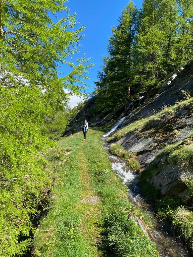
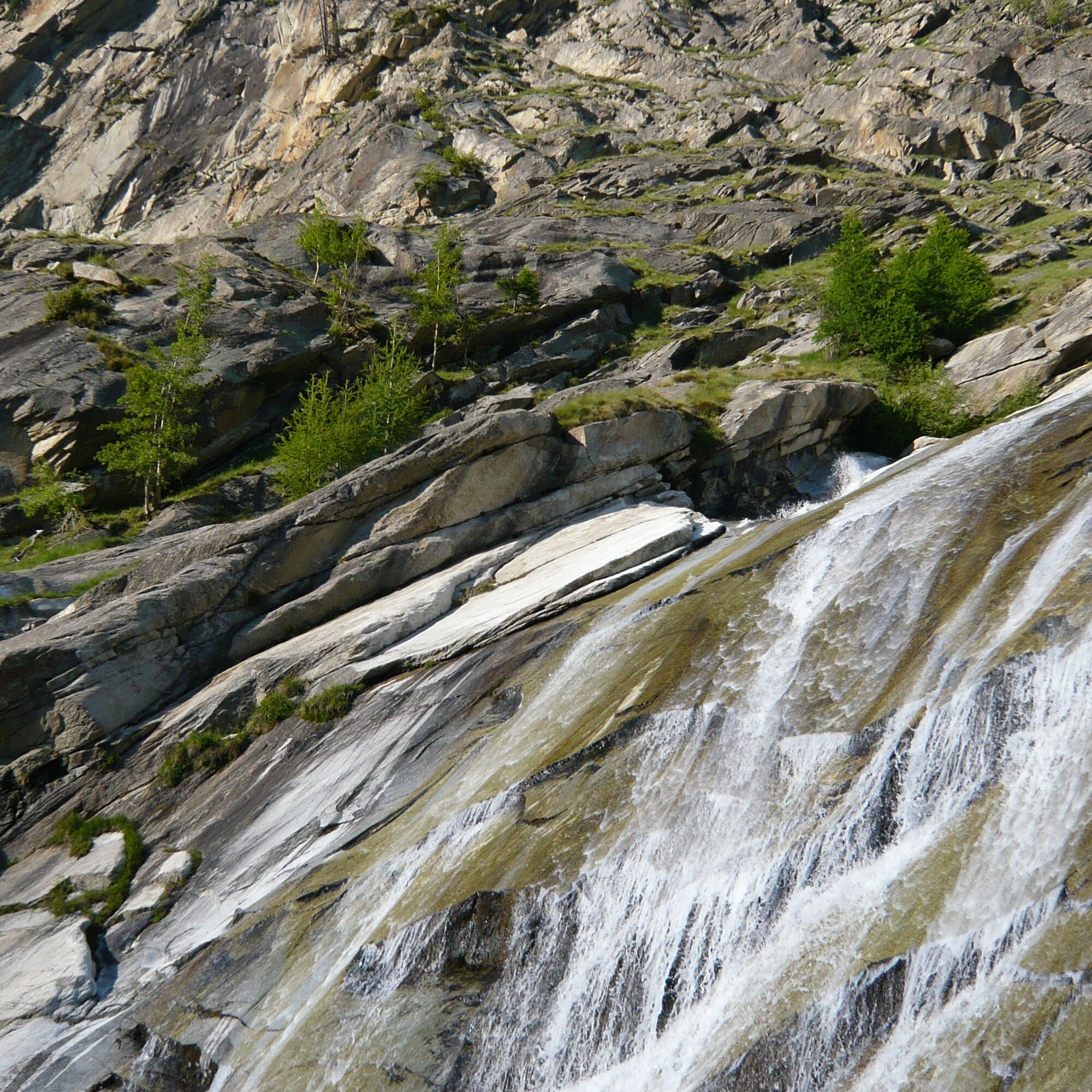
On the Suonenweg, water enlivens the soul and tells of hard, past times and daily life. The Suonen (water channels) bring the urgently needed water over ditches and pipes to the meadows and gardens. These...
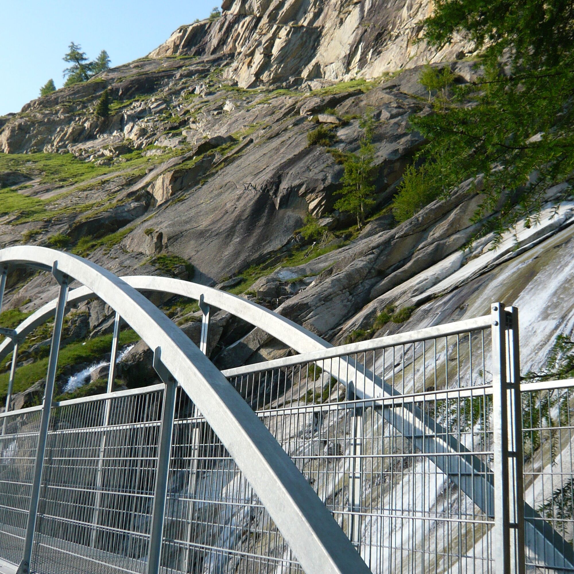
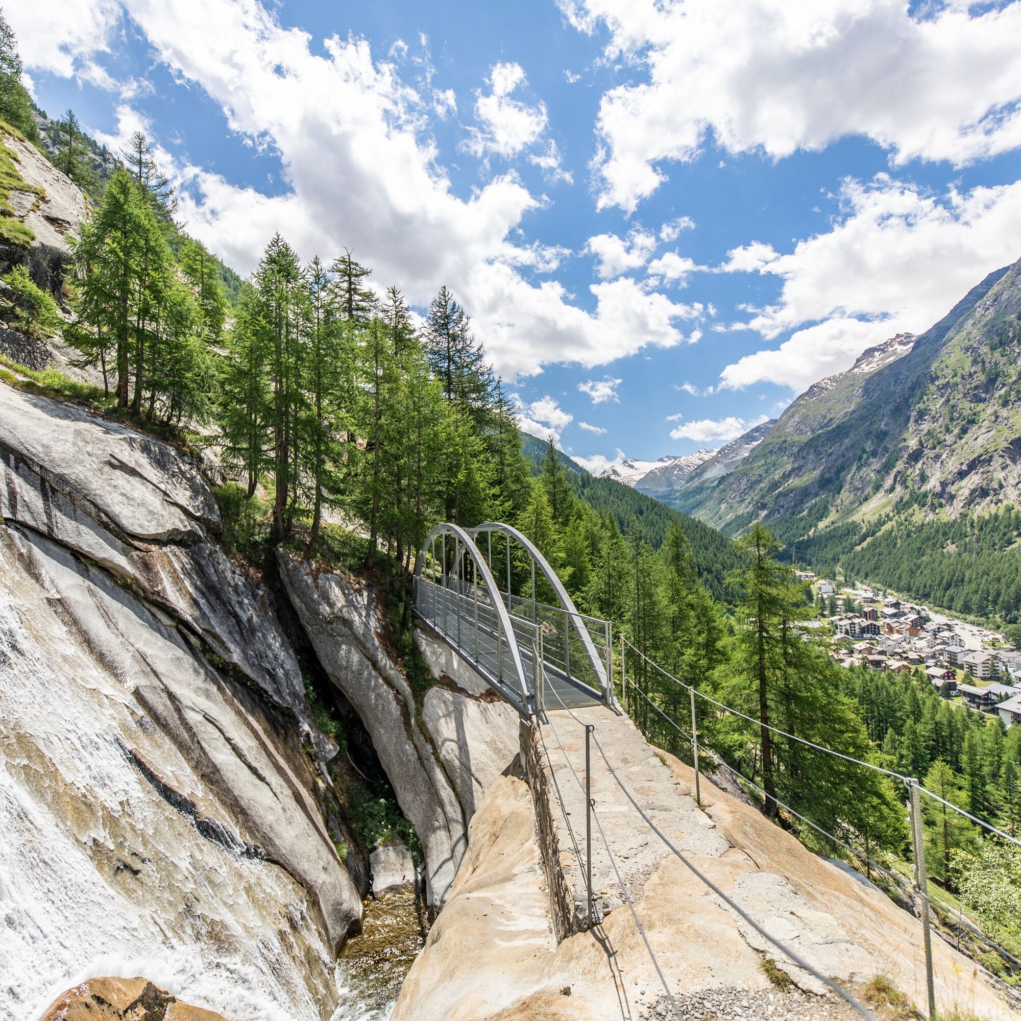
On the Suonenweg, water enlivens the soul and tells of hard, past times and daily life. The Suonen (water channels) bring the urgently needed water over ditches and pipes to the meadows and gardens. These kilometers-long channels originated from water scarcity, which made people inventive and resourceful. Along the way, hikers experience cultural-historical structures up close. The new bridge over the Almagellerbach, the reopening of part of the old water channel "Heuwete," and the Suone "Moosgufer" make the path even more attractive.
The Suonenweg begins at the valley station of the Saas-Almagell chairlift heading northeast. In the first third, follow the markings to "Zum Berg," through the Spisswald to the Almagellerbach, where the bridge is located. From the bridge, the trail leads below the Moos shore to the "Weiler zum Moos" and above the valley road past "Unter den Bodmen," "Zer Brigge," and "Ze Löübinu" to Saas Grund. The path ends in the village section "Gasse" of Saas-Grund near the Postplatz.
Valley station chairlift Saas-Almagell - Zum Moos - Unter den Bodmen - Obere Gasse - Postplatz Saas-Grund
Da
Good footwear
Outdoor clothing: always carry a waterproof jacket
Sun protection
Fluids and provisions
Hiking poles (optional)
Navigation tool
First-aid kit
Use of hiking trails and information on this website is at your own risk. Conditions on site may cause changes to the route.
Use only marked hiking trails and follow all signs and instructions – for your own safety, to protect livestock, and without disturbing the wildlife.
Be considerate of other trail users and the landscape. Take your rubbish and other people's rubbish with you.
Carry sun protection. UV rays at high altitudes can be very strong, even in cloudy weather.
Plan your hike carefully: consider the required fitness of all participants, weather forecasts, and seasonal dependencies.
Weather conditions can change very quickly and without warning in the mountains. Appropriate clothing and sufficient supplies (food and drink) are very important. Turn back early in case of bad weather.
Do not venture onto glaciers without a mountain guide.
Observe warning signs indicating dangers.
Inform third parties about your trip and, if possible, never go alone.
Pay attention to the opening times of the mountain lifts.
By car, the Saastal is easily and conveniently accessible from all directions, whether from Switzerland or abroad. From the north, you reach us via Bern through the Lötschberg car train. From the east, you come via the Furka Pass or the Furka car train. From the south, we are accessible via the Simplon Pass or the Simplon car train, and from the west, you drive via Lausanne along the Rhone Valley to Visp and from there towards Saas-Fee. From Visp, drive south towards Saas-Fee. At the "Killerhof" roundabout near Stalden, take the second exit to Saas-Fee. In Saas-Grund, turn left after the church towards Saas-Almagell.
Take the SBB to Visp and change there to the post bus towards Saas-Fee (bus 511). In Saas-Grund, at the Post stop, change to the post bus towards Saas-Almagell (bus 513). Get off at the Dorfplatz stop.
Large parking lot after the Postplatz.
T2
Saastal Tourismus AG
Obere Dorfstrasse 2
3906 Saas-Fee
Tel.: +41 (0)27 958 18 58
E-Mail:
www.saas-fee.ch
Saastal Tourismus AG
Information office Saas-Almagell
3905 Saas-Almagell
Tel.: +41 (0)27 958 18 88
Enjoy the magnificent view from the bridge of the village Saas-Almagell as well as the natural Mattmark dam.
Priljubljeni izleti v okolici
- 4,9
Allalinhorn vom Mittelallalin über Normalweg
srednjaVisokogorska tura 6,15 km - 3,3
Europaweg Grächen - Europahütte - Zermatt
težkoPohodništvo 39,9 km - 3,6
Höhenweg Kreuzboden - Almagelleralp - Saas-Almagell
Pohodništvo 9,74 km - 3,5
Waldweg Saas-Fee - Saas-Almagell
Pohodništvo 2,83 km - 3,8
Höhenweg Saas-Fee - Grächen
Pohodništvo 12,0 km - 5,0
Weissmies Südgrat von Saas Almagell
srednjaVisokogorska tura 20,5 km - 5,0
Via ferrata Jägihorn
težkoVia ferrata 6,14 km - 3,5
Saas-Fee - Gemsweg - Hannig - Plattjen
Pohodništvo 6,89 km - 3,0
Mattmark - Monte Moro - Macugnaga
Pohodništvo 10,6 km - 5,0
Winter Hike Mattmark
srednjaZimsko pohodništvo 14,0 km
Pohodništvo in sledenje


Ne zamudite ponudb in navdiha za naslednje počitnice
Vaš e-poštni naslov je bil dodan na poštni seznam.