


Adventure hike in the UNESCO World Natural Heritage
The scenic circular hike leads through the UNESCO World Natural Heritage Jolital. Along the "Stäger Suon," a water channel characteristic of the Valais valleys, the path passes through old hamlets and...
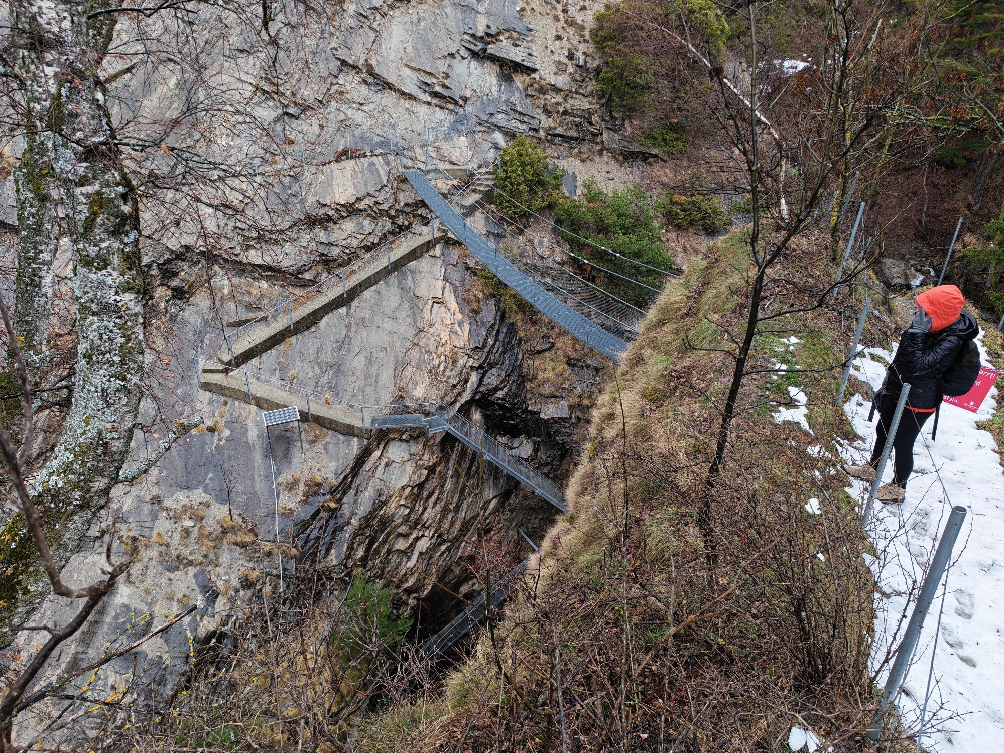
The scenic circular hike leads through the UNESCO World Natural Heritage Jolital. Along the "Stäger Suon," a water channel characteristic of the Valais valleys, the path passes through old hamlets and over an impressive gorge. Across a dizzying high suspension bridge, you reach the picturesque knight village Niedergesteln.

The varied hike leads through the Jolital, which is part of the UNESCO World Natural Heritage. Starting at the public car park in Niedergesteln, you ascend towards Stäger Suon, a historic water channel that the hiking trail follows. With the Rhone Valley and Niedergesteln always in sight, you reach the wild Jolischlucht, which serves as a connection between the sunny Lötschberg southern ramp and Niedergesteln. The gorge is crossed through a tunnel. In darkness, you are welcome to use the flashlights provided at the entrance. After the waterfall, a 20 m high, dizzying suspension bridge with breathtaking views of the valley is worth the visit. Across fields and meadows, you descend into the picturesque knight village of Niedergesteln.
Da
Sturdy footwear, weather-appropriate clothing, possibly hiking poles, water
Arrival
By train from Visp / Brig to Raron. Then by local bus to Niedergesteln.
The UNESCO World Natural Heritage car park is located directly at the starting point
The audio circular tour through the small village of Niedergesteln with an ascent via the knight's path to Gestelnburg and the illuminated Ice Age cave is especially worthwhile.
Priljubljeni izleti v okolici
-
4.0
Rundwanderung Lötschenpasshütte
srednjaPohodništvo 12.2 km -
5.0
Moosalp Panoramaweg
svetlobaPohodništvo 6.36 km -
5.0
Lauchernalp-Lötschenpass-Selden
težkoPohodništvo 12.0 km -
4.7
Lötschentaler Höhenweg
svetlobaPohodništvo 9.17 km -
5.0
Bella-Tola
srednjaVisokogorska tura 6.72 km -
5.0
Restipass
Pohodništvo 14.5 km -
5.0
Torrenthorn- Rigi der Walliser Alpen
Pohodništvo 2.99 km -
Gratweg
Via ferrata 5.16 km -
4.0
Wolfstritt
Pohodništvo 7.02 km -
Talabfahrt (Rinderhütte-Tunnel-Folljeret-Leukerbad)
Pohodništvo 7.78 km
Pohodništvo in sledenje


Ne zamudite ponudb in navdiha za naslednje počitnice
Vaš e-poštni naslov je bil dodan na poštni seznam.