


Mattsand Enduro
Stopnja težavnosti: S2

The route starts in the middle of the idyllic mountain village of Grächen and leads at first via Gasenried to Schalbettu. The slightly ascending section partly runs along forest roads and passes through...
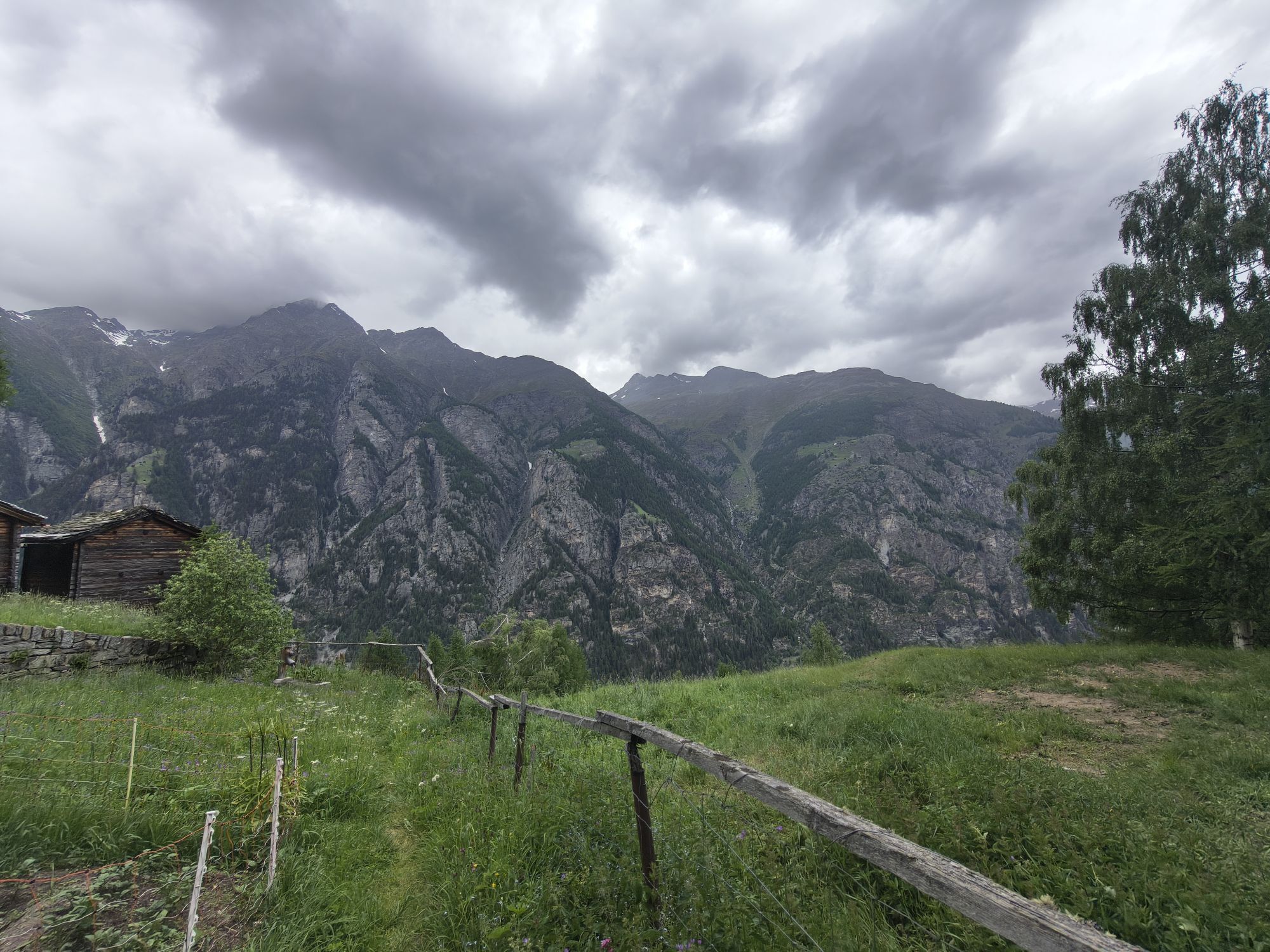
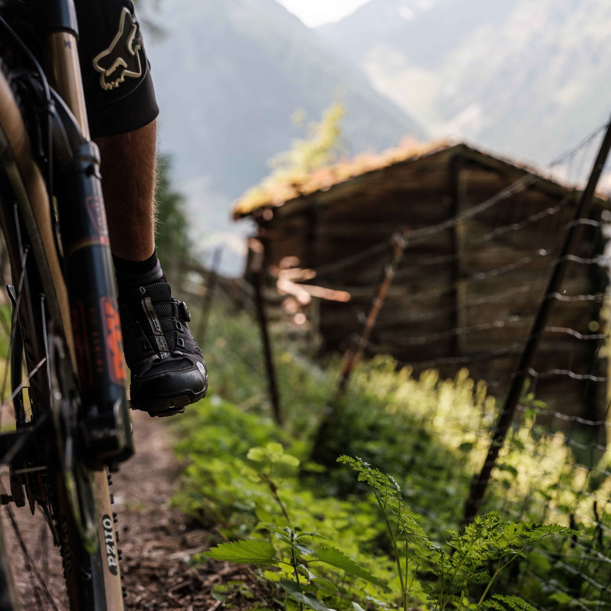
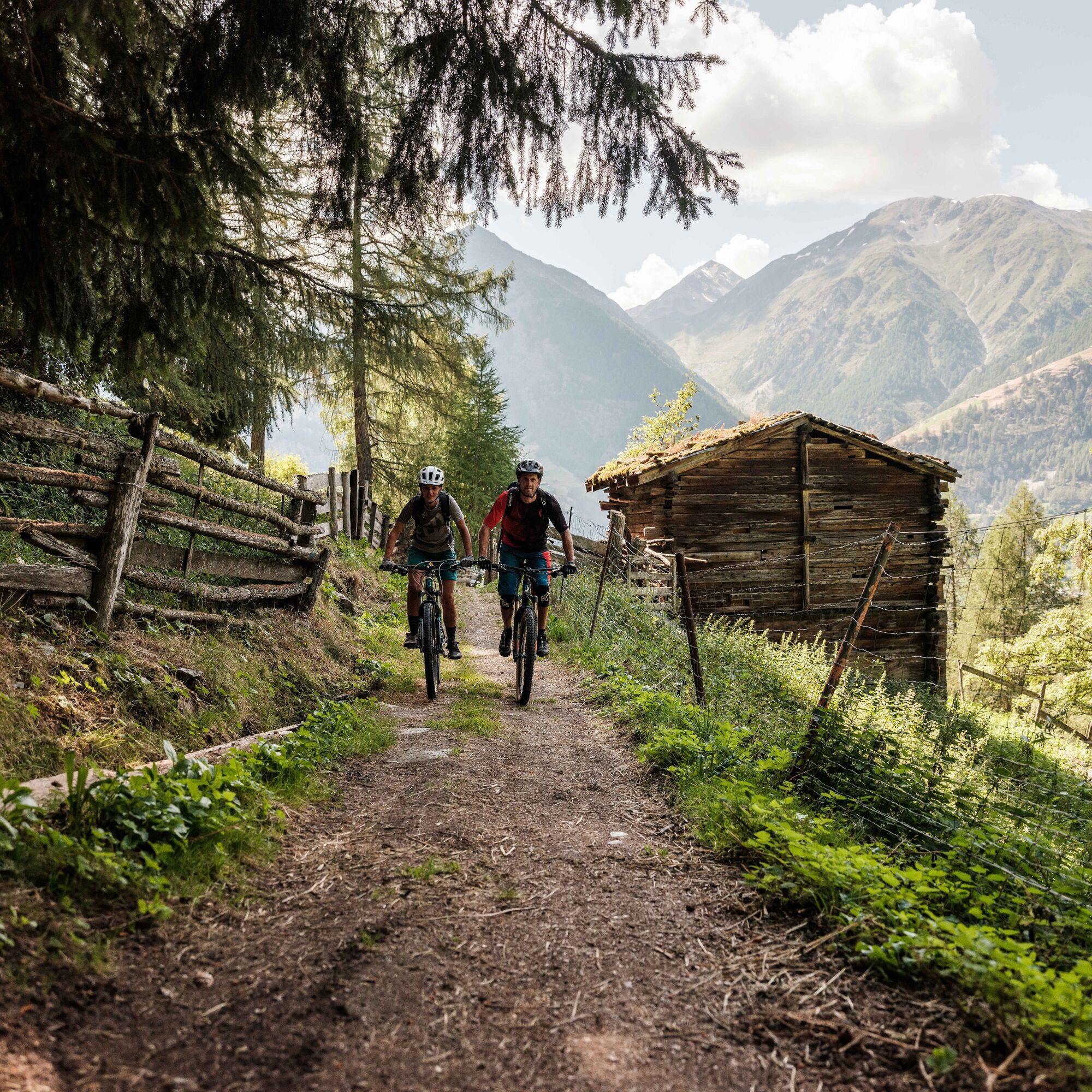
The route starts in the middle of the idyllic mountain village of Grächen and leads at first via Gasenried to Schalbettu. The slightly ascending section partly runs along forest roads and passes through a charming piece of forest. After Schalbettu, the path crosses the Riedbach and after a few hundred meters on the forest road leads into a wonderful trail. This clings to the mountainsides for the first two kilometers and then leads into the Matter Valley. Anyone who is not yet out of breath will be speechless at the view of the high alpine mountain world with classics like Weisshorn and Zinalrothorn – simply breathtaking. From the Balmu area, the descent and trail fun starts. The versatile and varied single trail to Mattsand is of the highest quality and promises endless biker fun. From Mattsand, the return route to St. Niklaus or the connection to the Visp–Zermatt trail (no. 150) is then available.

The route is signposted only in one direction: Grächen -> Gasenried -> Mattsand
Da
Da
Our recommendation: technically flawless bike, helmet, gloves and bell, clothing suitable for the weather (always carry rain protection), drink and food
The mountains, a place of joy to share and respect. The mountain world is a place to meet and create unforgettable moments together – whether by bike or on foot. To ensure all users can benefit, it is essential to share this space with respect for nature and agriculture. Respectful behavior allows everyone to enjoy their recreational activities under the best conditions. Inform yourself about recommendations and rules.
Assess your own skills and fitness well. Riding the various routes is fundamentally at your own risk.
Ideally up to St. Niklaus
You can reach our region in an environmentally friendly and convenient way by public transport. Regular train connections from all over Switzerland to St. Niklaus, then by post bus to Grächen (remember to reserve a place for your bike in the post bus, as places are limited).
Remember to reserve a space for your mountain bike via the SBB Mobile app or on sbb.ch.
Parking spaces are available in the parking garages and on the parking garage roofs of St. Niklaus, Herbriggen, and Ried.
S2
Visit the world-unique mountain guide museum in the oldest still preserved building in the Nikolai Valley, the Meier Tower in St. Niklaus.
Spletne kamere s turneje
Priljubljeni izleti v okolici
-
4.9
Allalinhorn vom Mittelallalin über Normalweg
srednjaVisokogorska tura 6.15 km -
3.3
Europaweg Grächen - Europahütte - Zermatt
težkoPohodništvo 39.9 km -
3.6
Höhenweg Kreuzboden - Almagelleralp - Saas-Almagell
Pohodništvo 9.74 km -
3.5
Waldweg Saas-Fee - Saas-Almagell
Pohodništvo 2.83 km -
5.0
Moosalp Panoramaweg
svetlobaPohodništvo 6.36 km -
3.8
Höhenweg Saas-Fee - Grächen
Pohodništvo 12.0 km -
5.0
Marmot mountain path Spielboden
srednjaPohodništvo 3.89 km -
5.0
Via ferrata Jägihorn
težkoVia ferrata 6.14 km -
3.5
Saas-Fee - Gemsweg - Hannig - Plattjen
Pohodništvo 6.89 km -
5.0
Mountain trail Kreuzboden - Hohsaas
srednjaPohodništvo 4.65 km

Pohodništvo in sledenje


Ne zamudite ponudb in navdiha za naslednje počitnice
Vaš e-poštni naslov je bil dodan na poštni seznam.