


Villages Bike
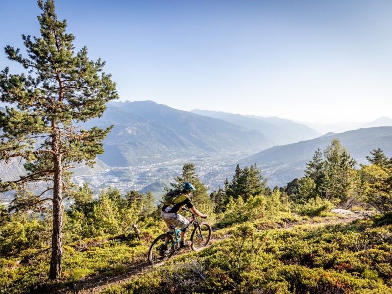
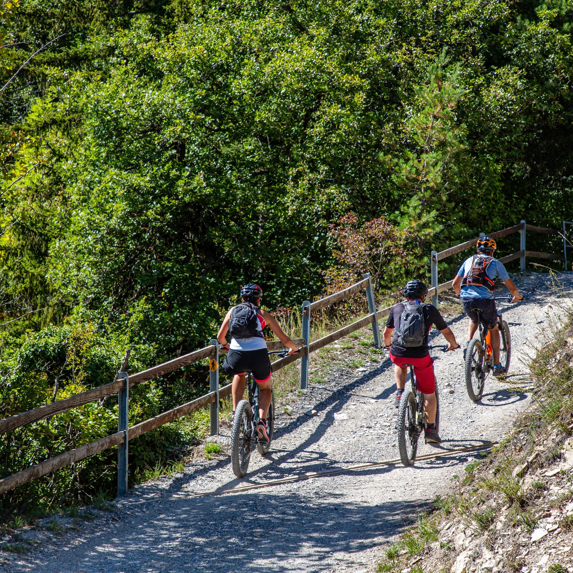
This 23 km mountain bike route will let you discover the villages located on the slopes of Crans-Montana and their sights. On the program: Venthône Castle, the church of Lens, Christ the King,...
The 23...
This 23 km mountain bike route will let you discover the villages located on the slopes of Crans-Montana and their sights. On the program: Venthône Castle, the church of Lens, Christ the King,...
The 23 km itinerary offers a gentle approach to our villages and their environment at your own pace. The departure is from Lac de la Moubra, then the route heads towards the villages of Randogne and Mollens to reach above Venthône. Then, return westward towards Chermignon-d'en-Bas, then Lens with a climb on the Chemin des Bouillettes at the foot of the Christ the King hill, which is left behind to reach Lac du Louché. The return to Crans-Montana goes through the heights of Icogne, the westernmost village of Crans-Montana. From the mountain pastures, the climb up to the resort demands a good effort. You can rest at Lac Miriouges in the heart of the forest before meeting again at La Moubra. This route combines all the ingredients of a real bike ride: technical descents, accelerations, various types of paths,... all in a very varied setting. This route can be done entirely (23 km) or in sections.
Departure from Lac de la Moubra - Marigny - La Comba - Mollens - St-Maurice-de-Laques - Venthône - Chermignon-d'en-Bas - Lens - Tsantové via Chemin de la Scie - Les Briesses - Forest passage parallel to Rue de Pirrazilina - Arrival at Lac de la Moubra
Wearing a helmet is mandatory.
Knee, elbow, and back protection are recommended.
Along the route, you will encounter pedestrians, walkers with dogs, riders, etc. Be careful and respect others !
Using the route is at each person's own responsibility.
We decline all responsibility in case of an accident.
To reach Crans-Montana by car, take the exit from highway A9 (Rhône motorway) called "Sierre ouest". At the highway exit, turn left and follow the signs indicating "Sierre". At the roundabout, turn right. Continue for 500 meters, then at the entrance to Sierre, turn left towards "Crans-Montana."
Take the Crans-Montana Road up to the fork of the old pneumology center. Then follow the Route de la Moubra on your right, then take the second exit at the roundabout towards Lac Moubra. The trip duration is about 20 minutes.
From Crans-Montana: reach the center of Montana and go down the Route de la Moubra to Lac Moubra.
The Crans-Montana resort is accessible from Sierre station with the SMC bus company or the funicular, as well as from Sion station with the postal buses. In addition, free shuttles from the SMC bus company serve the entire Crans-Montana resort.
The closest stop to the departure of this route is "Lac Moubra" with line 433.
Free parking is available at La Moubra
For any other information: https://www.crans-montana.ch/fr/activites/bike?ete
Priljubljeni izleti v okolici
-
5.0
Bella-Tola
srednjaVisokogorska tura 6.72 km -
4.7
Leukerbad - Gemmipass - Lämmerenhütte
srednjaPohodništvo 9.49 km -
4.0
Grand Bisse de Lens
svetlobaPohodništvo 8.73 km -
4.0
Gemmipass - Lämmerenhütte - Rote Totz Lücke - Daubensee - Gemmipass
srednjaPohodništvo 13.7 km -
4.0
Tripon - Brac – Ancien Bisse du Torrent Neuf – St. Marguerite – Torrent Neuf – Prafirmin - St. Germain
svetlobaPohodništvo 12.9 km -
4.0
Wolfstritt
Pohodništvo 7.02 km -
4.0
Belvédère via ferrata
srednjaVia ferrata 1.81 km -
5.0
Klettersteig Daubenhorn
težkoVia ferrata 5.34 km -
5.0
Wildstrubel Umrundung 4-Tage
srednjaPohodništvo 79.1 km -
5.0
777 (Flaschen- Torrentalp- Rinderhütte)
Pohodništvo 3.50 km
Pohodništvo in sledenje


Ne zamudite ponudb in navdiha za naslednje počitnice
Vaš e-poštni naslov je bil dodan na poštni seznam.