


Helsana Trail Green
Stopnja težavnosti: 2


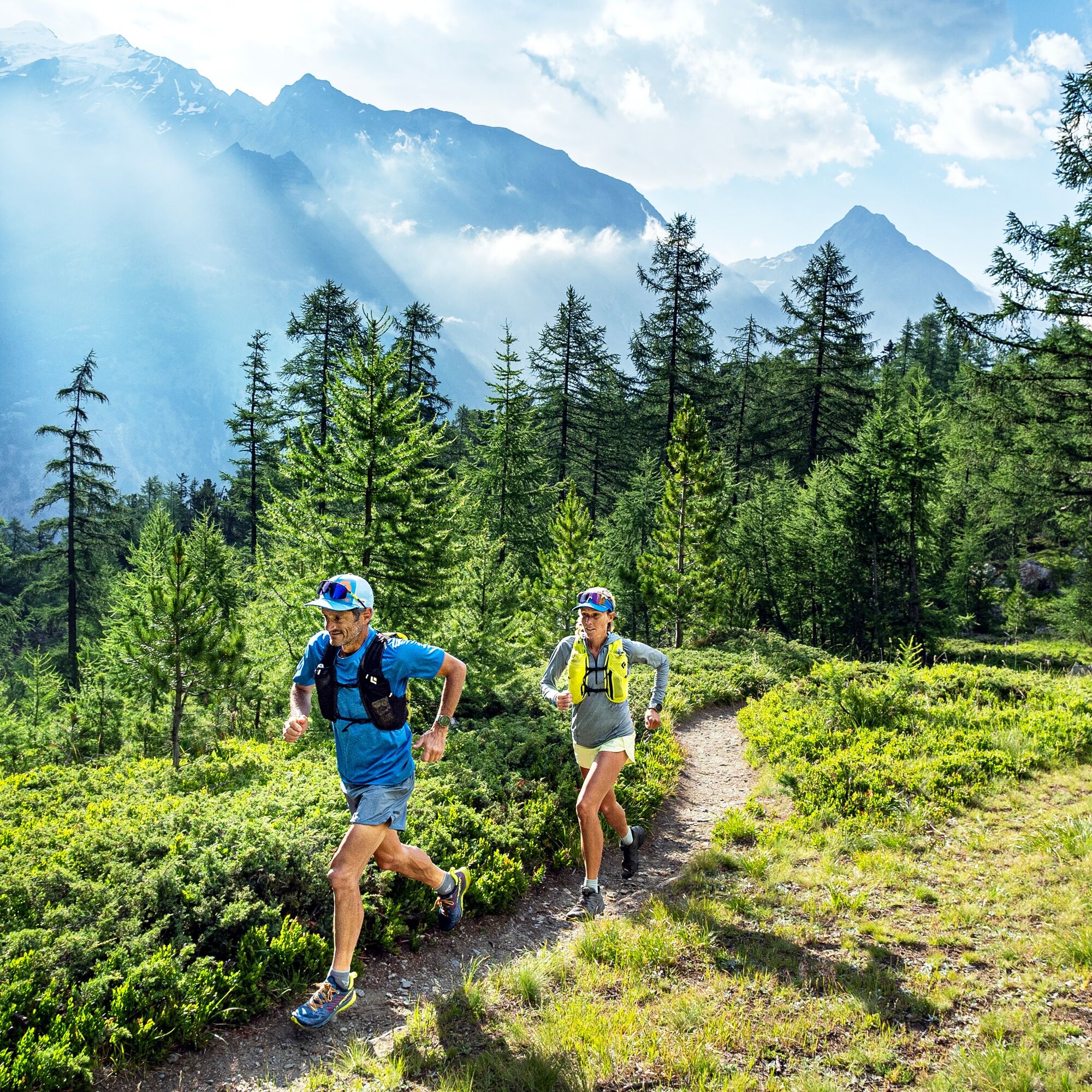
The Helsana Trails provide the perfect setting for enjoying nature and exercise. The signposted circuits can be found throughout Switzerland and vary in length and elevation gain.
The green trail in the...
The Helsana Trails provide the perfect setting for enjoying nature and exercise. The signposted circuits can be found throughout Switzerland and vary in length and elevation gain.
The green trail in the Saastal is about 6 km long and has an elevation difference of 170 meters, guiding athletes through the picturesque larch forest of Saas-Fee. The circuit offers a perfect nature break and an introduction to trail running.

Grossus Moos - Wildi - Waldhotel Fletschhorn - Sengg - Unnere Senggbodu - Bäru-falla - Mälchbodu - Honeggu - Hannig valley station (- Grossus Moos)
Trail running shoes
Outdoor clothing: always carry a waterproof jacket
Sunscreen
Fluids and snacks
Poles
Navigation tool
First aid kit
Use of the hiking trails and the information on this website is at your own risk. Conditions on site may lead to changes in the route.
Use only marked trail paths and heed all signs and instructions - for your own safety, to protect grazing animals, and out of respect for wildlife. Close gates after passing through. Be considerate of other path users, plants, and animals. Carry additional sunscreen. UV rays at high altitudes can be very strong, even in cloudy weather. Plan your trail carefully: consider the required fitness level of all participants, weather forecasts, and seasonal dependencies. Weather conditions in the mountains can change very quickly and without warning. Appropriate clothing and provisions (food and drink) are very important. In unstable weather, turn back early. Inform others about your trail route and if possible do not go alone. Observe warning signs indicating dangers at riverbanks, along watercourses below dams and reservoirs: water levels can rise quickly and without warning.
The Saastal is easily and comfortably accessible by car from all directions, whether from Switzerland or abroad. From the north you reach us via Bern through the Lötschberg car train. From the east you come via the Furka Pass or Furka car train. From the south we are reachable via the Simplon Pass or Simplon car train and from the west you drive via Lausanne along the Rhone Valley to Visp and from there towards Saas-Fee.
From Visp drive south towards Saas-Fee. At the roundabout "Killerhof" near Stalden take the second exit towards Saas-Fee. In Saas-Grund turn right after the church towards Saas-Fee.
Take the SBB to Visp and change there to the PostBus towards Saas-Fee (bus 511).
You can find parking in the parking garage directly at the entrance to Saas-Fee.
2
Saastal Tourismus AG
Obere Dorfstrasse 2
3906 Saas-Fee
Tel.: +41 (0)27 958 18 58
info@saas-fee.ch
www.saas-fee.ch
Helsana-Trails
Tel.: 0844 80 81 82
www.helsana.ch
Priljubljeni izleti v okolici
- 4,9
Allalinhorn vom Mittelallalin über Normalweg
srednjaVisokogorska tura6,15 km - 5,0
Weissmies Südgrat von Saas Almagell
srednjaVisokogorska tura20,5 km - 3,8
Höhenweg Saas-Fee - Grächen
Pohodništvo12,0 km - 5,0
Ibex path
srednjaPohodništvo9,02 km - 4,5
Jegihorn via ferrata
srednjaVia ferrata6,40 km - 5,0
Marmot mountain path Spielboden
srednjaPohodništvo3,89 km Around the Mattmark Reservoir in the Saastal
svetlobaPohodništvo8 km- 4,6
Gspon high-altitude route
srednjaPohodništvo13,9 km - 5,0
Via ferrata Jägihorn
težkoVia ferrata6,14 km - 4,5
Saas Fee - Bärenfalle - Melchboden - Hannigalp
srednjaPohodništvo8,38 km
Pohodništvo in sledenje


Ne zamudite ponudb in navdiha za naslednje počitnice
Vaš e-poštni naslov je bil dodan na poštni seznam.