


Cima Cece
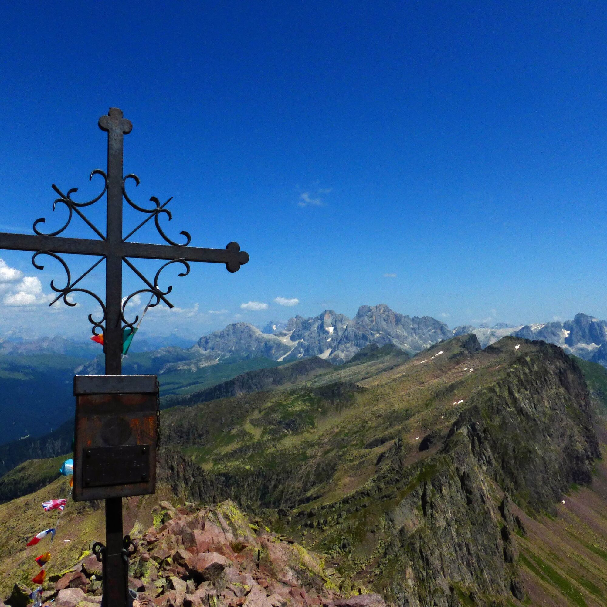
The summit cross that awaits you on the top is like a vision, after a very long but extremely satisfying excursion. In the initial part of the route there are two beautiful lakes: the basin of Lake Cece,...
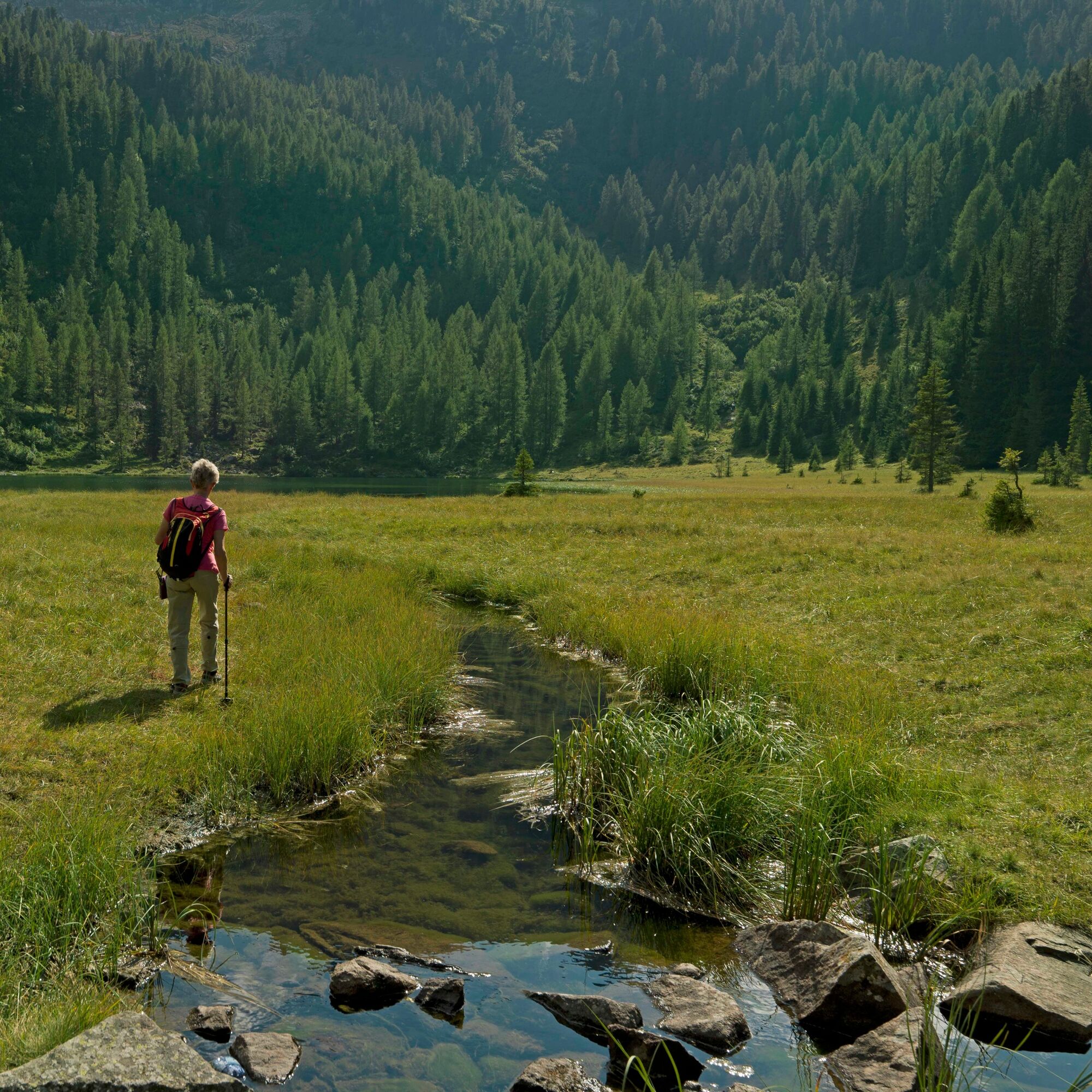
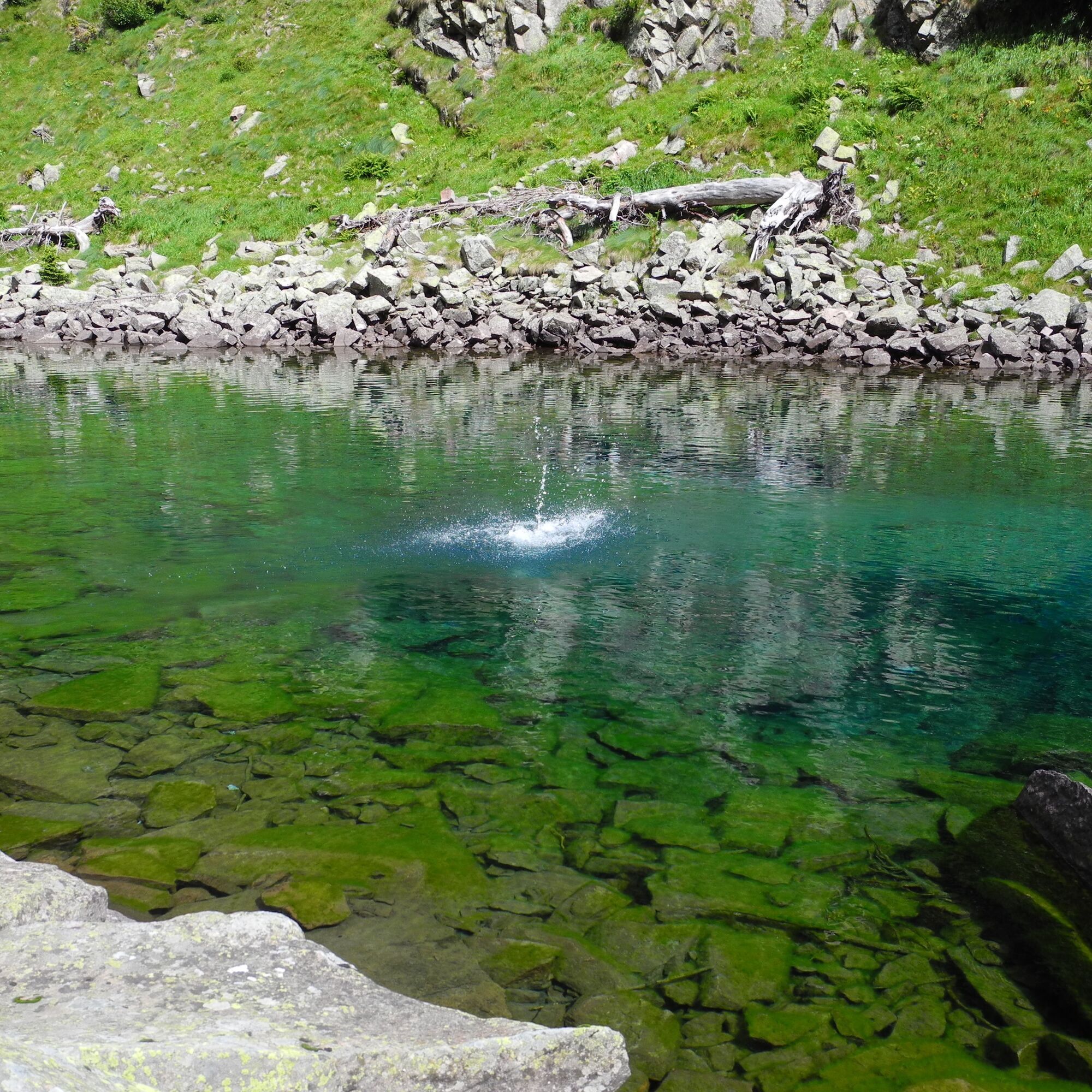
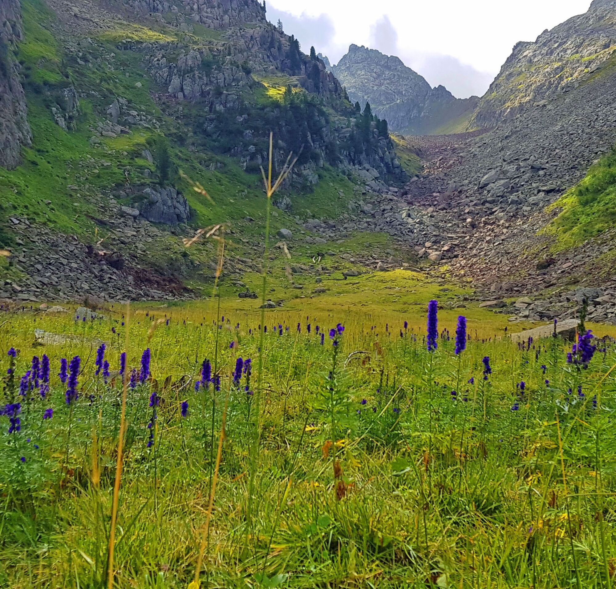
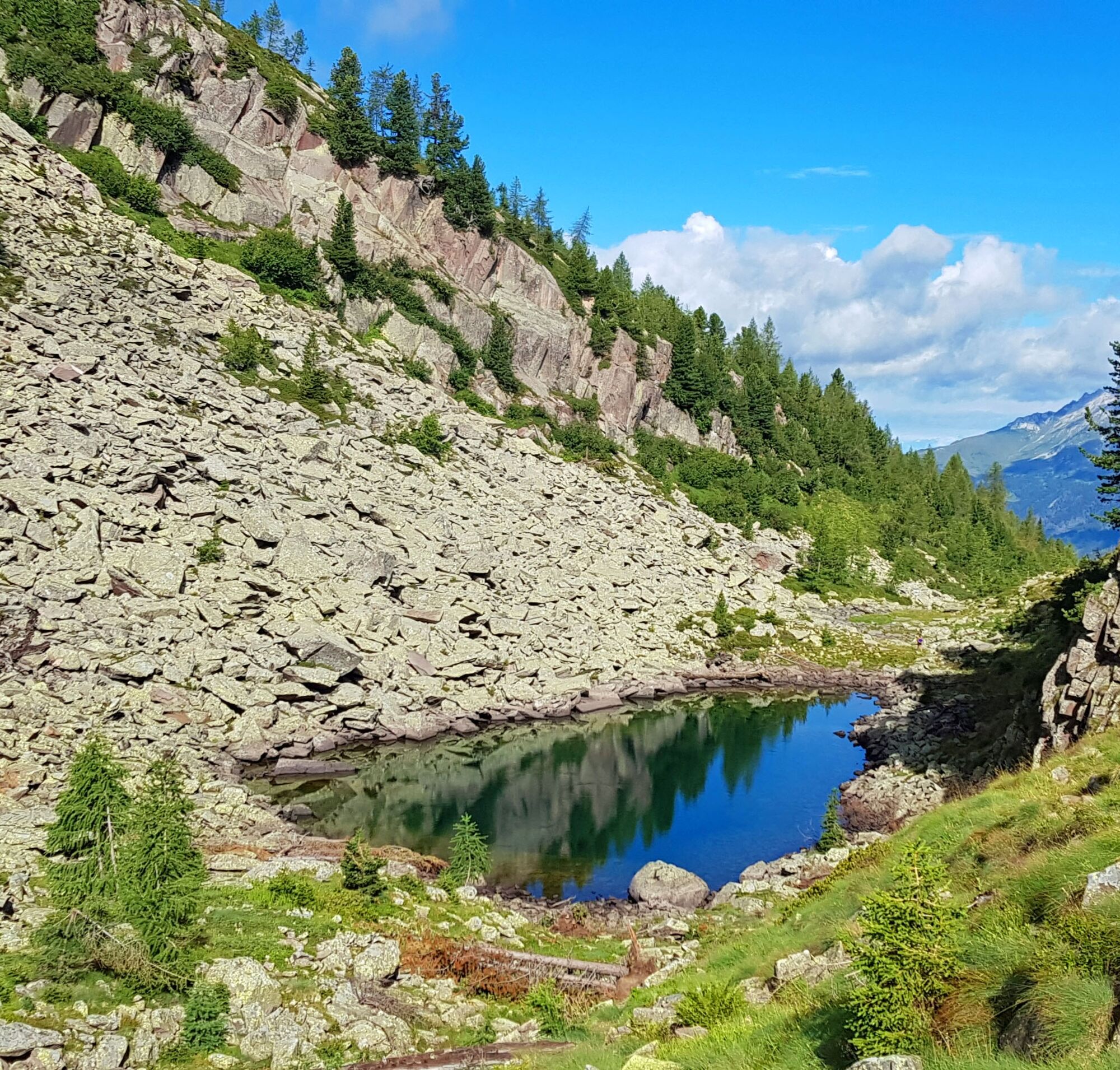
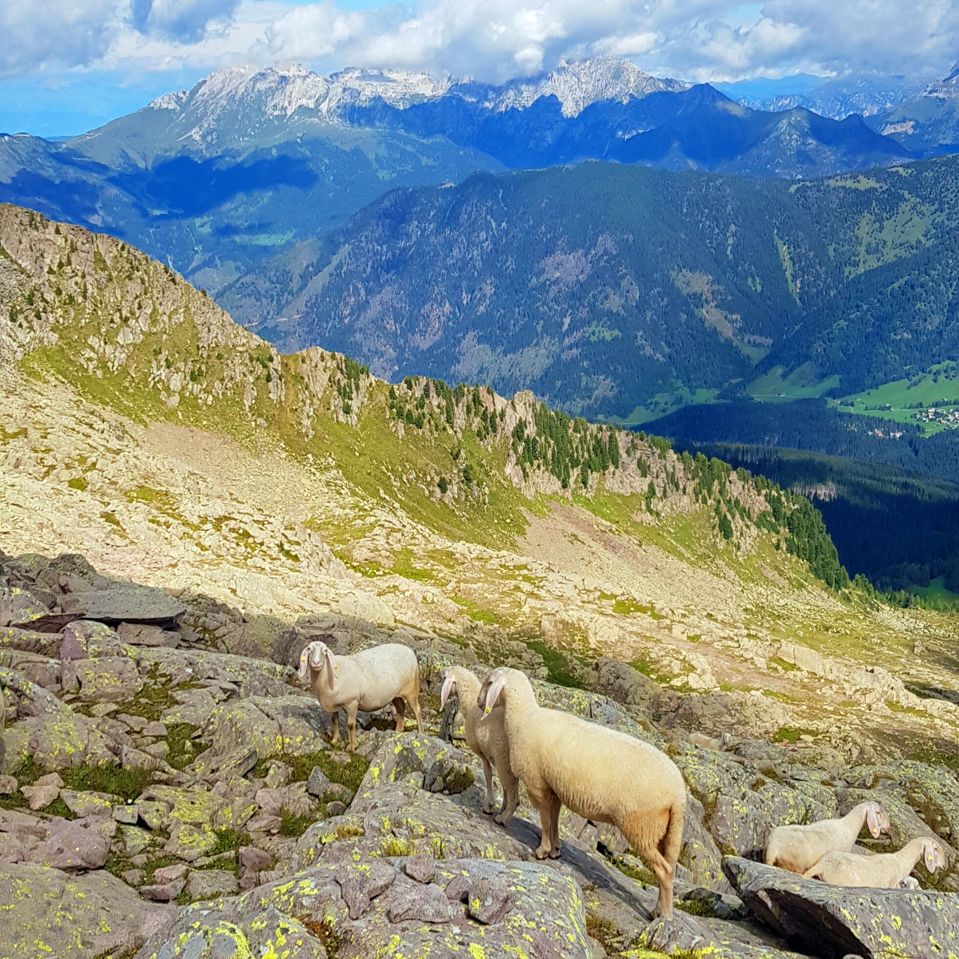
The summit cross that awaits you on the top is like a vision, after a very long but extremely satisfying excursion. In the initial part of the route there are two beautiful lakes: the basin of Lake Cece, and the picturesque lake Caserina, with an emerald green color. Once you reach the Forcella di Cece, you will go along the path of the legendary Translagorai until you reach the Paolo and Nicola bivouac. The detour quickly leads to the most coveted peak of the Lagorai. The path is of rare beauty. The wild Lagorai reserves glimpses of stone and rocks, panoramas as far as the eye can see, the emotion of being on the remains of the walkways of the First World War. You can find many tunnels dug into the rock by soldiers. From Caserina lake onwards it is likely that you will meet few hikers: you will be immersed in the silence of nature. Important: during the summer 2020 the bivouacs will remain closed.

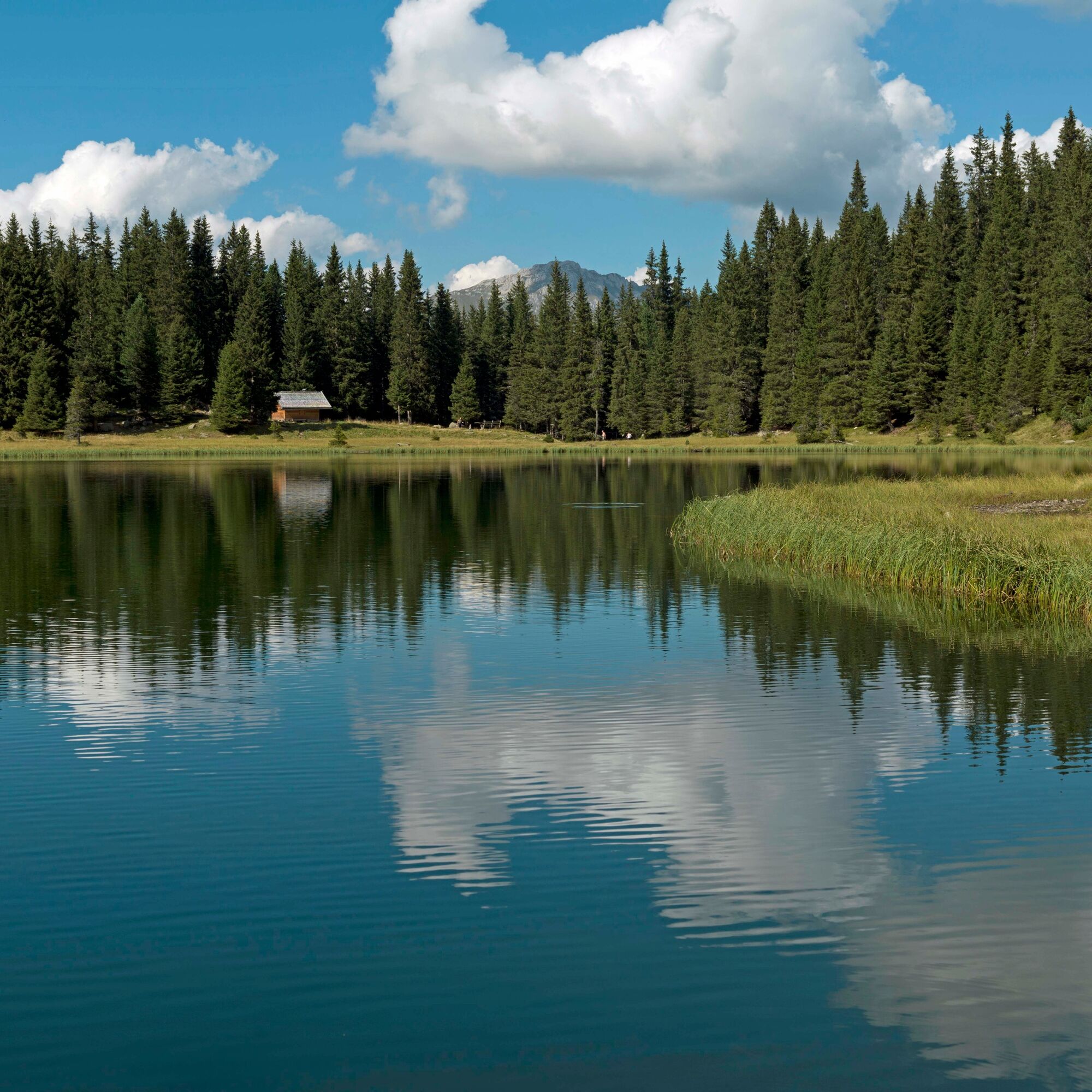
From Predazzo drive up to Valmaggiore. From the bridge just before Malga Valmaggiore (1.570 m) take trail No. 336 to Lago di Cece (1.879 m).
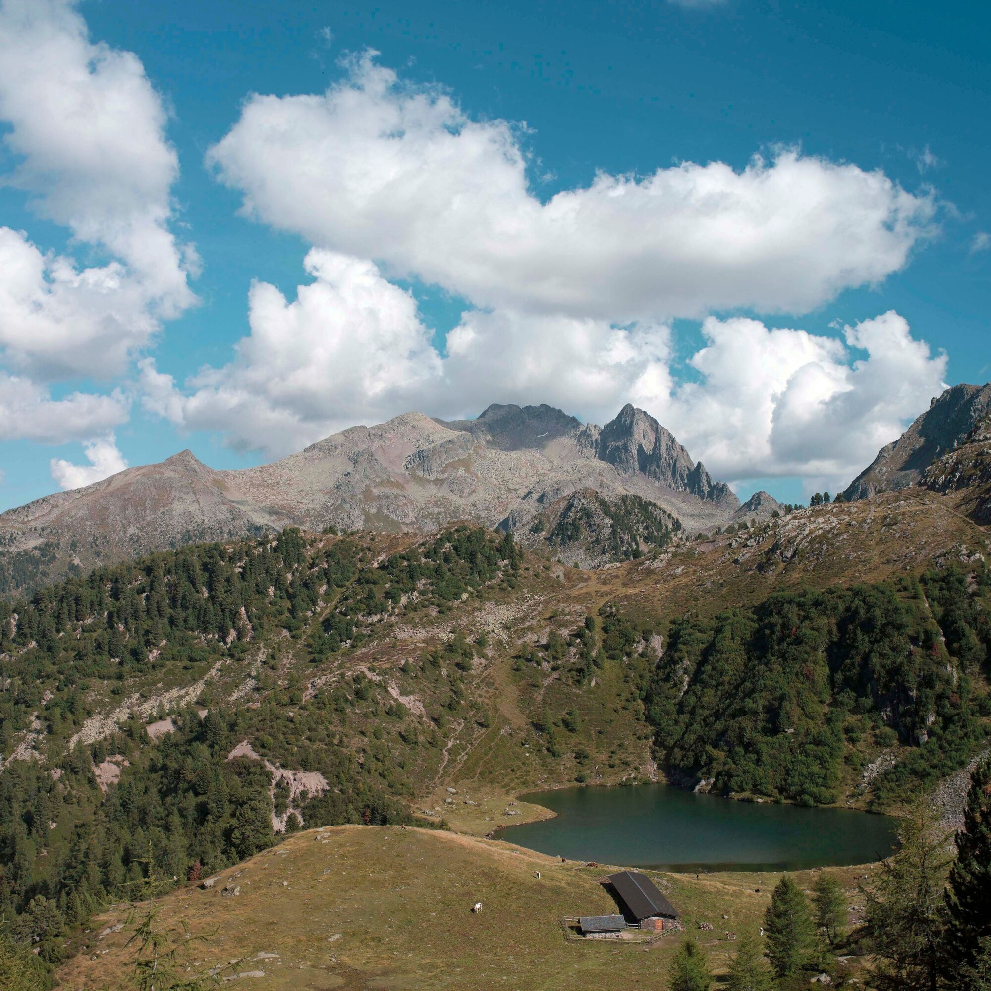
Continue along the same trail first to the beautiful Lago della Caserina (2.087 m) and then up to Forcella di Cece (2.393 m).
Take trail No. 349 and after one hour’s walk take the left turn which soon leads up to the summit of Cima Cece (2.754 m). Continuing along trail No. 349 descend to Forcella di Valmaggiore (2.180 m) along an ancient paved path, still perfectly preserved, that leads to Bivacco Paolo e Nicola. Follow trail No. 335 to return back to the car-park. SUMMER 2024: DAIRY VALMAGGIORE CLOSED
Da
Hiking shoes, rain-jacket, hiking poles, water, sun cream
THE 10 RULES FOR HIKERS
Prepare your itinerary beforehand Choose an itinerary that suits your physical abilities Choose suitable clothes and equipment Check the weather forecast Hiking by yourself is more risky; if this is the case, take a mobile phone with you Leave information about your itinerary and your expected return time If you are not sure about your itinerary, contact an Alpine Guide Pay attention to signposts and directions that you find along your way Do not hesitate in going back if you feel too tired In case of emergency call 112Please note that the practicability of the itineraries in a mountain environment is strictly linked to the contingent conditions and is therefore influenced by natural phenomena, environmental changes and weather conditions. For this reason, the information contained in this page may have changed. Before leaving for a tour, make sure the path you will approach is still accessible by contacting the owner of the mountain hut, the alpine guides or the visitor centres of the nature parks, the info offices of the local tourist board.
From Predazzo drive 7 km up to Valmaggiore
Before the bridge of Malga Valmaggiore
APT Val di Fiemme - Tel. +39 0462 241111 - info@visitfiemme.it - www.visitfiemme.it
The 360° view over the Dolomites (Pala group, Tofane, Marmolada, Sella group, Sasso Piatto, Rosengarten group, Latemar) and the Cima D’Asta, the Lagorai range, Fiemme valley and the mountains of Western Trentino.
Priljubljeni izleti v okolici
-
4.8
Torre di Pisa mountain hut
srednjaPohodništvo 9.09 km -
5.0
Latemar Umrundung - die Kurze und Bequeme
srednjaPohodništvo 12.1 km -
4.8
Latemar Tour - Tour 930
srednjaMountainbike 37.4 km -
4.8
Cavallazza Peak
srednjaPohodništvo 7.82 km -
5.0
The amazing Val Venegia and Baita Segantini - Tour 934
srednjaMountainbike 18.6 km -
2.0
The amazing Val Venegia
srednjaPohodništvo 12.3 km -
4.5
Tour of Lusia Lakes
srednjaPohodništvo 13.0 km -
4.3
The three lakes
srednjaPohodništvo 11.1 km -
5.0
Tour of Monte Cornon
srednjaPohodništvo 7.65 km -
5.0
Cima d’Asta (vetta via normale)
srednjaPohodništvo 17.5 km
Pohodništvo in sledenje


Ne zamudite ponudb in navdiha za naslednje počitnice
Vaš e-poštni naslov je bil dodan na poštni seznam.