


Monte Casale
Fotografije naših uporabnikov
 © Antero Varini de PaulaUstvarjeno na 26.04.2026
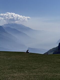 © Antero Varini de PaulaUstvarjeno na 26.04.2026
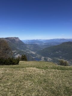 © Antero Varini de PaulaUstvarjeno na 26.04.2026
 © Antero Varini de PaulaUstvarjeno na 26.04.2026
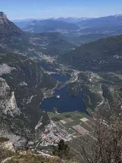 © Antero Varini de PaulaUstvarjeno na 26.04.2026
 © Daniele SpeziaUstvarjeno na 17.12.2023
 © Daniele SpeziaUstvarjeno na 17.12.2023
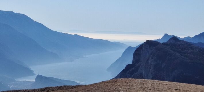 © Daniele SpeziaUstvarjeno na 17.12.2023
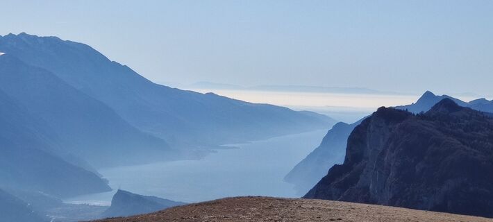 © Daniele SpeziaUstvarjeno na 17.12.2023
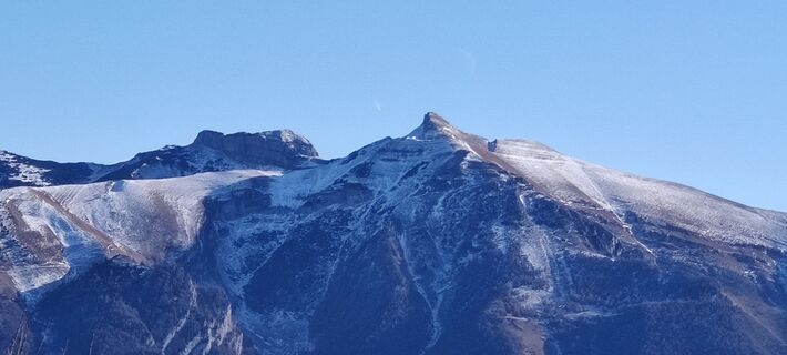 © Daniele SpeziaUstvarjeno na 17.12.2023
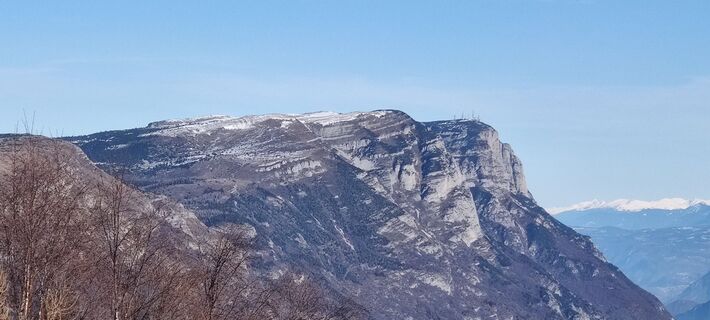 © Daniele SpeziaUstvarjeno na 17.12.2023
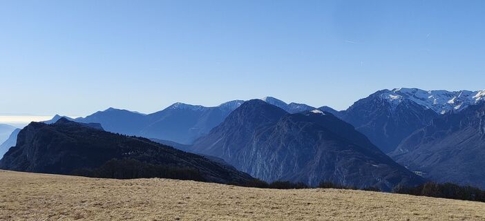 © Daniele SpeziaUstvarjeno na 17.12.2023
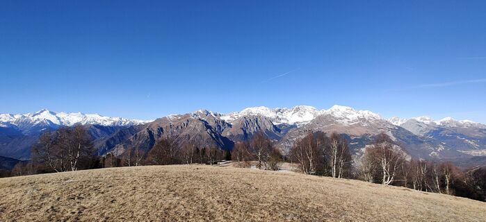 © Daniele SpeziaUstvarjeno na 17.12.2023
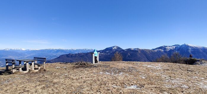 © Daniele SpeziaUstvarjeno na 17.12.2023
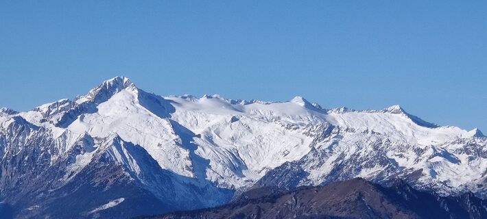 © Daniele SpeziaUstvarjeno na 17.12.2023
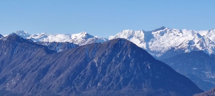 © Daniele SpeziaUstvarjeno na 17.12.2023
 © Daniele SpeziaUstvarjeno na 17.12.2023
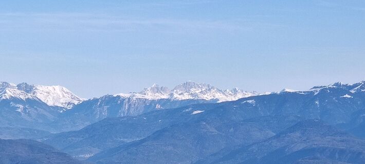 © Daniele SpeziaUstvarjeno na 17.12.2023
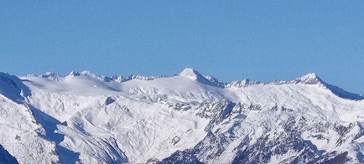 © Daniele SpeziaUstvarjeno na 17.12.2023
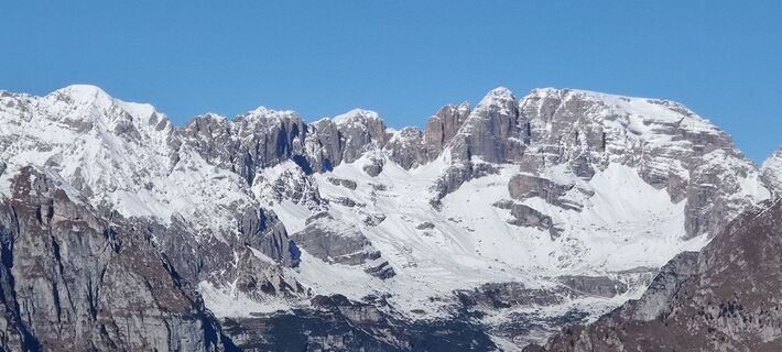 © Daniele SpeziaUstvarjeno na 17.12.2023
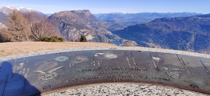 © Daniele SpeziaUstvarjeno na 17.12.2023
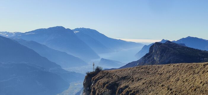 © Daniele SpeziaUstvarjeno na 17.12.2023
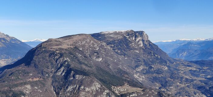 © Daniele SpeziaUstvarjeno na 17.12.2023
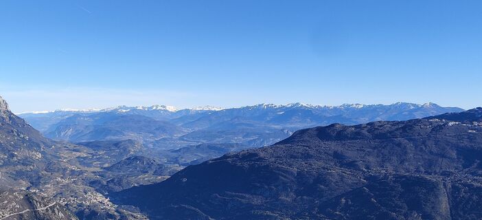 © Daniele SpeziaUstvarjeno na 17.12.2023
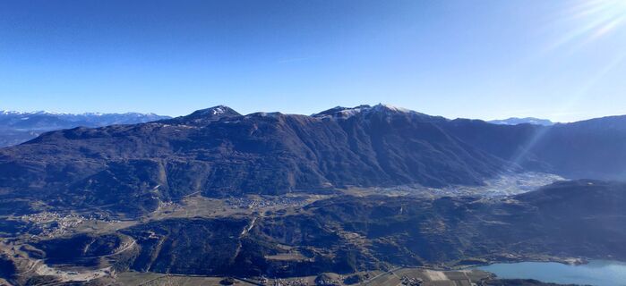 © Daniele SpeziaUstvarjeno na 17.12.2023
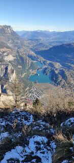 © Daniele SpeziaUstvarjeno na 17.12.2023
 © Daniele SpeziaUstvarjeno na 17.12.2023
 © Daniele SpeziaUstvarjeno na 17.12.2023
 © Daniele SpeziaUstvarjeno na 17.12.2023
 © CornihUstvarjeno na 25.09.2024
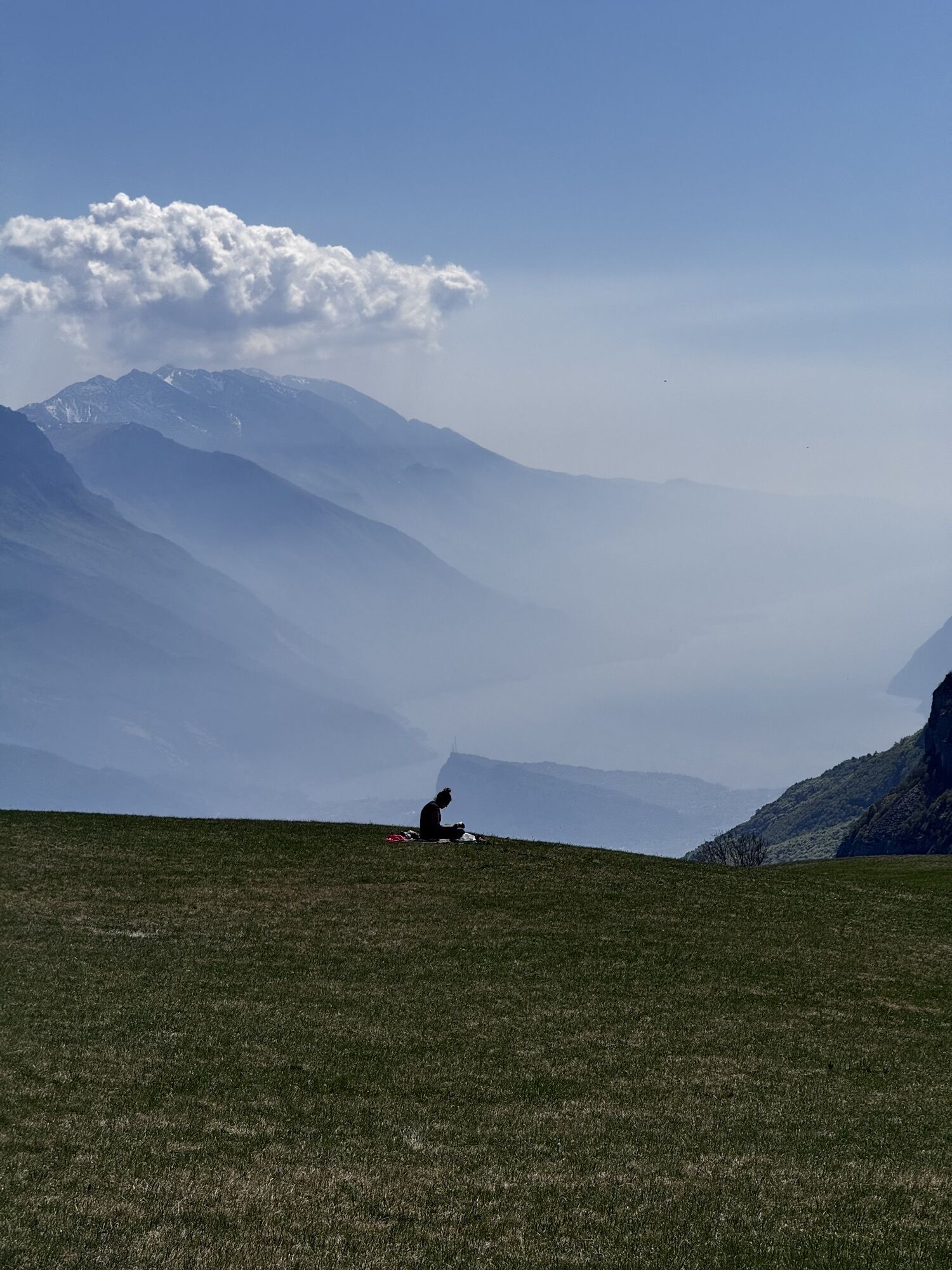
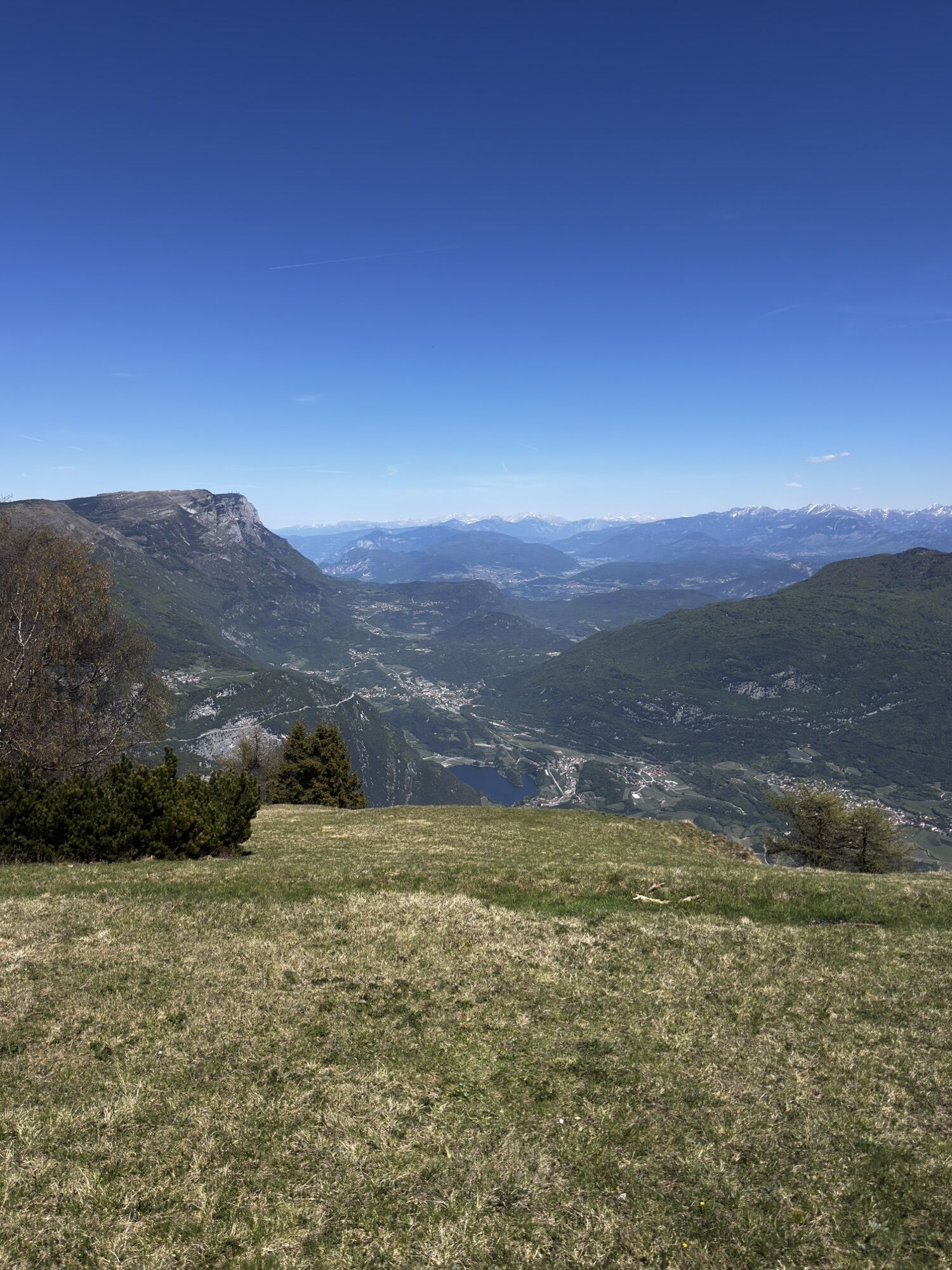
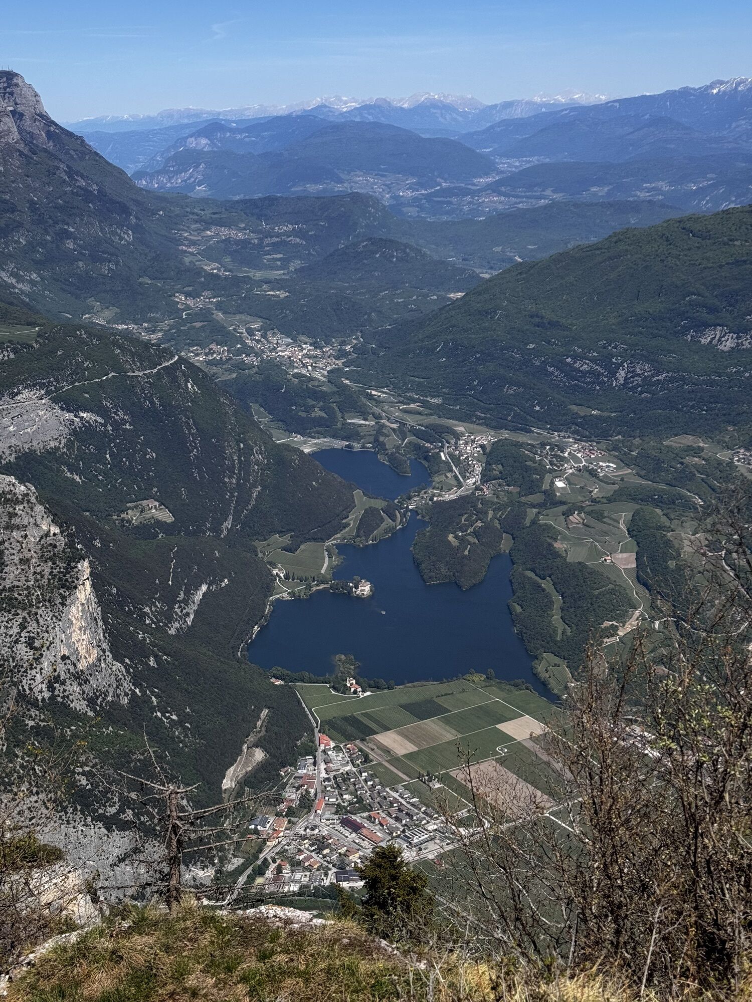
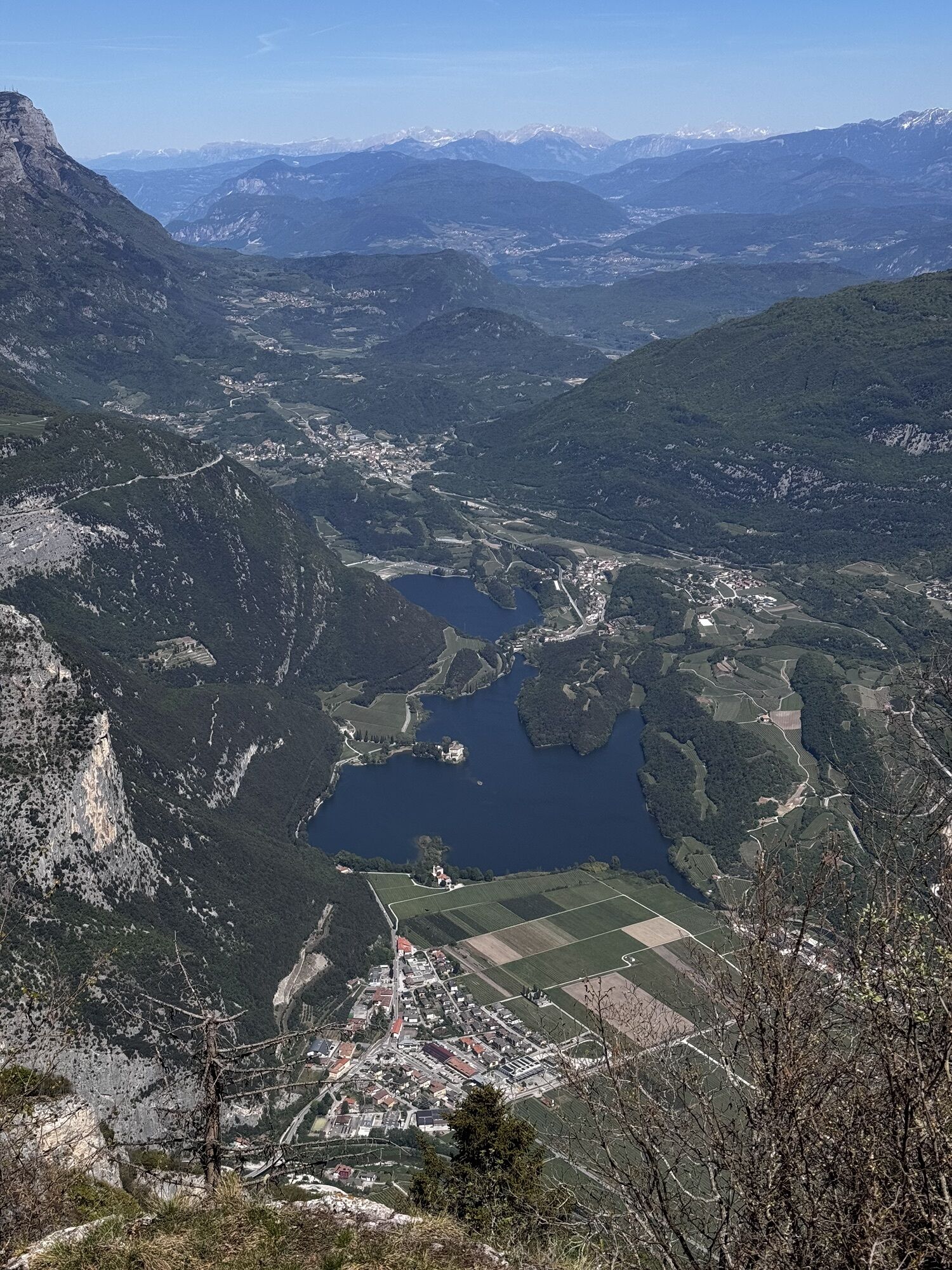
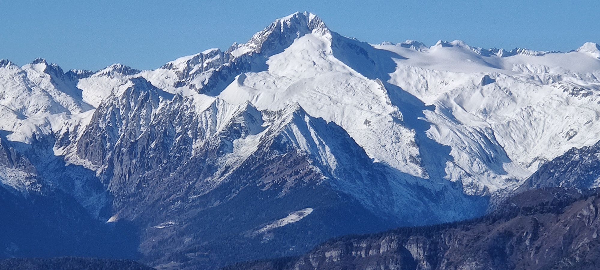
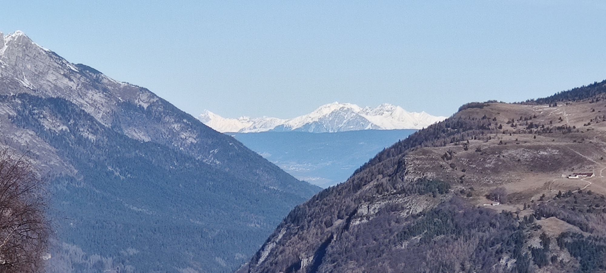

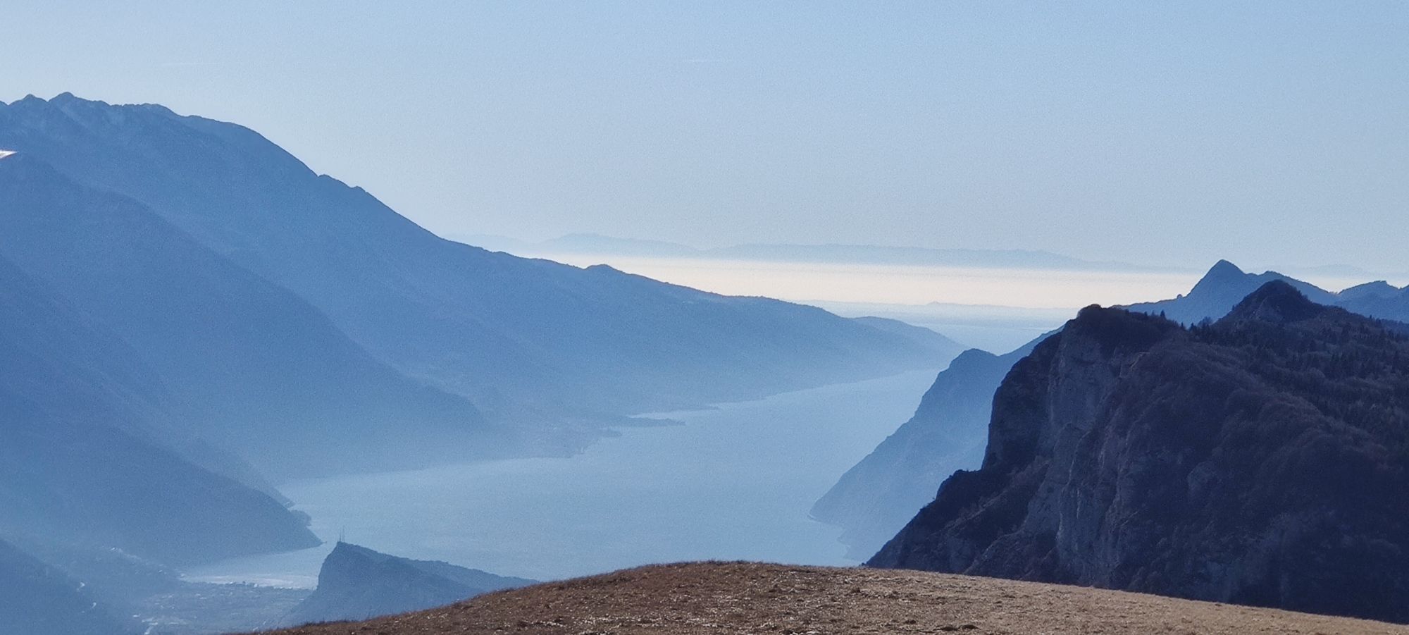


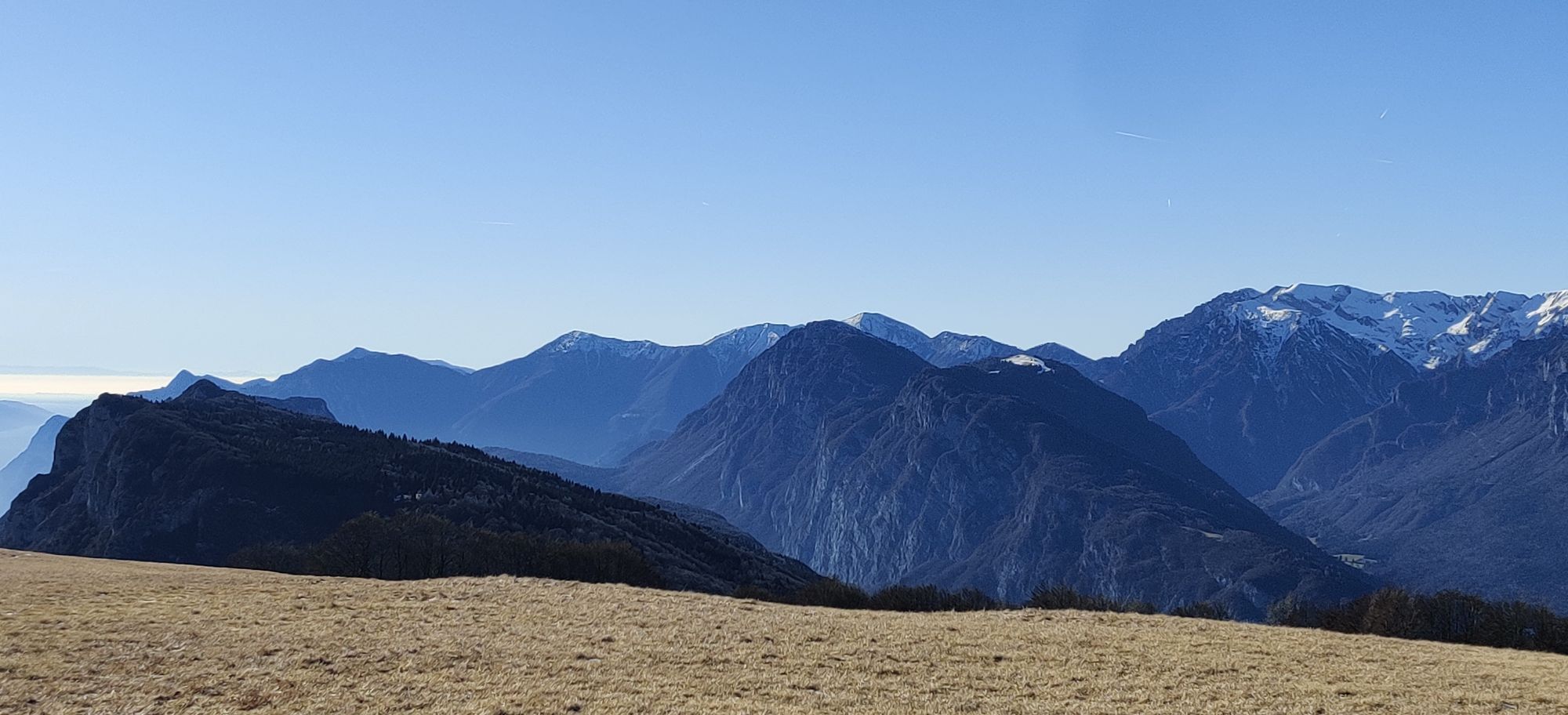
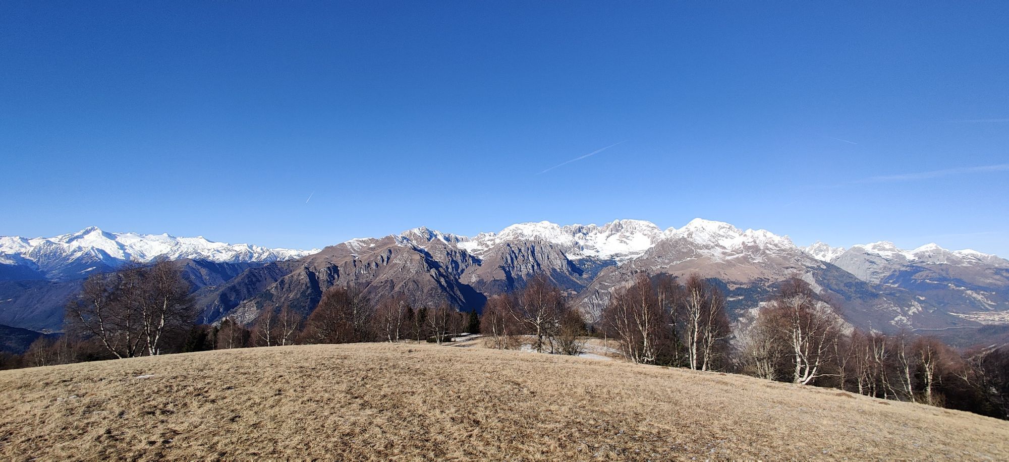


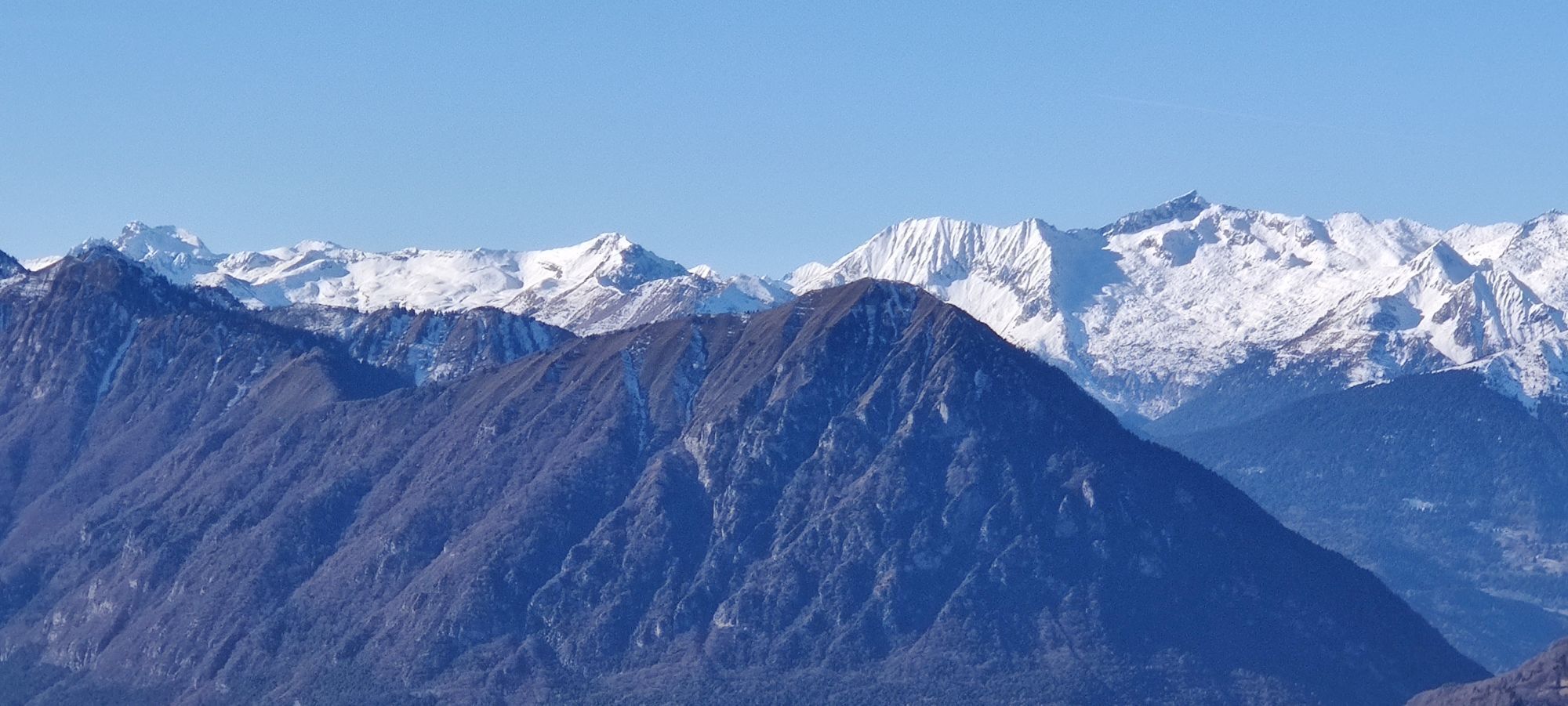
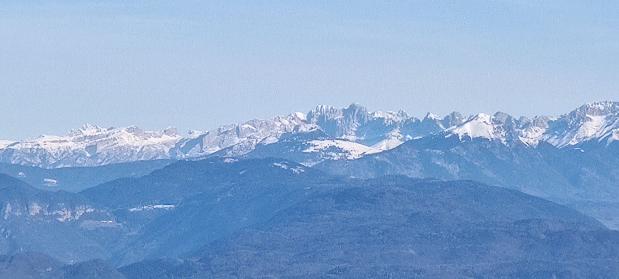
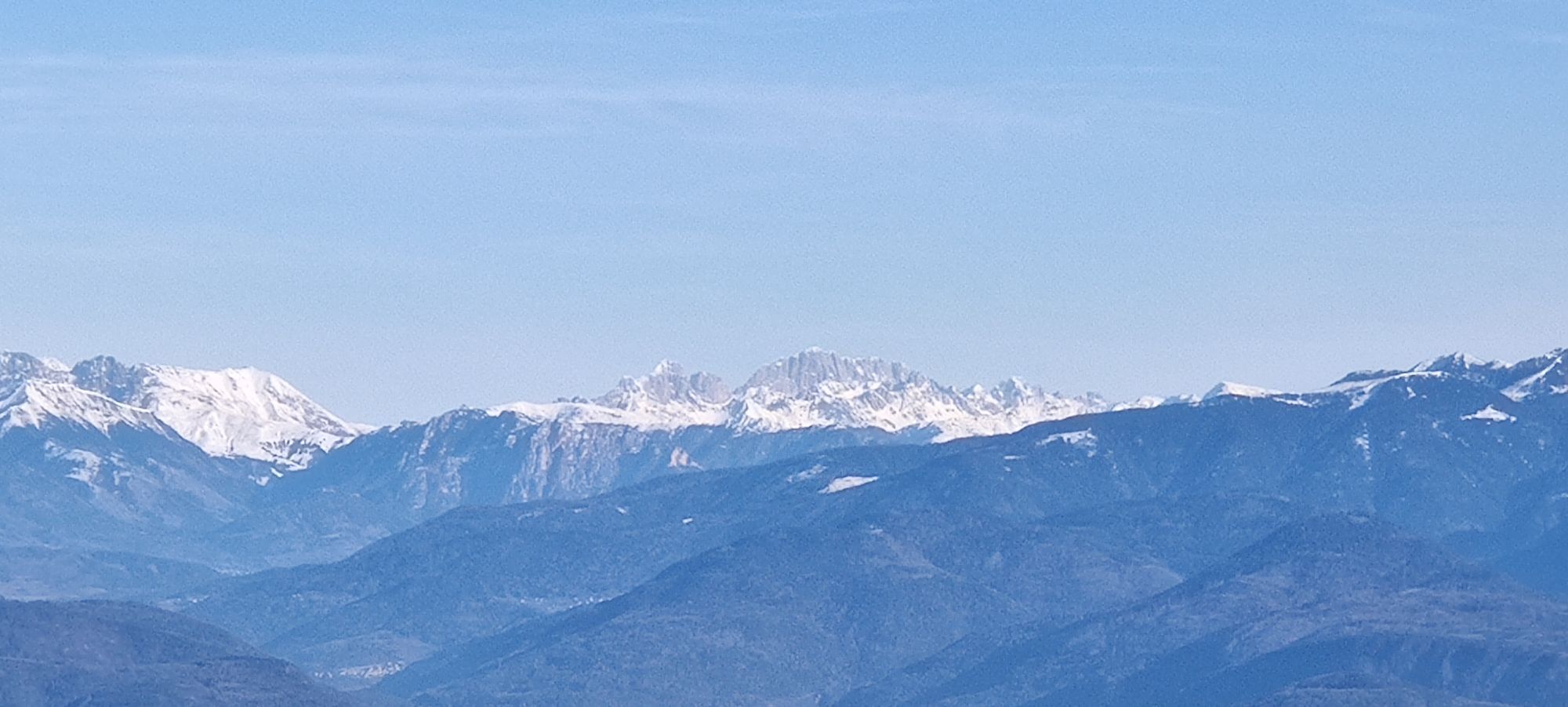

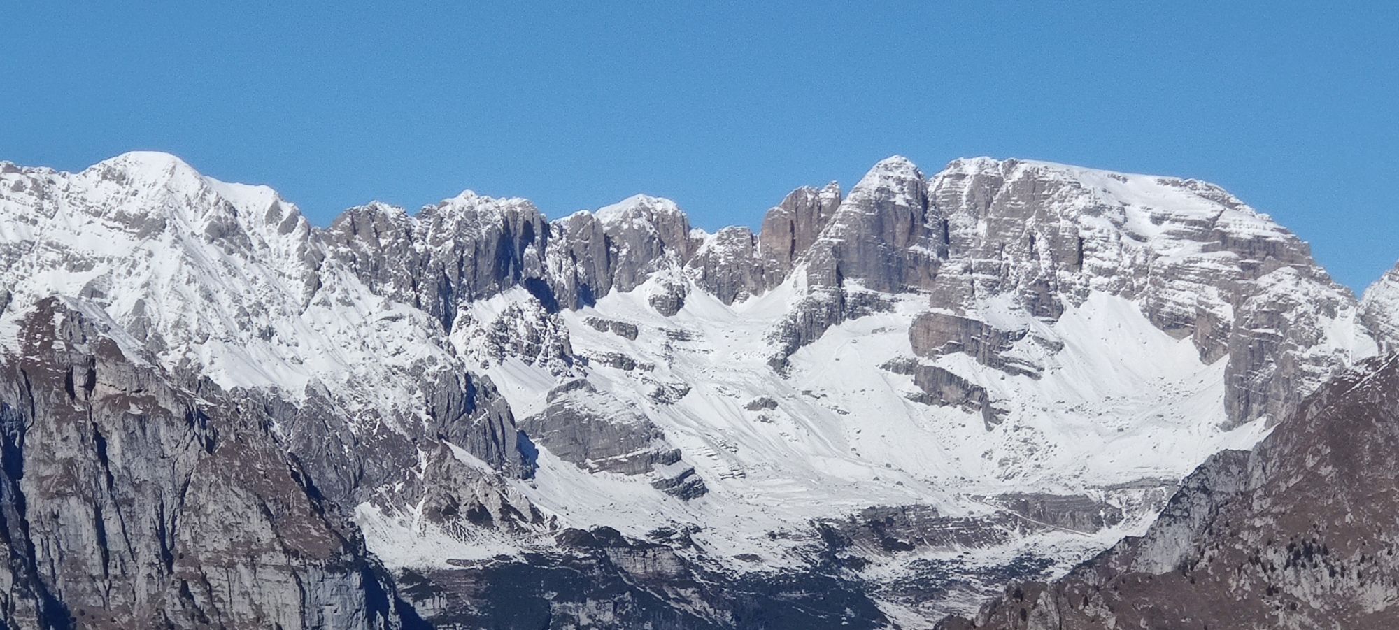


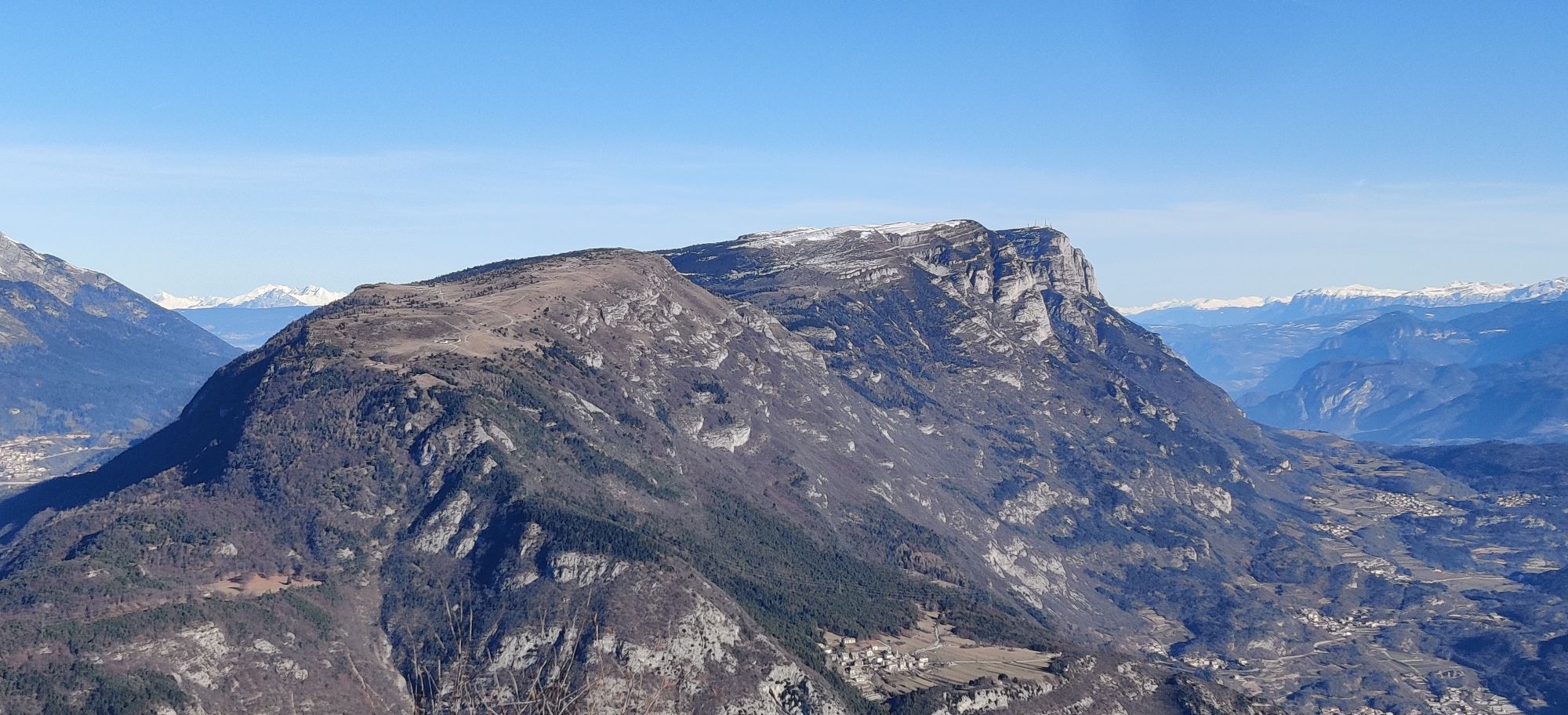


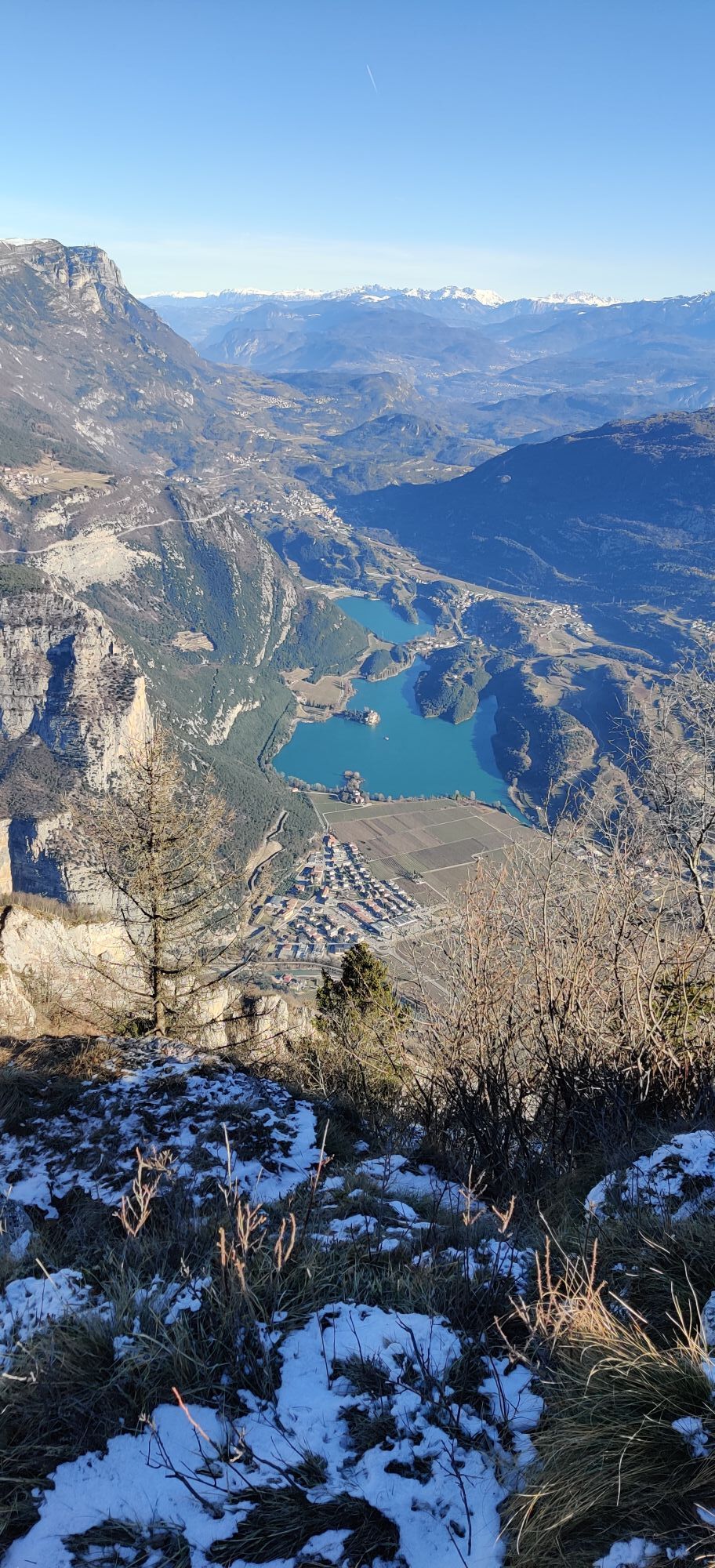
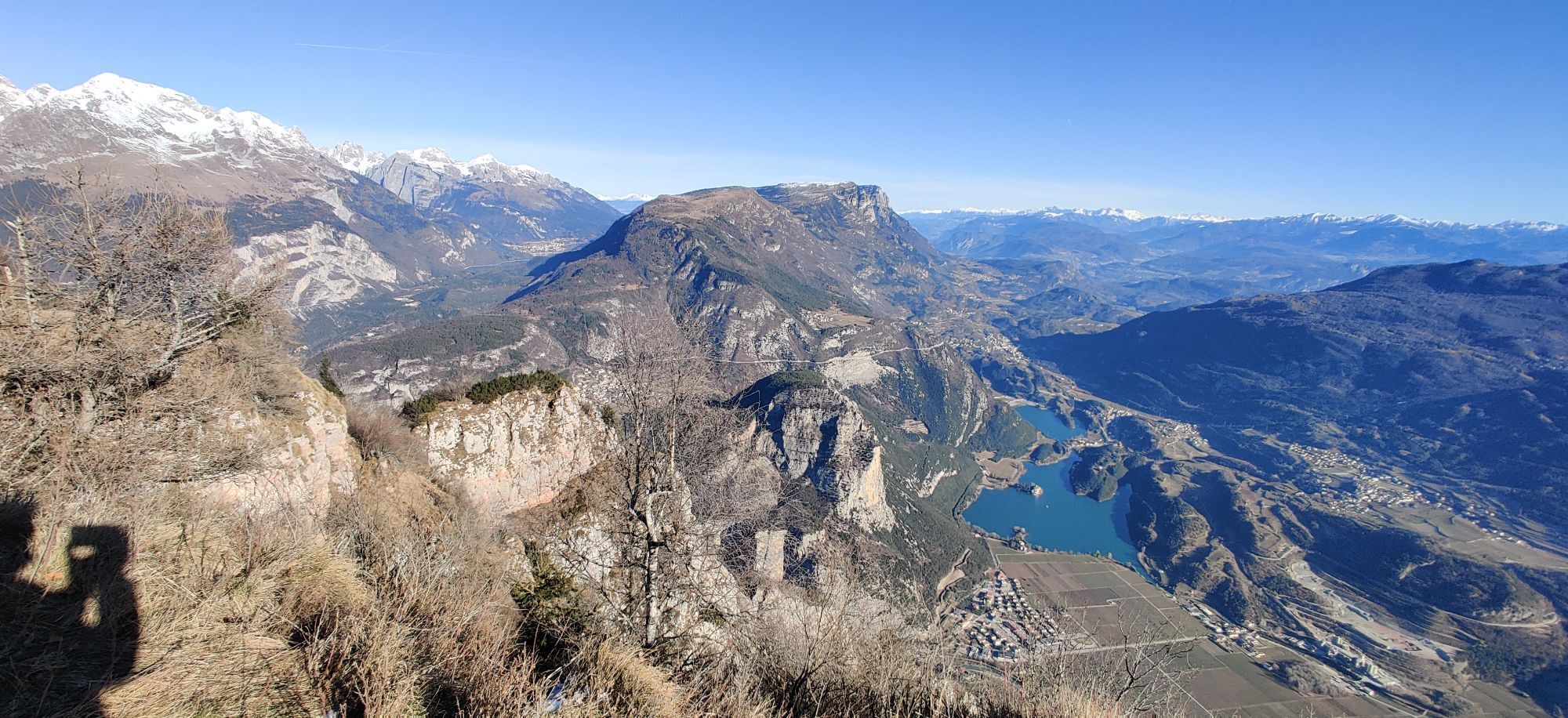
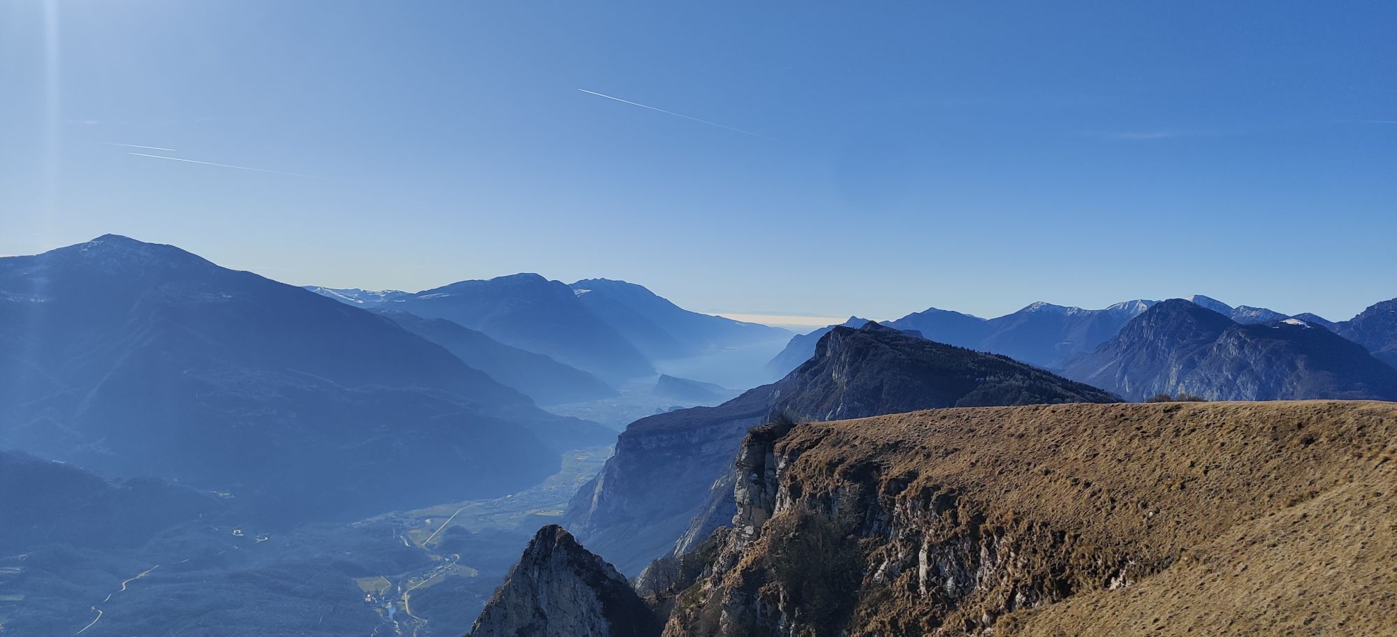
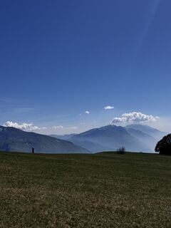
Monte Casale offers the most scenic view over the valley. You can admire all the mountain peaks towering on the horizon: from the Fiemme & Fassa Dolomites to the Bondone, from the Ladrensi Alps to the...
Monte Casale offers the most scenic view over the valley. You can admire all the mountain peaks towering on the horizon: from the Fiemme & Fassa Dolomites to the Bondone, from the Ladrensi Alps to the Adamello Group, over to the Presanella and the Ortles, the Brenta range and the Paganella. Below them, Lake Molveno, Lake Toblino & S. Massenza, with Lake Cavedine, Lake Tenno, Lake Terlago and finally Lake Garda.
Itinerary: Comano Paese, Monte Casale Rifugio Don zio Pisono, Comano Paese.


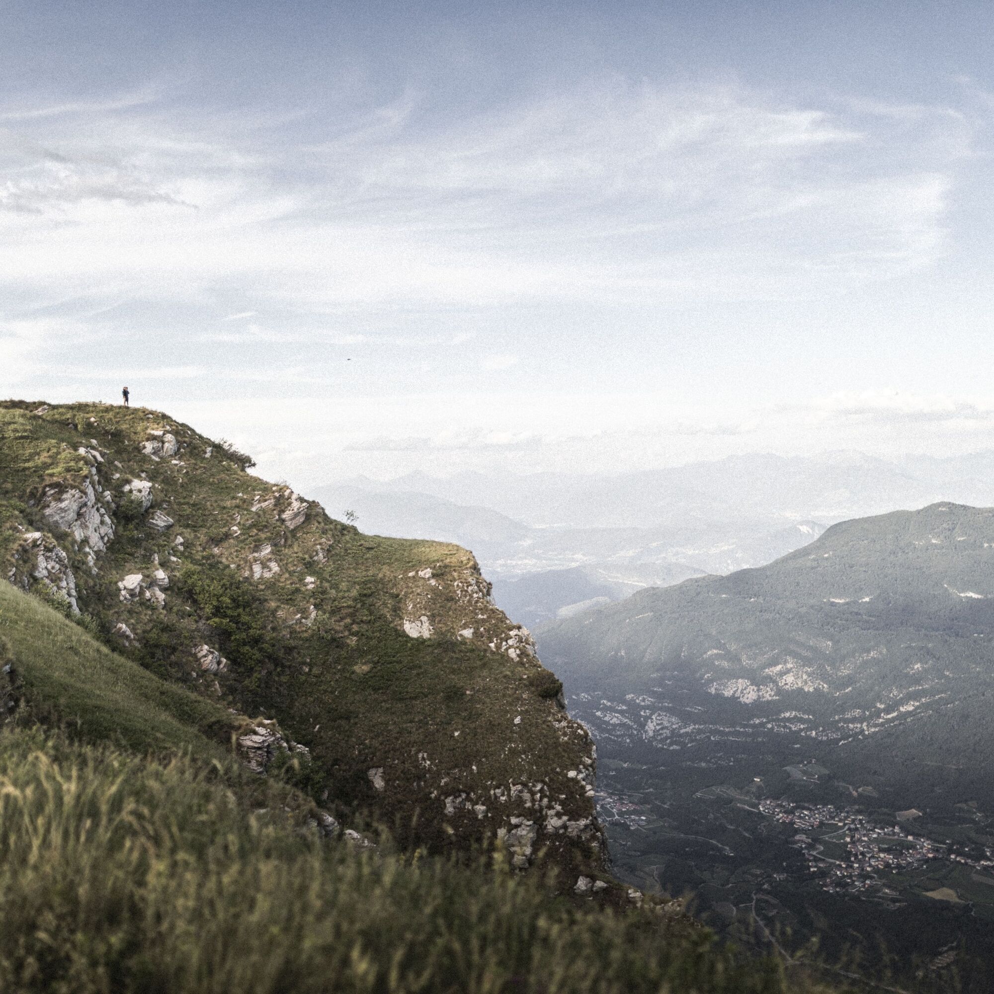
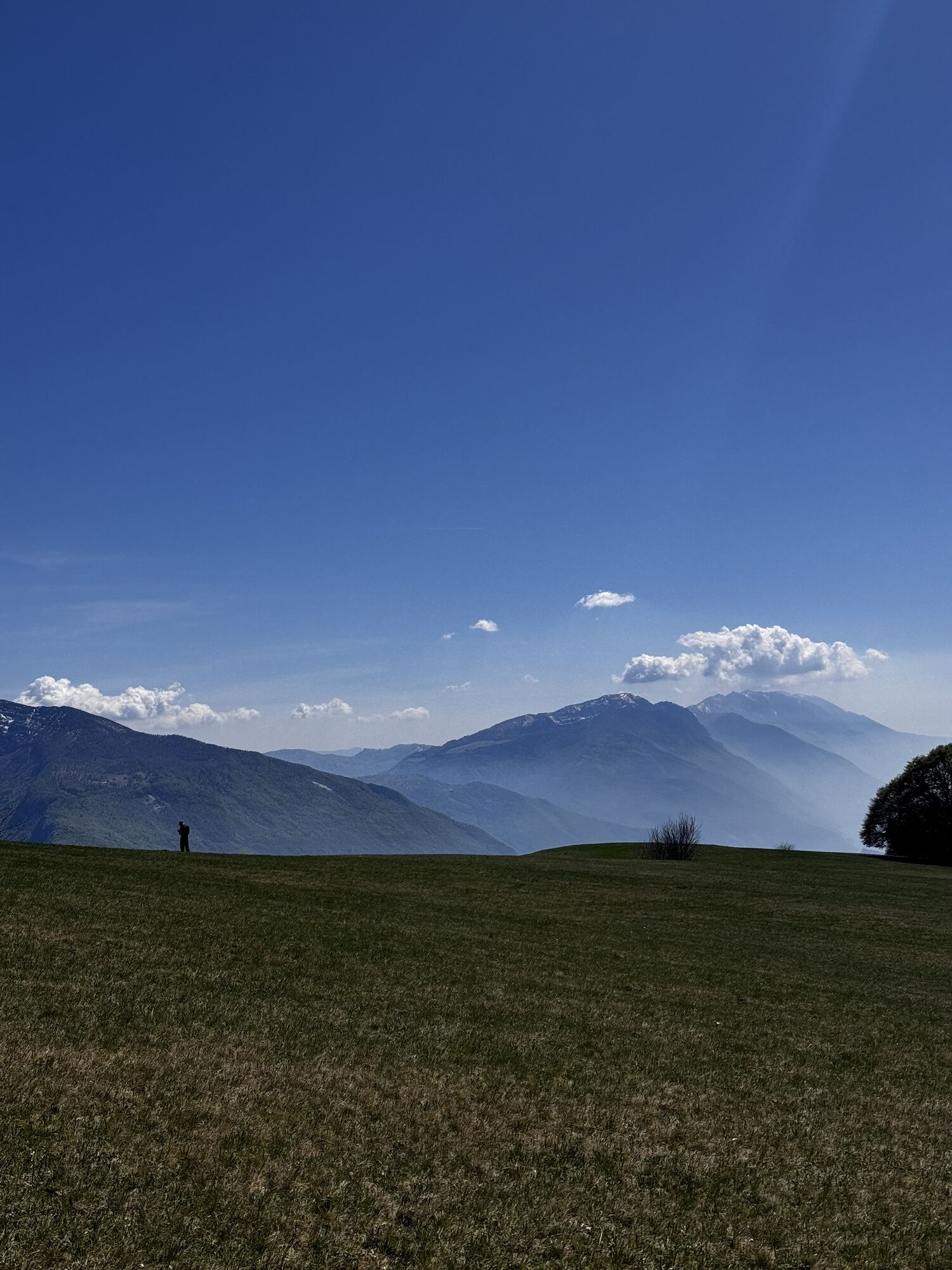
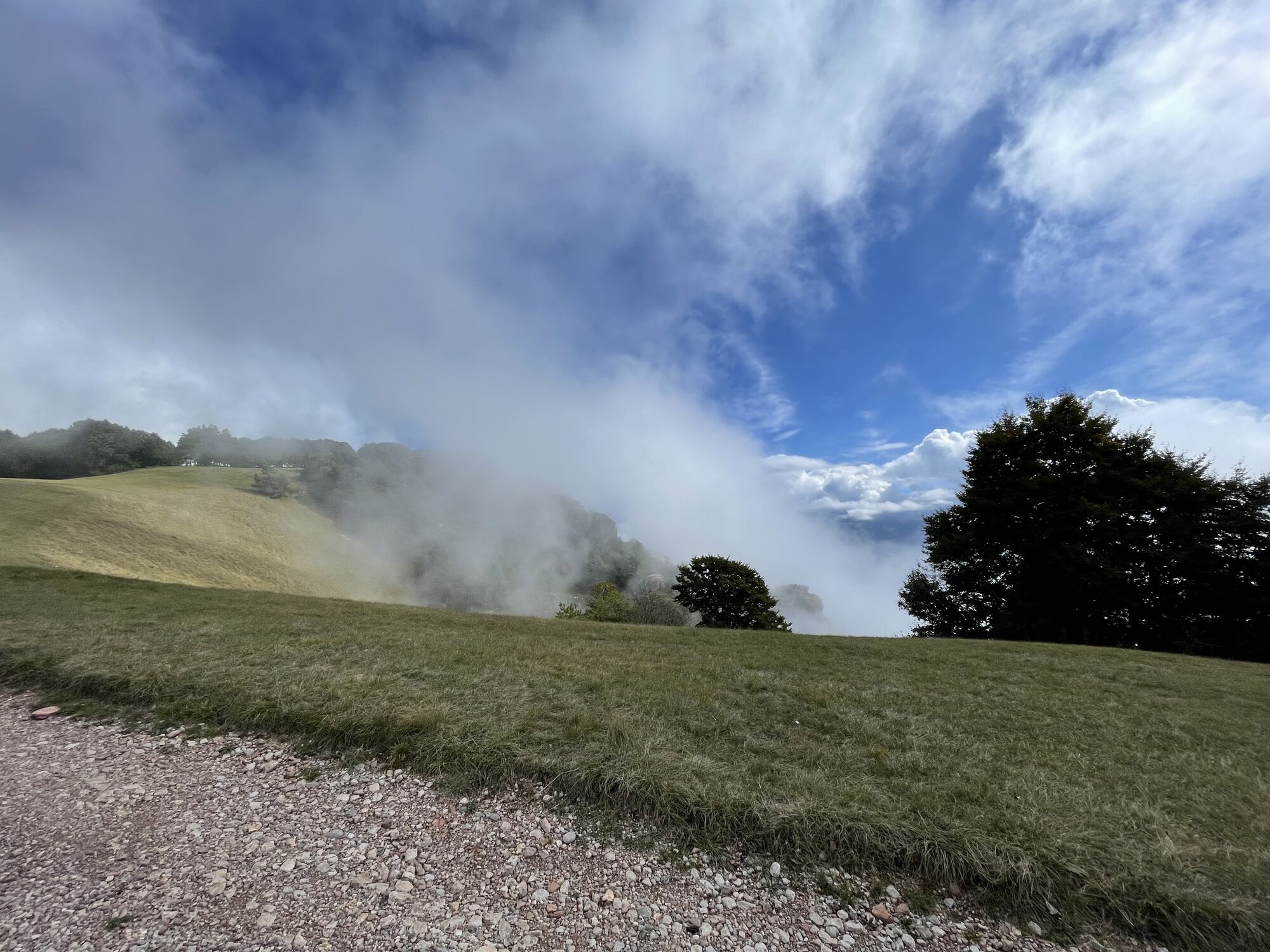
From Comano start climbing along the SAT 411 until you reach Monte Casale. En route you will come to “Le Quadre” area. Here, the view stretches to the horizon revealing a unique spectacle that only nature can offer: stunning panoramas, rolling luscious fields, green pasture and the entire valley with its hamlets dotted around the vast plain. After walking for about 15 minutes through the grassy fields you will reach the top of Monte Casale. Here, you will find a sign with arrows pointing in different directions to easily spot each peak and mountain range. Further ahead, a big iron cross close to the sheer drop over the Lakes Valley. Those with not much training in their legs can drive up to the sign restricting vehicular entry, near the television aerials, and continue on foot. Those who, instead, wish to enjoy the panorama without any physical effort, can purchase a daily permit – from the Panoramica Hotel in Comano- and reach the car park near the fields only 15 minutes from Capanna Don Zio.
Da
You need to wear the right clothing and take the proper gear when you go hiking in the mountains. Even on relatively short easy outings make sure to take all you need so you don't run into trouble if things take an unexpected turn, for example a storm blows up or you have a sudden drop in energy levels.
What should you take when you go on a hike?
Your rucksack (for a day trip a 25/30L capacity should do) should contain:
water canteen (1L) snacks (e.g. mixed dried fruit or chocolate) First aid kit windproof jacket fleece change of t-shirt and socks (in a plastic bag) make sure to wear or at least bring a pair of long trousers hat sun screen sunglasses gloves whistle to attract attention in an emergencyMake sure you're wearing the right footwear for the trail and season. The going can get rough and rocky underfoot and a pair of hiking boots will protect you from sprains. When wet, a grassy slope, rocky slab or steep trail can be dangerous unless you are wearing the proper footwear.
And finally... don't forget to bring your camera! You'll need it to capture the stunning views you come across all over Garda Trentino. And if you like, you can share your memories with us at #GardaTrentino.
Emergency telephone number 112.
Safety Tips
Choose itineraries that suit your physical and technical abilities. Collect information about the area you are visiting and the trail’s conditions and get a detailed trekking map. Wear clothes and take equipment that suit the difficulty and length of your tour. Keep emergency gear in your rucksack, including first aid supplies. Do not go walking alone in the mountains. In any case, tell someone where you are going and report back on returning. Look at the weather forecast before setting off and always keep an eye on the weather. In case of doubt, go back. It is better to give up than risk bad weather or face difficulties beyond your strength, ability and equipment. Do not leave marked paths and do not take shortcuts. All described walks are in a natural environment and therefore their use is at your own risk.This information is subject to inevitable variations, so none of these indications are absolute. It is not entirely possible to avoid giving inexact or imprecise information, given how quickly environmental and weather conditions can change. For this reason, we decline any responsibility for changes which the user may encounter. In any case, it is advisable to check environment and weather conditions before setting out.
From Ponte Arche/Comano Terme take the SP (provincial road) heading to Comano Paese (4 km). From here follow the signage.
Find out how to reach Garda Trentino.
The area around Comano is connected by the intercity bus lines 211 (Riva del Garda - Tenno - Fiavè - Ponte Arche) and 201 (Trento - Ponte Arche - Campiglio – Tione) to the other places in Garda Trentino.
Free parking in Via San Giacomo (Comano paese).
For more information on routes, services (guides, mountain huts, shops etc.) and hiking friendly accommodation: Garda Trentino - +39 0464 554444
We suggest to organize an excursion to the top of Monte Casale during the spring and autumn when the colours of nature are brilliant.
Priljubljeni izleti v okolici
- 4,8
Via Ferrata Rio Sallagoni
srednjaVia ferrata 2,75 km - 5,0
Via Ferrata Signora delle Acque - Rio Ruzza
težkoVia ferrata 5,32 km - 4,6
Colodri Klettersteig (A/B)
Via ferrata 7,50 km - 4,4
Lakes Cycle Path: Torbole – Sarche
srednjaKolesarjenje 24,8 km - 4,2
Sentiero dell'Anglone + Sent. Scaloni (A/B)
Via ferrata 7,01 km - 4,5
From Malga Campo to Monte Stivo
srednjaPohodništvo 8,46 km - 3,8
Monte Velo - Tour
težkoMountainbike 29,4 km - 4,2
Monte Colodri - Colt
srednjaPohodništvo 9,94 km - 4,5
Hiking to the mountain hut San Pietro on Monte Calino
srednjaPohodništvo 9,13 km - 5,0
Laghel - Tour
srednjaMountainbike 10,3 km
Pohodništvo in sledenje


Ne zamudite ponudb in navdiha za naslednje počitnice
Vaš e-poštni naslov je bil dodan na poštni seznam.