


Mountain route - Hochplatte


This enjoyment route really has a lot to offer: besides the breathtaking views of the Wetterstein, the Allgäu and Lechtal Alps as well as the lakes of the Alpine foothills, the Hochplatte crossing features...
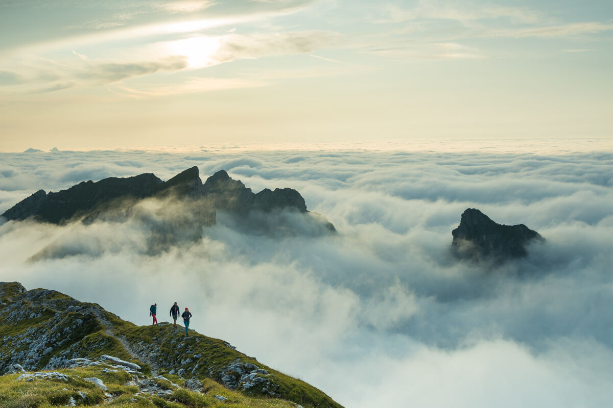
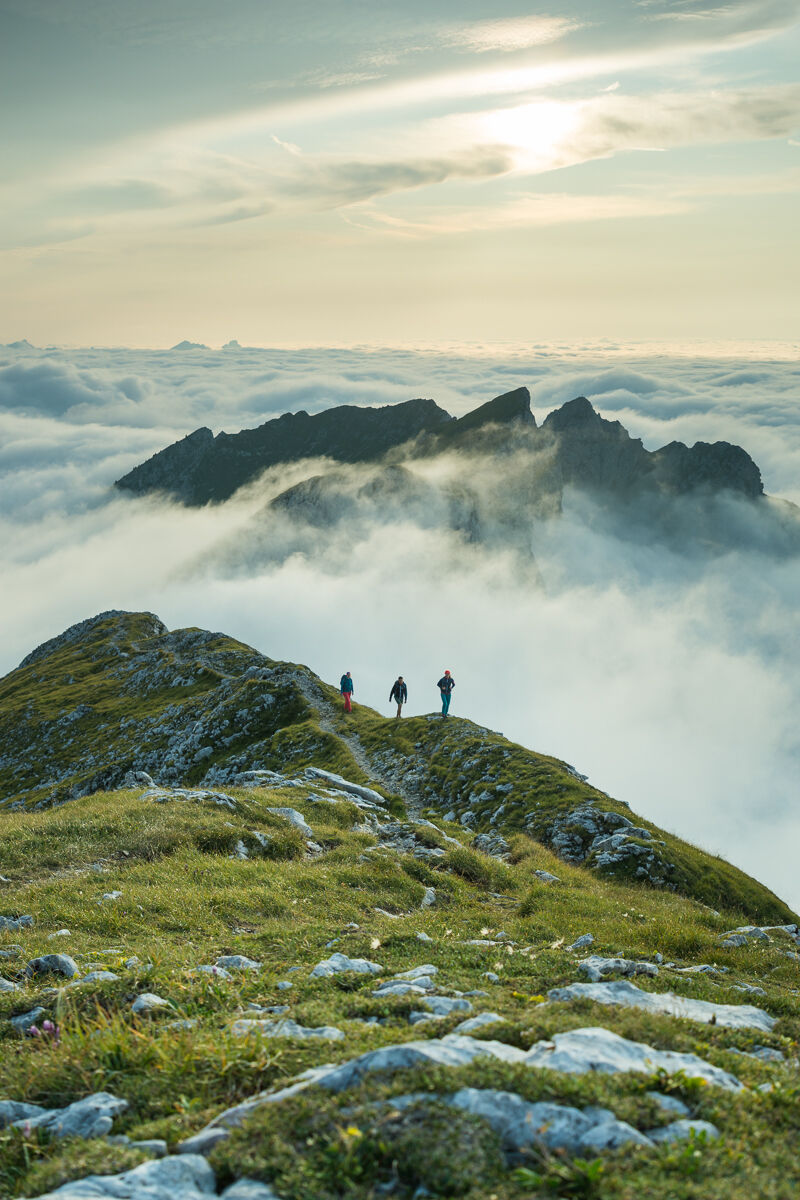
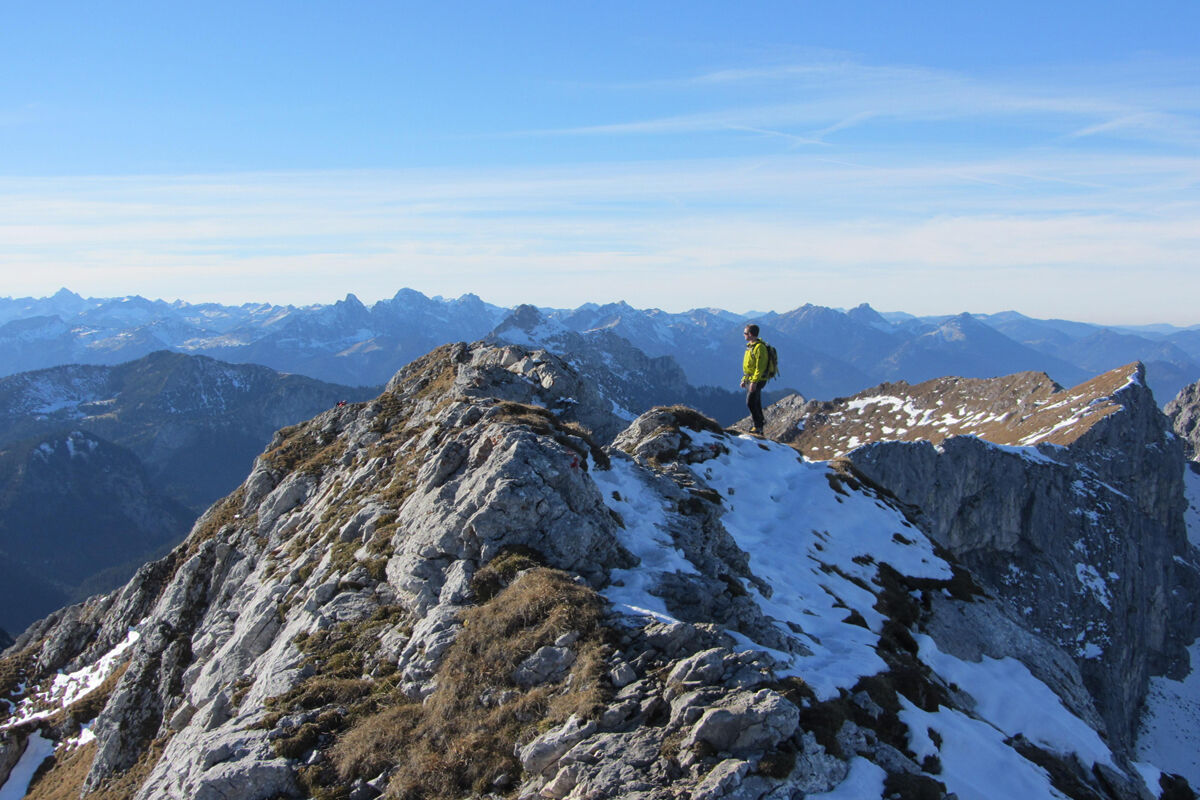
This enjoyment route really has a lot to offer: besides the breathtaking views of the Wetterstein, the Allgäu and Lechtal Alps as well as the lakes of the Alpine foothills, the Hochplatte crossing features an airy ridge walk, short scrambling sections, and a hole in the rock.
The ascent via the Fensterl is somewhat more challenging than the summit scramble via the Weitalpjoch. However, you must be sure-footed and free from fear of heights on both ascent variants.

You leave the car park directly at the Ammerwaldalm via the forest road, which leads into the forest past the alm on the left.
As soon as you reach the Roggentalbach, turn onto the narrow path on the right side of the stream bed. After a few minutes, you cross an old wooden bridge and switch to the left side of the creek. The path now winds steeply up the slope. After about an hour, you reach a junction where you turn left towards the Fensterl.
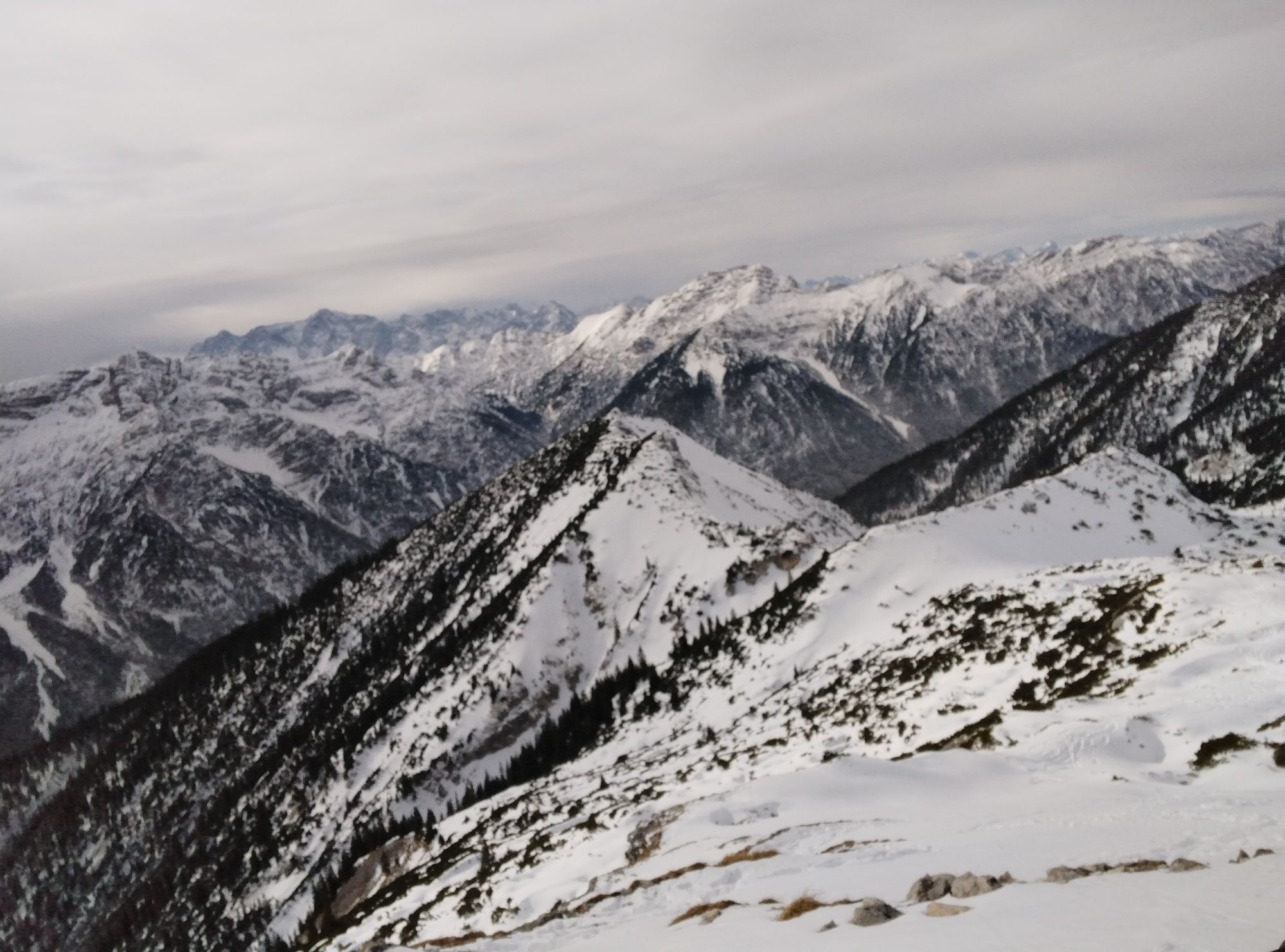
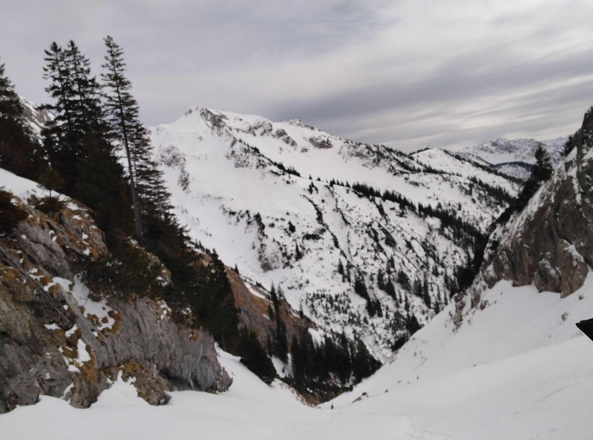
You now climb through the Roggentalgraben, the saddle between Hochplatte and Hochblasse. After another hour of walking, you stand at the saddle. For the first time, the fantastic view opens towards the Allgäu and Lechtal Alps; to your right, you see the summit of the Kräh. After another 10 minutes, you finally reach the Fensterl, a hole in the rocky ridge of the Hochplatte. At the Fensterl, turn right.
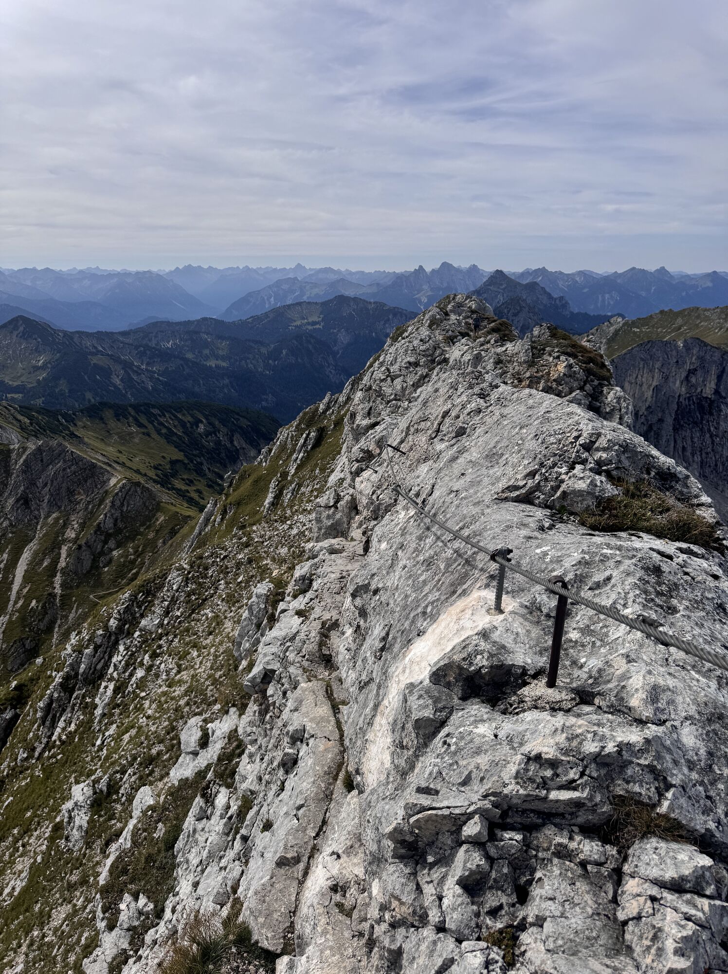
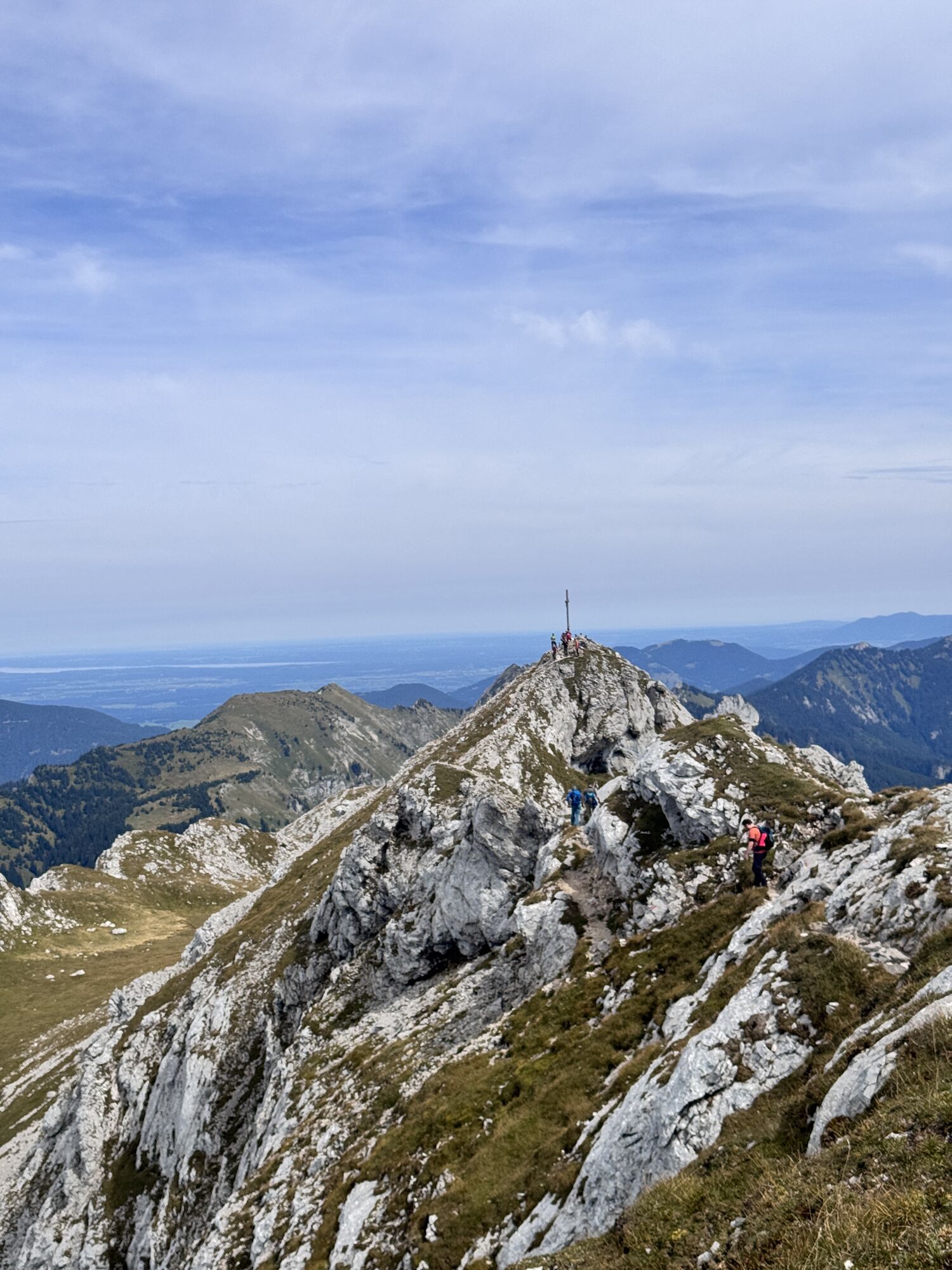
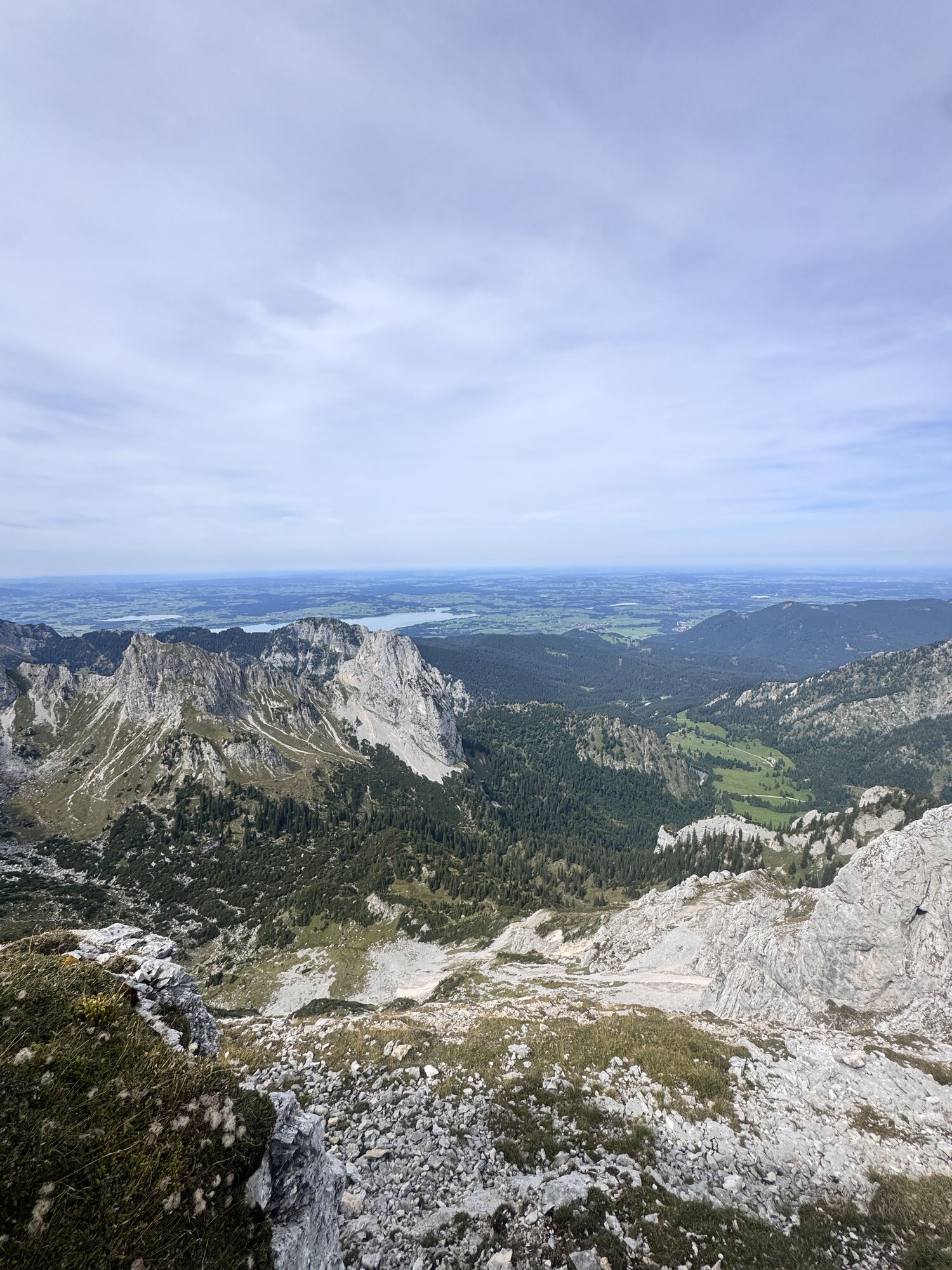
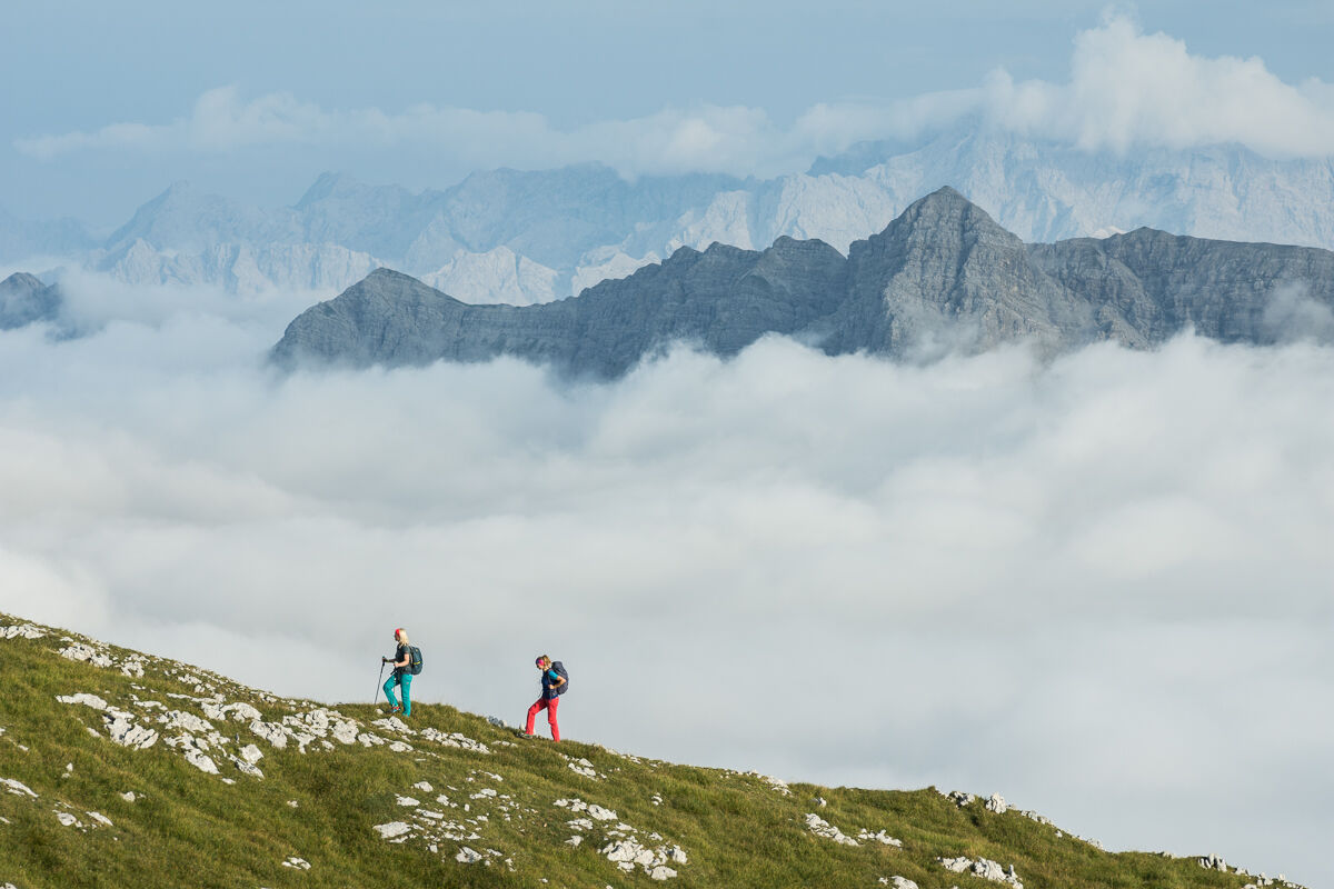
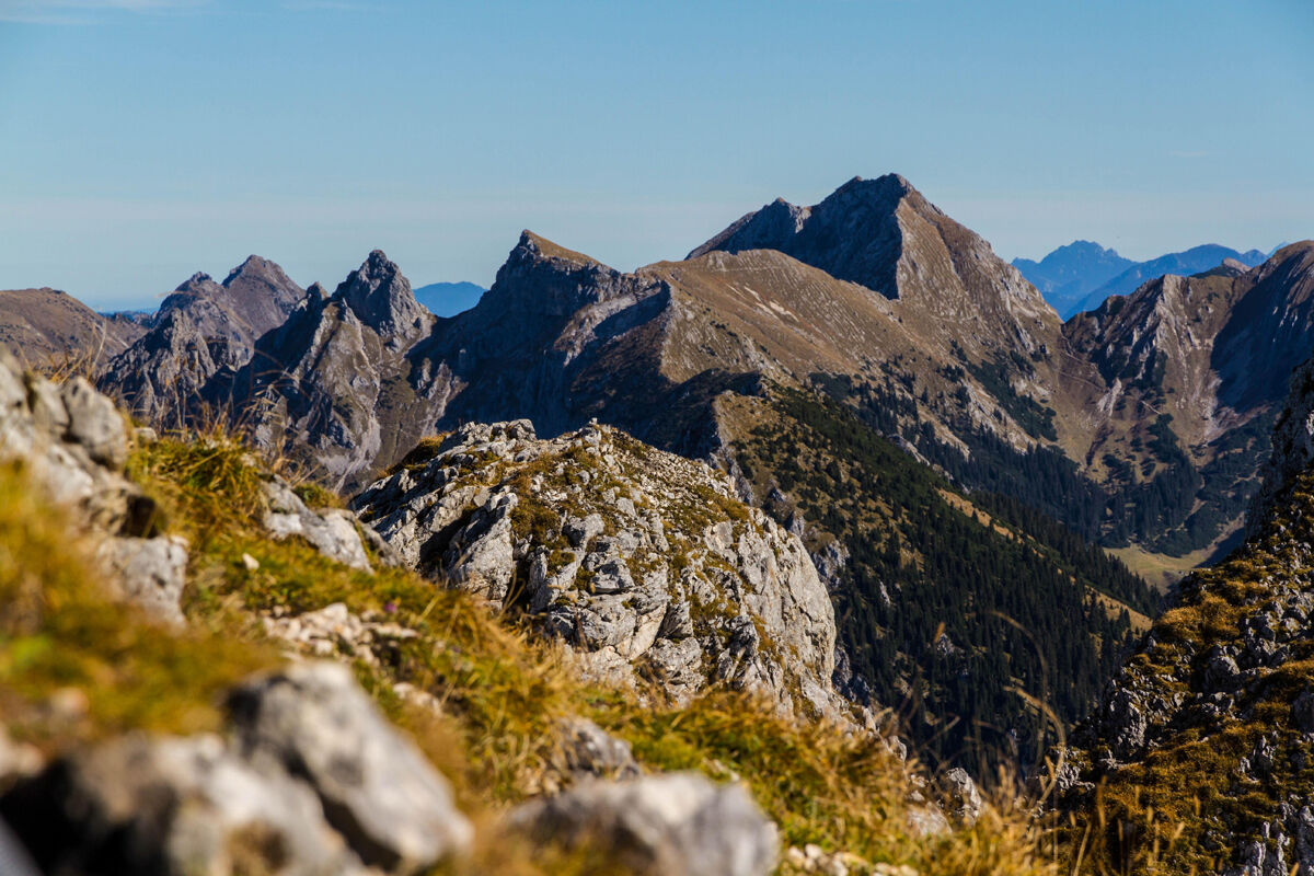
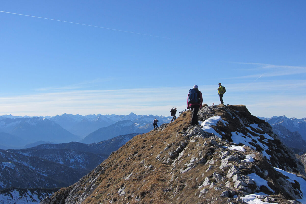
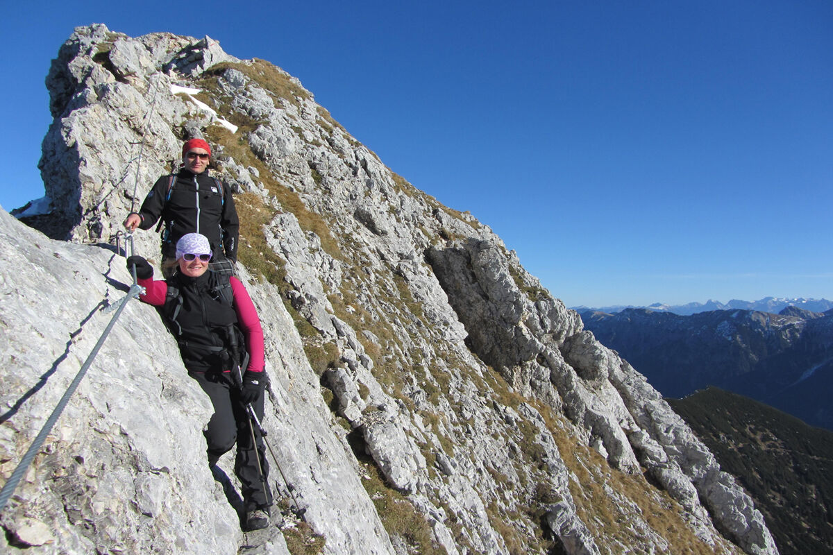
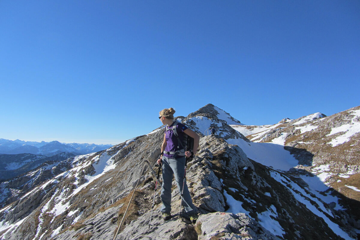
The ridge walk begins. Below you lies the Forggensee and the Ammergau region, which will accompany you along the entire ridge walk - a dreamlike panorama. A few meters further up, the ridge narrows more and more and you must climb down a cable-secured section. It goes up and down towards the summit cross, which you reach after a few minutes. The summit view is one of the best in the entire Ammergau Alps - directly in front of us is the Wetterstein block with Germany's highest mountain - the Zugspitze.
The descent heads east. Here the path leads you along a well-secured ridge before the path widens again and you continue descending. The path becomes flatter and you reach the Weitalpjoch. From here, keep right towards Roggental until you reach the junction you know from the ascent. The last 400 vertical meters take you back to the Ammerwaldalm along this lovely path.
Our recommendation:
Never get lost again - we recommend the free app "Zugspitz Region" including GPX tracks for all routes in the region
Da
Welcome to the Naturpark Teststubn! Here you can extensively test hiking poles, daypacks, child carriers, and crampons from well-known manufacturers before you decide to buy. Let our team advise you to experience the best possible outdoor adventure. You can find our Naturpark Teststubn at the tourist offices in Bad Bayersoien and Bad Kohlgrub and at Drahtesel Rental Lukas Spindler in Oberammergau.
More information: www.ammergauer-alpen.de/teststubn
In an emergency, please contact the nearest rescue control center. Regardless of location, you can reach them throughout Germany at the telephone number 112.
A95, Ettal, Graswang towards Plansee/Reutte
not accessible by public transport
Car park Ammerwaldalm, Ammerwald
Parking is free of charge
Parking duration: no time limit
At the Fensterl, a hole through the rock at the start of the summit ridge of the Hochplatte, very unique photos can be taken.
Priljubljeni izleti v okolici
- 4,2
Cultural trail Schutzengelweg
srednjaPohodništvo5,13 km - 4,5
Teufelstättkopf / Unterammergau
srednjaPohodništvo12,2 km - 4,5
Circular hike Dreh- and Rohrkopfhütte
svetlobaPohodništvo8,76 km - 3,6
Rundwanderung Plansee
srednjaPohodništvo9,80 km - 4,7
Yellow Wall Trail, Tegelberg (A)
srednjaVia ferrata3,65 km - 4,6
Rundwanderweg um den Eibsee
svetlobaPohodništvo6,89 km - 4,5
Traumhafte Panorama Plansee-Umrundung
svetlobaPohodništvo13,8 km - 4,6
Tegelbergsteig: Via ferrata, Schwangau (B/C)
težkoVia ferrata3,54 km - 4,6
Schönleitenschrofen
težkoPohodništvo15,5 km - 4,7
Hochplatte
srednjaPohodništvo10,4 km
Pohodništvo in sledenje


Ne zamudite ponudb in navdiha za naslednje počitnice
Vaš e-poštni naslov je bil dodan na poštni seznam.