


Adlerweg trail. Stage 1: Ströden – Johannishütte


Starting point is the car park in Ströden, from there after the bridge proceed along the Maurerbach up to the Stoanalm snack station at 1450 metres. On the orographic left side of the river the trail heads...
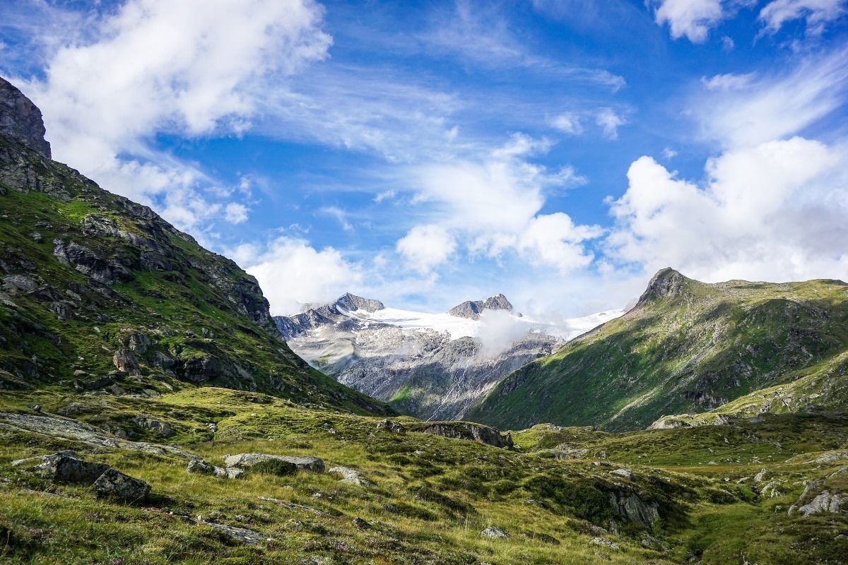
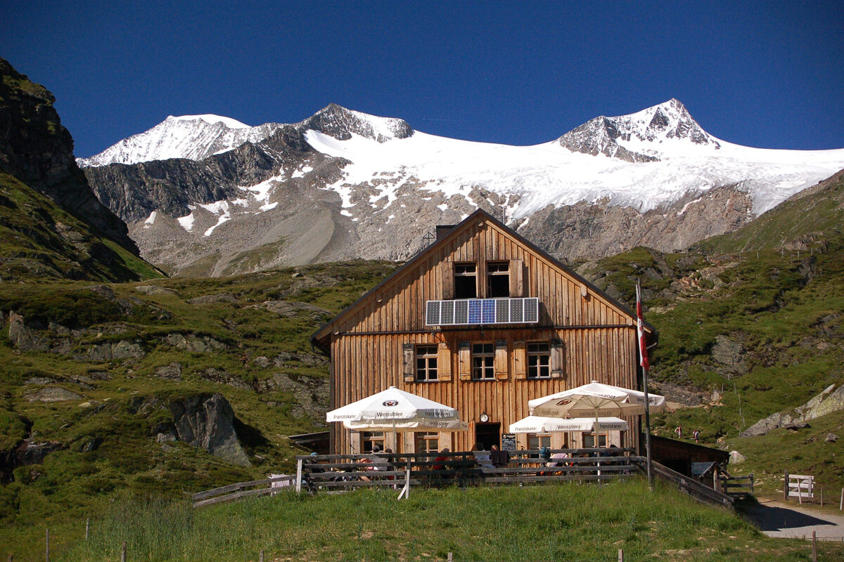
Starting point is the car park in Ströden, from there after the bridge proceed along the Maurerbach up to the Stoanalm snack station at 1450 metres. On the orographic left side of the river the trail heads to the valley station for the goods cable car. Continue on a steep trail up a valley section where larch trees are growing. After some two dozen steep hairpin bends up to Göriacher Ochsnerhütte (1948 metres), continue on the path, always close to the river, via tree-lined gentle slopes into the run-up to the glacier-covered Venediger mountains and to the bridge at the upper Ochsnerhütte at Maurerbach. The powerful glacier river separates the Göriacher from the Maurer Alpe in the west. The route now proceeds in the final slope up to the Essener-Rostocker Hütte, in a moraine area of the secluded Simonykees area. After a well-deserved break continue hiking from Essener-Rostocker Hütte via Schweriner Weg. Negotiate the mountain flank via the hairpin bends and after about an hour of walking proceed along the south west slope of the Kleinen Geiger. Proceed now via the grinding marks which were left during the Ice Age and via widely scattered scree fields to Türml and its bright red rocks, at whose base is the Türmljoch (2772 metres). To the east of here a path proceeds in loops along the path through snow hollows and the rubble surface, continuing down along the eastern slope of the Dorferkamm. Around ¼ hour later you turn, over a few rivulets, heading north east. The path then turns into terrain heading south across a mountain slope, down into the village of Bach, where you get to gaze in wonder at the lovely ground rocks. Finally the route proceeds past the memorial cross and via Zettalunitzbach on the final section to the traditional and spacious Johannishütte (2121 metres).
Please note: This is a very long day's stage - an early start is recommended!
Von Matrei in Osttirol aus zuerst der Gereitstraße und dann der Virgener Straße in westlicher Richtung folgen. Nach rund 19 km erreichen Sie den Parkplatz Ströden.
Prägraten am Großvenediger - Hinterbichl/Ströden
Parkplatz Ströden
Priljubljeni izleti v okolici
- 4.6
Vom Matreier Tauernhaus über die Felsenkapelle nach Innergschlöss
svetlobaPohodništvo9.19 km - 4.1
Gletscherlehrweg Innergschlöß
srednjaPohodništvo9.36 km - 3.2
Krimmler Tauernhaus - Warnsdorfer Hut - Gamsspitzl
težkoPohodništvo10.5 km - 5.0
Gletscherweg Innergschlöß Großvenediger
srednjaPohodništvo11.0 km - 5.0
Vom Matreier Tauernhaus zum Venedigerhaus
svetlobaPohodništvo8.98 km - 4.9
Oberhausalm - Jagdhaushütte
svetlobaPohodništvo14.0 km - 5.0
Muhs-Panoramaweg
srednjaPohodništvo14.0 km - 3.0
Neukirchen: Großvenediger route
težkoPohodništvo7.40 km - 4.8
Wanderung zu den Umballfällen
svetlobaPohodništvo6.73 km - 4.0
Habachtal bis zur Thüringer Hütte
Pohodništvo6.53 km
Pohodništvo in sledenje


Ne zamudite ponudb in navdiha za naslednje počitnice
Vaš e-poštni naslov je bil dodan na poštni seznam.