Navigacija po spletni strani
Pridobite to turo v svoj mobilni telefon
Zemljevid
Vergeletto-Capanna Salèi-Capanna Arena-Alpe Porcaresc-Vergeletto
srednja
Pohodništvo v daljavo
28.52 km
Skenirajte kodo QR in začnite navigacijo v aplikaciji bergfex.
QR Code
Pohodništvo in sledenje

Vergeletto-Capanna Salèi-Capanna Arena-Alpe Porcaresc-Vergeletto

Razdalja
28.5 km
Trajanje
09:25 h
Ascent
1,130 hm
Morska gladina
896 - 1,843 m

Stopnja težavnosti: T3

Prenos skladbe
Zemljevid
Vergeletto-Capanna Salèi-Capanna Arena-Alpe Porcaresc-Vergeletto
srednja
Pohodništvo v daljavo
28.52 km

You can reach Vergeletto by bus (direction Spruga with a change in Russo) or by car. You can start the hike directly from here or take the cable car to Alpe Salèi (operates from May to October). If you...

Opis
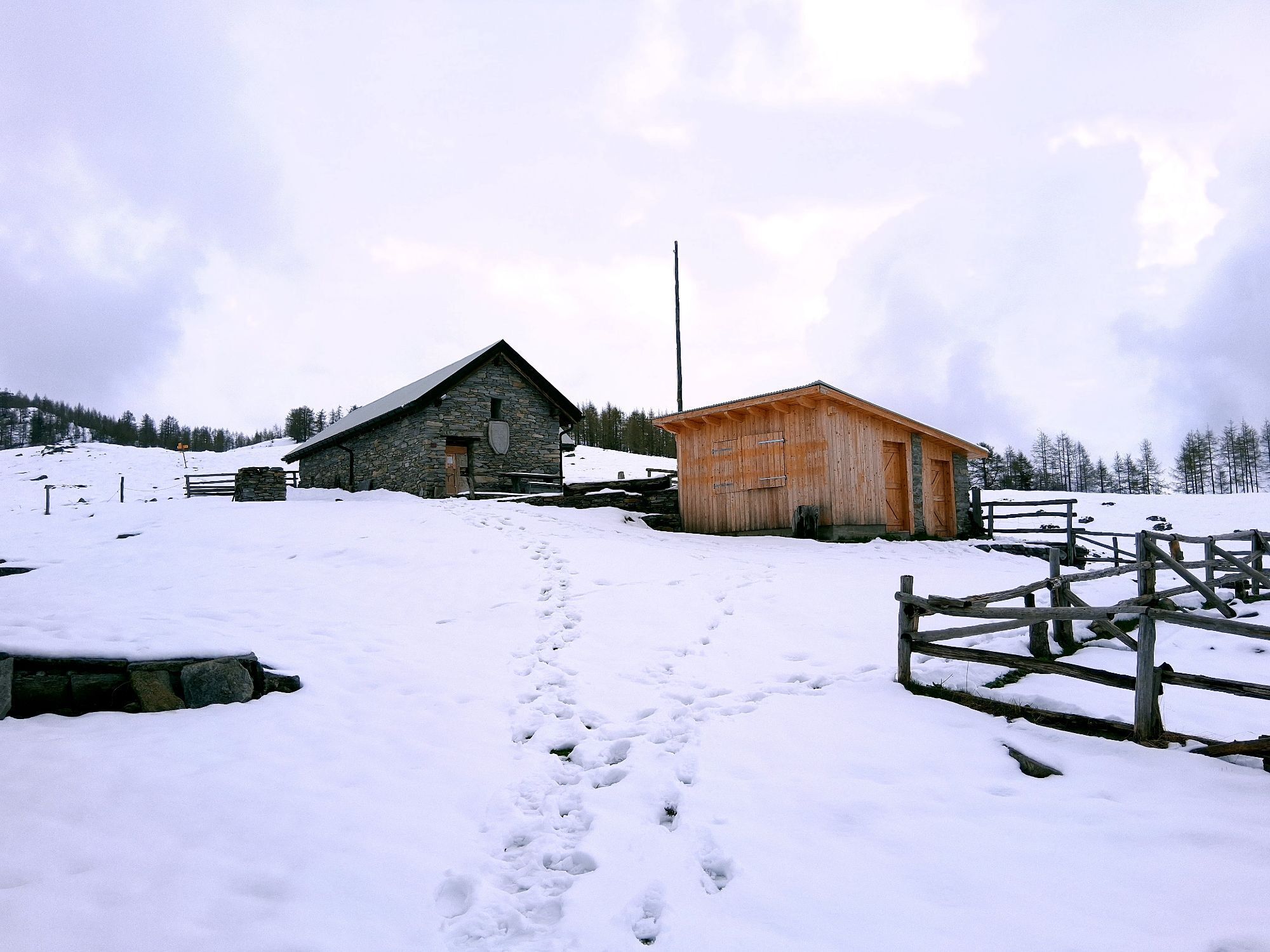
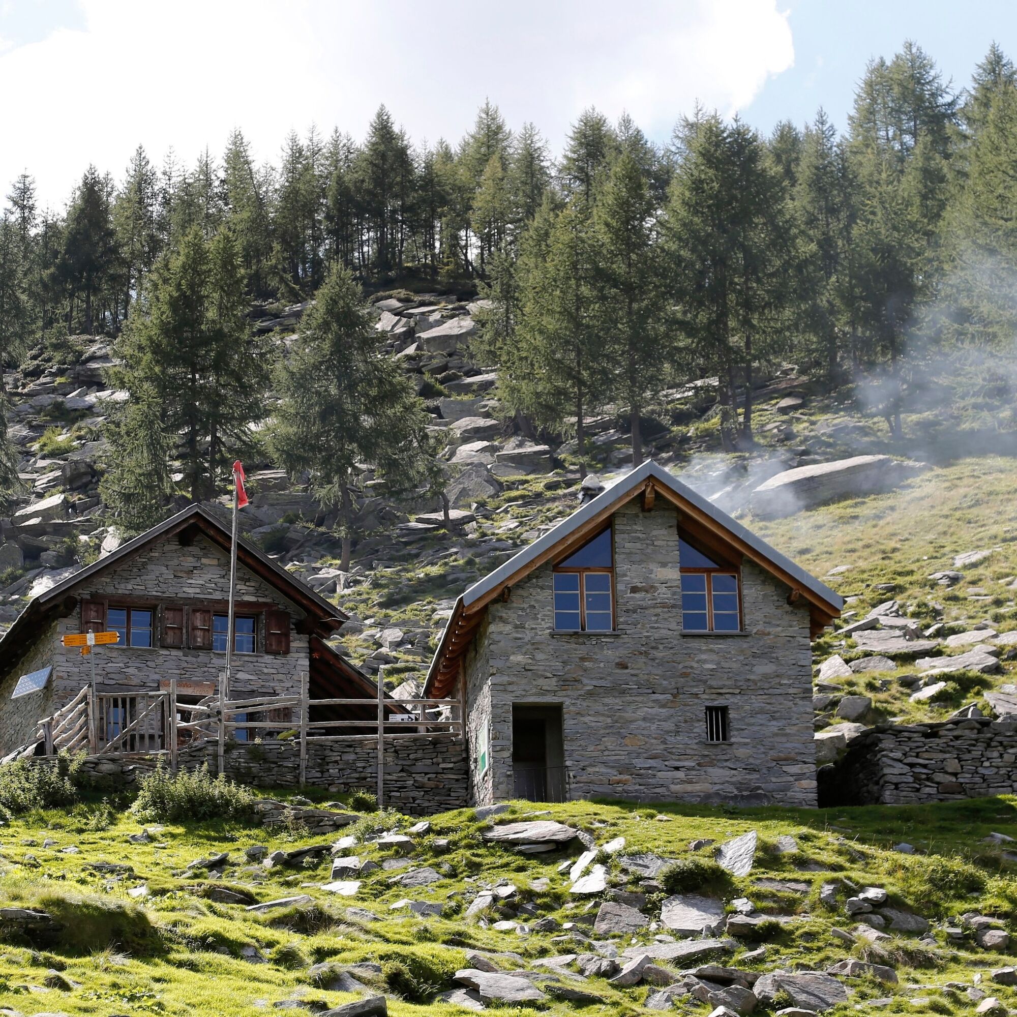
You can reach Vergeletto by bus (direction Spruga with a change in Russo) or by car. You can start the hike directly from here or take the cable car to Alpe Salèi (operates from May to October). If you go up on foot, Capanna Alpe Salei is the right place to rest and catch your breath. The trail crosses meadows and larch woods below the ridges up to the Bùsan Pass and Alpe Pièi Bachei. The trail continues with ups and downs to Alpe Arena, where the hut of the same name is located and where it is possible to spend the night. The hut (unattended and open from June to October) has a kitchen, wood stove, bathroom, electricity and drinks. A panoramic trail leads through the alpine landscape along the valley basin to Alpe di Porcaresc. Then you undertake a steep descent to Al Casón and Vergeletto, where you take the bus again. In summer, it is possible to buy cheese from the alpine farmers.

Attention: Between Alpe d’Arena and Salèi, flocks of sheep guarded by livestock guardian dogs may be present.

Pot
Pot
Zemljevid
Vergeletto-Capanna Salèi-Capanna Arena-Alpe Porcaresc-Vergeletto
srednja
Pohodništvo v daljavo
28.52 km
Osteria della Piazza
(897 m)
Restavracija
0.0 km
Vergeletto
(906 m)
Vas
0.0 km
Monte della Chià
(949 m)
Poravnava
1.8 km
Zott
(969 m)
Poravnava
2.4 km
Locanda Zott
(970 m)
Restavracija
2.5 km
La Valáscia da Dént
(1,021 m)
Koridor/teren
3.2 km
I Piéi
(1,089 m)
Koridor/teren
3.8 km
Alpe Salèi
(1,769 m)
Postaja gondole
8.9 km
Capanna Alpe Saléi
(1,777 m)
Zavetišče
9.2 km
A Aréna
(1,689 m)
Poravnava
14.3 km
Capanna Alpe Arena
(1,689 m)
Zavetišče
14.4 km
Buco d'Arena
(1,680 m)
Koridor/teren
14.6 km
Murisc
(1,669 m)
Koridor/teren
15.1 km
A Madèi
(1,762 m)
Poravnava
15.9 km
A Porcarésc
(1,796 m)
Poravnava
18.3 km
Grotto Fondovalle
(1,115 m)
Restavracija
23.0 km
Piano delle Cascine
(1,080 m)
Koridor/teren
23.3 km
Al Partös
(1,077 m)
Poravnava
23.9 km
I Piéi
(1,089 m)
Koridor/teren
24.5 km
La Valáscia da Dént
(1,021 m)
Koridor/teren
25.2 km
Zott
(969 m)
Poravnava
25.8 km
Locanda Zott
(970 m)
Restavracija
25.9 km
Monte della Chià
(949 m)
Poravnava
26.5 km
Vergeletto
(906 m)
Vas
28.4 km
Osteria della Piazza
(897 m)
Restavracija
28.5 km
Informacije o turneji

Two-day hike in the enchanting landscape of the Onsernone Valley. Route on a mountain trail (marked white-red-white) that passes isolated alpine pastures surrounded by majestic peaks.

Tehnologija
3 / 6
Stanje
4 / 6
Pokrajina
n.a.
Izkušnje
n.a.
Najboljši letni čas
Jan
Feb
Mar
Apr
Maj
Jun
Jul
Avg
Sep
Okt
Nov
Dec
Skupna turneja
Zemljevid
Vergeletto-Capanna Salèi-Capanna Arena-Alpe Porcaresc-Vergeletto
srednja
Pohodništvo v daljavo
28.52 km
Napaka
Zgodila se je napaka. Prosimo, poskusite znova.
Informacije o poti
Pot

Cable car Salèi, Zott-Valascia-Capanna Salei-Pièi Bachei-Capanna Alpe Arena-Murisc-Alpe di Madéi-Alpe di Porcaresc-Alpe del Casone-Valascia-Zott-Monte della Chià-Zardin-Vergeletto

Gondola/kabinska žičnica

Da

Informacije o prihodu
Javni prevoz

From Locarno: take bus B 324 towards Spruga. Change bus in Russo and take bus B 325 to Vergeletto.

Return from Vergeletto: take bus B 325 to Russo. Change bus and take bus B 324 towards Locarno. Get off at the station. More information: www.sbb.ch

Dodatne informacije in nasveti
Stopnja težavnosti

T3

Pohodništvo in sledenje

Pohodništvo in sledenje

Pohodništvo in sledenje
Zaradi več kot 550.000 predlogov izletov, podrobnih zemljevidov in intuitivnega načrtovanja poti je aplikacija obvezna oprema za vse ljubitelje narave.
bergfex