


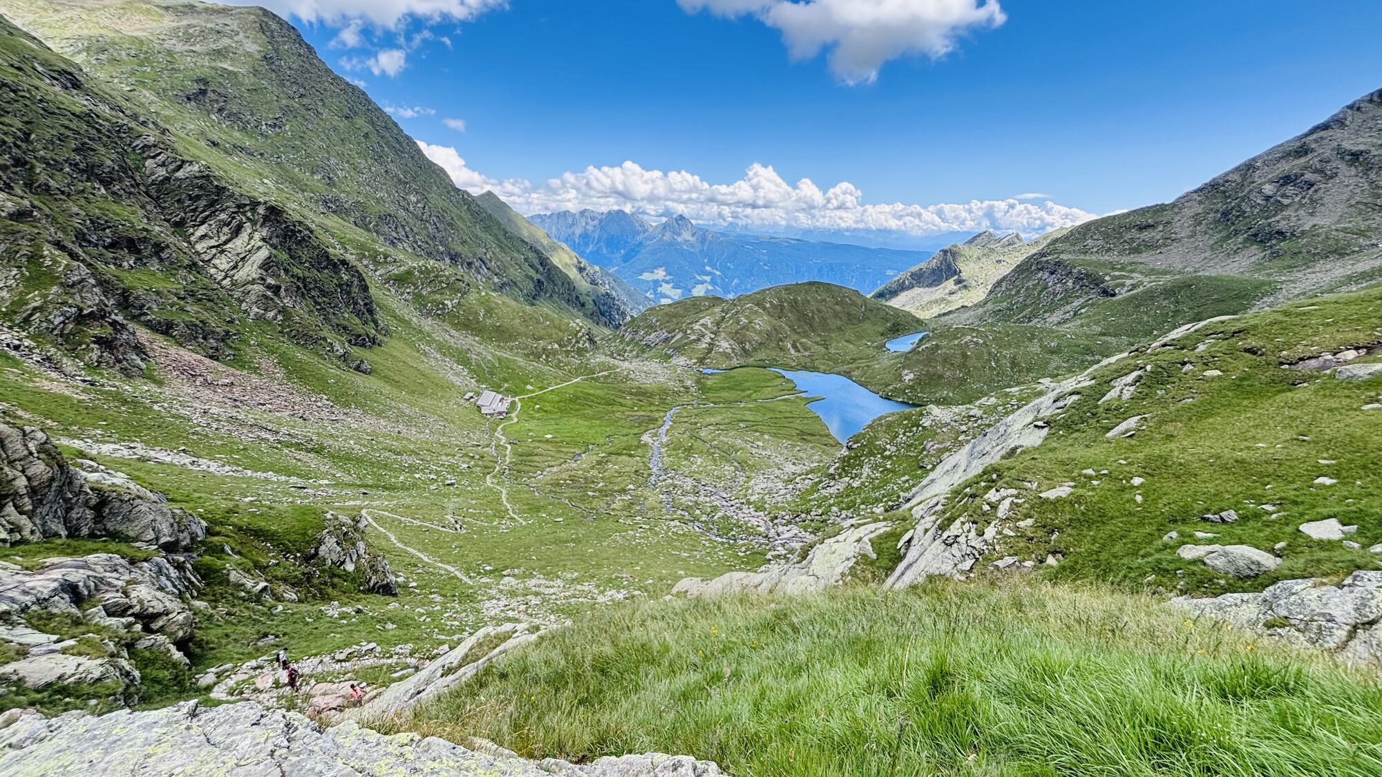
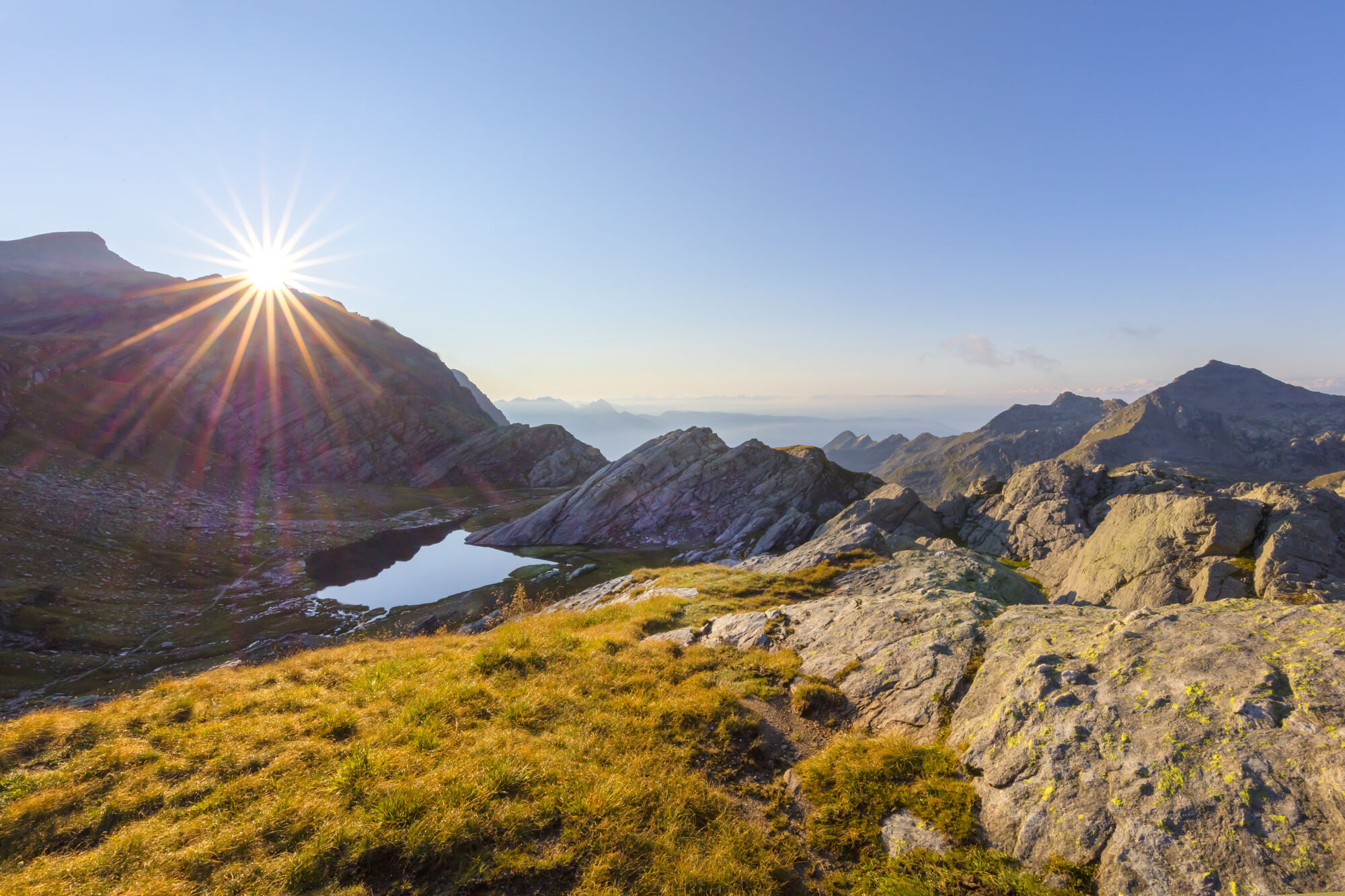
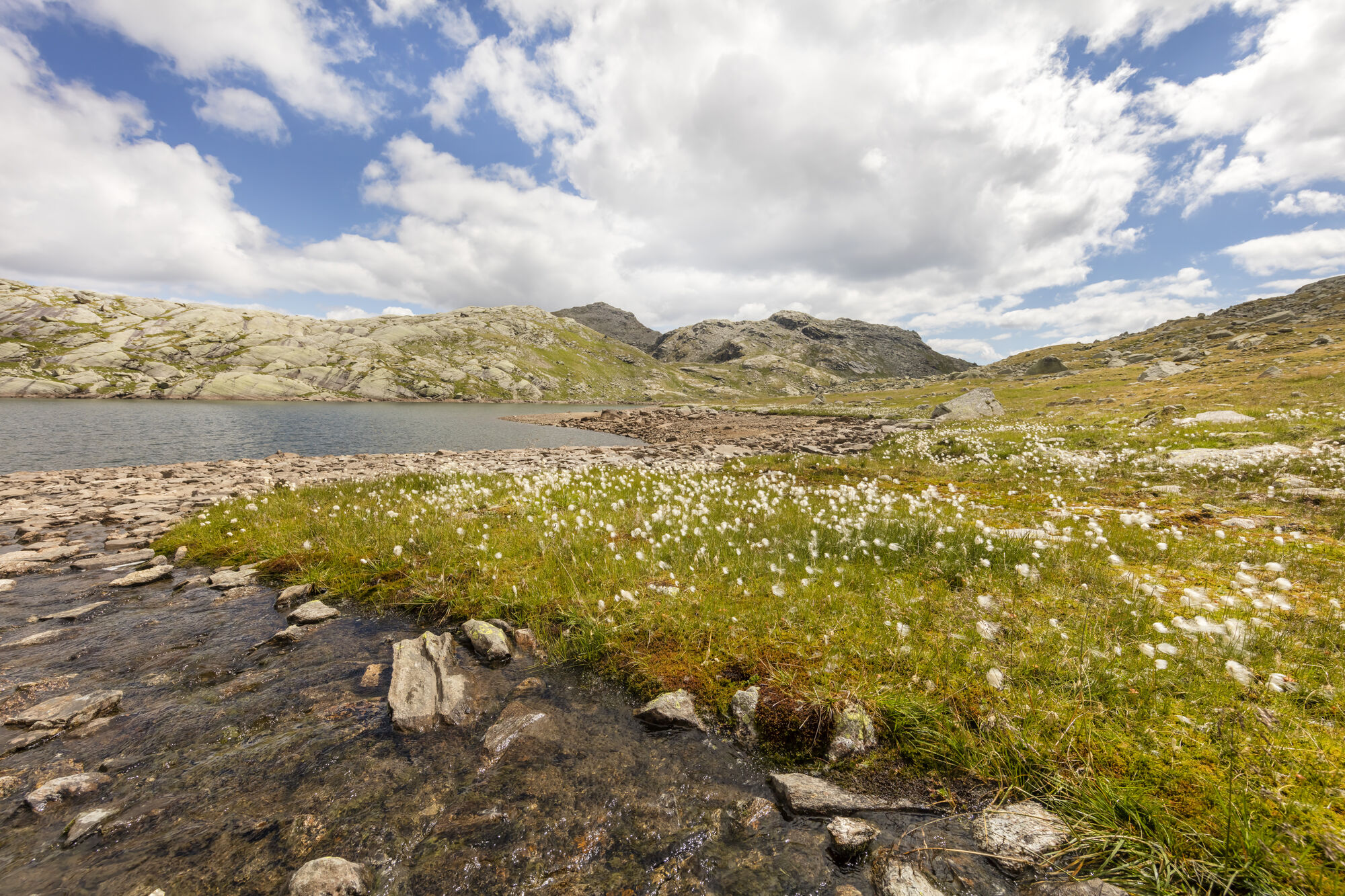
Spronser Seen lakes: At the heart of the Texelgruppe Nature Park
Fotografije naših uporabnikov
 © Marco WolfUstvarjeno na 28.03.2026
 © Marco WolfUstvarjeno na 28.03.2026
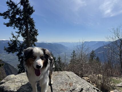
 © Norbert HerbigUstvarjeno na 16.10.2025
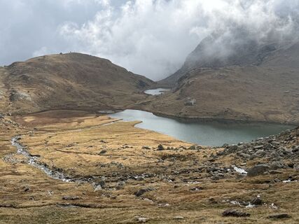 © Norbert HerbigUstvarjeno na 16.10.2025
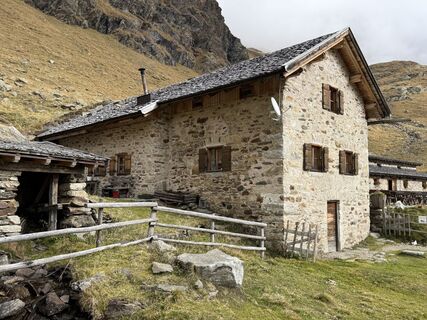 © Norbert HerbigUstvarjeno na 16.10.2025
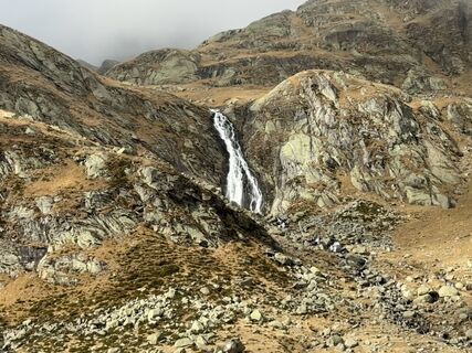 © Norbert HerbigUstvarjeno na 16.10.2025
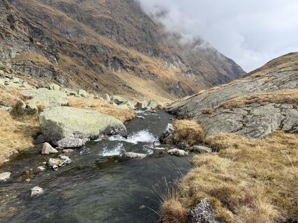 © Norbert HerbigUstvarjeno na 16.10.2025
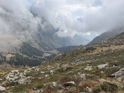 © Norbert HerbigUstvarjeno na 16.10.2025
 © Klaus ScharfeUstvarjeno na 14.10.2025
 © SilkeUstvarjeno na 20.08.2025
 © Dino DeckUstvarjeno na 19.08.2025
 © Andreas SalscheiderUstvarjeno na 17.08.2025
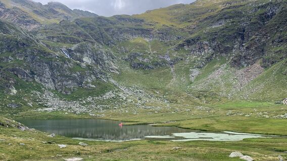
 © Daniel CondeUstvarjeno na 06.08.2025
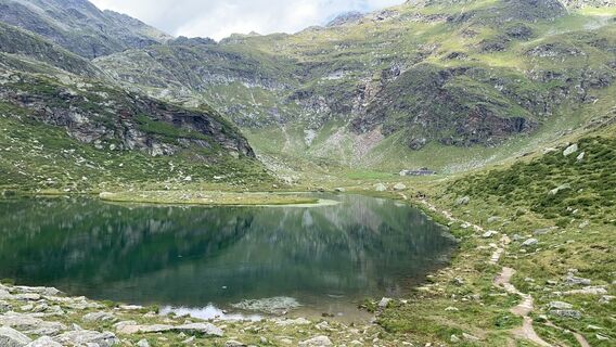 © Daniel CondeUstvarjeno na 06.08.2025
 © Daniel CondeUstvarjeno na 06.08.2025
 © Daniel HärtelUstvarjeno na 27.07.2025
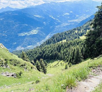
 © Eva TheißUstvarjeno na 22.07.2025
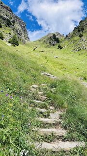 © Eva TheißUstvarjeno na 22.07.2025
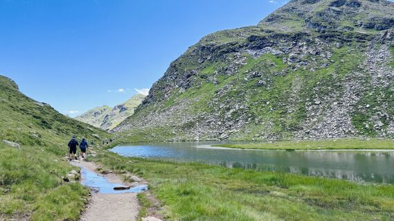 © Eva TheißUstvarjeno na 22.07.2025
 © Eva TheißUstvarjeno na 22.07.2025
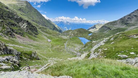 © Eva TheißUstvarjeno na 22.07.2025
 © Eva TheißUstvarjeno na 22.07.2025
 © Daniel HärtelUstvarjeno na 17.07.2025
 © Daniel HärtelUstvarjeno na 17.07.2025
 © Daniel HärtelUstvarjeno na 17.07.2025
 © Daniel HärtelUstvarjeno na 17.07.2025
 © Daniel HärtelUstvarjeno na 17.07.2025
 © Michael PutzUstvarjeno na 10.07.2025
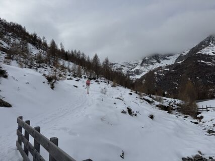
 © Hans-Dieter EmilUstvarjeno na 22.01.2025
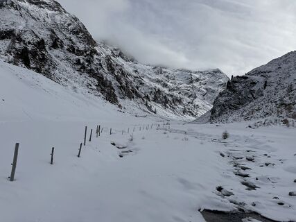 © Hans-Dieter EmilUstvarjeno na 22.01.2025
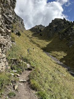
 © Thomas TrautweinUstvarjeno na 19.09.2023
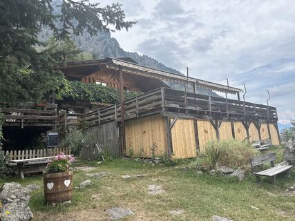 © Thomas TrautweinUstvarjeno na 26.08.2023
 © Thomas TrautweinUstvarjeno na 26.08.2023
 © Rainer PieperUstvarjeno na 26.07.2024
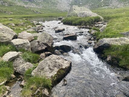 © Rainer PieperUstvarjeno na 26.07.2024
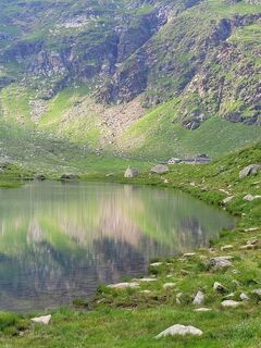 © Rainer PieperUstvarjeno na 26.07.2024
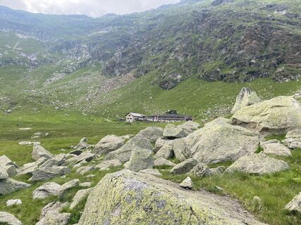 © Rainer PieperUstvarjeno na 26.07.2024
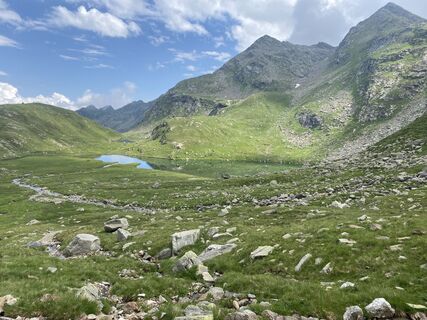 © Rainer PieperUstvarjeno na 26.07.2024
 © Rainer PieperUstvarjeno na 26.07.2024
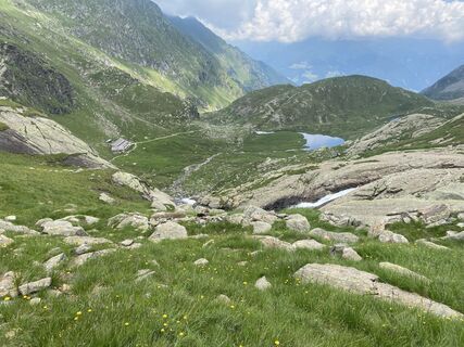 © Rainer PieperUstvarjeno na 26.07.2024
 © Rainer PieperUstvarjeno na 26.07.2024
 © Rainer PieperUstvarjeno na 06.08.2021
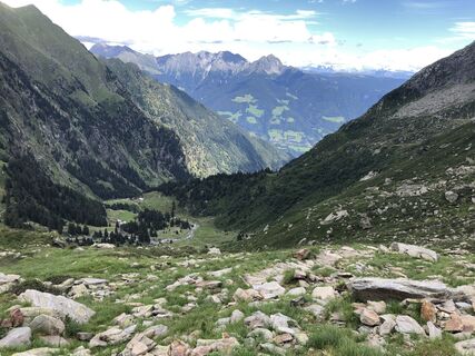 © Rainer PieperUstvarjeno na 06.08.2021
 © Rainer PieperUstvarjeno na 06.08.2021
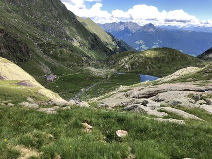 © Rainer PieperUstvarjeno na 06.08.2021


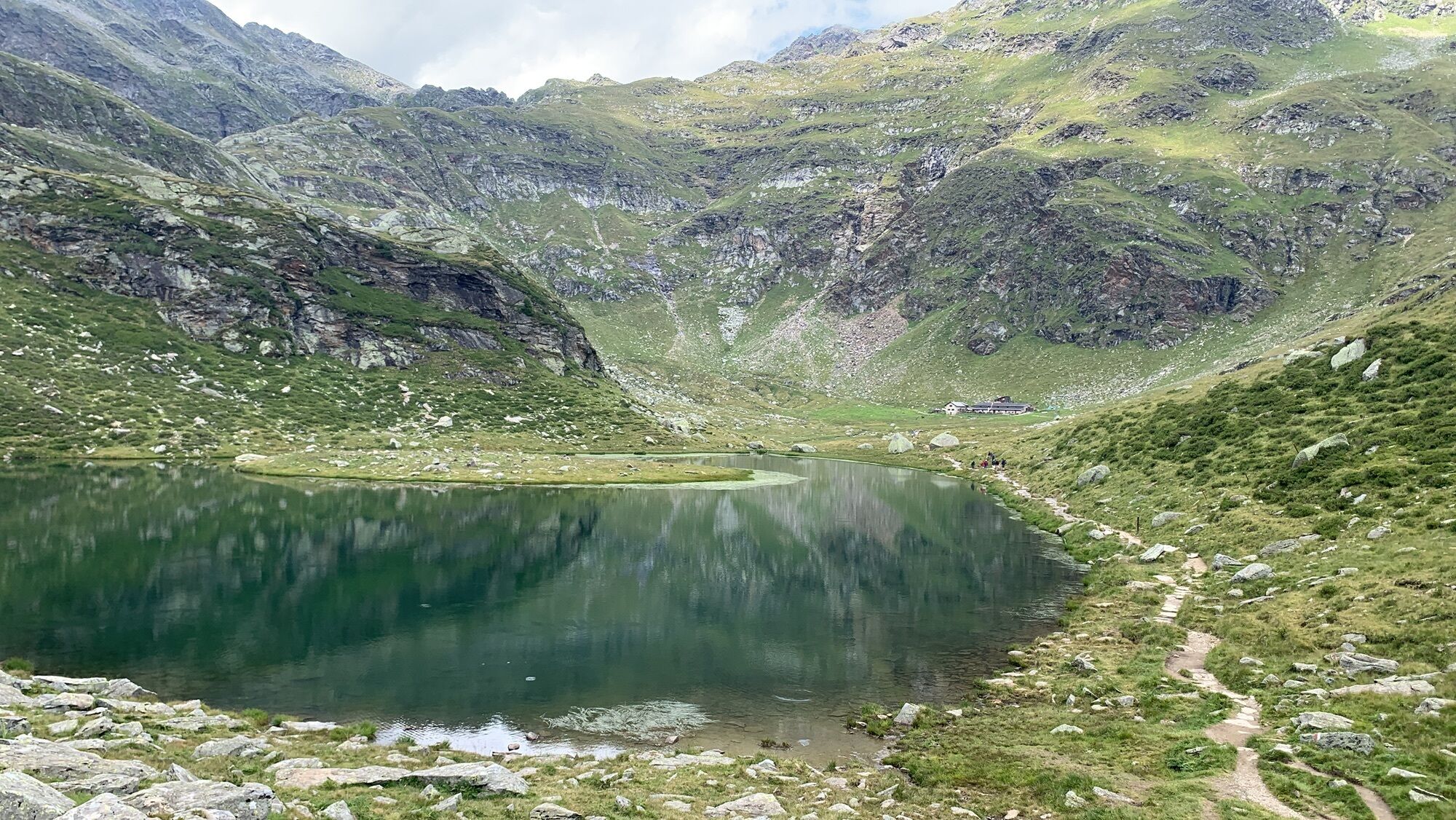
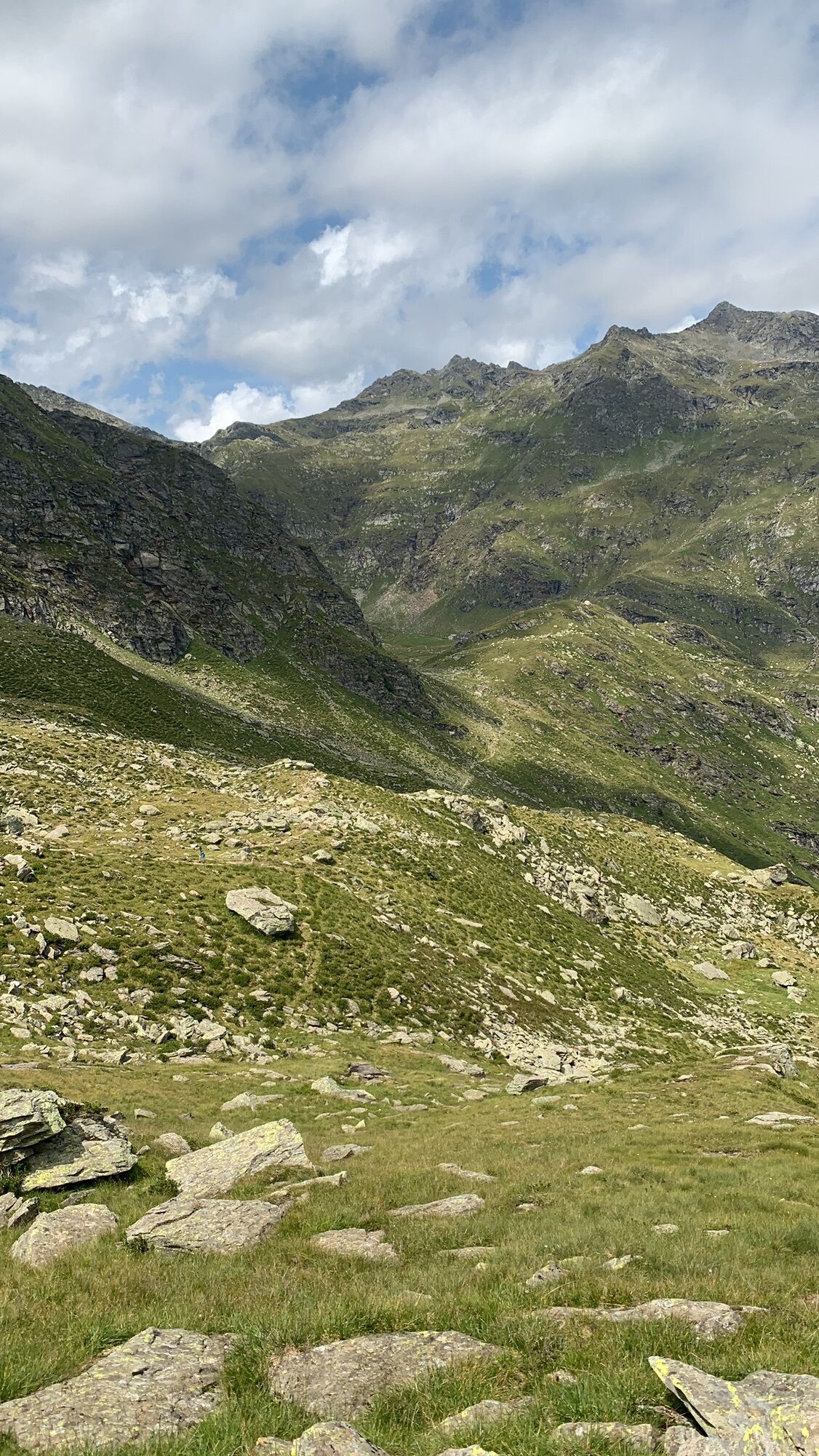


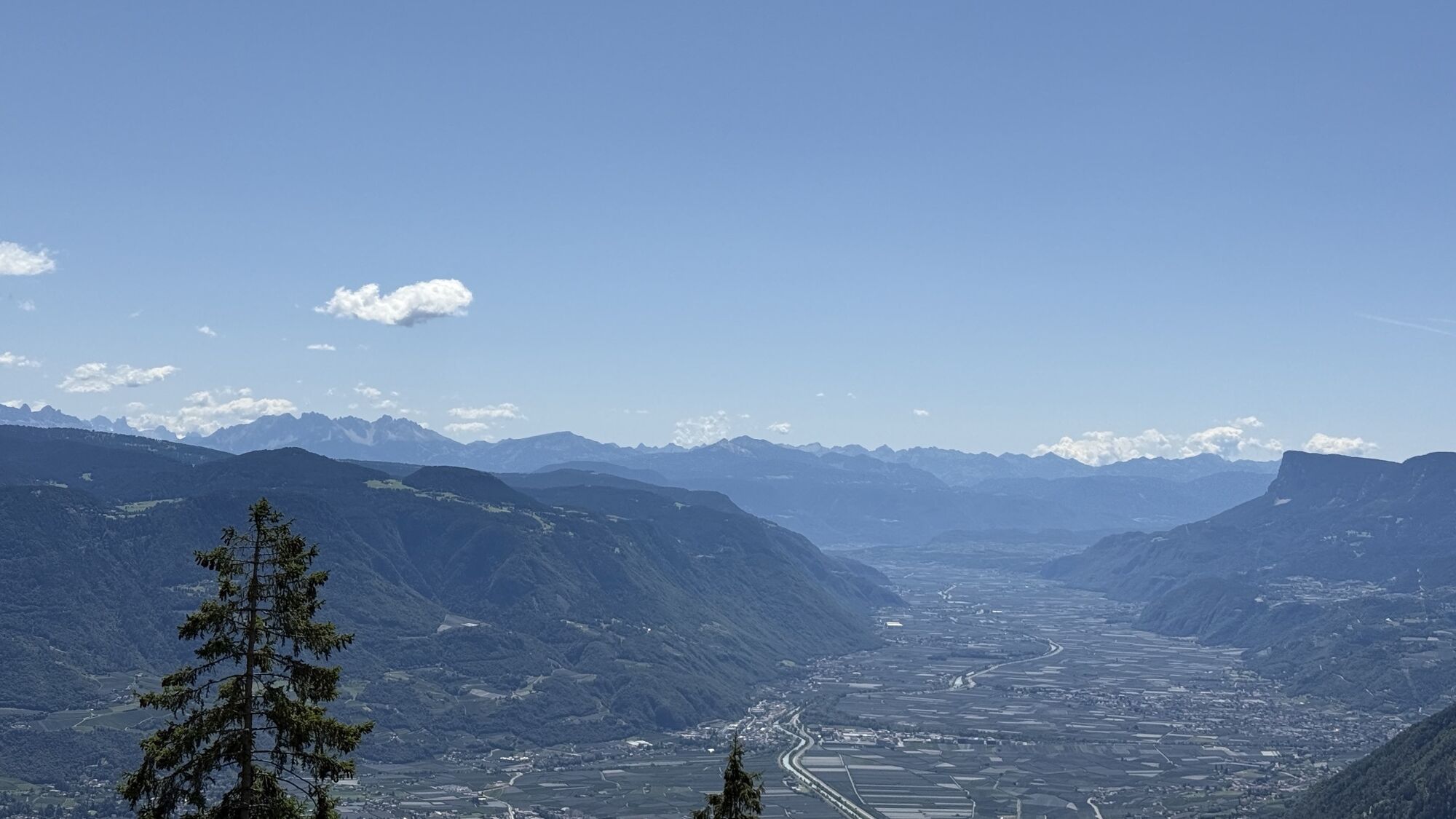
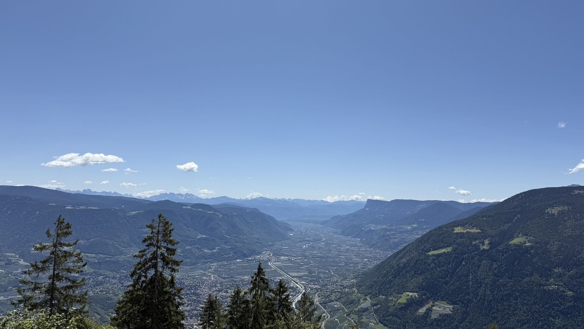
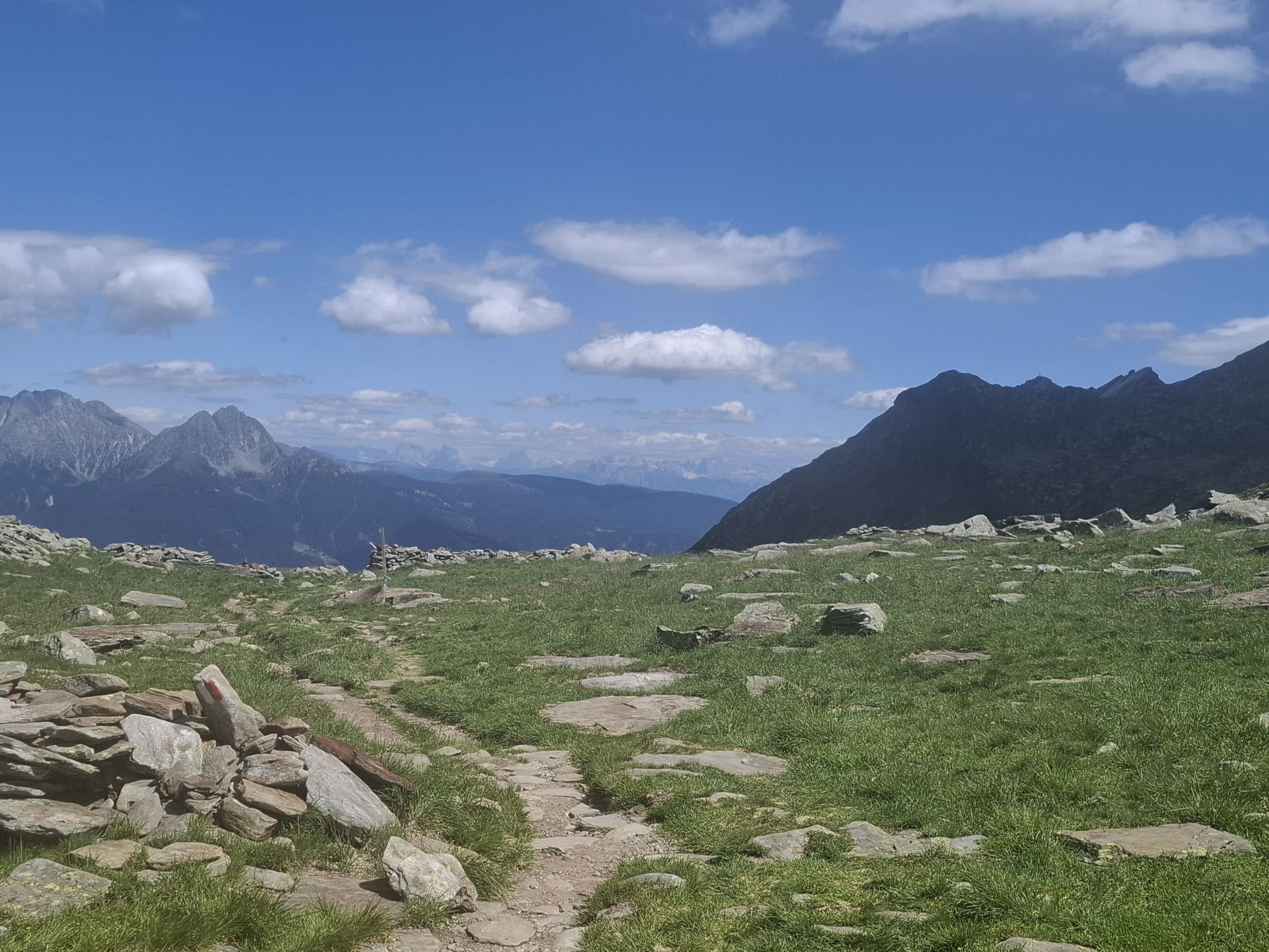


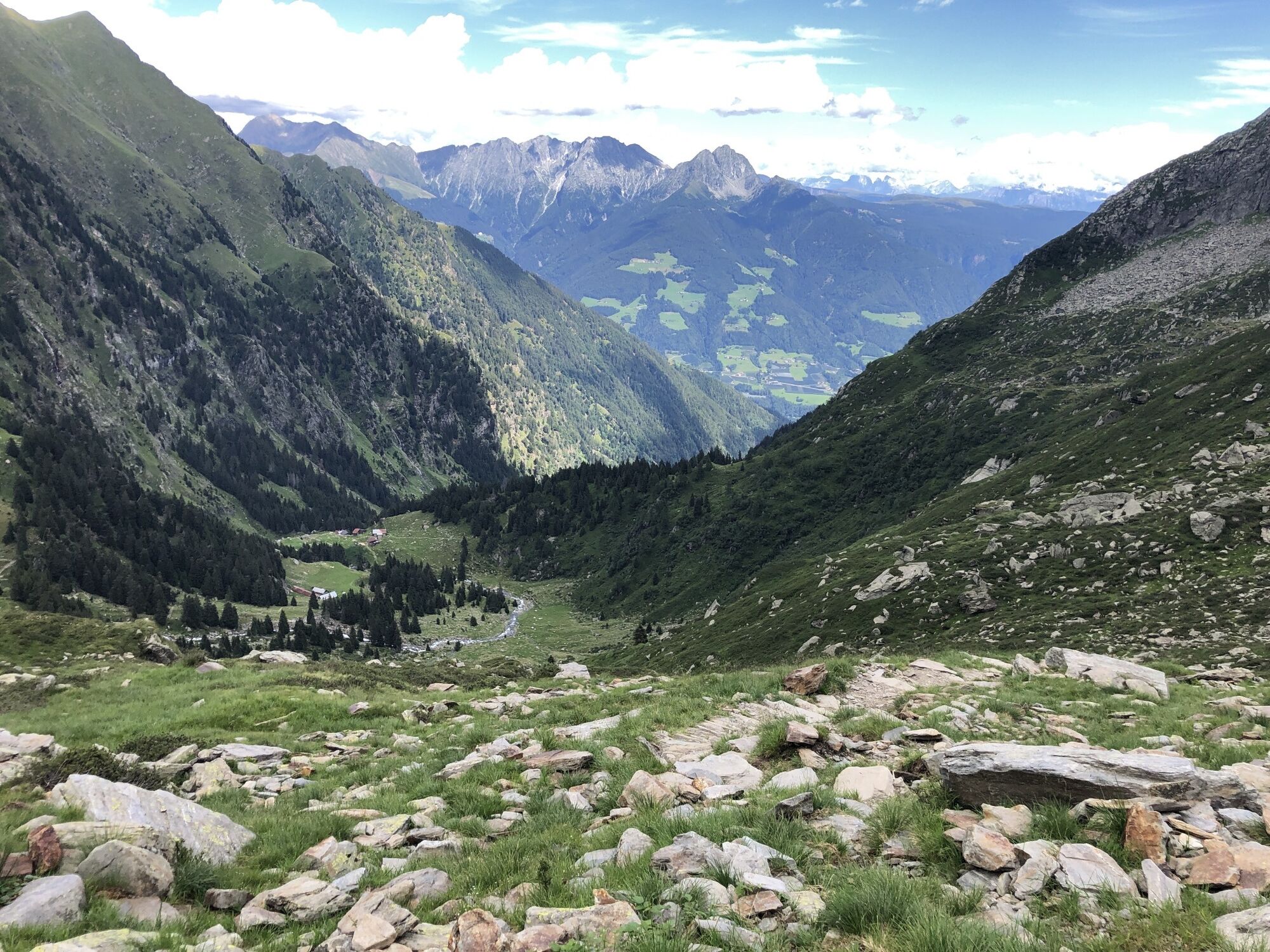
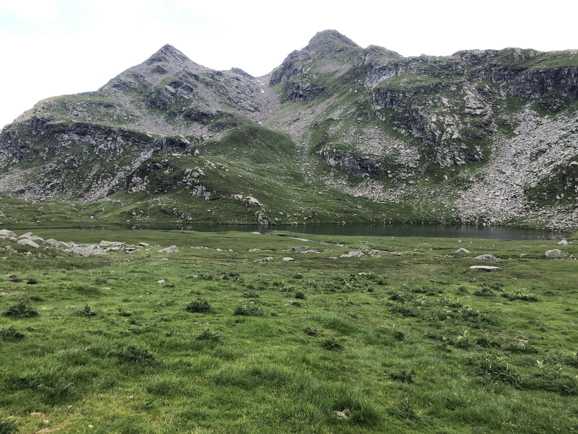

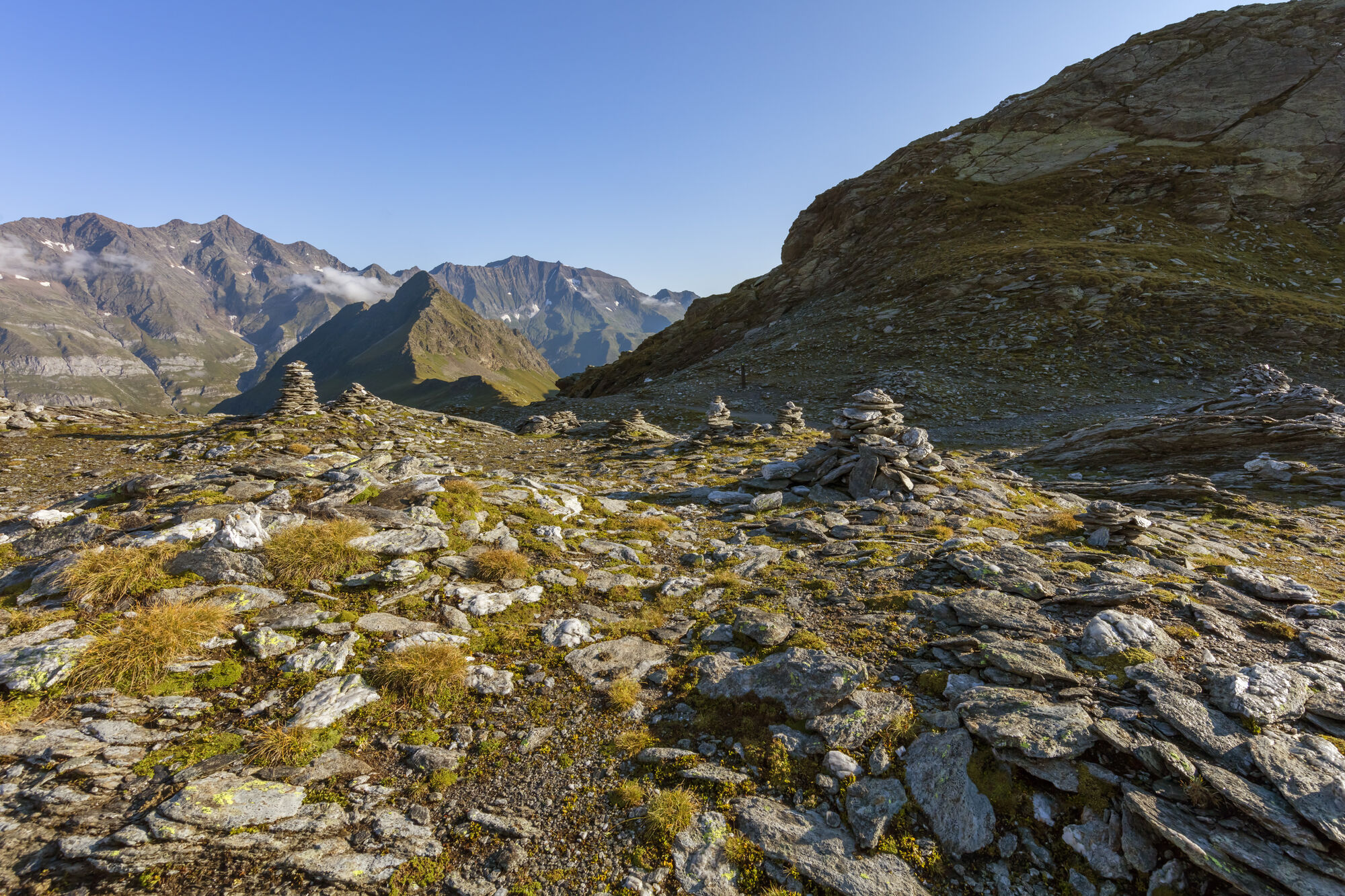
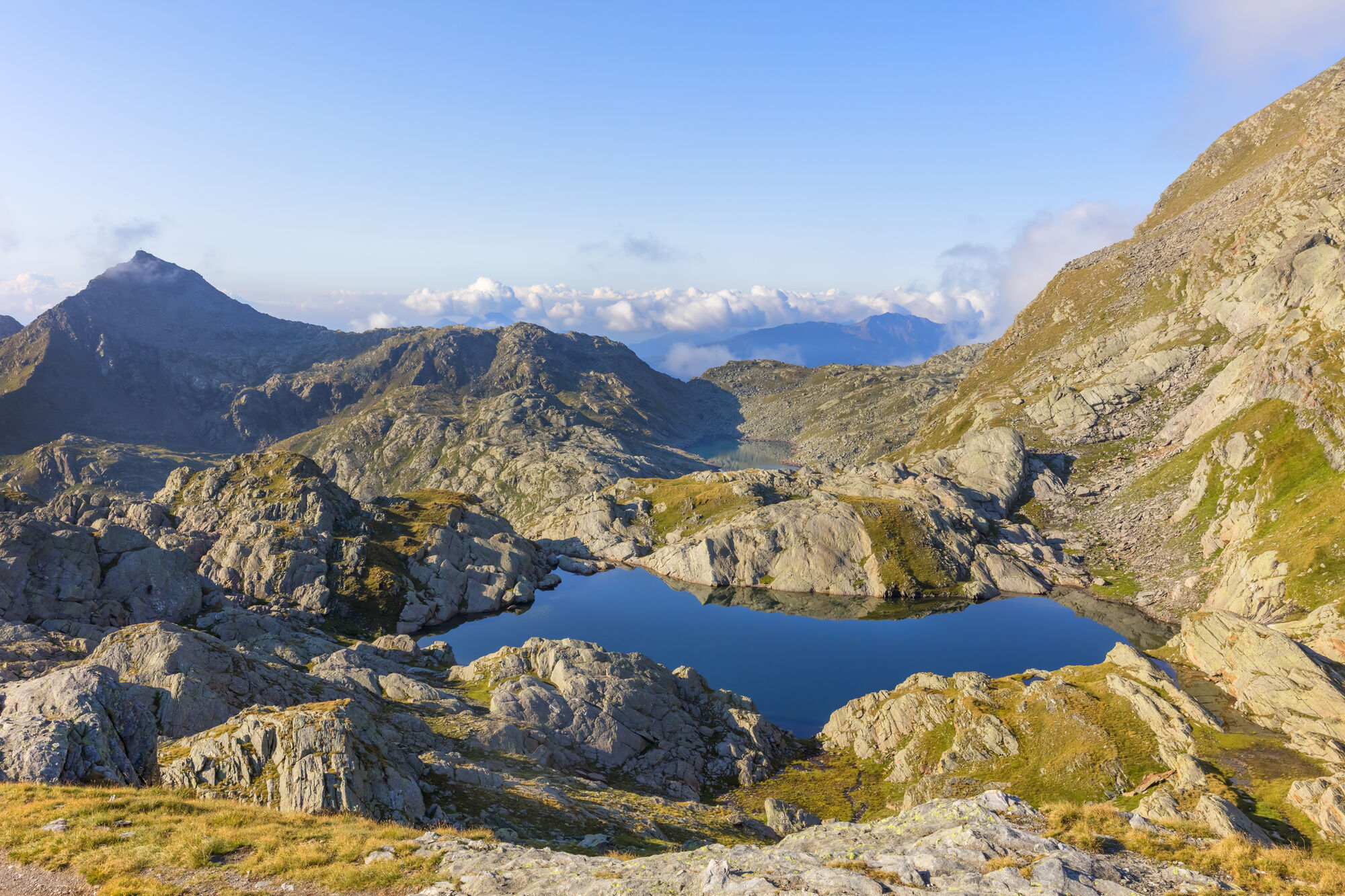
The starting point of this tour is Pfelders/Plan (1,628 m) in the Passeiertal valley. Take trail no. 6 up to the Faltschnal Alm mountain hut, cross the Faltschnaltal valley and continue until the Faltschnaljöchl...
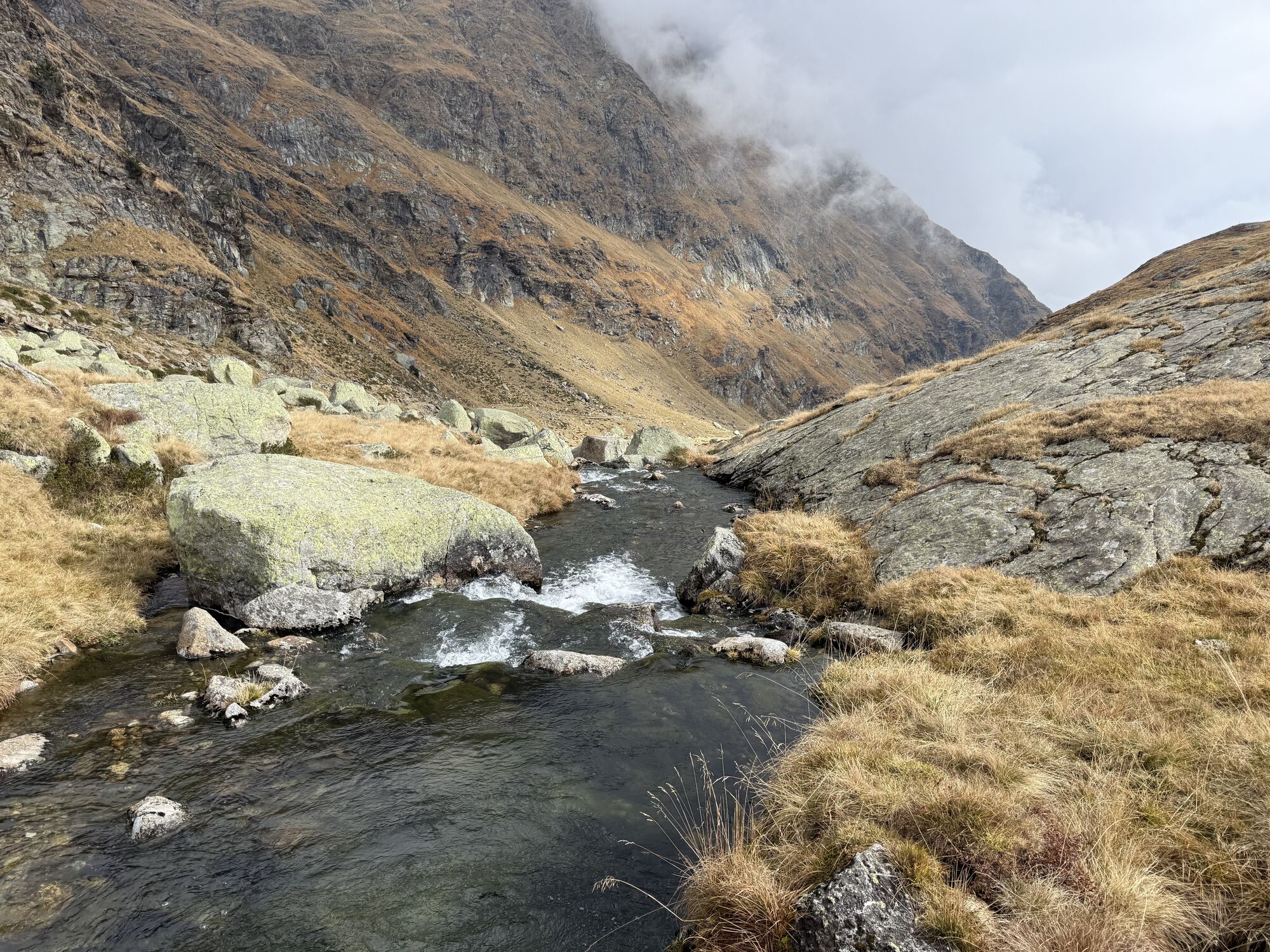
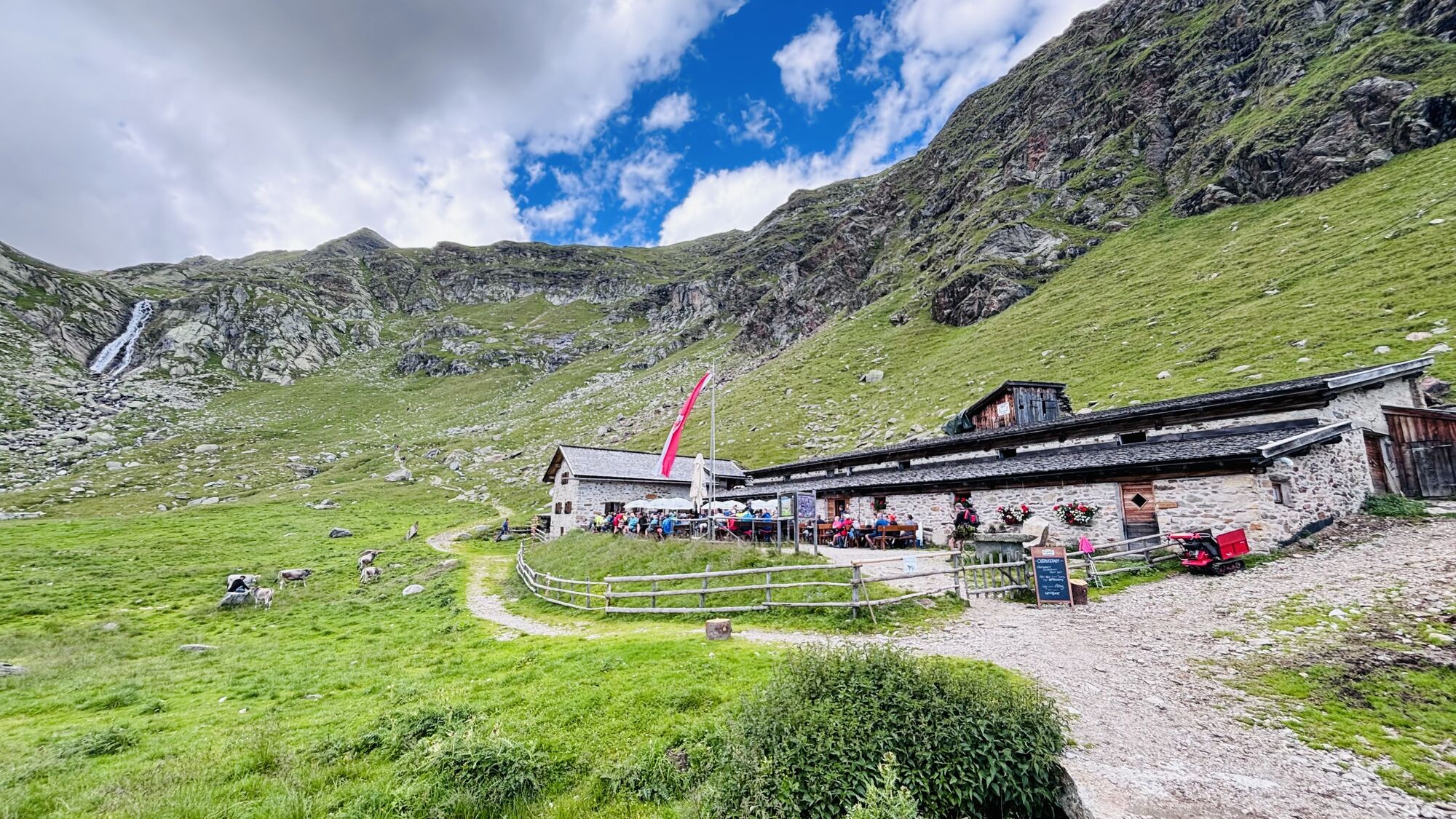
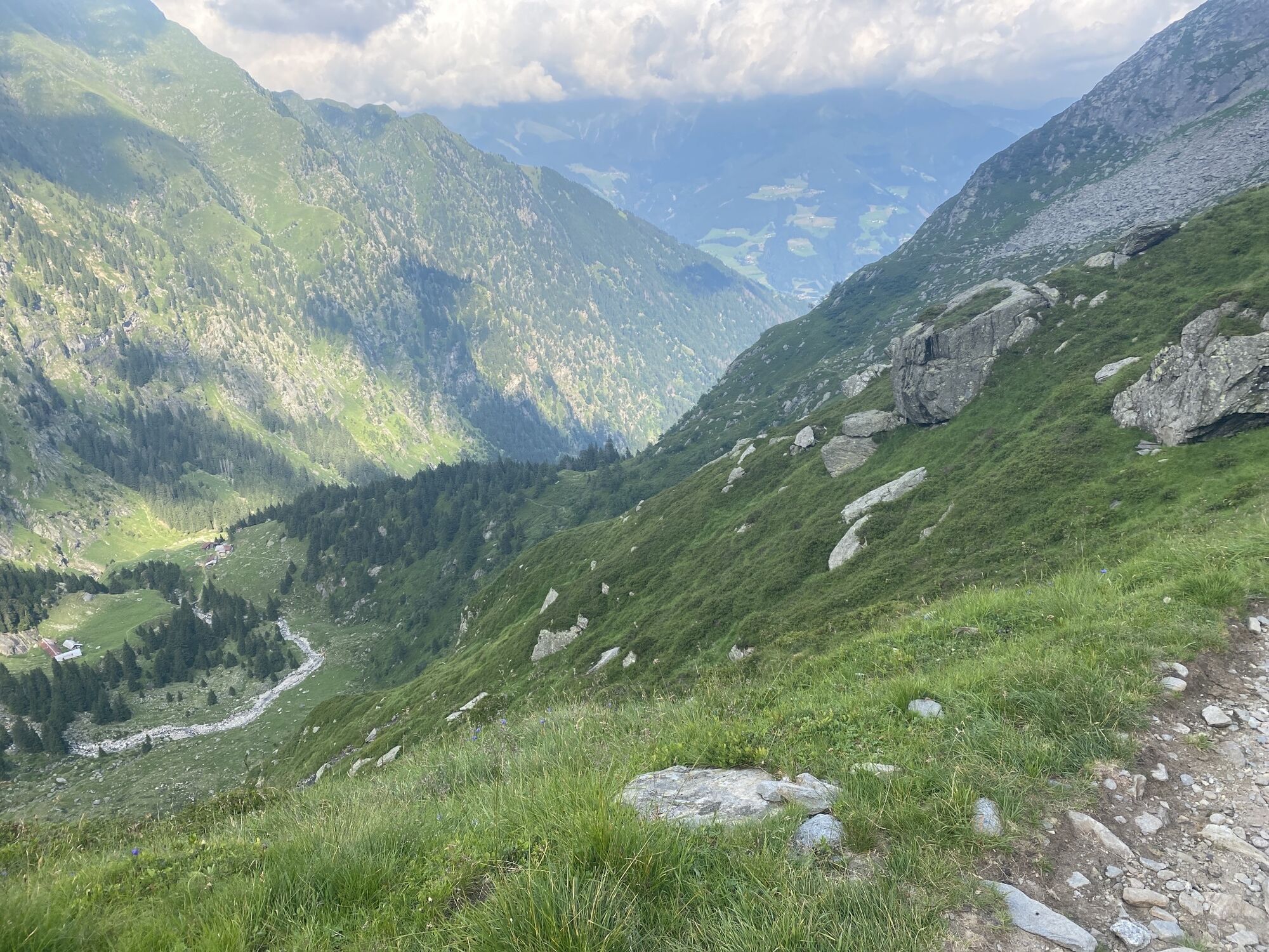
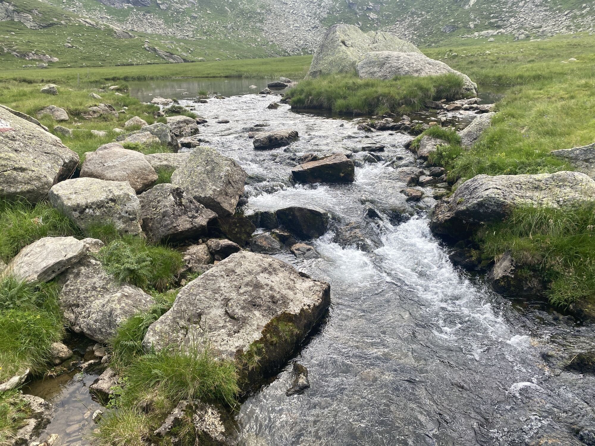
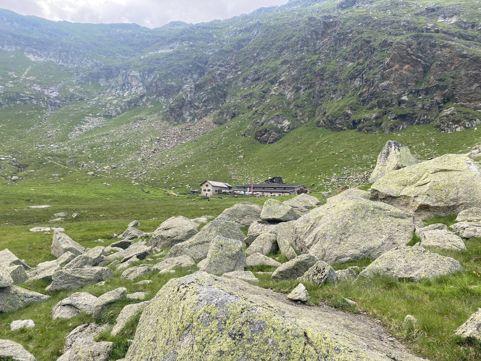
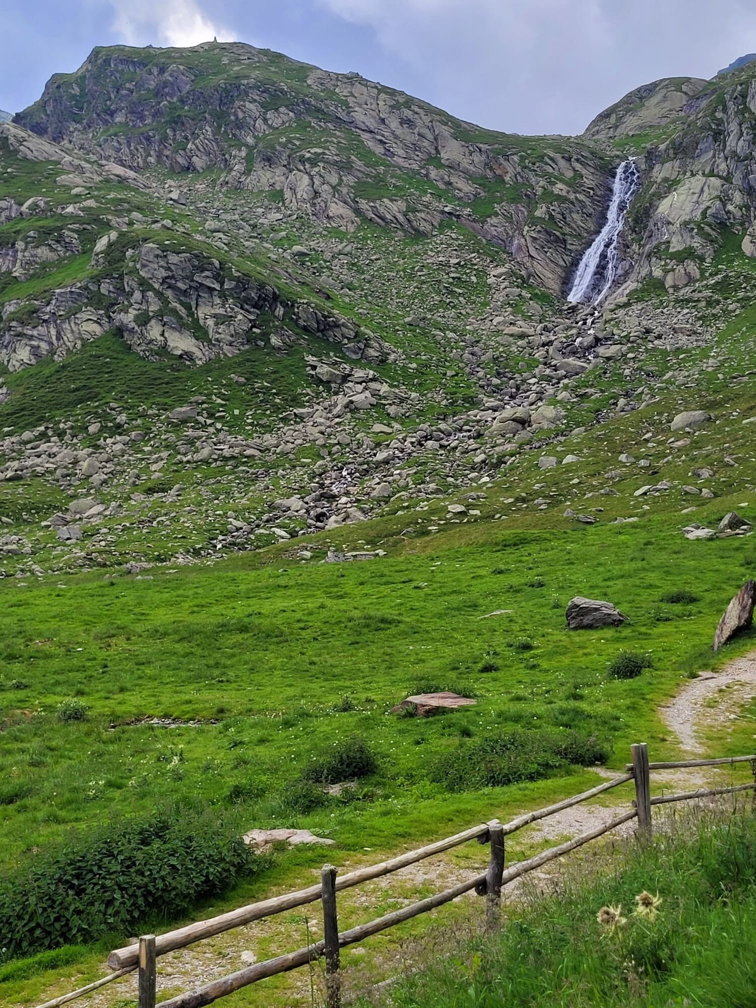
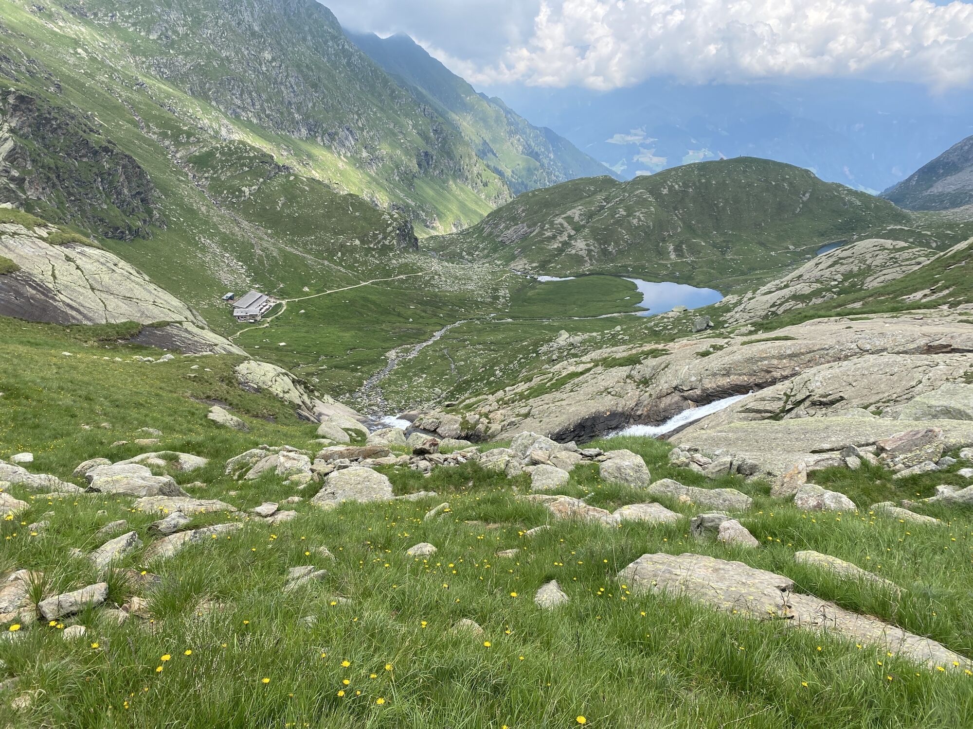
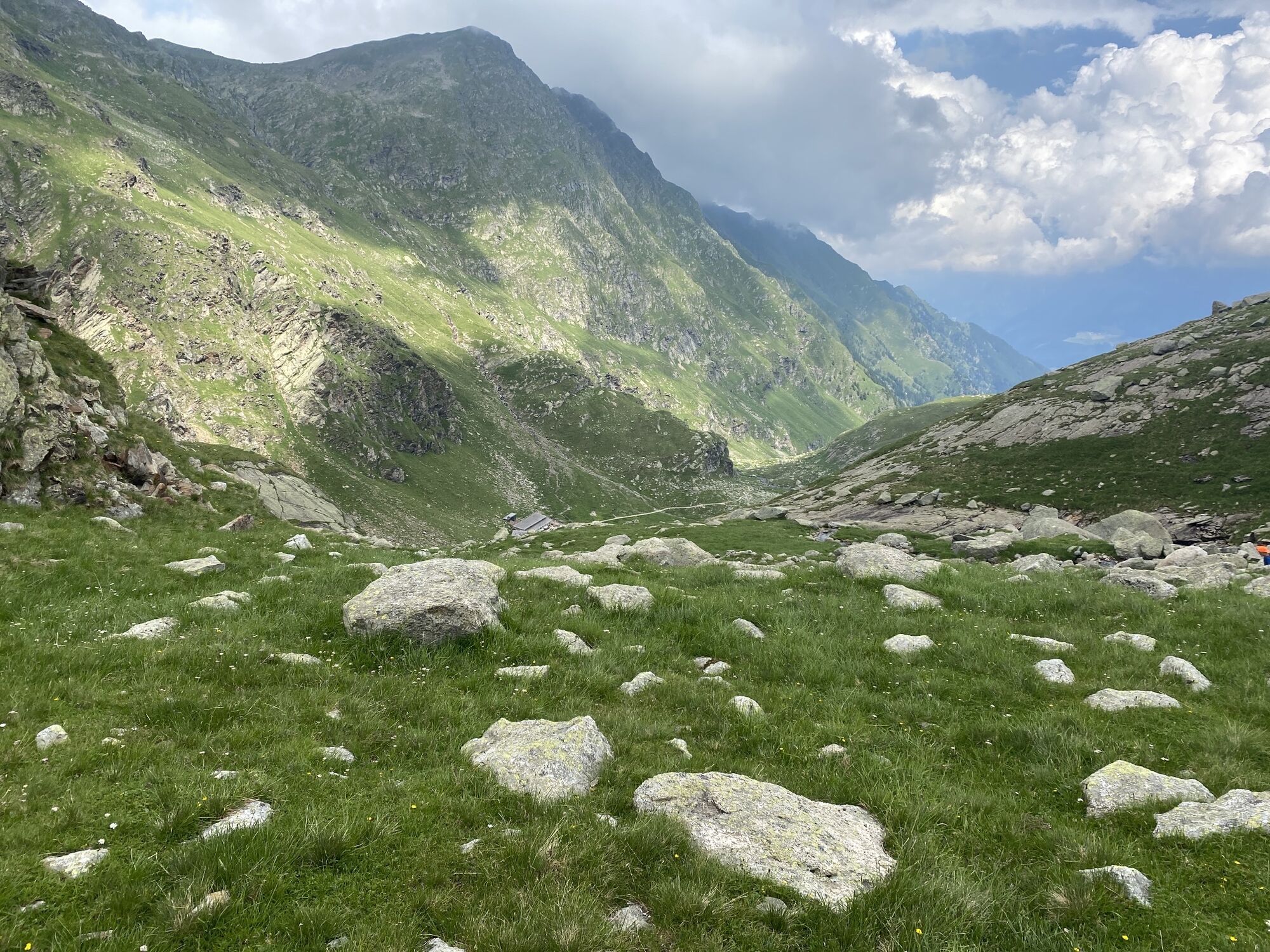
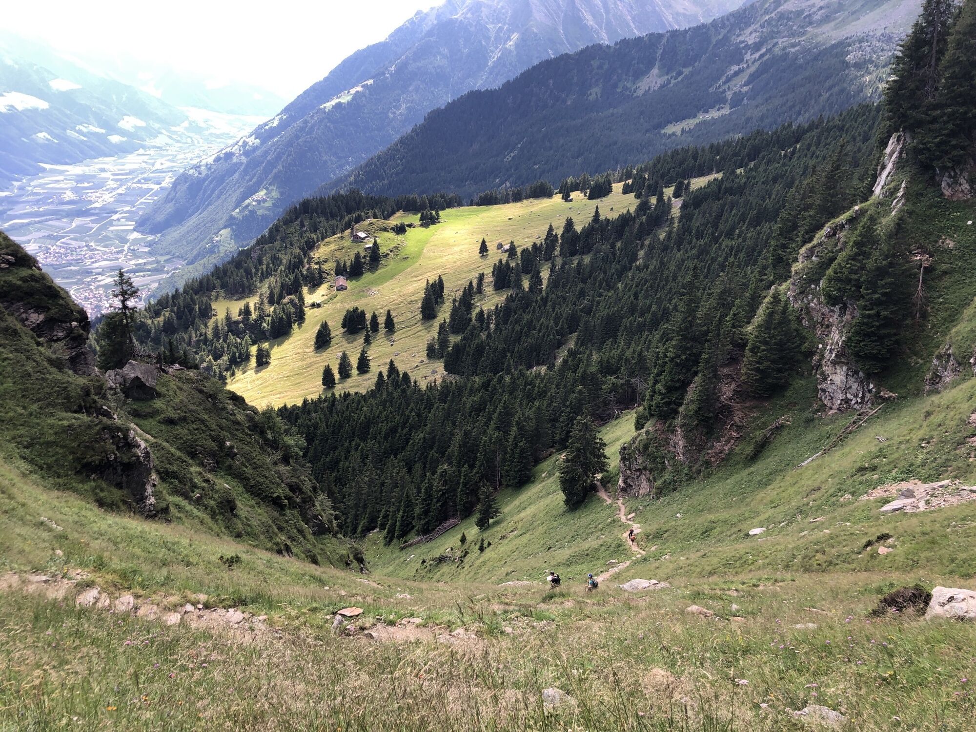
The starting point of this tour is Pfelders/Plan (1,628 m) in the Passeiertal valley. Take trail no. 6 up to the Faltschnal Alm mountain hut, cross the Faltschnaltal valley and continue until the Faltschnaljöchl pass and then until the Spronser Joch pass (2,581 m), the highest point of the tour with a view of (almost) all the Spronser Seen lakes. Descend along trail no. 6 past the crystal clear, colorful mountain lakes down to the Oberkaser Alm mountain hut (2,314 m). Trail no. 22 then leads past the Kaserlacke and the Pfitscherlacke lakes until the junction with trail no. 25B that you follow up until the Taufenscharte pass (about 100 metres of altitude difference). Descend along the rather steep trail with serpentines until you meet trail no. 24 (Meraner Höhenweg high alpine trail) and follow it until the Leiter Alm mountain hut, where you take the gondola basket lift to Vellau/Velloi and then the chair lift or bus back to Algund/Lagundo.
Da
Da
Da
Da
Da
Da
Take the Brenner motorway until you get to Bozen Süd, then the MEBO clearway until the exit for Meran Süd. Then, follow the signage for Jaufenpass / Timmelspass / Passeiertal via Riffian-St. Martin-St. Leonhard, Moos until you reach Pfelders in Passeier.
Mit dem Bus 213 von Algund oder dem Citybus bzw. der Vinschgau Bahn nach Meran Haltestelle Bahnhof; Bus 240 nach Pfelders.
Rathaus Algund (gebührenpflichtig)
Öffentlicher Parkplatz (Praderplatz) nähe Bahnhof Meran,
ACHTUNG: dienstags und freitags verboten!
Priljubljeni izleti v okolici
- 4.7
Algund Waalweg canal trail
svetlobaPohodništvo 4.45 km - 4.3
Vorderkaser - Eishof / Texelgruppe
svetlobaPohodništvo 4.83 km - 4.5
Aschbach / Rio Lagundo – Naturnser Alm mountain pasture - Vigiljoch/San Vigilio
srednjaPohodništvo 10.3 km - 4.8
Naturns Unterstellbahn bis Texelbahn auf dem Meraner Höhenweg
srednjaPohodništvo 9.77 km - 4.5
Leiter Alm mountain hut – Hochganghaus refuge - Gamplweg trail – Velloi
srednjaPohodništvo 9.77 km - 4.7
Leiteralm - Hochmuth - Vellau - Rundweg
svetlobaPohodništvo 5.89 km - 4.5
Meran Tappeinerweg
svetlobaPohodništvo 6.77 km - 4.9
Hirzer Almenrunde
svetlobaGorski pohodništvo 9.02 km - 4.6
Passerschlucht
svetlobaPohodništvo 8.84 km - 5.0
Obergurgl - Ramolhaus
Pohodništvo 7 km

Pohodništvo in sledenje


Ne zamudite ponudb in navdiha za naslednje počitnice
Vaš e-poštni naslov je bil dodan na poštni seznam.