


Mountain route from the Kötschachtal to the natural jewel Reedsee


Fotografije naših uporabnikov
 © Schirmi68Ustvarjeno na 20.10.2025
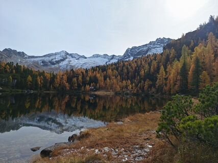
 © Herbert SchratteneckerUstvarjeno na 19.10.2025
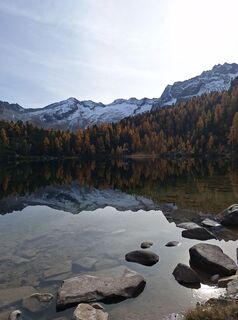 © Herbert SchratteneckerUstvarjeno na 19.10.2025
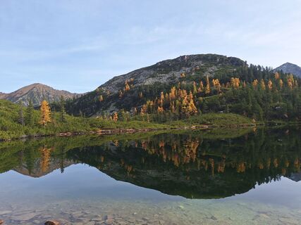 © Herbert SchratteneckerUstvarjeno na 19.10.2025
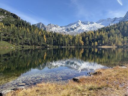
 © Stefka KöflerUstvarjeno na 11.10.2025
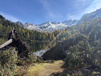 © Stefka KöflerUstvarjeno na 11.10.2025
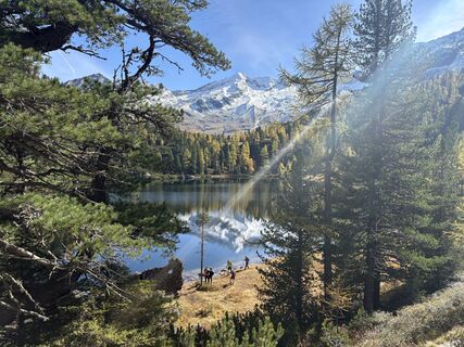 © Stefka KöflerUstvarjeno na 11.10.2025
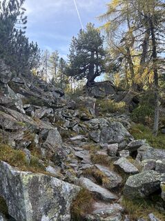 © Stefka KöflerUstvarjeno na 11.10.2025
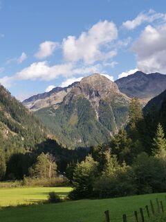 © P KowatschekUstvarjeno na 11.09.2025
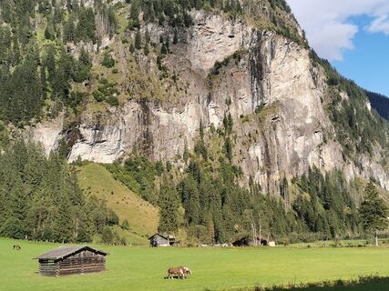 © P KowatschekUstvarjeno na 11.09.2025
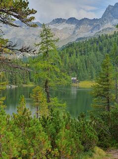 © Marie-Louise KohnUstvarjeno na 27.08.2025
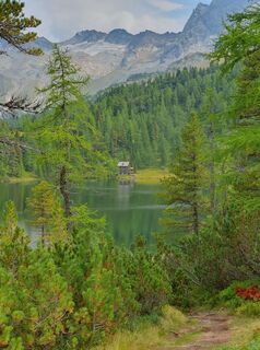 © Marie-Louise KohnUstvarjeno na 27.08.2025
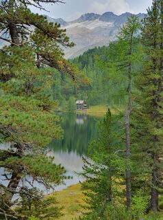 © Marie-Louise KohnUstvarjeno na 27.08.2025
 © SchääfchenUstvarjeno na 26.08.2025
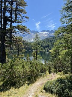 © SchääfchenUstvarjeno na 26.08.2025
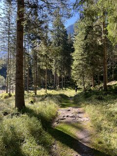 © SchääfchenUstvarjeno na 26.08.2025
 © Magnus MoserUstvarjeno na 19.06.2025
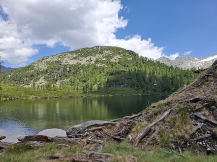 © Magnus MoserUstvarjeno na 19.06.2025
 © Magnus MoserUstvarjeno na 19.06.2025
 © Magnus MoserUstvarjeno na 19.06.2025
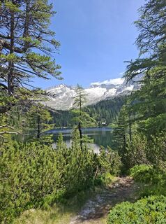 © Magnus MoserUstvarjeno na 19.06.2025
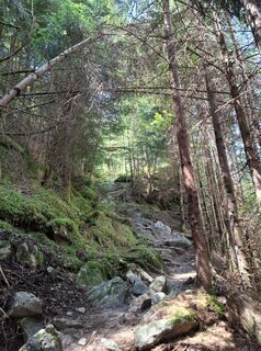 © Magnus MoserUstvarjeno na 19.06.2025
 © Magnus MoserUstvarjeno na 19.06.2025
 © MauiGraUstvarjeno na 07.02.2025
 © MauiGraUstvarjeno na 07.02.2025
 © MauiGraUstvarjeno na 07.02.2025
 © MauiGraUstvarjeno na 07.02.2025
 © MauiGraUstvarjeno na 07.02.2025
 © MauiGraUstvarjeno na 07.02.2025
 © MauiGraUstvarjeno na 07.02.2025
 © MauiGraUstvarjeno na 07.02.2025
 © MauiGraUstvarjeno na 07.02.2025
 © Christina TurnwaldUstvarjeno na 31.07.2023
 © Christina TurnwaldUstvarjeno na 31.07.2023
 © Christina TurnwaldUstvarjeno na 31.07.2023
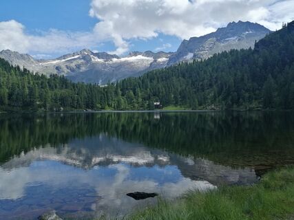 © Christina TurnwaldUstvarjeno na 31.07.2023
 © Christina TurnwaldUstvarjeno na 31.07.2023
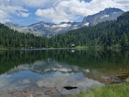 © Christina TurnwaldUstvarjeno na 31.07.2023
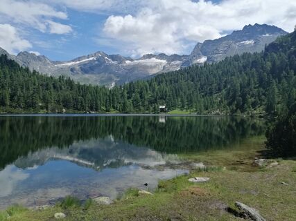 © Christina TurnwaldUstvarjeno na 31.07.2023
 © Christina TurnwaldUstvarjeno na 31.07.2023
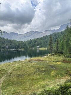
 © MasuUstvarjeno na 16.08.2025


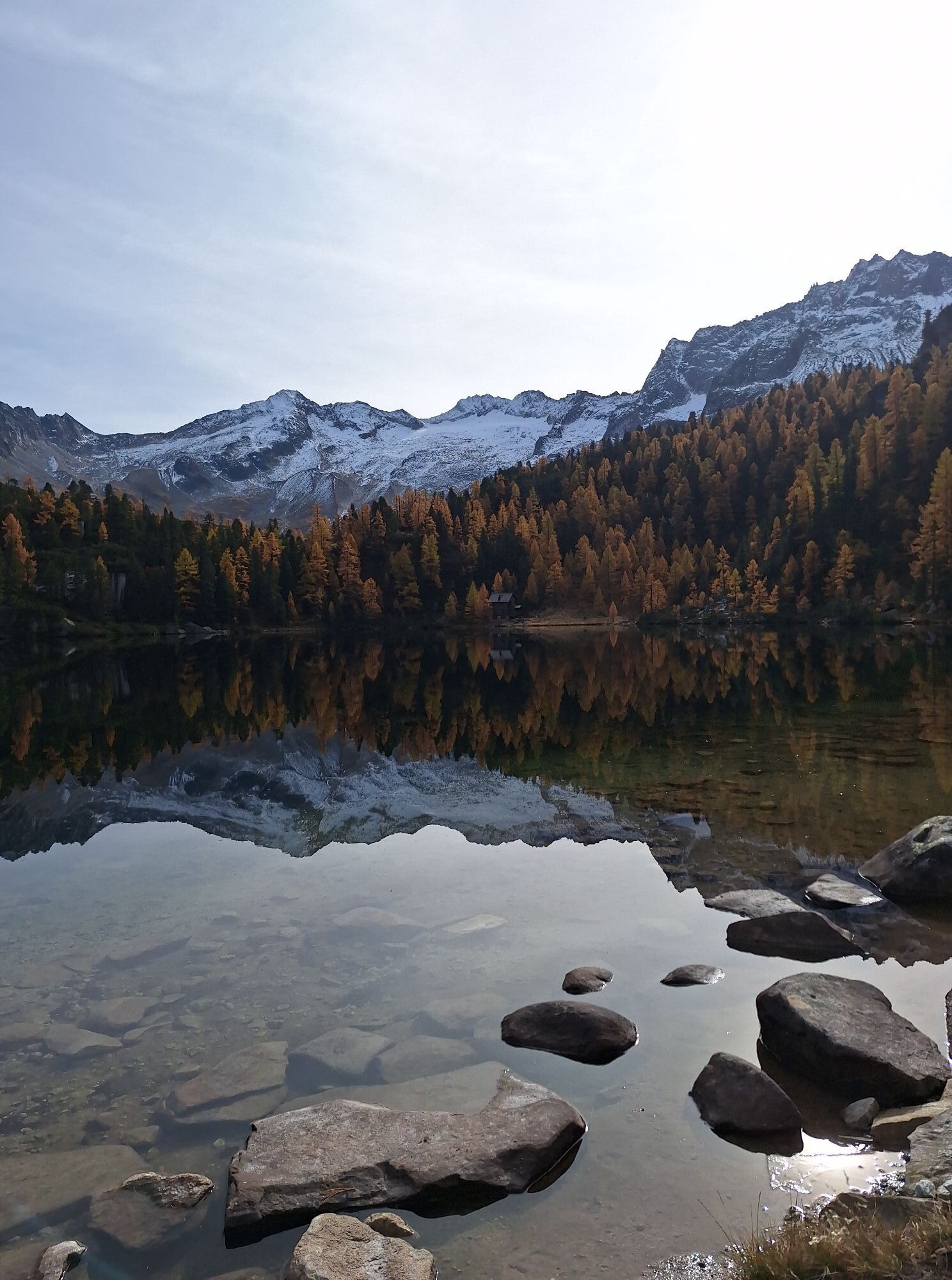
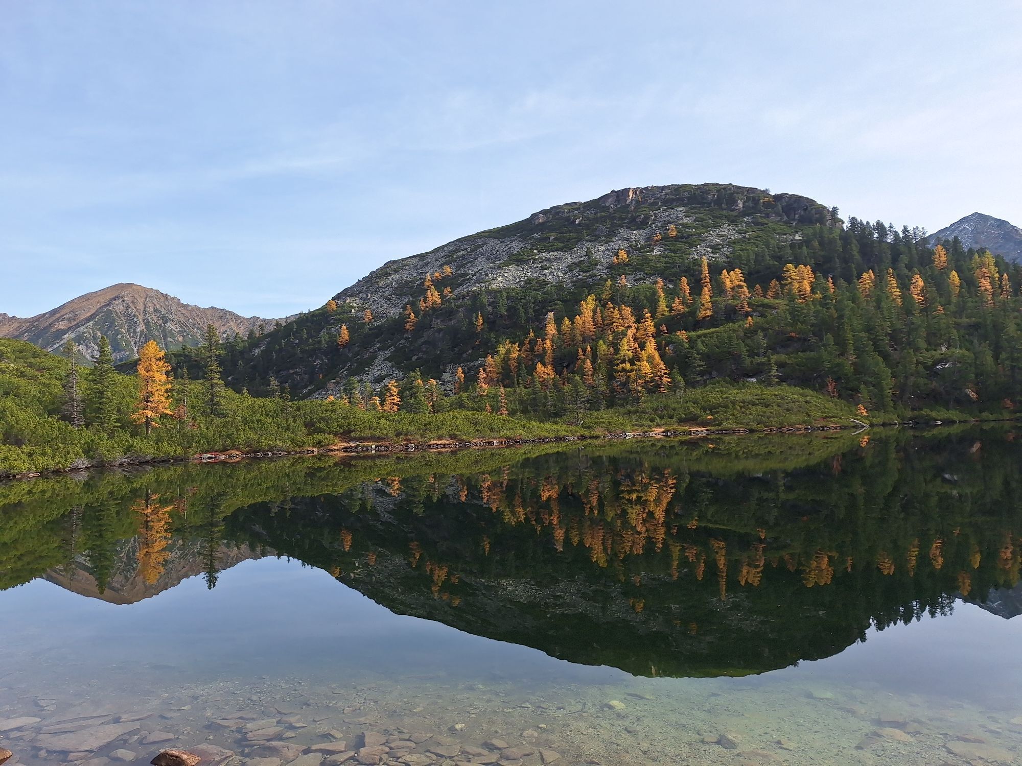


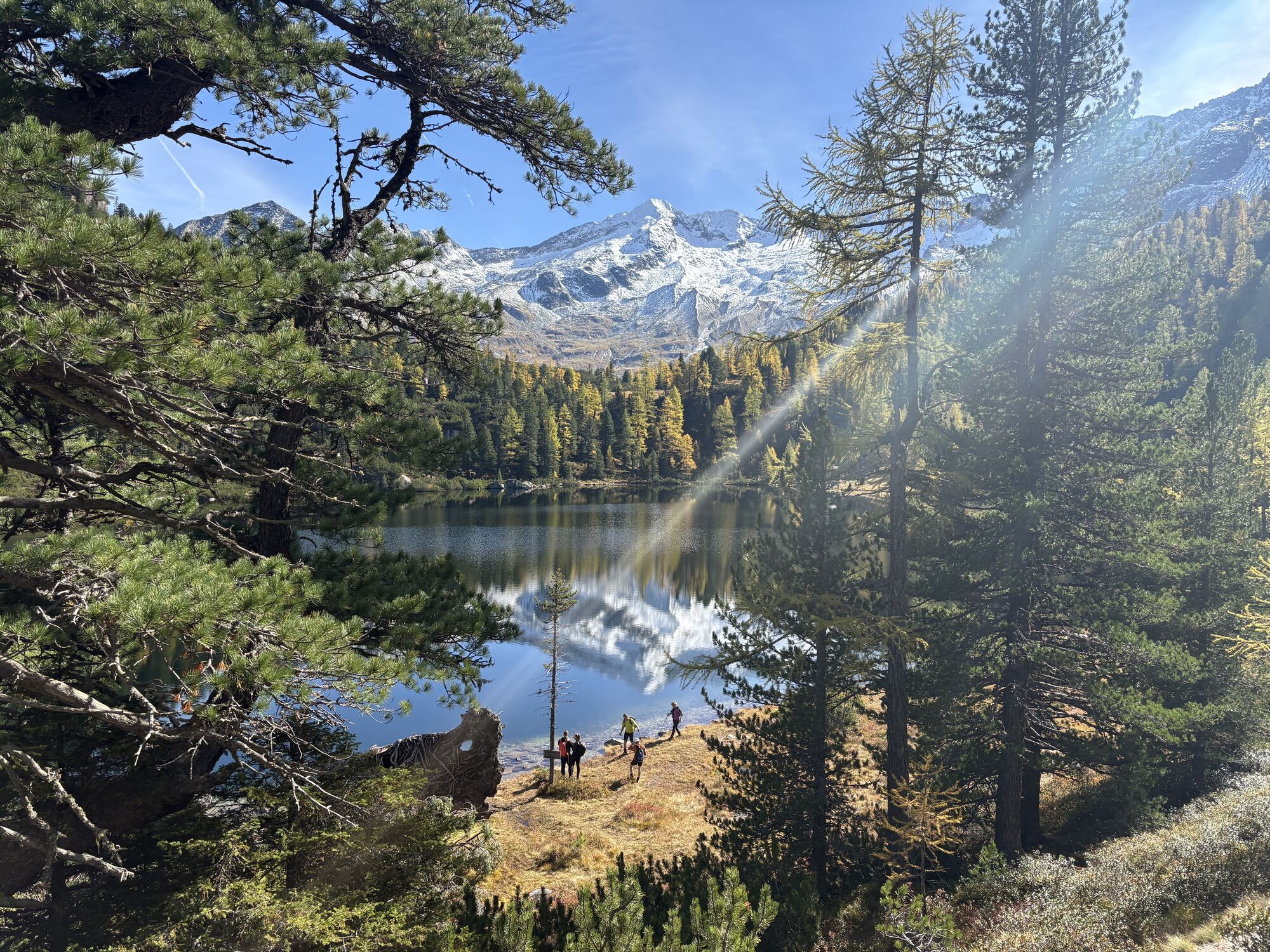

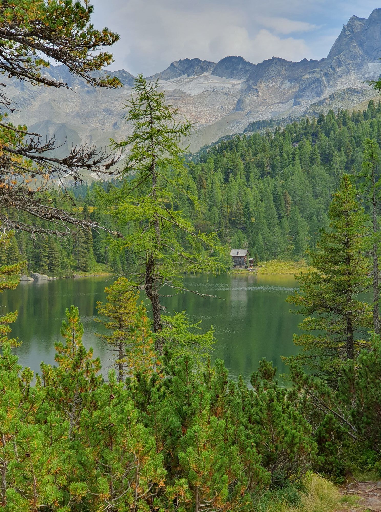


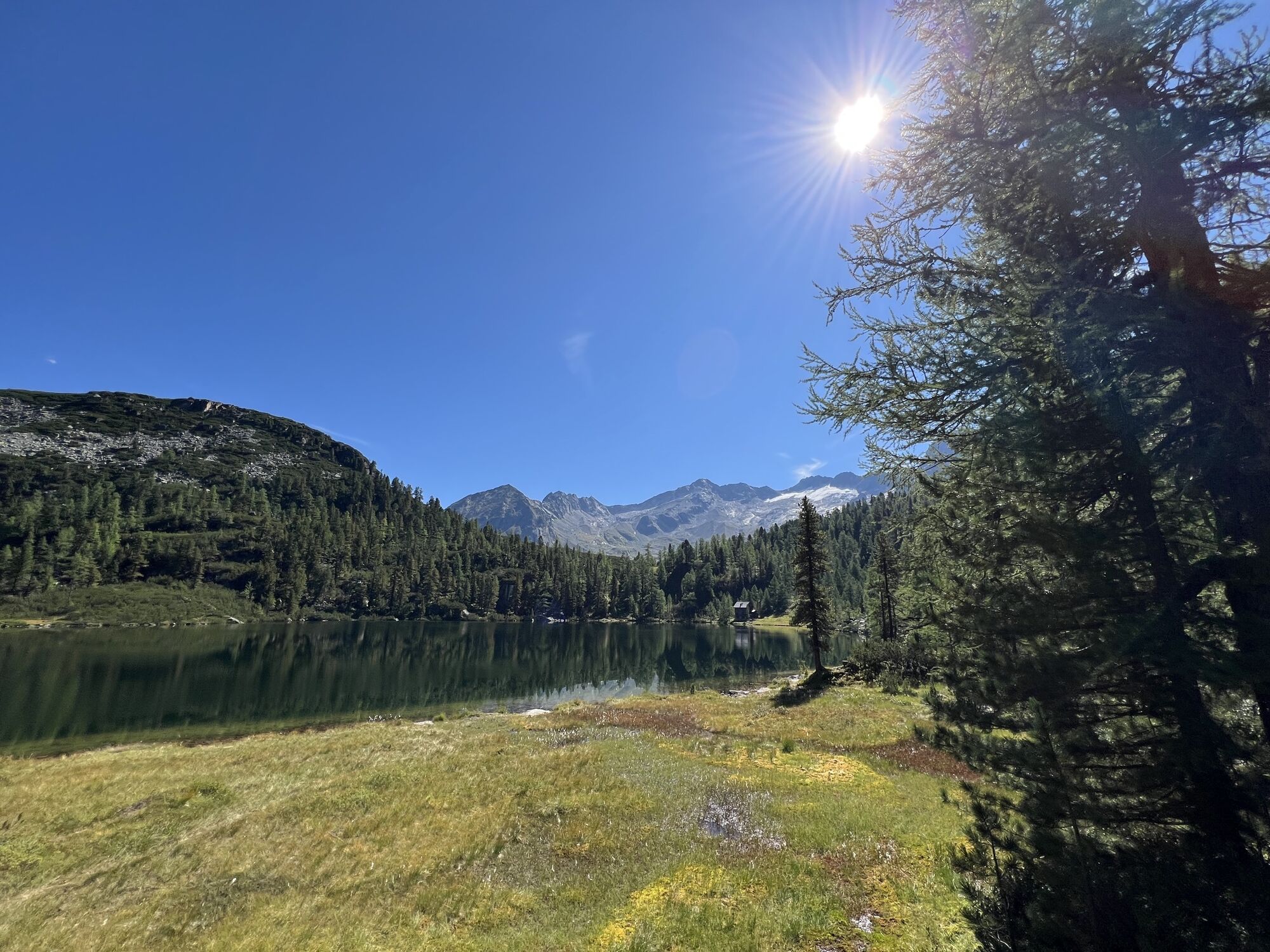
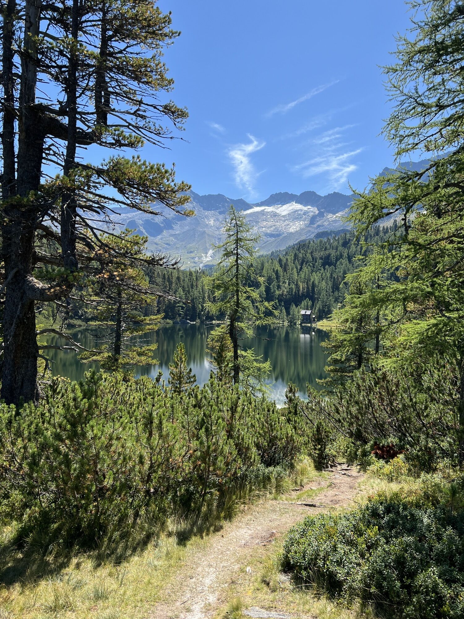

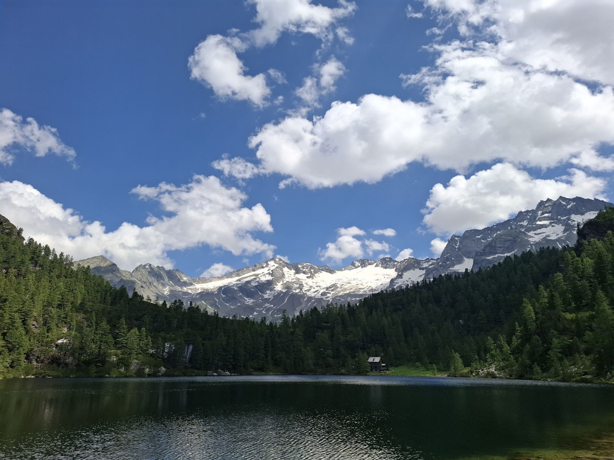

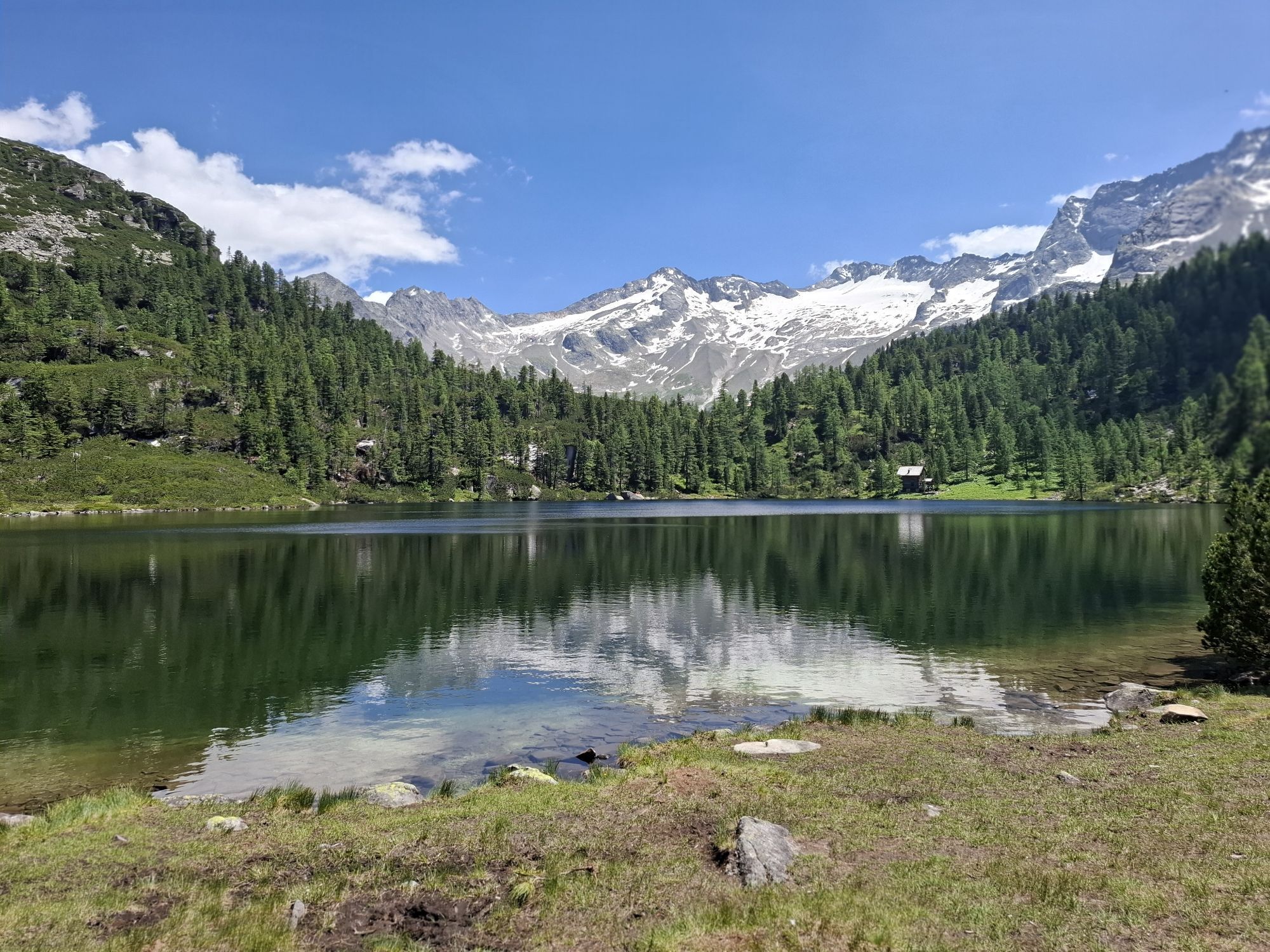
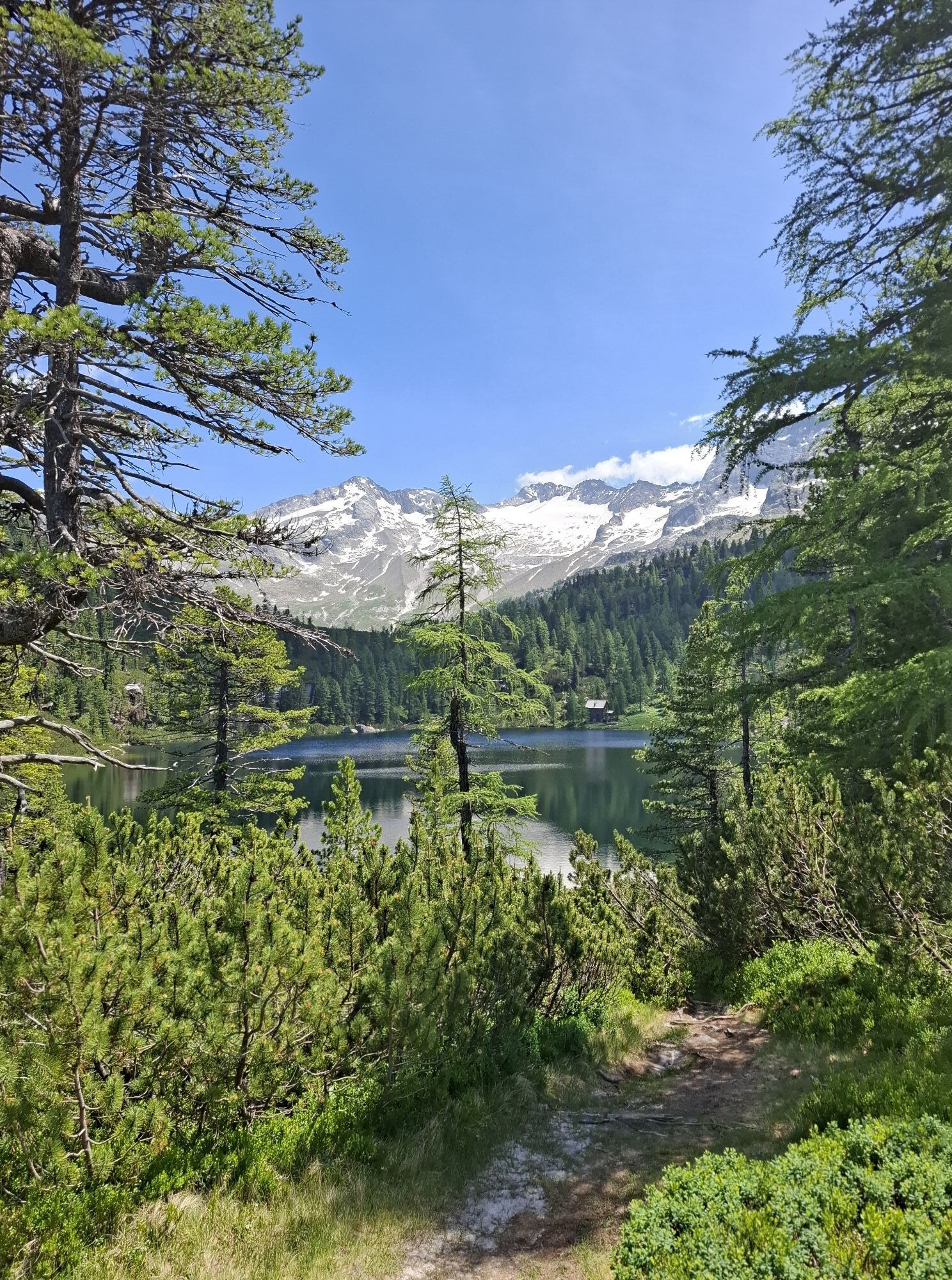

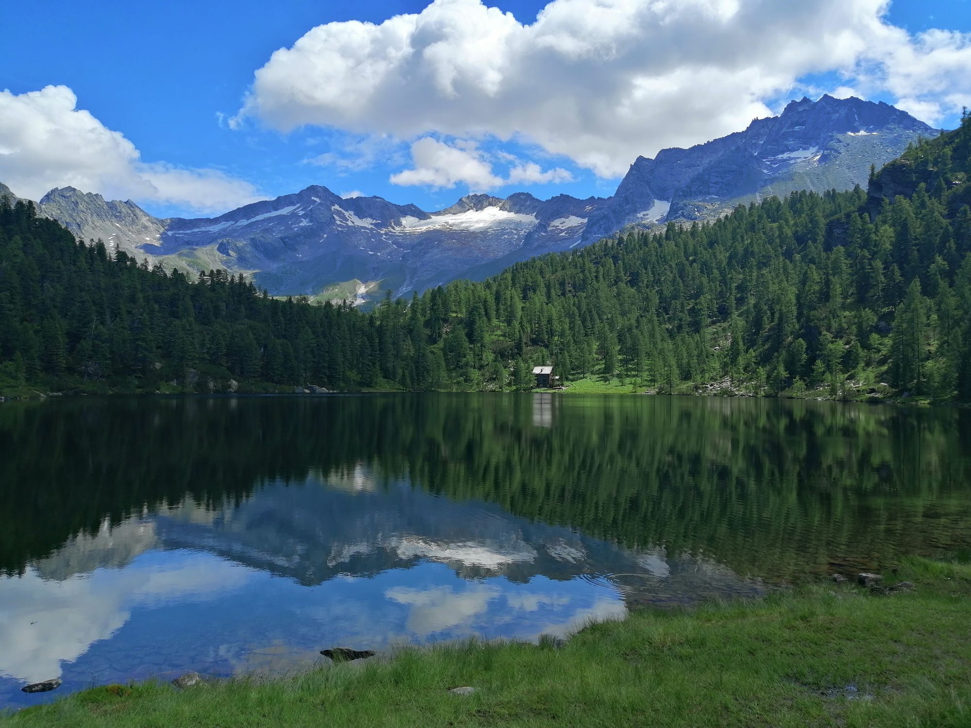
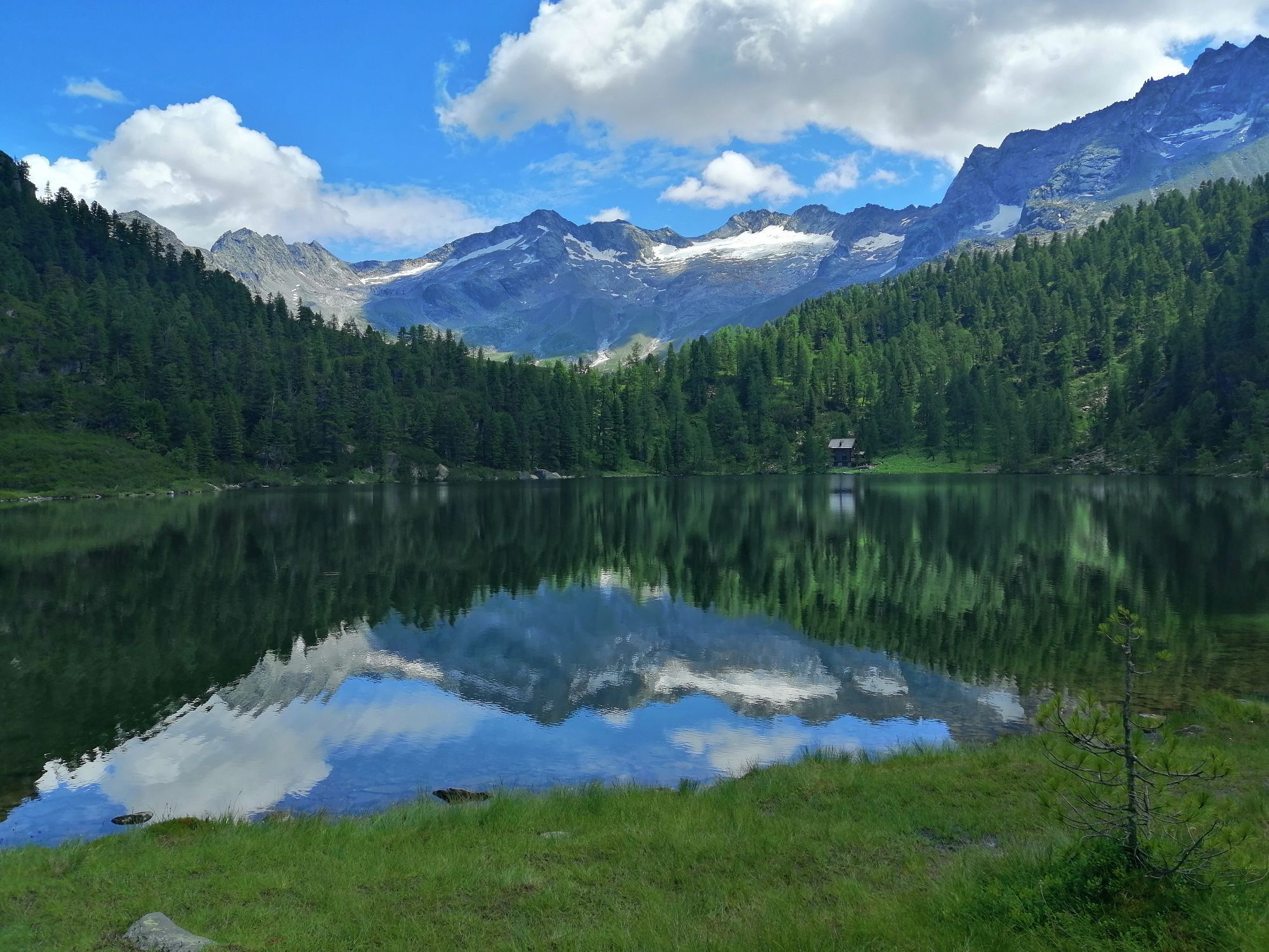


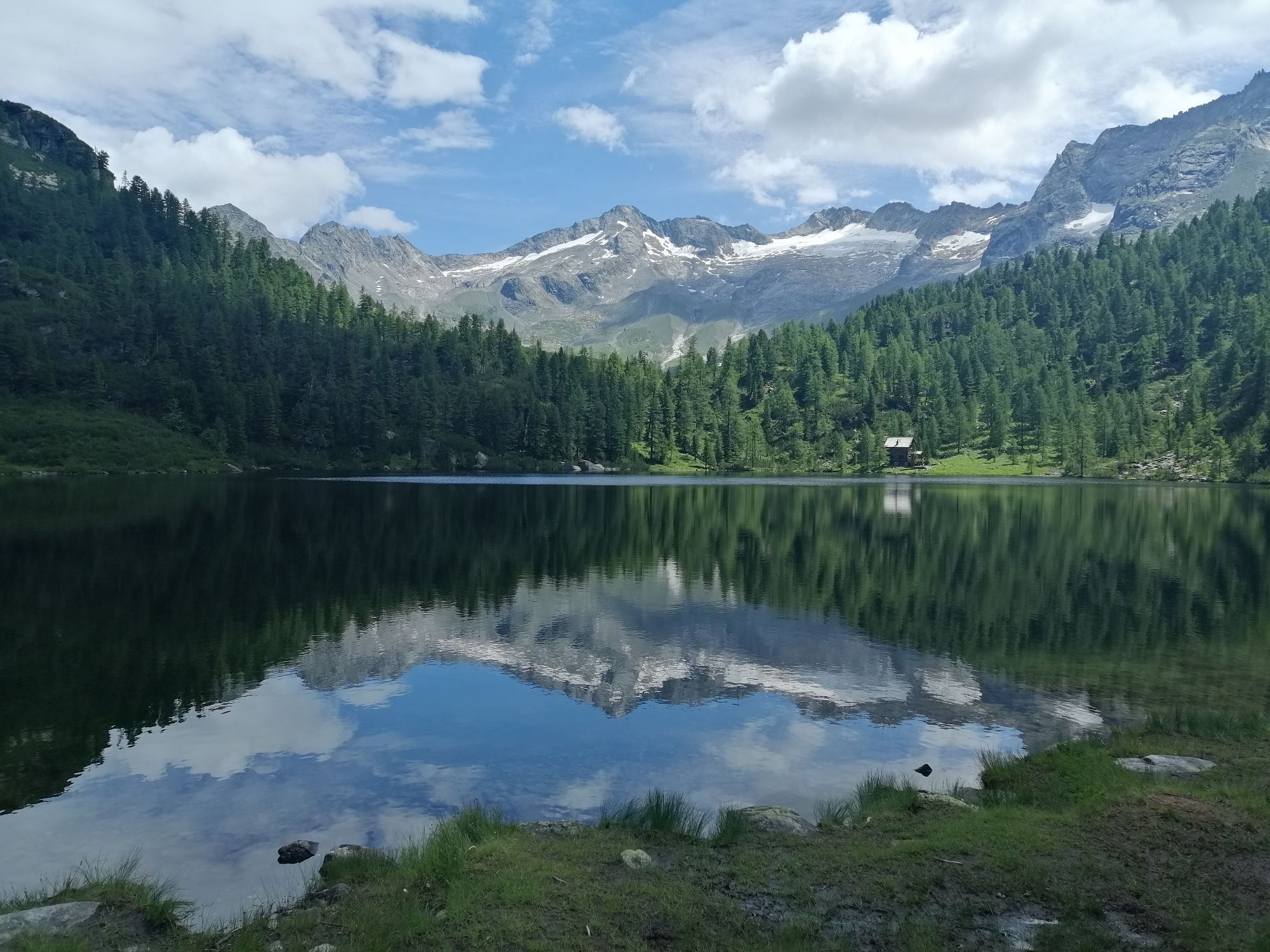

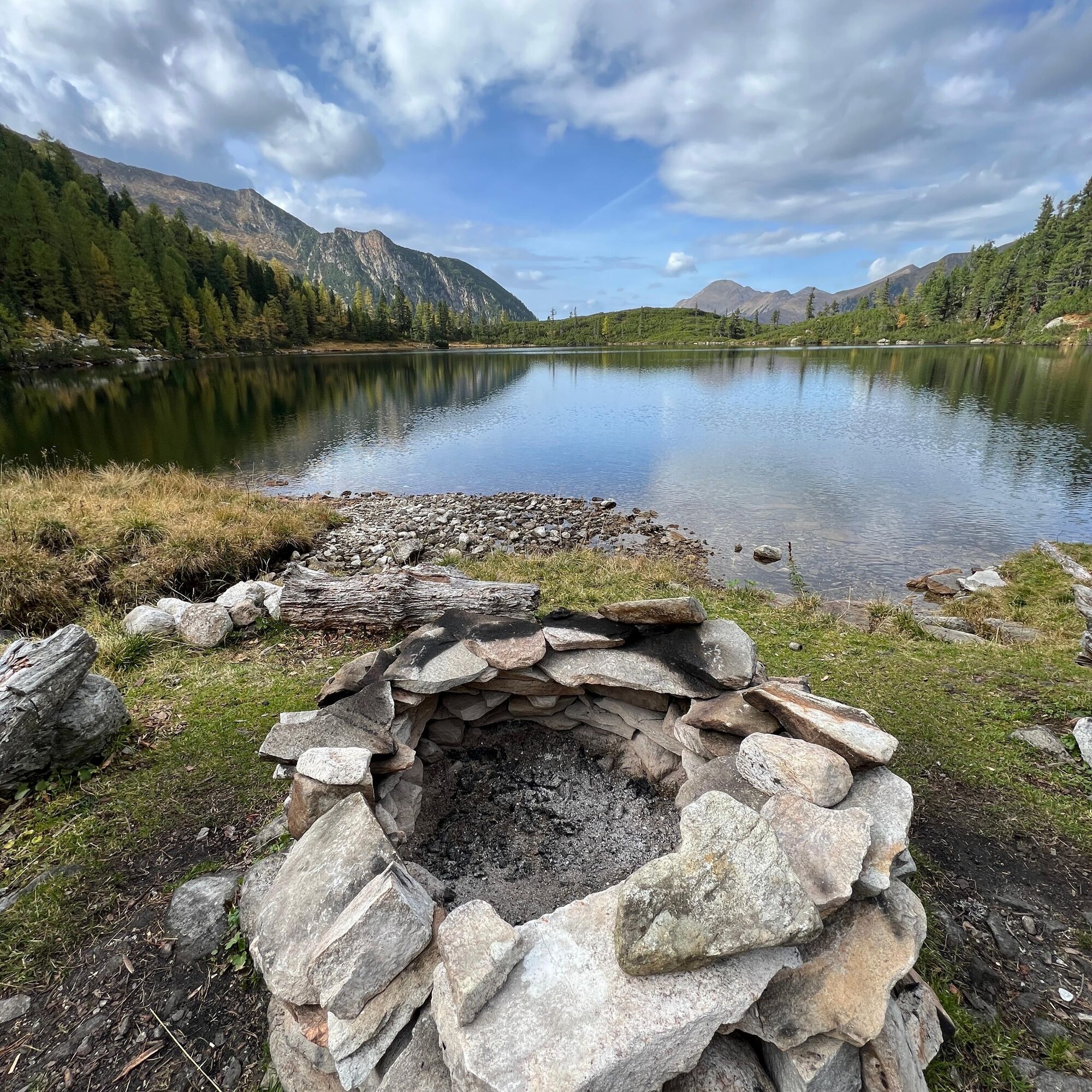
Nestled in centuries-old mountain forest, the Reedsee stretches at an altitude of 1,831 meters in an idyllic forest clearing that extends to the majestic peaks of the Tischler group. In the calm surface...
Nestled in centuries-old mountain forest, the Reedsee stretches at an altitude of 1,831 meters in an idyllic forest clearing that extends to the majestic peaks of the Tischler group. In the calm surface of the water, you can discover enchanting reflections of the trees, mountains, and glaciers. This hike is an annual highlight for many locals, especially in the autumn months when the breathtaking beauty of this mountain lake is in full display.

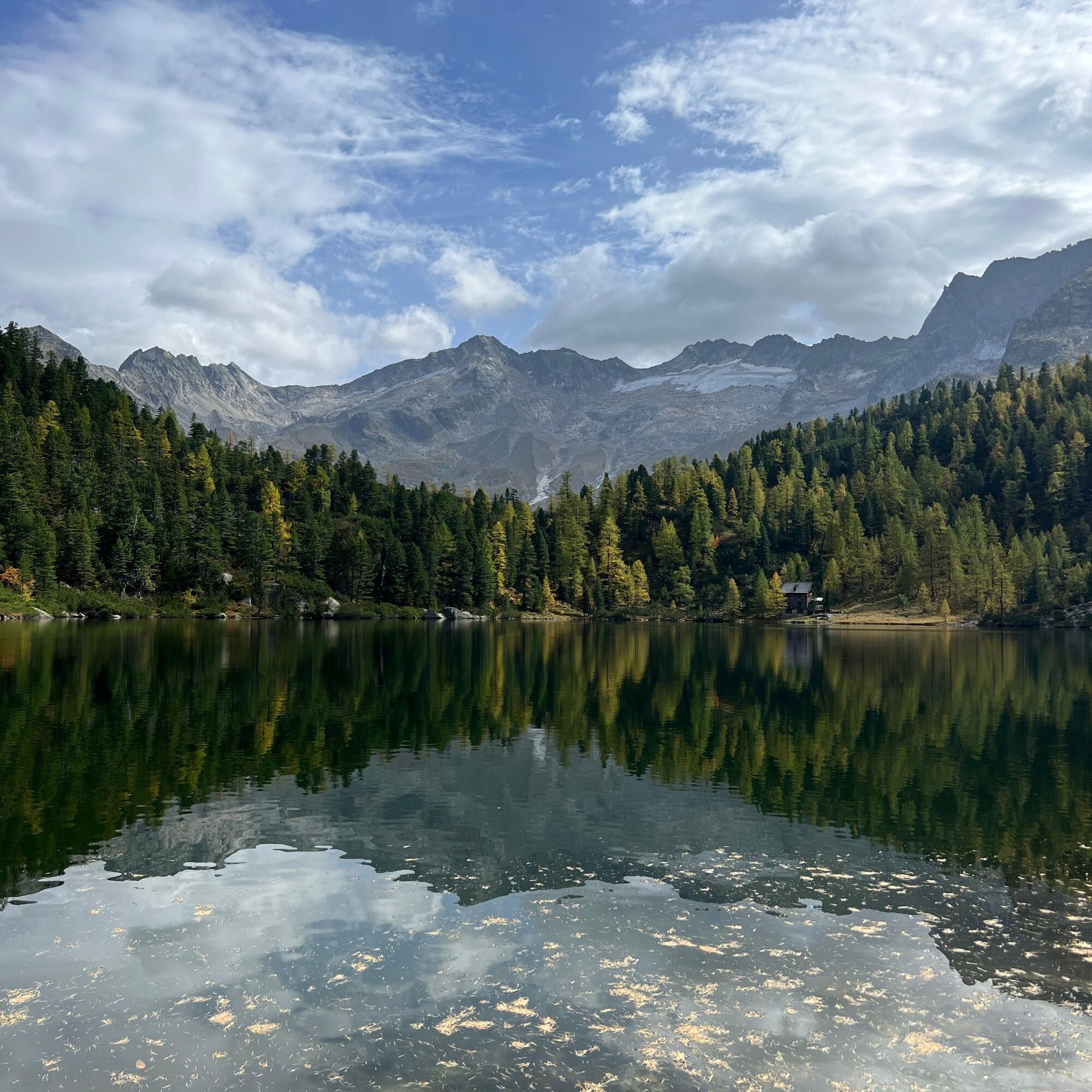
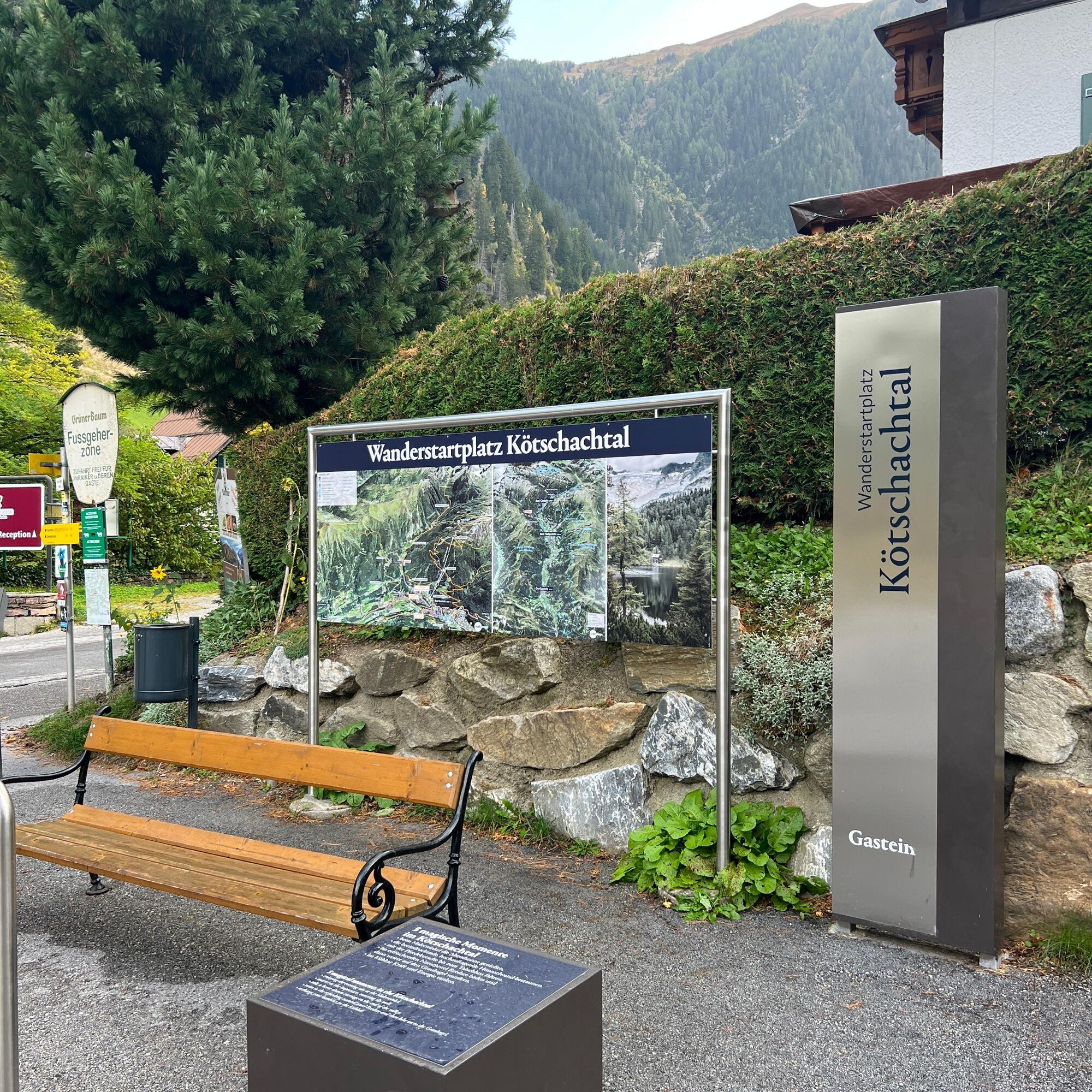
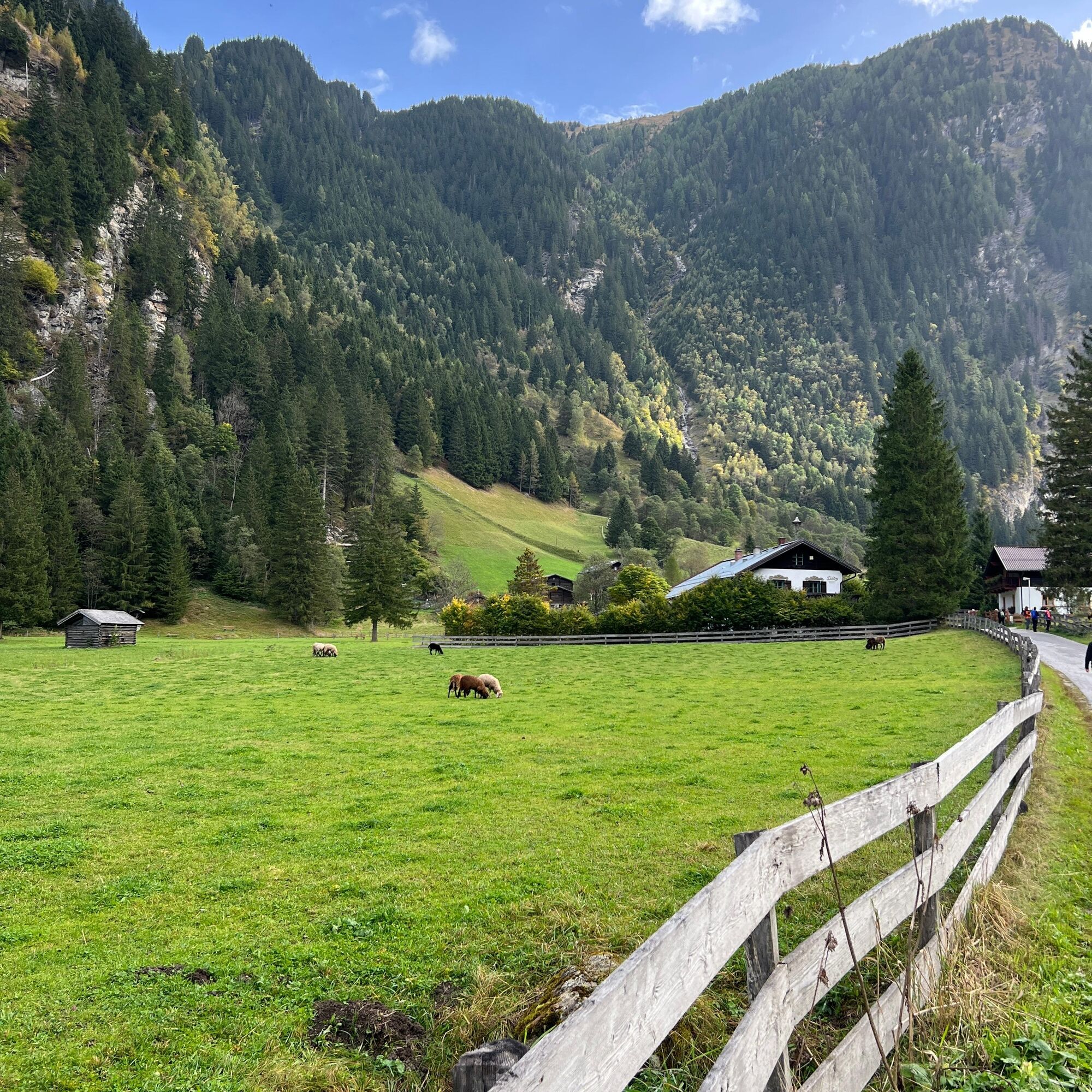
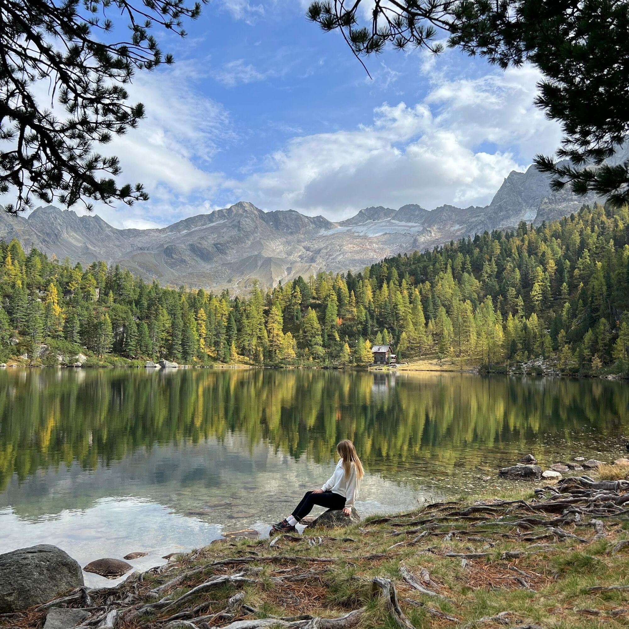
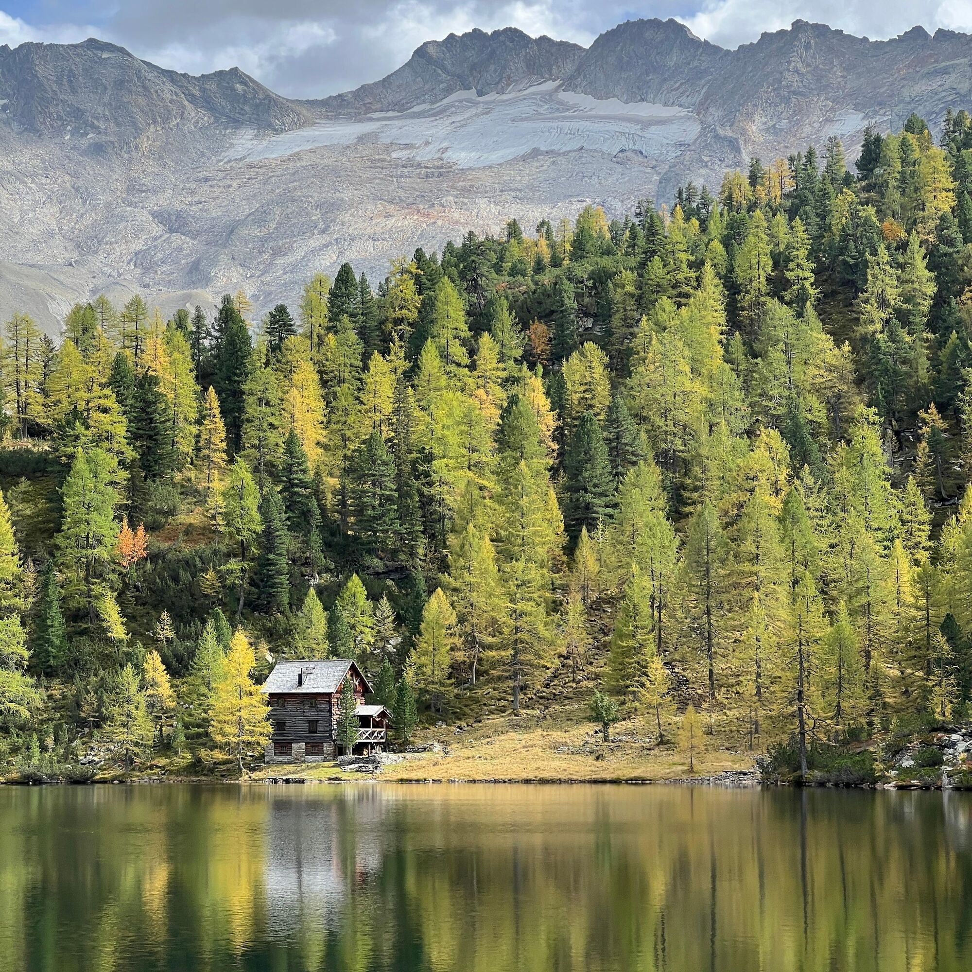
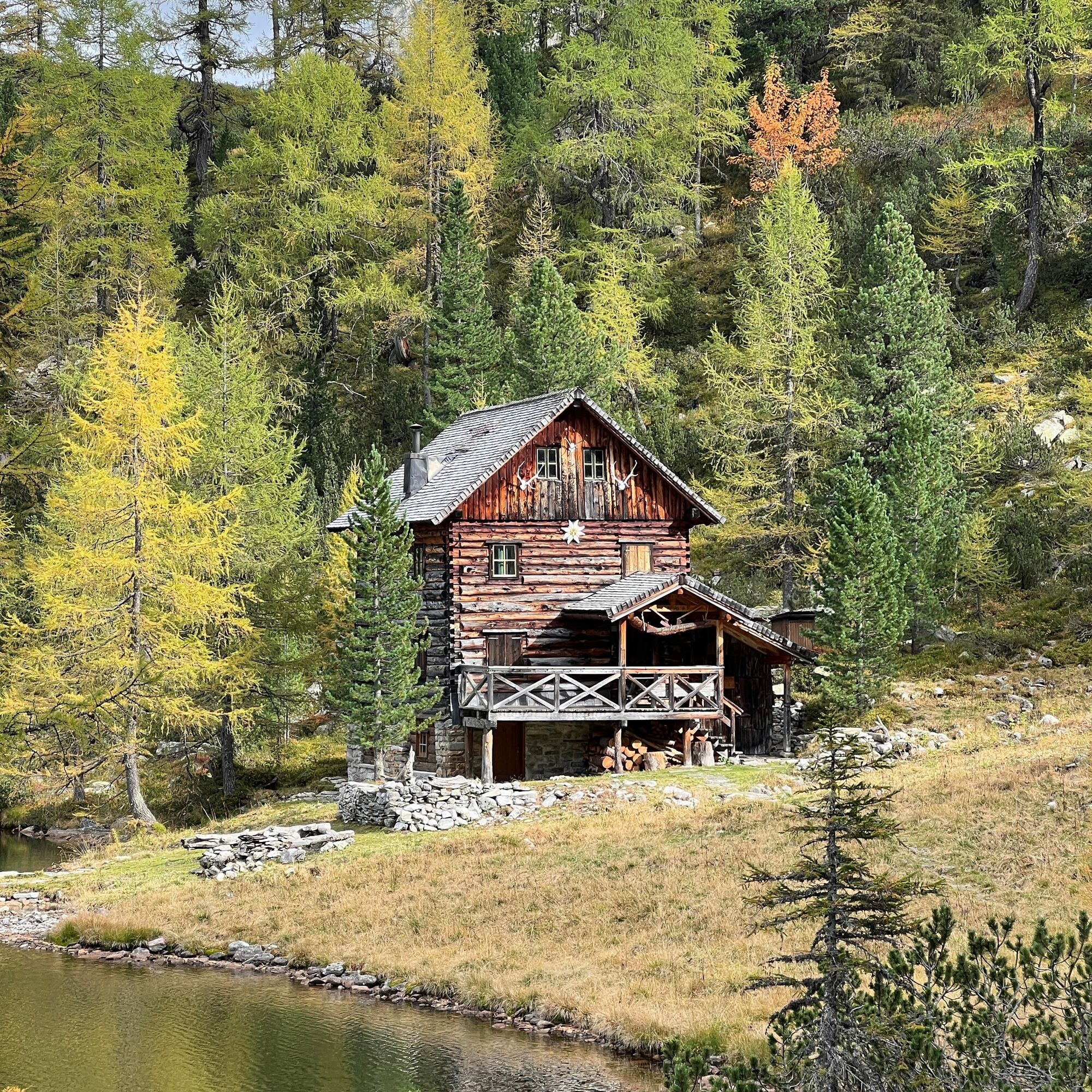
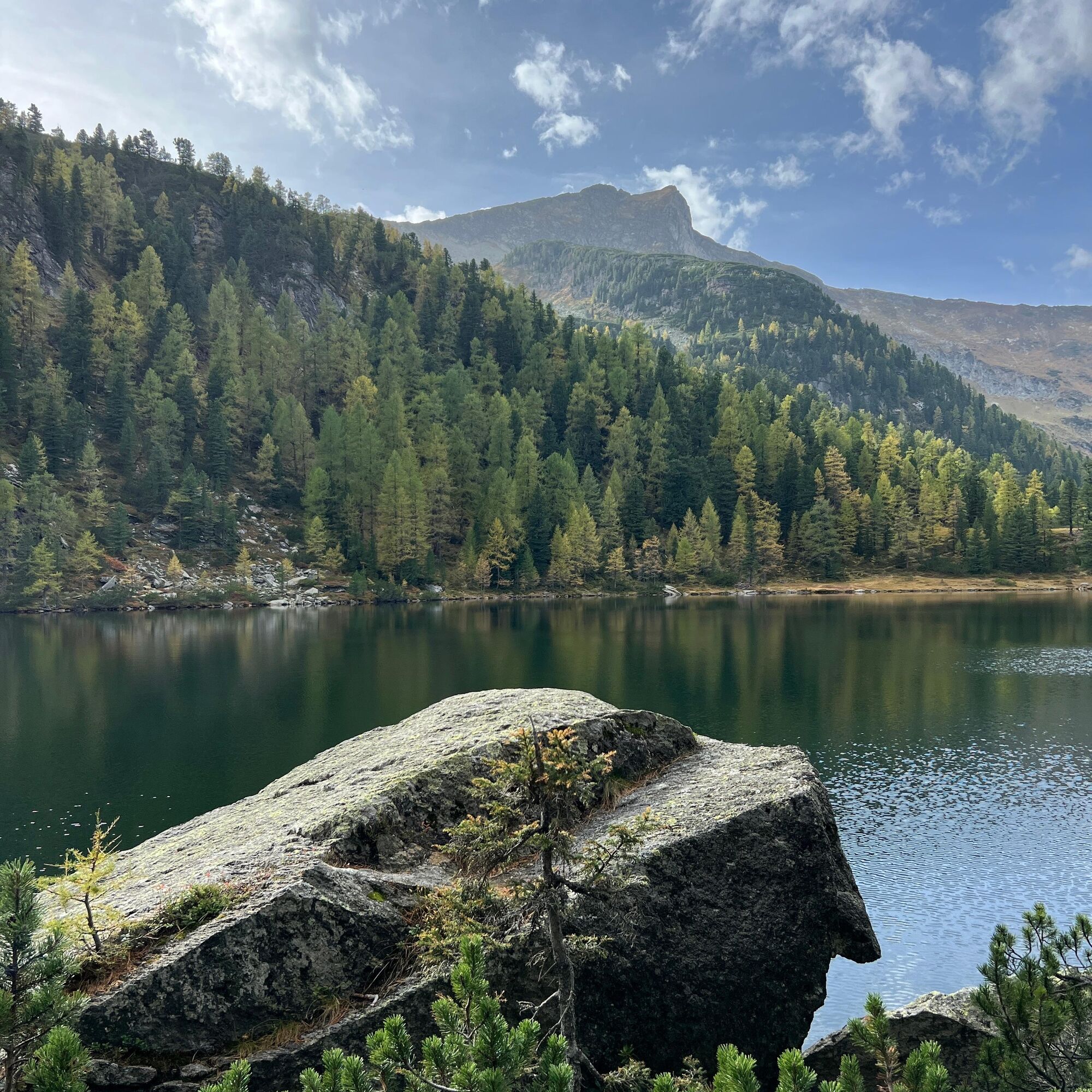
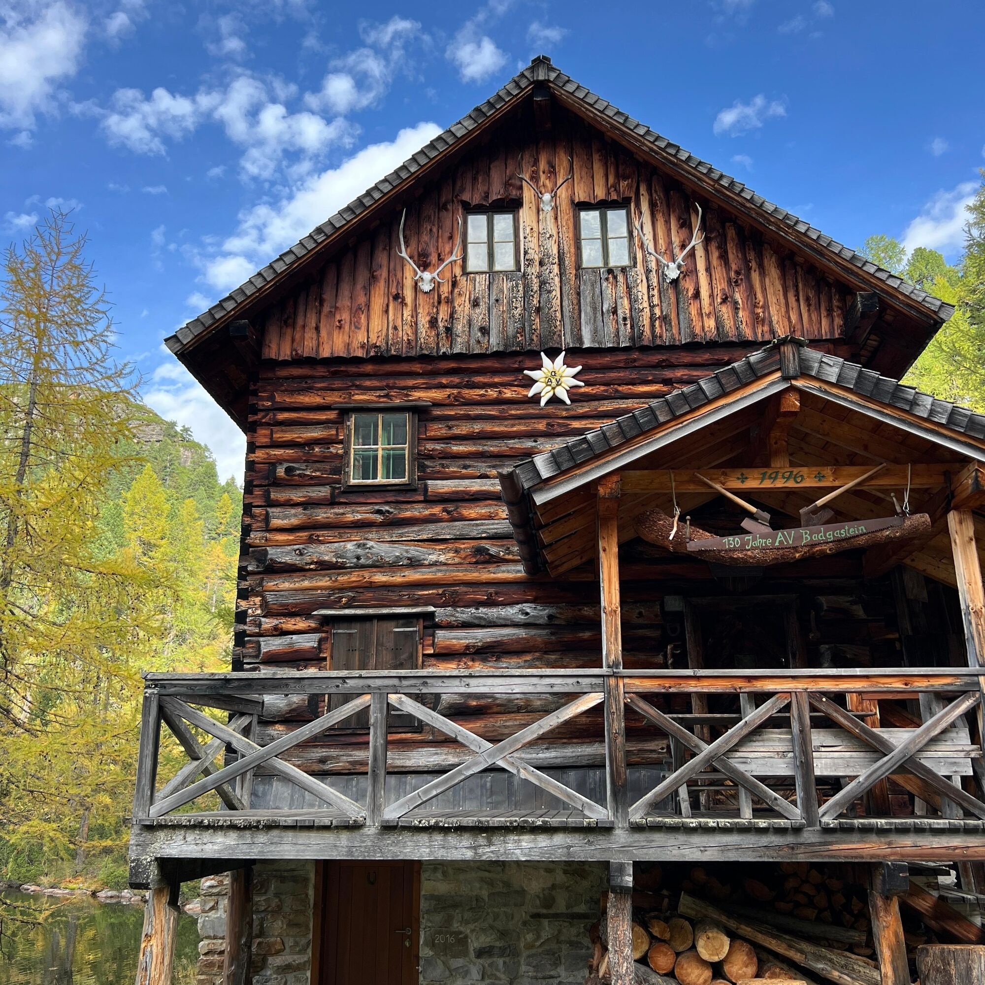
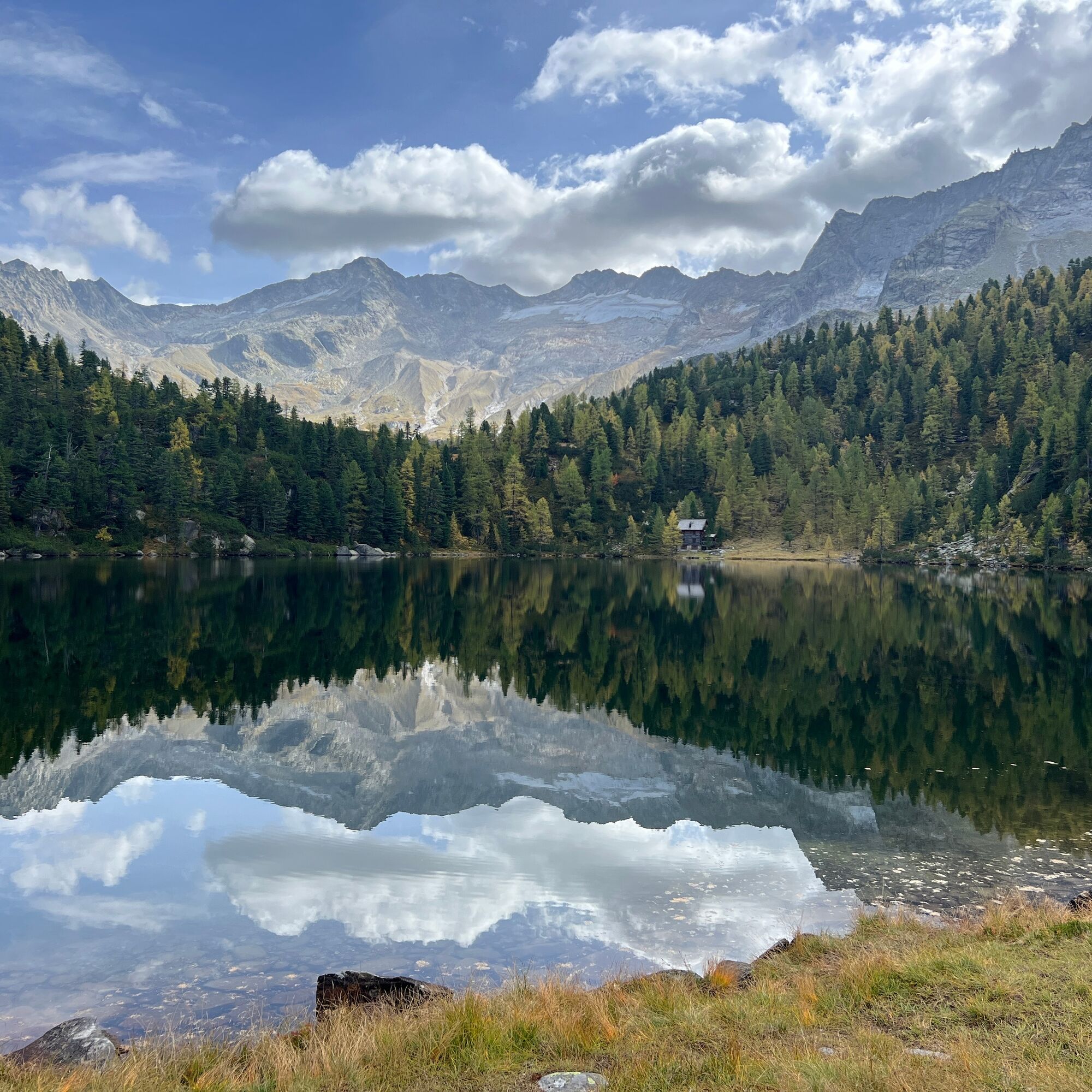
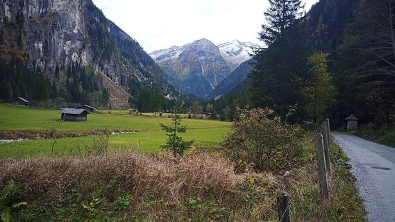
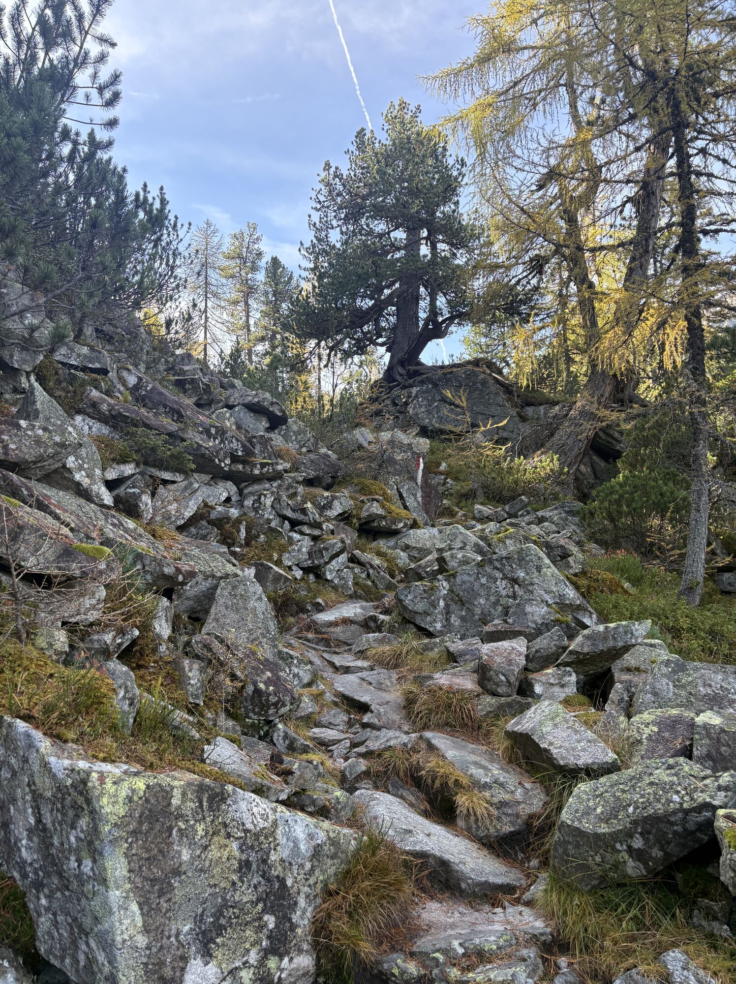
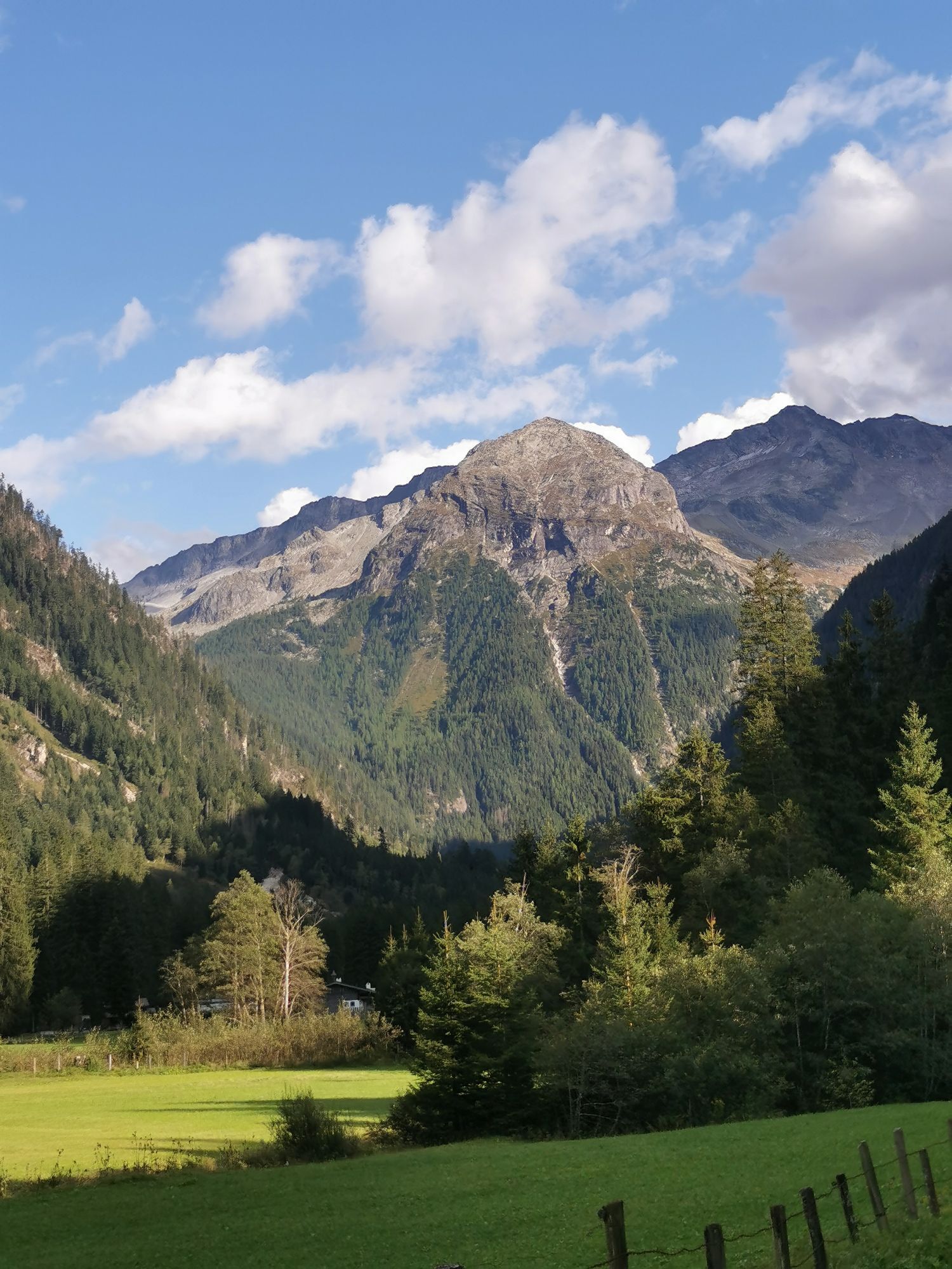
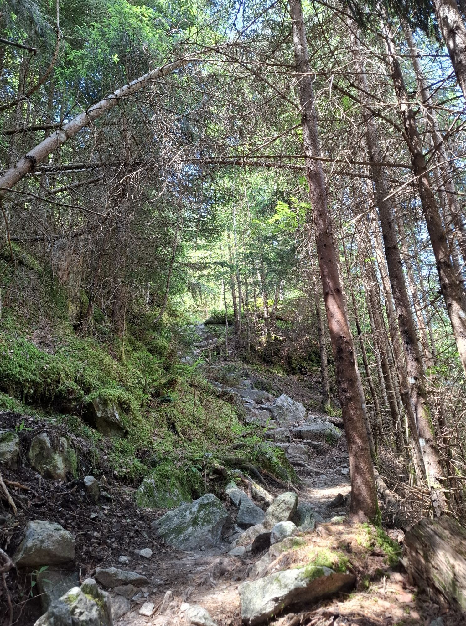
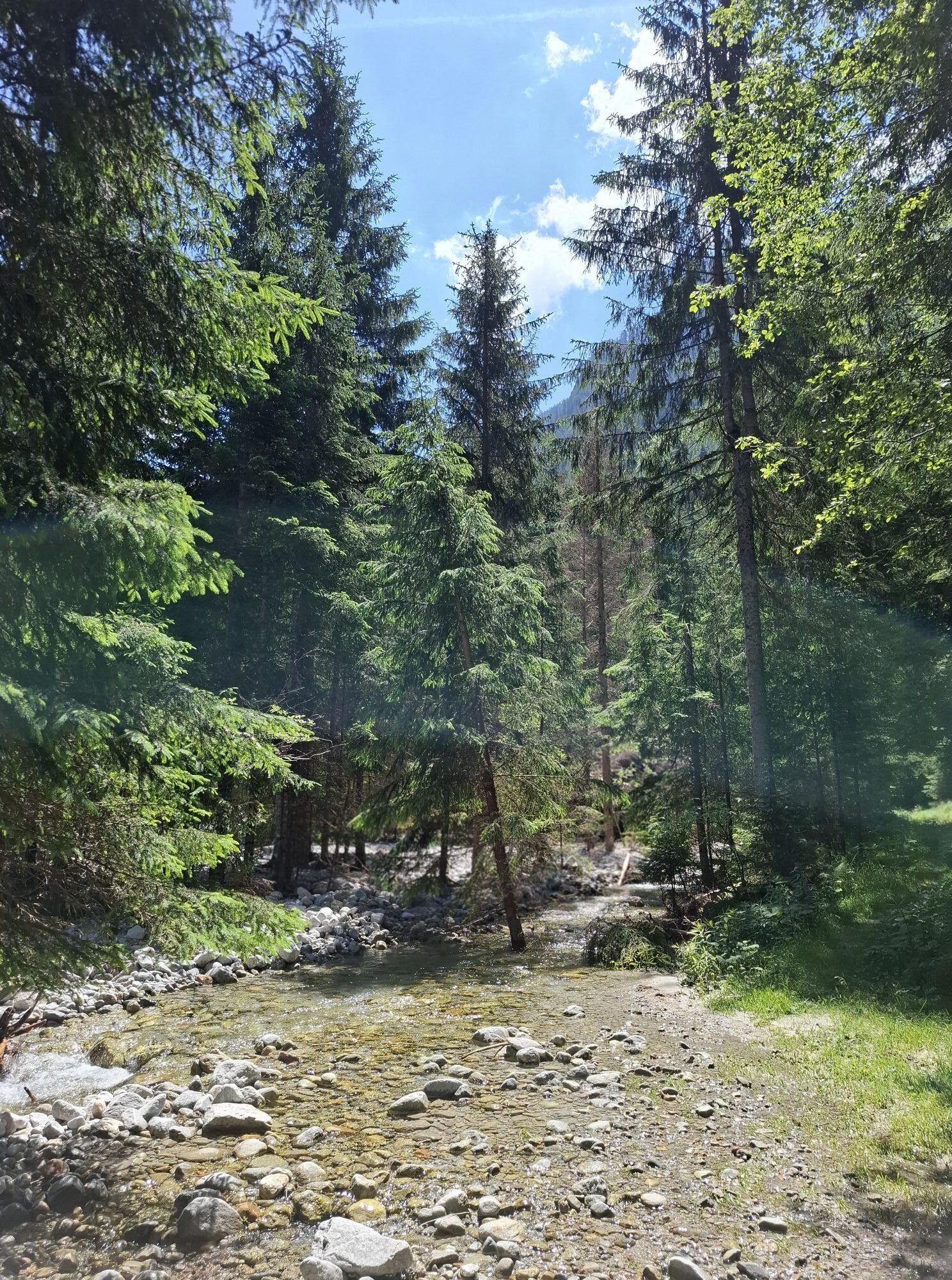
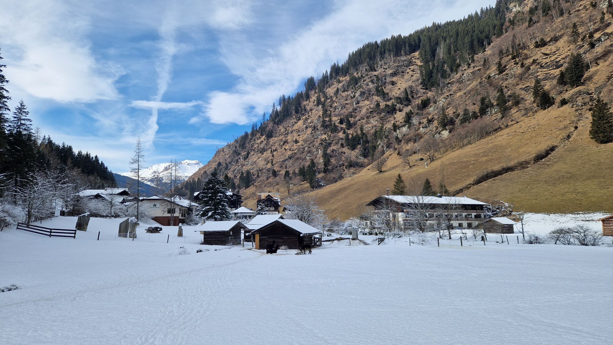
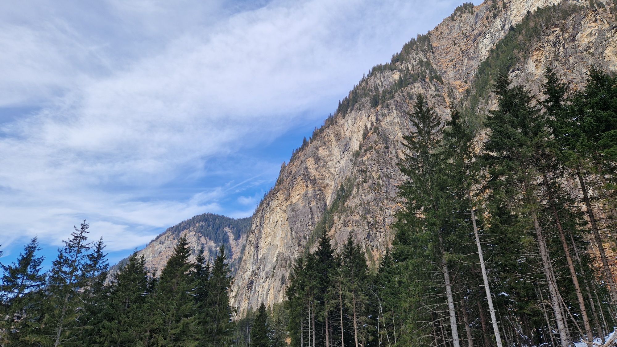
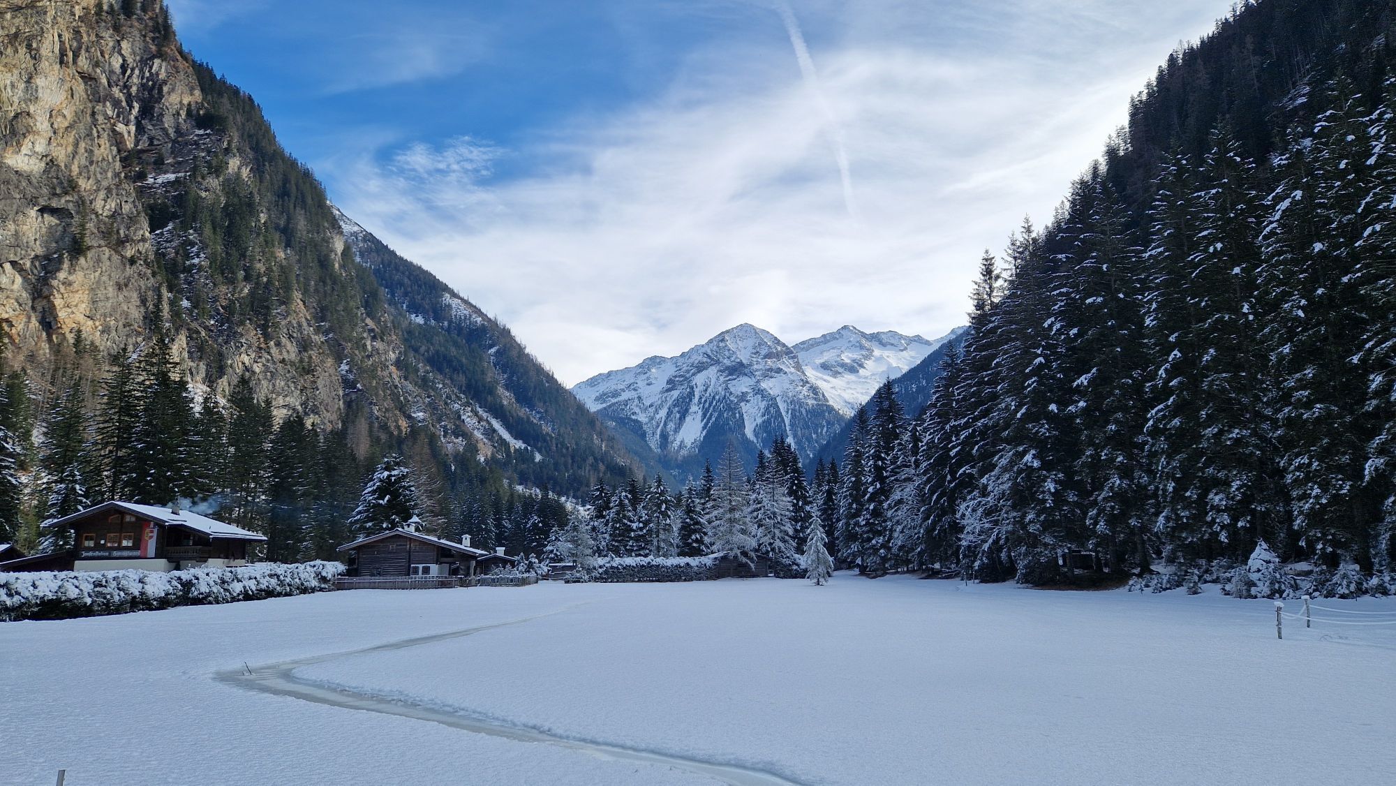
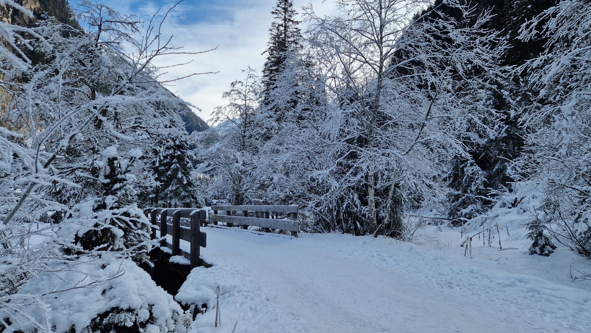
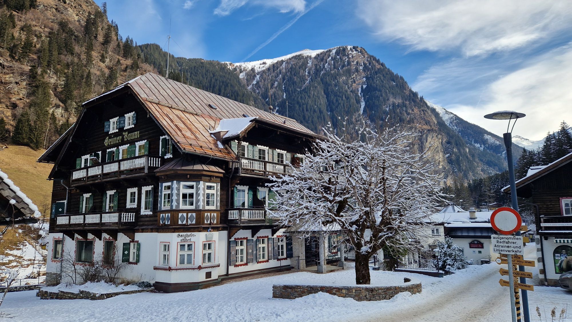
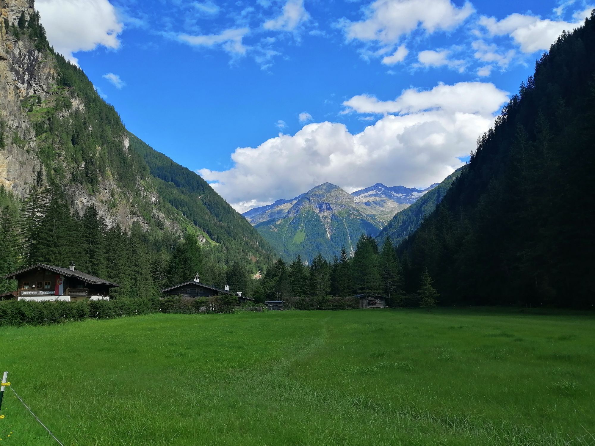
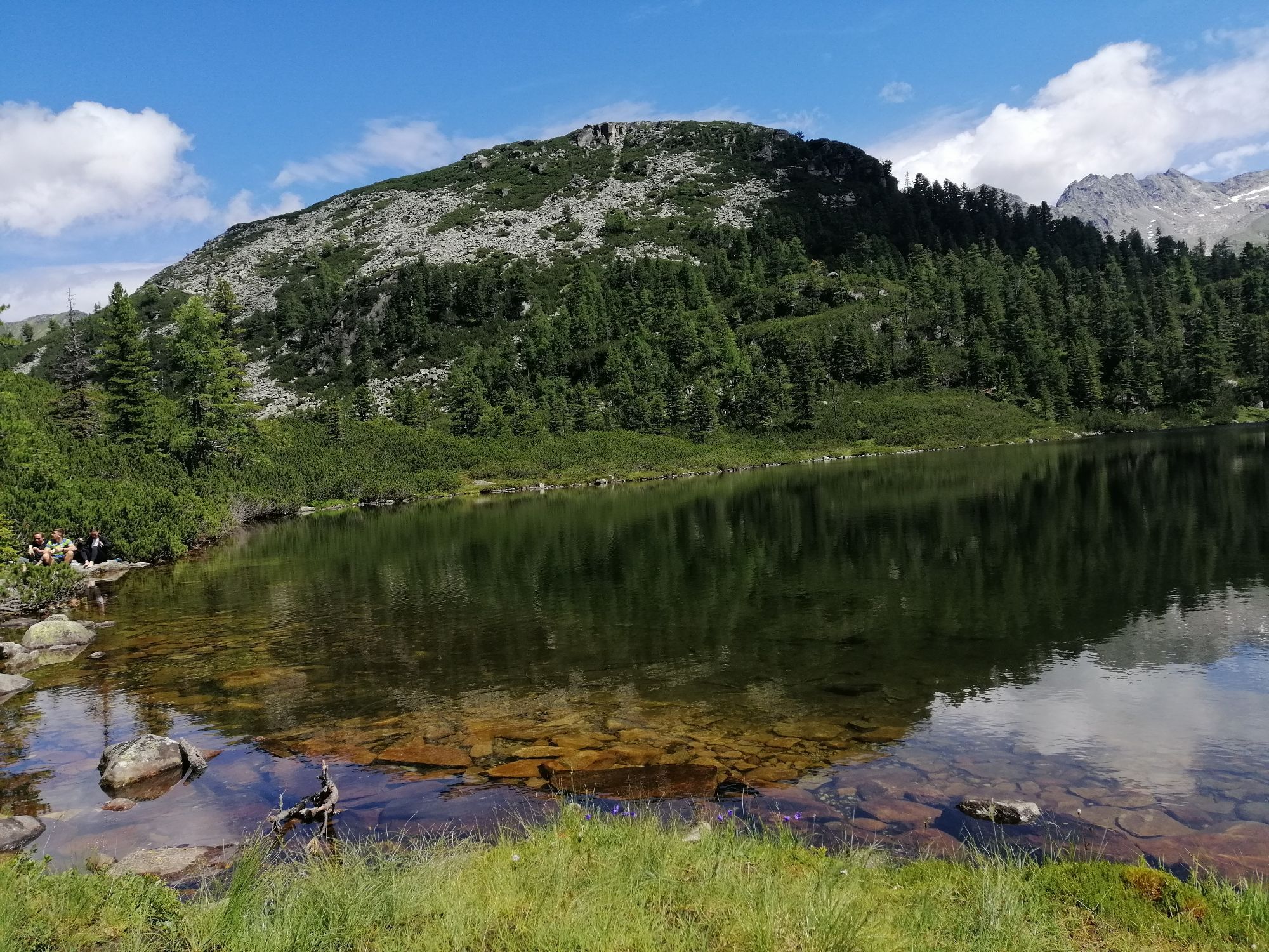
The starting point of this hike is the "Hoteldorf Grüner Baum" in Bad Gastein in the picturesque Kötschachtal. From here, the mountain route begins comfortably on the almost flat forest road into the Prossau. After about half an hour of hiking on the forest road, you will reach a sign that says "Reedsee" and a small bridge on the right side. Cross this bridge, and from this point, the path to Reedsee will no longer be missed. After another short stretch on flat terrain in the forest, the more demanding ascent to Reedsee begins, characterized by roots and stones. The path leads you through a primeval forest and past numerous cowberry and blackthorn bushes. After about 1.5 hours of climbing (from the bridge), the destination is reached. Here, amidst a mountain pine forest, you will find an enchanting lake, a cozy hut, and a breathtaking view of the glacier. Return to the starting point along the same path.
Da
By bus 555 from Bad Gastein station.
By train to "Bad Gastein station." From there, take bus 555 to "Grüner Baum."
Schedule information and download: Online at www.salzburg-verkehr.at or on your smartphone via the free Salzburg Verkehr app for Android and iOS.
Daria Denisova 5020 Salzburg Instagram: @dashismiles
Photo credit: Daria Denisova
Very well accessible by public transport.🚠Since there is no serviced hut at Reedsee, it is advisable to bring a small snack and enough water to enjoy directly by the lake. Alternatively, you can stop at the Himmelwandhütte on the return trip. Here you can refresh yourself after the hike with regional delicacies. Be sure to try the blueberry strudel.🤤 (!) It's best to call a day in advance to check if the hut is open.
Priljubljeni izleti v okolici
- 4,7
Bahnhof Bad Hofgastein nach Bahnhof Bad Gastein
srednjaPohodništvo13,0 km - 5,0
Türchlwand von der Bergstation Schlossalmbahn Bad Hofgastein, Österreich
srednjaGorski pohodništvo7,05 km - 4,6
Gasteiner Höhenweg von Bad Gastein nach Bad Hofgastein
svetlobaPohodništvo8,58 km - 4,8
Hüttenkogel - Graukogel von der Bergstation
srednjaGorski pohodništvo4,68 km - 4,7
Gasteiner Höhenweg (Schlechtwettervariante)
svetlobaPohodništvo9,50 km - 4,4
Wasserfall Bad Hofgastein
svetlobaPohodništvo3,89 km - 4,7
Kölnbreinspeicher bis Osnabrücker Hütte
svetlobaPohodništvo15,9 km - 5,0
Rifflscharte - Kolmkarscharte - Bockhartscharte - Sportgastein
srednjaPohodništvo13,5 km - 4,5
Wasserfallweg - Achenpromenade (Schlechtwettervariante)
svetlobaPohodništvo7,90 km - 4,3
"Elendrunde" Kleinelend Valley - Zwischenelendscharte - Großelend Valley
srednjaPohodništvo21,9 km
Pohodništvo in sledenje


Ne zamudite ponudb in navdiha za naslednje počitnice
Vaš e-poštni naslov je bil dodan na poštni seznam.