


Bramberg: 4B Habachtal


You start from the center of Bramberg, from where you follow the "Tauern cycle route" towards Neukirchen am Großvenediger. Arriving at the entrance to the Habachtal, the moderately ascending forestry road,...
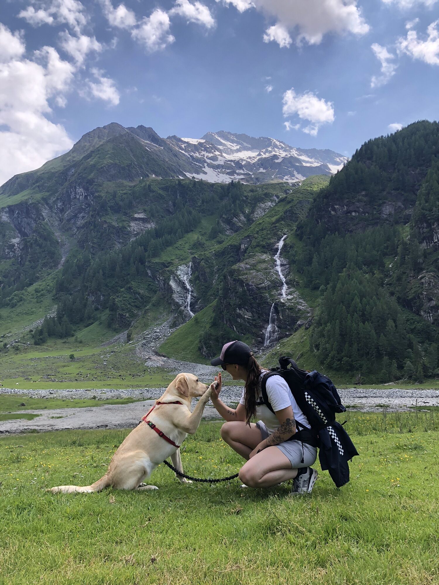
You start from the center of Bramberg, from where you follow the "Tauern cycle route" towards Neukirchen am Großvenediger. Arriving at the entrance to the Habachtal, the moderately ascending forestry road, partly paved and partly gravel, leads e-bikers into the scenically impressive Habachtal.
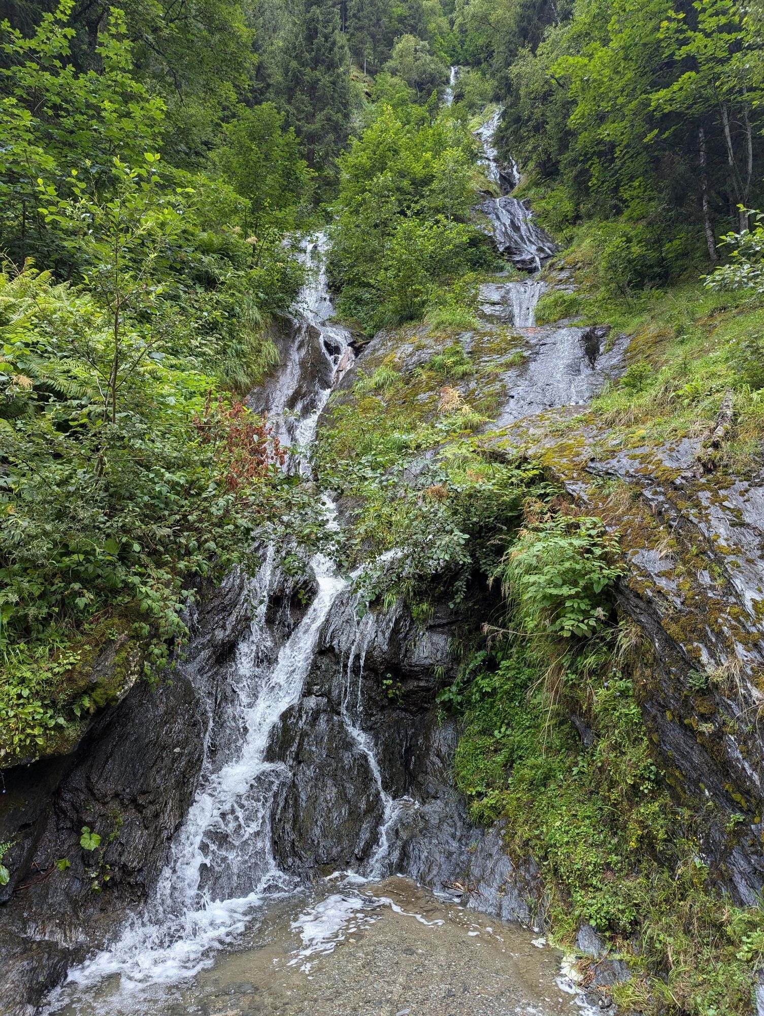
The Habachtal is also well known for its beautiful Emerald Trail. This branches off from the wide alpine path for mountain bikers and offers numerous informative stations as an adventure route for hikers. Legends, important information about the geology and mineralogy of the Habachtal, wonderful views, and much more accompany you on the way and will surely astonish you. Along the path, several resting places invite you to linger: the Enzianhütte, the Alpenrose inn, and the Alte Moa-Alm. At the end of the path, you reach the Alte Moa-Alm, where the Habachtal opens and continues only on foot.

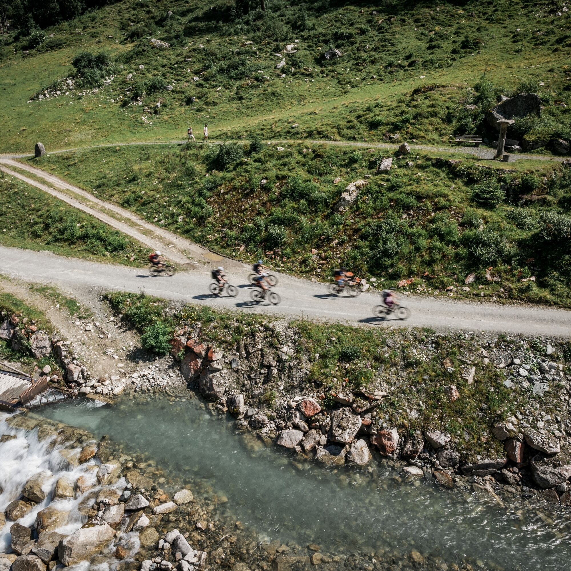
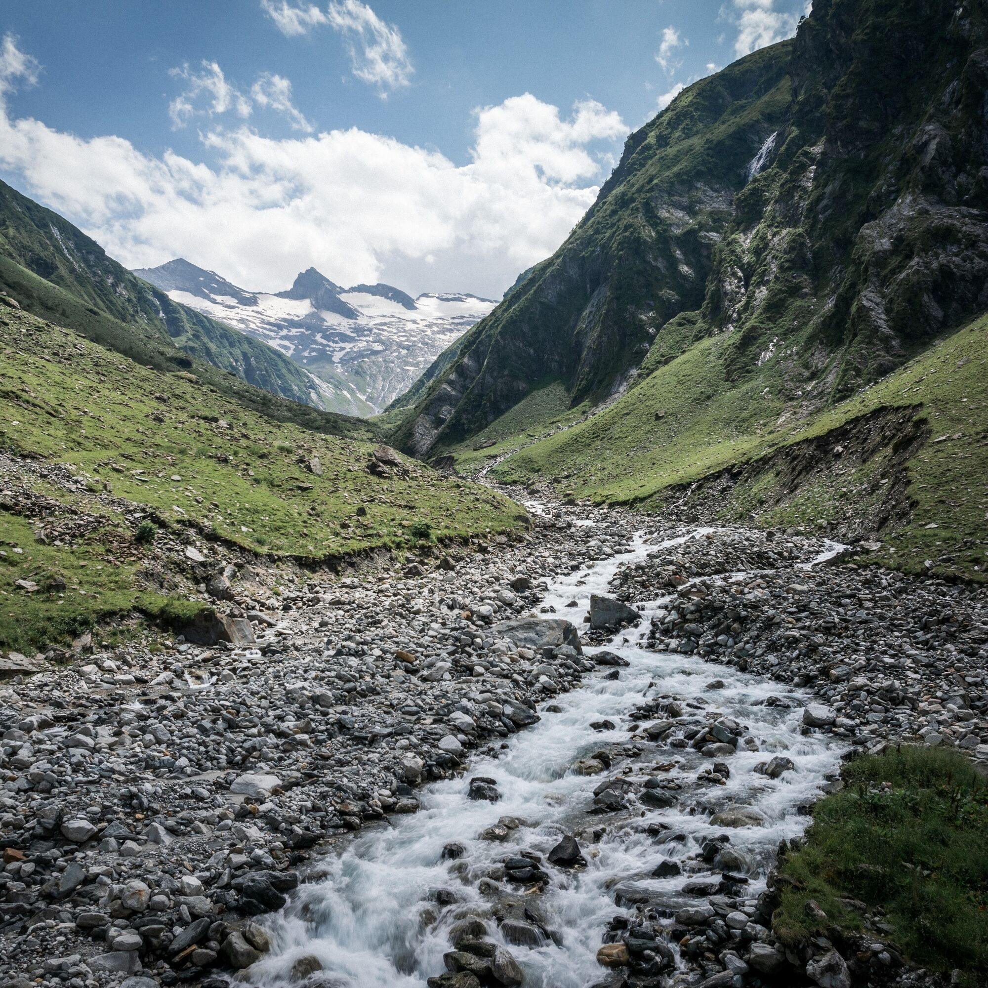
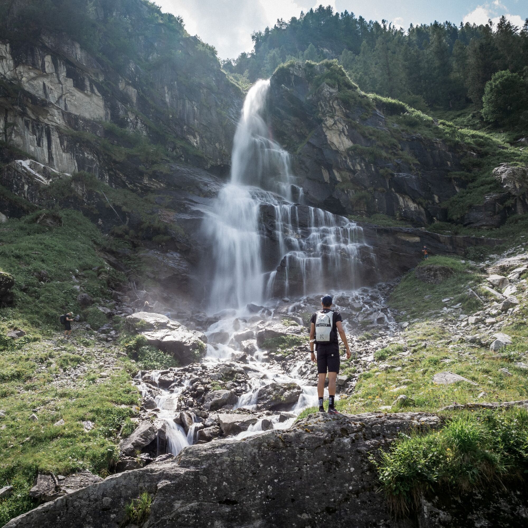
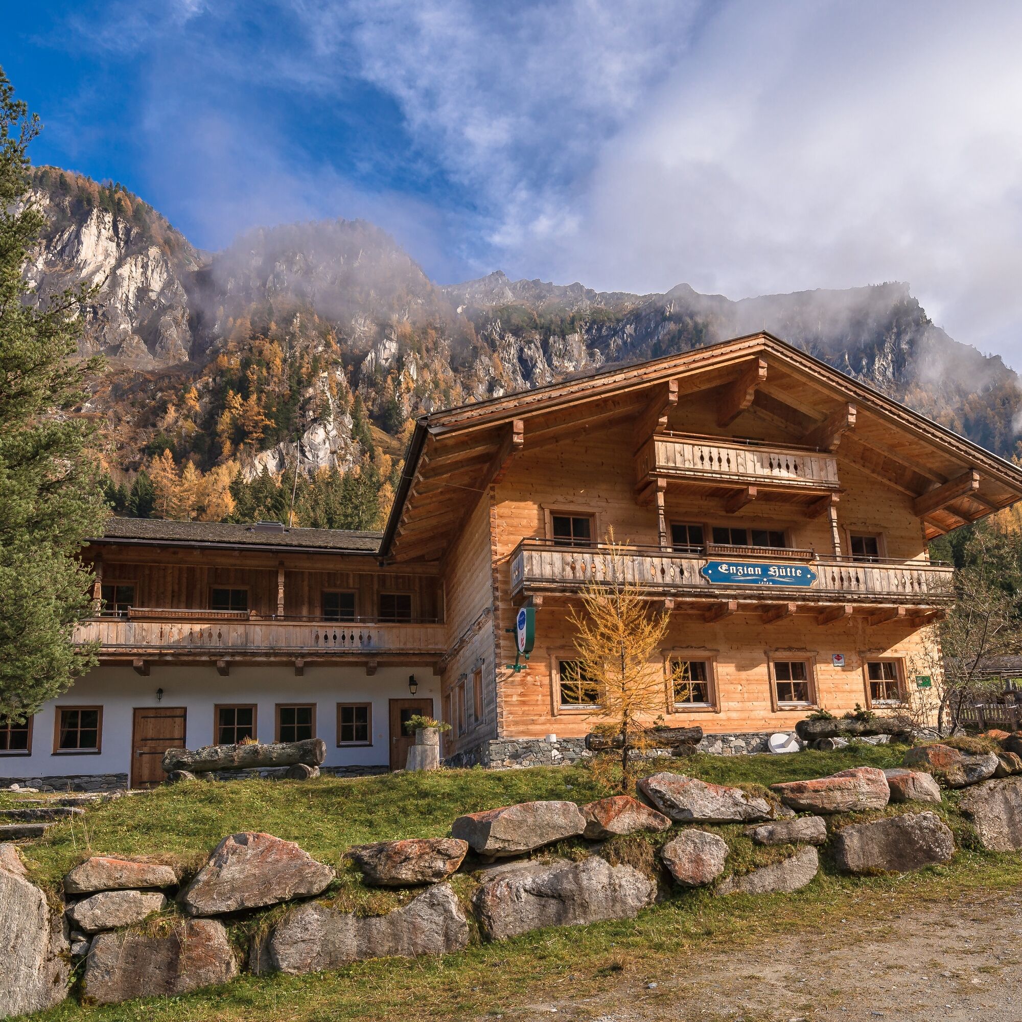
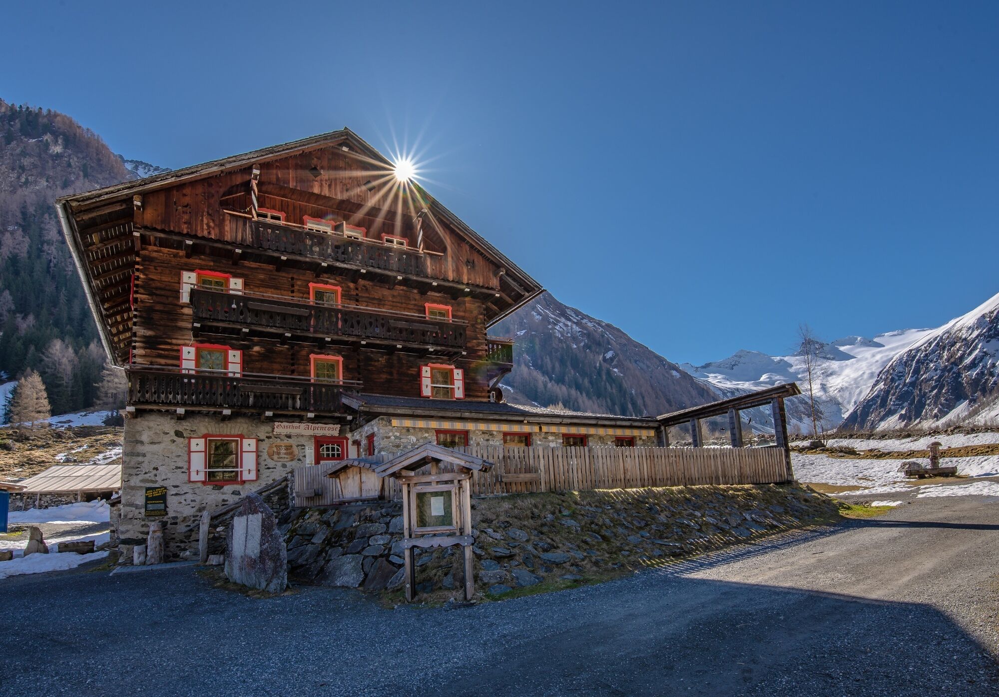
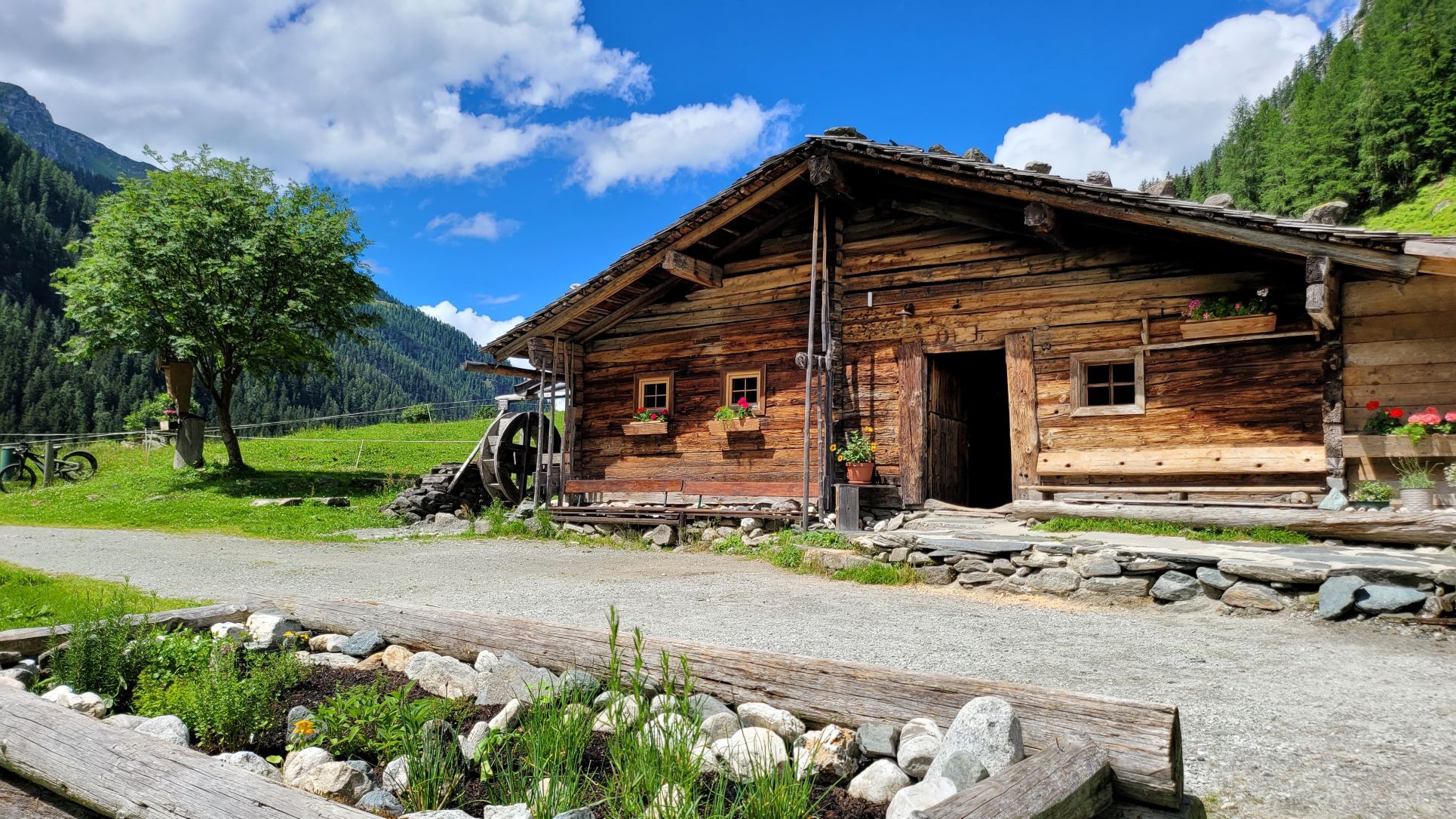
The starting point is the center of Bramberg, from where you follow the well-developed Tauern cycle route towards Neukirchen to the entrance of the Habachtal. At the National Park information center, the moderately ascending alpine path begins on the right, partly paved and partly a gravel path. In the middle section, you overcome a steep climb of about 500 m, also known as "Kramer Bichl." First, the route takes you past the Wennser Alm, the Enzianhütte, and the alpine inn Alpenrose until you reach the idyllically situated alpine hut Alte Moa-Alm. From there, it continues only on foot to the valley end. Return on the same route.
Da
Helmet, sunscreen, provisions
Moderate local and hiking taxi traffic along the route is to be expected; please always watch out for oncoming cars. Stay on the marked routes/tracks.
Coming from the north
(D, NL,...) Munich - exit Kufstein south (toll sticker required) - St. Johann i. T. - Kitzbühel - Pass Thurn - Mittersill - Bramberg-Habach
Coming from the west
(CH) Inntal motorway (A12: toll sticker required) - exit Wörgl East - St. Johann i.T. - Kitzbühel - Pass Thurn - Mittersill - Bramberg-Habach
Coming from the east
Vienna - Salzburg (A1: toll sticker required) - Bischofshofen - Zell am See - Mittersill - Bramberg-Habach
Coming from the south
(I, SLO) Tauern motorway (A10: toll sticker required) - exit St. Michael or exit Bischofshofen - Zell am See - Mittersill - Bramberg-Habach
Gerlos Alpine Road
A day ticket for the Gerlos Alpine Road is included in the National Park Summer Card.
Travel by the Pinzgauer Lokalbahn to Mittersill or by ÖBB bus line 670 to Bramberg.
Parking lot Habachtal (address Habach 35, 5733 Bramberg) is fee-based.
Tourist offices Neukirchen & Bramberg
Tel. +43 (0) 720 710 730
info@wildkogel-arena.at
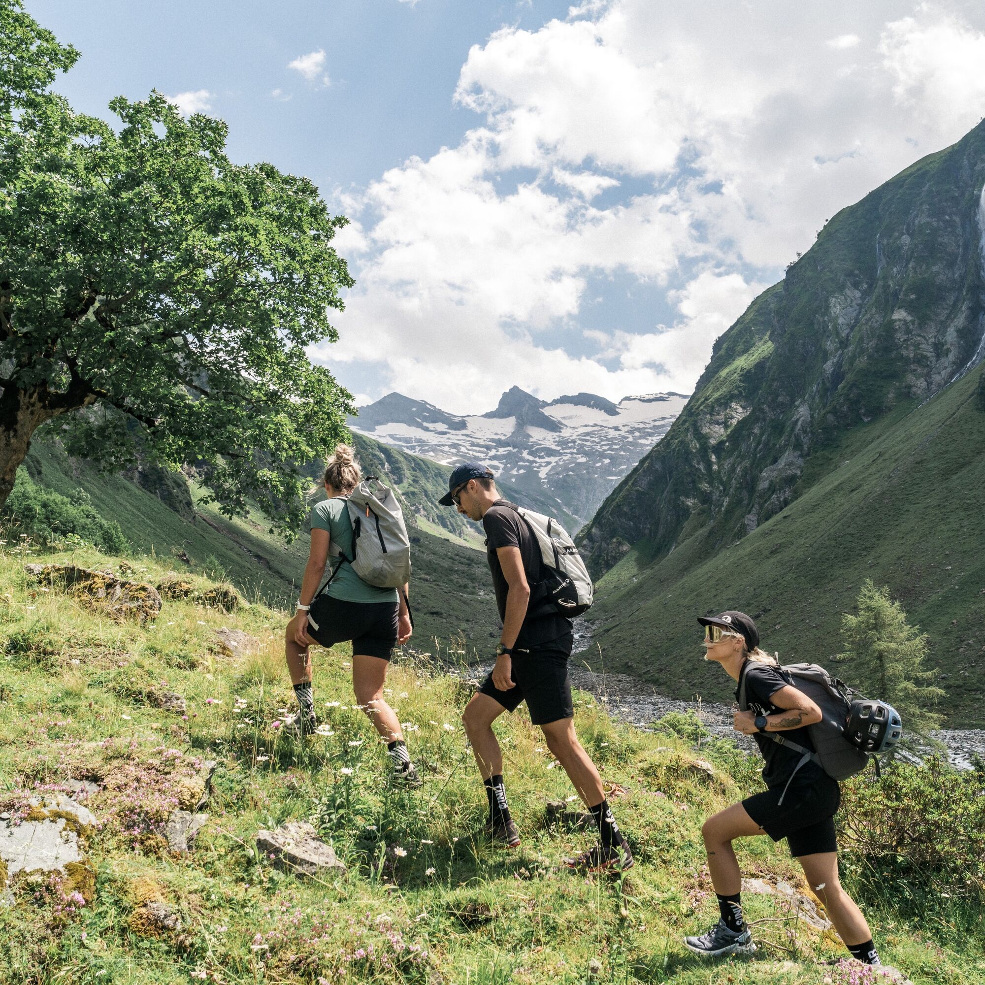
For those with particularly strong calves: A day trip option is the combination of bike & hike with the ascent from Alte Moa-Alm to Neue Thüringer Hütte (2,240 m). The e-bike riding time is about 2.5 hours total, and the hiking time is approximately 4.5 hours round trip.
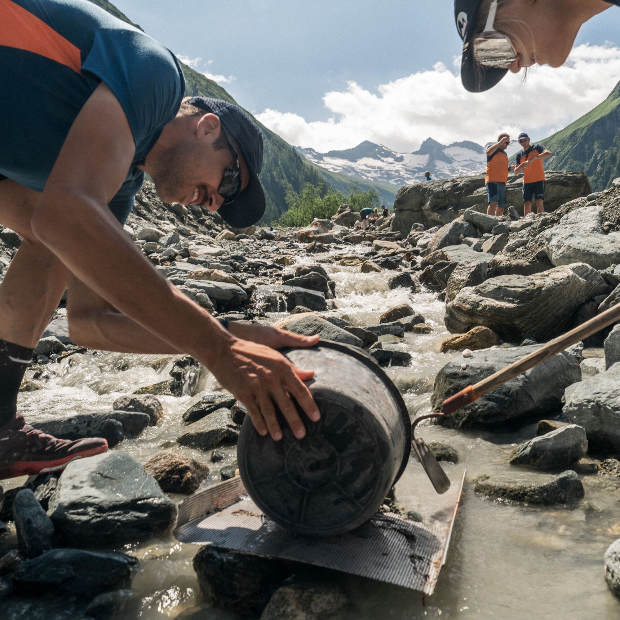
For adventure seekers: Combination of mountain biking and emerald panning: rental options for sieves, buckets, etc., are available at the alpine inn Alpenrose. Several times a week, guided emerald panning tours are also offered. Information & registration: https://www.wildkogel-arena.at/
Priljubljeni izleti v okolici
- 4,3
Krimmler Tauernhaus
srednjaPohodništvo10,4 km - 4,3
Krimml Waterfall Path - Panorama Viewing Path
srednjaPohodništvo4,74 km - 4,1
Gletscherlehrweg Innergschlöß
srednjaPohodništvo9,36 km - 4,4
Bramberg: Smaragdweg
svetlobaTematska pot7,27 km - 4,7
Krimmlerwasserfälle
srednjaPohodništvo10,5 km - 4,7
Der Krimmler Wasserfallweg
srednjaPohodništvo7,19 km - 4,5
Smaragdweg
svetlobaPohodništvo7,84 km - 4,4
Untere Wasserälle Krimml Krimml, Österreich
svetlobaPohodništvo5,04 km - 5,0
Gletscherweg Innergschlöß Großvenediger
srednjaPohodništvo11,0 km - 4,0
Krimmler Achental
srednjaMountainbike20,3 km
Pohodništvo in sledenje


Ne zamudite ponudb in navdiha za naslednje počitnice
Vaš e-poštni naslov je bil dodan na poštni seznam.