
Laubenheim - Kapelle in den Zornheimer Weinbergen - St. Michael - Sankt Laurentius
težko
Pridobite to turo v svoj mobilni telefon
Laubenheim - Kapelle in den Zornheimer Weinbergen - St. Michael - Sankt Laurentius
težko
Mountainbike
93.63
km
Skenirajte kodo QR in začnite navigacijo v aplikaciji bergfex.


Pohodništvo in sledenje



Laubenheim - Kapelle in den Zornheimer Weinbergen - St. Michael - Sankt Laurentius
težko
Razdalja
93.6
km
Trajanje
06:58
h
Ascent
1,242
hm
Morska gladina
85 -
243
m

V aplikaciji si oglej pot
Brezplačno namestite aplikacijo in spremljajte pot z GPS-navigacijo in sledenjem.
bergfex zdaj uporabljaj v aplikaciji
S kamero poskeniraj QR-kodo
Ko je aplikacija nameščena, se vsebina odpre takoj. Če aplikacije še nimaš, te bo preusmerila na stran za brezplačen prenos.
Prenos skladbe
Laubenheim - Kapelle in den Zornheimer Weinbergen - St. Michael - Sankt Laurentius
težko
Mountainbike
93.63
km




Pot
St. Andreas
(160 m)
Kraj čaščenja
10.6 km
St. Valentinuskapelle
(196 m)
Kraj čaščenja
12.3 km
Selzer Berg
(237 m)
Vrh
41.4 km
Mariä Geburt
(130 m)
Kraj čaščenja
46.2 km
St. Michael
(154 m)
Kraj čaščenja
66.6 km
Hasenberg
(192 m)
Vrh
75.7 km
Ebersheim
(204 m)
Vas
84.0 km
Pot
Laubenheim - Kapelle in den Zornheimer Weinbergen - St. Michael - Sankt Laurentius
težko
Mountainbike
93.63
km
Laubenheim
(90 m)
Vas
0.1 km
Wegekapelle Koppernweg
(125 m)
Kraj čaščenja
1.3 km
Oma Lotte
(165 m)
Restavracija
10.2 km
Evangelische Kirche
(160 m)
Kraj čaščenja
10.5 km
St. Andreas
(160 m)
Kraj čaščenja
10.6 km
Klein-Winternheim
(161 m)
Vas
10.6 km
Ober-Olm
(219 m)
Vas
12.0 km
St. Valentinuskapelle
(196 m)
Kraj čaščenja
12.3 km
Kappeltrog
(197 m)
Vir:
12.3 km
Essenheim
(216 m)
Vas
14.7 km
Domherrngärten
(168 m)
Soseska
14.8 km
Nieder-Olm
(130 m)
Mesto
18.3 km
Nieder-Olm
(130 m)
Mesto
28.6 km
Weinberg IV
(213 m)
Soseska
28.9 km
Weinberg V
(208 m)
Soseska
29.2 km
Goldberg
(201 m)
Poravnava
30.9 km
Katholische Pfarrkirche Maria Opferung
(163 m)
Kraj čaščenja
32.2 km
Sörgenloch
(159 m)
Vas
32.2 km
Kneippbecken
(120 m)
Vir:
37.5 km
Zornheim
(220 m)
Vas
40.9 km
Selzer Berg
(237 m)
Vrh
41.4 km
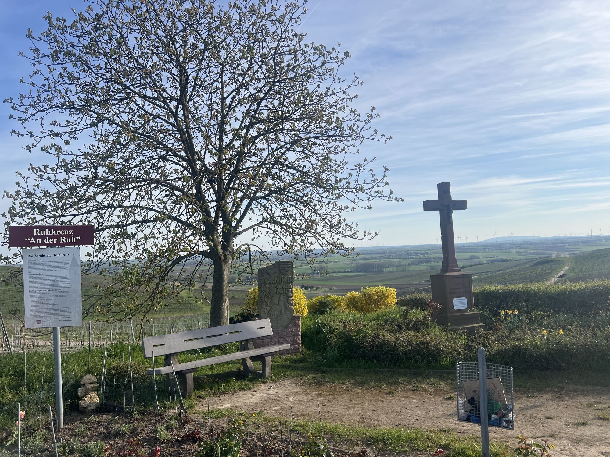
Kapelle in den Zornheimer Weinbergen
(233 m)
Kraj čaščenja
41.6 km
Mariä Geburt
(130 m)
Kraj čaščenja
46.2 km
Selzen
(131 m)
Vas
46.2 km
Jordan's Untermühle
(126 m)
Restavracija
48.0 km
Köngernheim
(133 m)
Vas
48.9 km
Friesenheim
(132 m)
Vas
50.3 km
Dexheim
(153 m)
Vas
55.6 km
Schwabsburg
(102 m)
Vas
59.6 km
Evangelische Kirche Schwabsburg
(106 m)
Kraj čaščenja
59.8 km
St. Pankratius
(101 m)
Kraj čaščenja
59.8 km
Nierstein
(84 m)
Mesto
63.2 km
Lörzweiler
(149 m)
Vas
66.5 km
St. Michael
(154 m)
Kraj čaščenja
66.6 km
Babbelbank
(153 m)
Miza za piknik
66.7 km
LCC Bänkchen
(170 m)
Miza za piknik
67.1 km
Gau-Bischofsheim
(149 m)
Vas
69.2 km
In den Borngärten
(183 m)
Soseska
69.4 km
Harxheim
(147 m)
Vas
70.2 km
Hasenberg
(192 m)
Vrh
75.7 km
Zornheim
(220 m)
Vas
76.6 km
Sankt Laurentius
(214 m)
Kraj čaščenja
83.6 km
Pizzeria Trattoria Da Rocco
(210 m)
Restavracija
83.7 km
Ebersheim
(204 m)
Vas
84.0 km
Am Weingarten
(193 m)
Soseska
85.6 km
Gau-Bischofsheim
(149 m)
Vas
85.7 km
Gaul´s Restaurant
(88 m)
Restavracija
91.6 km
Laubenheim
(90 m)
Vas
93.5 km


Še ni pregledov
Priljubljeni izleti v okolici
-
4.3
Alter Friedhof von Hedesheim - Stadecken - Stadecken-Elsheim
srednjaPohodništvo 9.89 km -
4.0
Fischweiher/Rund ASV Seerose Ober-Olm, Deutschland
svetlobaPohodništvo 2.92 km -
5.0
ALZEY | Hiwweltour Neuborn - (Rheinland-Pfalz)
svetlobaPohodništvo 8.89 km -
5.0
Nieder-Olm-Udenheim-Saulheim
svetlobaKolesarjenje 15.0 km -
4.0
Ginsheim Altrhein Nonnenau
svetlobaKolesarjenje 19.2 km -
5.0
Selzen - Gau-Bischofsheim Amiche Radtour
svetlobaKolesarjenje 17.6 km -
4.0
Von Vendersheim nach Monzernheim (Westhofen) #LL2ROM_E012
srednjaPohodništvo 23.4 km -
4.0
Selztal Terroir-Weg 1, Jugenheim Rheinhessen, Deutschland
srednjaPohodništvo 4.41 km -
4.0
Nieder-Olm-Klein-Winternheim-Ebersheim-Zornheim -Nieder-Olm
srednjaKolesarjenje 22.2 km -
4.0
Zornheim um Stiftung Wald für Leben
srednjaPohodništvo 4.83 km
Pohodništvo in sledenje

Zaradi več kot 550.000 predlogov izletov, podrobnih zemljevidov in intuitivnega načrtovanja poti je aplikacija obvezna oprema za vse ljubitelje narave.

Ne zamudite ponudb in navdiha za naslednje počitnice
Naročite se na novice
Napaka
Zgodila se je napaka. Prosimo, poskusite znova.
Zahvaljujemo se vam za prijavo
Vaš e-poštni naslov je bil dodan na poštni seznam.
Izleti po vsej Evropi
Avstrija
Švica
Nemčija
Italija
Slovenija
Francija
Nizozemska
Belgija
Poljska
Lihtenštajn
Češka
Slovaška
Španija
Chorvátsko
Bosna in Hercegovina
Luksemburg
Andora
පෘතුගාලය
අයිස්ලන්තය
එක්සත් රාජධානිය
අයර්ලන්තය
ග්රීසිය
ඇල්බේනියාව
North Macedonia
Malta
Norway
Montenegro
Moldova
කොසෝවො
හන්ගේරියානු සමුහාණ්ඩුව
San Marino
රුමේනියාව
එස්ටෝනියා
ලැට්වියාව
බෙලාරස්
සයිප්රස්
Lithuania
Serbia
බල්ගේරියාව
Monaco
ඩෙන්මාර්කය
Sweden
ෆින්ලන්තය


