


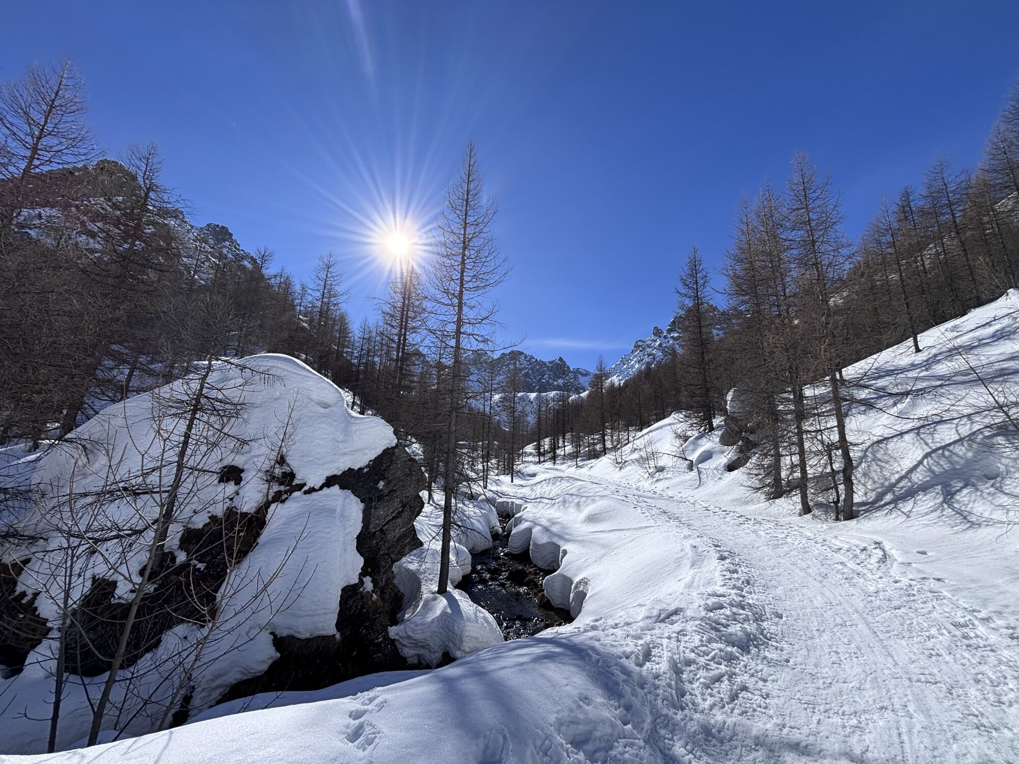
Sentiero delle Fortificazioni: Stage 3 Rifugio di Viviere - Rifugio CAI della Gardetta
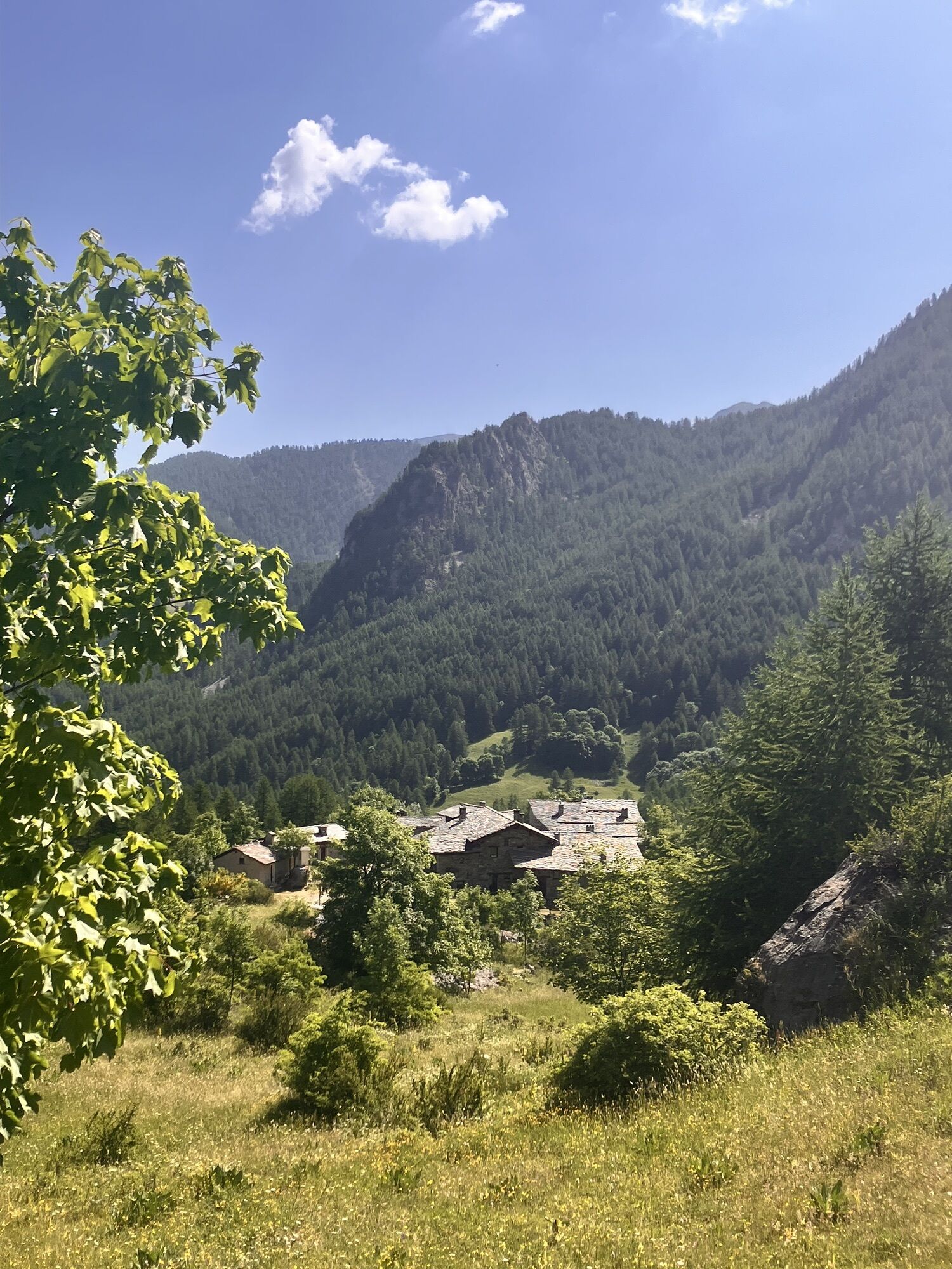
From the village of Viviere you go back up on a path until you cross the former military carriage road and reach the flat basin of Prato Ciorliero. Once here, you keep to the right along the well-known...
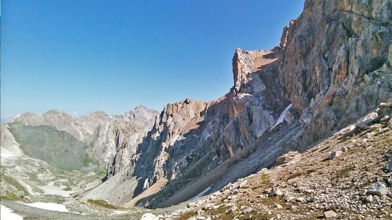
From the village of Viviere you go back up on a path until you cross the former military carriage road and reach the flat basin of Prato Ciorliero. Once here, you keep to the right along the well-known "Roberto Cavallero" itinerary which leads to the Carlo Emanuele I Barracks (Escalon shelter) and Colletta Vittorio (2522 m) from where you can reach Le Due Valli bivouac along the crest of La Repiatetta. Following long stretches of former military roads (partly interrupted by landslides) you reach in succession, Colle Oserot (2640 m), Passo Rocca Brancia (2606 m) and Passo della Gardetta (2440 m), from where you can admire an exceptional panorama: on the left the imposing bordering peaks (Oronaye, Brec and Aiguille de Chambeyron), and on the right the Gardetta plateau dominated by Rocca la Meja. The cart track shortly descends to Rifugio CAI della Gardetta below.

From B.ta Viviere you go up the path until you cross the former military road and reach the flat valley of Prato Ciorliero. Once here, keep right along the well-known "Roberto Cavallero" itinerary which leads to the Carlo Emanuele I Barracks (Escalon shelter) and the Colletta Vittorio (2522 m) from where it is possible to reach the Le Due Valli bivouac along the La Repiatetta crest . Following long stretches of former military roads (partly interrupted by landslides) you reach, in succession, the Oserot hill (2640 m), the Rocca Brancia pass (2606 m) and the Gardetta pass (2440 m), from where you can admire a panorama exceptional: on the left the imposing border peaks (among all Oronaye, Brec and Aiguille de Chambeyron), on the right the Gardetta plateau dominated by Rocca la Meja. The cart track soon descends to the CAI della Gardetta refuge below.
Considering the route which develops on a high mountain route, the use of trekking boots, fleece, trousers and wind jacket in technical fabric is recommended.
Nothing to report in this regard
Acceglio can be reached by private transport or by bus departing from Cuneo, the capital www.benese.it/orari-bus. Canosio is not reached by public transport. There is a 24/7 taxi service with luggage transport active all year round (Sherpabus) 348 8231477 - sherpabus@libero.it
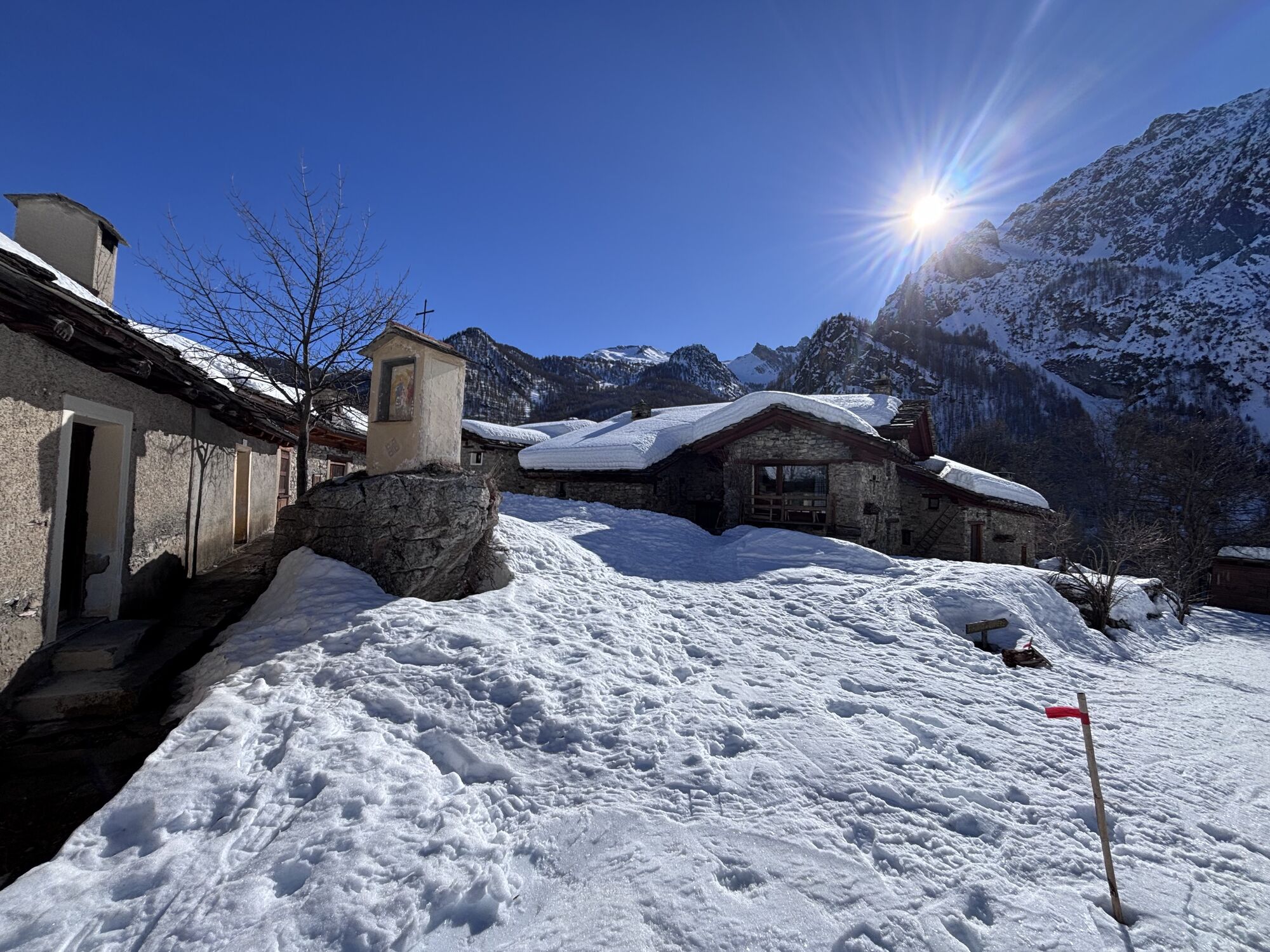
Military bunkers and small barracks along the route.
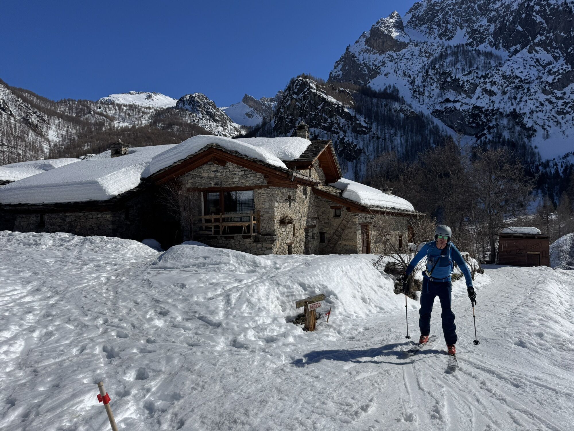
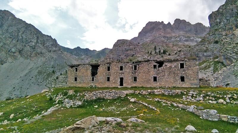
Barracks of Prato Ciorliero: winter shelters with dormitories, kitchens and stables. Caserma Vittorio Emanuele I (Shelter Escalon): a barracks used during the Second World War; some frescoes still remain inside
Priljubljeni izleti v okolici
- 4,5
Acceglio, bric boscasso
srednjaSmučarska tura 12,1 km - 4,5
Col de Larche - Lac du Lauzanier, France
svetlobaPohodništvo 13,7 km - 5,0
Rocca le Meja - Valle Maira
težkoVisokogorska tura 19,8 km Gardetta Bike Emotions
srednjaMountainbike 13,5 km- 5,0
Occitan routes: Stage 6 Elva - San Michele di Prazzo
srednjaPohodništvo 11,5 km San Giacomo-Colle Valcavera
srednjaCestno kolo 13,2 km- 5,0
Occitan Routes: Stage 8 Borgata Ussolo - Borgata Chiappera
srednjaPohodništvo 14,5 km - 5,0
Goldtoni - Alpenbogen A077 Refugium Campo-Bousieyas
srednjaPohodništvo v daljavo 34,1 km - 5,0
Chiappera- Spaziergang
svetlobaPohodništvo 8,39 km - 5,0
Goldtoni - Alpenbogen A109 Sambuco-Ruata Valle (Stroppo)
srednjaPohodništvo v daljavo 36,8 km
Pohodništvo in sledenje


Ne zamudite ponudb in navdiha za naslednje počitnice
Vaš e-poštni naslov je bil dodan na poštni seznam.