






Orizzonte Monviso - Stage 4: Crissolo - Hking refuge La Galaberna
You depart from the square of the Town Hall of Crissolo (1330 m approx.) going uphill along the municipal road for about a hundred metres, then, following the signs to the right for Pian del Re, you pass...
You depart from the square of the Town Hall of Crissolo (1330 m approx.) going uphill along the municipal road for about a hundred metres, then, following the signs to the right for Pian del Re, you pass a narrow passage between the houses and immediately take the mule track that is on the left a few metres further on. The track goes uphill with a direct route towards the first houses of the village of Serre, comes out on the left side of the church, continues on flat ground in the village, then at a crossroads near a fountain (left towards the cemetery and then down to Crissolo) bends sharply to the right going uphill among the buildings further uphill, until it comes out on the provincial road (about 1390 m). After crossing the road, take the mule track in front of it which, after a short woody strip and then open grassy slopes, reaches the first houses of the village of Borgo and a crossroads (ignore the right fork downhill towards the Sanctuary of S. Chiaffredo). Turn left through narrow alleys, sometimes paved in stone, to shortly arrive near the church overlooking a small square with a washhouse (about 1510 m). Skirt the religious building and go slightly to the right for about a hundred metres, until you leave the asphalt road that goes towards the locality of Ciampagna, to take the mule track on the right that gradually descends into the woods. After a few hairpin bends, the track stretches out again and reaches the characteristic stone bridge over Rio Toussi (about 1400 m); after a short ascent and a stretch on sloping ground, you reach the small but lovely Chapel of the Madonna degli Angeli (about 1430 m) in Bertolini, with an excellent view of Monviso. Continue on pleasant grassy ground for about 200 m, until you get back onto the asphalt road (about 1440 m) a few metres beyond the fork to the left towards the village of Brich. You descend along the road accompanied by the beautiful view of Monviso, leaving the first fork on the left to the village of Fenogli, then the one to that of Sagne, and the one to that of Martino, thus arriving directly in the houses of Ciampagna (about 1360 m). Continue along the carriage road admiring the church of Madonna del Buon Consiglio above, then turn left downhill until you pass Rio Combe. After about 100 m, leave the asphalt road and follow an ancient road on the left, initially narrow (about 1310 m direction of la Villo signposted Vie d'Oustano), which enters the beech wood and continues on sloping ground passing some deviations. Leave the one on the left (Davi - Sre) and the one on the right (S. Chafr) to reach the nrune shrine (1295 m approx.); ignore the fork to the left (Vio des Coste), and continue on a constant descent along the narrow and irregular path that levels out just before reaching the asphalt road in the locality of Marchetti that goes up towards the centre of Ostana (approx.. 1225 m), reaching the Galaberna Hiking Refuge (loc. Valentin - Ostana - Villa).

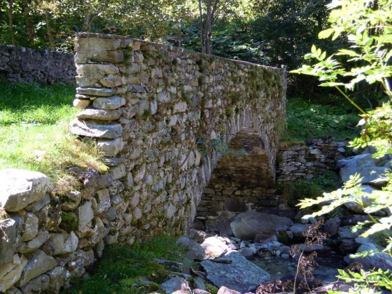
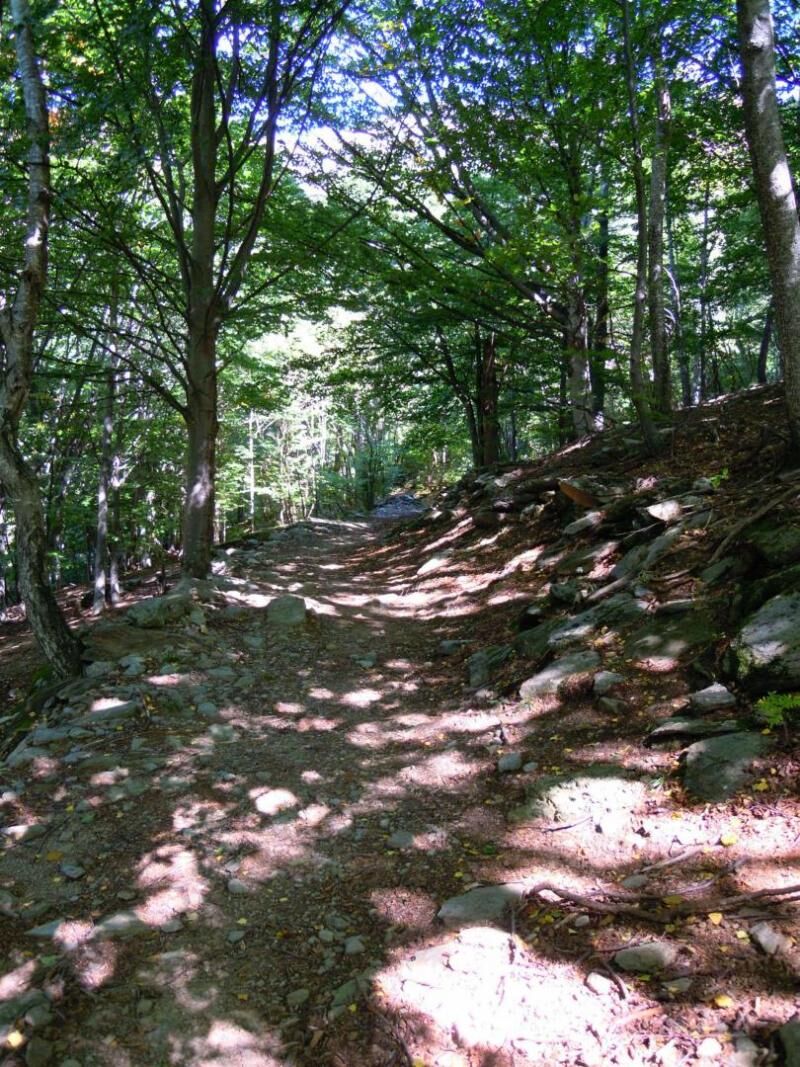
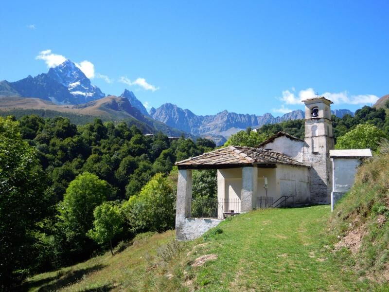

The excursion starts from the town hall square of Crissolo (about 1330 m) going uphill along the municipal road for about a hundred metres, then, following the signs on the right for Pian del Re, you pass a narrow passage between the houses and immediately take the mule track that opens on the left a few meters ahead. The route goes up with a direct route towards the first houses of the Serre village, emerges on the left of the church, continues on level ground in the town, then at a crossroads near a fountain (on the left towards the cemetery and then down onto Crissolo) it bends sharply to the right going up between the buildings further upstream, until you emerge on the provincial road (approximately 1390 m). Once you have crossed the road, take the mule track in front which, after a short wooded strip and then along open grassy slopes, reaches the first houses of the Borgo hamlet and a crossroads (ignore the right branch downhill towards the Sanctuary of S. Chiaffredo) . Turn left through narrow alleys, sometimes paved in stone, to quickly arrive near the church overlooking a small square with a wash house (approximately 1510 m). Go alongside the religious building and slope slightly to the right for about a hundred metres, until you leave the asphalt road that heads towards Ciampagna, to take the mule track on the right which progressively descends into the woods. After a few hairpin bends, the route stretches out again and reaches the characteristic stone bridge over the Rio Toussié (approximately 1400 m); a short climb and a stretch on a slight slope allow you to reach the small but lovely chapel of the Madonna degli Angeli (approximately 1430 m) in the Bertolini area shortly afterwards in an open field, with an excellent view of Monviso. Continue on a pleasant grassy surface for about 200 m, until you reach the asphalt road again (approximately 1440m) a few meters beyond the fork on the left towards the Brich village. You go down the road accompanied by the beautiful view of Monviso, leaving on the left first the crossroads for the village of Fenogli, then the one for the village of Sagne, finally the one for the village of Martino, thus arriving directly inside the houses of Ciampagna (approximately 1360 m). Continue on the carriage road admiring the church of the Madonna del Buon Consiglio above, then turn left downhill until you pass the Rio Combe. After about 100 m, you leave the asphalt road to follow an ancient road on the left which is initially narrow (approximately 1310 m - sign for La Villo - signs for the Vie d'Oustano) which enters the beech forest and advances on a slight slope, touching on some detours . We ignore both the one on the left (Davi - Sère) and the one on the right (S. Chafré) to reach the Ënrune pylon (approximately 1295 m); ignore the branch on the left (the Vio des Coste), and continue steadily downhill on the narrow and irregular path until it flattens out slightly just before crossing the asphalt road in the Marchetti area that goes up towards the center of Ostana (approximately 1225 m) , arriving at the Galaberna hiking refuge (Loc. Valentin – Ostana – Villa).
Considering that the route takes place in predominantly mountainous territory, we recommend the use of trekking boots, trousers and a windbreaker in technical fabric.
Nothing to report in this regard
A6 Turin-Savona motorway, exit: Marene toll booth; turn left and merge onto the SS 662 towards Savigliano, continue until Saluzzo, then follow the signs from Saluzzo for the Po valley along the SP 26 or SP 260; A21 TURIN – ALESSANDRIA – PIACENZA motorway, Asti est exit – then continue towards Alba- Bra- Marene- Savigliano- Saluzzo- Valle Po exit (SS 662); from Paesana continue on the SP 26 up to Crissolo. From Turin, ring road, Pinerolo exit, continue on SP 161 towards Bibiana then SP 27 towards Barge – Paesana through the section called “Colletta”; SP 26 in the direction of Crissolo.
From Turin and Cuneo: Atibus, timetables on the website www.buscompany.it/ati, Turin-Saluzzo, Cuneo-Saluzzo, Saluzzo-Paesana lines. From Turin and Pinerolo: Cavourese bus lines, download timetables from the website www.cavourese.it, Turin - Barge line. From Barge and Paesana: Dossetto Bus, timetables on the website www.dossettobus.it, Barge - Paesana - Crissolo line.
Panorama of the Monviso chain and the Sanctuary of San Chiaffredo; the characteristic stone bridge over the Rio Toussi; the chapel of the Madonna degli Angeli; the church of the Madonna del Buon Consiglio; the Enchanted Wood in the hamlet of Marchetti in Ostana; the Civic Ethnographic Museum of Ostana in the Villa hamlet; the Vie d'Oustano, a network of paths connecting the villages of Ostana equipped with signs and information panels on tradition, history, culture and language.
Priljubljeni izleti v okolici
-
Gran Tour del Monviso
srednjaPohodništvo 57.1 km -
5.0
BOBBIO PELLICE Upslowtour - Ring 2 of the refuges
težkoKolesarjenje 37.6 km -
5.0
04 Monviso Ring. Rifugio du Viso - Rifugio Alevè . Pontechianale, Piemont/Italien
svetlobaPohodništvo 13.3 km -
5.0
Rifugio Quintino sella - monte Monviso
srednjaPlezanje 9.13 km -
5.0
Invincibles valley - Alpe Caugis
Pohodništvo 15.3 km -
BRICHERASIO The Via della Pietra
svetlobaKolesarjenje na dolge razdalje 11.5 km -
5.0
01-Monviso Ring. Rifugio Alevè - Rifugio Quintino sella Pontechianale, Piemont/Italien
svetlobaPohodništvo 11.8 km -
BOBBIO PELICE Trekking in the hamlets and forests around Bobbio
srednjaPohodništvo 7.72 km -
5.0
BOBBIO PELLICE Climb to the Barbara Lowrie Refuge
težkoCestno kolo 9.19 km -
TORRE PELLICE The Shepherds' Way
svetlobaMountainbike 11.0 km
Pohodništvo in sledenje


Ne zamudite ponudb in navdiha za naslednje počitnice
Vaš e-poštni naslov je bil dodan na poštni seznam.





