


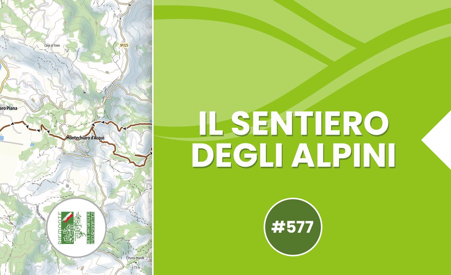
The Alpini Trail - Trail 577 by mountain bike
The first stretch of the route follows the municipal road that runs through the wheat fields in the Pieve area, then at the first fork keep right, overlapping for about 1 km with trail 573 (Montechiaro...
The first stretch of the route follows the municipal road that runs through the wheat fields in the Pieve area, then at the first fork keep right, overlapping for about 1 km with trail 573 (Montechiaro Loop).
The trail continues uphill, passes Cascina Mancina, now abandoned, until it reaches SP225 at km 3.
At this point, the two trails diverge: trail 573 turns right towards the Torbo stream valley, while trail 577 turns left, follows the paved road for a very short stretch and then begins to climb the wooded slope.
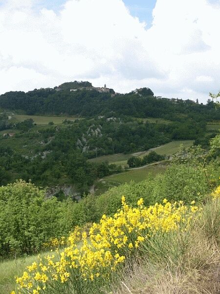
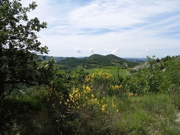
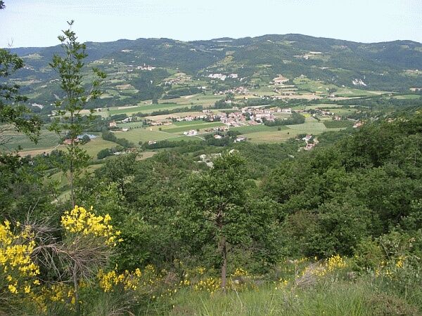
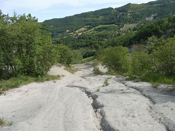
The steep ascent characterized by short hairpin bends on the calcareous slope is worthily rewarded by the increasingly wide panoramic view of the Acqui hills and the delightful environment created, especially in May and June, by the abundant and fragrant blooming of the broom bushes.
At the end of the climb, the trail reaches SP225 near the town of Montechiaro d’Acqui Alto (mt. 501 - a visit to this charming village is a must!), turns left and climbs the provincial road, passes the Pro Loco headquarters and briefly coincides again with trail 573.
From the Pro Loco headquarters, the route continues on asphalt for about 150 meters and then turns right onto the trail that begins to descend towards the Rio Plissone valley floor.
At first, the route descends crossing the gullies, then passes through a wooded area, turns right, bypassing a meadow area, reaches the valley floor, crosses the stream and begins to ascend slightly to a shelter, a resting point from which a sometimes steep descent towards the Rio Plissone begins.
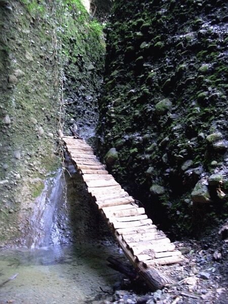
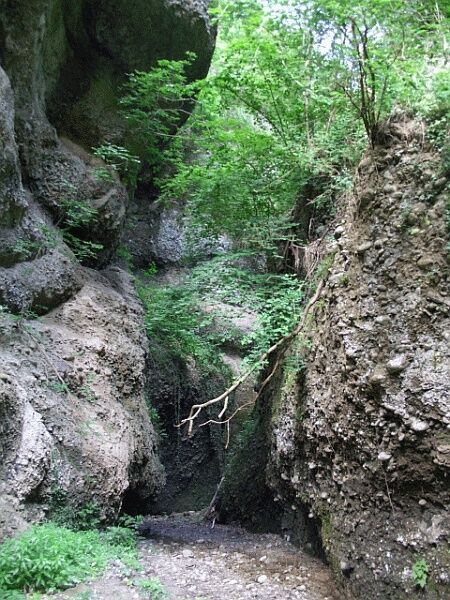
Upon reaching the valley floor, the trail follows the stream and in some specially marked points it is possible to visit the gorges, which the watercourse created in geological times.
These are deep incisions, in the form of narrow channels with steep and rugged walls, created by the slow but continuous erosive action of sand and pebbles in the water of a stream, carving the bed in resistant rocks.
Inside them develops a very particular ecosystem characterized by high humidity and very low lighting; under these conditions, numerous types of ferns, mosses and some herbaceous plants such as Aruncus dioicus grow luxuriantly.
Continuing on flat ground, the trail crosses what was once an area cultivated as gardens (“L'orto d'Franceschein”) by local inhabitants, who used the stream’s water to irrigate their crops.
Today this area has been reclaimed by forest vegetation, which remains the absolute master of the valley floor.
The trail follows a stretch of gravel road (where there is a reconstruction of an ancient well) and then leaves it to turn left onto the trail that climbs for about 150 meters along the Rio Ciapin, a small tributary of the Rio Plissone, up to the point where there is a detour to visit the particularly scenic “Orrido dei Laghi”.
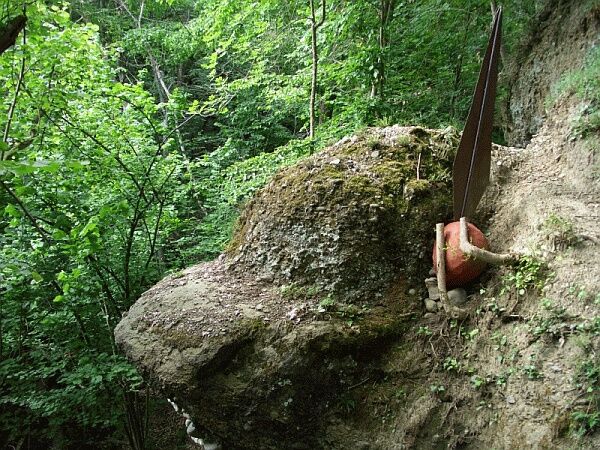
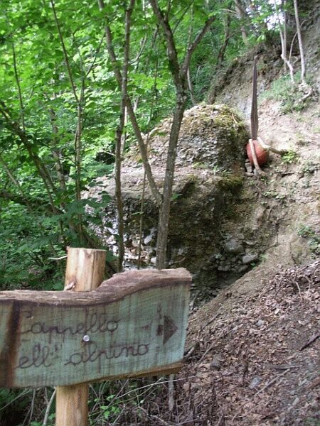
From the detour point, trail 577 begins the steep ascent of the wooded slope, passes a rock outcrop nicknamed for its shape “The Alpino’s Hat” (mt. 270) and then, also thanks to a support ladder, reaches the comfortable ridgeline dirt road, which soon rejoins the asphalt of the municipal road to the Chiarini hamlet.
The route turns right, climbs towards Montechiaro Alto, emerging on SP225 near the settlement, where the loop route closes; from the town of Montechiaro Alto the initial stretch is retraced downhill to return to the Church of S. Anna, from where the itinerary started.


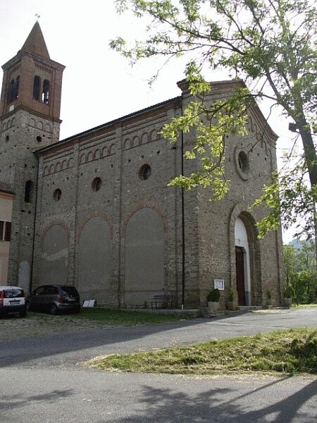
From Acqui Terme, follow the former state road 30 of Val Bormida up to the town of Montechiaro d’Acqui Piana; after the traffic light in the center of the town, turn left towards the Church of Sant’Anna (mt. 204), where the Alpini headquarters are located, the starting point of the route.
Priljubljeni izleti v okolici
-
5.0
Sentiero anello di Bistagno - Sentiero 500 in camminata
Romarska pot 14.7 km -
5.0
IL GRANDE CAMMINO DEL MONFERRATO - 7°TAPPA: CANELLI - PONTI
težkoRomarska pot 20.3 km -
Sentiero "Giro delle 5 Torri" - Sentiero 5T in mountain bike
Mountainbike 29.4 km -
Rundweg Montechiaro - Weg 573 mit dem Mountainbike
Mountainbike 30.9 km -
Sentiero anello di Cimaferle - Sentiero 534 in camminata
Romarska pot 8.13 km -
Sentiero anello di Cimaferle - Sentiero 534 in mountain bike
Mountainbike 8.13 km -
Sentiero anello di Merana - Sentiero 575 in camminata
Romarska pot 10.5 km -
Rundwanderweg Montechiaro - Weg 573 zum Wandern
Romarska pot 30.8 km -
Sentiero delle Chiese Campestri - Sentiero 571 in camminata
Romarska pot 21.5 km -
Sentiero Cartosio - Ponzone - Sentiero 569 in camminata
Romarska pot 6.83 km
Pohodništvo in sledenje


Ne zamudite ponudb in navdiha za naslednje počitnice
Vaš e-poštni naslov je bil dodan na poštni seznam.