The Zère valley
srednja
Pridobite to turo v svoj mobilni telefon
The Zère valley
srednja
Pohodništvo
15,45
km
Skenirajte kodo QR in začnite navigacijo v aplikaciji bergfex.

Pohodništvo in sledenje


The Zère valley
srednja
Razdalja
15,45
km
Trajanje
04:00
h
Ascent
178
hm
Morska gladina
188 -
325
m
Prenos skladbe
The Zère valley
srednja
Pohodništvo
15,45
km
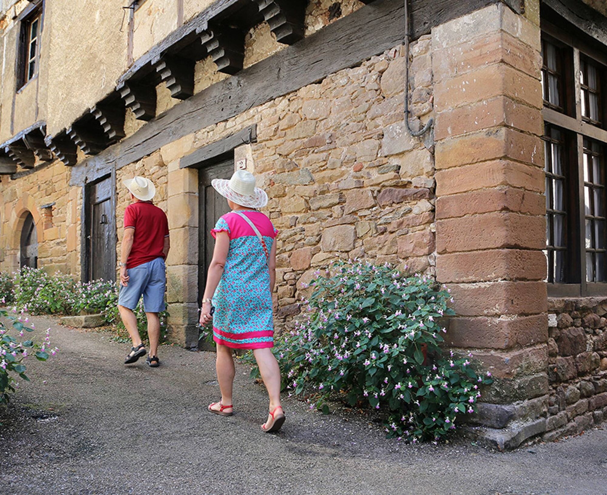
Nestled around its church listed as a Historic Monument which houses 4 classified statues representing the four virtues, it offers us a glimpse of its history. A keep, some towers now embedded in facades,...
Opis
Nestled around its church listed as a Historic Monument which houses 4 classified statues representing the four virtues, it offers us a glimpse of its history. A keep, some towers now embedded in facades, traces of the castle and fortified enclosure, still testify to life in the Middle Ages.
Good to know:
Opened in 2010, a thematic circuit recalls that the Cérou valley was affected by the Albigensian Crusade. Certainly, usually one first thinks of the nearby Cordes city, but the inhabitants of Salles also wanted to pay tribute to one of the lesser-known actors of this crusade, Imbert de Salles, descendant of Gosselin I, reputed restorer of their village.
Pot
Salles sur Cérou
(190 m)
Vas
0,0 km
Église Saint-Sauveur
(193 m)
Kraj čaščenja
0,0 km
La Coste
(272 m)
Poravnava
5,4 km
Le Barry
(206 m)
Soseska
8,7 km
Monestiés
(211 m)
Vas
8,9 km
LOU PAÏDOL
(188 m)
Restavracija
15,3 km
Église Saint-Sauveur
(193 m)
Kraj čaščenja
15,4 km
Pot
The Zère valley
srednja
Pohodništvo
15,45
km
Salles sur Cérou
(190 m)
Vas
0,0 km
Église Saint-Sauveur
(193 m)
Kraj čaščenja
0,0 km
La Coste
(272 m)
Poravnava
5,4 km
Le Barry
(206 m)
Soseska
8,7 km
Monestiés
(211 m)
Vas
8,9 km
Salles sur Cérou
(190 m)
Vas
15,3 km
LOU PAÏDOL
(188 m)
Restavracija
15,3 km
Église Saint-Sauveur
(193 m)
Kraj čaščenja
15,4 km

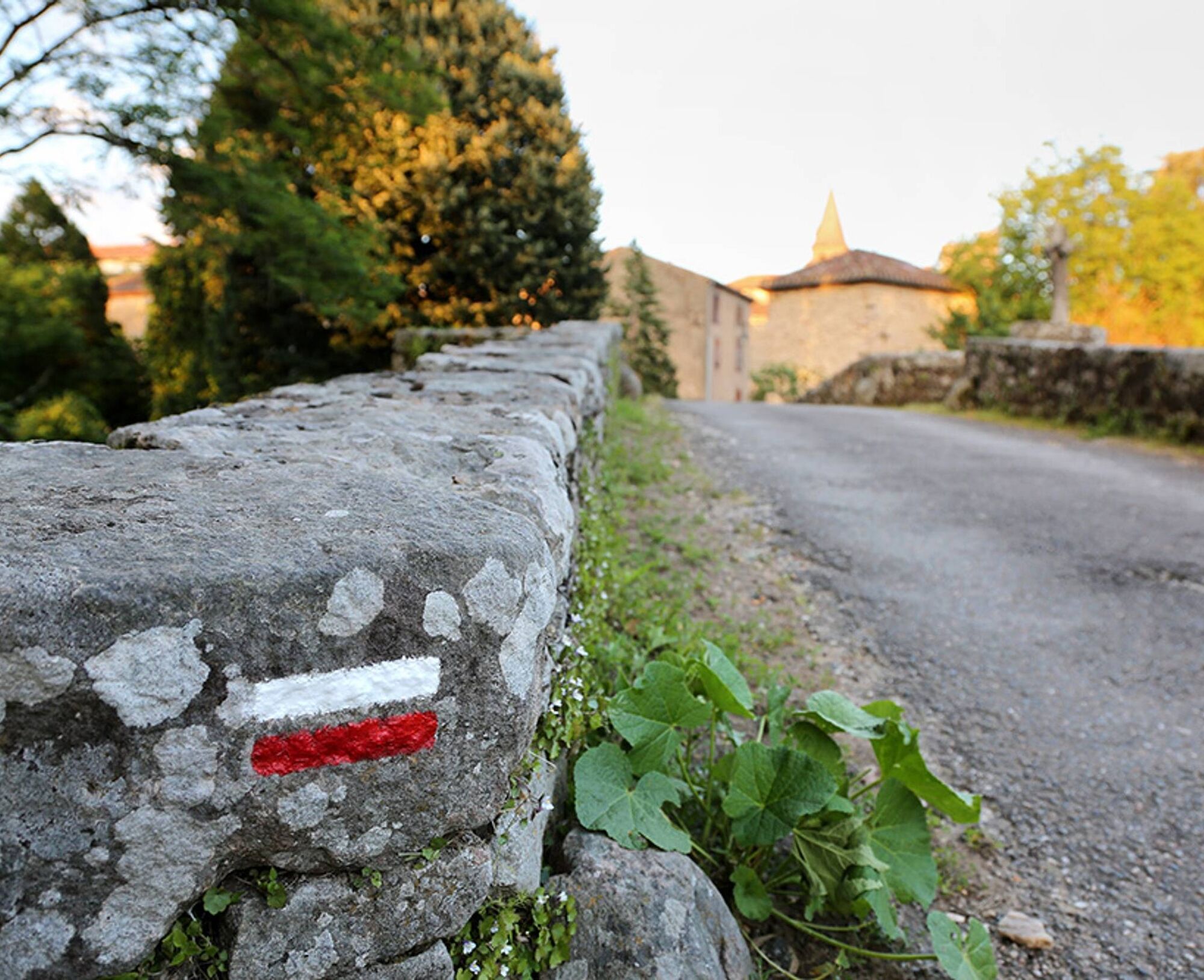
Informacije o poti
Pot
Park at the church square. Facing the town hall, take road D27 on the right towards Virac. Pass the cemetery, then leave the road on the left and climb the start of the hill (300 m).
1. After the bend, take the dirt path to the left towards the Zère valley. Leave the Ferrière mill on the left and continue straight for about 2 km. 2. Take the dirt path on the left that crosses the Zère (old Roman bridge). Climb up to the hamlet of la Coste. After this place, follow the paved road to the crossroads. 3. Turn right, then take the 1st road on the left passing near the cemetery. 200 m later, turn right. 4. Turn left onto the Monestiés road via la Jouvenate. Follow it for about 1.5 km. Reach D73, the Monestiés to Blaye les Mines road, go down it until you cross the bridge. 5. Take the road just after the bridge on the left. Follow the banks and before the Post Office, turn left into the alley which crosses the Cérou via the stone bridge (Pont de Candèze). 6. Just after, turn right, follow the Cérou to the avenue of plane trees. Turn left then immediately right. Pass between the stadium and the retirement home. Follow the GR of the old railway line (GR 36) until the village of Salles.
1. After the bend, take the dirt path to the left towards the Zère valley. Leave the Ferrière mill on the left and continue straight for about 2 km. 2. Take the dirt path on the left that crosses the Zère (old Roman bridge). Climb up to the hamlet of la Coste. After this place, follow the paved road to the crossroads. 3. Turn right, then take the 1st road on the left passing near the cemetery. 200 m later, turn right. 4. Turn left onto the Monestiés road via la Jouvenate. Follow it for about 1.5 km. Reach D73, the Monestiés to Blaye les Mines road, go down it until you cross the bridge. 5. Take the road just after the bridge on the left. Follow the banks and before the Post Office, turn left into the alley which crosses the Cérou via the stone bridge (Pont de Candèze). 6. Just after, turn right, follow the Cérou to the avenue of plane trees. Turn left then immediately right. Pass between the stadium and the retirement home. Follow the GR of the old railway line (GR 36) until the village of Salles.
Dodatne informacije in nasveti
Dodatne informacije
Intermediate
Še ni pregledov
Priljubljeni izleti v okolici
Le sentier des Infournats
svetlobaPohodništvo 2,65 kmGrain of salt path (Chemin du grain de sel)
srednjaPohodništvo 10,6 kmMaraval trail - dune section
svetlobaPohodništvo 1,72 kmSentier de découverte de Les Cabannes "Sur les traces des bâtisseurs"
svetlobaPohodništvo 2,63 kmTour du Tarn à cheval : Narthoux / Jouqueviel
težkoJahanje 26,3 kmHeritage and Health Route
svetlobaPohodništvo 5,62 kmTéroundel path (Sentier du Téroundel)
svetlobaPohodništvo 2,58 kmCordes heritage trail
srednjaPohodništvo 14,8 kmLacapelle Sainte-Lucie circuit
srednjaPohodništvo 11,5 kmCausse Trail
srednjaPohodništvo 12,4 km
Pohodništvo in sledenje

Zaradi več kot 550.000 predlogov izletov, podrobnih zemljevidov in intuitivnega načrtovanja poti je aplikacija obvezna oprema za vse ljubitelje narave.

Ne zamudite ponudb in navdiha za naslednje počitnice
Naročite se na novice
Napaka
Zgodila se je napaka. Prosimo, poskusite znova.Zahvaljujemo se vam za prijavo
Vaš e-poštni naslov je bil dodan na poštni seznam.
Izleti po vsej Evropi
Avstrija Švica Nemčija Italija Slovenija Francija Nizozemska Belgija Poljska Lihtenštajn Češka Slovaška Španija Chorvátsko Bosna in Hercegovina Luksemburg Andora පෘතුගාලය අයිස්ලන්තය එක්සත් රාජධානිය අයර්ලන්තය ග්රීසිය ඇල්බේනියාව North Macedonia Malta Norway Montenegro Moldova කොසෝවො හන්ගේරියානු සමුහාණ්ඩුව San Marino රුමේනියාව එස්ටෝනියා ලැට්වියාව බෙලාරස් සයිප්රස් Lithuania Serbia බල්ගේරියාව Monaco ඩෙන්මාර්කය Sweden ෆින්ලන්තය