


TRAIL OF THE BOUT DU MONDE
WARNING, no specific markers on this route. Download the GPX track to be able to follow the itinerary.
Starting from the village of Soubès, this trail route will quickly immerse you in the atmosphere with...
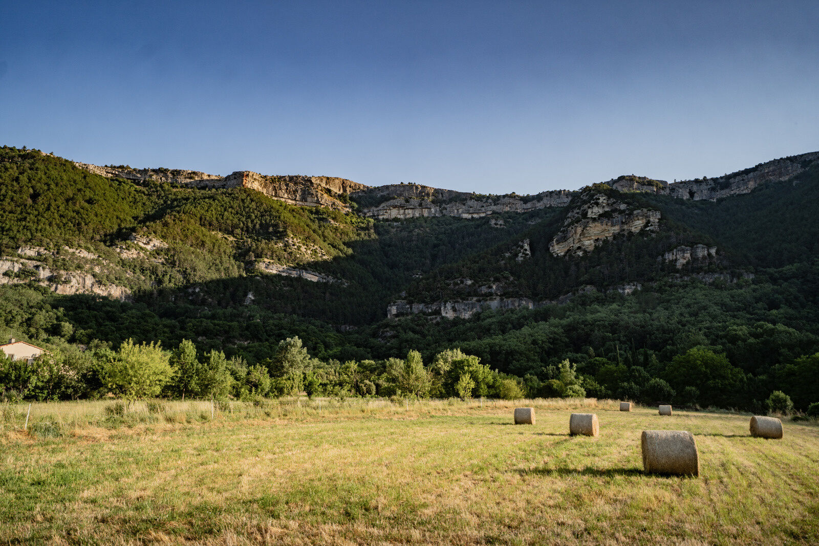
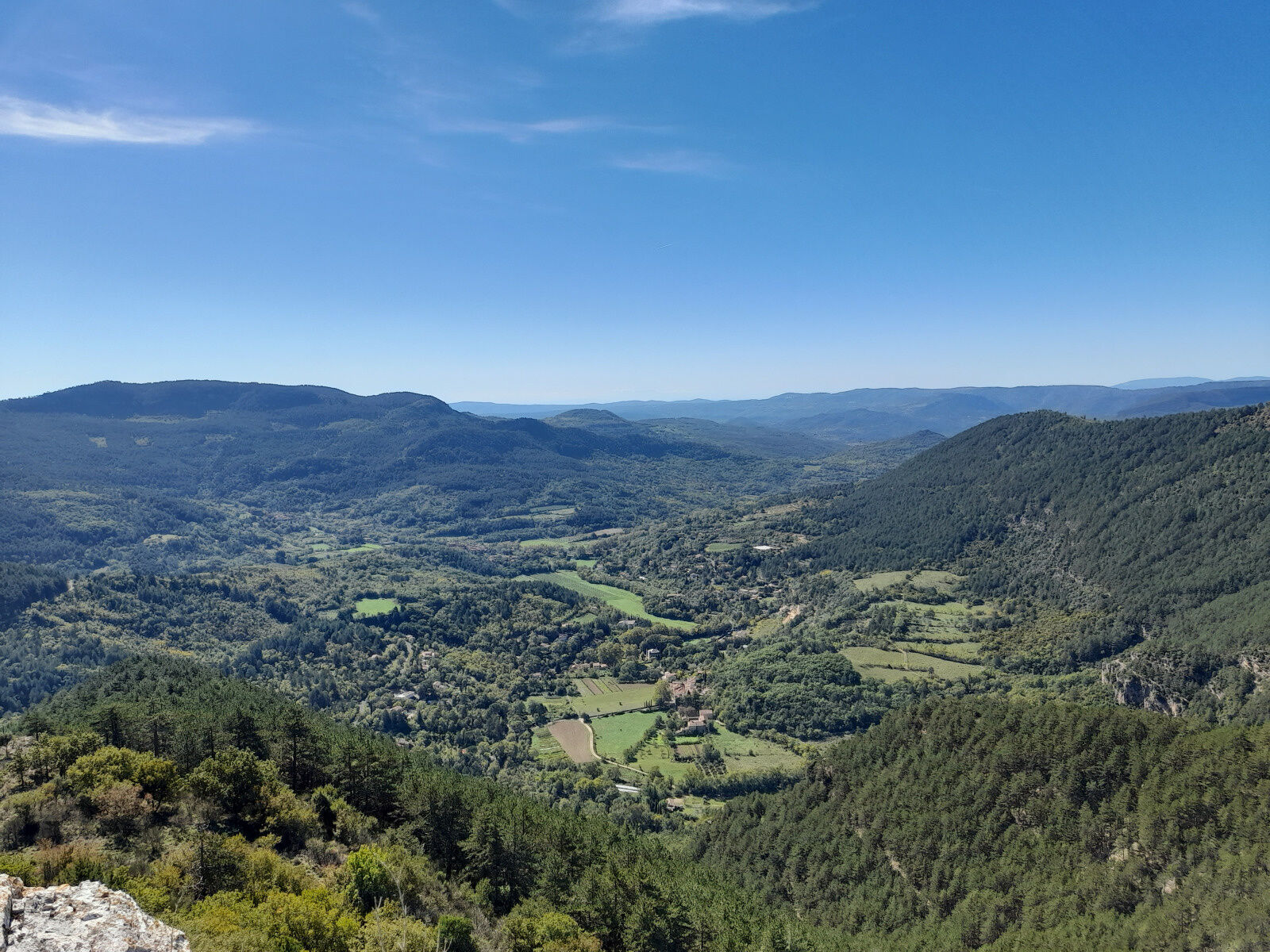
Starting from the village of Soubès, this trail route will quickly immerse you in the atmosphere with an alternation of technical trails, rolling sections, and passage on an ancient Roman road. The itinerary will gradually lead you up to the heights of the Cirque du Bout du Monde, where an exceptional viewpoint awaits you over the entire valley.
The route will also take you through the hamlet of Gourgas and its refreshing fountain, a favored stop for runners before tackling the next section, which already reveals the terrain and the challenge ahead. You will then continue with the crossing of the Causse, a typical terrain suitable for acceleration, where it is not uncommon to encounter some semi-wild cows.
The finish will be in the village of Soubès, where the atmosphere and ambiance are friendly. You can recover with a nice cold drink or a well-deserved refreshment on the village square.

1
From the parking lot, take the Garennes path then Farrat path following the red and yellow GRP® Tour du Larzac Méridional markings. Follow the Roman Way to the intersection with the PR Cirque du Bout du Monde (190 m elevation gain)
2
At the intersection, turn right and follow the yellow markings of the PR Cirque du Bout du Monde. Cross the hamlet of Gourgas, then the ford on the Brèze and turn right onto the climbing trail, then right again onto the Lagardie path for 300m, then leave the road to the left and follow the yellow markings.
3
Turn left onto the track and continue to follow the yellow markings. At the intersection, immediately turn left, pass the gate (end of yellow marking) and climb immediately right up the embankment. Come out onto the track and take the left path that climbs up to La Roque, a steep and technical ascent over 1.3 km (340 m elevation gain from marker 3 bridge)
4
At the cross, leave the yellow and red markings towards St Pierre-de-le-Fage and turn left onto the track, then left again onto the path along fences. Pass through the gate and continue the path for about 2 km overlooking the cliffs.
5
At the track junction, turn right and after 50m turn left again. Pass through the gate and continue on the pleasant track for about 2 km. At the intersection of a track, turn left for 300m.
6
Leave the drivable track and continue right on a slightly stony path and follow it for 1 km. At the intersection turn left, pass the gate, find the yellow markings again, the PR Camin Farrat. Pass the pond and continue straight on to the dolmen keeping the PR markings (pleasant descent through the woods 430 m elevation loss) until Soubès and back to the starting parking lot.
SOUBES
Bring water
Avoid in extreme heat
Possible presence of guarding dogs
Yellow MTB markers
Yellow and red local GR
Yellow PR
+33 4 67 88 86 44
LODEVOIS AND LARZAC TOURIST OFFICE
Priljubljeni izleti v okolici
- 5,0
LES VAILHÉS HIKING TRAIL
srednjaPohodništvo 9,28 km - 5,0
CIRCUIT N°1 LE LAC DU SALAGOU - ESPACE VTT-FFC DU SALAGOU
srednjaMountainbike 26,9 km - 4,0
HIKE OF THE GRÉZAC PLATEAU
srednjaPohodništvo 14,0 km HIKING OF THE FENESTRETTES
srednjaPohodništvo 10,4 kmHIKE FROM DRY VALLEYS TO SOTCHS
srednjaPohodništvo 11,5 kmLAVAL DE NIZE HIKE
svetlobaPohodništvo 6,07 kmTRAIL OF THE TOUR OF LAKE SALAGOU (SHORES OF CLERMONT) - GR® OF THE REGION BETWEEN 2 LAKES Avène – Salagou
srednjaTrailrunning 25,6 kmHIKING TOUR IN THE HEART OF THE CAUSSE - GR® DE PAYS TOUR DU LARZAC MÉRIDIONAL
srednjaPohodništvo 56,7 kmCORNICHES DE LAUROUX HIKE
srednjaPohodništvo 13,8 kmROUTE NO. 87 - THE LION OF SERVIÈRES - MTB AREA FFC LODÉVOIS AND LARZAC
srednjaMountainbike 28,0 km

Pohodništvo in sledenje


Ne zamudite ponudb in navdiha za naslednje počitnice
Vaš e-poštni naslov je bil dodan na poštni seznam.