







VÉLOCCITANIE, FROM MAZAMET TO BÉZIERS

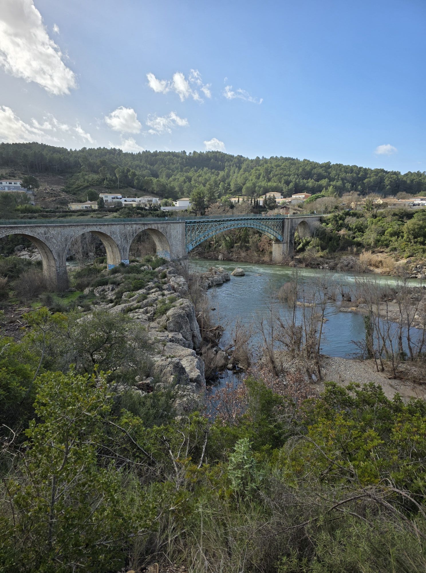
From Mazamet to Béziers, La Véloccitanie offers a varied tour of southern France. We leave the Montagne Noire to follow the PassaPaïs through the heart of the Haut-Languedoc Regional Nature Park, between...
From Mazamet to Béziers, La Véloccitanie offers a varied tour of southern France. We leave the Montagne Noire to follow the PassaPaïs through the heart of the Haut-Languedoc Regional Nature Park, between pastures, rivers and hilltop villages. The Fenille tunnel marks the entrance to a more Mediterranean atmosphere, before joining Saint-Pons and the Jaur and Orb valleys, dominated by the Caroux. Olargues and its Eiffel bridge are a highlight, as are the Gorges d'Héric for the more curious. After Bédarieux, the mountains give way to the vineyards of the Avant-Monts. The route then reveals the Oppidum d'Ensérune, the Etang de Montady, the Malpas tunnel and the Fonseranes locks, before arriving in Béziers and its rich heritage.


1
From Mazamet, nestled on the edge of the Montagne Noire, you're now on the PassaPaïs, the green way of the Haut-Languedoc. Before you set off, don't miss a detour via the footbridge overlooking the Arnette valley and the medieval village of Hautpoul. This cycling getaway takes place in the heart of a valley marked by the Thoré river. The green route takes you through rolling pastures, charming villages and towering mountains. The tunnel under the Col de la Fenille takes you from the "oceanic" Tarn countryside to the Mediterranean basin of the Hérault. At the end of the stage, to appreciate the geological richness of the area, a visit to the grotte de la fileuse de verre (glass spinner's cave) is a good way to stop off before arriving in Saint-Pons-de-Thomières.
2
A section of La Véloccitanie that still follows the PassaPaïs, this stage unfolds with the Jaur and Orb rivers as its common thread. The Somail mountains and the Caroux massif dominate the route as we cross. After a remarkable passage through Olargues, nestled on its rocky knoll and listed as one of France's "most beautiful villages", the Eiffel bridge will take you over the valley to appreciate its wilderness, heather moors and varied rock formations. For the more determined, a detour to the Gorges d'Héric and its village perched in the heights will enchant you with natural pools and splendid panoramas. After winding through numerous bridges and tunnels, the stage ends with an arrival in Bédarieux along the banks of the Orb.
3
Bédarieux marks the end of the PassaPaïs. The mountainous landscapes have given way to the gentler landscapes of the Avant-Monts, where vineyards stretch as far as the eye can see; the sea is a distant promise for the cyclist. You're entering a region rich in terroir and know-how handed down from generation to generation, with today's vineyards boasting renowned appellations. Enchanting landscapes bear witness to the work of men and their ingenuity, notably in the construction of dry-stone walls and capitelles. Even more ancient traces await you a little further on. The Oppidum d'Ensérune, an ancient Elisian and later Gallic village, and the Etang de Montady, a starlit dry pond. As for the genius of Pierre-Paul Riquet, the Malpas Tunnel, dug under a hill to make way for the Canal du Midi, or the nine monumental locks at Fonseranes in Béziers, bear witness to this. A final stop in Béziers to discover the splendid bourgeois buildings that bear witness to a flourishing industry, the Saint-Nazaire cathedral and the famous Béziers camel.
Mazamet
Voie verte" signs
+33 4 67 97 06 65
Office de tourisme du Minervoix au Caroux
Hérault Vélo

Priljubljeni izleti v okolici
-
4.0
GORGES DE COLOMBIERES HIKE
srednjaPohodništvo 12.0 km -
5.0
HIKING OF THE HÉRIC GORGES VIA THE ORIENTATION TABLE
srednjaPohodništvo 16.3 km -
4.0
CAROUX SUMMIT HIKE
srednjaPohodništvo 7.94 km -
5.0
HIKING OF THE L'ESPAZE ARBORETUM
srednjaPohodništvo 12.3 km -
5.0
HIKING ROUTE OF THE TERRASSES DE L'ESPINOUSE
srednjaPohodništvo 16.8 km -
3.0
CYCLE LOOP No. 29 - FROM THE VALLEYS TO THE PEAKS OF HAUT-LANGUEDOC
srednjaKolesarjenje 64.3 km -
5.0
HIKING THE RED ROCK
srednjaPohodništvo 7.01 km -
5.0
OENORANDO® THE VALLEY OF AROMAS
srednjaPohodništvo 13.7 km -
HERIC GORGES ROAD - MONS LA TRIVALLE
srednjaPohodništvo 9.38 km -
HIKE OF SAINT MICHEL DE MOURCAIROL
srednjaPohodništvo 11.7 km
Pohodništvo in sledenje


Ne zamudite ponudb in navdiha za naslednje počitnice
Vaš e-poštni naslov je bil dodan na poštni seznam.





