


Navigacija po spletni strani
Pridobite to turo v svoj mobilni telefon
Zemljevid
COL DE LA CROIX BLANCHE
svetloba
Kolesarjenje
34.29 km
Skenirajte kodo QR in začnite navigacijo v aplikaciji bergfex.
QR Code
Pohodništvo in sledenje
Prenos za iOS
Prenos za Android

COL DE LA CROIX BLANCHE

Razdalja
34.29 km
Trajanje
03:00 h
Ascent
555 hm
Morska gladina
384 - 904 m

Stopnja težavnosti: 2

Prenos skladbe
Zemljevid
COL DE LA CROIX BLANCHE
svetloba
Kolesarjenje
34.29 km

This route is ideal at the beginning of the season or before tackling the major cols, offering an original discovery of the Pays de Lourdes on peaceful roads. After a gentle climb to the Col de Lingous,...

Opis

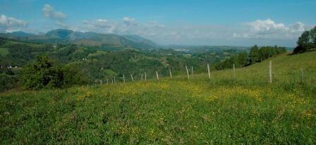
This route is ideal at the beginning of the season or before tackling the major cols, offering an original discovery of the Pays de Lourdes on peaceful roads. After a gentle climb to the Col de Lingous, you will continue to the Col de la Croix Blanche, linking the Bagnères de Bigorre valley (this is a route pleasant to take on the Tourmalet loop). At the Col de la Croix Blanche, stop to admire the panorama of the mountain range. The return is via the Lézignan plain.

Pot
Lourdes
(402 m)
Mesto
0.1 km
Église Saint-Cyriaque
(434 m)
Kraj čaščenja
3.9 km
Germs-sur-l'Oussouet
(862 m)
Vas
13.4 km
Église Saint-André
(642 m)
Kraj čaščenja
19.2 km
Astugue
(642 m)
Vas
19.3 km
Escoubès-Pouts
(388 m)
Vas
26.2 km
Lourdes
(402 m)
Mesto
33.2 km
Pot
Zemljevid
COL DE LA CROIX BLANCHE
svetloba
Kolesarjenje
34.29 km
Lourdes
(402 m)
Mesto
0.1 km
Pont-Neuf
(387 m)
Koridor/teren
1.9 km
Lugagnan
(430 m)
Vas
2.8 km
Saint-Créac
(429 m)
Vas
3.7 km
Église Saint-Cyriaque
(434 m)
Kraj čaščenja
3.9 km
Juncalas
(491 m)
Vas
6.1 km
Auberge de casteloubon
(547 m)
Restavracija
7.4 km
Cheust
(551 m)
Vas
7.4 km
Las Courreges
(552 m)
Koridor/teren
8.0 km
Esclate-Caouat
(587 m)
Koridor/teren
10.0 km
Germs-sur-l'Oussouet
(862 m)
Vas
13.4 km
La Serre
(724 m)
Poravnava
16.5 km
Cartau
(679 m)
Poravnava
16.8 km
Neuilh
(694 m)
Vas
16.9 km
Lamarque Devant
(650 m)
Koridor/teren
19.2 km
Église Saint-André
(642 m)
Kraj čaščenja
19.2 km
Astugue
(642 m)
Vas
19.3 km
Tudelle
(609 m)
Koridor/teren
19.5 km
Lamarque-Darré
(586 m)
Koridor/teren
19.8 km
Loucrup
(527 m)
Vas
22.3 km
Siaoubère
(514 m)
Koridor/teren
23.1 km
Lacoste
(484 m)
Koridor/teren
23.2 km
Arrioume
(392 m)
Koridor/teren
24.4 km
Escoubès-Pouts
(388 m)
Vas
26.2 km
Arcizac-ez-Angles
(408 m)
Vas
28.4 km
Lézignan
(406 m)
Vas
29.4 km
Lourdes
(402 m)
Mesto
33.2 km
Informacije o turneji
Tehnologija
2 / 6
Stanje
2 / 6
Pokrajina
5 / 6
Izkušnje
5 / 6
Najboljši letni čas
Jan
Feb
Mar
Apr
Maj
Jun
Jul
Avg
Sep
Okt
Nov
Dec
Skupna turneja
Zemljevid
COL DE LA CROIX BLANCHE
svetloba
Kolesarjenje
34.29 km
Napaka
Zgodila se je napaka. Prosimo, poskusite znova.
Varnostna navodila

In case of emergency, dial 112

Informacije o prihodu
Prihod

Route connecting the Pays de Lourdes and the Haut Adour valley via the Col de la Croix Blanche. This route can be used on the Tourmalet loop.

Javni prevoz

Prefer the train for your journeys

Parkirišče

Lourdes - Pic du Jer

Dodatne informacije in nasveti
Stopnja težavnosti

2

Dodatne informacije
Col de Lingous (575 m): Category 3 (from Juncalas) - average gradient: 6%; maximum gradient: 8% Col de la Croix Blanche (820 m): Category 2 (from Juncalas) - average gradient: 6%; maximum gradient: 8%

None
Nasveti

Recommended period: all year round
Gears: from 39x25 to 34x25

Pohodništvo in sledenje

Pohodništvo in sledenje

prenos za iOSprenos za Android
Pohodništvo in sledenje
Zaradi več kot 550.000 predlogov izletov, podrobnih zemljevidov in intuitivnega načrtovanja poti je aplikacija obvezna oprema za vse ljubitelje narave.
bergfex


