


Artistic Route (EAB): "In Sight" - Parallels between Arrats and Gimone
Stopnja težavnosti: 2


Starting from Sarrant, after a tour of the medieval village (mural by the Superbrut-e Collective, Maison de l'Illustration, Micro-Folie Digital Museum...), you will take the D205 towards Mauvezin.
After about 4km, turn right towards Bouvéés.
At the entrance to Bouvéés, turn left towards Mauvezin. On your right, you will admire the castle of Bouvéés.
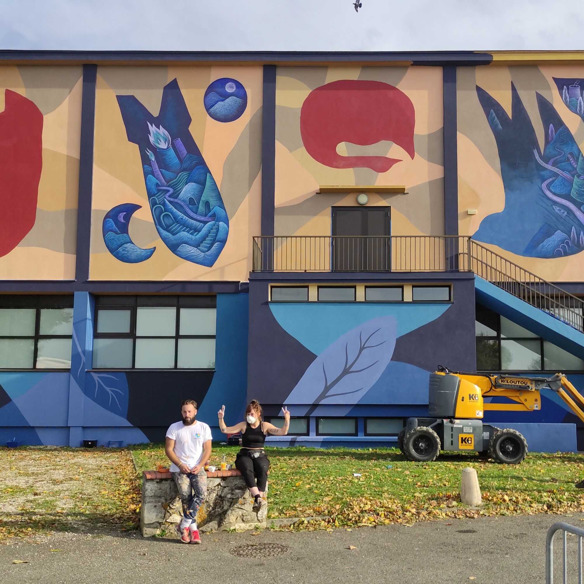
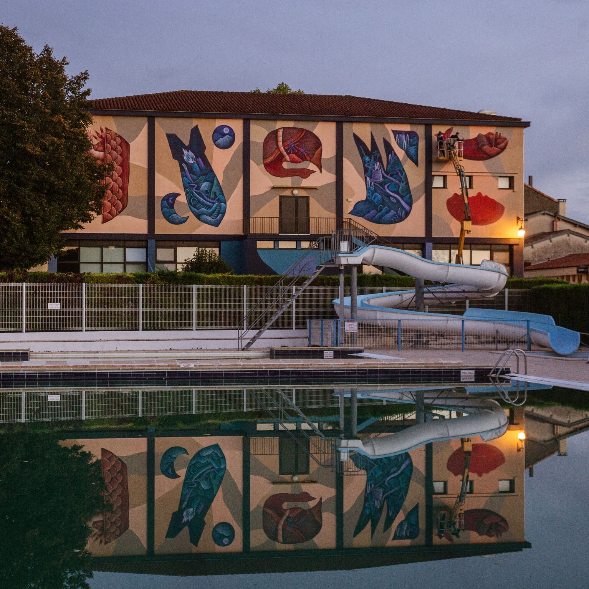
On arrival at Mauvezin, take Gaston path then Saint-Céré path and Saint-Céré street, which will lead you to the "Signs" mural by the artist Loraine Motti and the Urban Art Agency, located behind the Rural Community Centre. Then you will go up Promenade du Plan and upon reaching Place du Foirail, go up rue du Foirail to reach the corner of the magnificent Mauvezin Market Hall. Then descend to the right, pass next to the church via Rue Saint-Georges. Arriving in the lower town, you will cross the Arrats river, follow the lake and carefully cross towards Nougaroulet.
Then take the first left to follow the Arrats for several kilometers before arriving at the village of Saint-Sauvy. After crossing the village downhill, turn right towards Ansan. Exiting the Armagnac state forest, you will enjoy a beautiful view of the Pyrenees and the Gascon hills.
At Ansan, turn left towards Aubiet. At the bottom of the descent (3km), turn left to take the path along the Arrats.
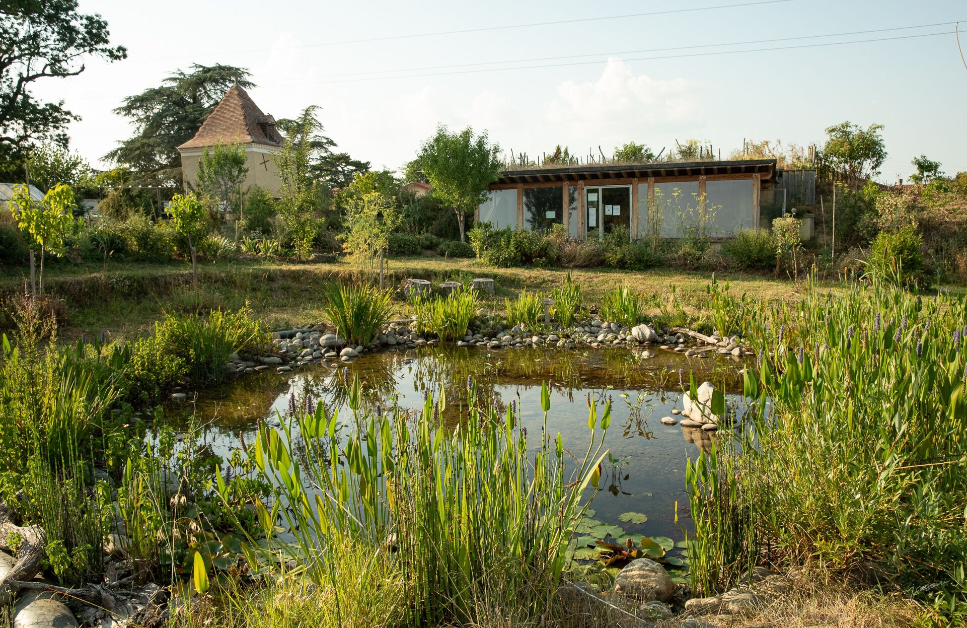
You will pass under the highway before arriving at Aubiet on your left. Go up the main street to find the Art and Environment work "La Nourrice", the forest garden by the artist Oliver Nattes. You will leave La Nourrice via Grande Rue, left then first right (Avenue du Groupe Scolaire). After passing the school, turn right at the stop sign. Leaving the village, take the second left (landmark: Foie Gras sign). You will then pass under the railway line then over the highway.
After the bridge, take the first right. You will overlook the highway and once again enjoy 360° views of the Gers countryside, with the Pyrenees mountain range in the background. At 700m, you will reach a fork with a house on the left and a trimmed bush in the middle, take left. Then straight ahead. After about 1.5 km, you will reach a crossroads where you will need to turn right (landmark: "cattle caution" sign). You will continue along the ridge, then descend towards Gimont, visible on the right.
Before reaching the bottom of the descent, take a path on the left just after the sign "En Sarrade". Then take the first right to reach the RD12. Cross it carefully to go left, then 15m to the right, take Chemin de l'Eglise de Saint-Jean. You will cross the Gimone river near the Saint-Jean Chapel and arrive at a crossroads at the foot of the railway. Turn right under the bridge to reach Gimont.
Enter Gimont until the junction with the main road (D924) and take it right. Before the bridge, turn left to go up towards the centre of the bastide, rue Nationale. Pass under the central market hall or stop for a drink. Continue straight to pass in front of the church and discover the heart of the village.
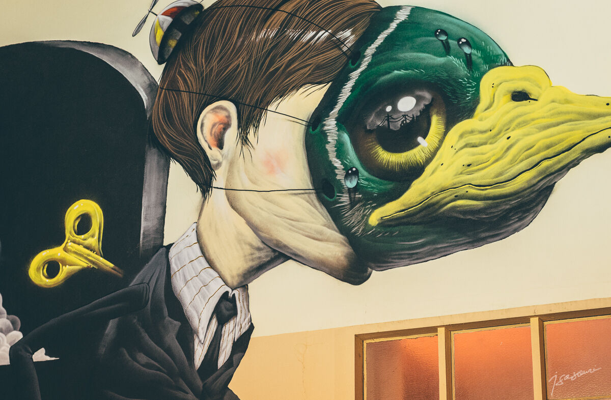
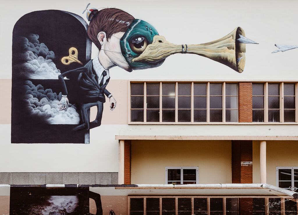
After the town hall, descend the third street on the left (Rue Antonin Carlès) to join boulevard du Nord. You will arrive opposite the Tourist Office. Turn left on the boulevard until the fat market hall to discover the various motifs of the work "Duck Face" signed by Veks Van Hillik.
Continue along the boulevard to the intersection where you arrived. At Chemin de St Jean, turn right to resume the route.
You will leave Gimont by the same route, but this time, when you pass under the small railway bridge, continue straight ahead for more than 4 km, where you will follow the Gimone river at the bottom of the valley.
At the end of this path, leave the main road which goes up to the right and continue (still straight ahead) along a small path that goes through agricultural buildings. After these buildings, this path becomes grassy and runs alongside fields while climbing. This is the "off-road" section of this route (about 1 km). You will have to get off your bike and walk to the crossroads. Warning! If it has rained, this part of the route can become muddy.
At the end of this path, continue straight ahead to take a small road leading to the village of Touget which you can see ahead of you.
In Touget, you can also take a stroll by entering on the right into this pretty medieval bastide and take a refreshment break in the shade of the market hall.
If you do not enter Touget, take the direction of Mauvezin (left) at the entrance to the village. Pass the town exit sign and take the first right, the D207, direction Saint-Orens. Stay on this road for about 5 km until you reach the D654 junction.
At the junction, take the D205 straight ahead towards Sarrant. Go straight on for about 5 km, and you are back at Sarrant.
Before setting off:
Ensure the bike is in perfect mechanical condition, including tires and brakes Make sure the bike is properly adjusted to your body shape Wearing a helmet is strongly recommended Bring a repair kit Ensure your smartphone battery is fully charged before leaving Remember the Highway Code applies to cyclists at all times Never ride more than two abreast and ride in single file when traffic conditions require it Respect other road users as you would like to be respected Choose a route suited to your physical abilities Inform those around you of your route Check weather conditions A first aid kit is not essential but can be very useful Be informed and keep emergency numbers handy Respect the environment by not throwing food wrappers on the roadside If you must return at nightfall, ensure you can see and be seenThis route is mainly on low-traffic roads, typical of the Gers hinterland. These roads are used by various motor vehicles, such as cars and agricultural machinery. Everyone’s vigilance is important.
On some sections, it will be necessary to ride in single file due to somewhat heavier car traffic than on the rest of the route.
CHECK THAT YOUR SMARTPHONE BATTERY IS FULLY CHARGED BEFORE YOU START THIS ROUTE.
Emergency number: 112
Consider carpooling
Parking near the starting point
2
The departure can be from Sarrant (Maison de l'Illustration), Gimont (Tourist Office) or Mauvezin (Tourist Office).
Warning: Starting from Gimont towards Touget, part of the route (about 1km) is on a grassy path. If the weather has been rainy, this section can become muddy. You will find the same grassy section in the other direction, between Touget and Gimont.
Due to the sometimes significant gradient of certain sections of this route, it is preferable to ride it on an electric-assist bike (EAB).
At the start or finish in the village of Sarrant, the mobile signal is sometimes weak or nonexistent. Geonavigation via the OutdoorActive app may be limited or even impossible. To follow the route, enter the village and leave via the D205 road (direction Mauvezin from Sarrant). A sufficient mobile signal for geonavigation is generally available a few hundred meters outside Sarrant. The OutdoorActive app then enables direct geonavigation.
Priljubljeni izleti v okolici
-
Gimone and Arrats with e-bike
srednjaKolesarjenje 41.8 km -
Itinéraire Artistique (VAE) : "Crêtes et arêtes" - En Couleurs Sur Les Coteaux Du Savès
Kolesarjenje 39.7 km -
The Gimone and its villages
srednjaKolesarjenje 42.7 km -
Discovery route of the Artistic Routes on the Arrats-Gimone hillsides
svetlobaKolesarjenje 11.1 km -
At the gates of Gascony
srednjaKolesarjenje 60.3 km -
De rivières en coteaux
srednjaCestno kolo 79.3 km -
Gimont - Villages et collines.
srednjaKolesarjenje 17.4 km -
From bastides to castelnaux – Gimont
težkoCestno kolo 87.0 km -
Starting from a bastide
srednjaKolesarjenje 20.9 km -
From Sainte-Marie to Escorneboeuf
srednjaKolesarjenje 19.6 km
Pohodništvo in sledenje


Ne zamudite ponudb in navdiha za naslednje počitnice
Vaš e-poštni naslov je bil dodan na poštni seznam.