







The Ariège MTB Crossing - Stage 01: Ax-les-Thermes to the Refuge du Chioula

Stopnja težavnosti: S4
To see:
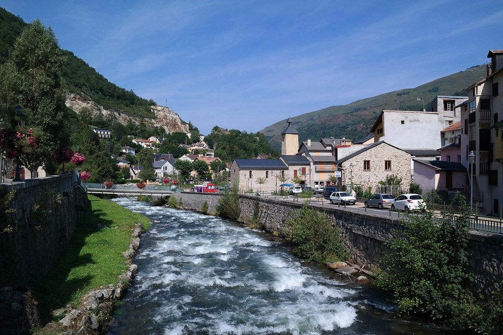
Ax-les-Thermes, water and mountain town
A first capture attributed to the pre-Roman era traces back the spa tradition of Ax-les-Thermes to the roots of our civilization. In 1260, the Count of Foix...
To see:
Ax-les-Thermes, water and mountain town
A first capture attributed to the pre-Roman era traces back the spa tradition of Ax-les-Thermes to the roots of our civilization. In 1260, the Count of Foix Roger IV had a leper hospital and the Ladres basin, fed by sulfurous waters, constructed there. However, the waters were used therapeutically only from the late 16th century.
The first thermal establishment built was the Couloubret, in 1780. It gets its name from the snake that once haunted the hot springs of the region. This chilly reptile used to slip through the pipes right into the spa cabins! Three thermal establishments currently operate, allowing guests to enjoy the benefits of the warmest waters in the Pyrenees (78°C) for the treatment of rheumatological and respiratory conditions, or simply for wellness.
In addition to thermalism, the mountain environment of Ax-les-Thermes and its surrounding valleys has gradually become the scene of various outdoor leisure and nature discovery activities: hiking, alpine skiing, Nordic skiing, climbing… The economy of the "Vallées d'Ax" is now closely linked to tourism.
The cultivated terraces
Whether still very visible, as on the sunny side of the upper Ariège valley, or recolonized over the years by the forest, the cultivated terraces are omnipresent on all the slopes of the montane level.
Tracing the Cathars, the chemin des Bonshommes
The chemin des Bonshommes takes you back to the Middle Ages, in the footsteps of the last Cathars hunted by the Inquisition. You cross the same passes as these freedom-loving men and women. Today, as a symbol of cross-border cooperation between Ariège and Catalonia, it offers an impressive mosaic of landscapes.


Signage: MTB signs
Da
Emergency number: 112
Consider carpooling
TER at Ax-les-Thermes
S4
To learn more about the destination, visit our site

Priljubljeni izleti v okolici
- 4,3
Pic de Tarbesou - Carena Runde - Etang Noir et Blue
srednjaPohodništvo 12,3 km Le Pic du Tarbésou
srednjaPohodništvo 2,82 kmCyclosport route 11 - The Ariège cyclotour - Stage 5: from Ax-les-Thermes to Foix
težkoCestno kolo 93,0 kmFontargente ponds
svetlobaPohodništvo 7,78 kmCyclosportive route 11 - The Ariège cycle route - Stage 3: from Auzat to Prades
težkoCestno kolo 107,4 kmRefuge du Rulhe via Le Rieutort
svetlobaPohodništvo 13,2 kmThe Ariège MTB Crossing - Stage 03: Comus to Lavelanet
težkoMountainbike 22,7 kmLa Grande Traversée VTT Ariège Pyrénées FFC Label
težkoMountainbike 32,5 kmÉtang d'Appy - from Appy
svetlobaPohodništvo 8,95 kmC 3. Etappe Artigues-Tarascon, Okzitanien/Frankreich
težkoKolesarjenje 63,2 km

Pohodništvo in sledenje


Ne zamudite ponudb in navdiha za naslednje počitnice
Vaš e-poštni naslov je bil dodan na poštni seznam.





