


Oga
Starting from the parking lot near the playground of the Santa Lucia hamlet, proceed south along via Fumarogo. After passing the Dosso locality, continue on the forest trail to La Ronca. For a short stretch,...
Starting from the parking lot near the playground of the Santa Lucia hamlet, proceed south along via Fumarogo. After passing the Dosso locality, continue on the forest trail to La Ronca. For a short stretch, the path joins trail N276, then returns to the forest trail. Near Presurina, it connects with trail N277 and, passing some clearings and the picnic area, arrives at Calosio, where it is possible to see some typical mountain huts. From here, the route winds through a dense forest before emerging in the outer areas of the Oga hamlet. The walk continues towards the town center until it intersects with trail N280 which, continuing to the right, leads to Costa del Madrecc and, subsequently, to the Osteglio locality. From here, the walk continues along via Fumarogo until returning to the starting point.
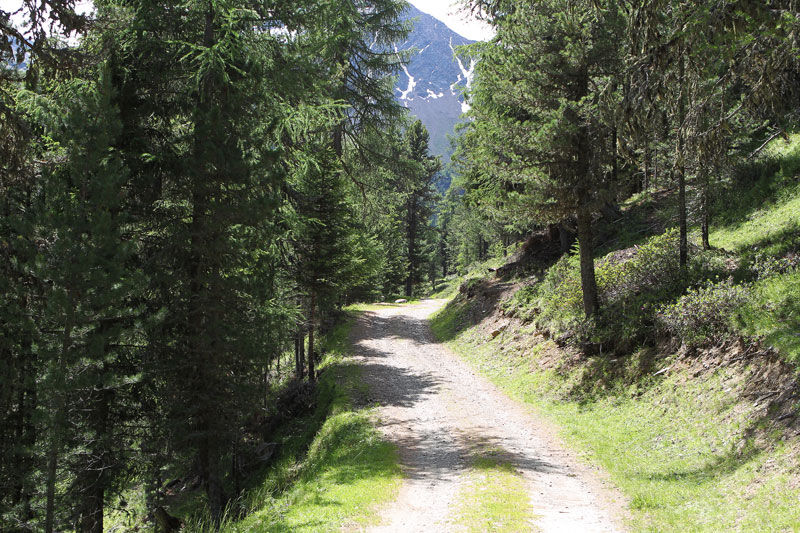
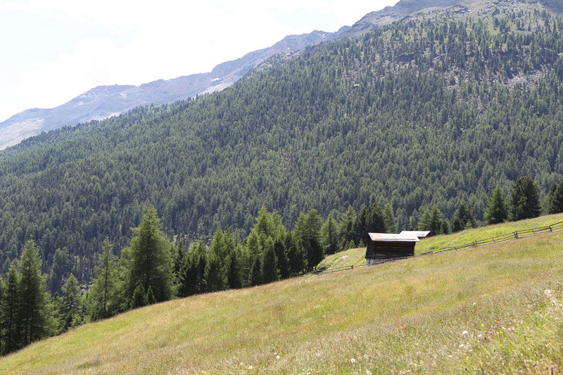
The colors of the mountain The path crosses dense woods, alternating with large clearings and very green meadows where typical mountain huts rise, allowing contact with the nature surrounding these places, appreciated by enthusiasts of mountain nature scenes.
Spletne kamere s turneje
Cima Bianca
Bormio 2000
Piste Stelvio
Cima Bianca
Cima Bianca
Cima Bianca
Cima Bianca
Bormio 2000
Bormio 2000
Bormio 2000
Bormio 2000
Bormio 2000
Bormio 2000
Bormio 2000
Cima Bianca
Bormio Terme
Bormio Terme
Bormio Terme
Piazza Kuerc
Piazza Kuerc
Piazza Kuerc
Piazza Kuerc
Uzza - Valfurva
Arrivo Cabinovia Cima Piazzi
Arrivo Cabinovia Cima Piazzi
Arrivo Cabinovia Cima Piazzi
Arrivo Cabinovia Cima Piazzi
Arrivo Cabinovia Cima Piazzi
Teleir - Oga
Teleir - Oga
Teleir - Oga
Teleir - Oga
Teleir - Oga
Priljubljeni izleti v okolici
- 4,3
Sonnenaufgang auf der Rötelspitze im Nationalpark Stilfserjoch
Pohodništvo 2,02 km - 3,4
Sta.Maria, Prà da Vau - Lai da Rims - Alp Sot - Prà da Vau
težkoPohodništvo 14,7 km - 3,3
Watervallen wandeling
svetlobaPohodništvo 4,95 km - 4,8
Wanderung: Heilige drei Brunnen zur Berglhütte
svetlobaPohodništvo 5,51 km - 4,0
Ortler Höhenweg
težkoVisokogorska tura 123,2 km - 2,0
Military Historical Hiking Trail "Scorluzzo"
srednjaPohodništvo 9,52 km - 5,0
TIP Panorama Road Tyrol ➤ Stelvio Pass
svetlobaMotorno kolo 40,8 km - 5,0
Piz Umbrail und Abstieg zum Lai da Rims
težkoVisokogorska tura 15,0 km - 5,0
444.02: Nationalpark Bike-Tour 2. Etappe
težkoMountainbike 39,6 km Lai da Rims - shorter version
srednjaPohodništvo 9,70 km
Pohodništvo in sledenje


Ne zamudite ponudb in navdiha za naslednje počitnice
Vaš e-poštni naslov je bil dodan na poštni seznam.