







Cima dei Forni Orientale

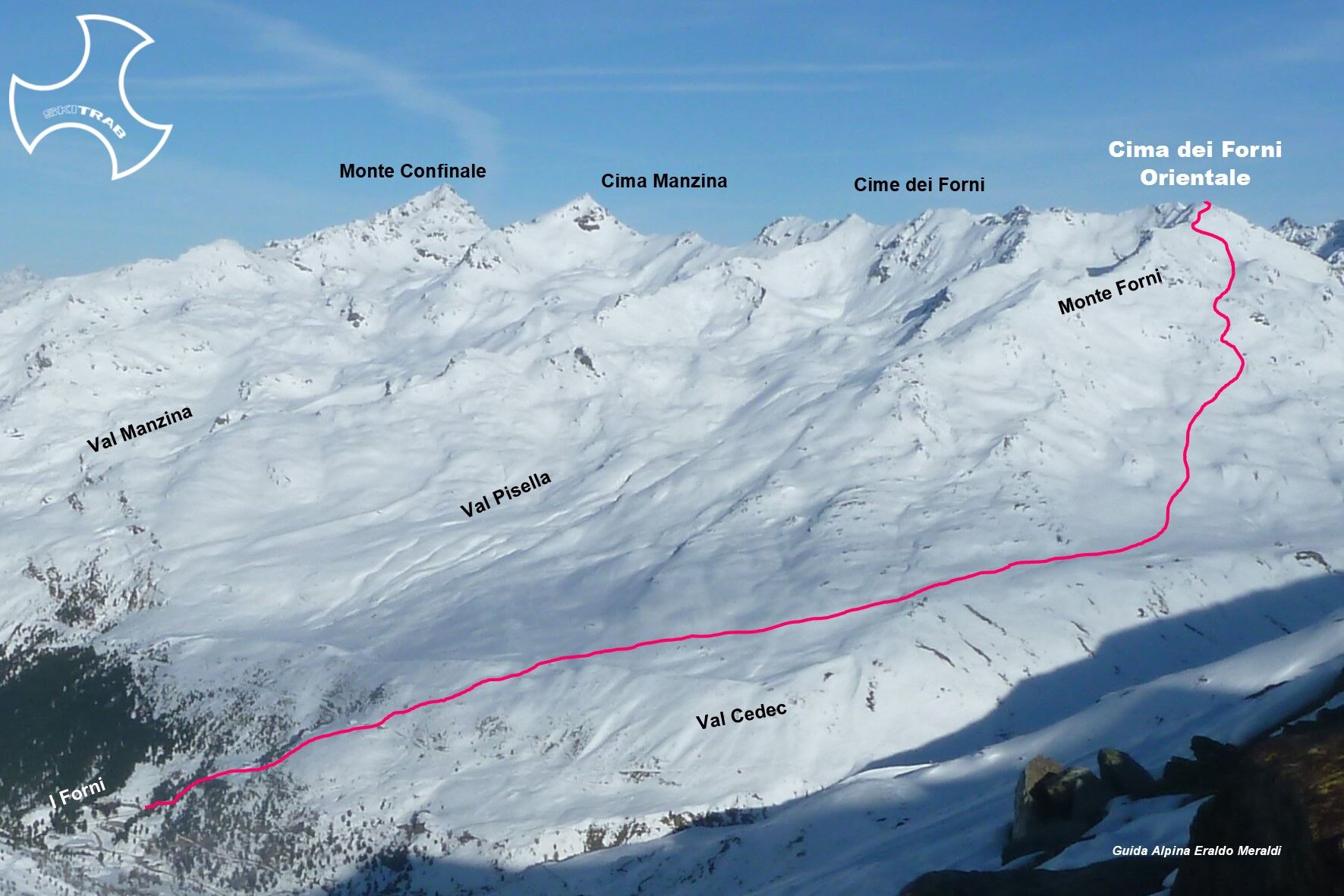
From Rifugio Forni follow the comfortable mule track that initially climbs two steep switchbacks, then to the right becomes flatter and a little further on climbs in the vicinity of a wooden hut. Now to...
From Rifugio Forni follow the comfortable mule track that initially climbs two steep switchbacks, then to the right becomes flatter and a little further on climbs in the vicinity of a wooden hut. Now to the right then straight ahead you come to a nucleus of old huts (Baite dei Forni). Continue on the slope above tending to the right until you reach a flatter area. Past the wide ridge you enter the Cedec valley and without an obligatory path, initially in a northerly direction, then in a northwesterly direction ascending to an obvious little valley. Pass it and climb the overhanging slope slightly to the right to the summit.

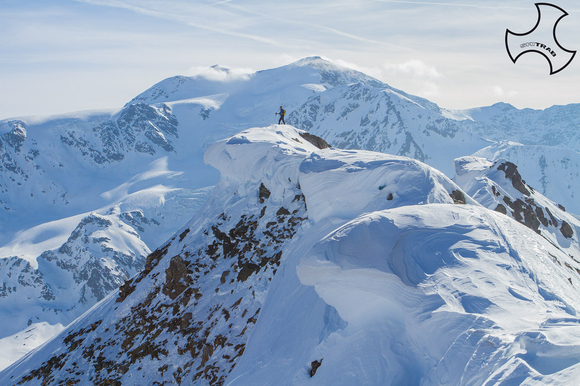

Plaghera, Ponte dell'Alpe, Cima di Gavia Northeast
Self-rescue equipment (ARTVA, shovel and probe). Rampant.
The route description and trail are approximate and should be verified on site depending on the condition of the snowpack present during the hike.
Because this is a hike in a snowy mountain environment at high altitudes subject to continually changing snowpack conditions, it is advisable to have adequate experience in ski mountaineering, knowledge of the area, and up-to-date information on snow conditions.
Accompaniment with a professional guide is recommended.
Ample parking at the start.
The route description and trail are approximate and should be verified on site depending on the condition of the snowpack present during the hike.
Because this is a hike in a snowy mountain environment at high altitudes subject to continually changing snowpack conditions, it is advisable to have adequate experience in ski mountaineering, knowledge of the area, and up-to-date information on snow conditions.
Accompaniment with a professional guide is recommended.
Spletne kamere s turneje

Priljubljeni izleti v okolici
-
4.5
Martellerhütte Höhenweg
srednjaVisokogorska tura 8.70 km -
5.0
Martell-Tal Rundweg zur Marteller Hütte
svetlobaPohodništvo 10.8 km -
4.9
Plimaschlucht
svetlobaGorski pohodništvo 7.23 km -
3.9
Von Sulden zur Hinteren Schöntaufspitze
srednjaPohodništvo 12.7 km -
4.9
Lyfispitze
srednjaPohodništvo 12.3 km -
3.7
Düsseldorfer Hütte 2721m
srednjaPohodništvo 4.14 km -
3.7
Payerhütte 3020m
Pohodništvo 6.98 km -
4.5
Tschengelser Hochwand Stelvio, Trentino-Alto Adige
srednjaVia ferrata 14.3 km -
4.4
Sonnenaufgang auf der Rötelspitze im Nationalpark Stilfserjoch
Pohodništvo 2.02 km -
5.0
Wanderung/Aufstieg zur Payerhütte
svetlobaPohodništvo 15.9 km

Pohodništvo in sledenje


Ne zamudite ponudb in navdiha za naslednje počitnice
Vaš e-poštni naslov je bil dodan na poštni seznam.





