


Rowing
The climb starts from the fork in the Trivulza Provincial Road (km 11.6), just before the bridge over the Crezza stream, where a right turn toward Coloredo and Menarola marks the beginning of the adventure....
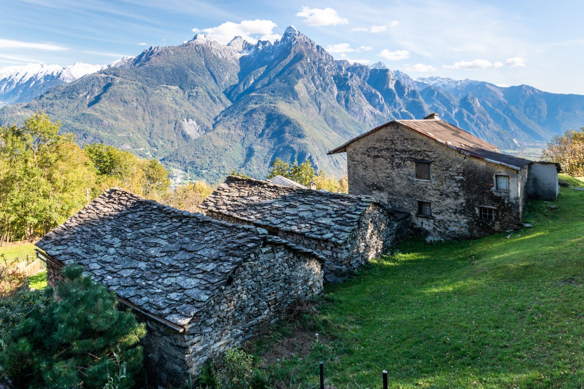
The route passes through the quaint scattered municipality of Menarola, a gem of just 43 inhabitants that has retained its dispersed soul: instead of an urban center, a constellation of hamlets winds along the mountainside. The route touches on authentic alpine gems: Motto (km 2.5), Gradisello (km 3.1), the lonely town hall (km 3.5), Castanedi (km 5.0) with its evocative Church of Our Lady of Sorrows, Foppo (km 8.5) and finally Voga (km 9.5).
The road surface presents a mosaic of conditions: mostly fair, it nevertheless requires the utmost care in the short bumpy sections, which are particularly dangerous downhill. The last mile and a half constitutes a real test of technical skill, with deteriorated asphalt and treacherous concrete culverts.
The narrowed roadway from the hamlet of Coloredo makes crossing between vehicles a tricky maneuver, offset fortunately by virtually nonexistent traffic. The trail meanders with a total of 29 hairpin bends (25 up to Voga, 4 in the final section), following the mile markers of SP 3 "di Menarola" to the town hall.
The woods provide valuable natural shade: chestnut groves in the initial sections give way to larch and birch in the higher elevations, creating a green tunnel that protects from the summer sun. The area is generous with sources of the purest water.
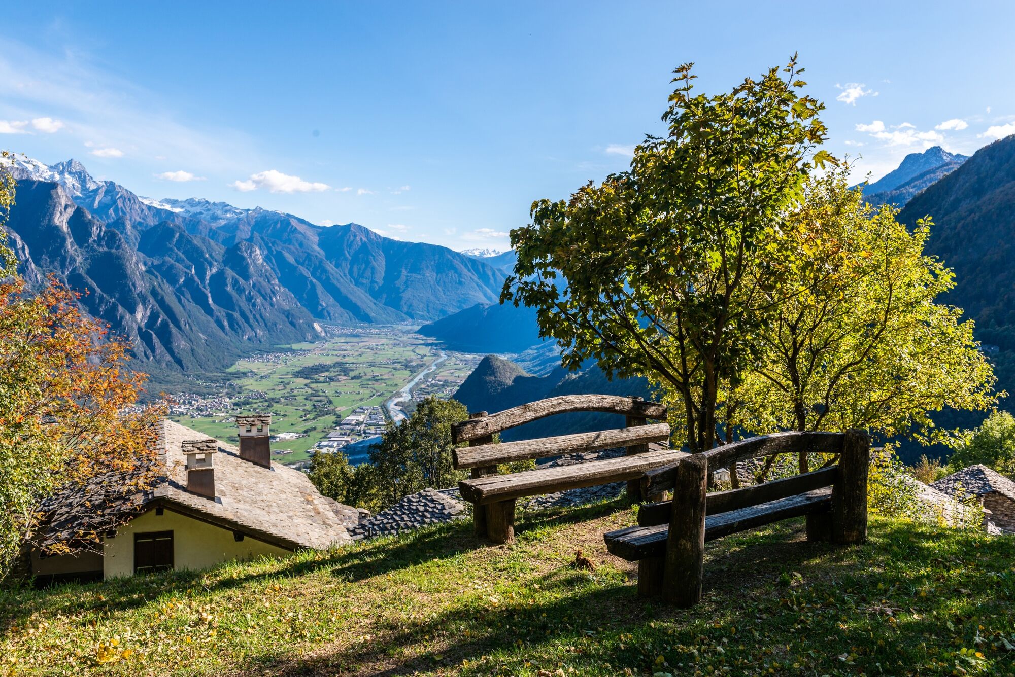
The natural end of the ascent coincides with the hamlet of Voga (1057 m), reached at kilometer 9.3, where a panoramic scenery of rare beauty opens up: to the right the Chiavenna plain stretches as far as Lake Novate Mezzola, frontally rises the imposing Pizzo di Prata, while to the left the peaks of Val Bregaglia draw a picture-postcard alpine horizon.
For the more determined, a final appendage (interdicted to unauthorized traffic) leads toward the maggenghi located close to 1,200 meters, offering an even more exclusive epilogue to this hidden gem of the Rhaetian Alps.

Priljubljeni izleti v okolici
- 5.0
Bocchetta Graglio Impressionante
srednjaPohodništvo 8.85 km - 5.0
Monte Berlinghera da San Bartolomeo
srednjaPohodništvo 8.74 km Acqua Fraggia waterfall scenic loop - Savogno
svetlobaPohodništvo 3.44 km- 5.0
Hike in Val Codera Novate - Rifugio Brasca ( Sentiero Roma first stage)
srednjaPohodništvo 10.7 km - 5.0
Berg und See „at it’s best“
srednjaGorski pohodništvo 6.59 km - 5.0
Val Codera
srednjaPohodništvo 13.6 km - 5.0
Lago di Darengo
srednjaPohodništvo 7.85 km - 4.0
Ciclabile Valchiavenna
svetlobaKolesarjenje 37.5 km - 5.0
Chiavenna - Cranna - Borgonuovo di Piuro - Chiavenna Ring
srednjaPohodništvo 8.93 km Donadivo - Cermine - Alpe Cima hike
srednjaPohodništvo 4.86 km

Pohodništvo in sledenje


Ne zamudite ponudb in navdiha za naslednje počitnice
Vaš e-poštni naslov je bil dodan na poštni seznam.