Sentiero Italia D27N - Stage from Rifugio Cristina to Alpe Prabello - Rifugio Cederna Maffina
težko
Pridobite to turo v svoj mobilni telefon
Sentiero Italia D27N - Stage from Rifugio Cristina to Alpe Prabello - Rifugio Cederna Maffina
težko
Romarska pot
6.18
km
Skenirajte kodo QR in začnite navigacijo v aplikaciji bergfex.

Pohodništvo in sledenje


Sentiero Italia D27N - Stage from Rifugio Cristina to Alpe Prabello - Rifugio Cederna Maffina
težko
Razdalja
6.18
km
Trajanje
03:25
h
Ascent
731
hm
Morska gladina
2,236 -
2,805
m
Stopnja težavnosti: T4
Prenos skladbe
Sentiero Italia D27N - Stage from Rifugio Cristina to Alpe Prabello - Rifugio Cederna Maffina
težko
Romarska pot
6.18
km
With this short but steep stage, the Sentiero Italia leaves the majestic peaks of the upper Valmalenco to move among the summits overlooking directly the Valtellina, continuing the journey eastward. From...
Opis
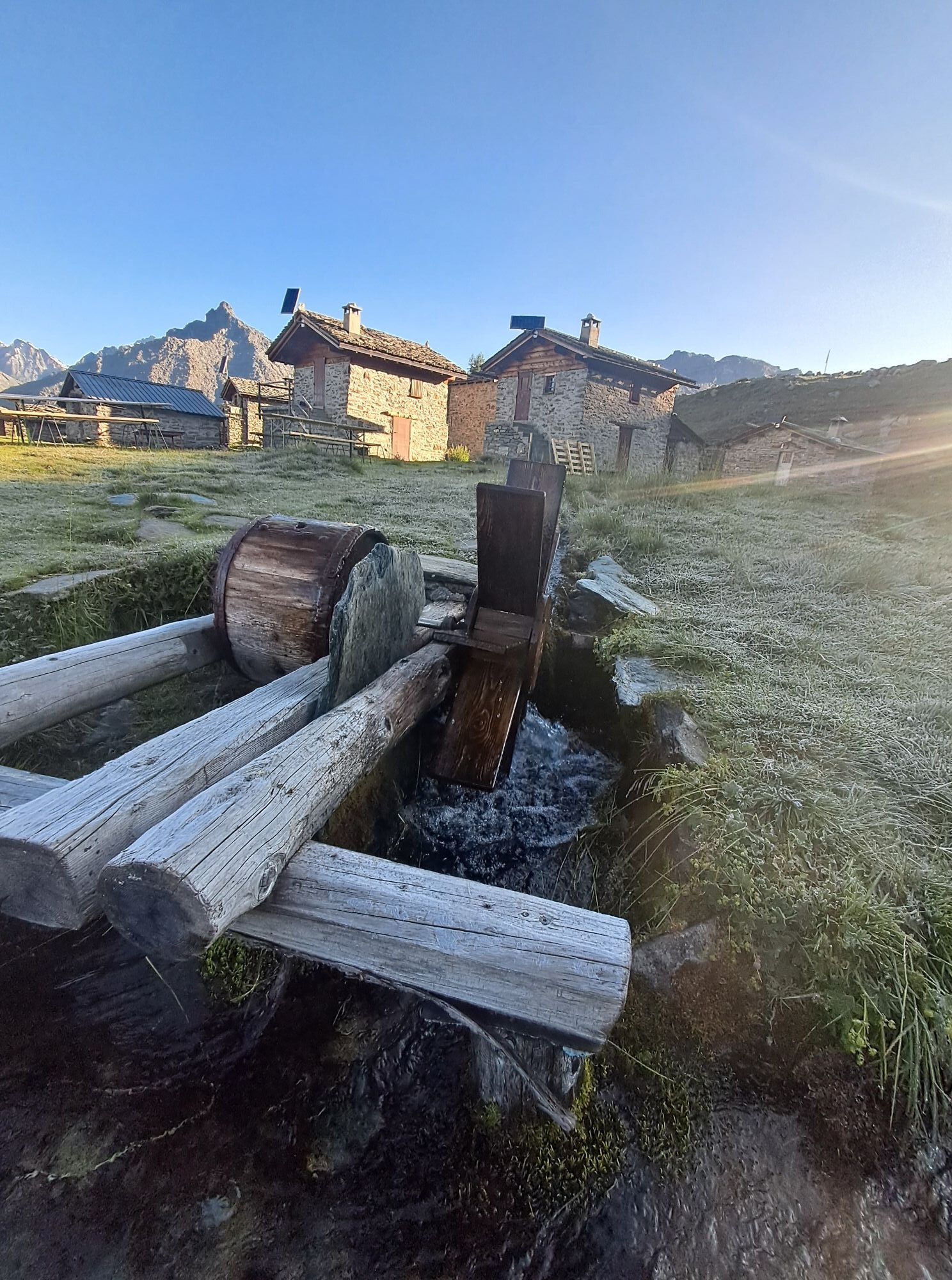
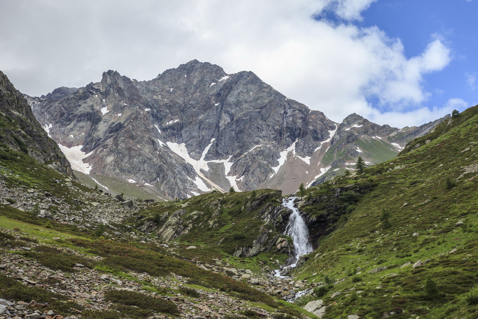
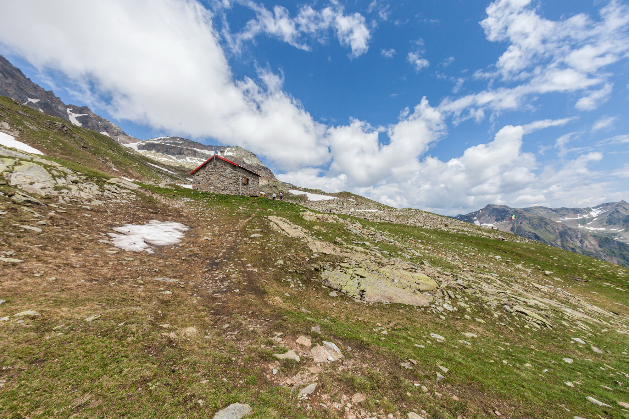
With this short but steep stage, the Sentiero Italia leaves the majestic peaks of the upper Valmalenco to move among the summits overlooking directly the Valtellina, continuing the journey eastward. From the Rifugio Cristina, you say goodbye to the last glacier in the area descending from the summit of Pizzo Scalino, from which it takes its name, which is circumnavigated throughout the day. A first climb leads to the Passo degli Ometti followed by a descent and ascent to the Passo Forame. From here, you descend to the Rifugio Cederna Maffina in the valley carved by the Fontana stream, a direct tributary of the Adda.
Pot
Alpe Prabello
(2,230 m)
Poravnava
0.0 km
Capanna Cederna-Maffina
(2,582 m)
Zatočišče (brez upravljanja)
6.1 km
Pot
Sentiero Italia D27N - Stage from Rifugio Cristina to Alpe Prabello - Rifugio Cederna Maffina
težko
Romarska pot
6.18
km
Avtor
Zagotavlja Valtellina Outdoor

Dodatne informacije in nasveti
Stopnja težavnosti
T4
Še ni pregledov
Priljubljeni izleti v okolici
-
4.3
Piz Palü (3.905m) – Hochtour
srednjaVisokogorska tura 13.4 km -
5.0
Ospizio Bernina Station - Alp Grüm (-Cavaglia)
svetlobaPohodništvo 4.97 km -
Alp Grüm - Cavaglia - Poschiavo
srednjaPohodništvo 9.41 km -
5.0
53 Bernina Tour Switzerland: Stage 1 Poschiavo-Bernina Pass
srednjaPohodništvo 14.6 km -
4.0
Giro del Lago - Le prese - Miralago
svetlobaPohodništvo 7.43 km -
5.0
Palu' Lake, a blue pearl in the center of Valmalenco.
srednjaPohodništvo 8.41 km -
4.5
Ghiacciaio Fellaria
svetlobaPohodništvo 5.23 km -
33.08 Ospizio Bernina - Cavaglia, Via Albula / Bernina
srednjaPohodništvo 9.39 km -
4.0
Capanna Marinelli
svetlobaPohodništvo 8.39 km -
Alp Grüm - Cavaglia (Via Stablini)
Pohodništvo 3.02 km
Pohodništvo in sledenje

Zaradi več kot 550.000 predlogov izletov, podrobnih zemljevidov in intuitivnega načrtovanja poti je aplikacija obvezna oprema za vse ljubitelje narave.

Ne zamudite ponudb in navdiha za naslednje počitnice
Naročite se na novice
Napaka
Zgodila se je napaka. Prosimo, poskusite znova.
Zahvaljujemo se vam za prijavo
Vaš e-poštni naslov je bil dodan na poštni seznam.
Izleti po vsej Evropi
Avstrija
Švica
Nemčija
Italija
Slovenija
Francija
Nizozemska
Belgija
Poljska
Lihtenštajn
Češka
Slovaška
Španija
Chorvátsko
Bosna in Hercegovina
Luksemburg
Andora
පෘතුගාලය
අයිස්ලන්තය
එක්සත් රාජධානිය
අයර්ලන්තය
ග්රීසිය
ඇල්බේනියාව
North Macedonia
Malta
Norway
Montenegro
Moldova
කොසෝවො
හන්ගේරියානු සමුහාණ්ඩුව
San Marino
රුමේනියාව
එස්ටෝනියා
ලැට්වියාව
බෙලාරස්
සයිප්රස්
Lithuania
Serbia
බල්ගේරියාව
Monaco
ඩෙන්මාර්කය
Sweden
ෆින්ලන්තය