


IM_12 Riva Ligure - Pompeiana
from via Aurelia in Riva Ligure take the road to Pompeiana (via Giuseppe Garibaldi, SP50). After a short strecth uphill turn right (arrow). Follow the mule-track which rises between the houses and greenhouses...
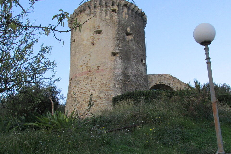
from via Aurelia in Riva Ligure take the road to Pompeiana (via Giuseppe Garibaldi, SP50). After a short strecth uphill turn right (arrow). Follow the mule-track which rises between the houses and greenhouses along the hill. A little further on, cross the asphalt road and carry on walking uphill on the mule-track. By a short but steep concrete stretch you soon reach the top of the ridge: turn right and walk along the narrow asphalt road. You shortly reach a little chapel dedicated to San Giuseppe and a little further on to the right is the saracen tower which overlooks the valley, the so called “Torre dei Panei” built in the XVI century to protect the coast from Barbary pirates' raids (place called Costa Panera, 205 m; 1 hour). After the tower (a plaque on the wall describes its history) you follow the cobbled path slightly descending through an olive grove as far as the first houses of Pompeiana. Turning left you reach Piazza Dante where you keep on walking uphill. To get to the main square it is advisable to cross the historical centre: leave the asphalt road and follow an uphill passageway to the left and then turn left again under an arch to reach the square of the church of N.S. Assunta (1.30 hours). From Pompeiana you can go back to Riva Ligure by doing the same itinerary or by using public bus (line number 18, autolinee Riviera Trasporti; www.rivieratrasporti.it).

Sanremo railway station (Genova-Ventimiglia railway line). From Sanremo to Riva Ligure: bus number 12 (bus line Riviera Trasporti www.rivieratrasporti.it)
Riva Ligure is located along the strada statale Aurelia SS1; it can be reached by the A10 motorway Genova-Savona-Ventimiglia (Arma di Taggia exit coming from west, Imperia Ovest exit coming from east).
Nature and Landscape * * * * Family * * * * * * Gourmet * * * * Culture * * * *
Priljubljeni izleti v okolici
- 3,0
IM_21 Arma di Taggia - Ospedaletti (Area 24)
Pohodništvo 13,3 km IM_18 San Romolo – Monte Bignone
Pohodništvo 3,41 kmDolcedo-Valloria, Italien
svetlobaPohodništvo 11,2 km- 5,0
Rundweg um Badalucco
svetlobaPohodništvo 4,07 km - 5,0
Passeggista dei Ponti / Santa Brigida in Dolcedo, Ligurien/Italien
Pohodništvo 7,59 km Costa Rainera-Cipressa-SantoStefano
svetlobaPohodništvo 15,4 kmTubi di San Lorenzo
težkoMountainbike 3,03 kmRed Cliffs
srednjaMountainbike 2,38 kmBadalucco
svetlobaPohodništvo 2,67 kmLe Creste
težkoMountainbike 5,22 km
Pohodništvo in sledenje


Ne zamudite ponudb in navdiha za naslednje počitnice
Vaš e-poštni naslov je bil dodan na poštni seznam.