


High altitude hike Alp Trider Sattel - Heidelberger Hütte


The tour starts at the top station of the world's first double-decker cable car on the Alp Trider Sattel. The high-level trail towards Ravaischer Salaas and towards Bergli passes dolines ("gypsum holes")....
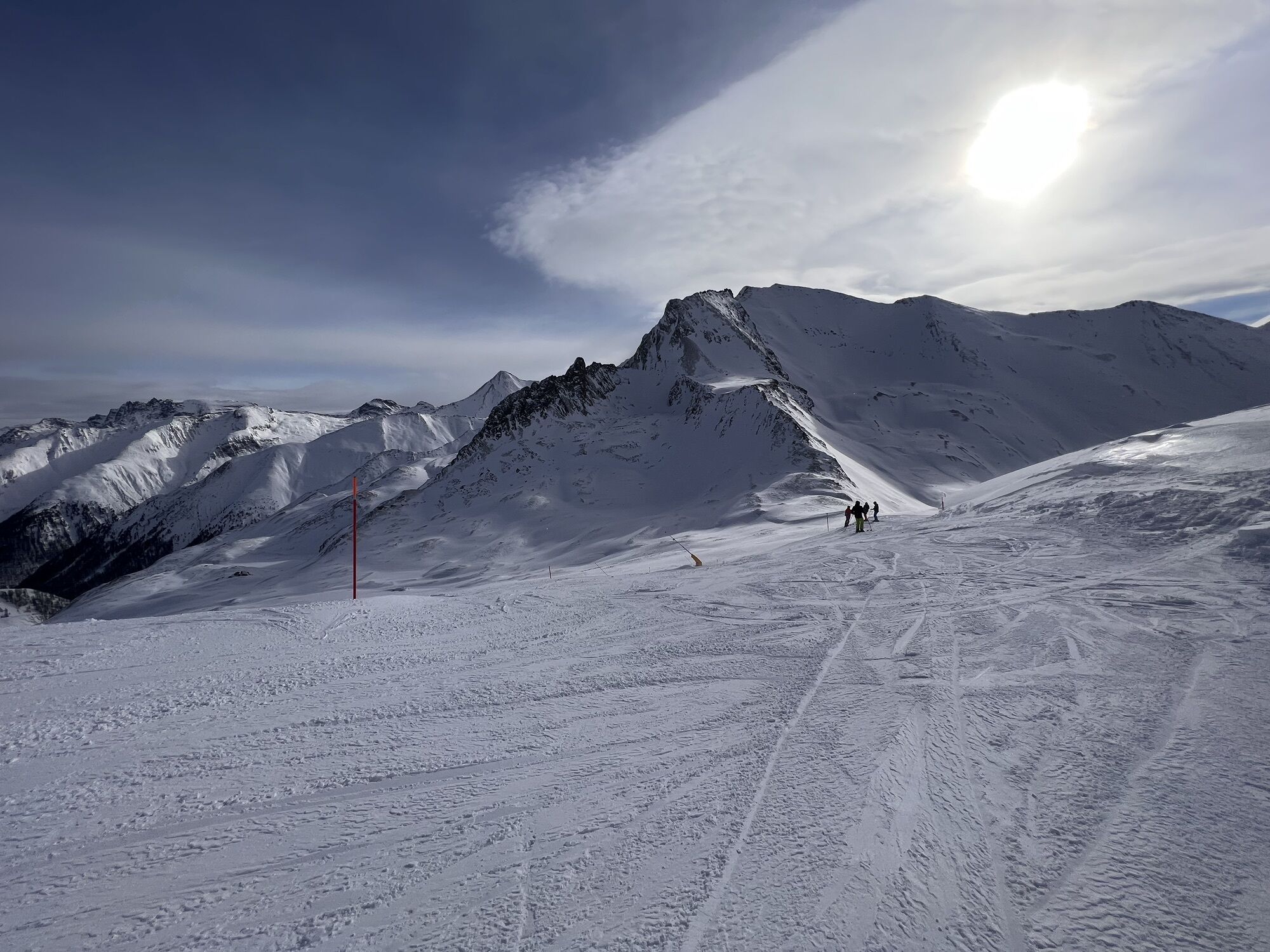
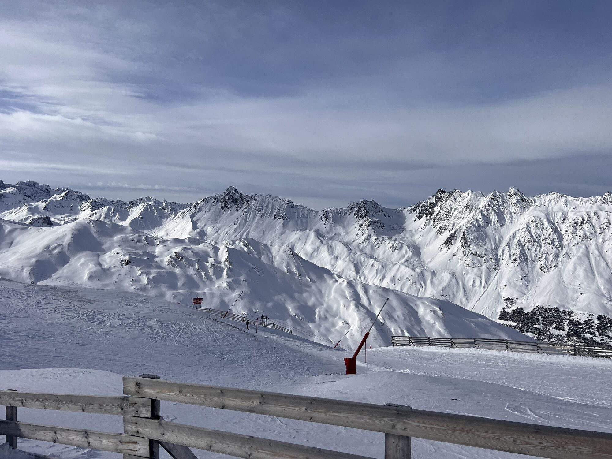
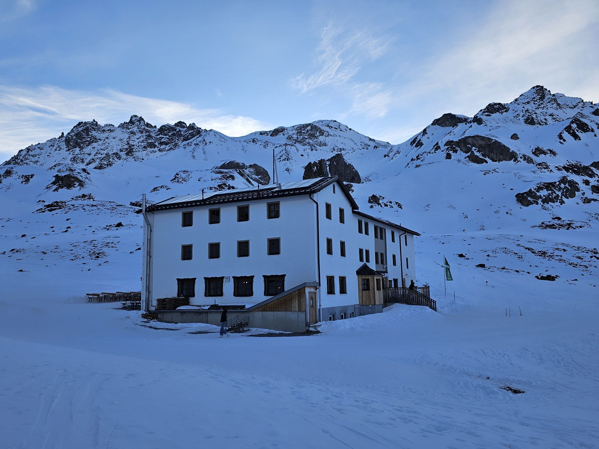
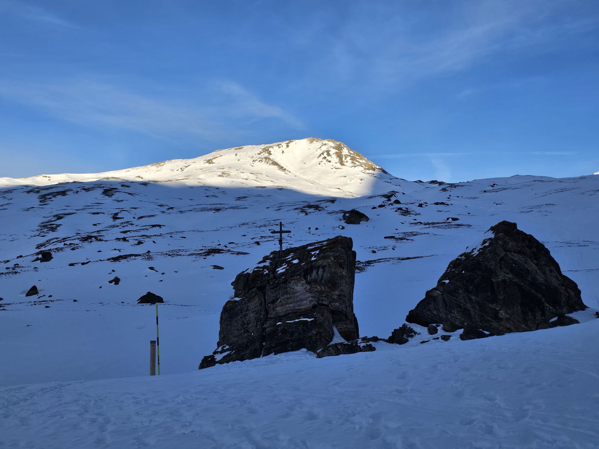
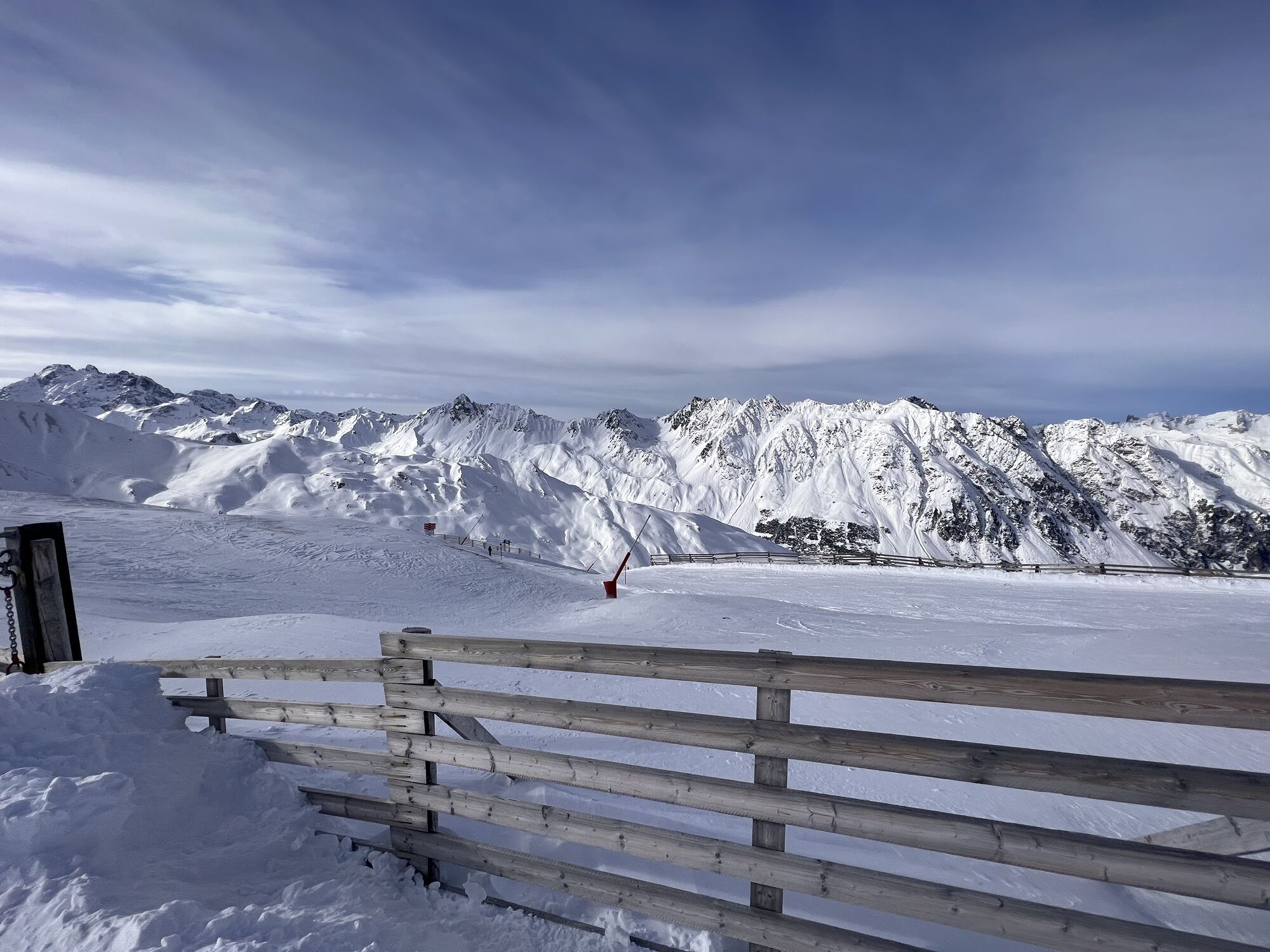
The tour starts at the top station of the world's first double-decker cable car on the Alp Trider Sattel. The high-level trail towards Ravaischer Salaas and towards Bergli passes dolines ("gypsum holes"). One continues walking over the Zeblasjoch, with a little luck one can see ibex or ptarmigan. The view into the extensive Fimba valley and the Fluchthorn is worthwhile. From Fuorcla Val Gronda at 2752 m above sea level, the path leads steadily down to the Heidelberger Hut.


From Samnaun, the only duty-free area in Switzerland, the trail leads over the Alptrider Sattel, towards Zeblasjoch, over the Fuorcla Val Gronda and down to the Heidelberger Hütte.
Good shoes, rain and sun protection, water bottle, bandages.
The tour has been evaluated under favorable weather conditions. Current weather conditions and weather forecasts must be taken into account before the tour starts. This hike requires elementary alpine experience, orientation skills, hiking boots are recommended.
Emergency call:
144 Emergency call, first aid
1414 Mountain rescue REGA
112 International emergency call
From the north: via Landquart - Klosters by car transport through the Vereina tunnel (Selfranga - Sagliains) Then take the H27 in the direction via Scuol and Martina to Vinadi. At the junction Vinadi to Samnaun (about 1 hour from Vereina Südportal)
From the east: via the Inn valley road B180 via Landeck to Pfunds, junction Kajetansbrücke and via Spiss to Samnaun-Ravaisch.
From the south: via Reschenpass (Nauders) on B180 to Pfunds, junction Kajetansbrücke and via Spiss to Samnaun-Ravaisch.
With the Rhaetian Railway (from Chur, Landquart/Prättigau or from the Upper Engadine) every hour to Scuol-Tarasp station
Continue by PostBus (from Scuol-Tarasp or Martina, Cunfin) every hour to the PostBus stop Samnaun-Ravaisch, mountain railroads
In Samnaun during the day hourly connection with the Samnaunbus to the PostBus stop Samnaun-Ravaisch, cable cars
Free parking in Samnaun village (Chasa Riva, Musella or Votlas)
Priljubljeni izleti v okolici
- 5.0
Menta Alm - Scheibenalm
svetlobaPohodništvo11.4 km - 4.7
Jamtal lodge
srednjaPohodništvo19.6 km - 4.0
Jamtalhütte
srednjaPohodništvo19.1 km - 4.3
Sonnenkogel - Friedrichshafener lodge
srednjaPohodništvo13.2 km - 5.0
Rundwanderung Berglisee, Mathon
težkoPohodništvo11.1 km Von Galtür zur Jamtalhütte mit Trail
srednjaE-MTB21 km- 5.0
Kappl, Diasbahn Bergstation, Niederelbehütte, Diasbahn, Österreich
srednjaPohodništvo10.1 km - 5.0
Samnaun Dorf – Muttler
težkoPohodništvo14.8 km Suspension Bridge Trail Val Sinestra – Zuort – Griosch – Vnà
srednjaPohodništvo11.0 km- 3.6
Bergstation Silvretta nach Patznauener Taja
svetlobaPohodništvo11.6 km
Pohodništvo in sledenje


Ne zamudite ponudb in navdiha za naslednje počitnice
Vaš e-poštni naslov je bil dodan na poštni seznam.