


The Faymont waterfall from Plombières-les-Bains
Rolling landscapes in forests, chapels and "chello", grain barns up to the view of the gastronomic village of Val d'Ajol.

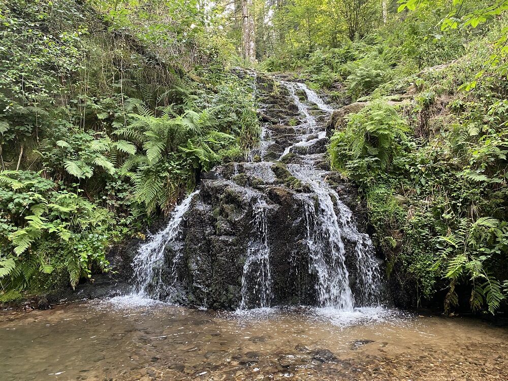
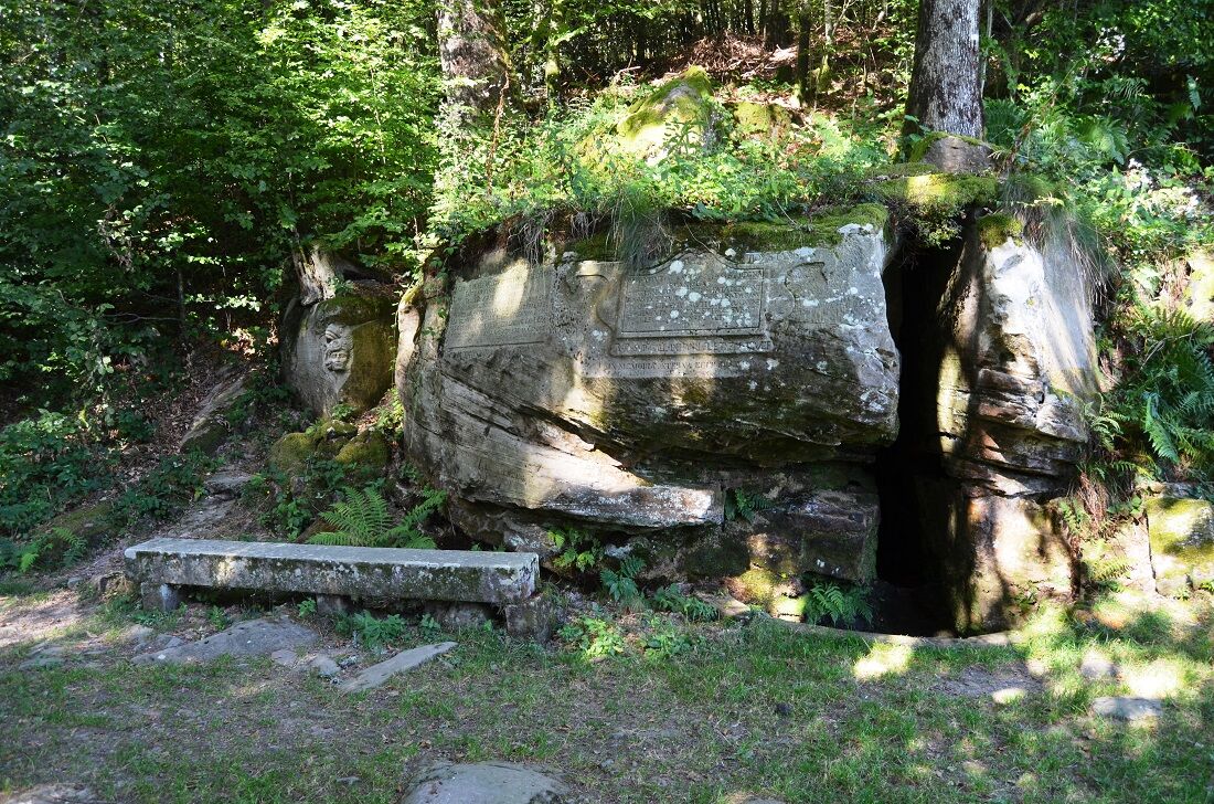
Access: From Remiremont, head towards Val-d'Ajol. At Faymont, before the sawmill, take a right. Parking: 100m from the sign "Cascade de Faymont" Distance: 2 km / Duration: 45 min / Elevation: 100m / Marking: Blue circle, about 400m unmarked. 1) Climb the small forest road up to the waterfall. Take the rocky path that goes up to the right of the waterfall (blue ring marking), up to a small forest road. Continue on the road and do not take the marked path to the right. 2) At the house, approach the building (do not continue to climb the path opposite). Follow the grassy path that passes to the left of the house and which, in a long left curve, joins the starting marking (blue ring). 3) Take the marking to the left and descend back to the parking lot.
Clothing suitable for the season and conditions (cold, hot, humid…)
Hiking shoes adapted to the terrain (even for children!)
Hiking poles (useful for stability and to relieve joints)
Mobile phone and spare battery
Check the general and local weather, ensuring there is no precipitation. Get information about the approach walk, route height, duration, possible escape (IGN map, GPS, guidebook, etc…)
Assess possible risks by consulting mountain professionals, refuges, lodges
Inform someone close about your objective and contact them in case of changes: departure and return times, number of participants with each one's phone number, vehicle(s), parking
Avoid going alone, use equipment appropriate for the activity, adjusted and in good condition, headlamp, complete first aid kit, survival blanket, etc…
In an emergency, call 112
Plombières-les-Bains 88370
Line 6 Remiremont > Val d'Ajol
Free parking on site
Priljubljeni izleti v okolici
-
Hike - Saint Mont
srednjaPohodništvo 3.89 km -
Hiking - The puddingstones and the Tocquaine Rock
Pohodništvo 4.71 km -
Cascade de
svetlobaPohodništvo 9.01 km -
Hike - La Piotte
svetlobaPohodništvo 4.83 km -
Mountain bike circuit no. 44 - Les grandes fontaines - Saint-Bresson - Southern Vosges
srednjaMountainbike 32.4 km -
Hiking - The Tumulus of the Cucherons
svetlobaPohodništvo 2.08 km -
Hiking - Villerain pond
svetlobaPohodništvo 1.26 km -
Circuit de Béviau
srednjaPohodništvo 11.6 km -
Randonnée - Les Feuillées
srednjaPohodništvo 8.99 km -
5.0
Hadol
srednjaPohodništvo 8.29 km

Pohodništvo in sledenje


Ne zamudite ponudb in navdiha za naslednje počitnice
Vaš e-poštni naslov je bil dodan na poštni seznam.