







The Balcons de Corcieux
11 km walk starting from Corcieux

Marking: yellow circle - blue circle.
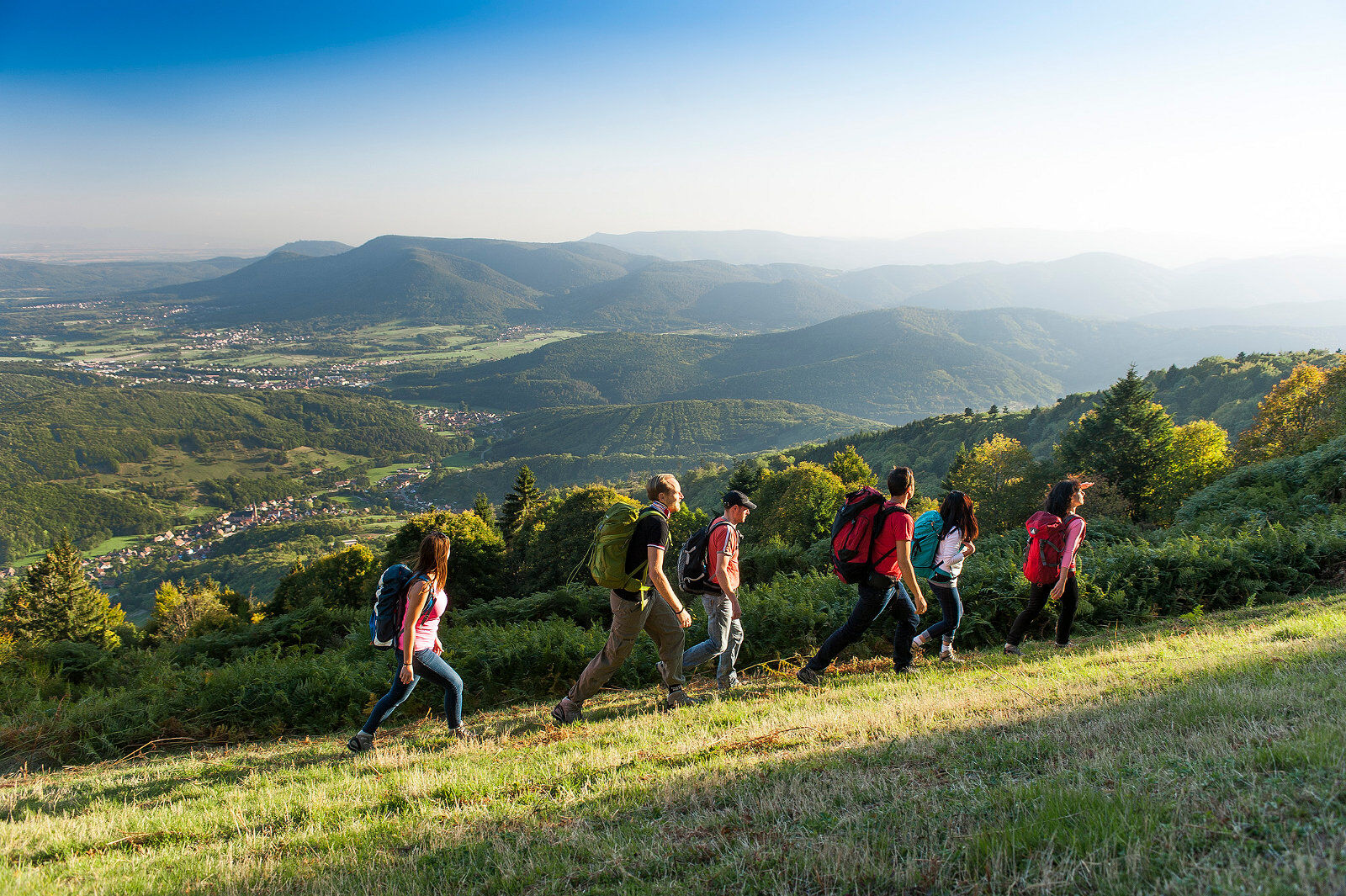
Start: 1/ Take Henry street to the crossroads (200 m) where you will turn right towards the campsites: Les Bans-La Tour. Follow the marking (Yellow circle) to the next crossroads. Take James Wiese street to the right at the La Mangeoire restaurant. You pass in front of the Domaine des Bans campsite then the Forfelet nursing home. 2/ At the crossroads, turn right towards Maison Pierre Nicole (Yellow circle). 3/ At the hamlet of Vichibure, turn left (Yellow circle). Notice, on the facade of the first house, its construction date (1827), its sandstone pediment, and two inscriptions H10 . CH6: during the German occupation, in 1940, homes were requisitioned to house the enemy army. The inscriptions specified the number of men (H 10) and horses (CH 6) that could be accommodated. On the southeast facade of the next house dated 1723, notice the small window in flamboyant Gothic style *. Continue and turn right at the next crossroads, towards La Folie (Yellow circle). After a short climb on a paved path, continue on the dirt path. On your right, a view of Corcieux, its steeple, and in the background, the Hennefête forest. 300 m further on your left, notice blocks of granite. Continue straight ahead (Yellow circle) on the pleasant forest path under the trees crossing the locality called La Folie. Below, you will see the ruins of an old mill fed by the Bans stream. 4/ Leave the path that climbs on the left and follow the marked trail on the right (Yellow circle). You cross an old stone bridge. On your right are old granite quarries. At the end of the path, take the paved road to the left for 100 m. At the crossroads, turn right then immediately left to follow the gravel path (Yellow circle). 600 m further on, at a ruined farm, turn left towards Les Balcons de Corcieux. Cross a first paved road and take the next one (Yellow circle) with a slight climb of about 100 m. Then take the dirt path on the right. Continue straight ahead ignoring the paths to the right and left to reach the superb panorama of the Balcons de Corcieux on the edge of a meadow: to the left the village of Corcieux is outlined; in front of you, the mountain ranges of Saint-Dié des Vosges and in the background, the Champ du Feu plateau, the trapezoid of Climont. Follow the meadow on the right and take, about a hundred meters further, a dirt path about 50 m long. 5/ At the intersection (Blue circle), turn right on the path to the next meadow which you cross still with a beautiful view on your left over the Corcieux basin and Mont Thiriville. Continue straight on the grassy path (on the right, the Tête de Nayemont dominates at 967 m) which then crosses a small wood. 6/ At the intersection (signs), turn sharply left (Blue circle), direction Rambaville. Follow the marking (Blue circle) crossing the meadow on the right. Continue on the slightly descending path (Blue circle) to the locality Le Haut Mont (alt 660 m). At the crossroads, take the direction Rambaville-Corcieux. Arriving at the small hamlet of Rambaville, turn left on the paved road. After 200 m, take the dirt path on the left (Blue circle), alt 570 m. At the farm, observe a beautiful calvary, turn left and cross the bridge over the Goulle stream. After a short climb on a paved path, turn right (Blue circle). A little further on, a second calvary * overlooks the stream. The pleasant Champ Balland path brings you back to Corcieux (Blue circle), alt 560 m. 7/ At the crossroads, turn right, Chenel street, cross the Haut des Creux housing estate to reach the center of Corcieux and the church square where you started. To see: A GOTHIC WINDOW: This small window in flamboyant Gothic style, carved in Vosges sandstone, dates from the time of the Martimprey counts. Jean-François 1st (1664-1746), having obtained the right of high and low justice in 1717, had turned this construction into a prison (imposing iron bars). THE CALVARY OF RAMBAVILLE: This calvary (The George Cross) is located between Rambaville and the Champ Balland. Nicolas George would have erected this cross on the occasion of the death, January 1, 1812, of one of his close relatives. Way crosses or calvaries represent both a geographical and historical heritage of our countryside.
Da
Clothing adapted to the season and conditions (cold, hot, humid…)
Hiking shoes suited to the terrain (even for children!)
Hiking poles (useful for stability and to relieve the joints)
Mobile phone and spare battery
Check the general and local weather ensuring no precipitation. Inform yourself about the approach walk, itinerary height, duration, possible escape routes (IGN map, GPS, guidebook, etc.)
Assess possible risks by consulting mountain professionals, refuges, lodges
Inform a close person of your objective and contact them in case of changes: departure and return times, number of participants with each phone number, vehicle(s), parking
Avoid going alone, use equipment suitable for the activity, adjusted and in good condition, headlamp, complete first aid kit, survival blanket, etc.
In case of emergency, call 112
Corcieux 88430
www.fluo.eu
Free parking on site
Tourist office of Corcieux
9 Henry street
88430 Corcieux
www.tourisme-corcieux.com
Take the opportunity to make a detour to the rock field, the mysterious heap of large granite boulders!
Priljubljeni izleti v okolici
-
4.5
Hike around Lake Gérardmer
svetlobaPohodništvo 5.49 km -
5.0
Vogesen Col de la Schlucht
težkoPohodništvo 19.3 km -
4.8
Longemer Col des Feignes Walk
srednjaPohodništvo 8.83 km -
4.7
The Lac Blanc ridge
svetlobaPohodništvo 5 km -
5.0
From the Schlucht to the Hohneck
srednjaPohodništvo 8.21 km -
5.0
Family route: the Bourrique jump
svetlobaPohodništvo 2.74 km -
4.7
Orbey, Grand Est
srednjaPohodništvo 4.52 km -
4.0
Le tétras bistrot - Hôtel - Restaurant du Chalet - Chapelle Notre-Dame-des-Chaumes - La Schlucht
srednjaPohodništvo 5.95 km -
Family outing: Lake Longemer Circuit
svetlobaPohodništvo 5.63 km -
Crossing of the Vosges Massif - Stage 14 - Le Bonhomme - Schlucht Pass
srednjaPohodništvo v daljavo 19.4 km
Pohodništvo in sledenje


Ne zamudite ponudb in navdiha za naslednje počitnice
Vaš e-poštni naslov je bil dodan na poštni seznam.





