


Hiking - The Tumulus of the Cucherons
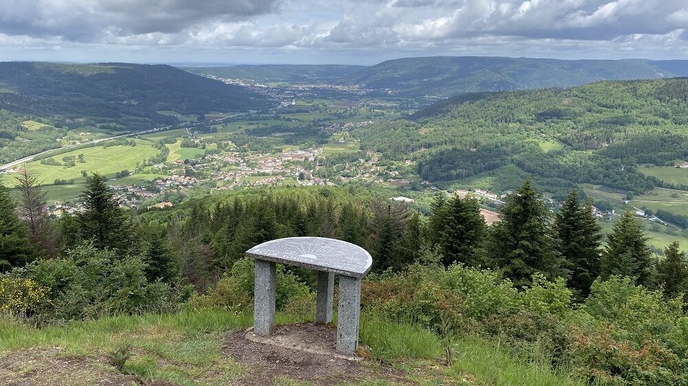
1) Take the small road (red disk marking) uphill to the orientation table and viewpoint.
2) Follow the marking on a flat path then a slight descent until a trail.
3) Leave the marking, go up to the right...
1) Take the small road (red disk marking) uphill to the orientation table and viewpoint.
2) Follow the marking on a flat path then a slight descent until a trail.
3) Leave the marking, go up to the right then descend to the road to return to the parking lot.
https://www.tourisme-lorraine.fr/a-voir-a-faire/loisirs/balades-et-randonnees/885004159-randonnee-le-tumulus-des-cucherons-vecoux
Da
Da
Recommended equipment
Clothing suitable for the season and conditions (cold, hot, humid ...)
Hiking shoes adapted to the terrain (even for children!)
Telescopic poles (useful for stability and joint relief)
Mobile phone and spare battery if needed
In case of problem
Call 112 (European emergency number)
5 key points to send your alert:
Where? Municipality, place, route, altitude
Who? Identity, phone number
What? Type of accident, number of victims, severity, fall dynamics
When? Time of the accident
Weather? Wind, visibility
Remiremont Plombières-les-Bains Tourist Office
https://www.tourisme-remiremont-plombieres.com/
Remiremont office: Tel. 03 29 62 23 70
Plombières-les-Bains office: Tel. 03 29 66 01 30
Val-d'Ajol office: Tel. 03 29 30 61 55
The Montagne des Cucherons located 2 km southeast of the village peaks at 803 m. Its summit is called the "Tumulus" because of its rocky spur shape, which Abbé Didelot had mistaken for a tumulus.
Priljubljeni izleti v okolici
The Dukes' trail
srednjaPohodništvo v daljavo 340.7 kmRide Farmhouse-Inn des Prenzières - On the way to the summer pasture
srednjaPohodništvo 4.94 kmThe Faymont waterfall from Plombières-les-Bains
srednjaPohodništvo 18.2 kmHautes Vosges greenway
srednjaCestno kolo 66.4 kmHike - Saint Mont
srednjaPohodništvo 3.89 kmCycling escapes in the heart of the southern Vosges
srednjaKolesarjenje na dolge razdalje 251.7 kmThe black pond
srednjaPohodništvo 11.7 kmHiking - The puddingstones and the Tocquaine Rock
Pohodništvo 4.71 kmCascade de
svetlobaPohodništvo 9.01 kmMountain bike circuit no. 44 - Les grandes fontaines - Saint-Bresson - Southern Vosges
srednjaMountainbike 32.4 km
Pohodništvo in sledenje


Ne zamudite ponudb in navdiha za naslednje počitnice
Vaš e-poštni naslov je bil dodan na poštni seznam.